|
After a summer of extreme temperatures in the Mediterranean and limited precipitation across Central Europe, a major weather pattern shift led to an active weather pattern across Central Europe with a strong trough bringing abundant precipitation to large parts of Europe. Particularly strong rainfall affected Slovenia and led to the worst flooding in the country since the end of the Cold War.
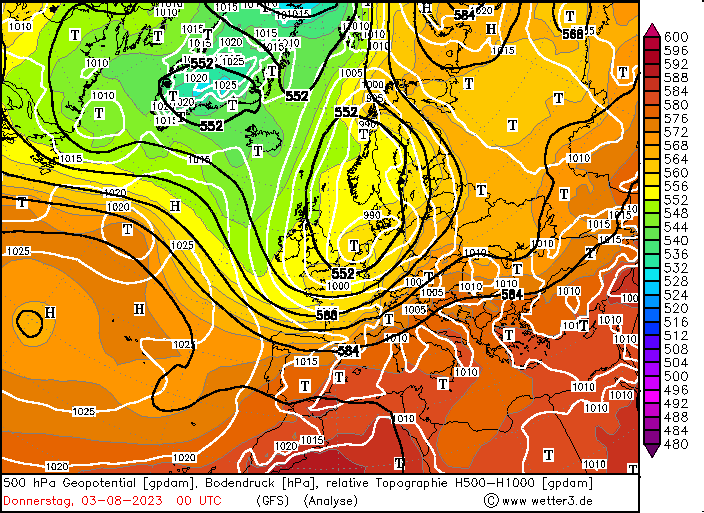
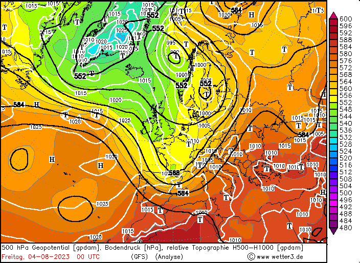
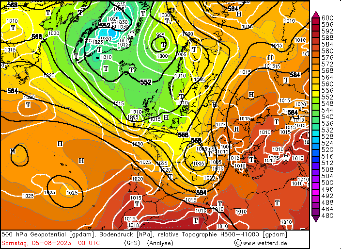
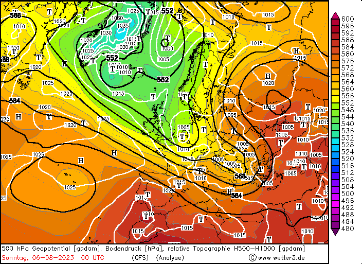
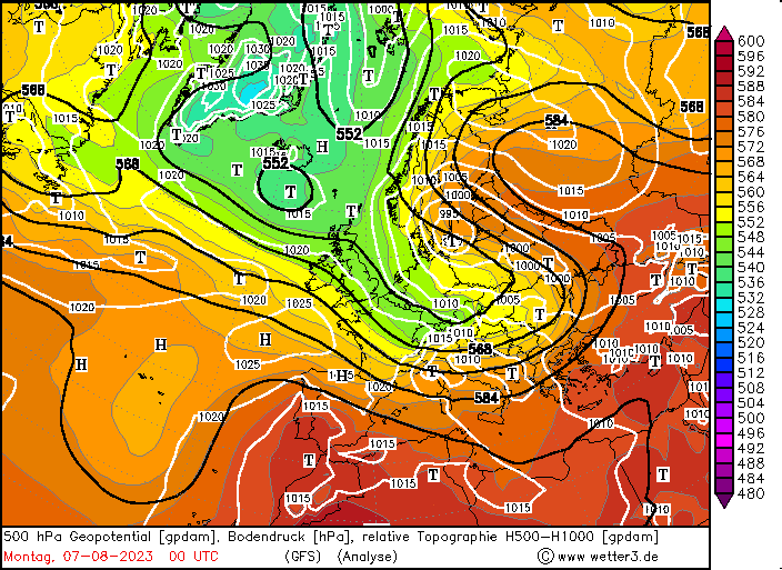
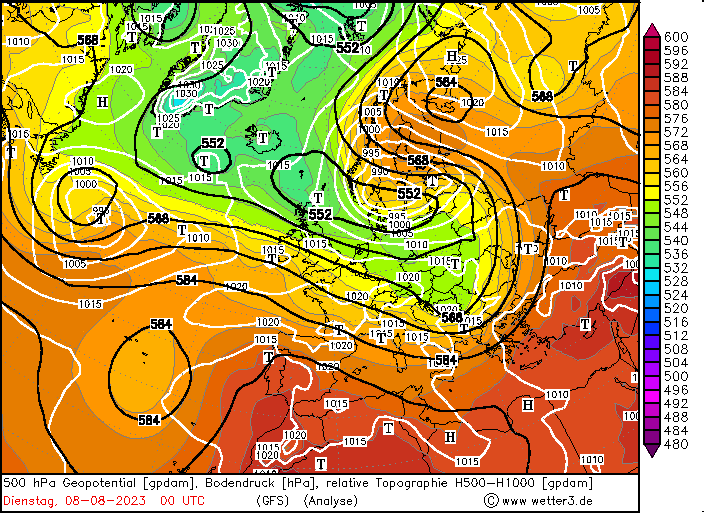
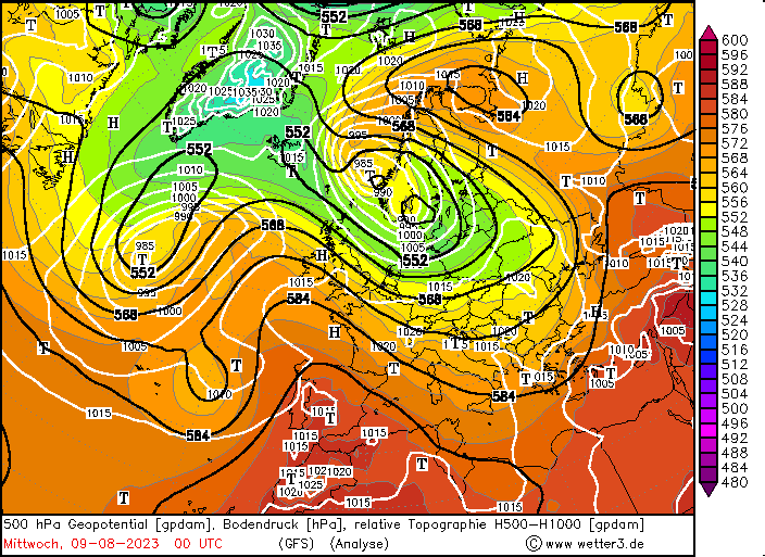
While the first half of the summer 2023 was dominated by strong ridges across Europe, intermittent severe weather outbreaks, and extreme heat in the Mediterranean, a significant weather pattern shift was observed in the third decade of July. While Central Europe already received abundant precipitation in the last days of July, took around a week for a trough to establish itself over the North Sea, to the west of Southern Norway. A particularly strong extratropical low developed during a stretch of active westerlies over the Eastern Atlantic, moving across Central Europe on August 02, 2023, and August 03, 2023.
|
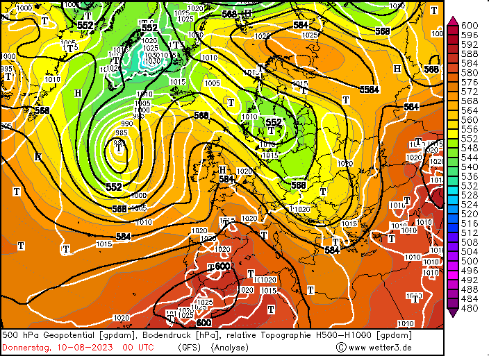
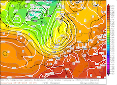
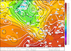
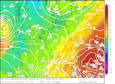
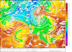
500 hPa Geopotential and sea surface pressure over Europe 03.08.2023 00 UTC - 10.08.2023 00 UTC, source:
wetter3
|
 |
 |
 |
 |
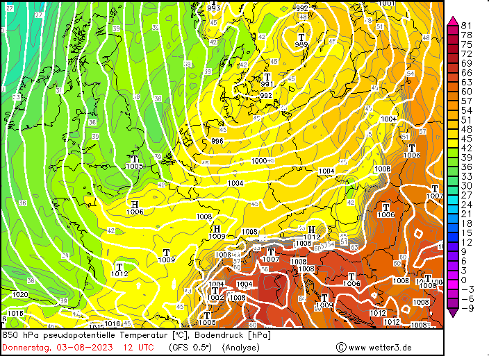
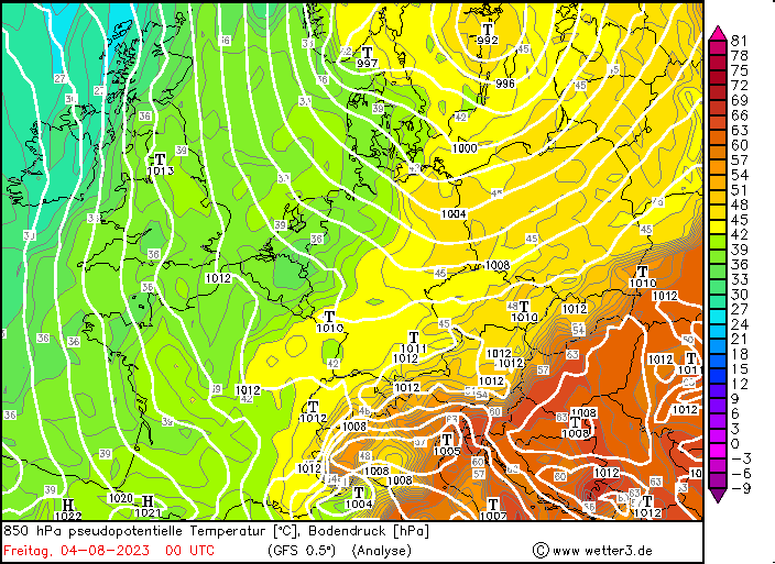
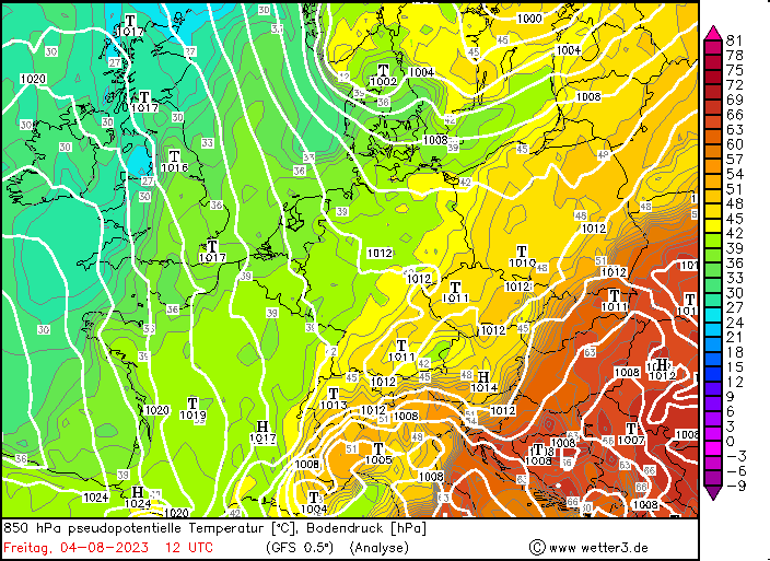
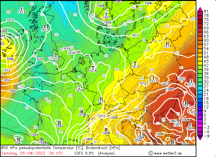
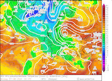
Behind the surface low, unseasonably cold air masses of Arctic origin were advected into Central Europe. The cold air masses could advance far south over the Western Mediterranean, inducing lee cyclogenesis over the Gulf of Genoa, with a secondary upper-level enhancing mid-level lifting. Ahead of the surface low over Northern Italy, strong southwesterlies established, advecting very moist air masses into Slovenia and Austria. In the Eastern Alps, the moist air masses led to intense orographic rain, with 48 h precipitation totals reaching 150 – 200 mm in Slovenia and Carinthia. At the Loibl Pass in Slovenia, 48 h precipitation totals reached up to 275 mm.
|
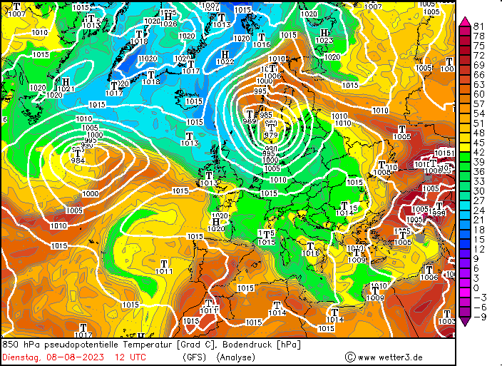
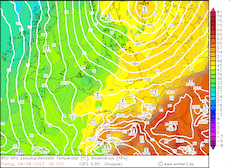
850 hPa Pseudo-potential temperature and sea surface pressure over Central Europe 03.08.2023 12 UTC - 05.08.2023 00 UTC, source:
wetter3
|
 |
 |
 |
 |
As a result of the intense precipitation, many rivers in the Drava and Sava basin reached flooding stages, as the soils in the region were already saturated by comparatively wet start to the summer. Along minor rivers in the respective river basins, 30 yearly floods were observed, with the worst flooding occurring in Slovenia. Especially in mountainous terrain, the river flooding along with landslide led to extensive damages, with many roadways into rural areas being impassable. Especially critical was the flooding along the river Mura, where a levee broke and led large downstream flooding. Locally, damages in the region can be compared to the devastation caused by the high-water in the summer 2021 in Western Germany. As a result, Slovenia requested international help to restore the damaged areas, with early estimates suggesting economic damages in the multi-billion-euro range in Slovenia alone. Extensive damage to roadways and thousands of homes were reported.
From Slovenia, the flood wave moved downstream into Croatia, where widespread river flooding was observed in the Drava basin. Near the confluence of the Drava and Mura, a century-old high-water record was broken, with the river levels rising more than 50 cm higher than in the previous high-water. Further downstream in Croatia, many agriculture areas were inundated. In the following days, river levels receded as the flood wave moved downstream into the Danube.
|
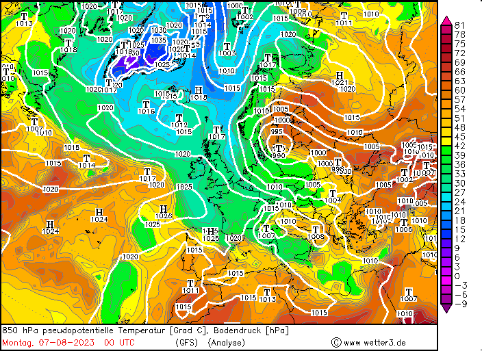
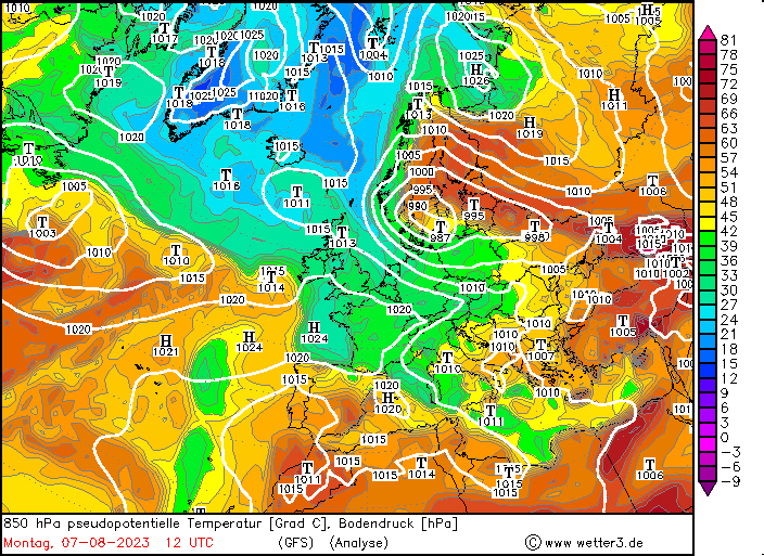
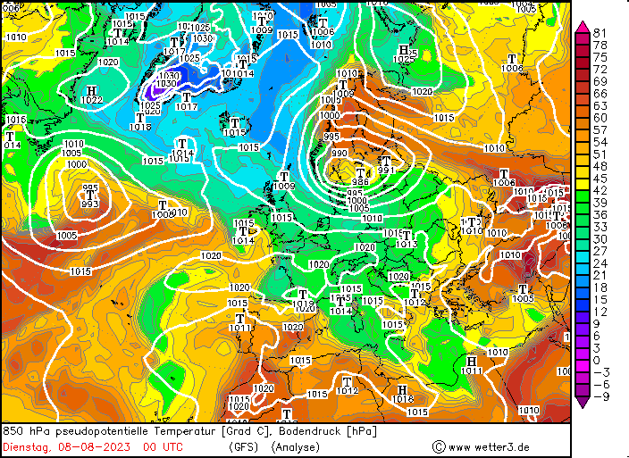
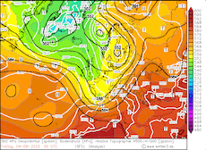
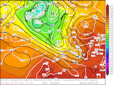
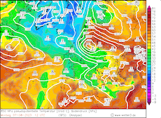
850 hPa Pseudo-potential temperature and sea surface pressure over Europe 07.08.2023 00 UTC - 08.08.2023 12 UTC, source:
wetter3
|
 |
 |
 |
 |
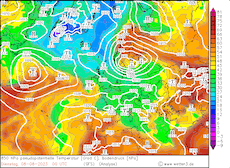
The surface low moved northwards over Eastern Europe on August 06, 2023, deepening rapidly on August 07, 2023. As the cyclone moved slowly westwards over Southern Scandinavia, the cyclone brought the second severe summer storm to Central Europe after storm low Poly in early July. Wind gusts reached up to 110 kph on August 08, 2023 at the shoreline of the Skagerrak. Along the German coast of the North and Baltic Sea, a rare summer storm surge was observed. Over Southern Norway and Sweden, the storm low brought intense precipitation, as unusually warm and moist air masses were advected into Northern Europe. 48 h precipitation totals in Southern Norway reached more than 100 mm, leading to high river run-off and local river flooding. Though, damages were only minor. In the Baltic and Southern Finland, a rare severe weather outbreak was observed, with strong thunderstorms forming, bringing heavy downpours and locally large hail.
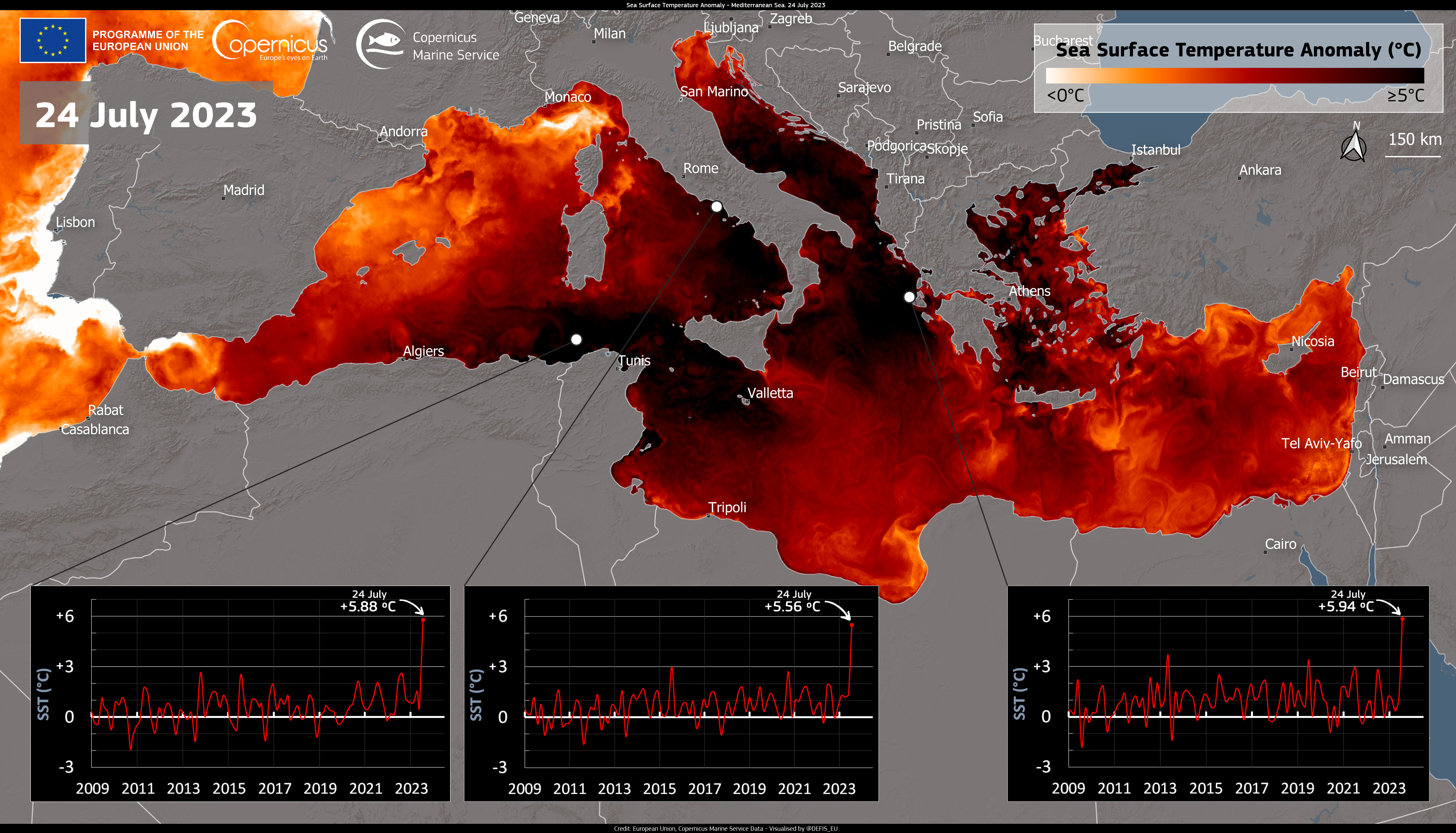
Sea surface temperature anomalies of the Mediterranean Sea, with timeseries at selected locations, 24.07.2023,
source:
Copernicus - Image of the Day, Credit: European Union, Copernicus Marine Service data
|
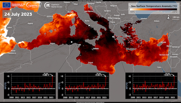 |
The river flooding in Slovenia and Croatia, was not only exceptional because of the extreme river run-off in the region, but also because it occurred during the summer months, when the river run-off in the region is on average the lowest. Further, the exceptional marine heat wave in the Mediterranean likely played a role in the synopsis of this event. In the last week of July, sea surface temperature deviation in large parts of the Mediterranean reached more than 5 K. This likely provided not only a source for an increased amount of water vapor in the atmosphere, but also led to increased diabatic heating as the cold air masses reached the Western Mediterranean, possibly enhancing the lee cyclogenesis over the Gulf of Genoa. These factors might have contributed to the extreme precipitation rates in Slovenia and Carinthia.
Text: KG
August 13, 2023
Information on warning levels and icons used
Information on meteoalarm.eu
|