|
Devastating flooding in Western Germany (NRW and RP) as well as large parts of Belgium from 13 to 16 July. Afterwards similar flooding in
southeastern parts of Bavaria and Austrian foothils of the Alps. Almost 150 mm of daily precipitation on 14 July in Kall-Sistig (NRW).
The summer of 2021 continues to be exceptional in many parts of Central Europe. After March, April and May were
too cold in many places in Germany, June was slightly warmer than average, but had above-average precipitation.
Only one notable heat wave was able to establish itself in Central Europe in the current summer, during the second
decade of June. The rest of the time was characterized by rather changeable weather and many periods of showers and
thunderstorms. The result was well-filled inland lakes and rivers. At the beginning of the second decade of June,
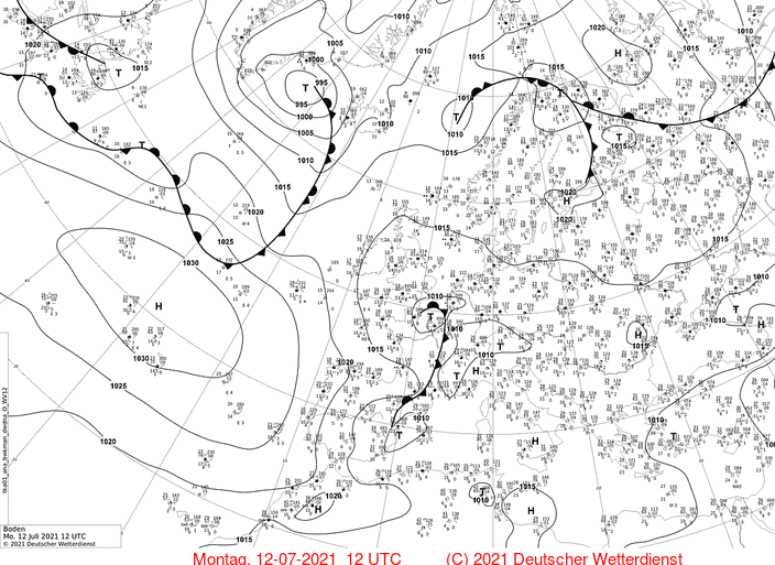
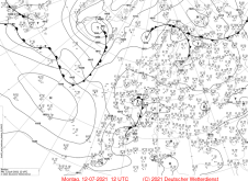
on July 12, a deep trough formed over the eastern Atlantic. Under slight eastward drift, the southern part of the
trough tied off and became a cut-off low. Due to the cold core of this low pressure area, low pressure area BERND
was not only concentrated on the layers near the ground, but extended over the full vertical range of the troposphere.
This specific type of depression is called a cold low.
|
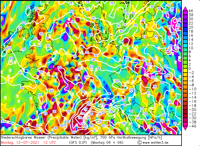
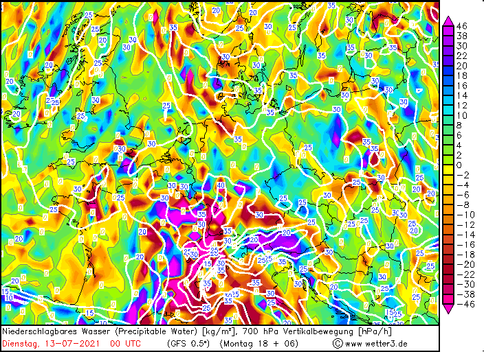
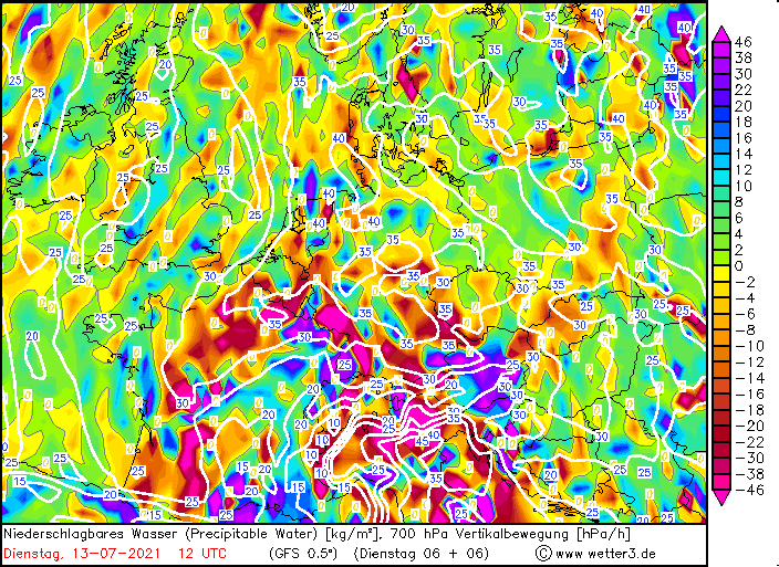
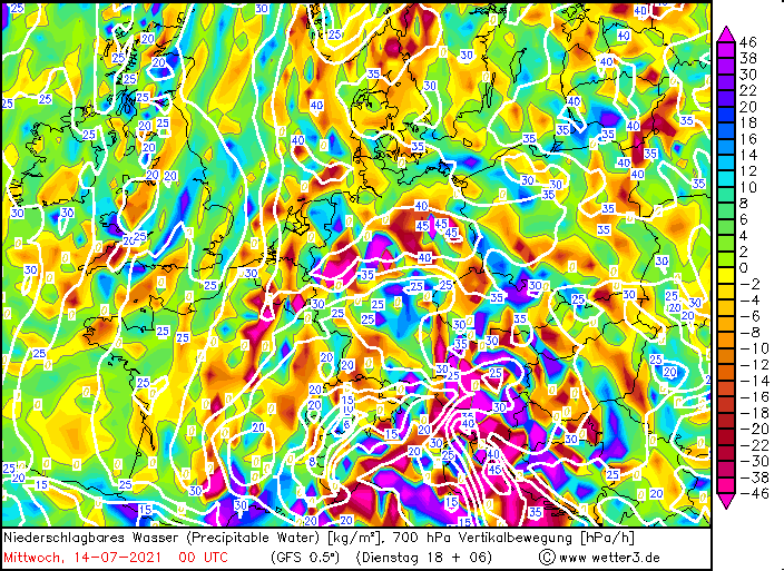
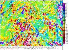
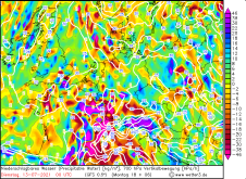
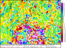
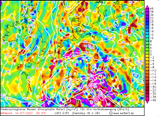
Sea level pressure and precipitable water from 12.07. 12 UTC until 14.07. 00 UTC, source:
Wetter3
|
 |
 |
 |
 |
 |
 |
 |
 |
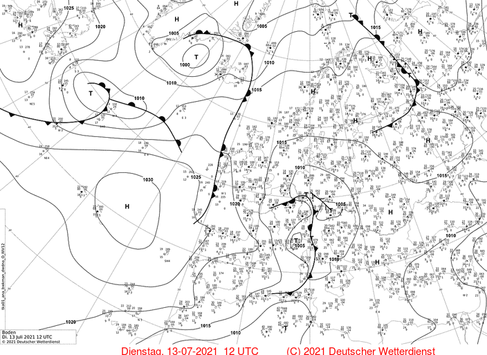
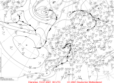
Warm, humid air of subtropical origin moved into Central Europe at the front of low pressure area BERND. This
resulted in heavy precipitation with embedded thunderstorms in Western Europe on the 12th and 13th. On July 14,
low pressure BERND moved slowly toward the northeast, causing the center of rotation to be located over southern
Germany. Due to the short distance to the core of the depression, the precipitation areas moved only slowly or even
became stationary. The result was widespread daily precipitation accumulations of more than 100 mm in the Volcanic
Eifel and in the district of Ahrweiler. The peak was marked by the station Kall-Sistig with a 24h precipitation of
144.8mm on July 14. 11 other stations within a radius of 50 km reported daily precipitation of more than 100 mm. A
listing of daily precipitation on July 14 can be found here,
as well as a listing of precipitation records on that day.
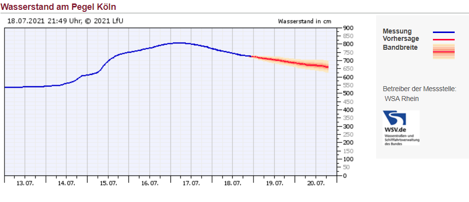
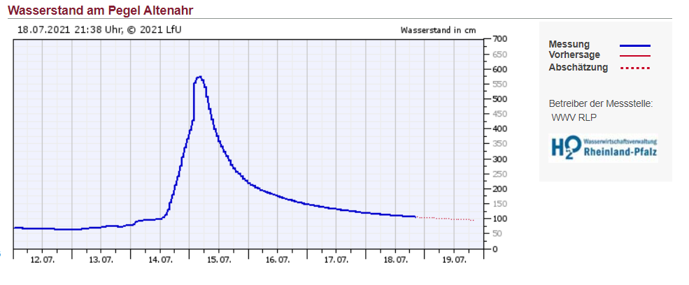
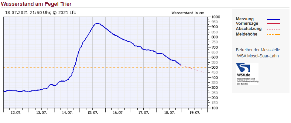
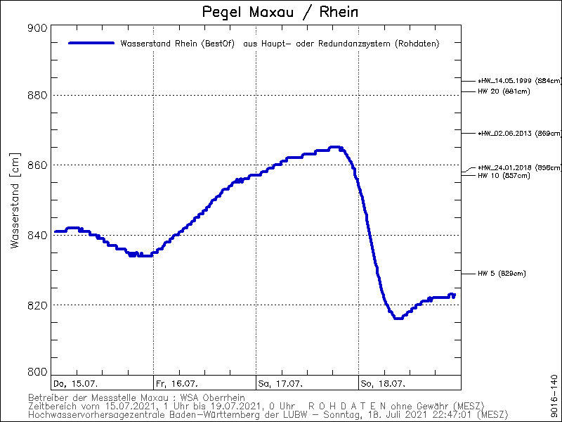
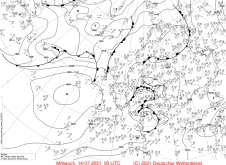
In western Germany, almost all rivers carried high water during this period.Larger water bodies such as the Rhine,
the Main, the Moselle showed water levels in the range of two to ten-year floods. Smaller rivers in NRW and RP like
the Ahr, the Ruhr and the Erft exceeded all thresholds and set all-time records, some of them 200% above the average
water level. On the back side of the low pressure area, a still high humidity continued to lead to abundant precipitation.
The precipitation maximum shifted to the southeast of the Netherlands and large parts of Belgium on July 15. Here, flooding
was also devastating. Roads were washed out and swept away, buildings were destroyed. There was also considerable damage
to infrastructure at the Circuit de Spa-Francorchamps race track.
|
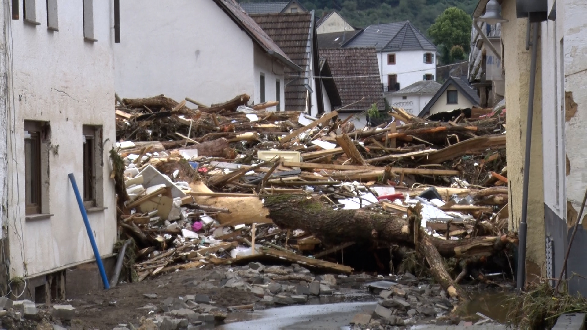
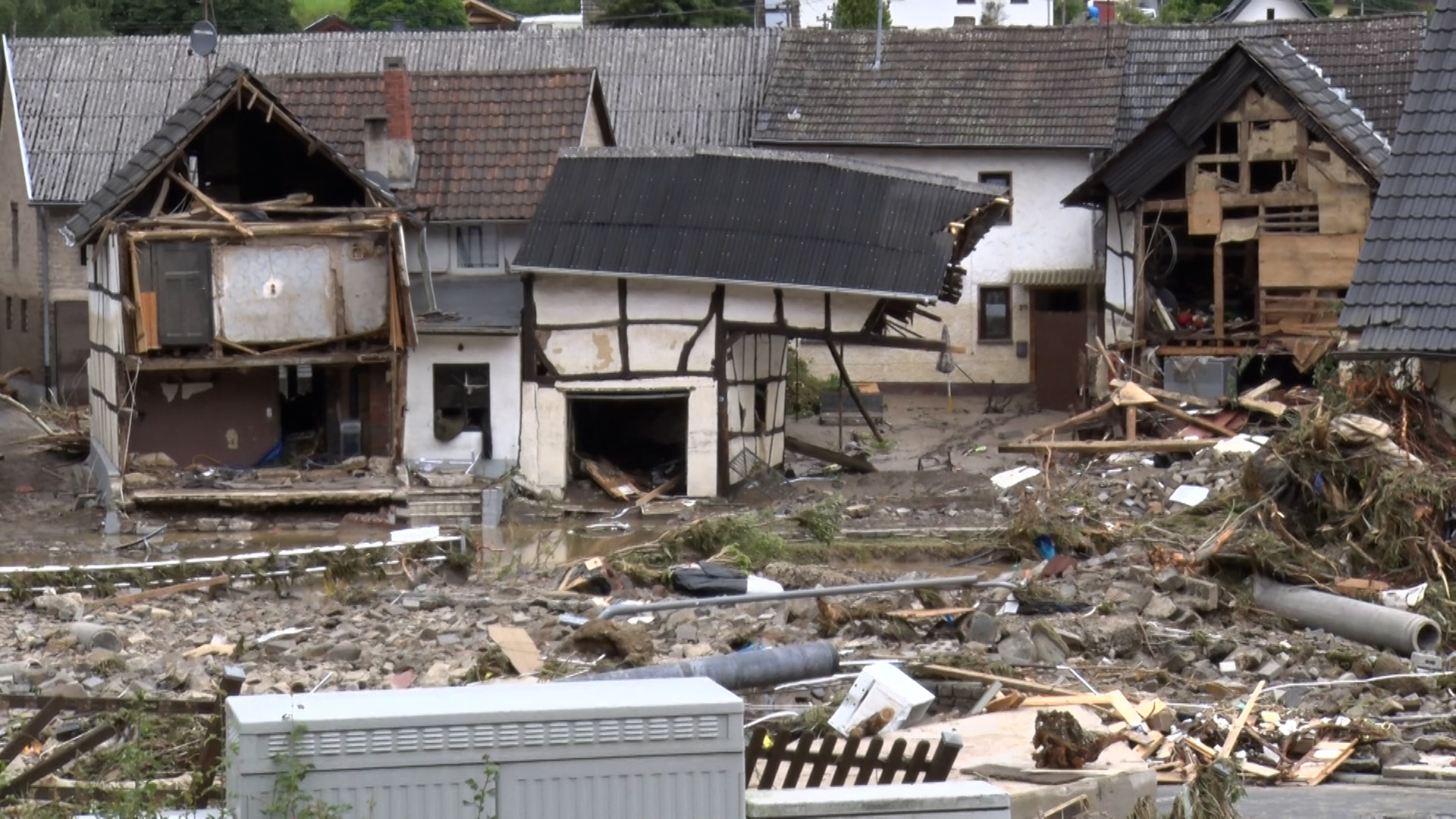
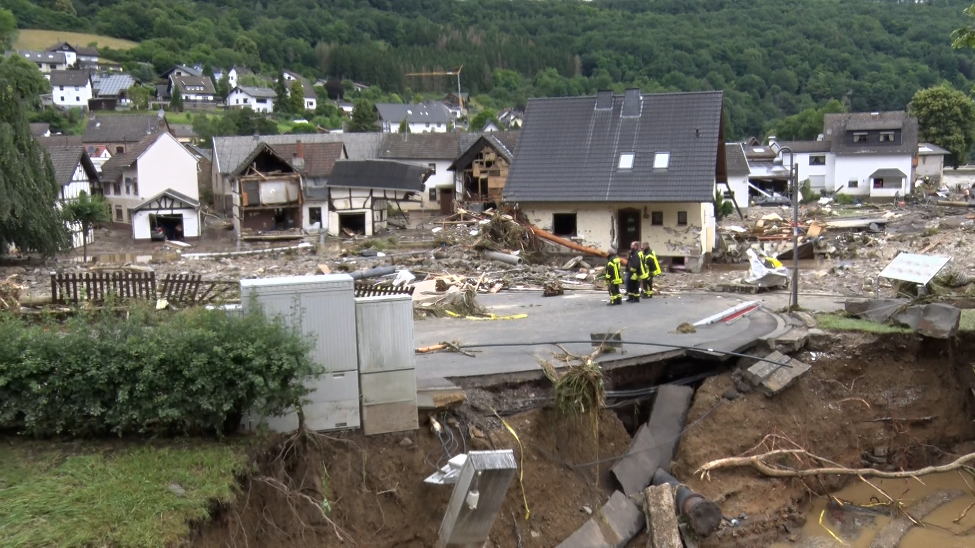
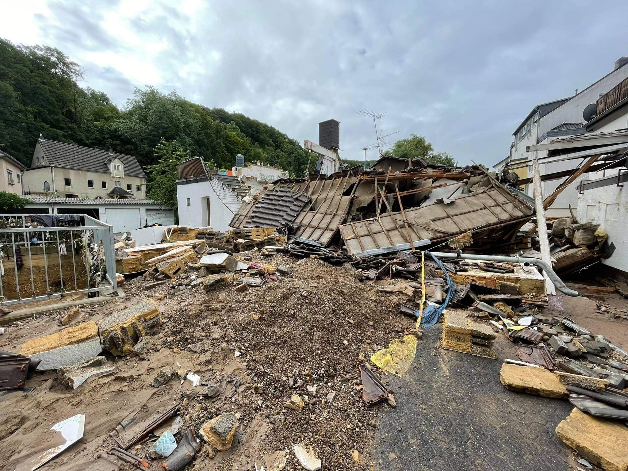
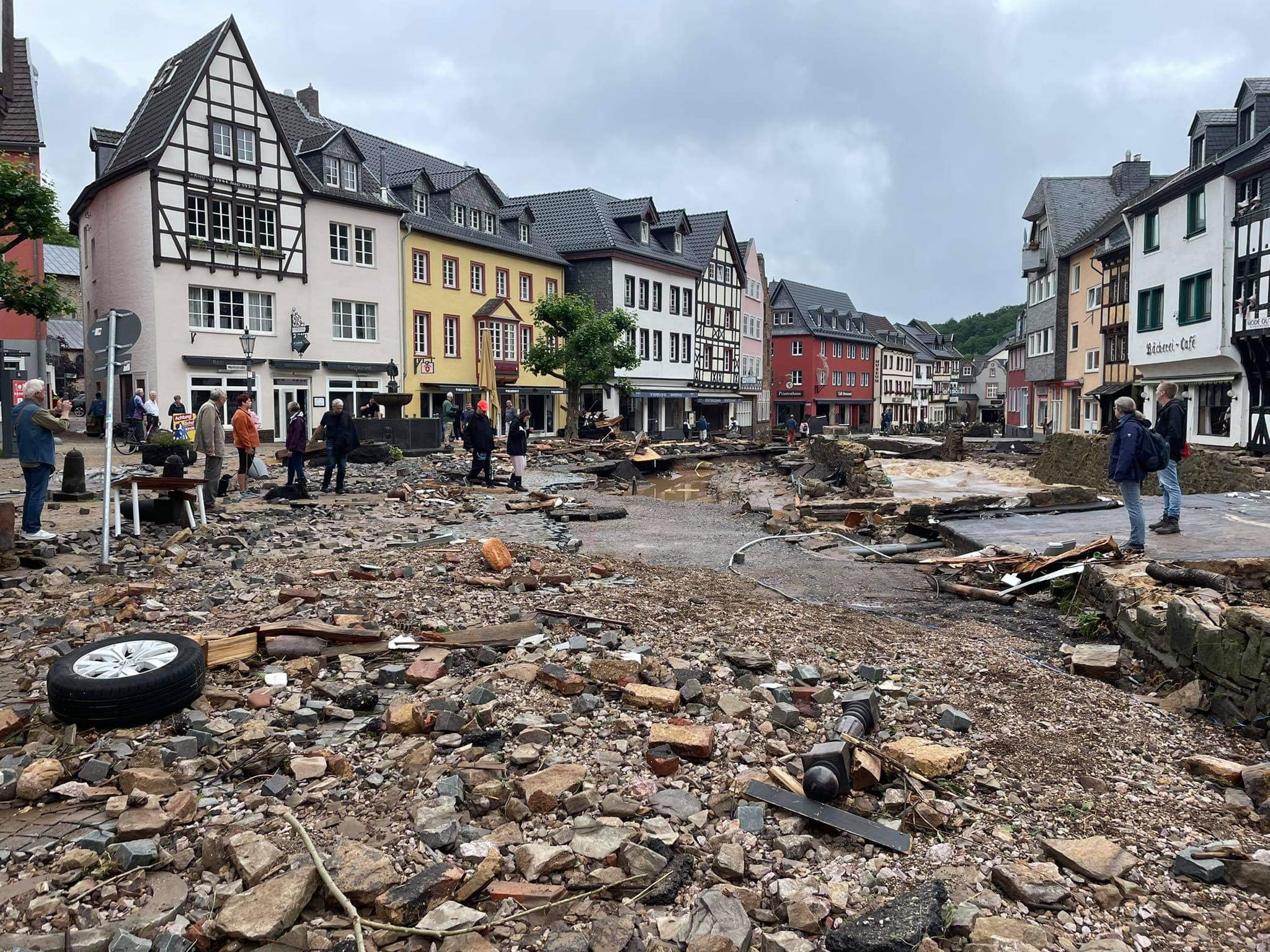
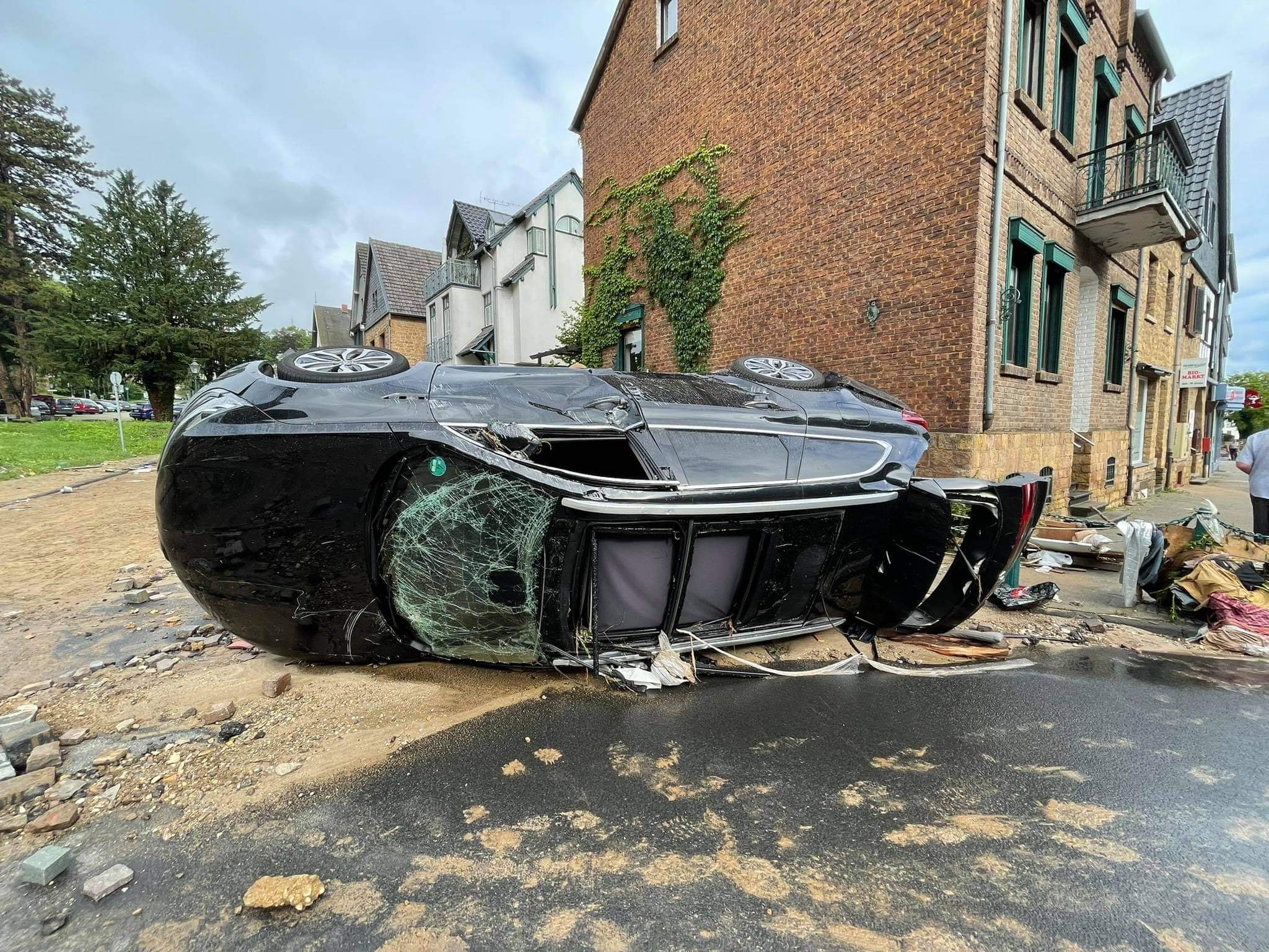
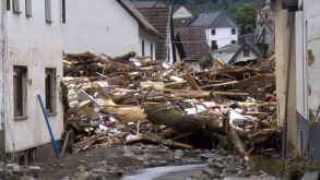
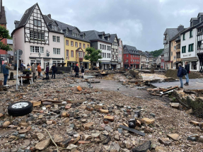
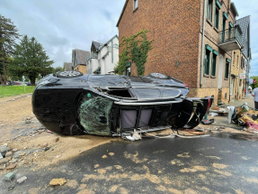
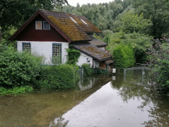
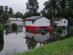
Impressions of Flooding and damage in Schuld (Rhineland Palatinate) and Bad Münstereifel (North Rhine-Westphalia), source:
Bernd März / Unwetter-Freaks
|
 |
 |
 |
 |
 |
 |
In the following days, the still existing low pressure area BERND moved further southeast across the Alps to Italy. As a result,
the precipitation areas shifted to the Alpine region in eastern Germany and Austria. In the Bavarian foothills of the Alps, daily
precipitation amounts of more than 50 mm were recorded widespread on July 17. The station Bischofswiesen-Winkl. registered a value
of 130.5 mm marking the peak of that day. Four neighboring stations in Germany also reported precipitation values of more than 100mm.
This illustrates the uniqueness of this precipitation event, with precipitation totals > 100mm, which are otherwise only known from
convective events, and at the same time a spatial extension, which is rather known from stratiform precipitation.
|
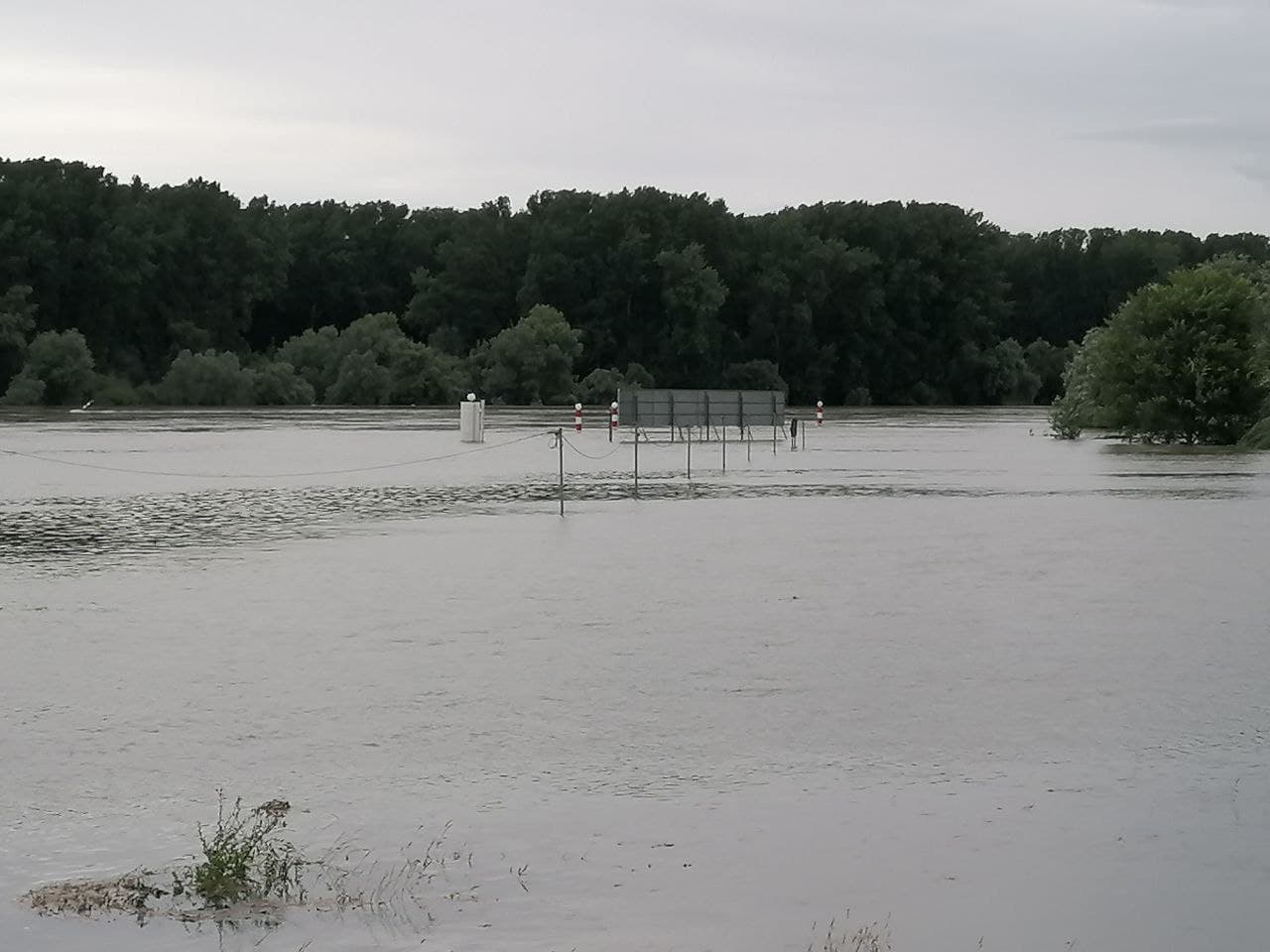
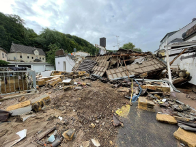
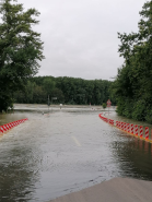
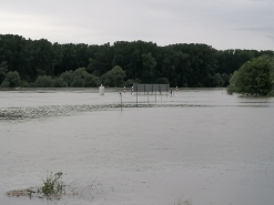
Impressions of Flooding in Eggenstein-Leopoldshafen (Baden Württemberg), source: Fabian Siegmann
|
 |
 |
 |
 |
The flood situation also triggered a political debate in Germany about flood prevention and climate protection measures. From a
meteorological point of view, it is obvious that the increase in atmospheric temperature caused by anthropogenic climate change
also leads to an increase in water vapor in the atmosphere and thus to larger amounts of precipitable water. Thus, there is
reasonable cause to believe that extreme events of this type will become more likely as a result of climate change. However, to
consider a single event as a consequence of climate change is not tenable from a scientific point of view.
Text: FS
July 19, 2021
|