


|
|
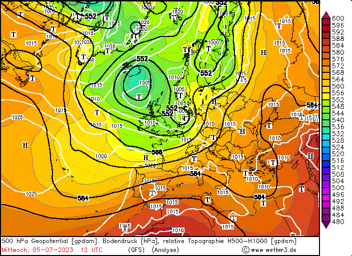
In the evening hours of July 05, 2023, the cyclone quickly filled while moving across the Kattegat. During its short life, summer storm Poly will be mostly likely one of the outstanding meteorological occurrences in Central Europe in 2023. As during the summer months, all the trees have leaves and therefore amplifying the tree's wind resistance. In the Netherlands, this led to many downed trees, disrupting travel by train and car. Poly is most likely the strongest summer storm in recorded history in the Netherlands and one of the most powerful summer storms in recent decades in Northern Germany, that led to the unfortunate loss of two lives in Germany.
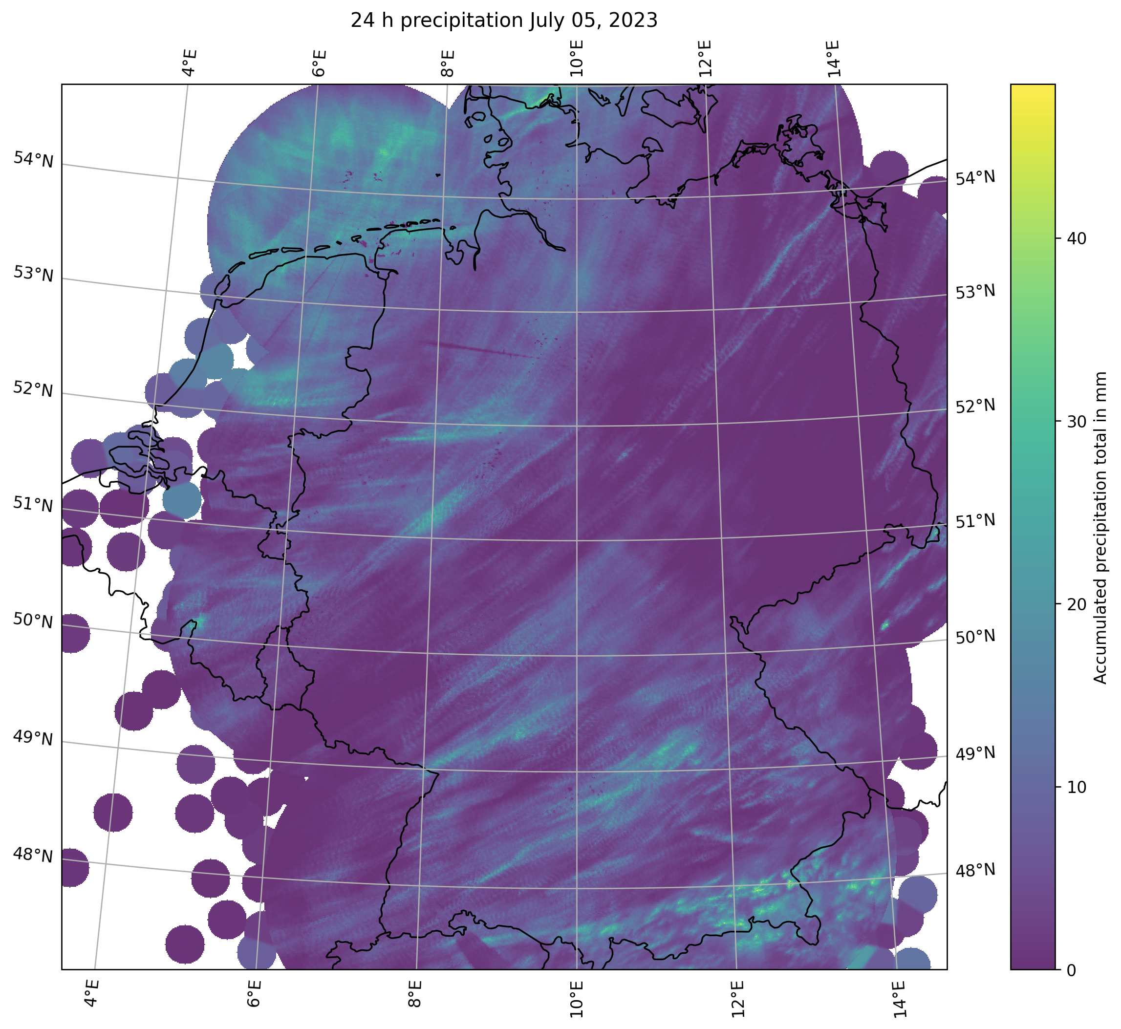
| 24 h precipitation totals over Germany on July 05, 2023, source: DWD, visualization: K. Gramlich |
 |
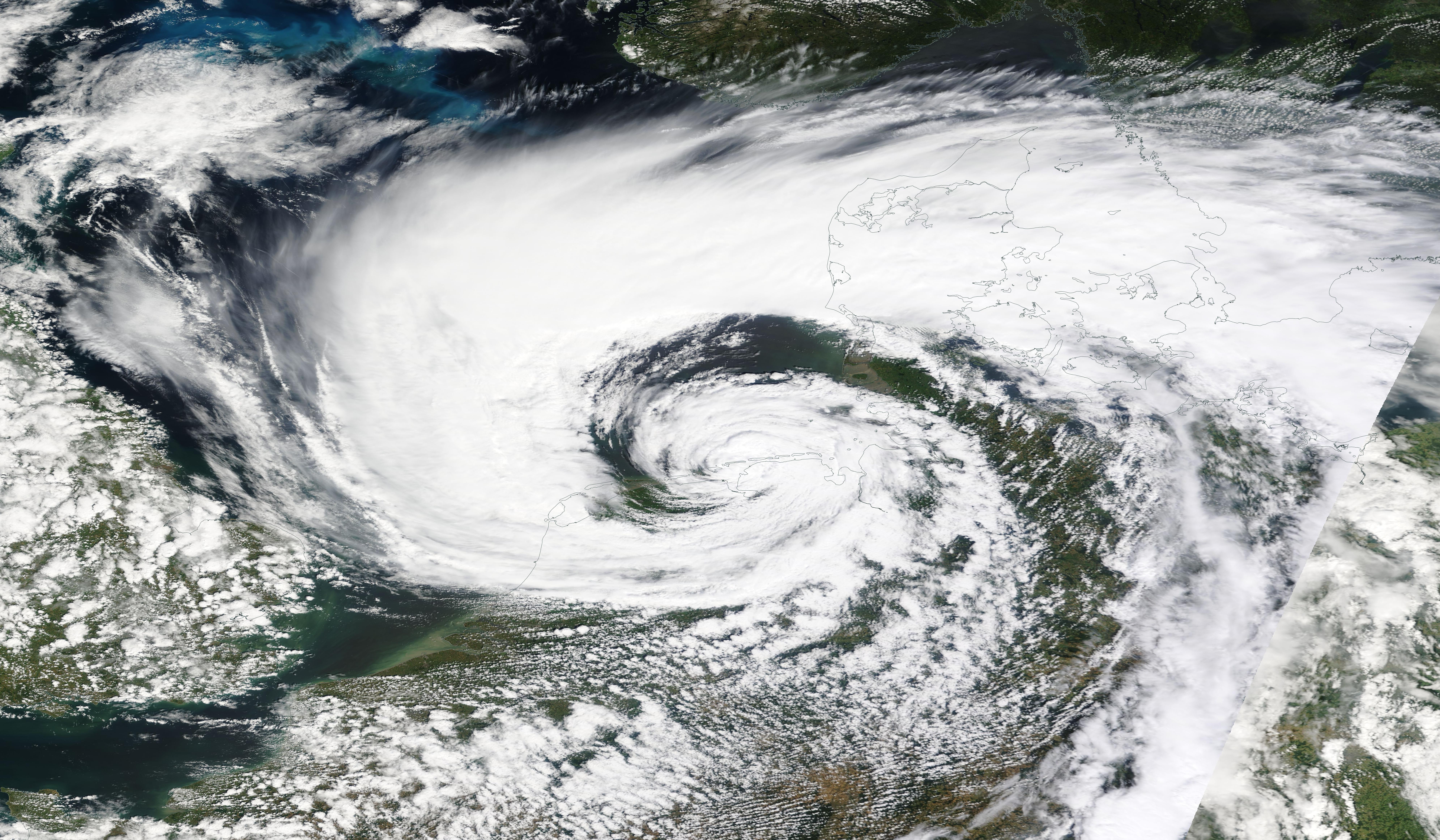
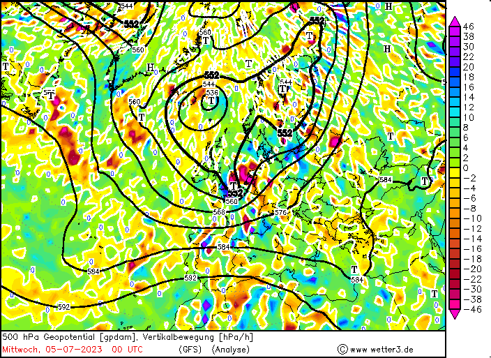
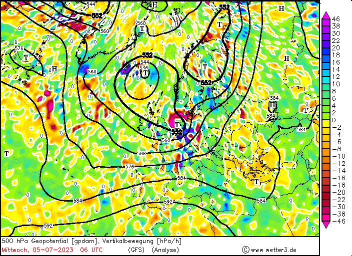
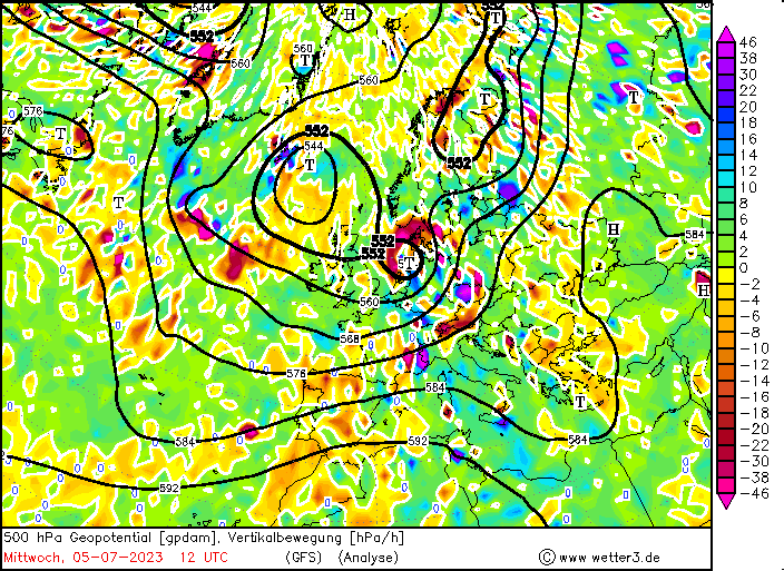
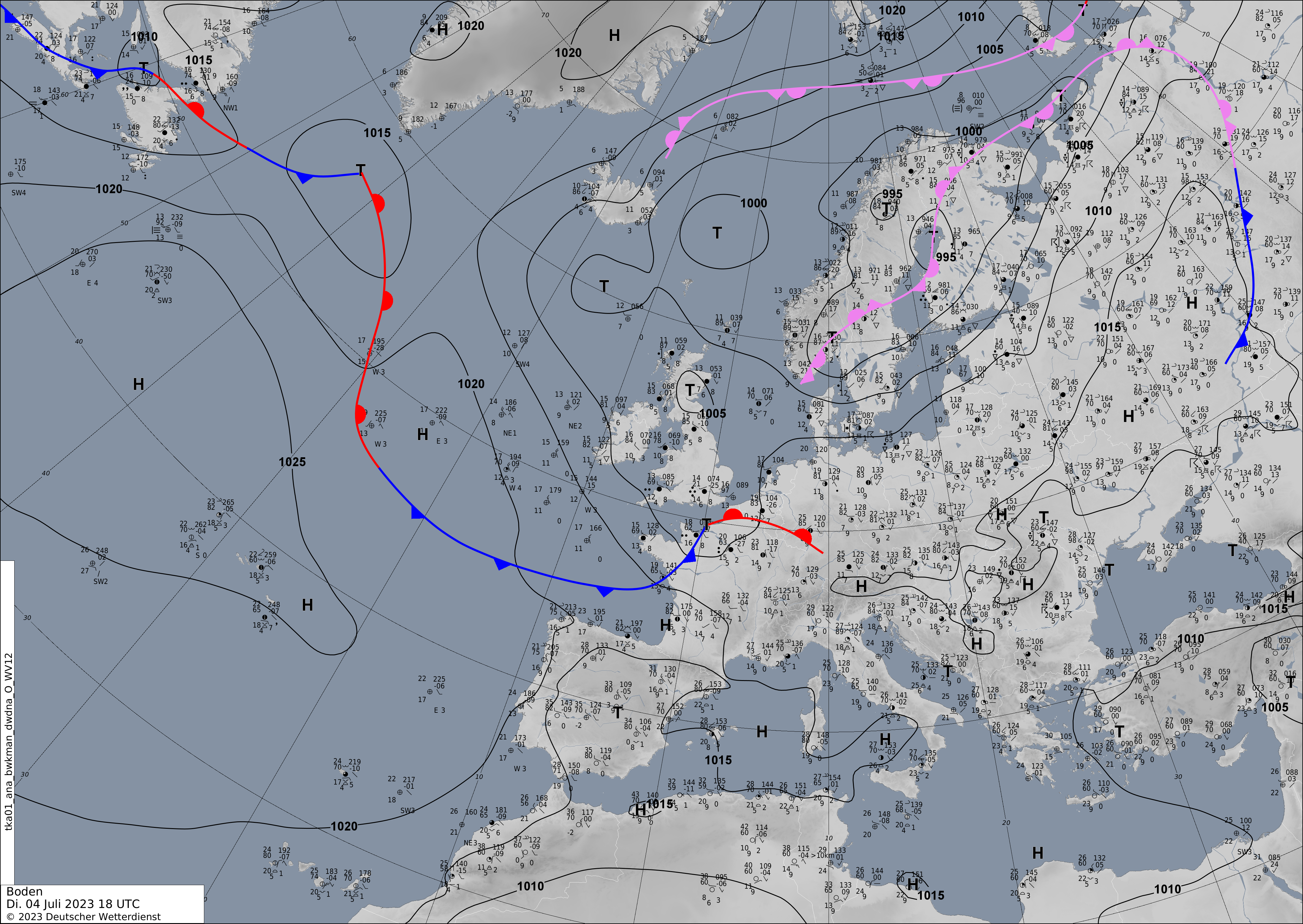
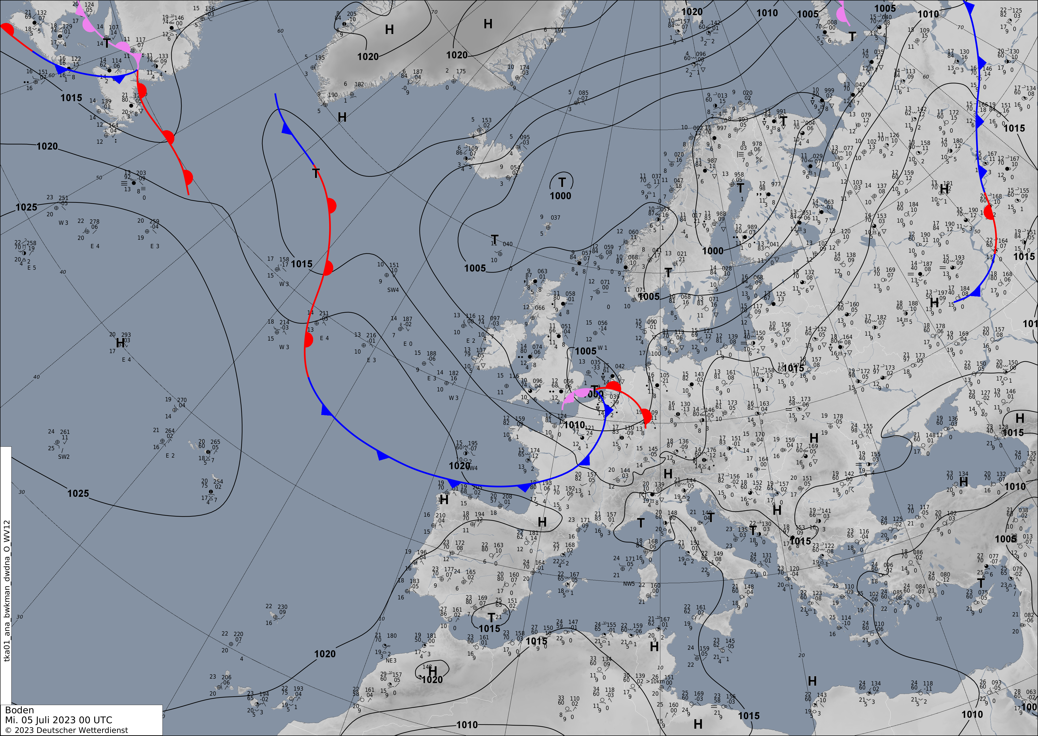
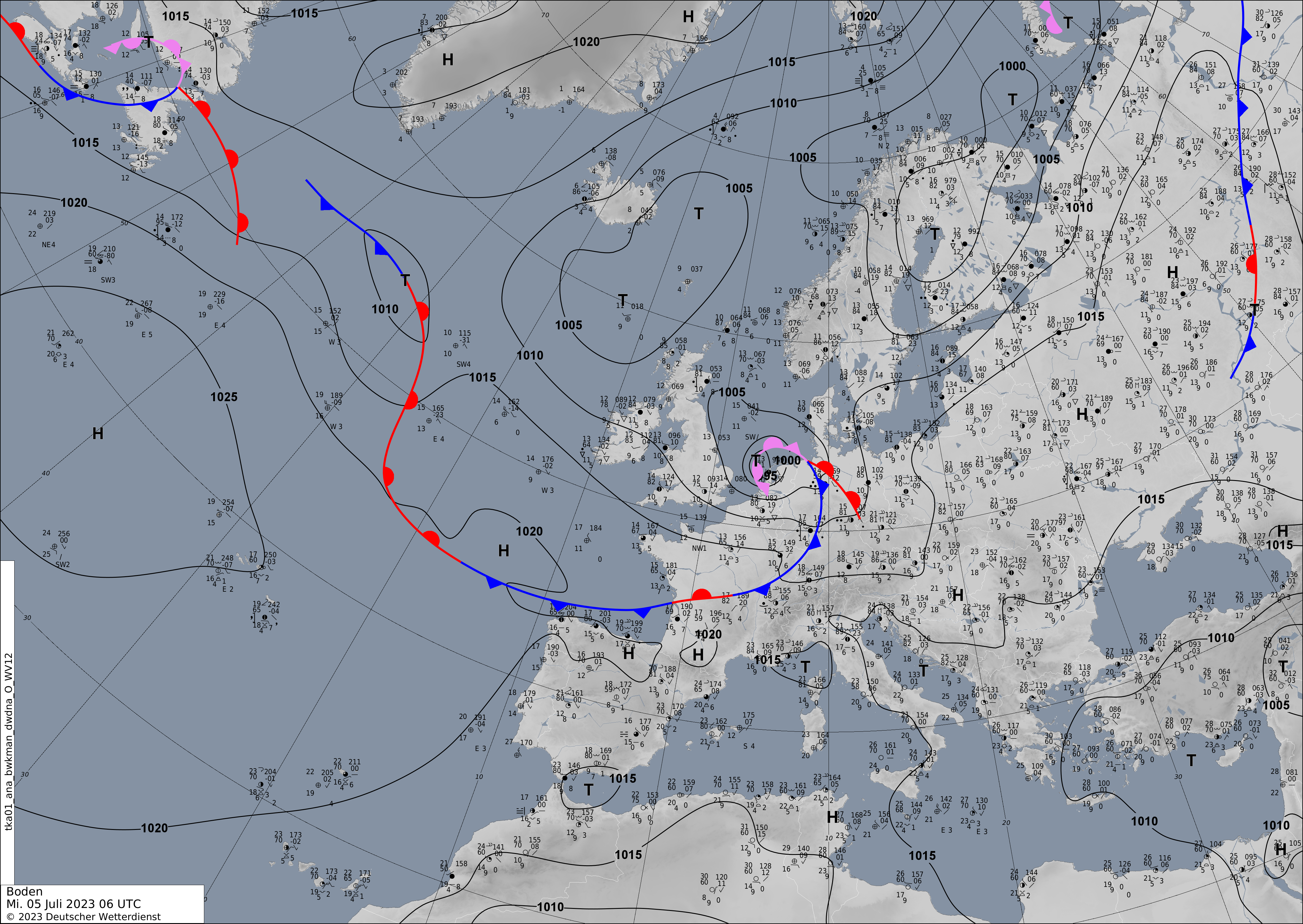
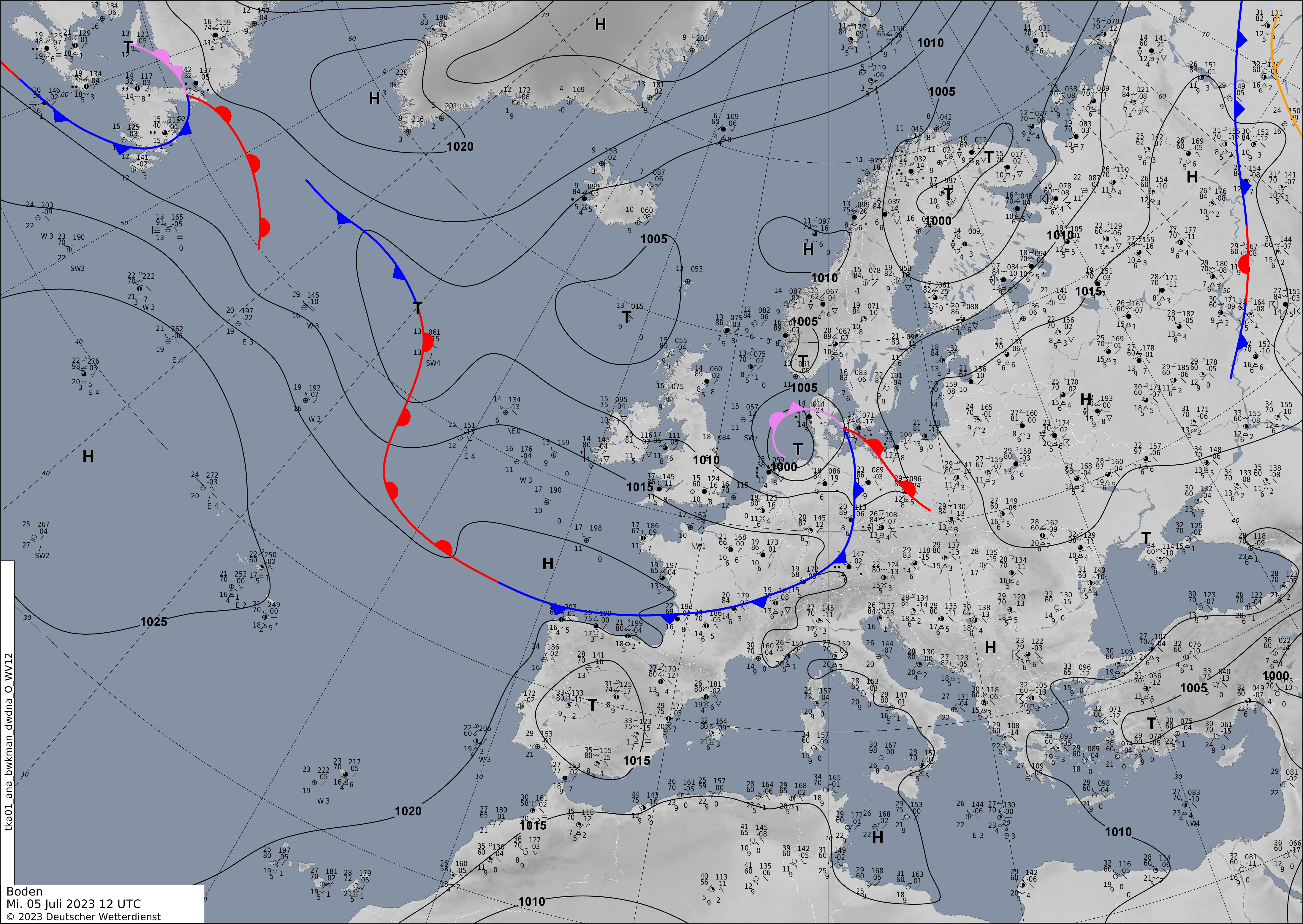
The main meteorological question that remains after the passage of storm Poly is, what was this storm. As described above, the cyclone underwent explosive cyclogenesis, which is common for Shapiro-Keyser cyclones. Looking at the frontal structure of the cyclone both via satellite and radar imagery, one might argue, that, like a Shapiro-Keyser cyclone, Poly had a frontal fracture with the cold front of the cyclone already passing Southern Germany in the morning hours of July 05, 2023. Further, the occluded warm front of the system wrapping around the cyclone center, resembles the process of the bent-back warm front wrapping around the cyclone center of a Shapiro-Keyser cyclone. When looking at the wind field of storm Poly, one can clearly see that over the Netherlands around the city of Amsterdam a distinct area of the most extreme wind gusts can be distinguished, outside of which no wind gusts of more than 120 kph were observed.
| Visible satellite image of storm Poly with the potential sting jet over the Netherlands, 05.07.2023 08 UTC, source: Eumetsatview |
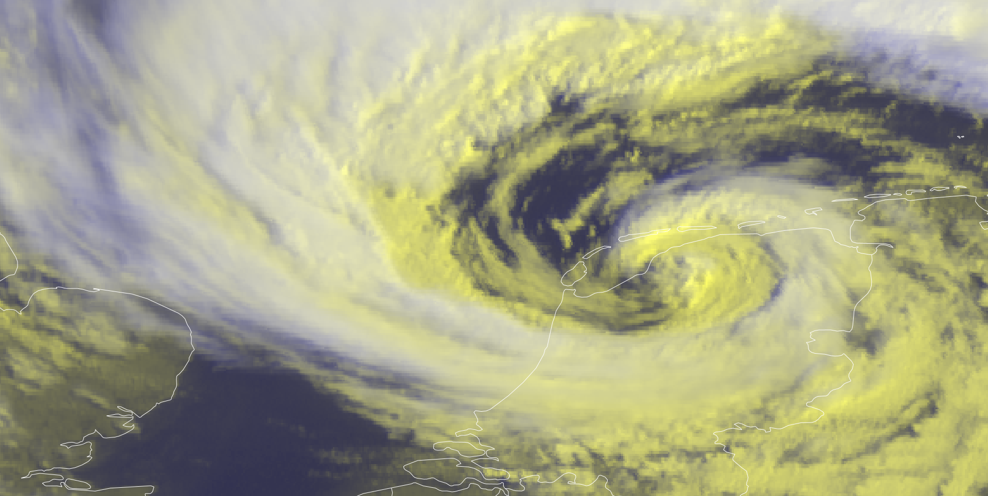 |
This could represent the footprint of a sting jet reaching the surface, though the satellite images don't show the classic finger-like structure at the tip of the cloud head of the bent-back front. In comparison in the radar images over the Netherlands, one might argue that the precipitation has a banded structure, which would reveal dry air masses descending in the region of the cloud head possibly connected to the sting jet, leading to evaporation and therefore reduced precipitation rates. Also, the confined area of these extreme wind gusts both on a temporal and spatial scale is classic property of a sting jet. Though, a sting jet's occurrence over Continental Europe is already very rare in the winter months, in the summer months such an occurrence would be exceptionally rare. Only in the last years, the first sting jet to impact Continental Europe was confirmed for storm Egon in January 2017 (see: Eisenstein et. al, 2020). To confirm a sting jet reaching the surface, complex backward trajectory analysis is needed. The backward trajectory analysis reveals the trajectory of different air parcels during the lifetime of a cyclone. In this analysis, it can be revealed how a coherent air flow descends from the tip of the cloud head into the dry slot of the cyclone. In this case, the weaker wind gusts in the afternoon hours over the East Frisian Islands are most likely connected to the cold jet wrapping around the cyclone center.
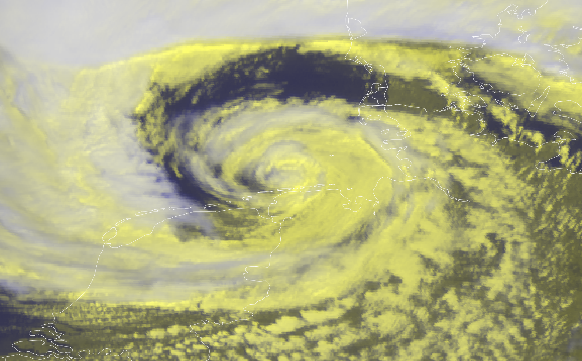
| Comparison between storm Poly (left), 05.07.2023 12 UTC, source: Eumetsatview and Subtropical Storm ANA (right), 22.05.2021, source: NASA Worldview | |
 |
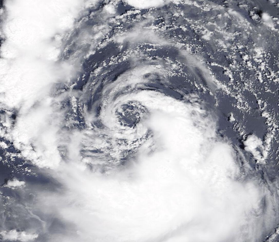 |
When analyzing the latter stages of development of storm Poly, the storm's structure once again is special. Like a Shapiro-Keyser cyclone, the storm most likely developed a warm seclusion in the cyclone center, leading to these distinct precipitation bands around the cyclone center. One might argue here that these bands have a similar structure to a warm core tropical cyclone, e.g., comparing it to subtropical storm Ana in 2021, which makes this storm even more special. A warm core can only be achieved by warm ocean waters which lead to a large energy release via latent heating. In this case, the latent heating might have played a significant role in the development of storm Poly, as the North Sea is much warmer than usual with water temperatures of more than 15 °C. Though, this is much too cool for a tropical cyclone, but also more than 10 °C warmer than in the winter months, which should amplify the role of latent heating during the cyclone development.
Overall, summer storm Poly was not only an exceptionally powerful storm during the summer months but will also likely lead to much scientific research to understand the remarkable structure of this storm.
Text: KG
July 08, 2023
