|
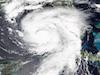
Hurricane IDALIA became the second major hurricane to make landfall in Florida in the last 12 months. IDALIA was the first major hurricane in recorded history to enter the Apalachee Bay, making landfall in the Big Bend region of Florida as a category 3 hurricane with sustained winds of up to 200 kph.
The tropical disturbance which eventually matured into Hurricane IDALIA, formed over the Eastern Pacific. By August 26, 2023, the tropical disturbance had moved into the Atlantic Basin into the Caribbean Sea and began to organize close to the Yucatán Peninsula. In the following days, the system lingered south of the Yucatán Peninsula gradually strengthening, reaching tropical storm force by August 27, 2023. By August 29, 2023, the system began moving northwards, passing Cuba, and entering the Gulf of Mexico. On the same day, IDALIA was upgraded to a category 1 hurricane.
|
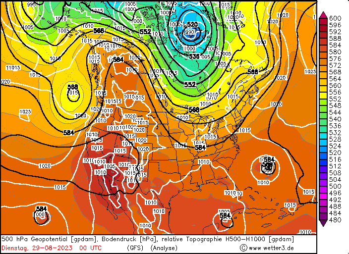
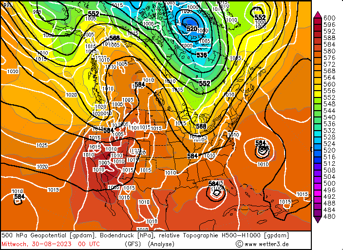
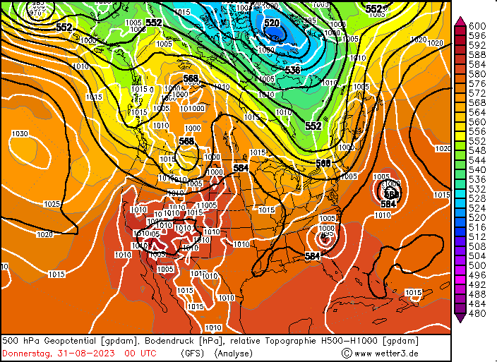
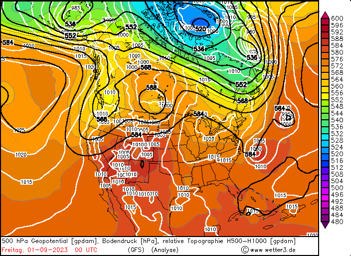
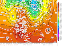
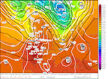
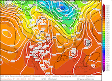
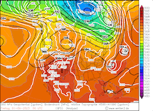
500 hPa Geopotential and sea surface pressure over North America, 29.08.2023 00 UTC - 01.09.2023 00 UTC, source:
wetter3
|
 |
 |
 |
 |
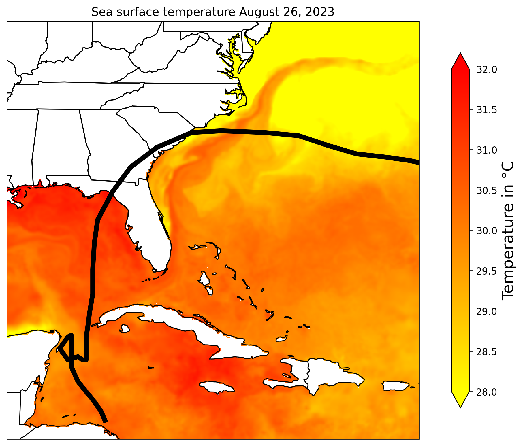
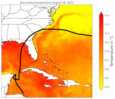
Over the Gulf of Mexico, the conditions for rapid hurricane intensification were given, as sea surface temperatures reached up to 31 °C combined with a low wind shear environment and high mid-level moisture levels. By August 30, 2023 09 UTC, Hurricane IDALIA had intensified into a category 4 hurricane with sustained winds peaking at 215 kph and the central pressure dropping to 940 hPa. Within a 24 h-period, the maximum sustained winds of IDALIA had intensified by 89 kph, one of strongest rapid intensifications observed in the Atlantic Basin in recorded history.
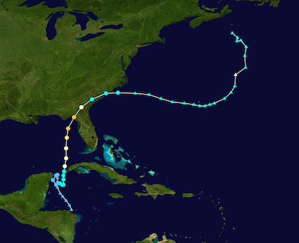
Track and intensity of Hurricane IDALIA (left), source:
NOAA, Sea surface tempeature along the track of Hurricane IDALIA (right), source: NOAA Coralreefwatch,
Visualization: K. Gramlich,
|
 |
 |
Before making landfall in the Florida Panhandle, IDALIA underwent an eyewall replacement cycle, which means that around the original eyewall of a hurricane, a second eyewall with a larger diameter is formed. As a result, the first eyewall is deprived of its moisture influx and diminishes, leading to a weakening of the hurricane as the new eyewall moves inwards. In the case of Hurricane Idalia, the eyewall replacement cycle weakened to a category 3 hurricane with sustained winds of up to 200 kph upon landfall.
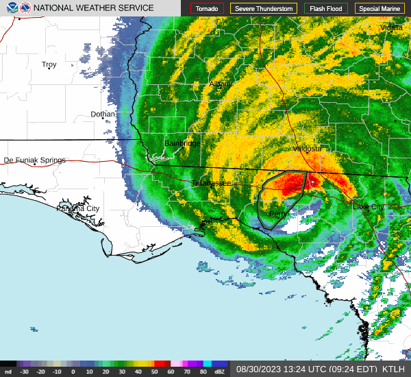
IDALIA made landfall on August 30, 2023 11:45 UTC, 30 km south of Perry, FL, bringing an extremely strong storm surge to the shallow shoreline of the Apalachee Bay. The town of Cedar Key, FL was severely affected by the storm surge of Hurricane IDALIA, with the storm surge reaching record-breaking heights of 2.7 m. Onshore winds in Tampa Bay caused a storm surge of 0.9 m. The Perry-Foley Airport recorded a wind gust of 140 kph. As Hurricane IDALIA moved onshore, the system quickly weakened as it moved northeastwards into Georgia.
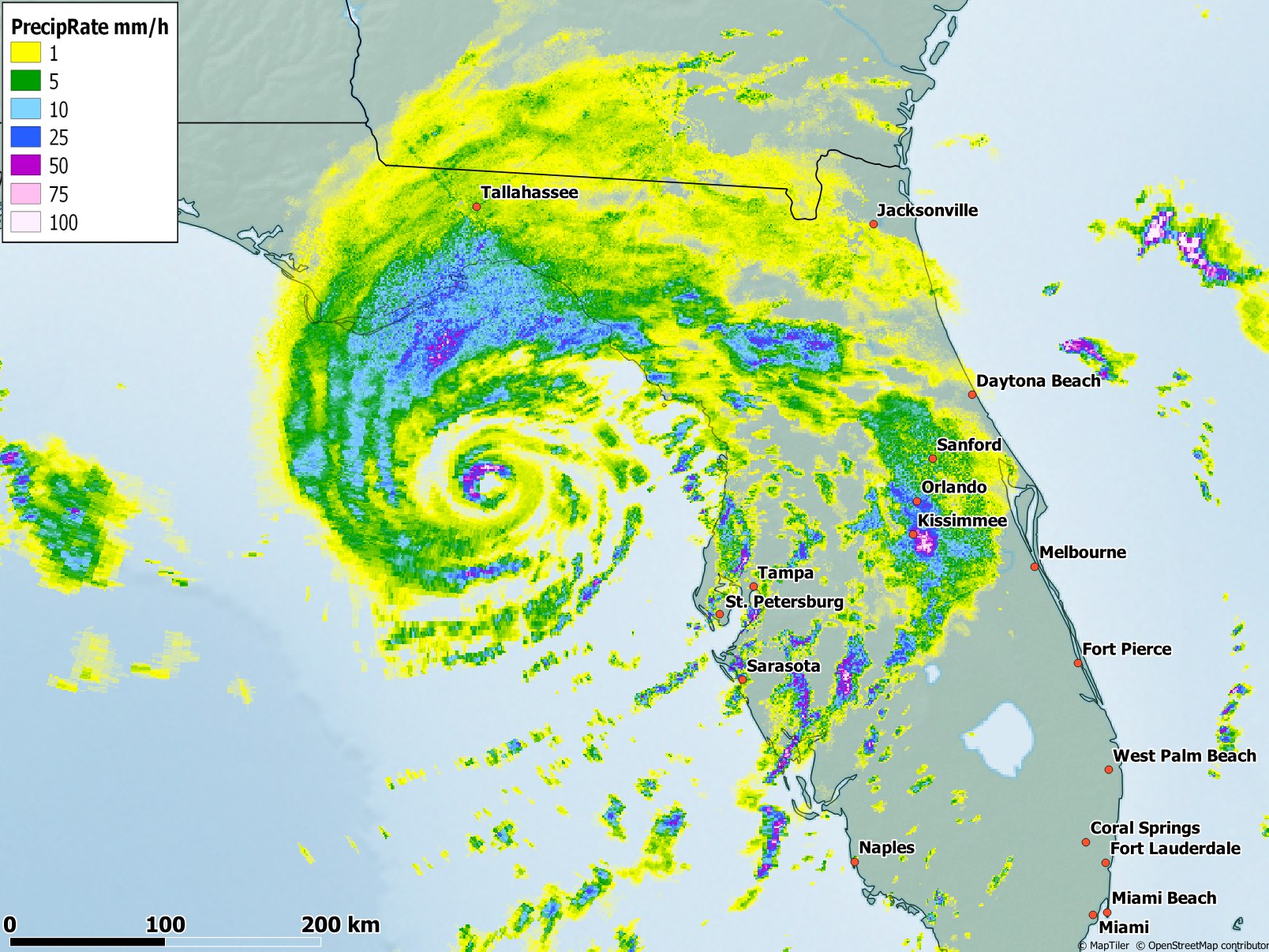
7-day accumulated precipitation over the southeastern part of the US with the track of Hurricane IDALIA, 04.09.2023,
source:
NWS Advanced Hydrological Service, Visualization: K. Gramlich
|
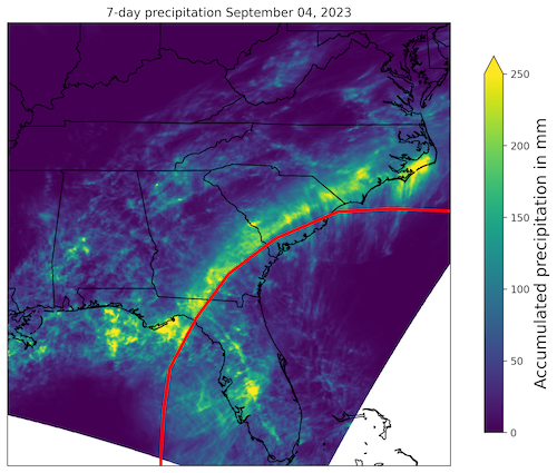 |
As the storm passed across the southeastern part of the US, IDALIA brought heavy rains, spreading as far northwards as North Carolina. Embedded into the rain bands of the hurricane, severe thunderstorms formed in the Carolinas, spawning a few tornadoes. Widespread rain totals during the passage of IDALIA reached more than 150 mm, with the highest precipitation accumulation of 344 mm being recorded at Holly Hill, SC. By early August 31, 2023, the weakened tropical storm moved over the open waters of the Atlantic, quickly transitioning into a post-tropical cyclone. In the following days, the storm moved eastwards bringing high winds and rough surf to the Bermudas. By September 02, 2023, IDALIA had transitioned into an extratropical low, losing all its tropical characteristics.
With Hurricane IDALIA and Hurricane Franklin active at the same time, two major hurricanes were active in proximity in the Atlantic Basin, marking an unusually active hurricane season over the Atlantic, with above-average tropical storm days and major hurricanes. Moreover, Hurricane IDALIA became the first major hurricane to enter Apalachee Bay in recorded history and was the strongest hurricane to make landfall in the Big Bend region of Florida since the Cedar Key Hurricane of 1896. Moreover, Hurricane IDALIA marks the 7th-straight year, with a major hurricane making landfall on the mainland of the US. Prior to 2017, 12 straight years without a major hurricane making landfall on the mainland of the US were observed. As Hurricane IDALIA hit a loosely populated part of Florida, the damages caused by the hurricane were much less in comparison to Hurricane IAN, which made landfall in September 2022 in the densely populated area of Fort Myers, FL. Nevertheless, IDALIA led to the loss of at least 8 lives and caused damages of up to 5 billion $.
Text: KG
September 06, 2023
|