|
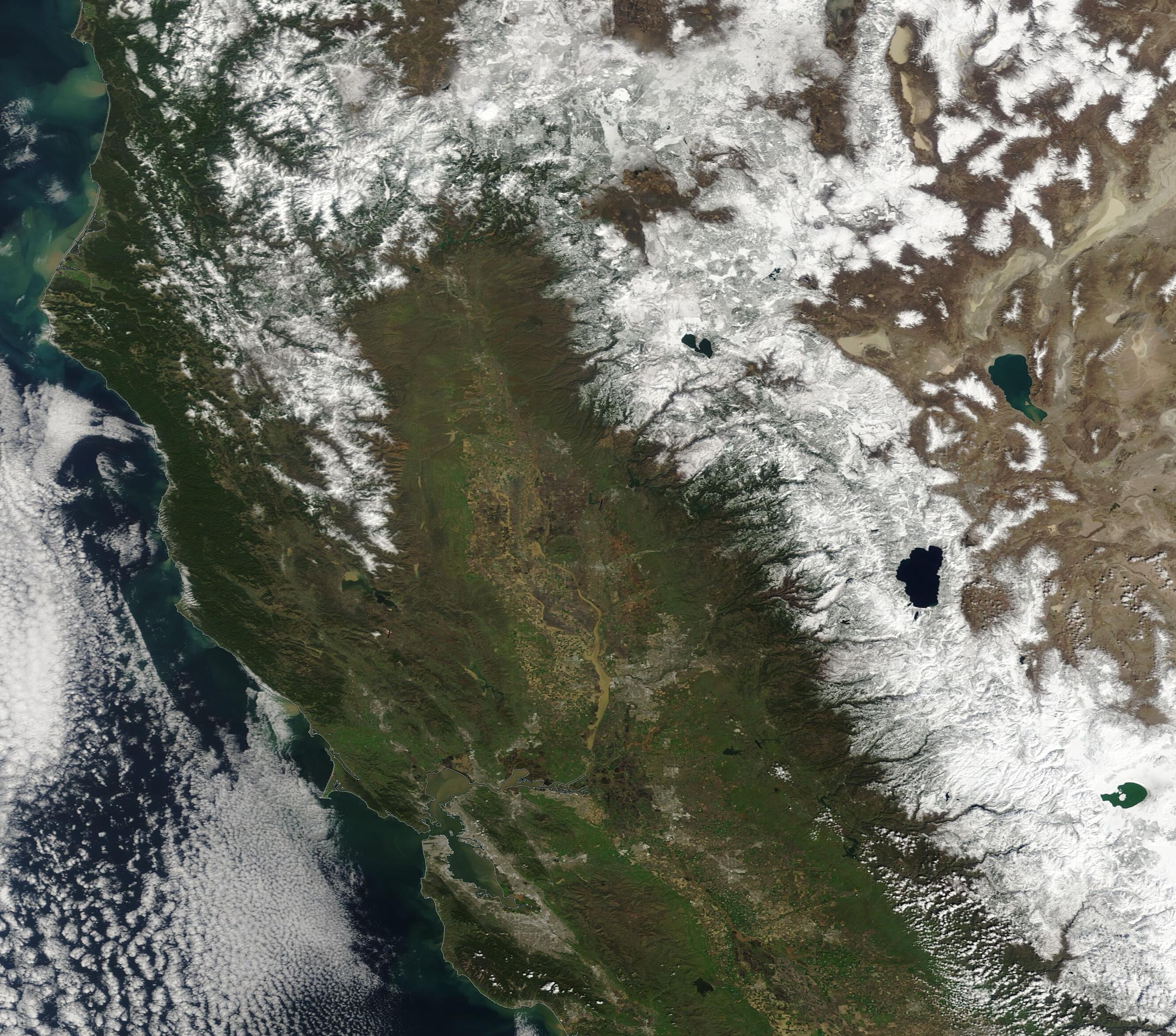
Friday, March 17, 2023, 18:00 UTC Heavy rain and snow California 09 March - 15 March 2023 Visible satellite image of California with visible fresh water runoff into the Pacific 16.03.2023 Source: NASA Worldview |
|
|
A strong zonally aligned flow over the Eastern Pacific dominated the weather over the western part of the US since March 09, 2023, leading to the advection of moist and warm air masses into the state of California, bringing heavy rains as well as heavy mountain snow to the state with subsequent river flooding at lower elevations.
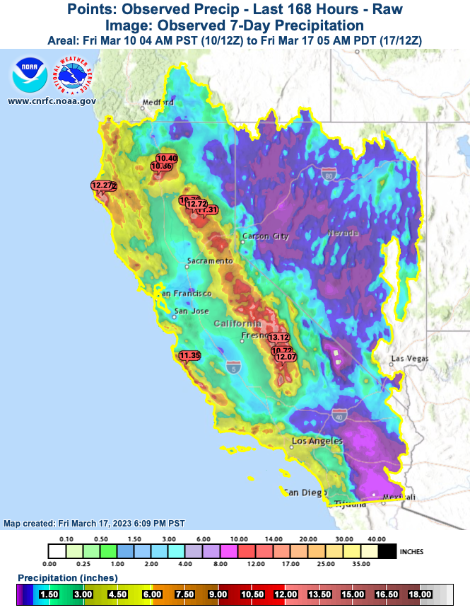
Can you spot the #AtmosphericRiver (AR) that's impacting the Golden State in this total precipitable water (TPW) loop? Moisture with this #AR has its origins tracing back to the subtropics near Hawaii. @NWSSacramento flash flooding going on right now downtown sonora pic.twitter.com/PYUY4fl1CW EMERGENCY ROAD CLOSURE 🚧 Please be advised Calaveras County Public Works has issued a complete road closure of Copper Cove Drive between Black Creek Drive and Cheyenne Road in #Copperopolis due to severe road damage and flooding. The road will be reopened as soon as possible. pic.twitter.com/dZ8TnBDnor Quarter Inch sized hail just fell here in Stockton, largest hail I’ve ever experienced in my life. Never heard the roof of the car pound that loud. #CAwx #WxTwitter pic.twitter.com/KFy9SY715D Here's a look at the 72 hour precipitation reports. Highest amounts were observed across the northern Sacramento Valley and over the mountains. Additional precipitation totals can be found here: https://t.co/Hdc69eelAv. Dry weather is expected through Friday morning. #cawx pic.twitter.com/oV84YxYQhg ❄️ Check out the 72 snowfall amounts! 1-2.5 feet of high elevation snow were observed across the northern Sierra Nevada. #cawx pic.twitter.com/yGnd0dCaAm Flash flooding west of Red Bluff at 4:45pm.#CAwx pic.twitter.com/W0jp0FSR6U CAL FIRE/Placer County FIire Department now in Unified Command with the Placer County Sheriff’s Office after a mudslide on Ben Taylor Road in Colfax (Placer County) impacted a residence. An evacuation warning has been issued for 20 additional residences. pic.twitter.com/WgBGfhEVex Amazing sediment plumes | In addition to the image published by @US_Stormwatch, here you go a more detailed view of one of those plumes in Bodega Bay & Sonoma Coast State Park - #California 2023-03-15.#Copernicus #Sentinel2 🛰️ N▶️ pic.twitter.com/eWqvqT374q Who wants an updated drought monitor?! Slight improvements over the last week, major improvements since the beginning of the water year. What an impressive gain in water storage from a year ago on this date. Shasta is now holding 81% more water and Oroville 76% more water than last year on this date. #cawx pic.twitter.com/0syF1jZRnT Mammoth, CA, Closes Main Lodge and Warns Public of Collapsing Roofs as Another Atmospheric River Slams Ski Areahttps://t.co/jfV7O9fdvv pic.twitter.com/xEINLURrLB |
|||||||||||||||||||||