Tuesday, 04 July 2023, 14:30 UTC
|
|
|
|
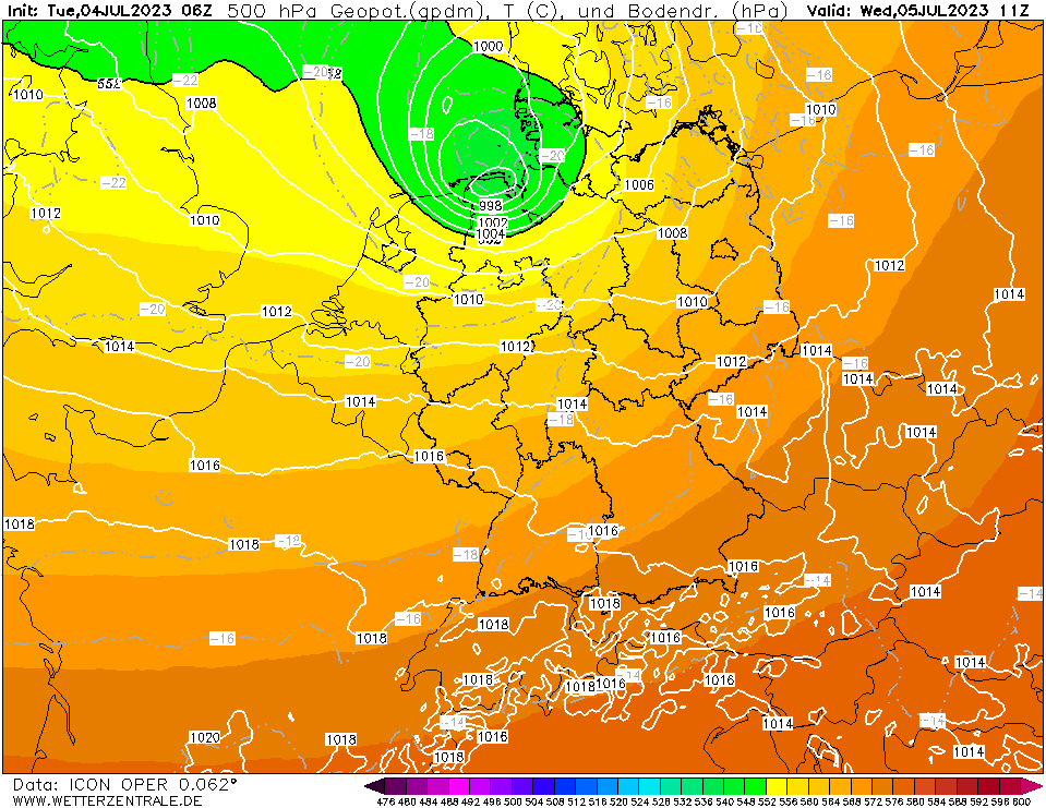
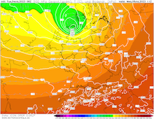
500 hPa Geopotential and sea surface
pressure Central Europe, 05.07 11 UTC
Source: wetterzentrale
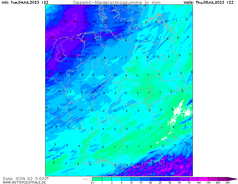
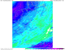
| Accumulated precipitation over Central Europe
until 06.07 12 UTC
Source: wetterzentrale
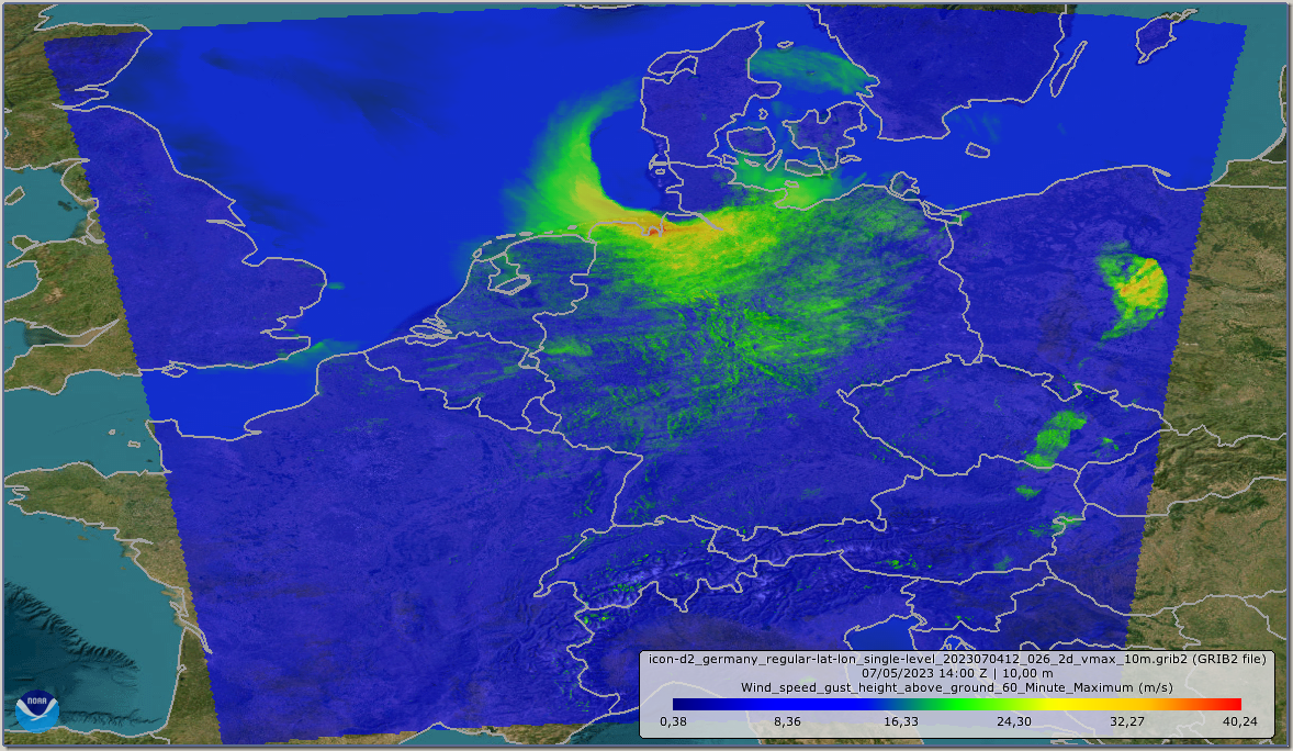
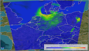
| Maximum 10 m wind gusts Central Europe, 05.07 14 UTC
Source: DWD
|
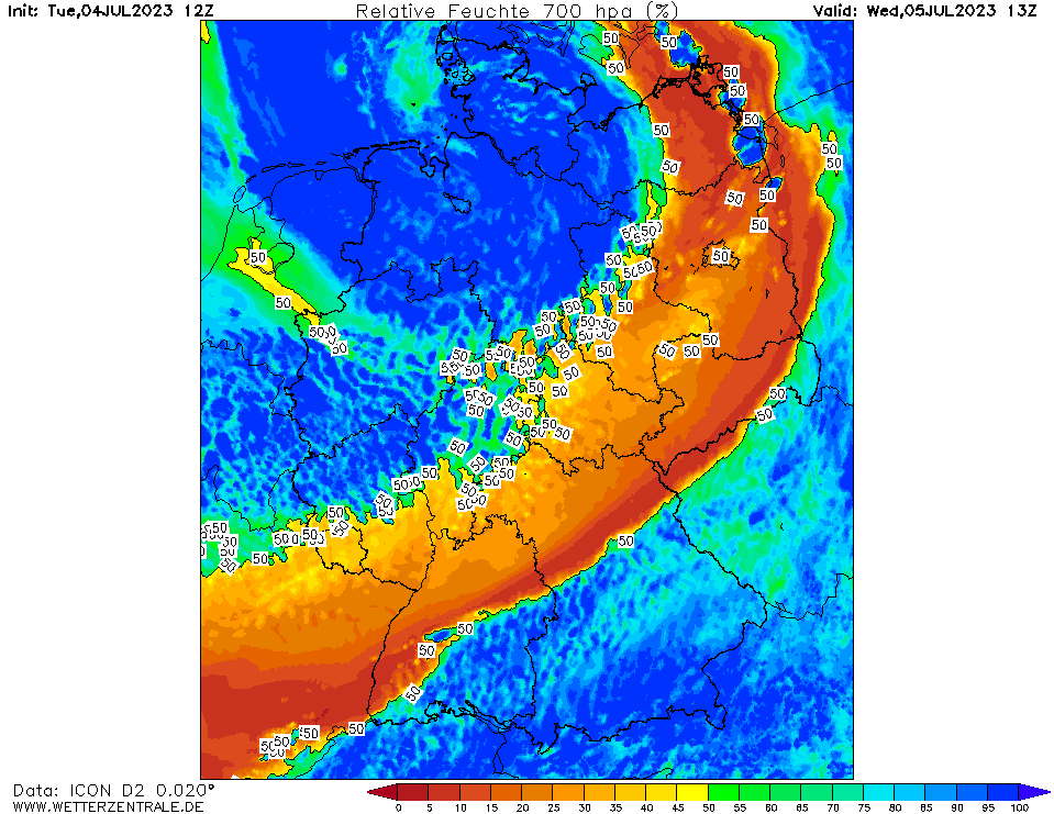
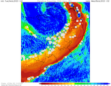
700 hPa relative humidity Central Europe,
05.07 13 UTC
Source: wetterzentrale
|
Storm low
Central Europe
Issued: Tuesday, 04 July 2023, 14:30 UTC
A shortwave trough accompanied by an unusually strong storm low for the month of July is expected to bring exceptionally strong winds to the Netherlands and Northern Germany with wind gusts of more than 100 kph. At exposed locations along the shoreline of the North Sea, wind gusts of more than 120 kph are possible on July 5, 2023.
04.07.2023
At the southern flank of an extended trough structure above the British Isles stretching towards Scandinavia, a secondary trough developed over Ireland, quickly moving westwards into Central Europe. Ahead of the trough a small surface is expected to form and deepen rapidly in the coming hours. The surface low will move northeastwards over the North Sea close to or along the shoreline of the Netherlands and Germany. Though, there is still a significant spread between the different models regarding the exact location of the surface low.
In the early morning hours of Wednesday July 05, 2023, the cold front of the storm low is expected sweep across the central part of Germany, likely forming an organized line of heavy precipitation, depending on the model solution a squall line could potentially form.
Over the Netherlands, the occluded warm front of the surface low is expected to extend past the cyclone center. In the following hours, the occluded front starts to wrap around the cyclone center. In the area of the occlusion, heavy precipitation must be expected with precipitation totals of more than 30 mm in a few hours. At the tip of the occluded front, the highest surface winds are excepted, with wind gusts reaching more than 100 kph over the northern parts of the Netherlands and Germany. Especially close to the North Sea, wind gusts of more than 120 kph are forecasted, giving the potential for an exceptional summer storm. In some model runs, the structure of the forecasted wind field is resembling a sting jet with wind gusts of up to 150 kph, though the formation of a Shapiro-Keyser cyclone over Central Europe would be an extremely rare occurrence in the summer months.
Overall, one must expect a larger impact of the windstorm has all the trees have leaves and are therefore more prone to wind damage. Large travel disruptions in the Netherlands and the northern parts of Germany must be expected. Further, a significant storm surge could potentially form in the afternoon hours in Northern Germany as the high tide and the onset of onshore winds is expected superpose one another.
Issued: July 04, 2023, 14:30 UTC
KG
|