Monday, 12 June 2023, 08:00 UTC

|
|

|

|
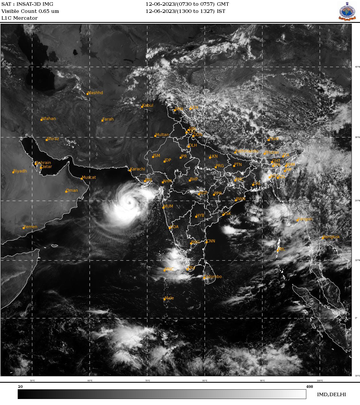
Visible satellite imagery of extremely severe
tropical cyclone BIPARJOY, 12.06 08 UTC
Source: IMD
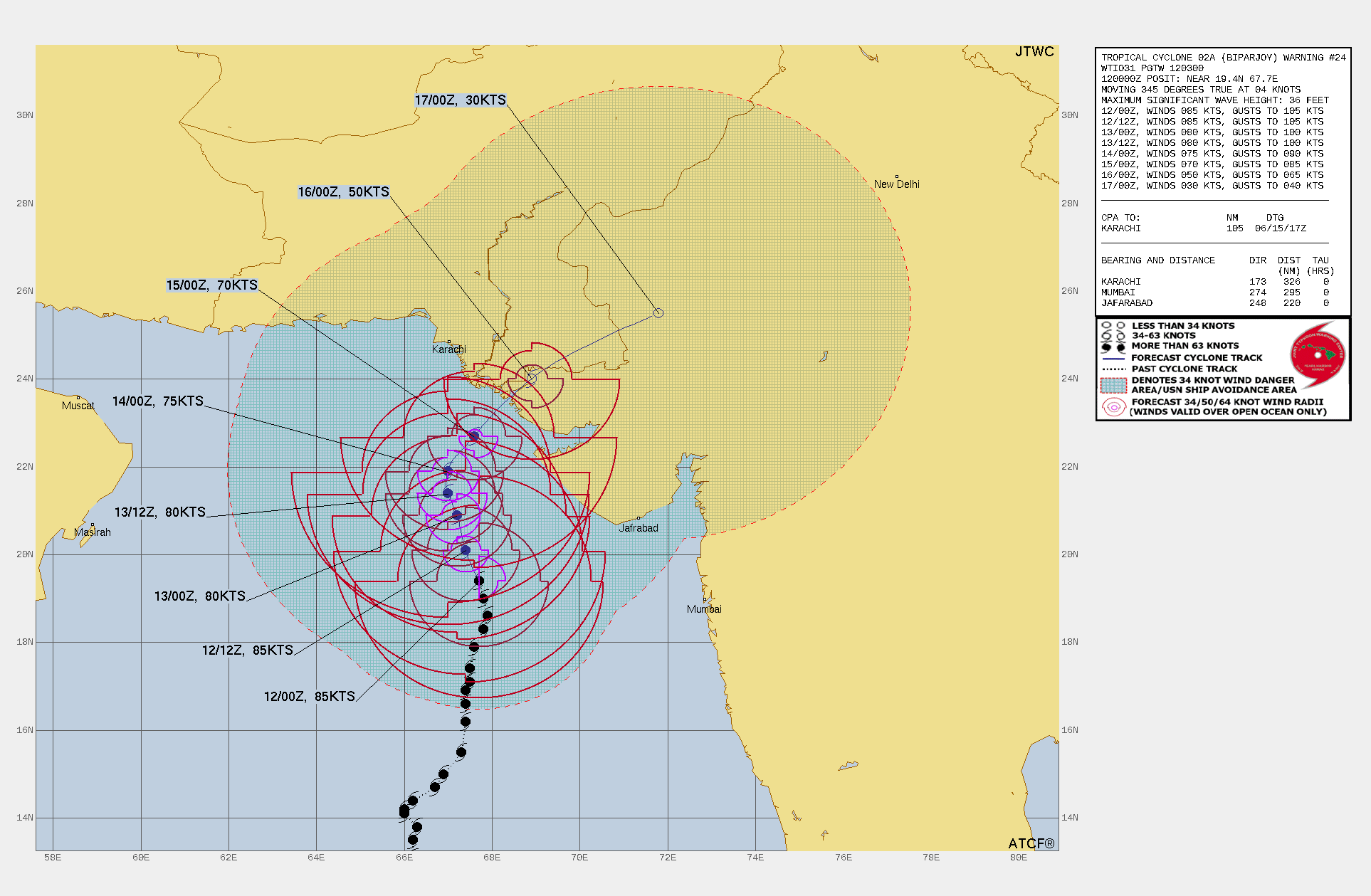
| Track and intensity forecast for cyclone BIPARJOY,
12.06 03 UTC
Source: JTWC
| Accumulated precipitation over South Asia until
17.06 00 UTC
Source: wetterzentrale
|
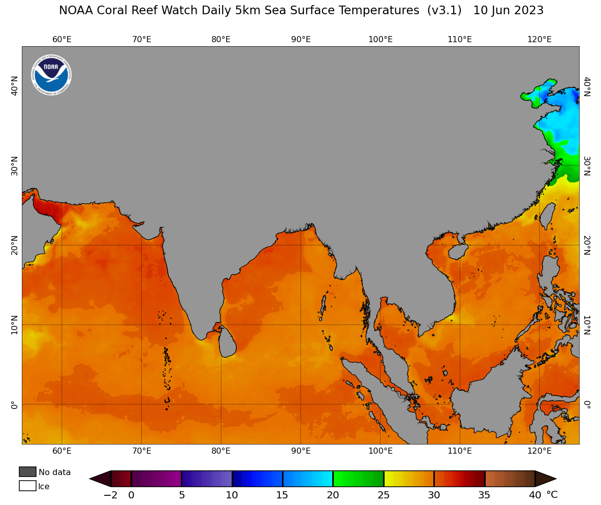
Sea surface temperatures over the Northern
Indian Ocean, 10.06
Source: NOAA
|
Tropical cyclone
India, Pakistan
Issued: Monday, 12 June 2023, 08:00 UTC
Extremely severe tropical cyclone BIPARJOY developed over the Central Arabian Sea and is threatening the coast of India and Pakistan with sustained winds of up to 155 kph and wind gusts of up to 195 kph. Due to the slow movement of the cyclone, excessive precipitation upwards of 500 mm must be expected upon landfall.
12.06.2023
In the beginning of June, a small cyclonic circulation developed over the central Arabian Sea, slowly drifting northwards and intensifying gradually. By June 06, 2023, the cyclonic circulation intensified into cyclonic storm BIPARJOY. On a northward trajectory, the system intensified further over the warm ocean waters of the Arabian Sea, with sea surface temperatures of up to 30 °C.
Currently, BIPARJOY has sustained winds of up to 155 kph and wind gusts of up to 195 kph, with a central pressure of 955 hPa, drifting slowly northeastwards at around 7 kph. In the coming days, the landfall of cyclone BIPARJOY is expected along the coast of India and/or Pakistan with sustained winds of up to 110 kph. Due to weak upper-level gradients steering the cyclone, the uncertainty of the track of cyclone BIPARJOY on a spatial scale is still very large. Currently, landfall is expected on June 15, 2023, with the center of the cyclone over the Indus Delta in the border region of Pakistan and India. Though, the cone of uncertainty stretches from Karachi in the west to Gulf of Khambhat in the southeast.
Depending on the exact location of the landfall of cyclone BIPARJOY, the effects could be large, if the cyclone hits the densely populated outside of the Indus Delta. As currently, the most intense precipitation is situated in the eastern quadrants of the cyclone, a landfall in the Indus Delta could affect the 20 million inhabitants of Karachi with intense precipitation. Due to the slow movement of the cyclone, precipitation totals of up to 500 mm along coast line must be expected, along with a strong storm surge.
Issued: June 12, 2023, 08:00 UTC
KG
|