|
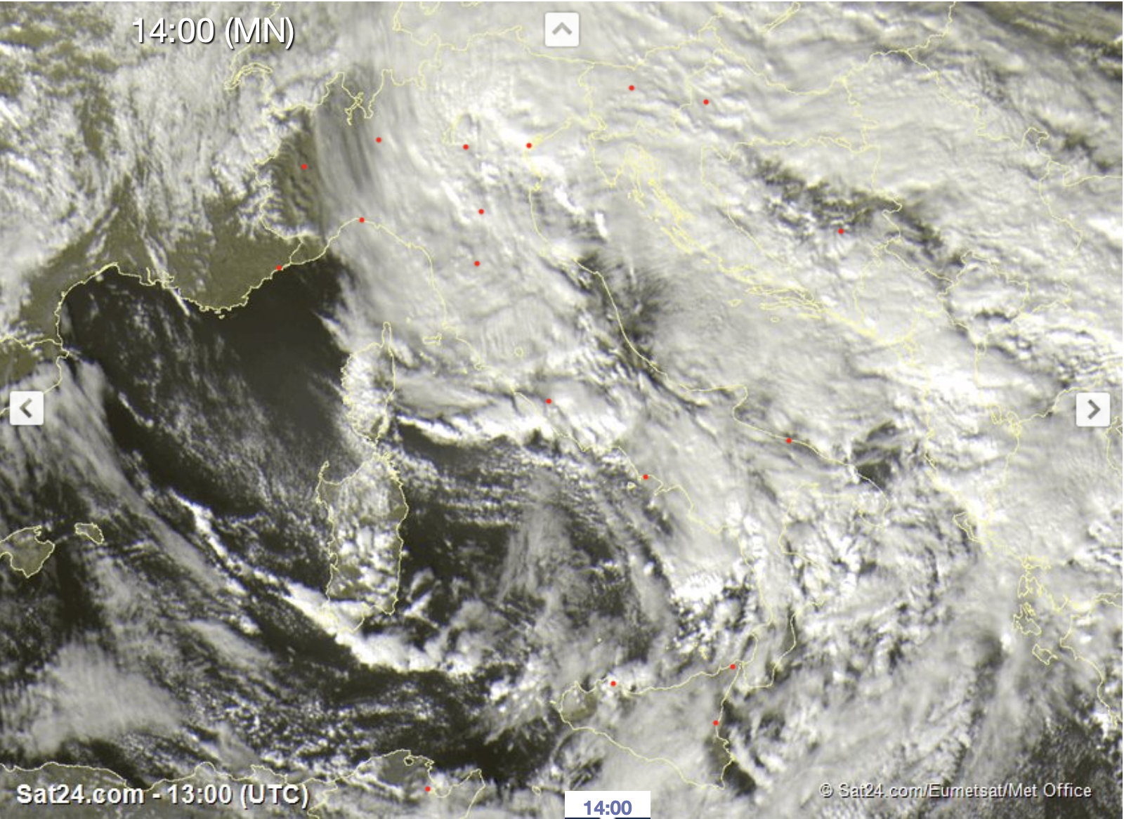
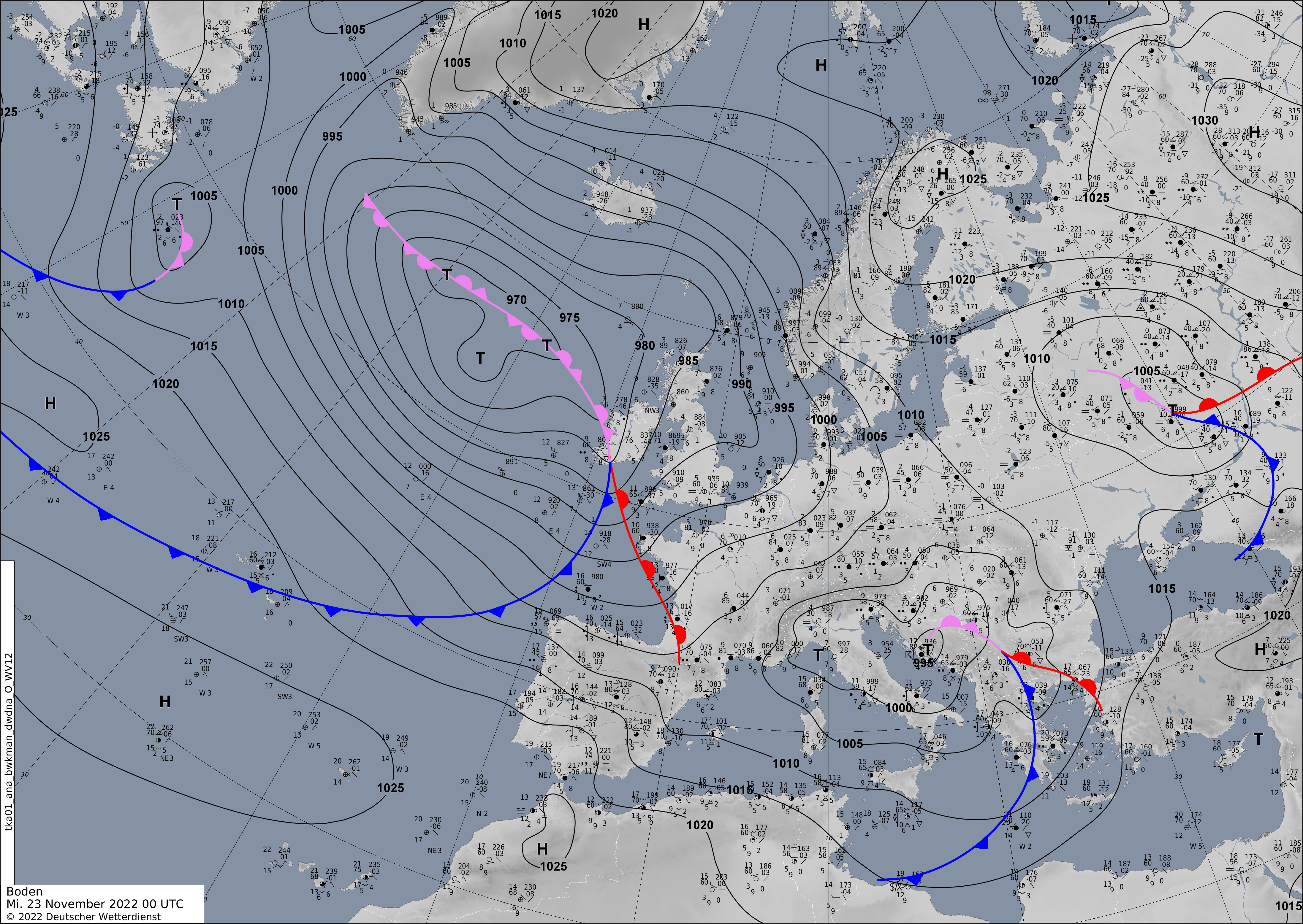
Italy low DENISE brought heavy precipitation to parts of northern Italy, with significant snowfall in the Southern Alps in the regions South Tyrol and Veneto. The low caused intense Mistral winds as well as an intense storm surge along the Adriatic coast.
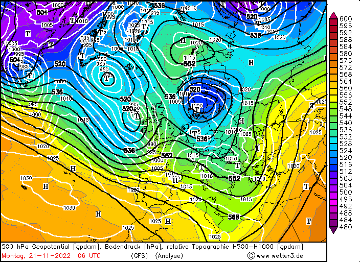
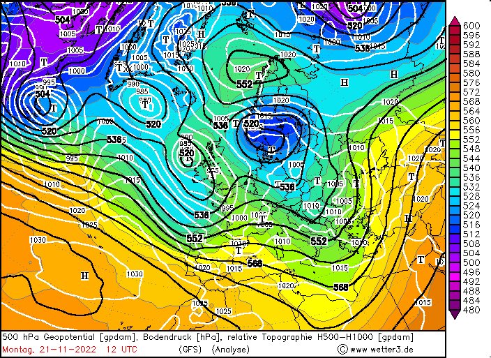
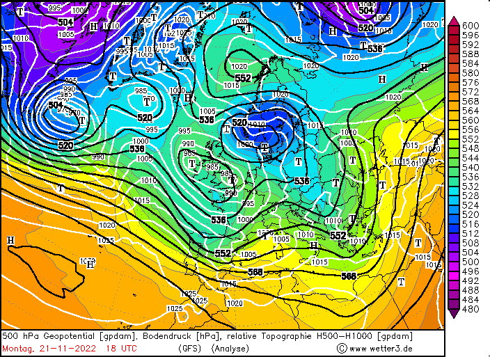
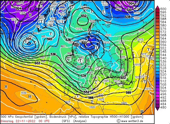
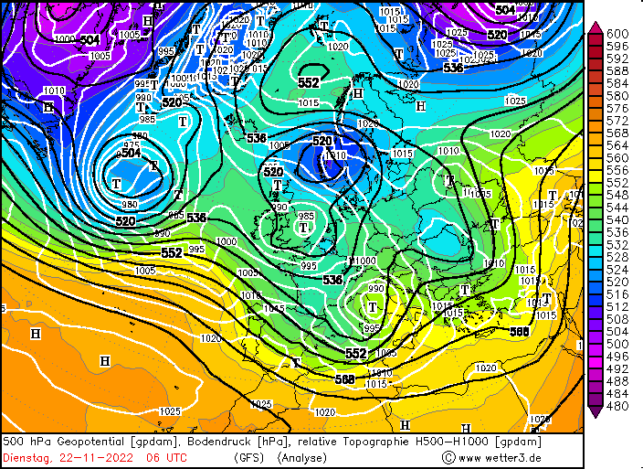
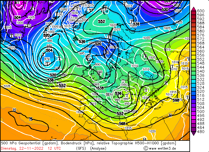
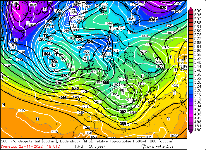
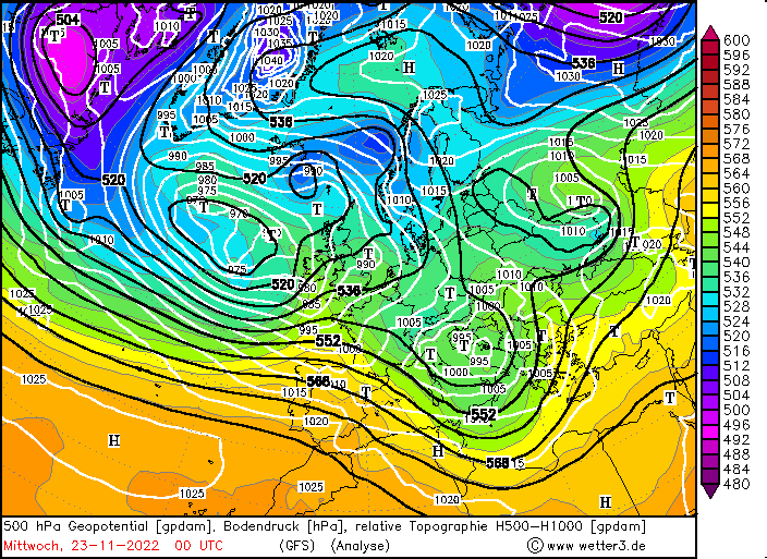
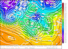
The low DENISE developed on November 21, 2022, at the southern tip of a broad low-pressure system over the British Isles. On the backside of the low-pressure system cold air masses could advance southward over France, driving secondary cyclone development over the Gulf of Genoa in the nighttime hours on November 21, 2022. Combined with an upper-level trough upstream of the system, further deepening of the low was favored.
|
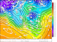
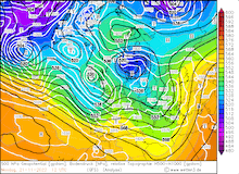
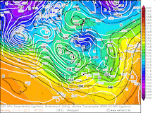
500hPa Geopotential and sea level pressure, 21.11.2022 06 UTC - 23.11.2022 00 UTC, source:
wetter3
|
 |
 |
 |
 |
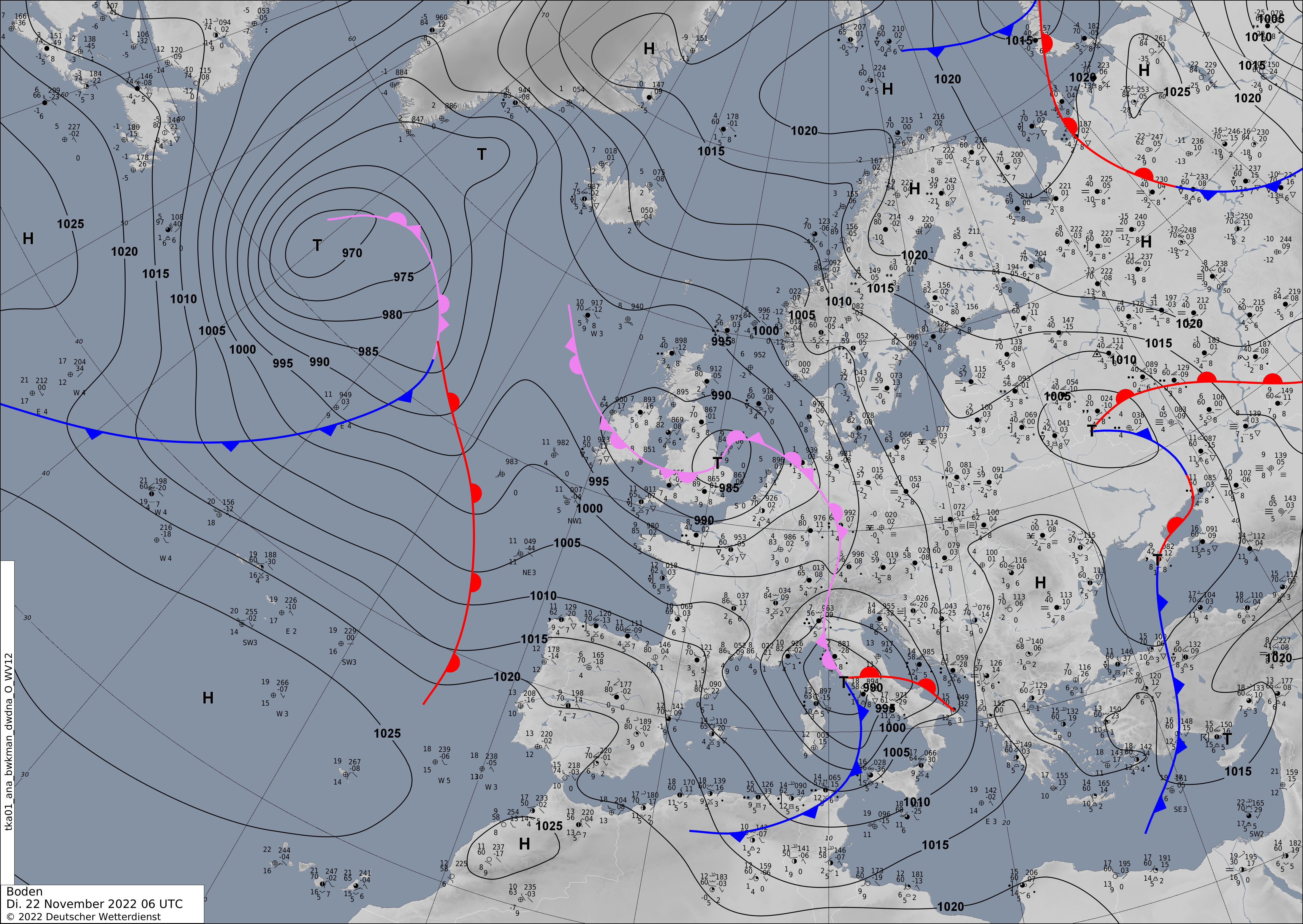
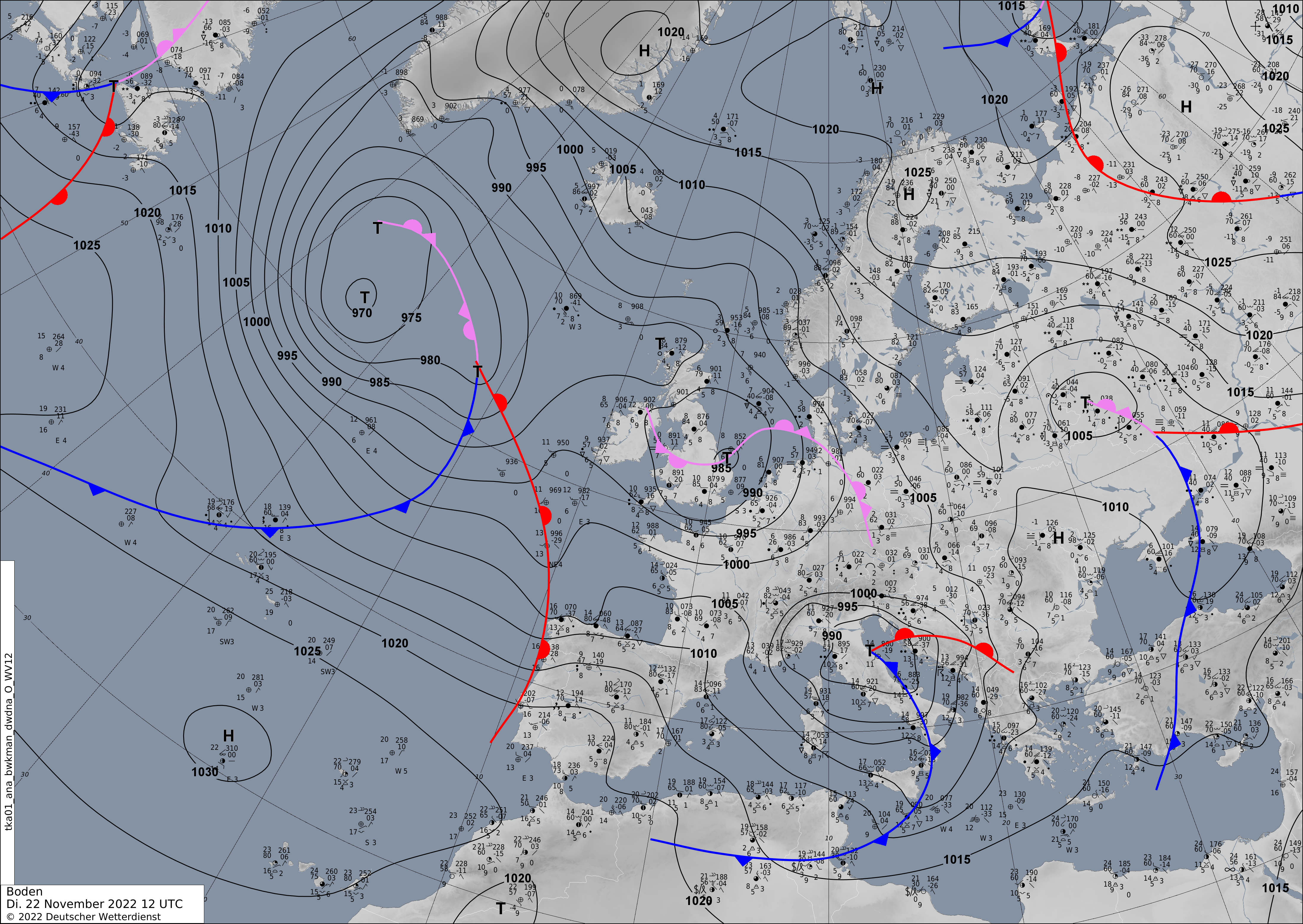
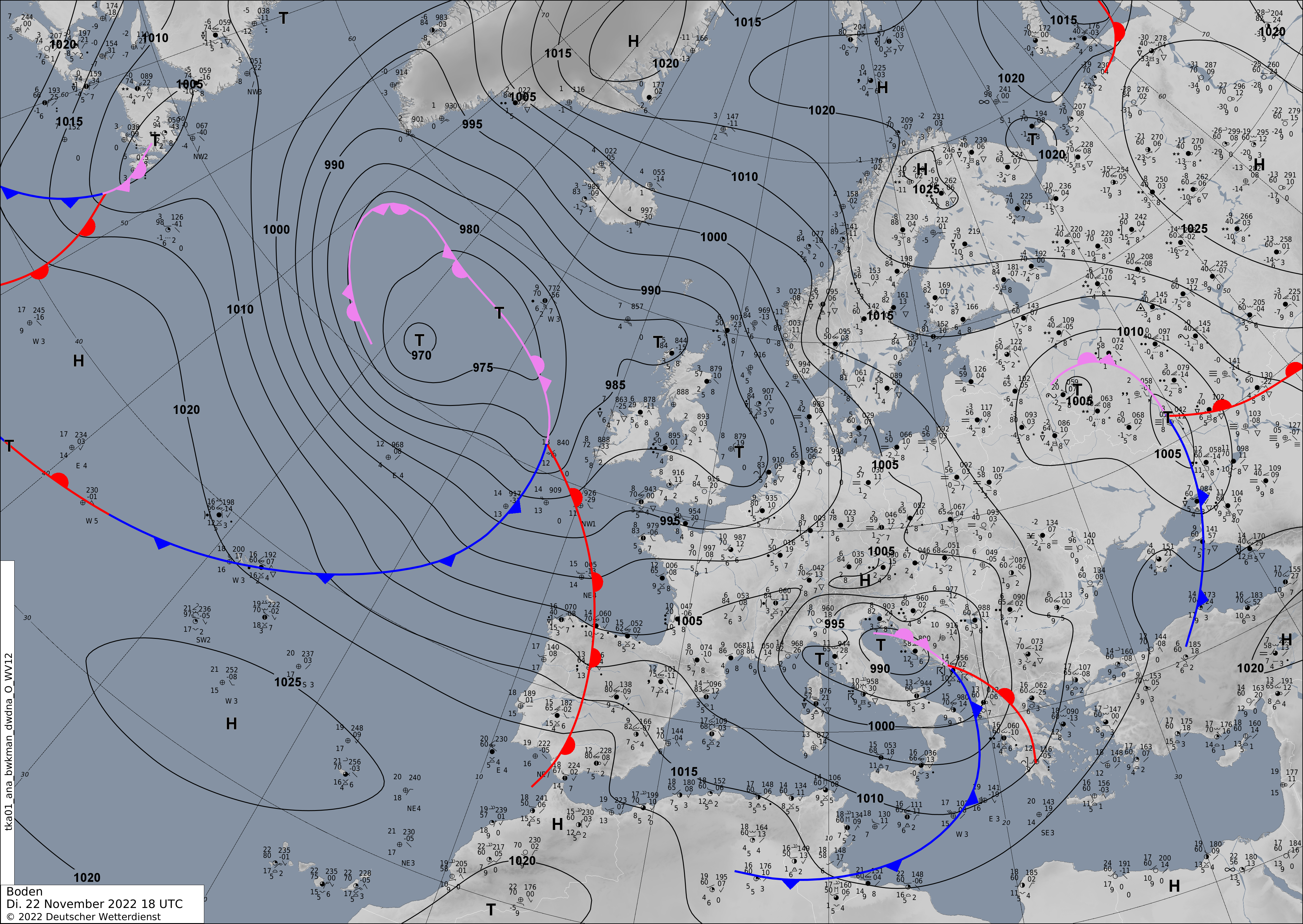
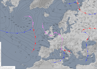
By November 22, 2022, the low moved southeastwards with the center close to the city of Rome, on the backside of the system strong Mistral winds developed over the Mediterranean Sea close to the coast France, expanding towards Sardinia and Corsica. Hurricane-force winds were observed at exposed locations on both islands, with the highest wind speed being observed at Pertusato on Corsica with 144.1 km/h.
|
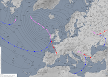
Surface pressure and analyzed fronts over Europe 22.11.2022 06 UTC - 23.11.2022 00 UTC, source:
DWD
|
 |
 |
 |
 |
On the eastern flank of the storm, warm and moist air masses were advected northwards. Especially, in the Po-region heavy precipitation was observed, with the 24 h precipitation rates reaching 113 mm in Ferrara. As winds curved eastwards further south than initially anticipated the snow accumulation on the Southern Alps was smaller than expected, as the orographic lift was less prominent compared to a southerly flow. Yet, prominently in the region of Veneto snow accumulation of > 40 cm / 24 h were reported, as well as along the Alpine divide significant fresh snow accumulations of over 40 cm/ 24 h were reported. Inducing travelling hazards in alpine territories in the South Alps. Measurable snow accumulation reached as low as 1000 m above sea level, marking the first significant snowfall event of the winter season 2022/23 in this part of the Alps.
Along the Adriatic coast the easterly winds combined with a strong Scirocco wind caused a major high water. In the city of Venice, a famous aqua alta occurred, while the new flood prevention system MOSE prevented a major flooding to occur. Without this system it is suspected that the city of Venice would have experienced water levels close to levels experienced in the major flooding 2019.
Text: KG
November 24, 2022
|