|
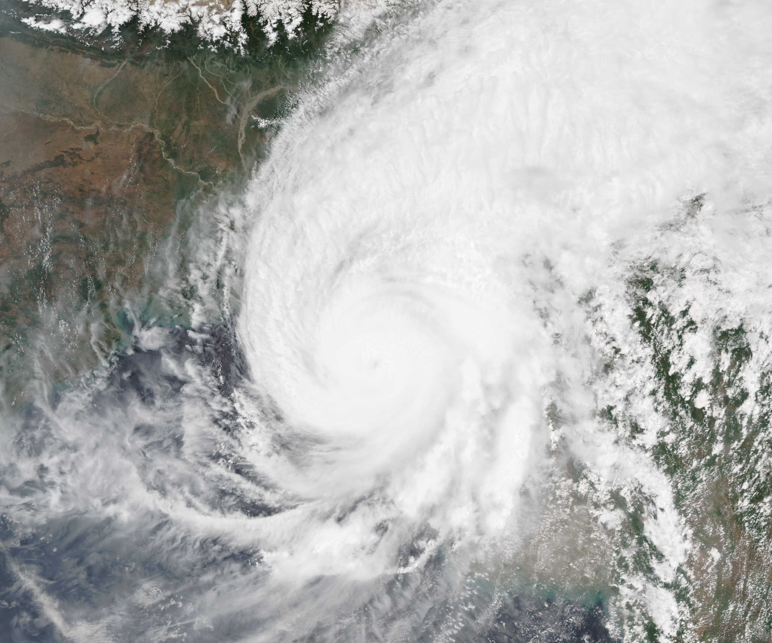
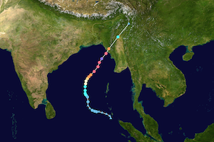
An exceptionally strong tropical cyclone formed over the Bay of Bengal as the second tropical depression forming in the 2023 North Indian Ocean cyclone season. At peak intensity, the extremely severe cyclonic storm MOCHA reached 1-min sustained winds of up to 280 kph and a central pressure of 918 hPa. The cyclone made landfall in Northern Myanmar close to the city of Sittwe, Myanmar also affecting parts of Bangladesh.
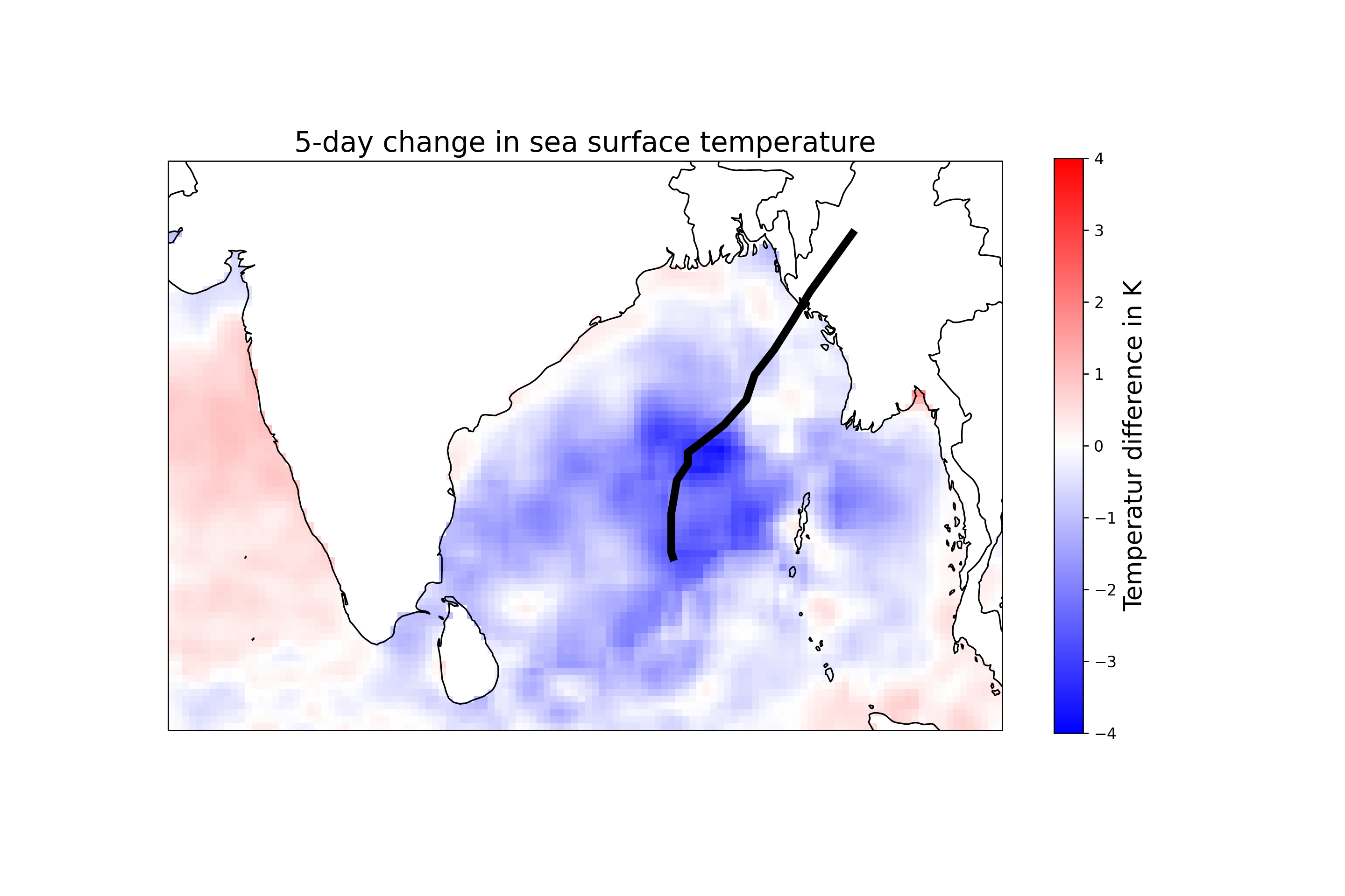
The tropical depression maturing into extremely severe cyclonic storm MOCHA formed on May 08, 2023, to the northeast of Sumatra over the Bay of Bengal. As it is often the case, the tropical cyclone formed ahead of the advancing monsoon front of the Indian monsoon system shifting northwestwards towards the Indian subcontinent. The tropical depression formed over the warm waters in the Bay of Bengal with SSTs > 30 °C as well as favorable atmospheric conditions for the formation of an intense tropical cyclone.
|
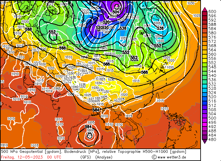
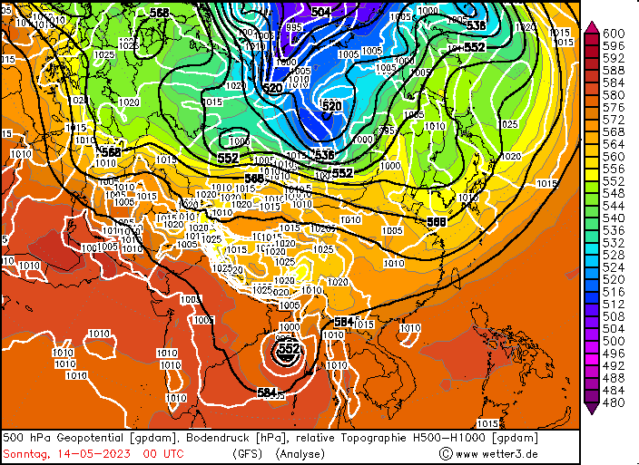
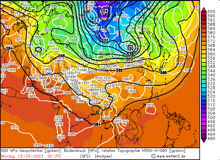
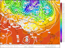
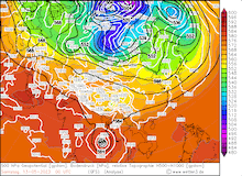
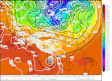
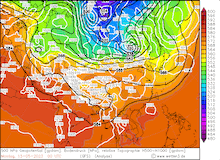
500 hPa Geopotential and sea surface pressure Asia, 12.05.2023 00 UTC - 15.05.2023 00 UTC, source:
wetter3
|
 |
 |
 |
 |
In the following days the system drifted northwards over the central part of the Bay of Bengal, while intensifying gradually, reaching cyclonic storm force by May 11, 2023, 12 UTC, with sustained winds of more than 90 kph and a dense overcast over the cyclone center indicating strong convective activity. With an upper-level present over the Indian subcontinent, the cyclone curved eastwards and moved on a northeasterly course towards the coast of Myanmar. On May 12, 2023, the cyclone intensified rapidly to an extremely severe cyclonic storm with the sustained winds increasing by around 100 kph in a 24 h-period and the central pressure dropping nearly 30 hPa at the same time. Satellite images revealed a distinct eye clearing out in the cyclone center.
|
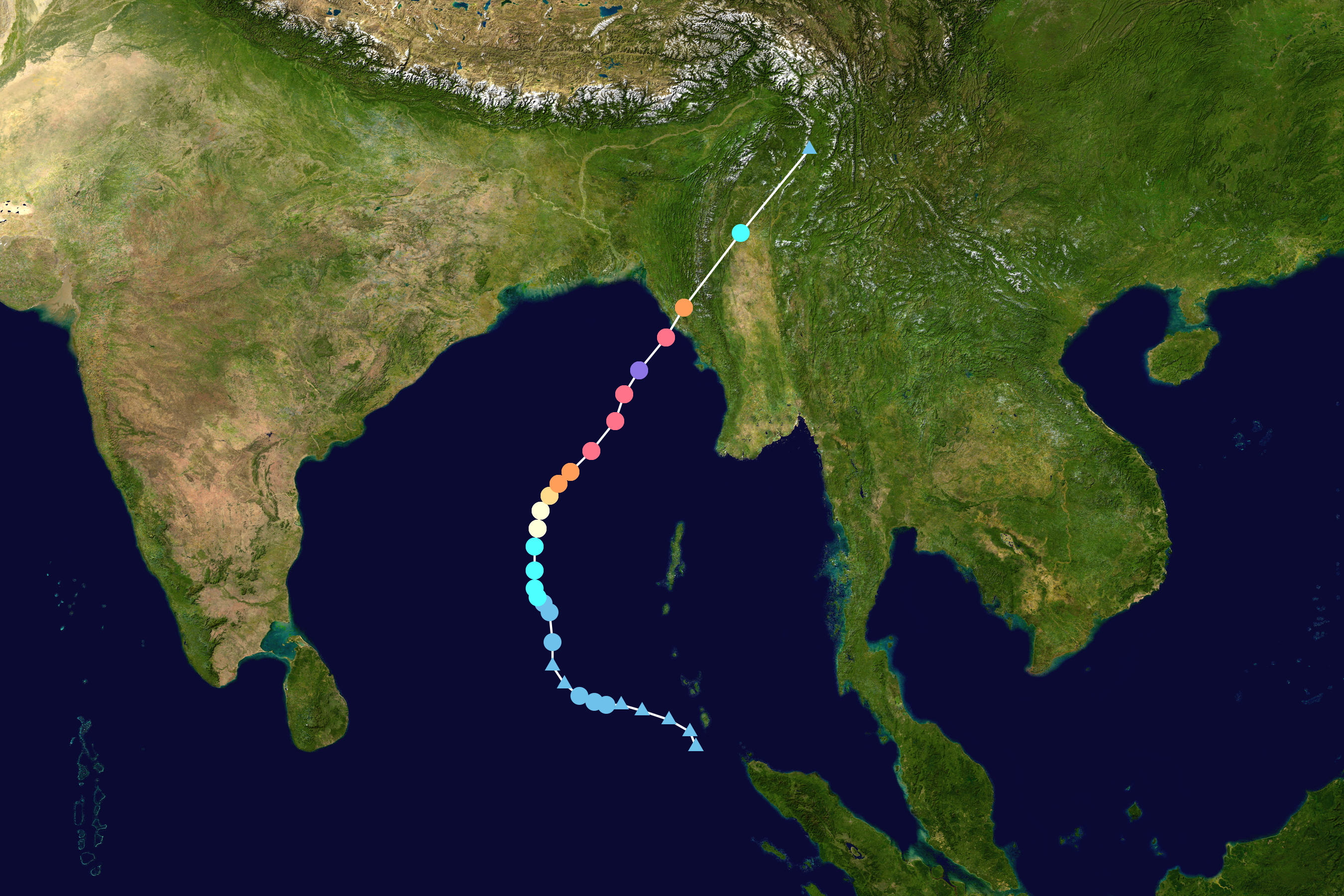
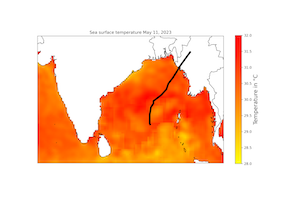
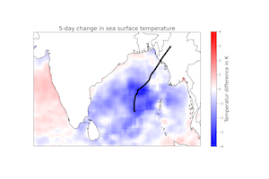
Track of extremely severe cyclonic storm MOCHA (left), source:
NASA, SST 11.05.2023 (middle) and 5-day SST change over the Bay of Bengal (right) 11.05.2023 - 15.05.2023, data:
PSL NOAA (both), visualization: K. Gramlich
|
 |
 |
 |
Strong upper-level outflow as well as low vertical shear over the Bay of Bengal allowed for the rapid intensification of the system combined with the warm ocean waters. In the night from May 12 to May 13, 2023, the intensification of the cyclone slowed significantly as the cyclone underwent an eye wall replacement cycle, where the old eye wall of the cyclone is replaced with an outer eye wall forming, usually leading to a short-lived decrease of the winds in the cyclone and a following reintensification of the cyclone. On May 13, 2023, MOCHA intensified further, with the sustained winds reaching a maximum of 280 kph on May 14, 2023, 00 UTC, according to estimations by the JTWC, tying the record of the 1999 Cyclone Fani for the highest sustained winds over the Northern Indian Ocean.
The storm had a very large and symmetric eye with a diameter of more than 35 km, reaching the coast of Myanmar in the morning hours of May 14, 2023, weakening before landfall due to drier air masses intruding into the cyclone on the northwestern side as well as an increased mid-level shear. Nevertheless, the JTWC estimated sustained winds of up to 215 kph upon landfall in Myanmar. Over land the cyclone dissipated extremely fast due to the roughness of the terrain in Northern Myanmar, completely dissolving by May 15, 2023, locally inducing heavy precipitation in parts of Southern China.
The cyclone made landfall near the city of Sittwe in Myanmar, bringing an exceptionally high storm surge of 3 m, affecting at least 100.000 people along the shallow coast lines of Northern Myanmar. The strong winds of the cyclone lead significant damages in the affected areas, estimates suggest more than 10.000 damaged homes in Northern Myanmar and the region around Cox's Basar in Bangladesh. Further, intense precipitation led to localized flooding, with weather stations reporting more than 200 mm/24 h precipitation in Northern Myanmar. Especially, the large refugee camps along the northern border of Myanmar were severely affected by MOCHA, currently at least 84 fatalities were confirmed following the passage of cyclone MOCHA, though past landfalls of tropical cyclones in the northern part of the Bay of Bengal with similar intensity had significantly larger fatality numbers.
Text: KG
May 17, 2023
|