|
The exceptionally active tropical cyclone season 2022/23 in the southern hemisphere is continuing over in Australia with the cyclone ILSA impacting Western Australia. At peak intensity the cyclone had sustained winds of 215 kph with wind gusts up to 260 kph and a minimum core pressure of 928 hPa. The cyclone made landfall in the northern part of Western Australia, 130 km to the northwest of Port Hedland, with sustained winds of up to 218 kph at Bedout Island.
The tropical disturbance maturing into cyclone ILSA developed in the beginning of April south of the island of Papua New Guinea. In the following days, the system tracked slowly southwestwards with weak and varying intensity. Only after April 11, the system intensified significantly, becoming a Category 1 tropical cyclone on April 11 according to the Australian tropical cyclone intensity scale.
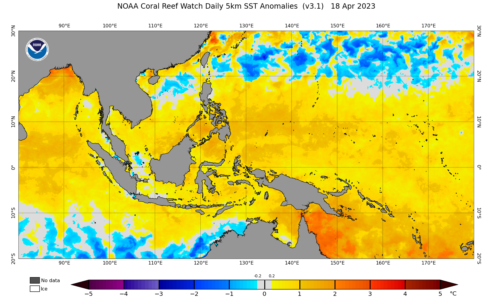
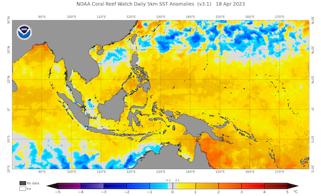
Cyclone track of severe tropical cyclone ILSA (right), sea surface temperature anomalies over Oceania with positive anomalies to the north of Australia (right),
source:
NASA
|
 |
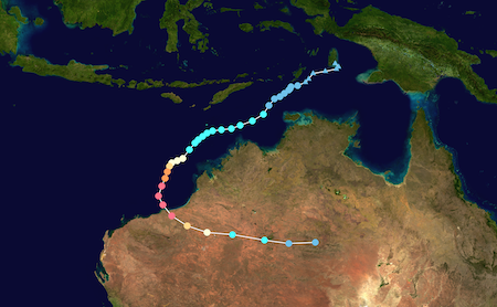 |
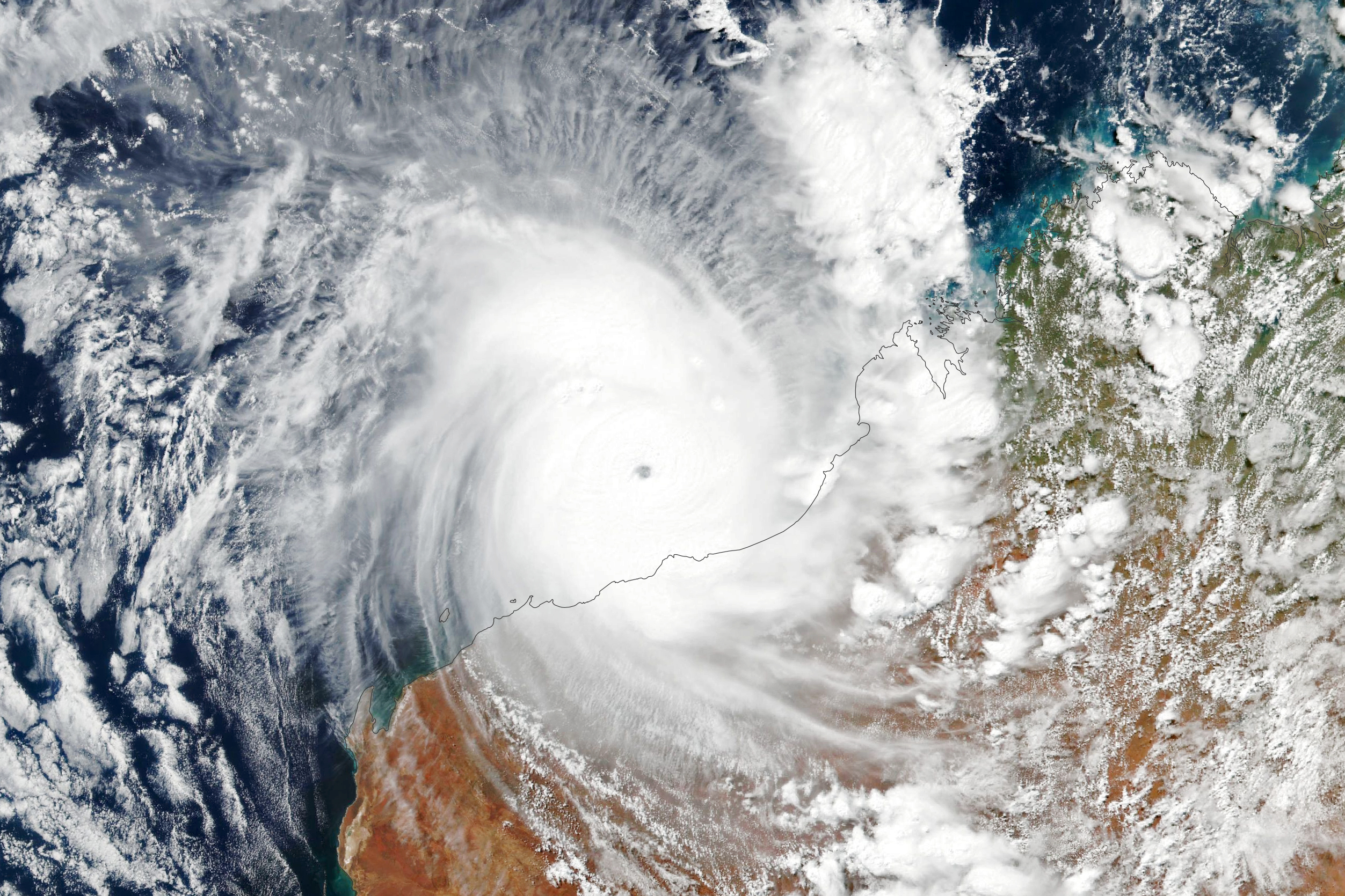
On April 12, the cyclone ILSA intensified rapidly with a distinct eye-structure appearing. Furthermore, the cyclone started to track in a more southerly direction, approaching the Australian continent. By April 13, ILSA was on southeasterly track directly impacting the Australian Continent in Western Australia, being elevated to a category 5 tropical cyclone by the Australian Bureau of Meteorology. The low shear and warm sea surface temperature environment favored the rapid development of the cyclone. Noticeably, the cyclone developed an eye with a very small diameter, which is suspected to lead to very high wind gusts in the eye wall.
The cyclone ILSA made landfall on April 13 in the Pilabara region of Western Australia, around 130 km to the northwest of Port Hedland. On Bedout Island sustained winds of up to 218 kph were measured during the passage of cyclone ILSA, marking the highest wind gust observed on this island. Due to the extreme remoteness and extremely low population density of the Pilabara region, the actual damages of the cyclone are minimal with early estimates of around 4 million Australian $. Most of these damages are observed at Pardoo Roadhouse, located close to the landfall point of cyclone ILSA.
After the landfall, the cyclone weakened comparatively slow, moving eastwards into the northern parts of the outback as tropical depression, leading to local heavy precipitation. By April 16, the cyclone completely dissolved. Nevertheless, the current tropical cyclone season in this part of the world has been nothing but exceptional, with many strong tropical cyclones forming. At the time of writing, 5 out of these cyclones reached the highest category of the Australian tropical cyclone intensity scale. Cyclone FREDDY became both the longest living tropical cyclone in recorded history as well as accumulating the highest Accumulated Cyclone Energy. In the Southern Pacific, cyclone JUDY and KEVIN led to the costliest Southern Pacific cyclone season in history.
Text: KG
April 19, 2023
|