|
A trough over the North Atlantic and several corresponding low-pressure areas on surface level caused an advance of extremely mild air masses to Central Europe during the change of the year. Temperatures of up to 12 °C were reached at 850 hPa, while on the ground the thermometer rose to 20.8 °C in Wielenbach on New Year's Eve. On New Year's Day, 19.4 °C Ohlsbach was reached.
After December 2022 initially presented itself as a true winter wonder in many places, the second half of the month was characterized by mild temperatures,
wind and lots of rain. During Christmas, the temperature climbed up to 14.2 °C in the southwest of Germany (Ohlsbach), and on New Year's Eve, it even broke
the 20 °C mark in some places. Never before Silvester and New Year saw temperaturesliek these in large parts of Europe. Even many monthly records for the months
of December and New Year's Eve were broken on New Year's Eve and New Year's Day, respectively.
|
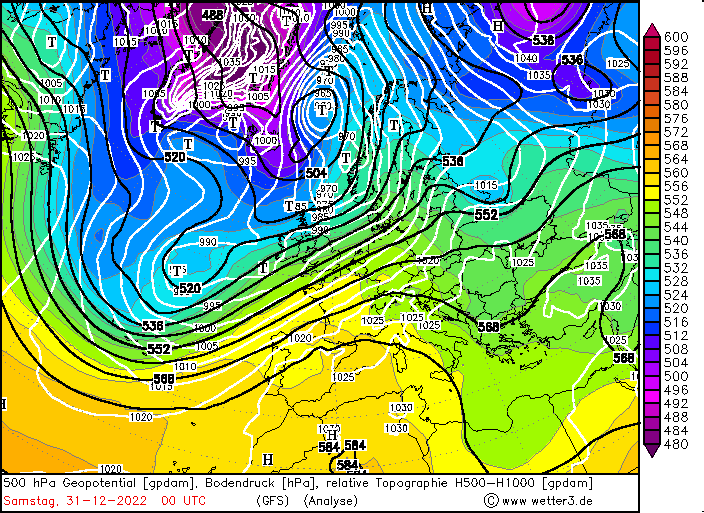
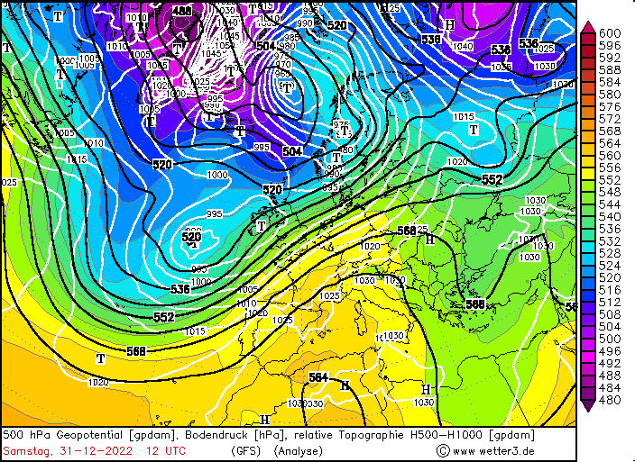
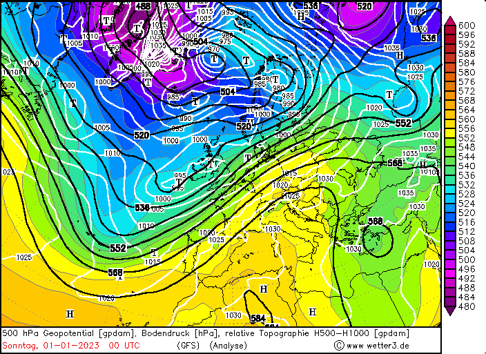
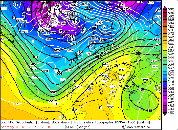
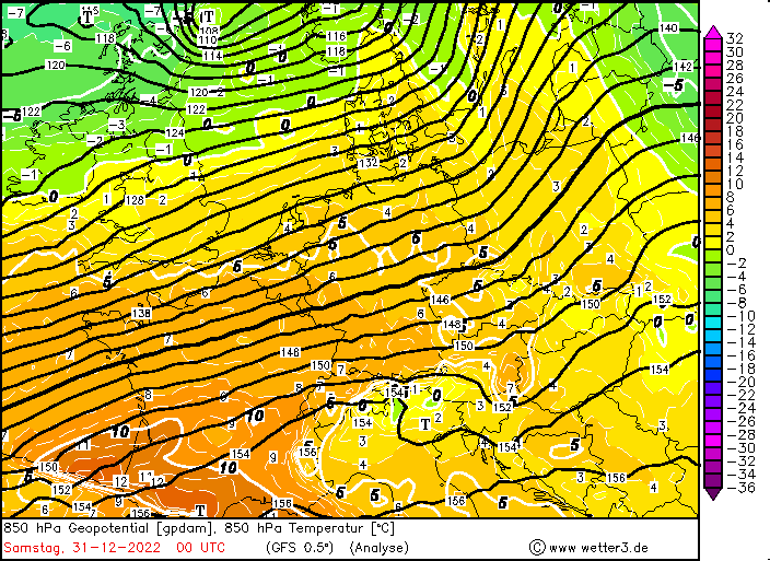
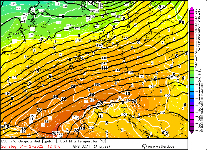
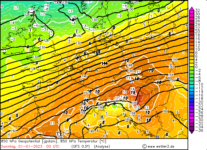
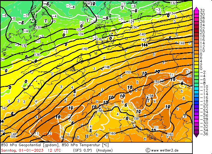
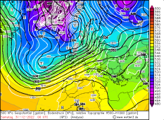
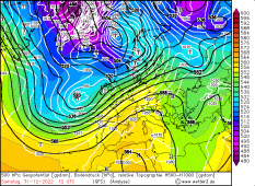
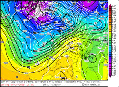
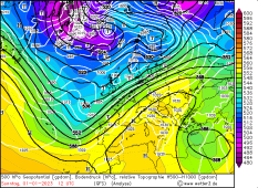
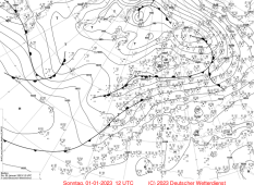
500 hPa Geopotential, sea level pressure and 850 hPa temperature, 31.12.2022 00 UTC until 01.01.2023 12 UTC, source:
wetter3
|
 |
 |
 |
 |
 |
 |
 |
 |
 |
 |
 |
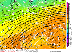 |
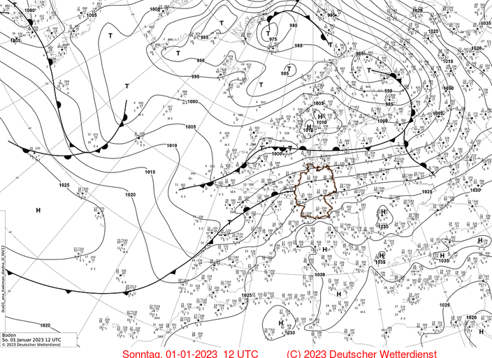
What is particularly interesting here is that the weather situation was not extremely eye-catching or unusual from a synoptic point of view.
A trough over the Atlantic reaching far south for this time of year initiated a southwesterly flow into Central Europe, which thus benefited
from mildly humid ocean air. Near the ground, this weather situation was maintained over a longer period of time by a series of low-pressure
areas (LIDDY I, II and II). Because both the displacement velocity of the low-pressure areas and the surrounding horizontal pressure gradients
were relatively high, the mild Atlantic air had hardly any time to cool down over the continental areas of Portugal, Spain and France on its
way to Central Europe.
--
|
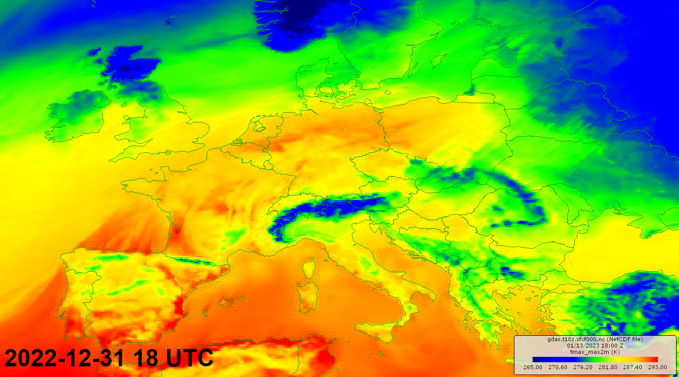
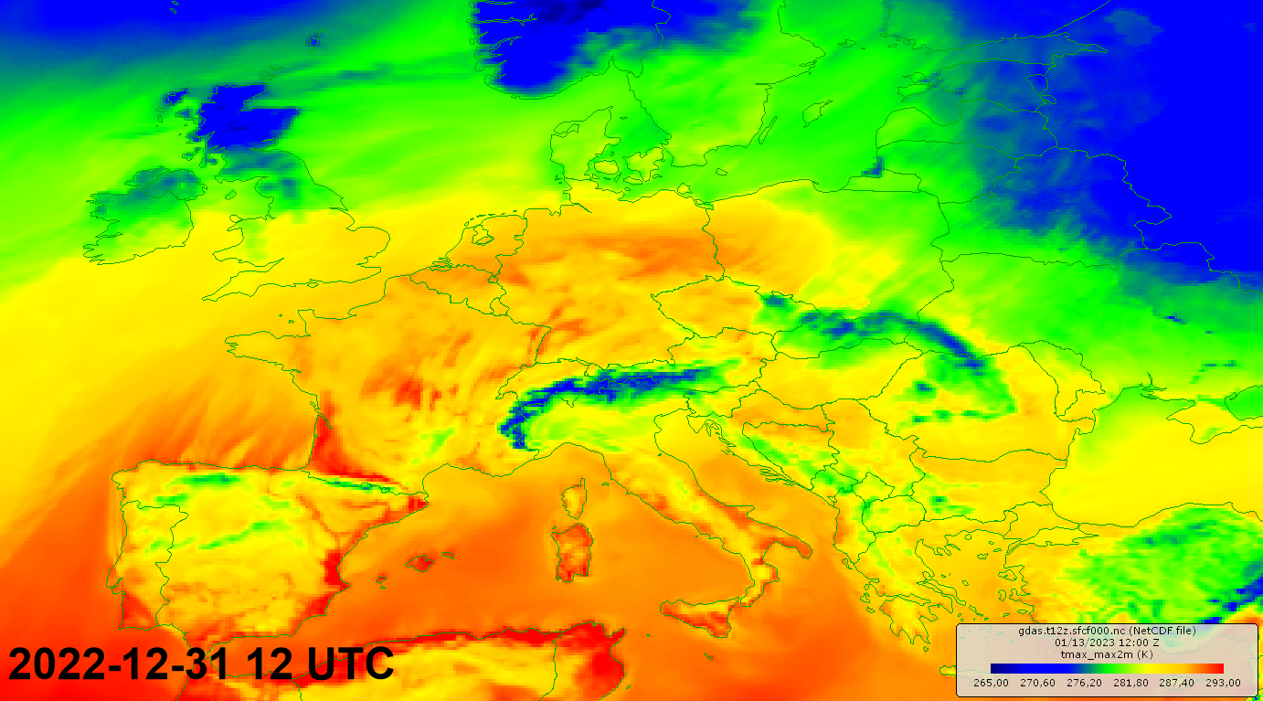
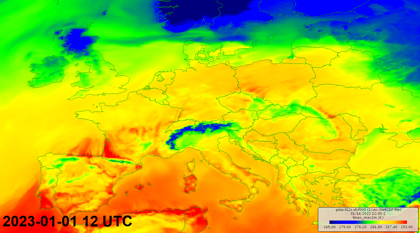
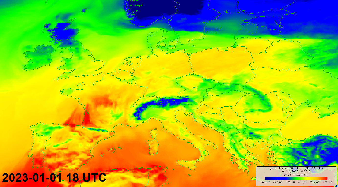
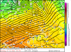
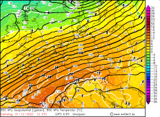
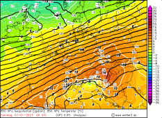
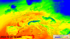
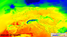
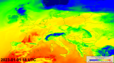
2 m temperature, 31.12.2022 12 and 18 UTC as well as 01.01.2023 12 and 18 UTC, source:
NCEII NOAA
|
 |
 |
 |
 |
The result were 850 hPa temperatures of up to 10 °C on New Year's Eve, and during the night even temperatures around 12 to 13 degrees were reached.
The moderate to fresh wind allowed good vertical mixing of the lower atmosphere and thus a vertical temperature gradient of 6 to 7 K/100m. Only in the
far east of Bavaria the wind did not penetrate effectively, causing temperatures here to remain below the 15 °C mark in some places.
Meanwhile, maximum values of up to 20.8 °C were reached on the ground (Wielenbach). That's the highest temperature ever recorded in Germany during the last eleven days of the month December. The 20 °C mark was also reached or exceeded in Ohlsbach, Müllheim and Munich City, which corresponded to new records
for the last decade of December.
Numerous decade and monthly records were also set on New Year's Day. Although the Germany-wide all-time record for the maximum temperature in January
(20.5 °C in Piding) could not quite be reached, nevertheless the stations Ohlsbach (19.4 °C), Baden-Baden-Geroldsau (19.3 °C) and Emmendingen-Mundingen
(19.2 °C), among others, set new monthly records. Numerous monthly records were also broken in other European countries. In Warsaw, 19 °C was reached,
thus exceeding the previous temperature record by 5 K. A detailed overview of the new decade and month records can be found in the table attached below.
Is there an explanation for this extreme temperature level besides the synoptic situation?
|
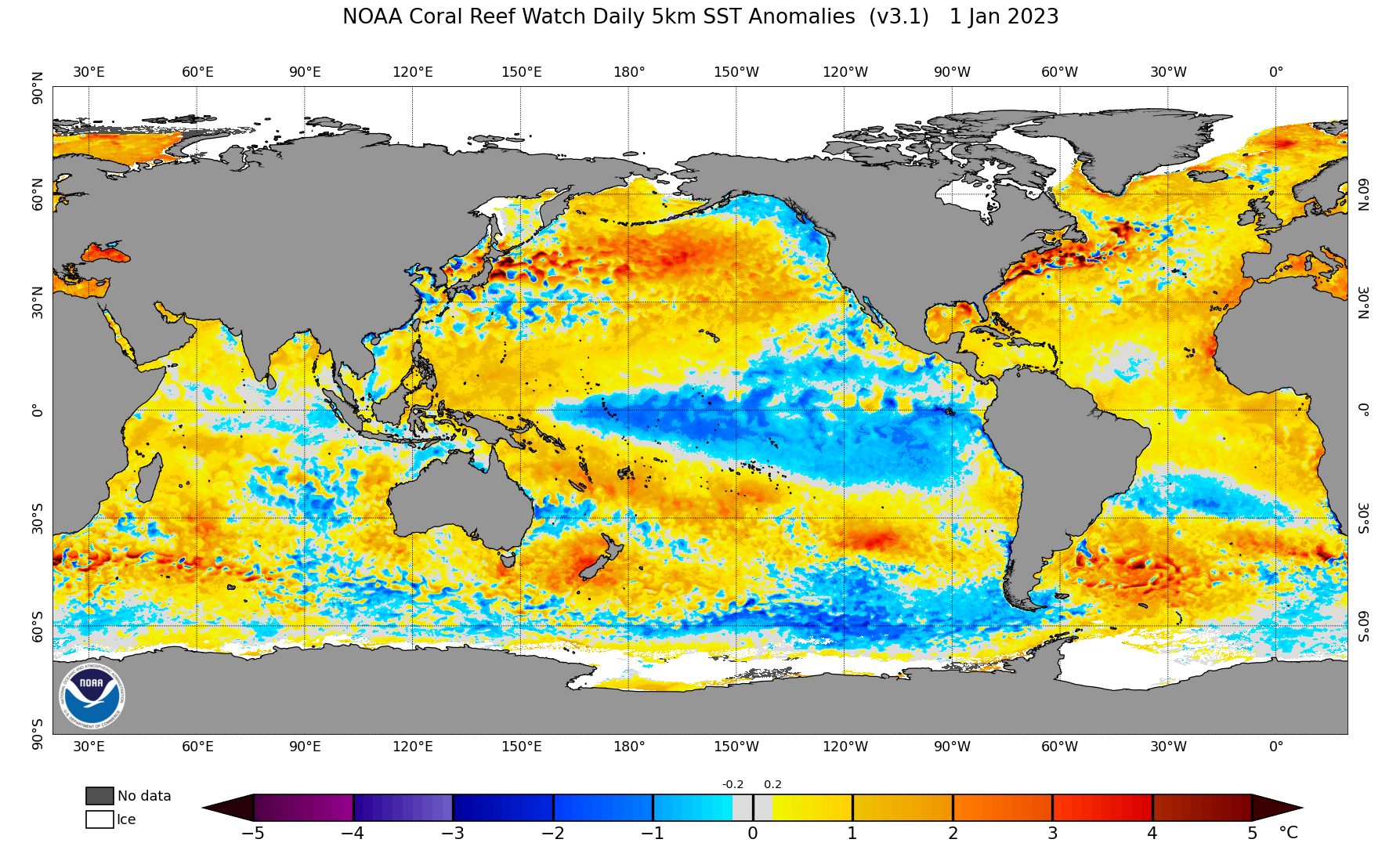
Sea surface temperature anomaly, source:
OSPA NOAA
|
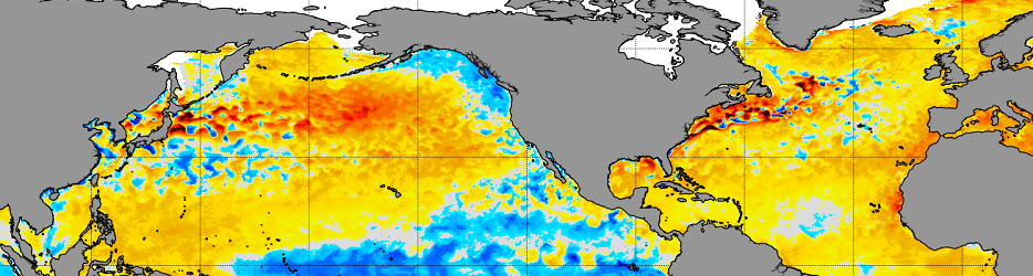 |
In any case, the sea surface temperature of the Atlantic also has a certain share in these record breaking conditions. Since the (North) Atlantic is the origin of the warm air masses, the surface
temperature of the ocean is decisive for the initial temperature of the air mass before it is directed to Central Europe by low-pressure areas. The hot summer and also partly extremely above-average
warm autumn still have an impact on the temperatures in the Atlantic. At the latitude of the Iberian Peninsula, 16 °C is currently the prevailing temperature in the Atlantic, which is about 2 K above
the climatological mean. Near the coast, the deviation is even 3 to 4 K. This pool of warmth can provide above-average warm conditions in Central Europe again and again during autumn and even during
winter, when these mild air masses are transported to Central Europe by Atlantic low-pressure areas.
| Location |
Tmax in °C |
Type of record |
Wielenbach (Demollstr.)
Ohlsbach
Müllheim
München-Stadt
Metzingen
Baden-Baden-Geroldsau
Bad_Kohlgrub (Rosshof)
Waghäusel-Kirrlach
Notzingen
Dresden-Hosterwitz
Buchenbach
Bad Dürkheim
Hohenpeißenberg
Berlin-Tempelhof
Jena
Feldberg(Mecklenburg)
|
20.8
20.3
20.3
20.0
19.8
19.7
19.6
19.5
19.4
19.4
19.4
19.4
18.6
17.9
17.7
14.4
|
Month
Month
Decade
Decade
Month
Month
Month
Month
Month
Month
Month
Decade
Month
Month
Month
Month
|
|
| Location |
Tmin in °C |
Type of record |
Ohlsbach
Baden-Baden-Geroldsau
Emmendingen-Mundingen
Müllheim
Lahr
Dresden-Hosterwitz
München-Stadt
Wielenbach(Demollstr.)
Rheinau-Memprechtshofen
Dresden-Strehlen
Metzingen
Oberstdorf
Hoyerswerda
München-Flughafen
Cottbus
Öhringen
|
19.4
19.3
19.2
19.1
18.6
18.5
18.5
18.5
18.4
18.3
18.3
18.0
18.0
17.9
17.8
17.8
|
Month
Month
Month
Month
Month
Month
Decade
Month
Month
Month
Month
Month
Month
Decade
Month
Month
|
|
Daily maximum temperatures from 31.12.2022 (left) and 01.01.2023 (right). Data source: DWD
Text: FS
January 03, 2023
|