|
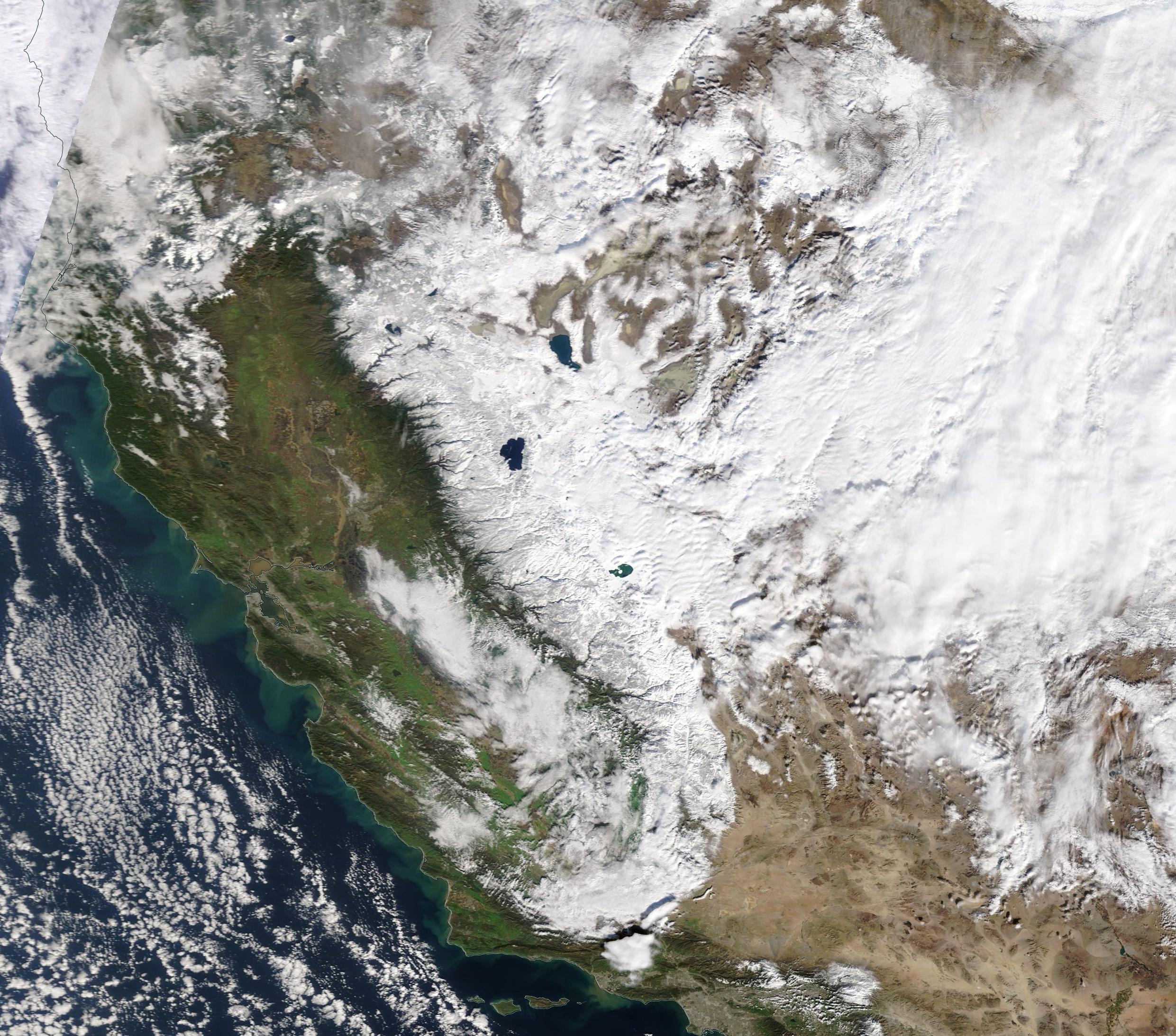
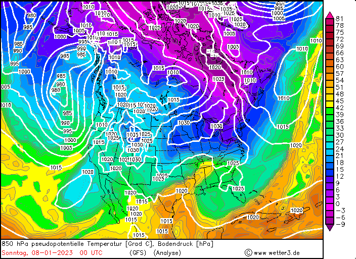
A persistent trough structure over the Eastern Pacific developed over the Christmas Days in 2022, lasting into mid-January 2023, bringing multiple intense storm systems into the state of California leading to intense precipitation, especially along the western flanks of the Sierra Nevada and the Coastal Mountain ranges of California. Precipitation totals of more than 1000 mm were observed as well as meters of fresh snow accumulation at higher elevations.
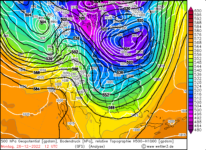
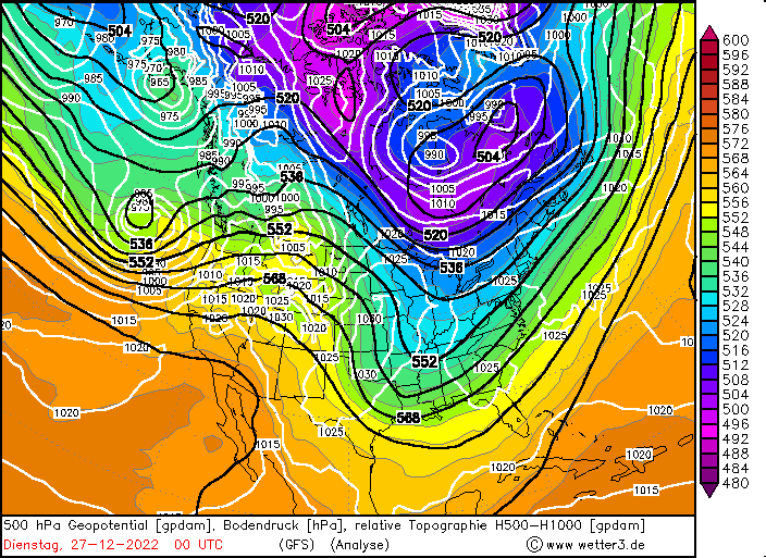
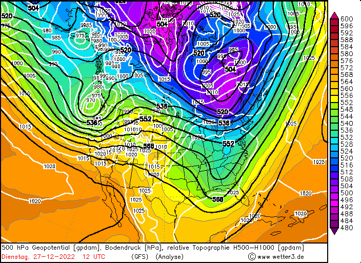
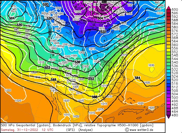
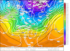
Storm 1 - December 26, 2022 to December 27, 2022
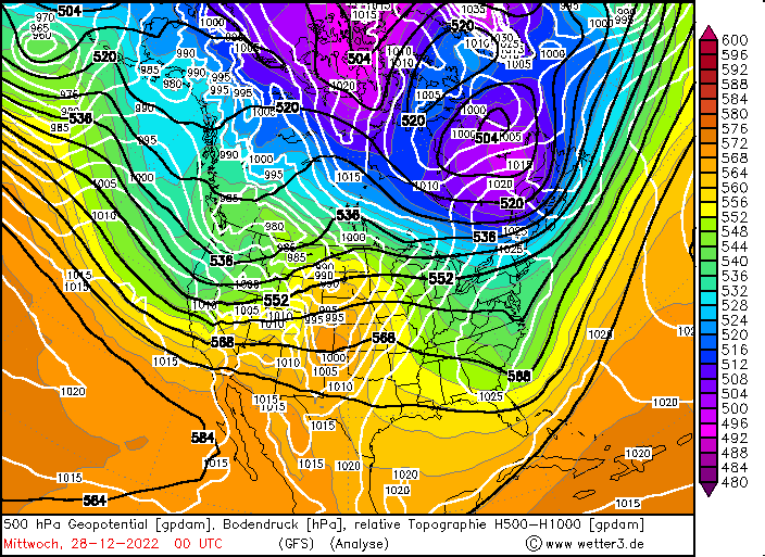
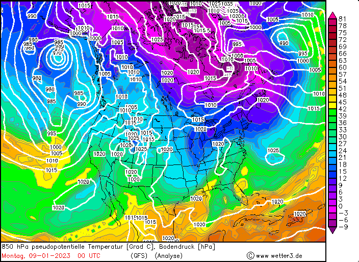
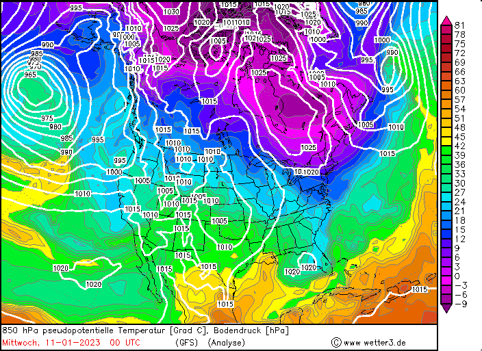
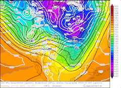
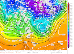
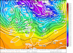
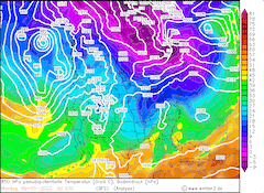
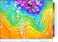
After an amplified ridge-trough-structure over North America led to a violent cold snap over the eastern part of the US, a second trough developed over the Eastern Pacific. With the accompanied extratropical low over the Pacific, a strong westward current developed over the West Coast of the US, advecting warm and moist air masses into the state of California. Due to the topography of California, intense orographic lift is induced as the air masses are lifted first above the coastal ranges of California and second above the Sierra Nevada.
|
500 hPa Geopotential (top), 850 hPa pseudopotential temperature (bottom) and sea level pressure North America, 26.12.2022 12 UTC - 28.12.2022 00 UTC, source:
wetter3
|
 |
 |
 |
 |
At lower elevations the system brought significant rainfall with storm totals up to 50 mm in the Central Valley and up to 100 mm of precipitation at higher altitudes in the Sierra Nevada, with the highest amounts observed along the western facing flanks of the Sierra Nevada. At higher elevations in the Sierra Nevada the storm brought intense snowfall with fresh snow accumulations of up to 50 cm in the Central Sierra Nevada.
As the winter season in California started fairly wet, with the snowpack already reaching around 150 % of season to-date average of the snow-water equivalent, the system helped to further increase the snowpack in the Sierra Nevada to around 160 % of the season to-date average, with an average snow-water equivalent of 340 mm. At higher elevations the system induced treacherous road conditions due to intense snowfall.
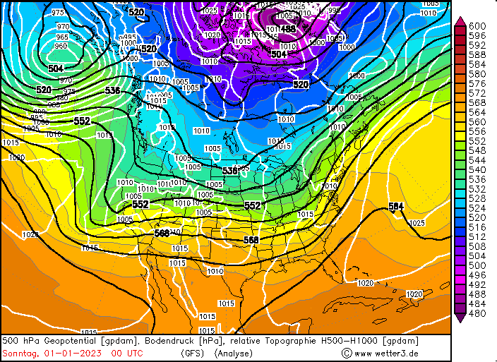
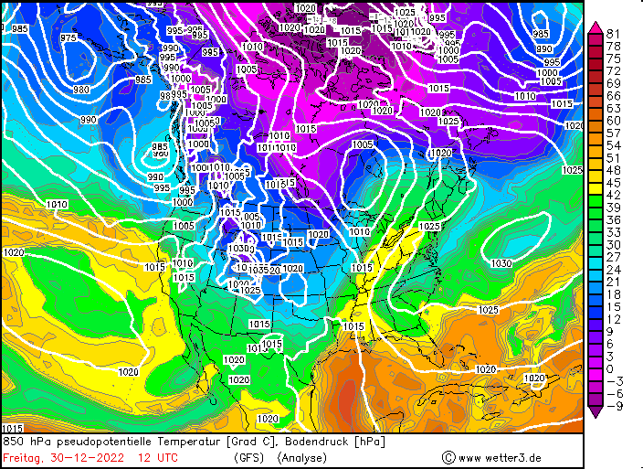
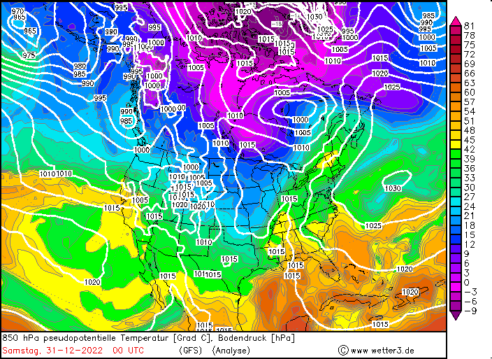
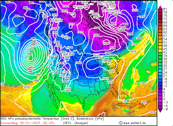
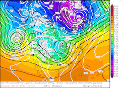
Strom 2 - December 30, 2022 to January 1, 2023
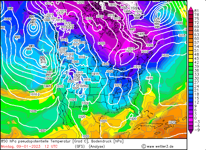
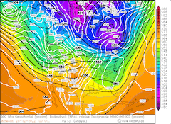
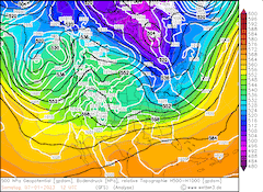
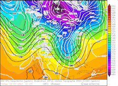
After a short break in storm activity over California, another powerful storm system moved over the western part of the US over the New Year. A zonally aligned jet structure brought a powerful extratropical low developing from a shortwave trough over the Eastern Pacific to California, with strong winds and intense precipitation.
|
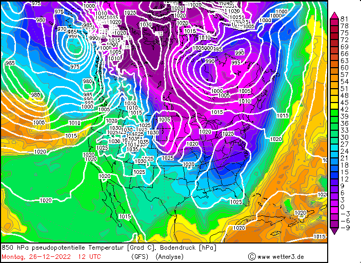
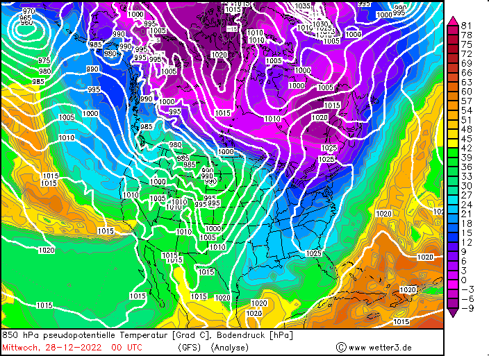
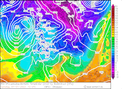
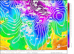
500 hPa Geopotential (top), 850 hPa pseudopotential temperature (bottom) and sea level pressure North America, 30.12.2022 12 UTC - 01.01.2023 00 UTC, source:
wetter3
|
 |
 |
 |
 |
As seen in the 850 pseudopotential temperatures over Northern America, very warm and moist air masses of subtropical origin were advected into California, bringing regionally record-breaking rainfall, for daily precipitation records. At the San Francisco Bay Area, New Year's Eve of 2022 was the second wettest day on record, at the station San Francisco Intl. with a 24-h precipitation of 138 mm, just 2 mm shy of the all-time record for daily precipitation set on November 5, 1994. The heavy precipitation falling on soils, which were getting continuously more saturated, high runoff was observed, leading to many creeks and small streams to be running very high. Locally streets closures were needed, as rivers flooded major roadways. Flooding was also observed in the Metropolitan Area of the San Francisco and Oakland, CA.
At higher elevations intense snowfall was observed, leading to treacherous road conditions in the Sierra Nevada, not only due to the intense snowfall and subsequent low visibility but also due growing avalanche danger by the fresh snow accumulations. At higher elevations of the Sierra Nevada fresh snow accumulations up to 140 cm were observed, locally even higher values can't be excluded due to the remoteness of parts of the high terrain of the Sierra Nevada. As the system passed snow levels fell and bigger cities like Reno, NV received up to 30 cm of fresh snow accumulation.
Overall, the December 2022 was one of the wettest months on the record in California, locally with record-breaking precipitation amounts.
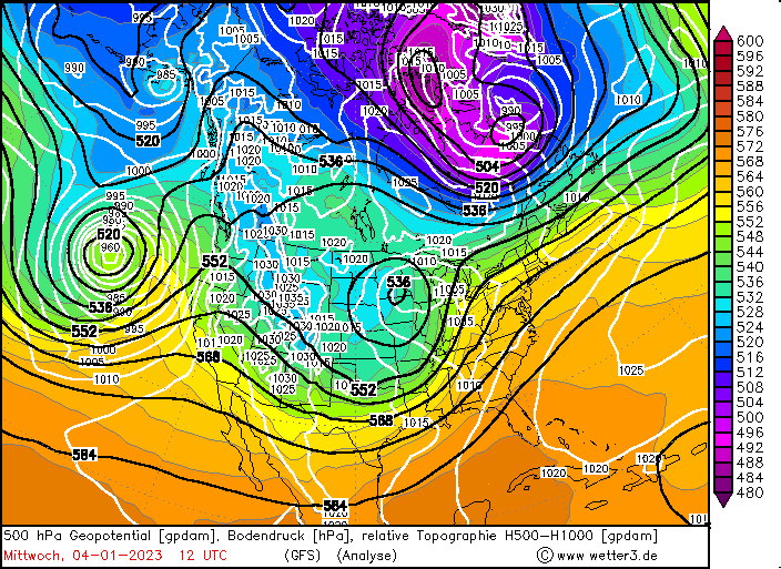
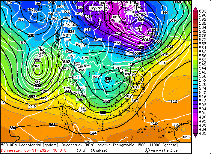
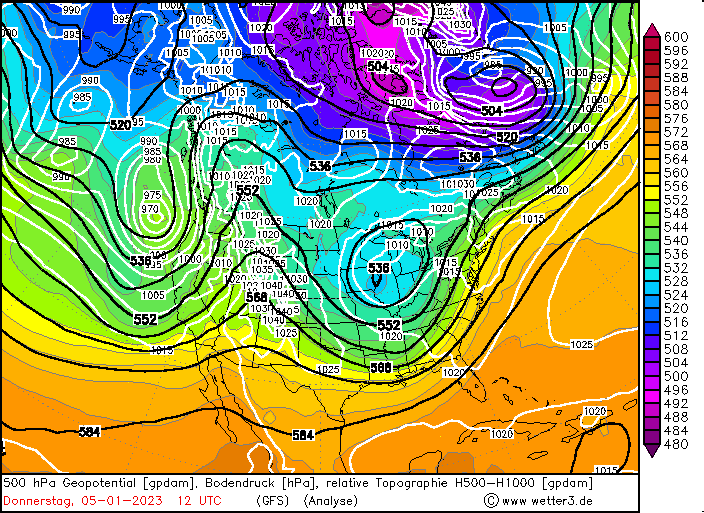
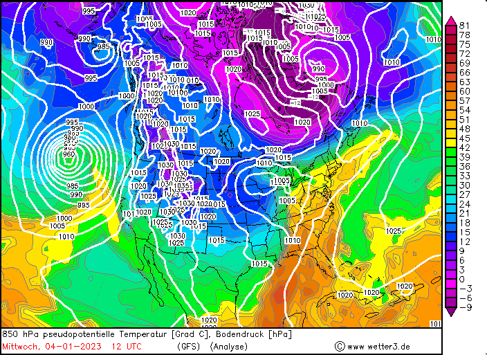
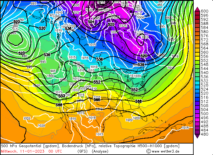
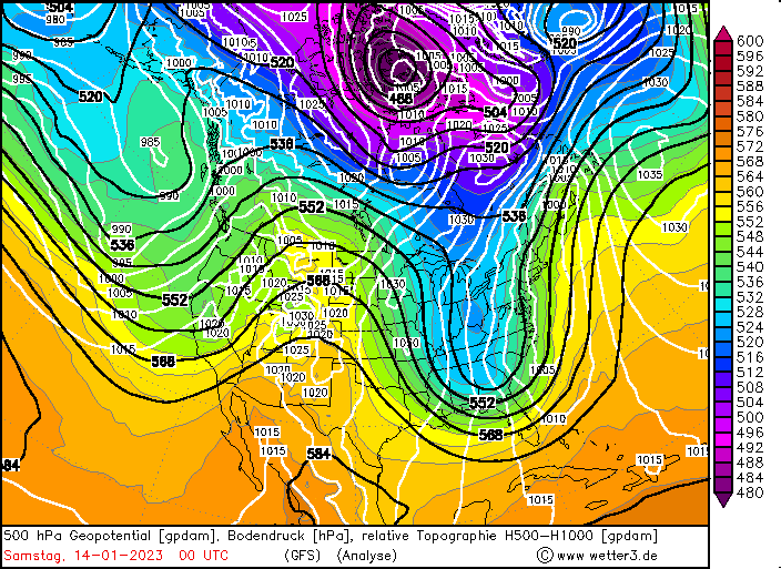
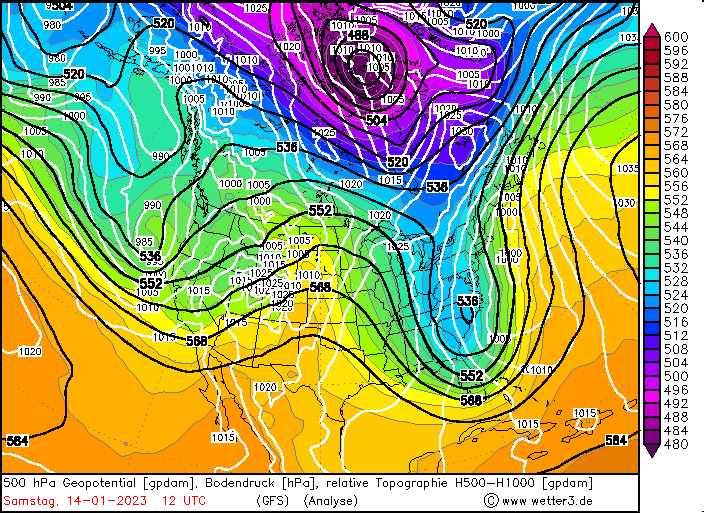
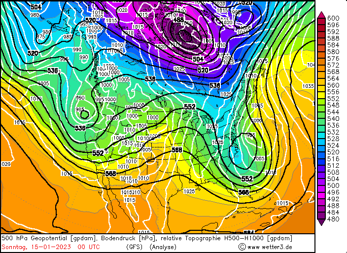
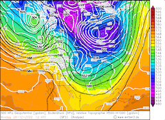
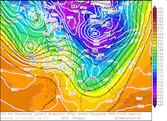
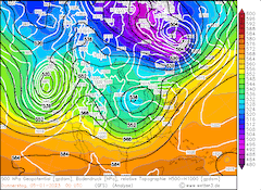
Storm 3 - January 4, 2023 to January 5, 2023
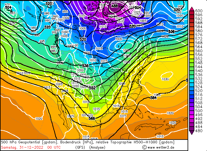
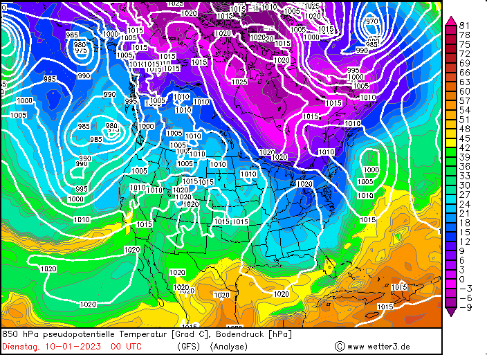
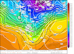
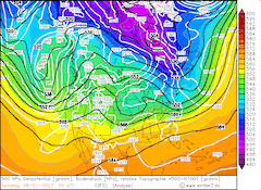
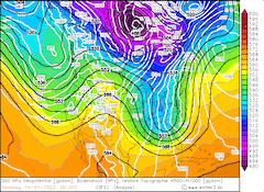
On January 4, 2023, a powerful extratropical low formed over the Eastern Pacific, moving eastwards approaching the West Coast of the US. The system rapidly deepened, as it moved over the Central Pacific, crossing the jet axis of the Pacific from the equatorial to the polar flank. The structure of the storm resembled a Shapiro-Keyser cyclone with the cold front of the cyclone being southeastwards of the cyclone center and the warm front wrapping around the cyclone center.
|
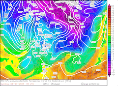
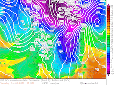
500 hPa Geopotential (top), 850 hPa pseudopotential temperature (bottom) and sea level pressure North America, 04.01.2023 12 UTC - 06.01.2023 00 UTC, source:
wetter3
|
 |
 |
 |
 |
The intense cyclone not only brought heavy precipitation to the state of California with 24 h-precipitation totals once again surpassing 100 mm in parts of the state. In parts of California the system induced the highest 24 h-precipitation totals of the entire wet weather period. Further, the cold front of the system brought strong wind gusts as it passed through the state, with wind gusts at lower elevations reaching more than 100 km/h. Leading, to many downed power lines and subsequently power outages across the state. The precipitation once again led to the rise of the rivers in the Central Valley as the soils in the Sierra Nevada were already saturated in large parts, with local evacuation order needed, as river flooding neared residential areas.
At higher elevations once again, intense snowfall was observed with fresh snow accumulations over 50 cm. With strong winds and intense snowfall rates, along the Sierra Nevada many roads were closed due to white-out conditions.
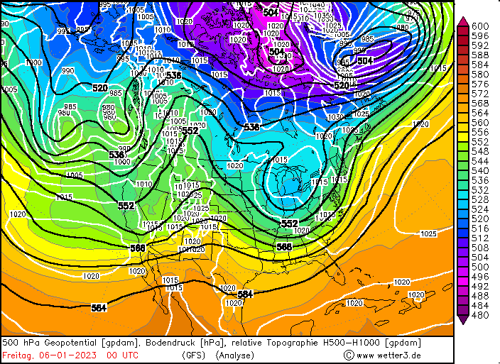
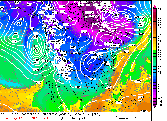
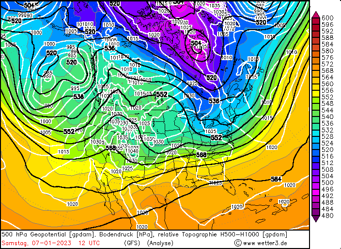
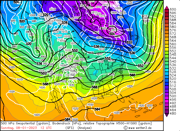
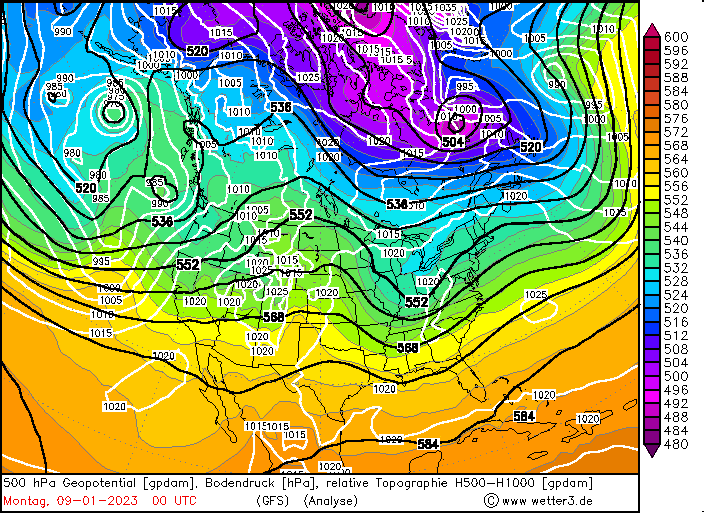
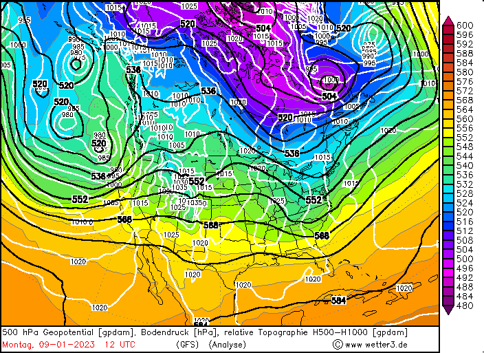
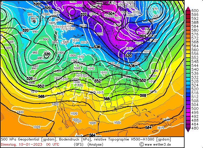
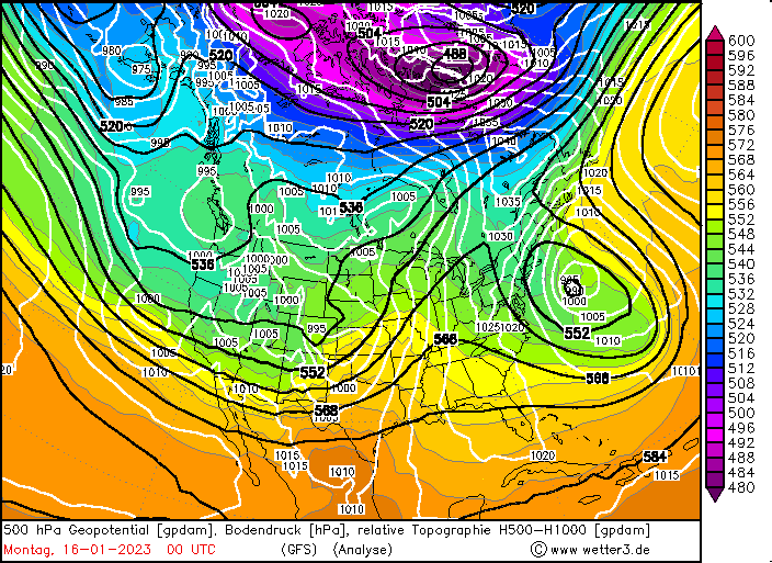
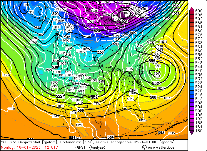
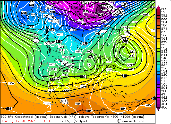
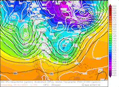
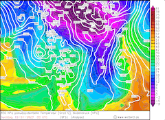
Storm 4 - January 7, 2023 to January 11, 2023
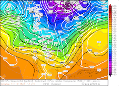
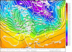
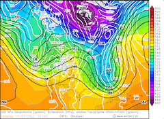
Upstream of the trough, accompanied by the previously described storm system, a second trough developed over the Eastern Pacific close to the West Coast of the US with a strong surface low pressure system below. The West Coast of the US laid on upstream of the trough, leading to a southwesterly current over the Eastern Pacific, bringing yet again moist and warm air masses of subtropical origin into California.
|
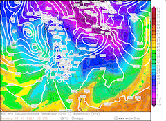
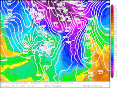
500 hPa Geopotential and sea level pressure North America, 07.01.2023 12 UTC - 11.01.2023 00 UTC, source:
wetter3
|
 |
 |
 |
 |
Along with bringing intense precipitation at lower elevations in California and intense snowfall at higher elevations, the system induced severe weather across California with intense thunderstorms leading tp local tornado warnings being issued by the NWS.
|
850 hPa Pseudo-potential temperature and sea level pressure North America, 07.01.2023 12 UTC - 11.01.2023 00 UTC, source:
wetter3
|
 |
 |
 |
 |
Due to the intense precipitation induced since December 26, 2022, by the multiple storm systems, extreme run-off and subsequent river flooding as well as flash flooding was observed during times of intense precipitation. For instance strong flooding was documented at Montecito, CA, but also in the Los Angeles Area flash flooding was observed due to the intense precipitation. Further, due to the saturated soils, many rockslides were observed. At higher elevations the extreme fresh snow accumulations not only caused massive traffic disruptions, but also the extreme snow heights caused problems, when trying to clear the roadways from the snow.
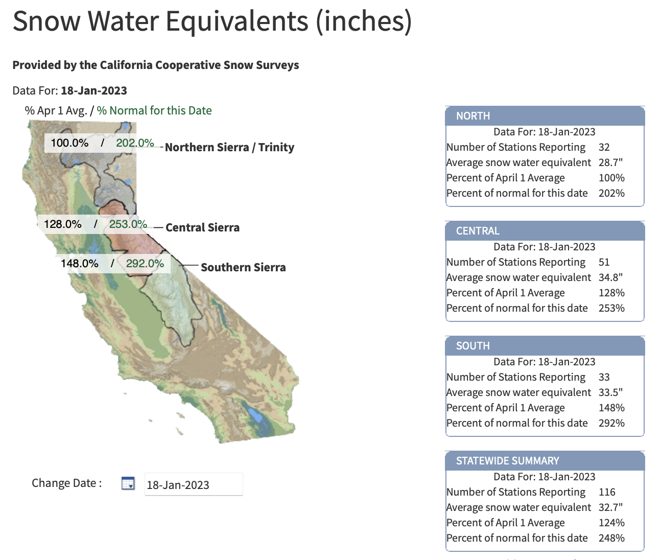
The snowpack of the Sierra Nevada reached 229 % of the season-to-date average with a statewide snow-water equivalent average of over 700 mm. Especially, in the Eastern and Southern Sierra Nevada, the snowpack reached record-breaking levels for the season-to-date, with snow-water equivalent reaching levels normally seen in March, comfortably surpassing the season average. Overall, both the heavy precipitation and the heavy snowfall led to significant improvements in the drought conditions over California, elevating the drought conditions across large parts of California by at least one stage, locally up to two stages.
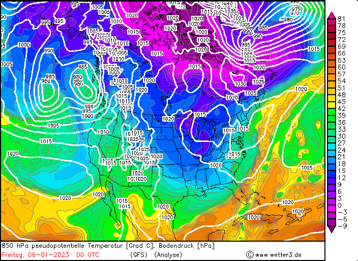
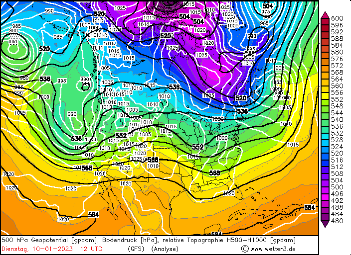
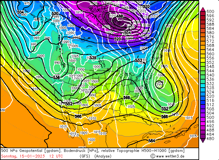
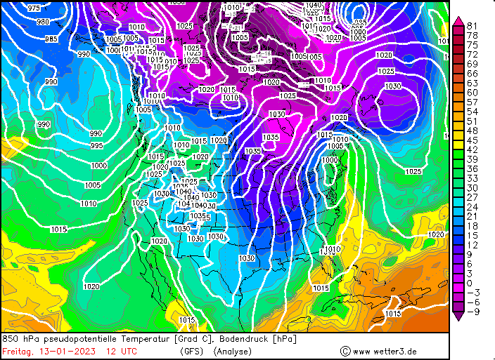
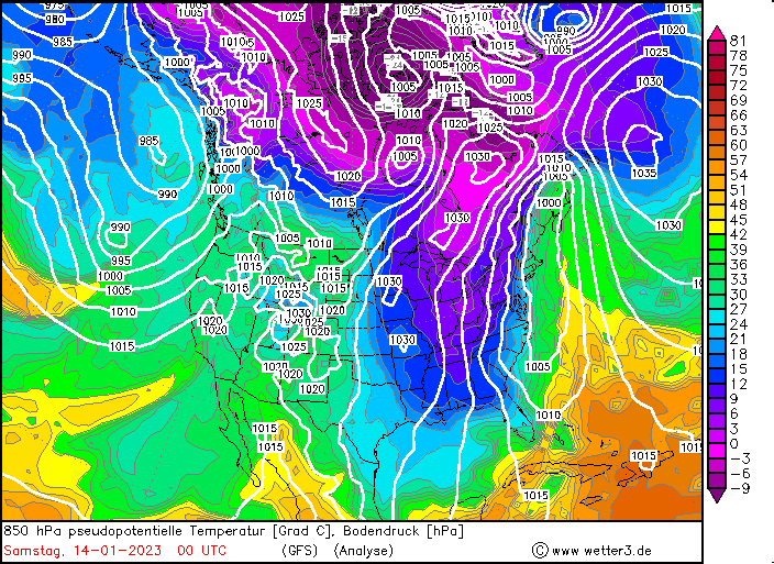
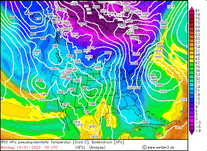
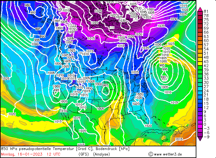
Storm 5 - January 14, 2023 to January 16, 2023
The last major storm system affecting California, during this intense wet weather period, starting around the Christmas Days 2022, formed as the trough previously affecting California moved eastwards, nearing the West Coast of the US. A strong extratropical low formed with its center off the coast of Northern California, inducing once again heavy precipitation across the state.
|
500 hPa Geopotential and sea level pressure North America, 13.01.2023 12 UTC - 17.01.2023 00 UTC, source:
wetter3
|
 |
 |
 |
 |
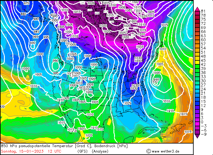
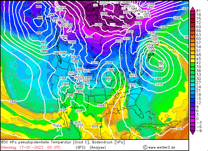
The surface low exacerbated the southwesterly current over the Eastern Pacific, advecting once again warm and moist air masses into the state of California, indicated by the high values of the pseudo-potential temperatures.
|
850 hPa Pseudo-potential temperature and sea level pressure North America, 13.01.2023 12 UTC - 17.01.2023 00 UTC, source:
wetter3
|
 |
 |
 |
 |
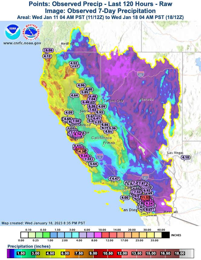
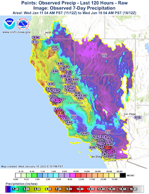
5 day-precipitation totals, with the precipitation mainly being observed between January 14, 2023, and January 16, 2023, surpassed once again the 100 mm-mark along western facing flanks. With the Central Valley receiving once again more than 50 mm. At the coastal ranges of California locally precipitation totals of more than 250 mm were observed. Especially, in Southern California intense precipitation was observed, leading to flooding in the San Diego Area. Also, in the Central Valley the rivers reached flooding stages again, albeit not reaching the levels seen previously for many rivers.
5-day precipitation observation overlayed with 7-day precipitation
over California, 18.01.2023, source:
CNRFC
|
 |
At higher elevations of the Sierra Nevada the system once again brought intense snowfall with 4 day-fresh snow accumulations reaching more than 150 cm in the Central Sierra Nevada, with observed maximums up to 190 cm. With substantial snow depth of multiple meters being documented in the high terrain of the Sierra Nevada.
With these snowfalls the snowpack in the Sierra Nevada in all regions surpassed the seasonal average when looking at the snow-water equivalent. While in the southern part of the Sierra Nevada the snow-water equivalent reached nearly 300 % of the season-to-date average with a state average of over 800 mm.
Summary
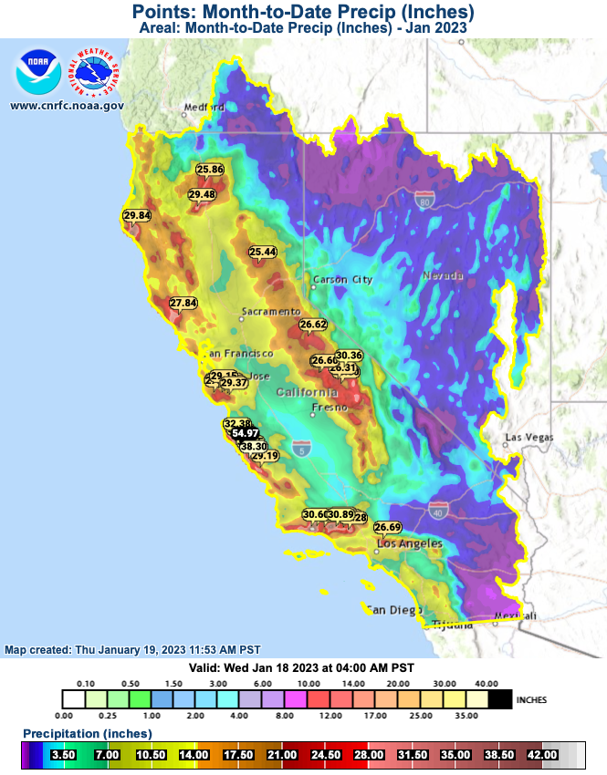
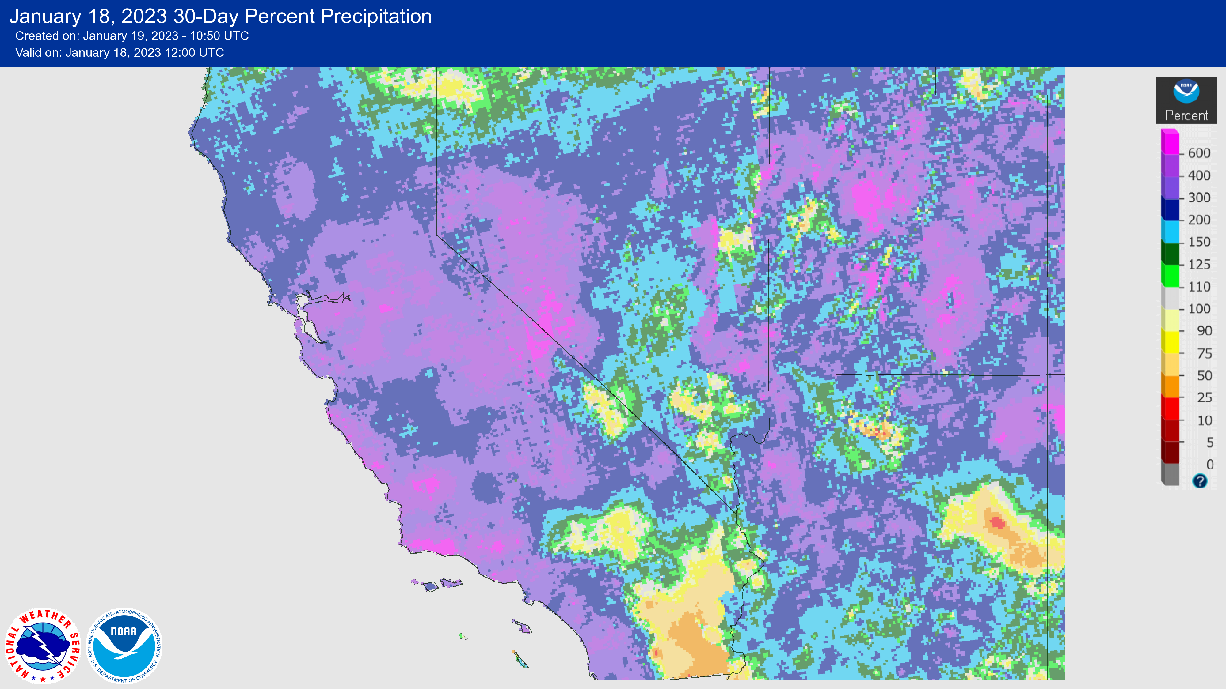
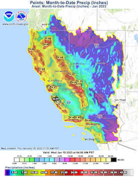
The precipitation totals observed since December 26, 2022, across California are exceptional. In the Central Valley, precipitation totals surpassed the 250 mm-mark, with lower values recorded in the rain shadow of the Coastal Mountain ranges. Along western facing flanks of the Coastal Mountain ranges and the Sierra Nevada, the precipitation totals are exceptionally high, with some stations reporting more than 1000 mm of precipitation.
Precipitation observed during January over California,
18.01.2023, source:
CNRFC
|
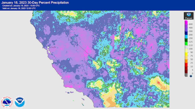
30-day precipitation anomaly over California, 18.01.2023, source:
water.weather.gov
|
 |
 |
This 22-day period was one of the wettest in the history for the state of California, in the San Francisco Bay Area it has been the second wettest period in the recorded history. Higher precipitation totals have only been observed during January 1862 during the Great Flood of 1862. In many regions of California in the 22-day period substantial amounts of the average yearly precipitation fell, regionally more than 50 % of the yearly precipitation. From space an amazing parade of extratropical cyclones can be observed, moving one after another from the Eastern Pacific into California.
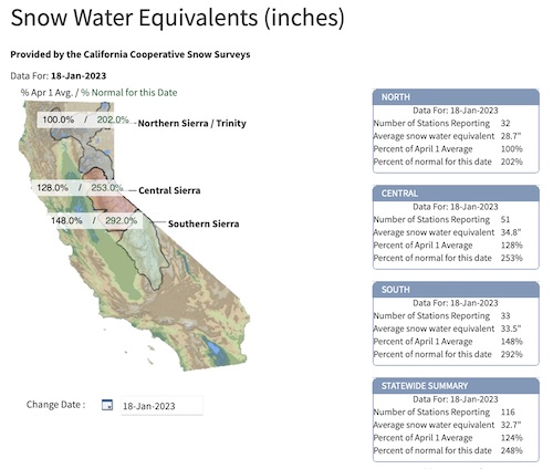
At higher elevations the snow accumulations were also exceptional, meters of fresh snow were accumulated in the Sierra Nevada, with snow depth changes of more than 3 m being measured along the Sierra Nevada. The snowpack of the Sierra Nevada reached exceptional levels, with reaching more than 120 % of the seasonal average.
|
Snow-water equivalent of the snowpack in the Sierra Nevada, 18.01.2023, source:
CDEC
|
 |
A webcam in Yosemite National Park captured the snow accumulation since beginning of this wet weather period, burying the webcam looking across the Yosemite Valley to Half Dome.
Skiing resorts along the Sierra Nevada have received more than 10 m of snow in this winter season. At lower elevation the abundant precipitation caused flooding, with at least 19 flood-related deaths being reported across California. Moisture also spread eastwards across the Sierra Nevada into the Rocky Mountains. Many parts of the Rocky Mountains, especially out to the west have received intense snowfall with snowpacks running close record levels for these regions as well.
With the large snowpack and intense precipitation across California and the western part of the US, water reservoirs have been filled by a substantial amount. Relieving the drought that has been persistent since more than a decade in the southwestern part of the US. With calmer weather in the forecast for the rest of the month, flooding will no longer be a concern. Yet, during the spring thaw with these large snowpacks in the Sierra Nevada and across the Rocky Mountains, river flooding will be once again a concern across the southwestern part of the US.
Text: KG
January 19, 2023
|