|
An outbreak of extremely cold air masses of Arctic origin led to an extreme cold snap over large parts of the US and Canada. Temperatures in Northern Canada dropped below the -50 °C-mark, while in the US over 200 million people were affected by the cold snap.
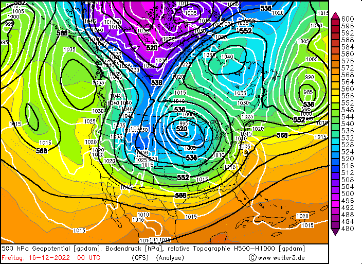
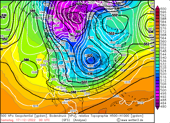
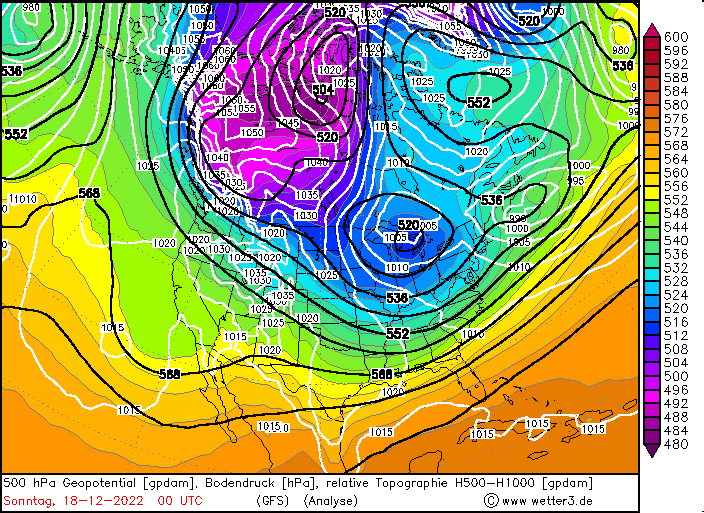
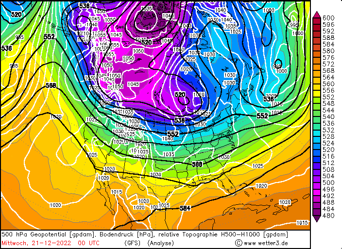
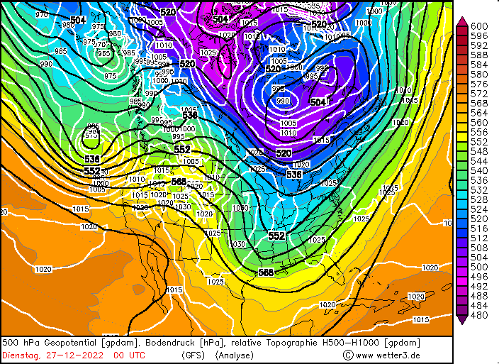
In mid-December on the backside of a trough over the Nunavut Territory in the Canadian High Arctic in combination with a strong secondary trough over the Northern Plains, extremely cold air masses with 850 hPa-temperatures below the -30 °C-mark were advected southwards from the Arctic Ocean over the Yukon and Northwest Territories, leading to temperatures dropping below the -50 °C-mark. Spreading southwards along the eastern flank of the Rocky Mountains in Canada, the extremely cold air masses reached the US-Canadian border by December 19.
|
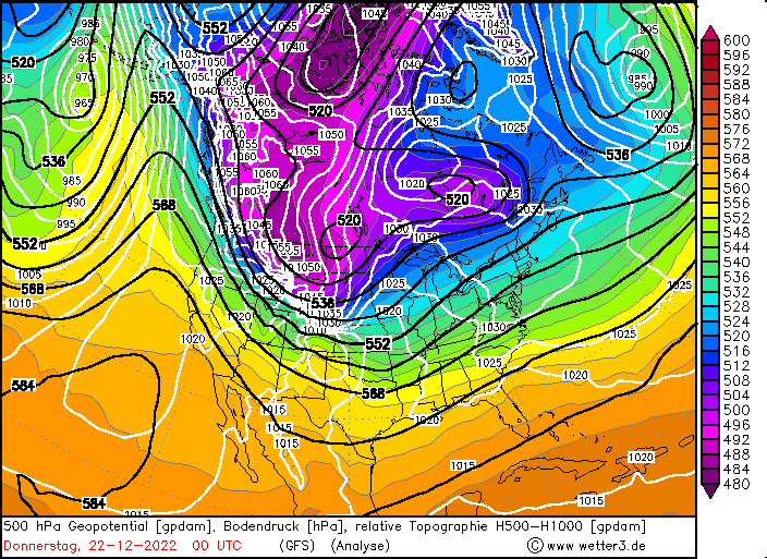
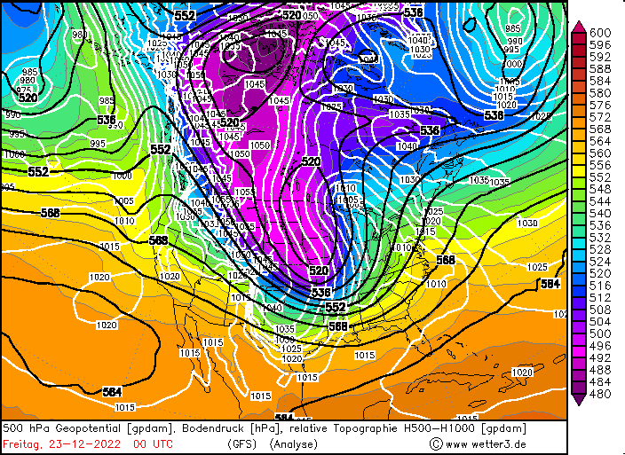
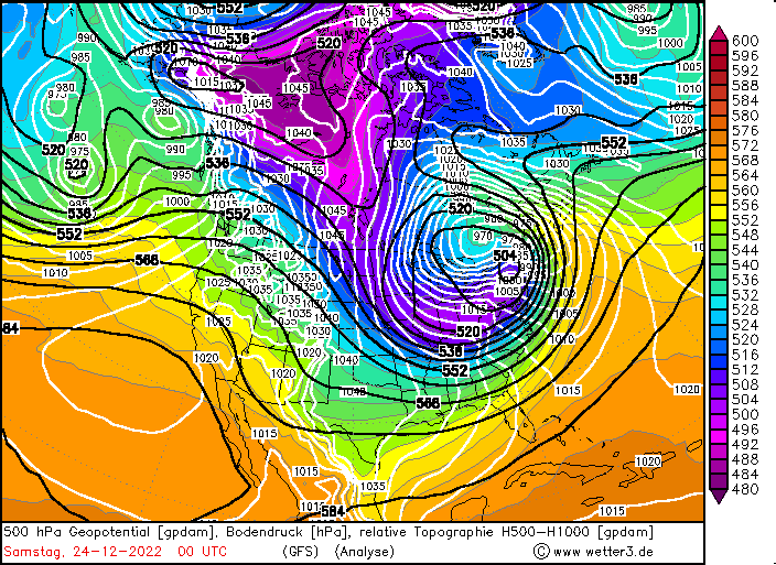
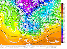
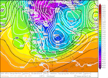
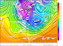
500 hPa Geopotential and sea level pressure North America, 16.12.2022 00 UTC - 27.12.2022 00 UTC, source:
wetter3
|
 |
 |
 |
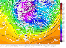 |
Until December 22, the pocket of cold air masses remained nearly stationary in the southern part of British Columbia and Alberta, affecting only Montana and North Dakota. Between December 20 and December 21, a shallow trough developed over the southern part of Saskatchewan and Manitoba, which enhanced the advection of the cold air mass along the eastern flank of the Rocky Mountains.
|
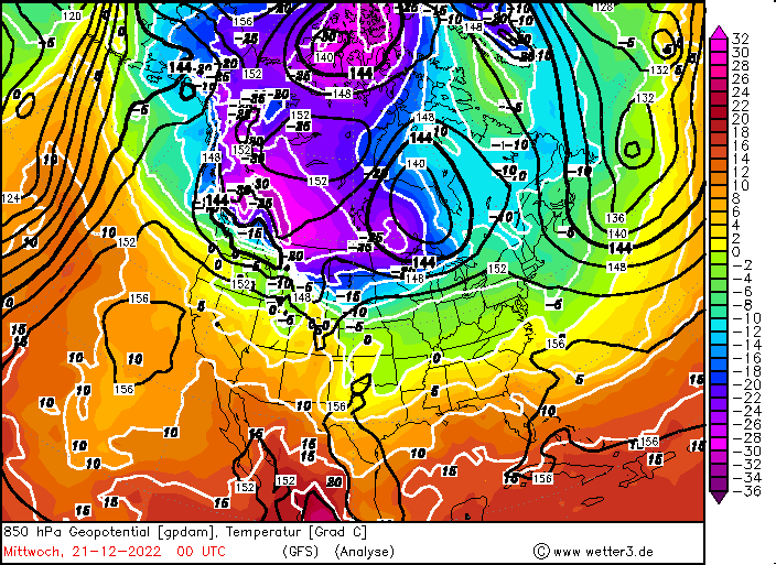
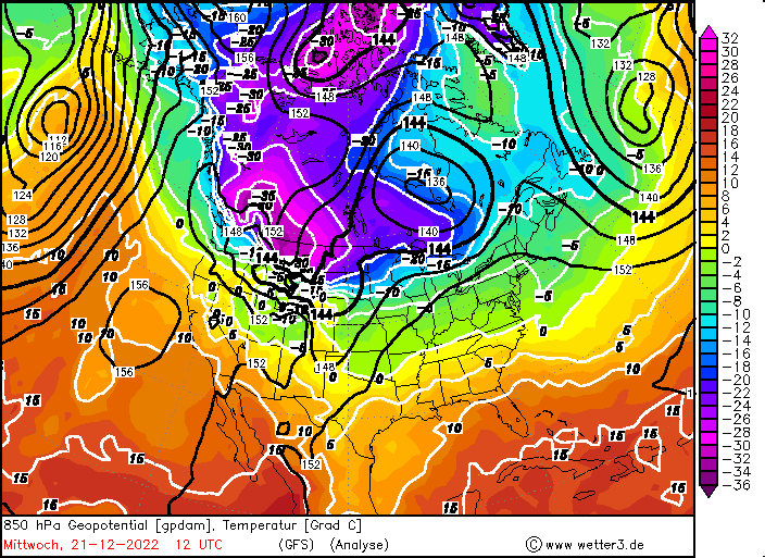
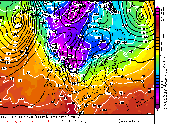
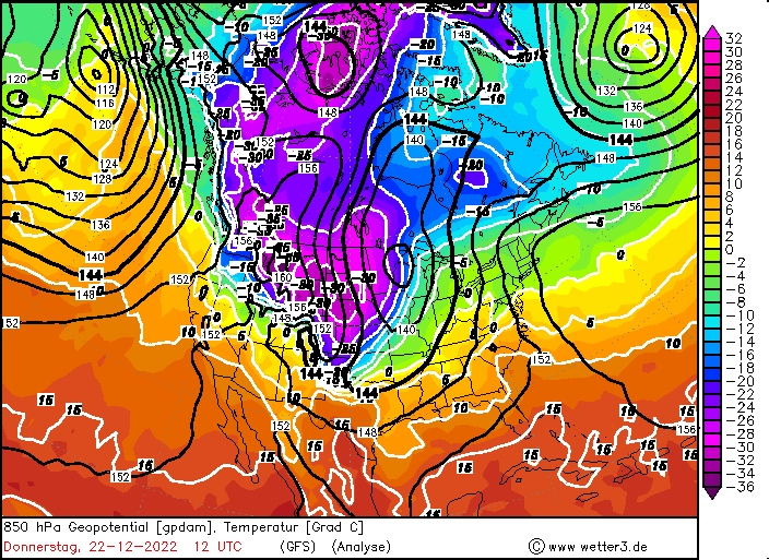
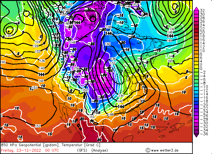
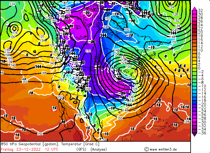
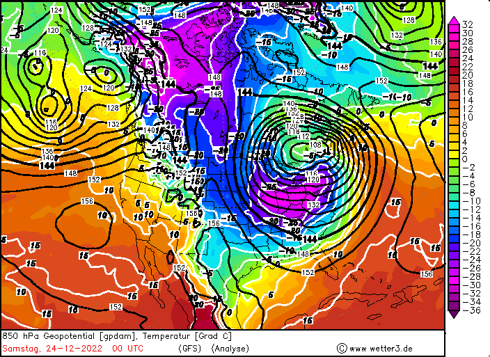
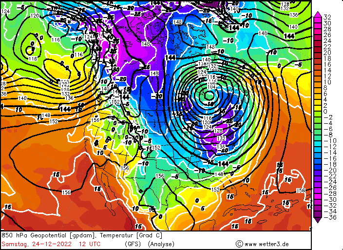
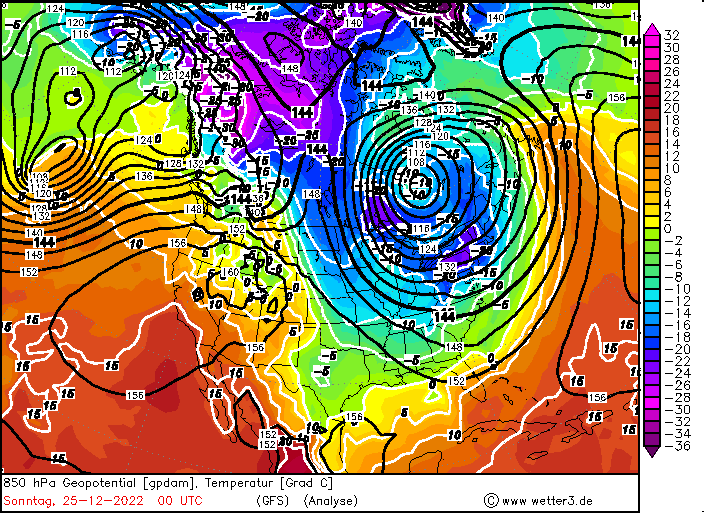
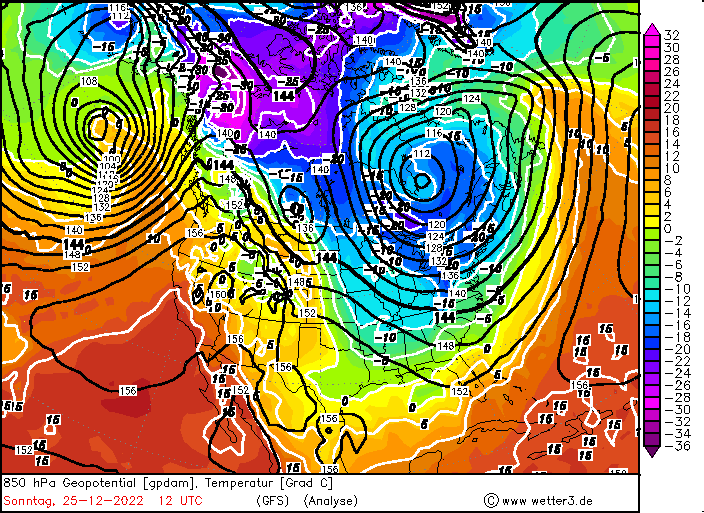
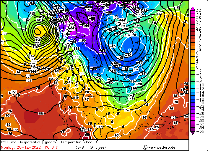
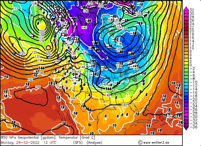
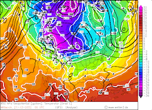
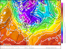
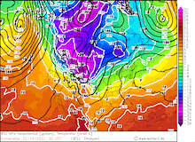
850 hPa Geopotential and 850 hPa temperature North America, 21.12.2022 00 UTC - 26.12.2022 12 UTC, source:
wetter3
|
 |
 |
 |
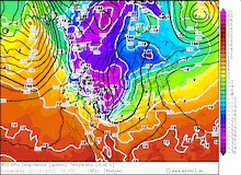 |
By December 22, extremely cold air masses with 850 hPa-temperatures below the -30 °C-mark advanced over Montana into Wyoming, the Dakota states, and the western part of Nebraska. With the cold temperatures, the mean sea level pressure rose to over 1050 hPa, locally more than 1055 hPa were measured. Nighttime low-temperatures dropped to below -35 °C, accompanied by strong northwesterly winds the apparent temperature dropped to life-threatening values below -50 °C in Montana, eastern Wyoming, and western Nebraska, inducing frostbites in a few minutes. In Malta, MT the apparent temperature on December 21 at 11:00 local time dropped to the extreme value of -57.8 °C.
In Casper, WY the extreme cold led to the observation of a new all-time record low-temperature of -41 °C on December 22, with the records going back to 1939. In large parts of eastern Wyoming the apparent temperature dropped below the -50 °C-mark.
While the cold air masses were advancing southwards, a distinct cold front formed, passing southwards over the Great Plains. With the cold front, violent temperature drops occurred, at Cheyenne, WY the temperature dropped more than 26 K within an hour, most of the temperature drop occurred within 30 minutes.
The extremely cold air masses enhanced the temperature gradient over the US massively, as subtropical air masses with 850 hPa-temperatures > 10 °C were present south of the cold pocket. This led to explosive cyclogenesis upstream of the trough over the Northern Plains, with the surface pressure dropping > 30 hPa / 24 h.
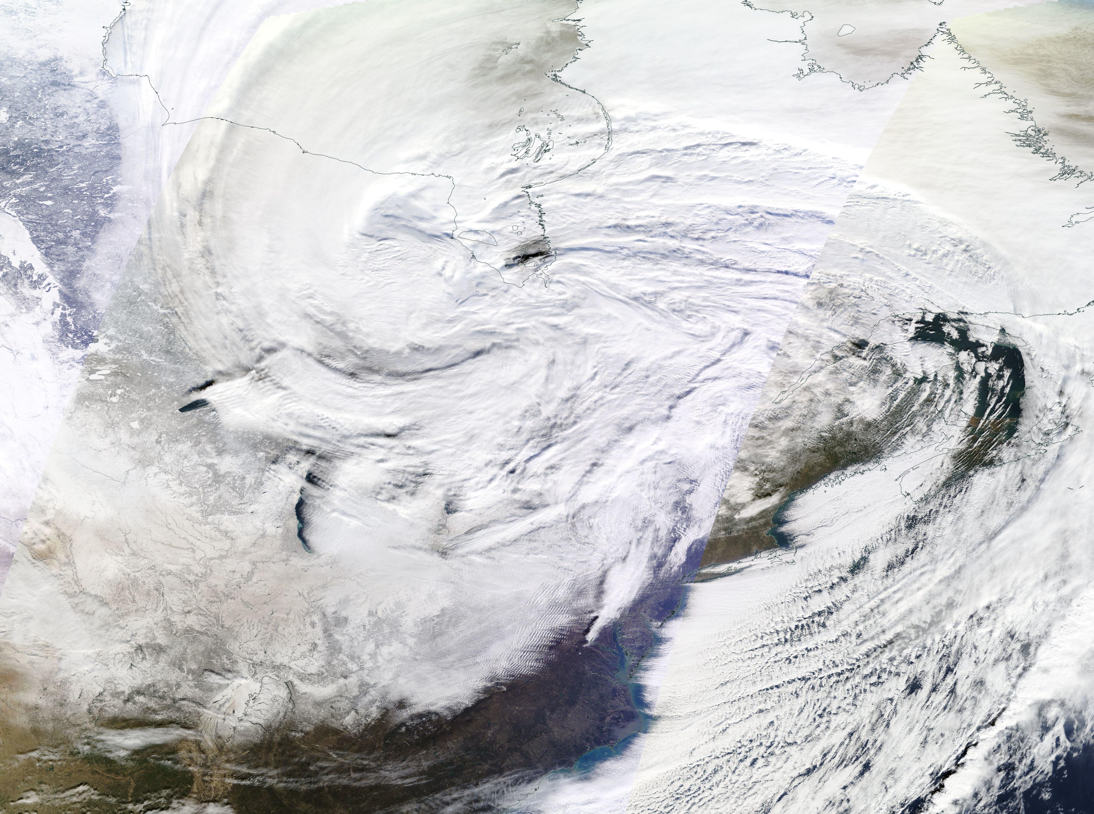
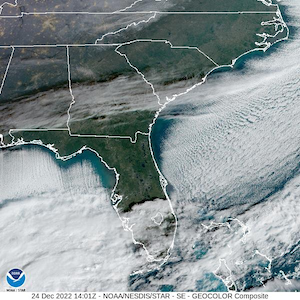
With the strong surface low developing the advection of the extremely cold air mass was further enhanced, with 850 hPa-temperatures dropping to -15 °C along the US-Mexican border by December 23. On the backside of the low, 850 hPa-temperatures south of the Great Lakes dropped below -25 °C by late December 23. By December 24, freezing 850 hPa-temperatures reached the Gulf Coast and dipped into Southern Florida. The cold air masses moving over the warm waters in the Gulf of Mexico formed distinct cloud streets stretching over the Gulf of Mexico.
Cloud streets forming over warm waters of the Gulf of Mexico,
24.12.2022 14:01 UTC,
source:
NOAA
|
 |
The low-pressure system caused heavy precipitation on the warm side of system over the eastern part of the US. In the Great Lakes region, on the cold side of the system intense lake effect snowfall was observed. As westerly winds with wind speeds over 100 km/h blew over the Great Lakes forming a strong lake effect event on the eastern coast of Lake Erie. The strong winds led to large waves, in combination with the cold temperatures this led massive ice accumulations along shoreline of Lake Erie. Further with the warm waters of Lake Erie and the extremely cold air masses passing over the lakes, strong snow squall lines formed. For the second time this winter season the metropolitan area of Buffalo, NY was hit by extreme snow accumulations (in November an extreme lake effect event left locally more than 2 m of fresh snow accumulation). Snow accumulations of more than 1 m were locally observed, with the lake effect snow band staying stationary over the Buffalo Metropolitan Area for over 40 hours over the Christmas days. The combination of the large fresh snow accumulations and the hurricane force winds led to extreme drift snow accumulations and extreme white-out conditions with zero visibility.
The extreme snow drift trapped residents in their homes, locally for multiple days. Further, the extreme weather conditions led to the shutdown of emergency services in the Buffalo area, with subsequent looting occurring. People were trapped in their cars as the heavy snowfall set in, leaving many dead. At least 38 people died in Buffalo, NY, at the time of writing, due to the blizzard with more suspected deaths as many cars are still suspected to be buried under the snow. Overall, at least 85 deaths in the US are related to the outbreak of extreme cold. With temporary power outages affecting millions of people across the US. Along with numerous daily temperature records being broken, Miami, FL at a latitude of 25 °N recorded a colder Christmas Day with 10 °C as London with a high temperature of 12 °C. By December 26, the cold air masses moved northwards into Canada again, with usually warm air masses being present along the eastern flank of the Rocky Mountains with 850 hPa-temperatures surpassing the 10 °C-mark. Leading to yet another extreme temperature swing in states such as Montana and Wyoming.
Text: KG
December 29, 2022
|