|
Wednesday, 14 December 2022, 10:00 UTC
Issued: Wednesday, 14 December 2022, 10:00 UTC
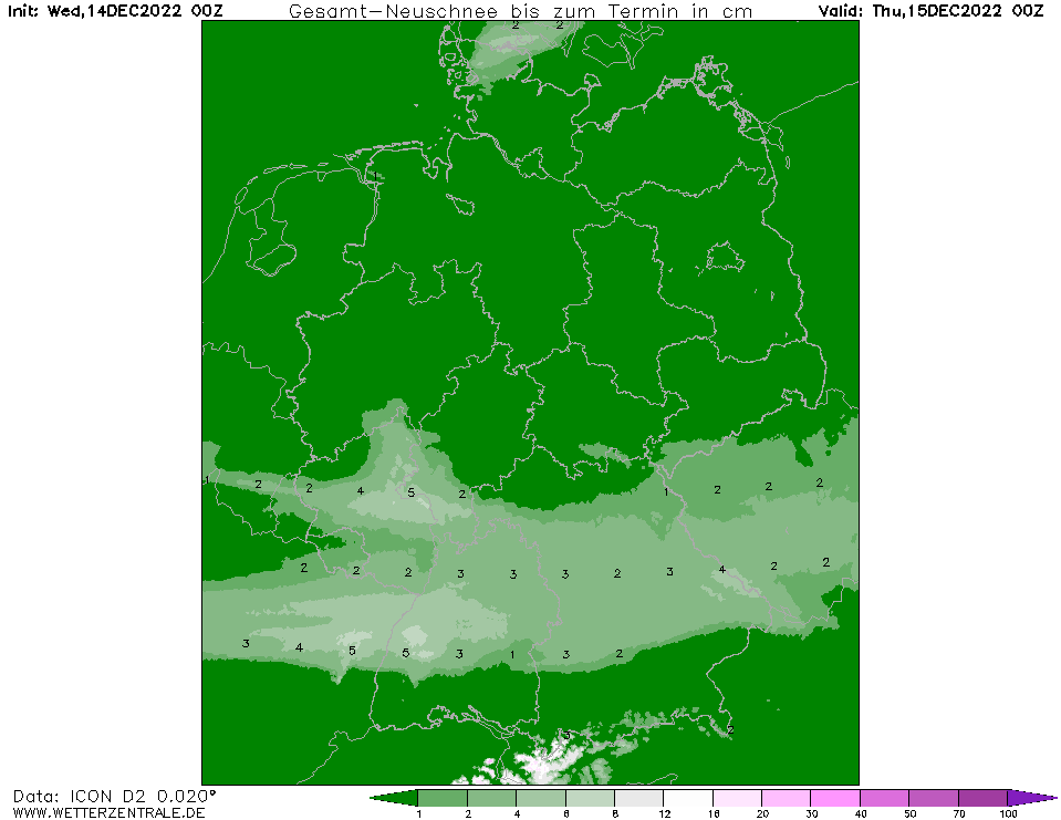
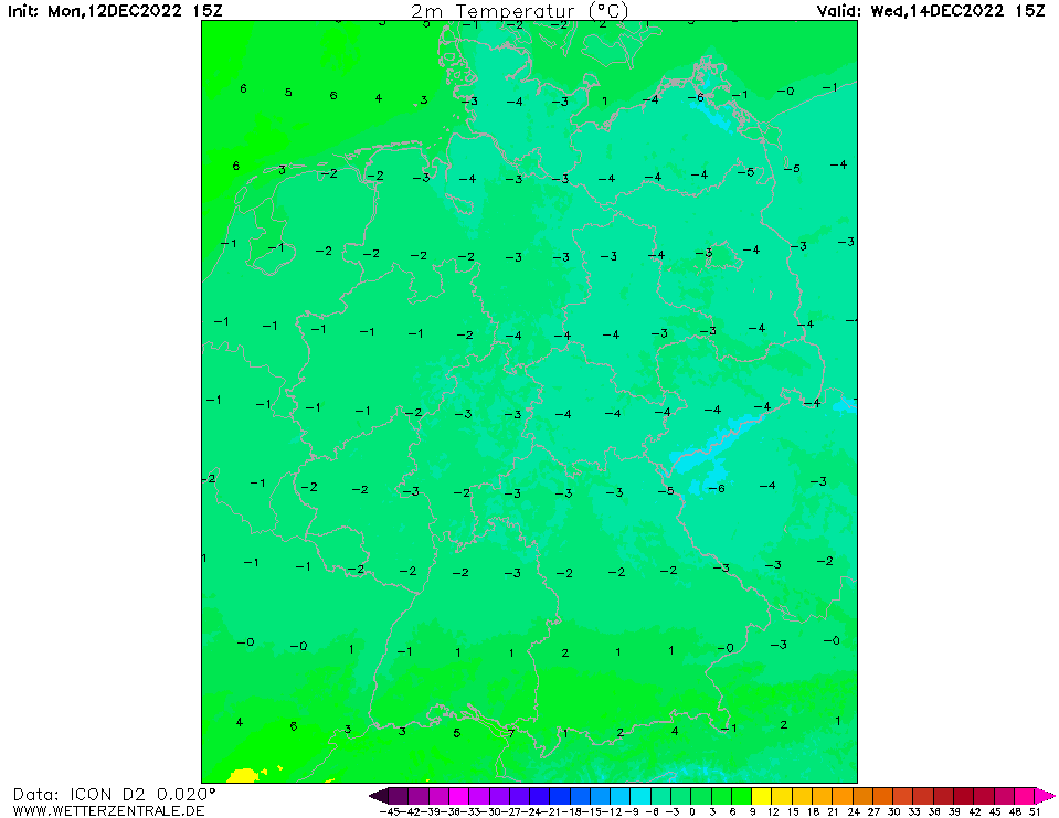
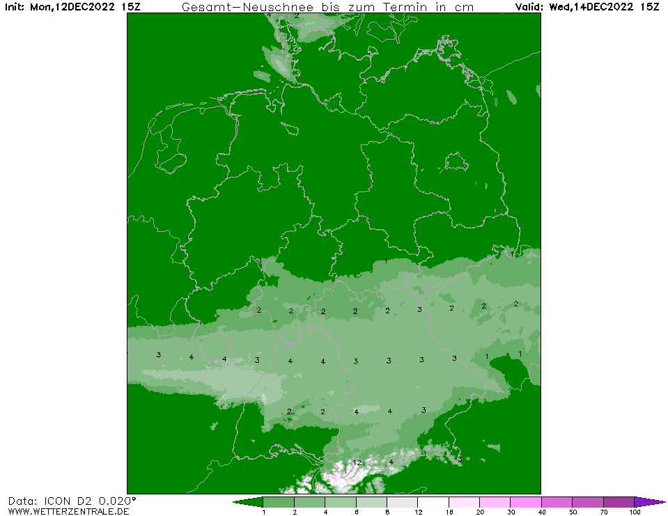
Starting early Wednesday, fresh snow of already up to 10cm accumulated in parts of Baden-Württemberg. Freezing rain occurred in Zürich and Basel, Switzerland and is likely to happen in southern Baden Württemberg as well.
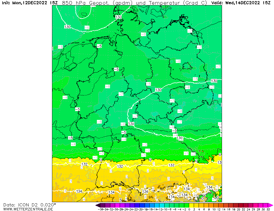
As predicted by most numerical forecast models, precipitation has formed along the air mass boundary over southern Germany. With temperatures below the freezing point, precipitation occurs as
snow down to the lowlands, particularly also in rather mild regions such as the Upper Rhine. The prevailing cold of the past few days (permanent frost in most places) ensures good conditions
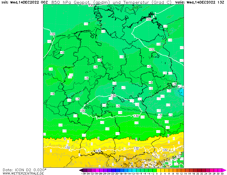
for the formation of a snow cover. During the day, the lower troposphere warms up, which is visible in the 850 hPa temperature. In the south of Baden-Württemberg and also in Switzerland, the 0 °C mark
is exceeded in 850 hPa. This can lead to dangerous freezing rain, where liquid water droplets freeze instantaneously on contact with the ground. Considerable restrictions in road and rail traffic are
expected. Precipitation will ease during the night on Thursday.
Monday, 12 December 2022, 19:00 UTC
Issued: Monday, 12 December 2022, 19:00 UTC
On Wednesday, fresh snow of up to 15 cm, as well as freezing rain, are possible in Baden-Württemberg.
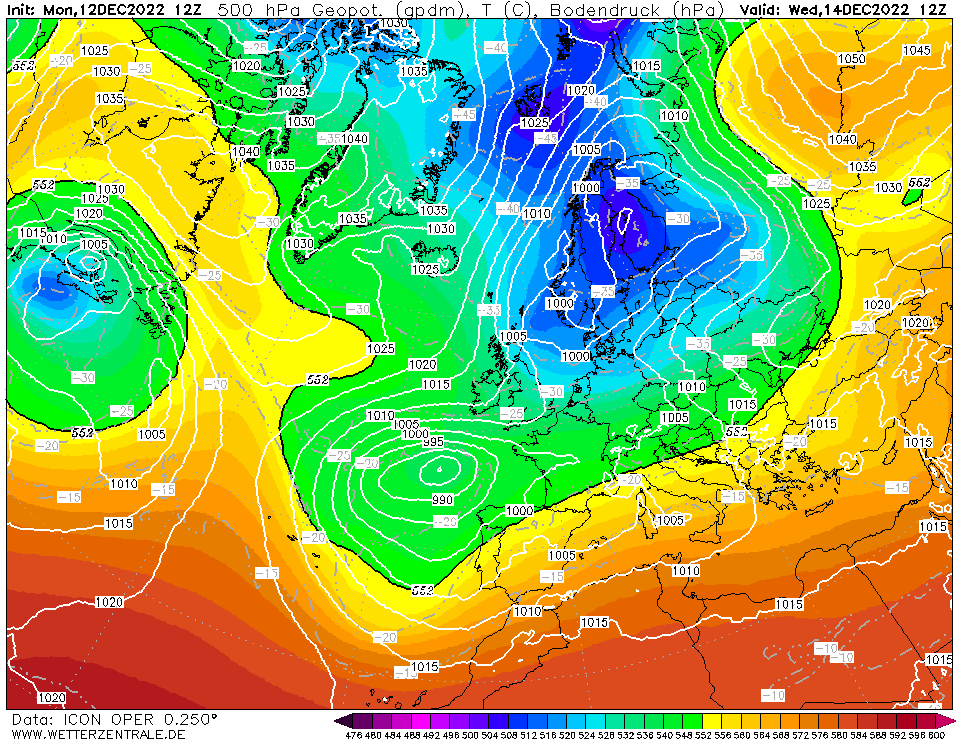
Along a low pressure ridge around low Efrain, a significant air mass boundary forms over the south of Germany on Wednesday. Efrain directs moist air to Germany, which, however,
encounters cold polar air over Baden-Württemberg and Bavaria, which flows in from the north and northwest. This leads to temperature contrasts of up to 11 K between southern
Germany and northern and/or central Germany on Wednesday. Due to uplifting processes, precipitation will occur along this air mass boundary. Here, fresh snow of up to 15 cm may
occur in a short time, but due to the mild temperatures in 850 hPa, freezing rain may also develop in the south of Germany. This poses a particular danger to road traffic, as
falling raindrops freeze instantaneously on contact with the ground and a coating of ice can form within a very short time.
Spannend wird es am #Mittwoch: Ein Tief bringt im Süden und möglicherweise der Mitte Schneefälle. Südlich davon (wahrscheinlich Alpenrand) hohes Eisregenpotential! Allerdings: Zugbahn noch *sehr* unsicher! Auch gar kein Eisregen oder Glatteis bis in die Mitte sind möglich! /V Issued: December 12, 2022, 19:00 UTC FS |