|
Tauktae was one of the strongest tropical cyclones which ever effect the west coast of India and the first extremely severe tropical storm
of the 2021 North Indian Ocean cyclone season. It reached Category 5 with a 1-minute sustained wind of 220 km/h and a minimum central pressure
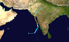
of 950 hPa on May 17. The Cyclone formed in the southern Ariabian Sea and moved along the west coast of India before they made landfall near Diu at the
northwest coast of India on May 18.
On May 11, an area of low pressure was observed over the southern Arabian Sea. The system of diffuse convection developed into a tropical cyclone in the following days.
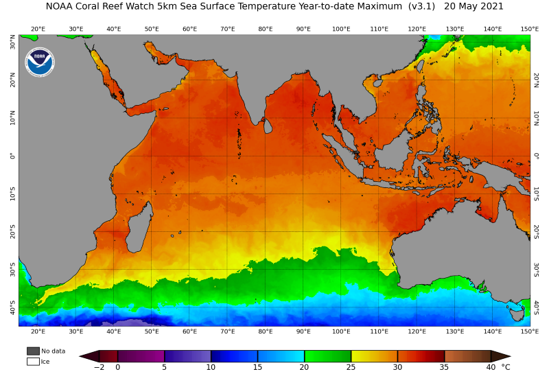
This was due to favorable environmental conditions. High sea surface temperatures around 30 °C provided sufficient energy for the low-pressure system to intensify into a tropical storm.
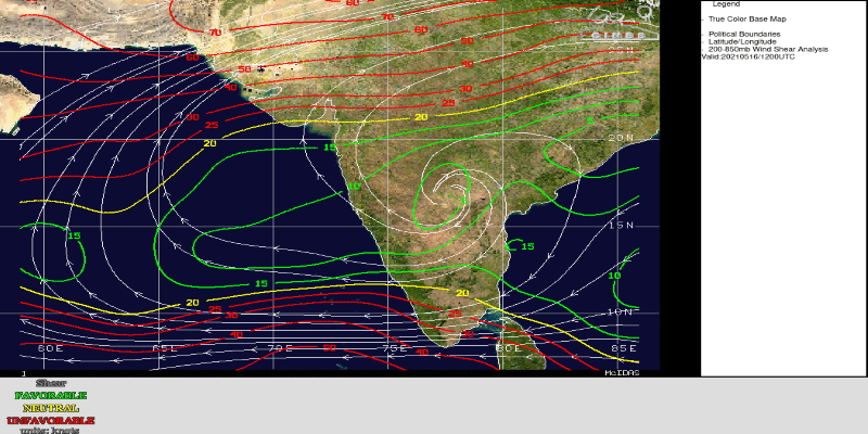
At the same time, low vertical wind shear and a humid mid-troposphere ensured that a vertical column with a relative humidity above 80% formed near the center.
Thus, the storm intensified into a strong tropical cyclone in the following days until May 15.
|
Sea surface temperature, 20.05.:
NOAA
|
 |
|
Deep layer vertical wind shear, 16.05.:
CIMSS
|
 |
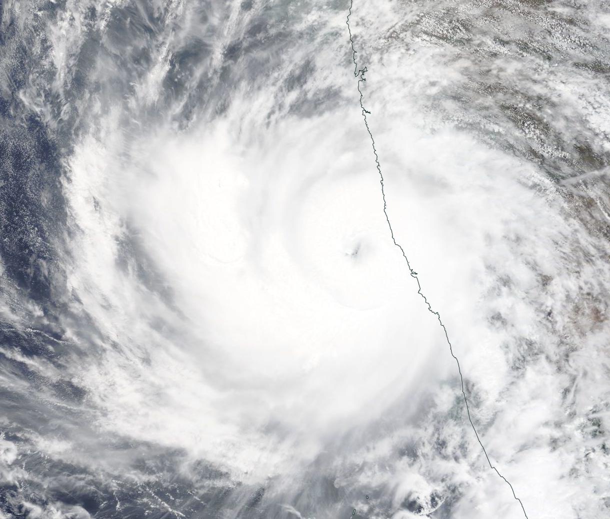
Over the next few hours, Tauktae moved north along the west coast toward the mainland. Due to the large extent of the precipitation area, it caused heavy rainfall along the coast of India. Locally, well over 200 mm accumulated in 24 hours. This caused locally large floods.
On May 17, the storm reached its highest intensity with 1-minute maximum winds of 220 km/h and a minimum air pressure of 950 hPa in the center. The rapid intensification was also caused by the very high amount of precipitable water, which led to a strong release of latent heat and thus significantly strengthened the cyclones.
Subsequently, however, Tauktae moved into an environment with higher wind shear and a somewhat drier middle atmospheric layer. This changed the structure of the tropical cyclone and weakened it somewhat.
|
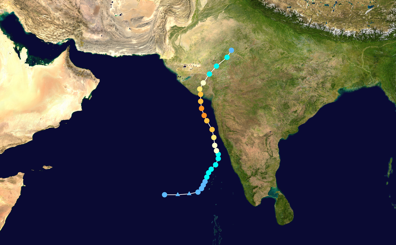
Tauktaes trajectory over the Arabian Sea
NASA
|
 |
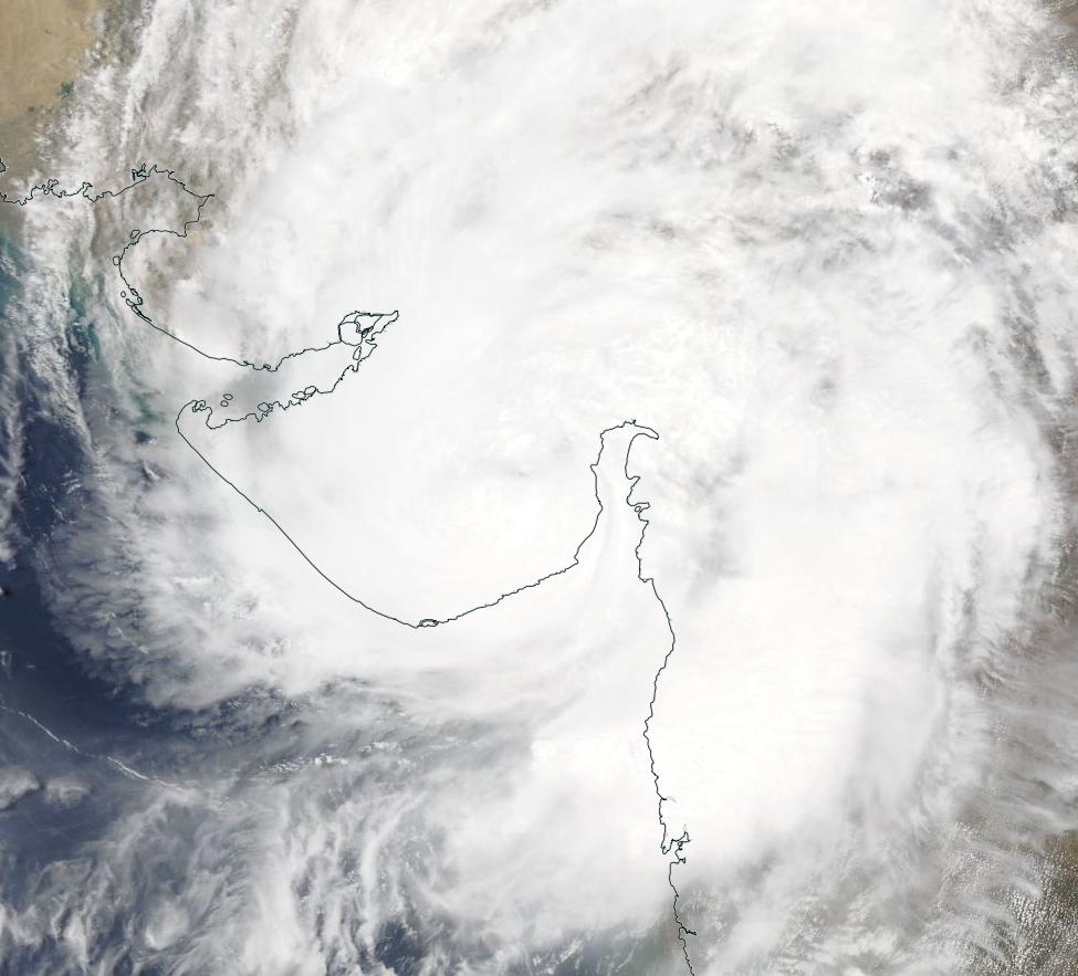
Before the landfall, the storm went under an eyewall replacement cycle. This was caused by unfavorable conditions such as higher ambient shear. This led to a weakening and a renewed intensification to a strong category 3 cyclone.
Thus, Tauktae made landfall early on 18 May with 1 minute maximum winds of 205 km/h.This placed it at the upper end of Category 3 of the Saffir-Simpson scale, making it the strongest cyclone in the Gujarat area since records began in 1998.
In the following hours, Tauktae weakened slowly despite frictional effects. The reason for this is the so-called Brown Effect, which is frequently observed in the very humid swampy lowlands of India and Bangladesh.
Due to a very humid layer close to the ground with small horizontal temperature differences, high amounts of latent energy are still converted even after landfall, causing the cyclone to weaken only very slowly, if at all.
This caused intense rainfall and strong winds in the Gujarat area, which in combination with a strong storm surge led to large-scale flooding.
It was not until noon on May 19 that the strong cyclone weakened to a depression.
|
Satellite image after landfall, 16.05.:
NASA |
 |
| Location |
24h Precipitation in mm |
Date |
Ratnagiri(IND)
Dahanu(IND)
Mumbai(IND)
|
364.0
283.0
230.5
|
17.05.2021
18.05.2021
18.05.2021
|
|
Text: NB
May 22, 2021
|