|
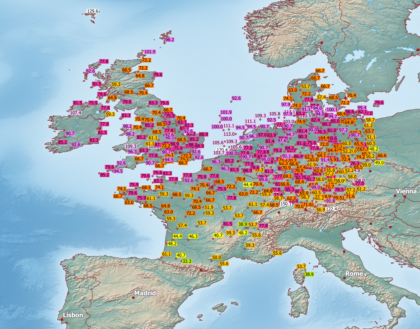
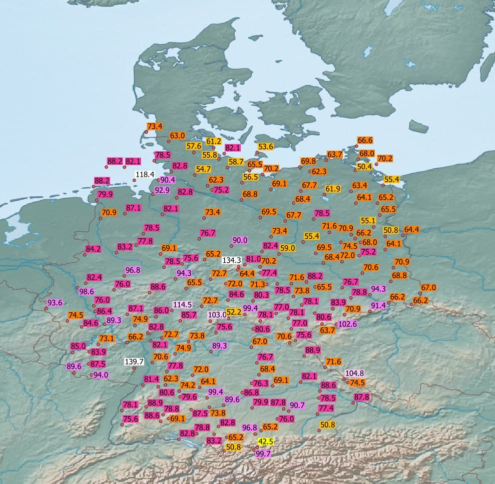
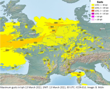
The passage of multiple extratropical storm system lead to windy conditions in Western and Central Europe
over several days. Gusts up to 130 kph occurred at multiple locations across Europe. The peak in Germany was
marked by the weather station of Weinbiet with 140 kph on 13 March.
After a record high temperatures at the end of February, the first half of March proved to be significantly cooler,
with more precipitation and mutiple extratropical storms. Peak gusts of over 100 kph occurred on several days, with
the peak at the weather station ofWeinbiet with 140 kph on 13 March. In the Black Forest there were precipitation
accumulations of up to 100 mm/72h.
|
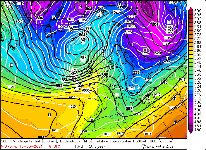
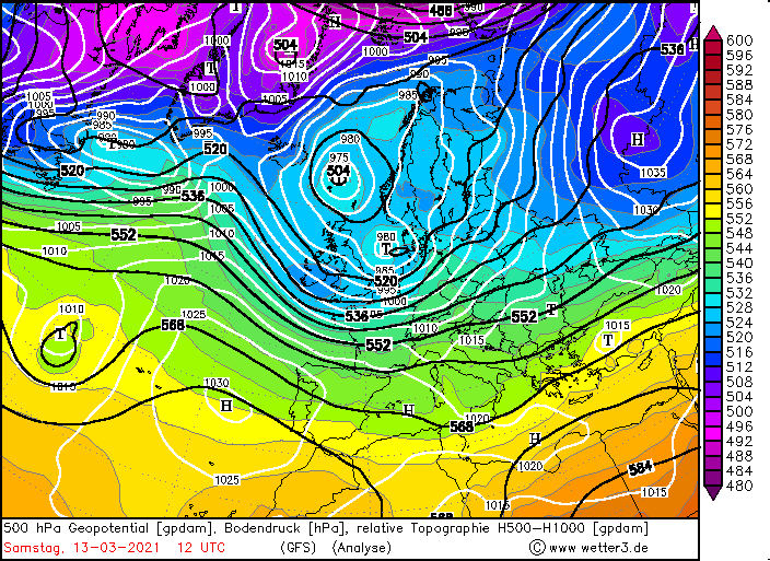
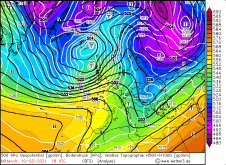
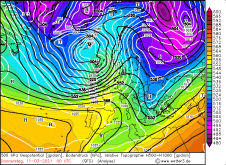
500hPa geopotential and temperature, 10. and 11.03.:
wetter3
|
 |
 |
 |
 |
Low pressure area JOSEF, which developed between the north of Great Britain and Greenland, only a few hundred km away
from the Faroe Islands, made the beginning on 09 March. On the front of a strong trough of the polar front, conditions
were suitable for rapid cyclogenesis. Thus, JOSEF reached a core pressure of less than 960 hPa and caused peak gusts
of around 120 kph on the coast of Northern Ireland as well as Scotland. At the weather station Capel Curig in Wales,
a peak gust of 113 kph was recorded on 09 March.
|
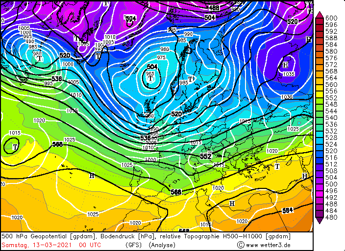
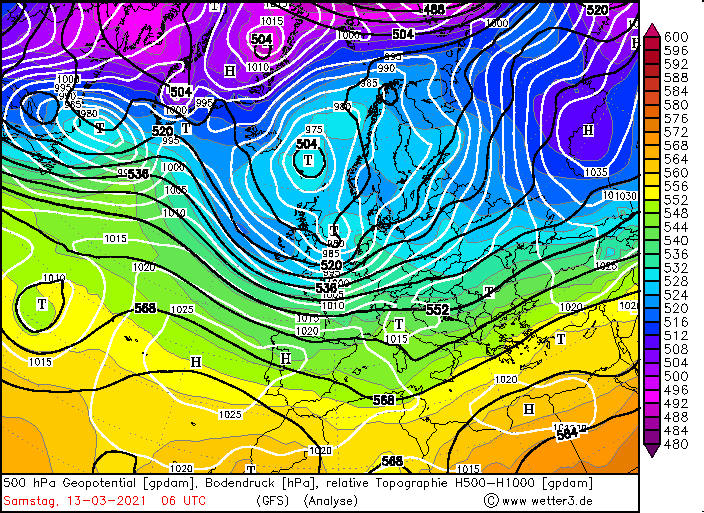
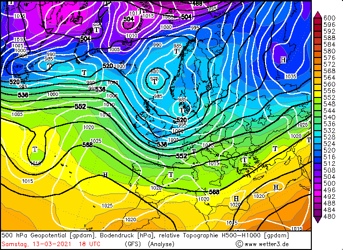
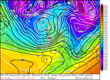
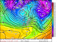
500hPa geopotential and temperature, 13.03.:
wetter3
|
 |
 |
 |
 |
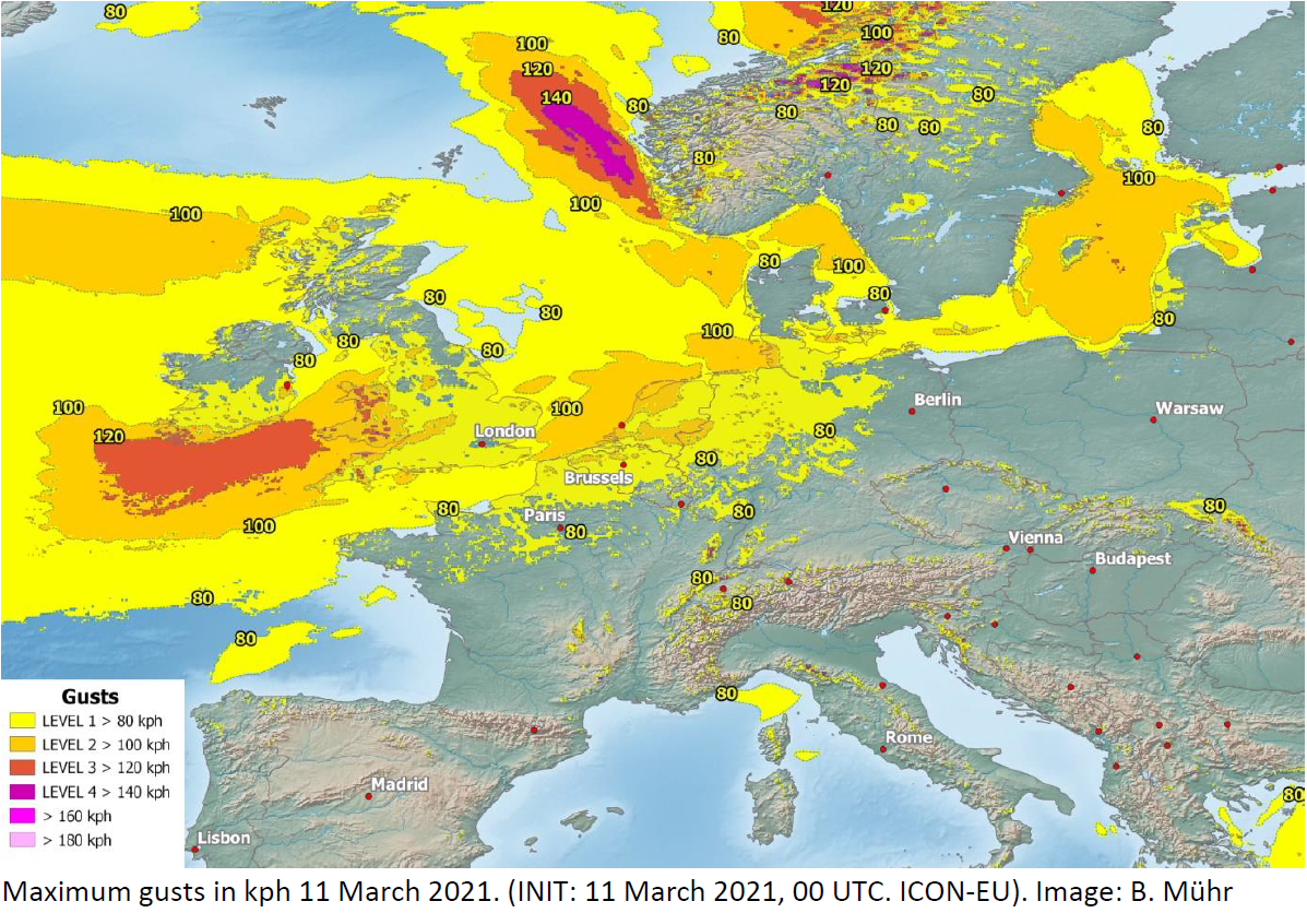
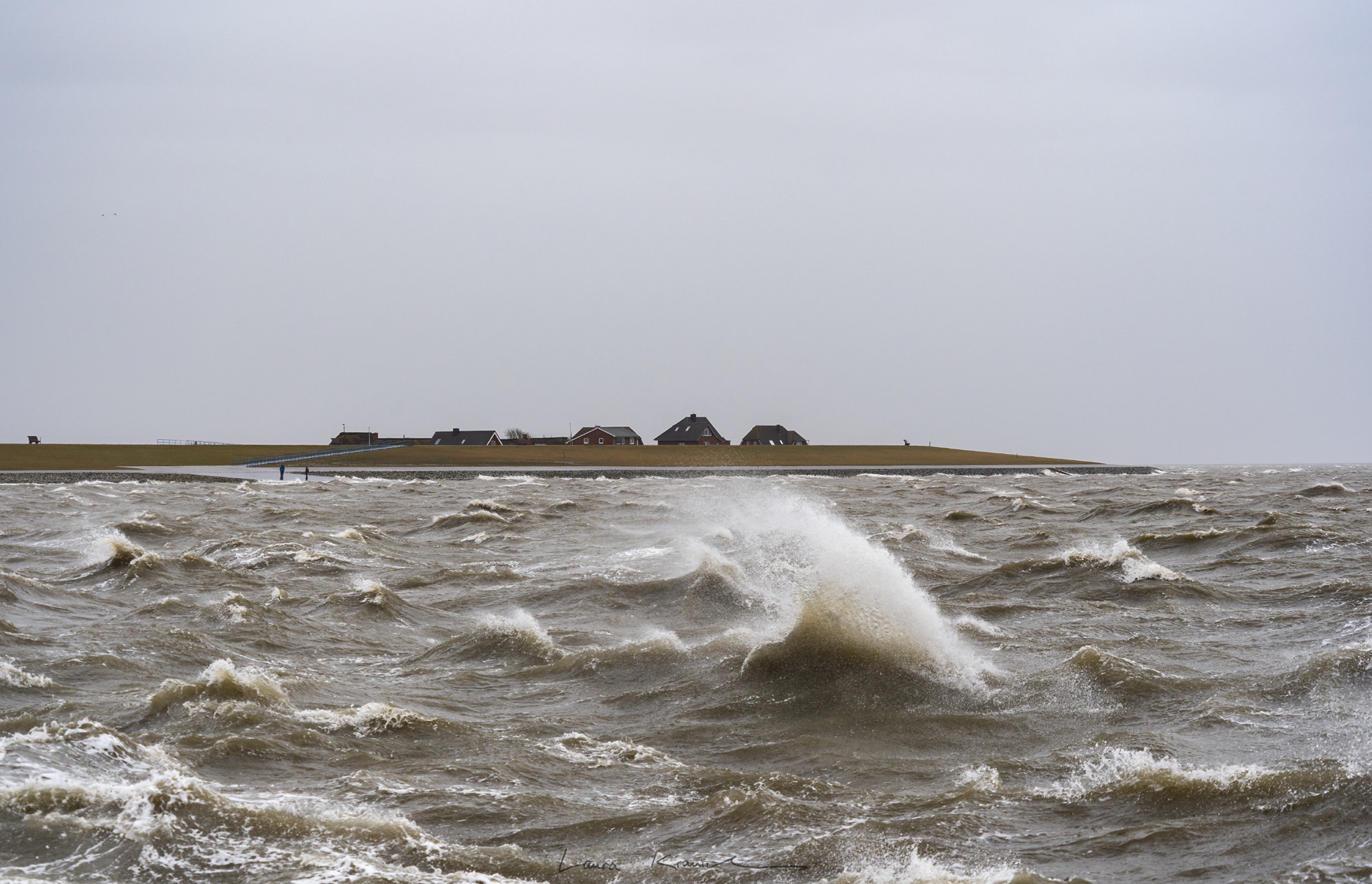
While JOSEF was still moving across Great Britain, the so-called fast-moving low KLAUS formed off the coast of Newfoundland
from a wave disturbance. KLAUS quickly shifted zonally to the east and rotated south around low pressure area JOSEF, which
took on the role of the controlling Icelandic low. This resulted in gale-force winds of up to 135 kph along the west coast
of Ireland and England during the night from Wednesday to Thursday. A peak gust of 139 kph was recorded in Capel Curig on 11
March, and 115 kph were measured in Sherik Island (Ireland). On the German North Sea coast, the effects of the storm were
felt early on Thursday morning. At the Alte Wester lighthouse station, 130 kph were recorded, in Büsum 122 kph.
|
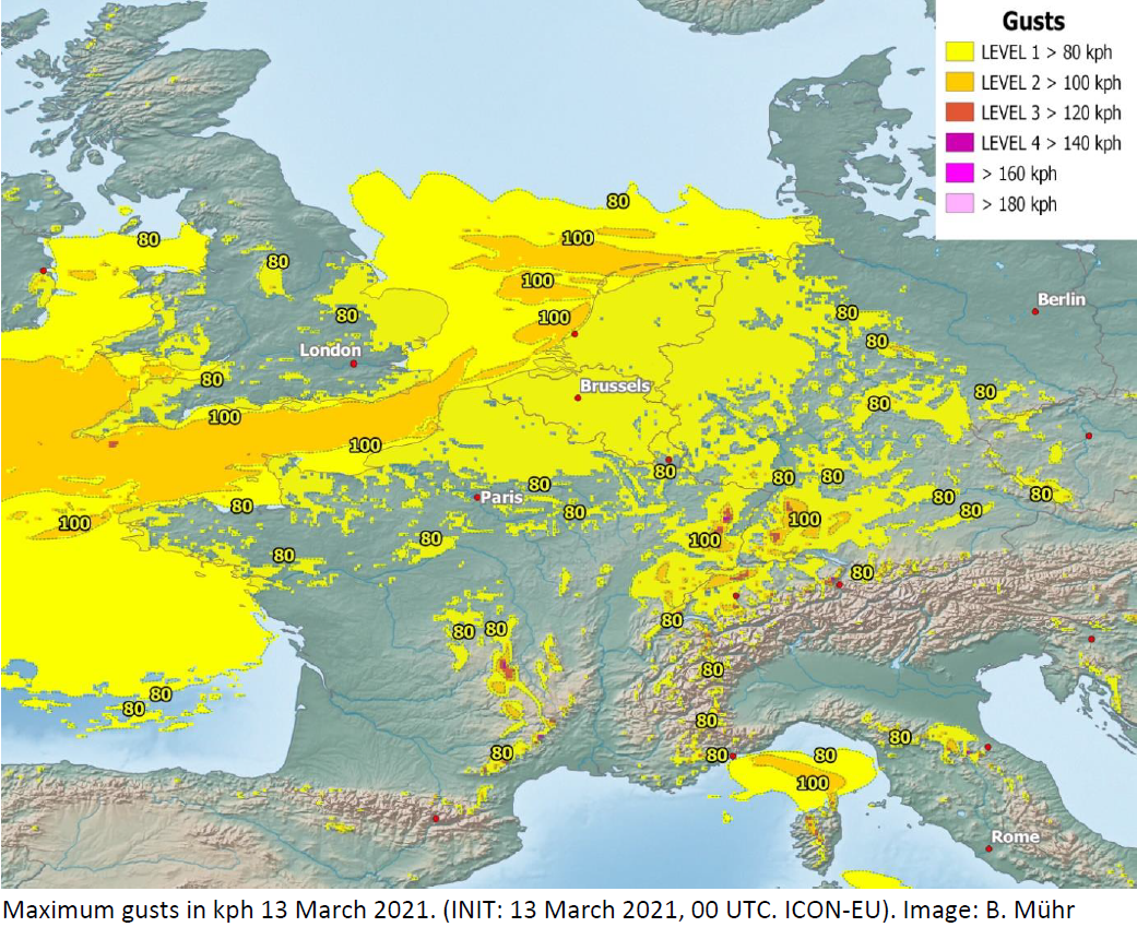
Wind gusts associated with KLAUS and LUIS (model predictions and observations from 11 and 13.03.:
DWD and Bernhard Mühr
|
 |
 |
 |
 |
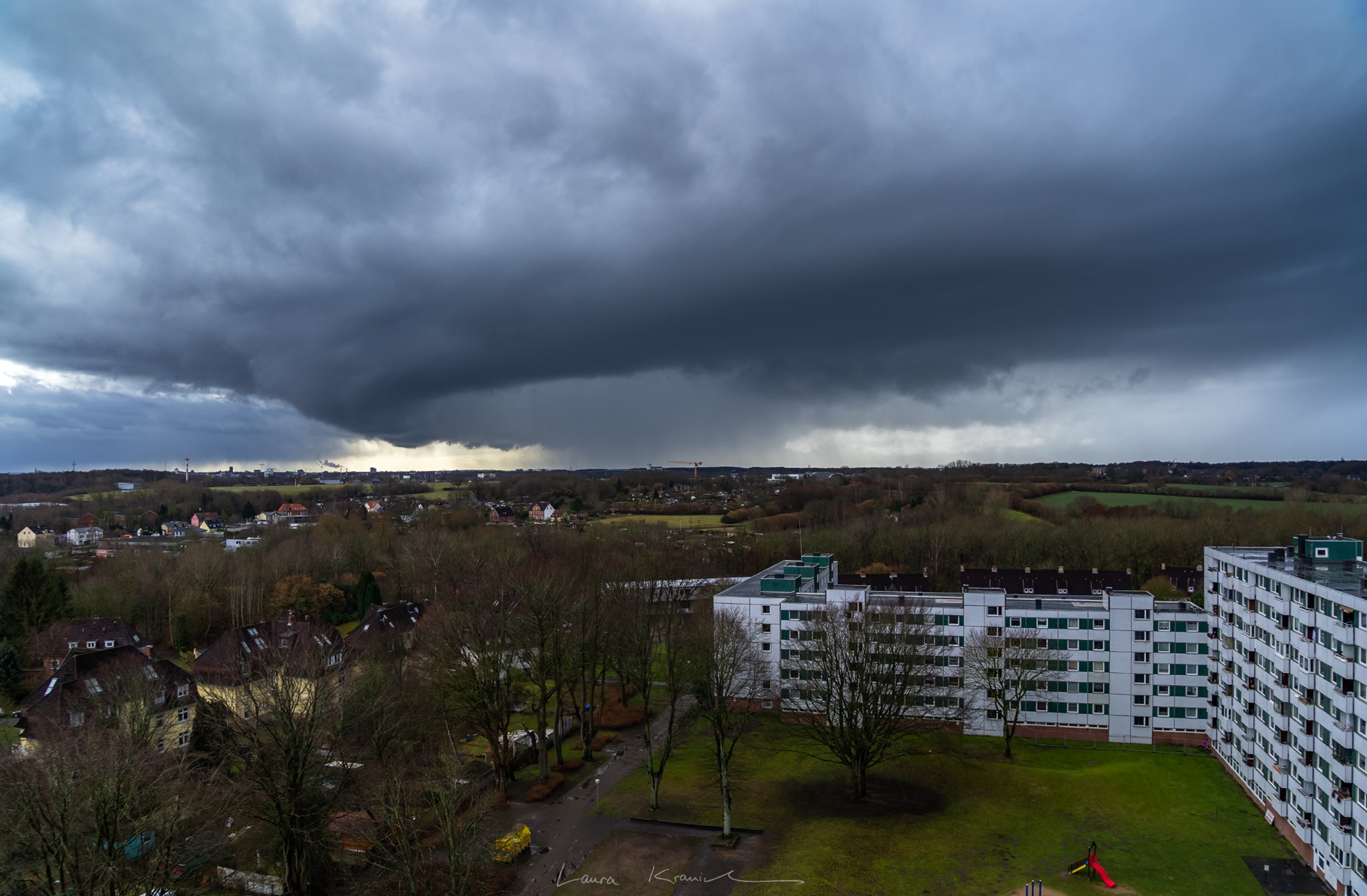
The turbulent late winter weather continued as a now pronounced central low north of the British Isles created an ideal
condition for small, fast-moving marginal low pressure system reaching Central Europe. A wave disturbance to the west of
Scotland developed into to the low-pressure area LUIS on 12 March. Under rapid cyclogenesis, it intensified until 13 March
and reached a core pressure of about 975 hPa. The rather small extent of the depression provided a large amount of positive
vorticity advection and a pronounced inflow of cold air at the rear of the system.
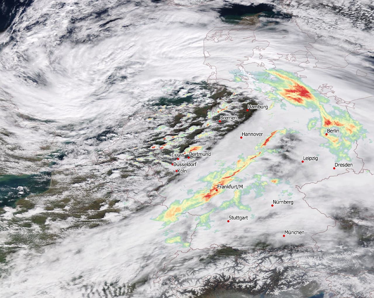
Sources: GOES Image Viewer
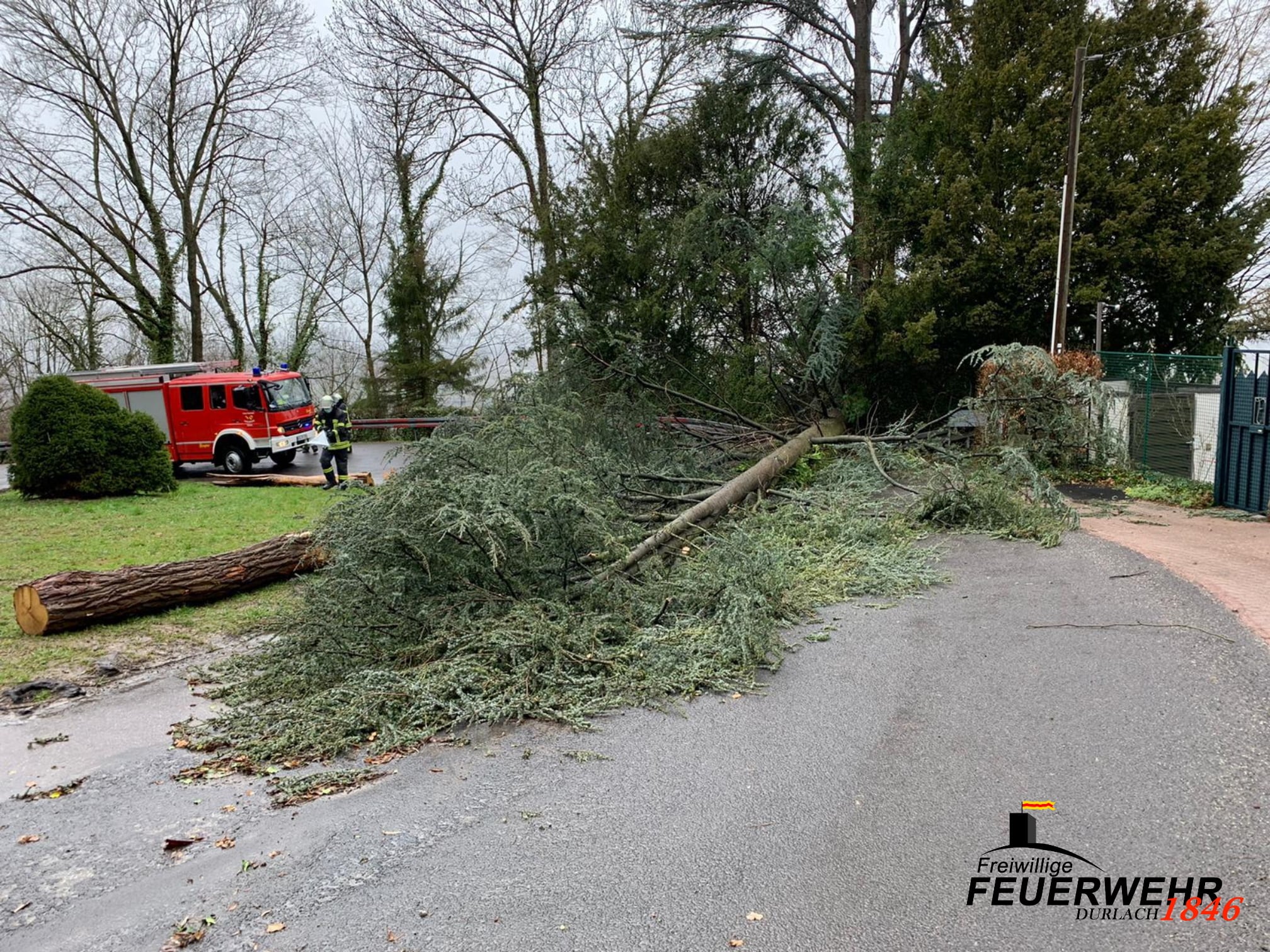
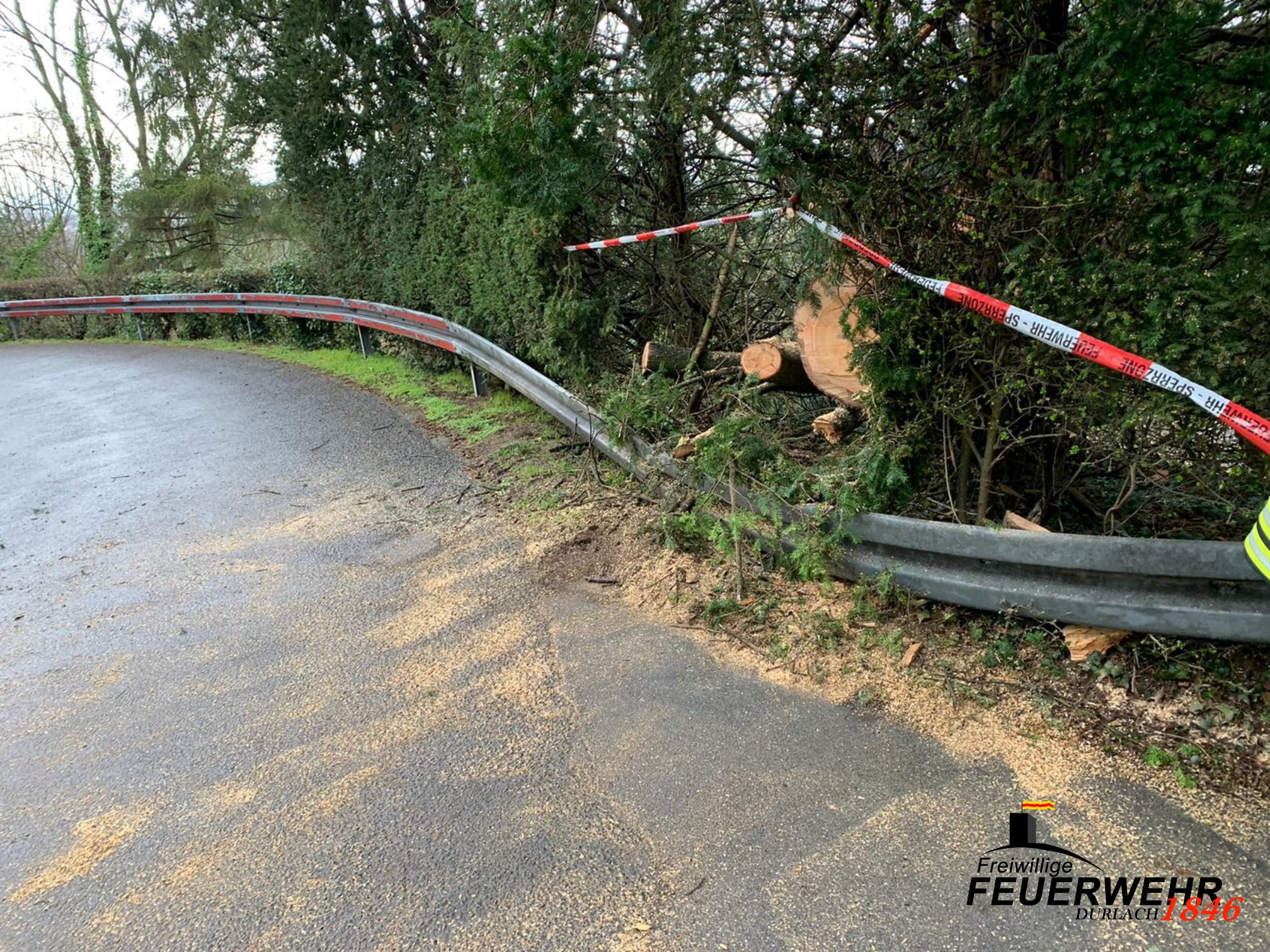
This led to heavy showers and graupel precipitation in southwestern Germany on 13 March. The strongest wind gusts occurred in
association with these showers, as downdrafts in the convection cells mixed the powerful winds aloft down to lower levels. Storm
gusts of over 80 kph occurred throughout Germany. In exposed locations over 100 kph occurred. The peak was marked at the weather
station of Weinbiet with 140 kph. On the Brocken, 134 kph were measured. Due to the passage of the cold front, the snow line dropped
to about 600 m, which led to snowfall up to medium altitudes on Saturday evening.
Text: FS
March 19, 2021
|