|
Severe Tropical Cyclone NIRAN was the sicth tropical cyclone and the second severe tropical cyclone of the 2020–21 Australian region
cyclone season. It reached Category 5 with 10-minute sustained wind speeds of up to 245 kph and a minimum pressure of 931 hPa. It formed in
the proximity of northern Queensland (Autralia) and moved very close along New Caledonia but did not make landfall.
On 25 February, the Bureau of Meteorology (BOM), the Australian weather service, registered a tropical depression in the
northwestern part of the Coral Sea. In a pressure field favourable for cyclogenesis, it developed into a tropical cyclone
on 01 March, which was named NIRAN by the BOM. Extremely favourable environmental conditions such as a sea surface temperature
of 28°C, low vertical wind shear and a moist mid-troposphere led to the storm reaching category 2 tropical cyclone status on
the same day.
|
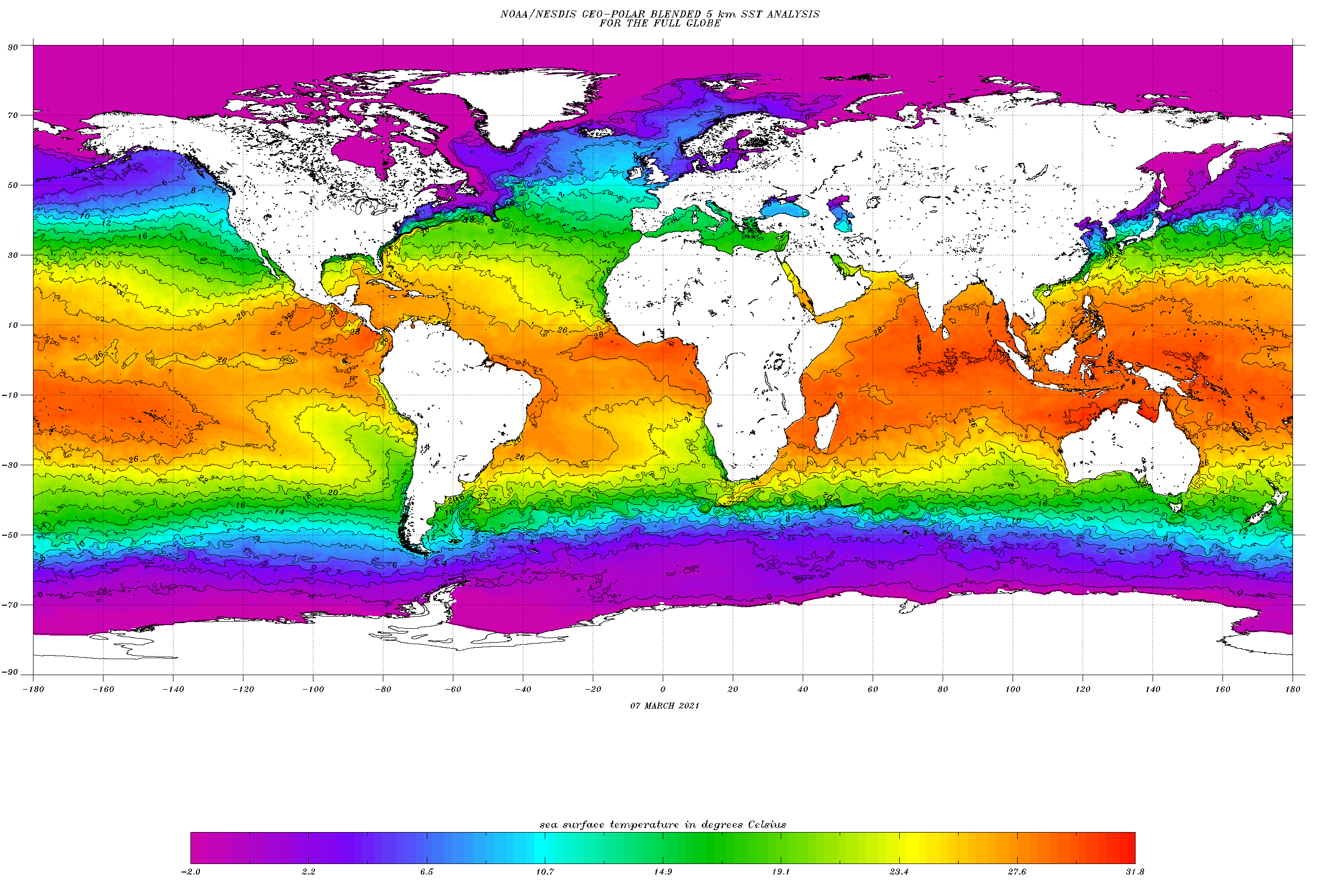
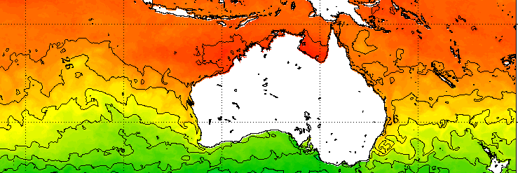
Sea surface temperature, 07.03.:
NOAA
|
 |
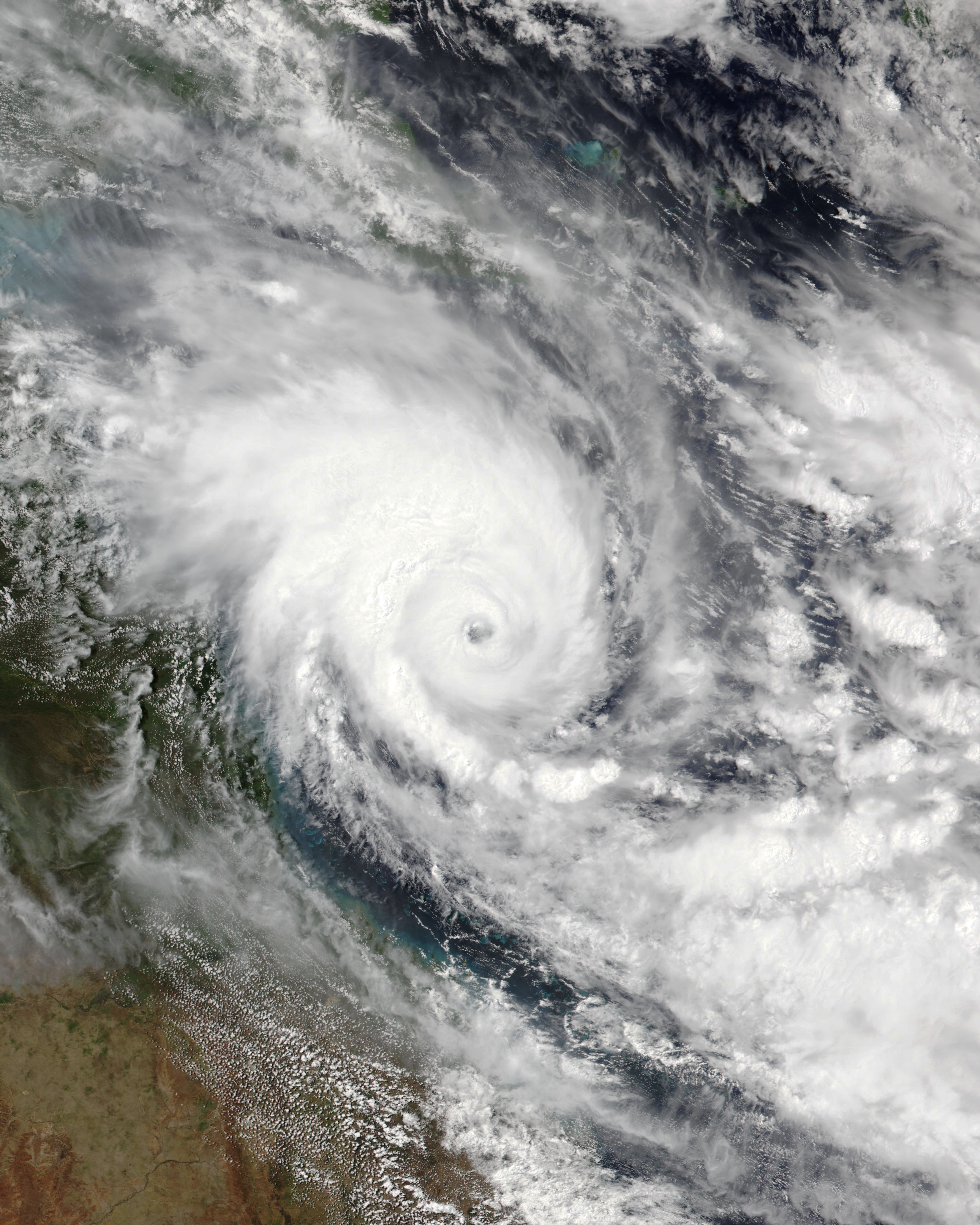
NIRAN moved away from mainland Australia to the west and underwent rapid intensification, reaching category 3 by the late evening
of 3 March. At 12 UTC on 5 March, the system reached its peak intensity as a strong category 5 tropical cyclone (on both the Australian
scale and the Saffir-Simpson hurricane wind scale). At this time, NIRAN had 10-minute sustained winds of up to 245 kph and a strong,
well-defined eye. The minimum air pressure of the system was 931 hPa.
|
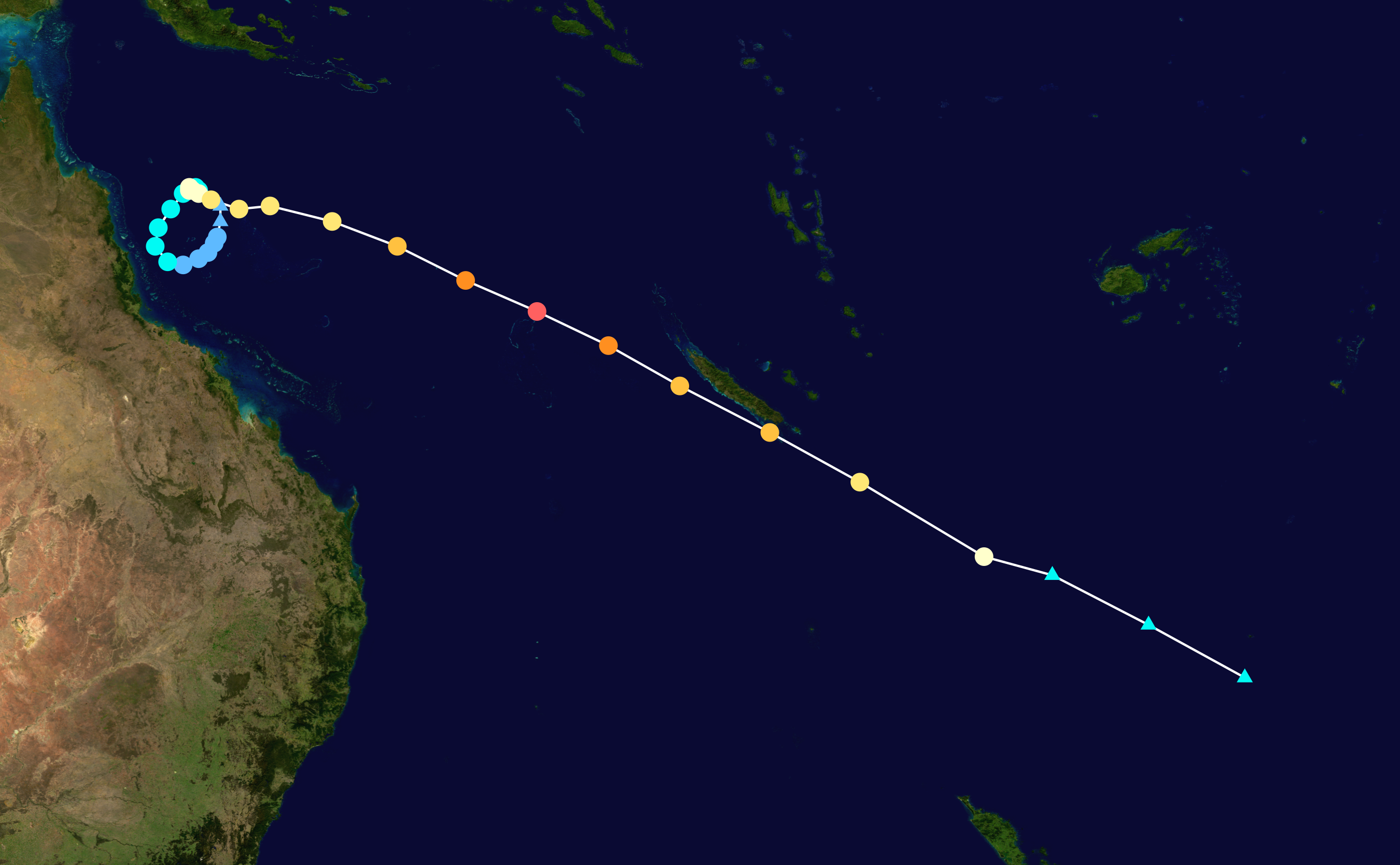
NORANs trajectory: Background image from
NASA, tracking information from
NOAA
|
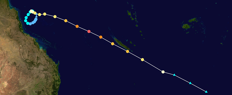 |
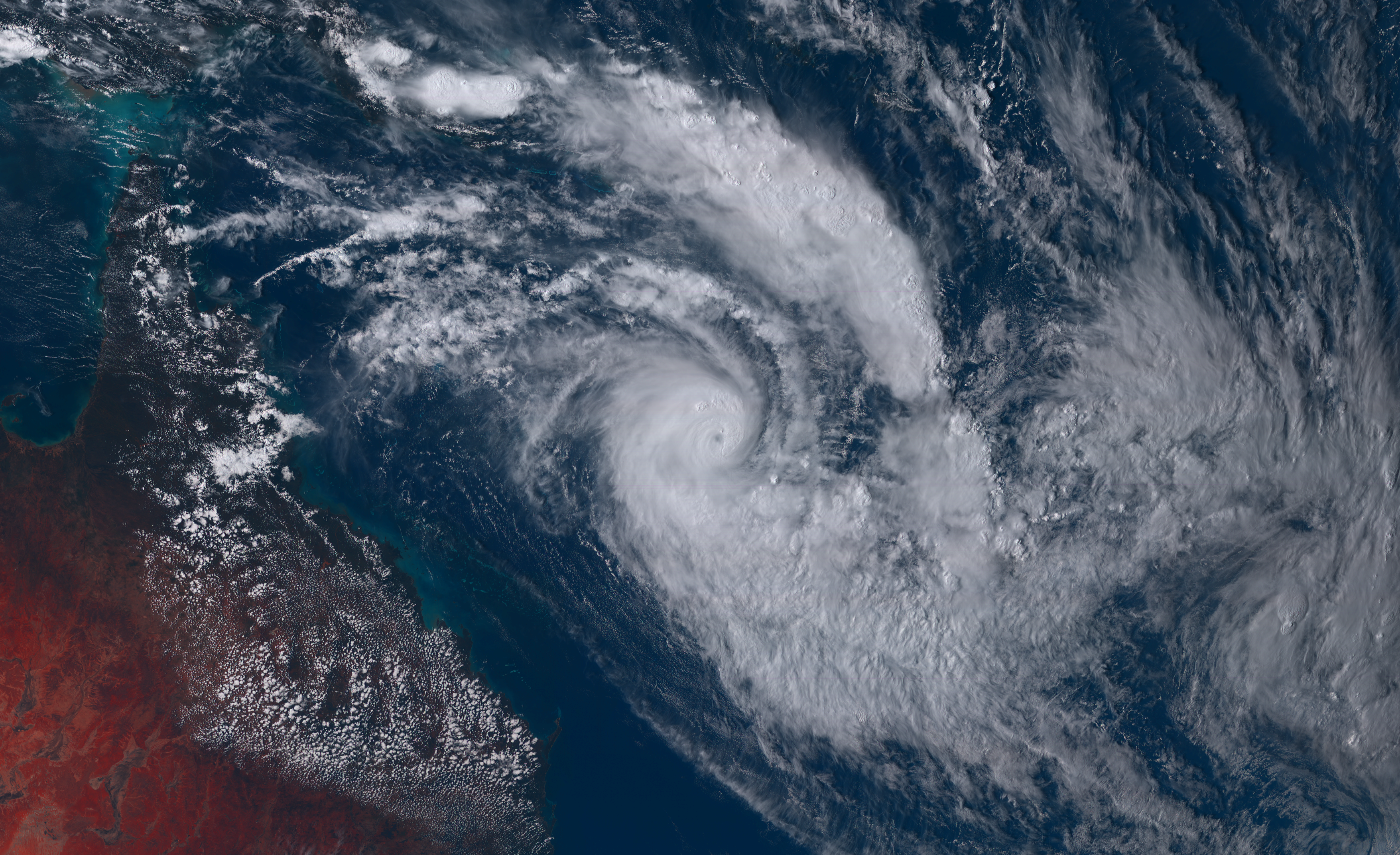
On its further trajectory, the storm moved into the Fiji Meteorological Service (FMS) area of responsibility as it moved in a
southeasterly direction towards New Caledonia. On the evening of 05 March, NIRAN began an eyewall replacement cycle and entered
an area of increasing vertical wind shear, which caused a weakening trend to begin. At 12:00 UTC on 06 March, NIRAN approached the
main island of Grande Terre in New Caledonia as a category 3 tropical cyclone. The centre of the storm passed only about 20km
south of the capital of New Caledonia, Nouméa. At this time, the system already showed a clear asymmetry with decreased convection in the northern part.
Under increasing wind shear, the storm weakened to category 2 in the evening of 06 March. By the night of 7 March, NIRAN already
underwent extratropical transition and dissipated rapidly.
Text: FS
March 09, 2021
|