|
Due to a significant airmass boundary over Germany moderate snowfall occured at the beginning of February. But also freezing rain and black ice caused problems.
Additionally the air pressure gradient strenghend which led to agle gusts over nothern Germany, Denmark and also the BeNeLux states.
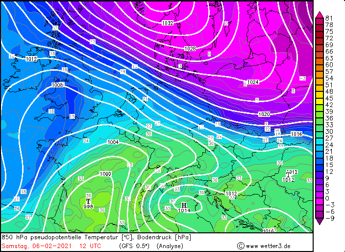
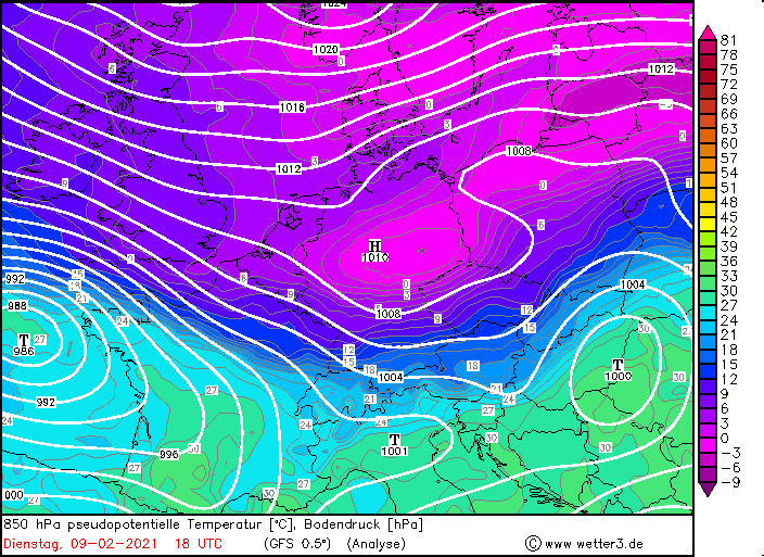
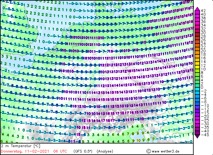
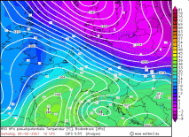
At the beginning of February Central Europe lain between a strong low over Irland and a massive high pressure bridge that reached from
Greenland over Scandinavia to the Black Sea. As a result airmasses with a sharp temperature gradient in a small corridor of about 50 km had formed over
Germany. The air mass boundary showed a temperature gradient of around 10K to 15K in a range of about 50 km In the southern parts there were mild sea airmasses
with temperatures in the double-digit range (Rhine plain). In the northern and northeastern parts, however, there was moist and cold air around freezing point.
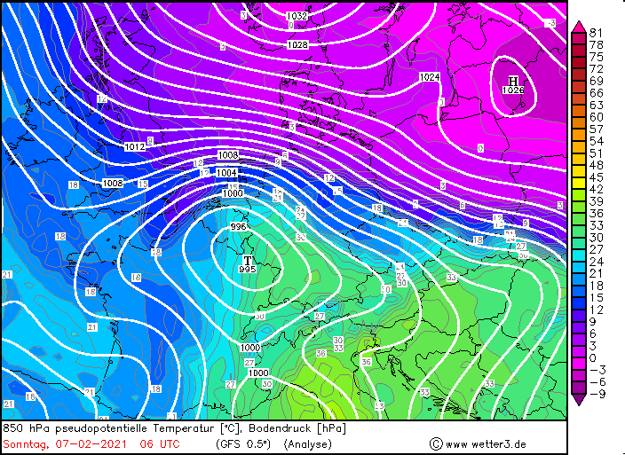
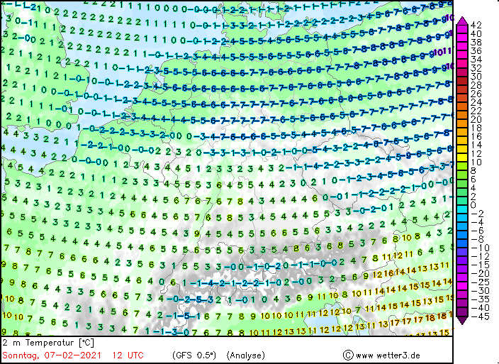
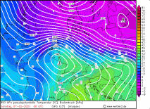
From Friday 5th February on the warm front of low TRISTAN reached southern Germany from the southwest, which again increased the temperature contrasts of northern
and souhtern Germany. Low TRISTAN moved over France towards Germany on Saturday 6th February. The wind in the south of Germany turned to the south,
which is why it remained mild there. But in the northeast of Germany the wind turned to the east, so that cold air masses below freezing point
( about -10 degree celcius) were advected there. At the air mass boundary/the frontal system of TRISTAN, heavy snowfall as well as freezing rain
occured, which resulted in severe icy conditions. Affected were mainly North Rhine-Westphalia, Lower Saxony and Schleswig-Holstein, but also Denmark and
the BeNeLux states.
|
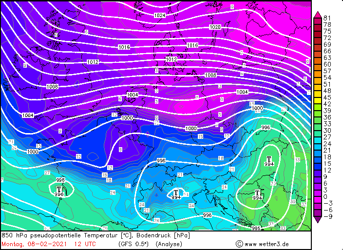
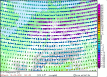
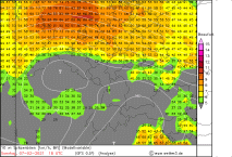
850hPa pseudopot. temperature, February 06 and 09, 2021:
Wetter3
|
 |
 |
 |
 |
|
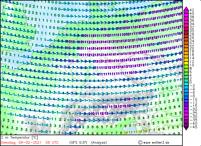
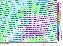
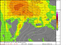
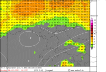
10m temperature, February 07 and 11 , 2021:
Wetter3
|
 |
 |
 |
 |
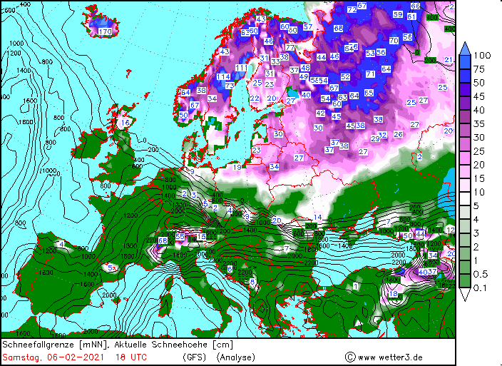
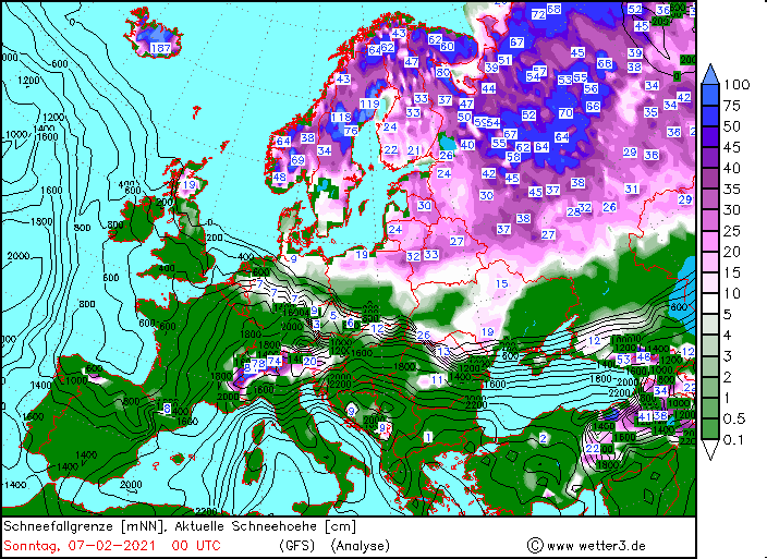
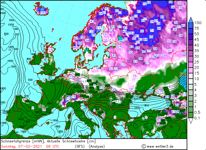
On Sunday the temperature gradient sharpend again and in addition to snowfall, the air pressure gradient over northern Germany and BeNeLux intensified.
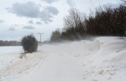
In addition to heavier snowfall, the wind (around 50 km/h, exposed locations around 100 km/h) caused snowdrifts and poor visibility conditions. On the coasts,
there was a risk of storm surge. The frontal system also moved very slowly to the north, so that local snowfall amounts of around 0.5m occured. In the south of
Germany, especially at the edge of the Alps due to the Föhn, it remained mild.
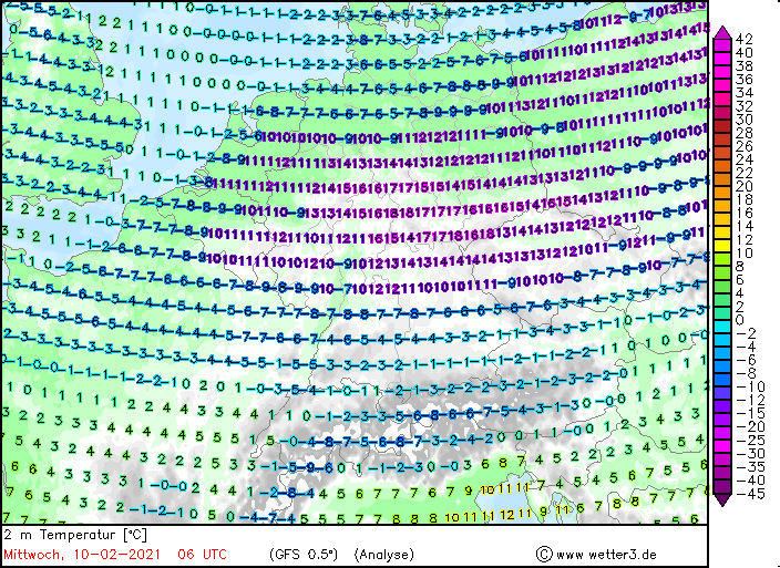
By the middle of the next week, the temperature gradient increased to around 20K. TRISTAN's frontal system overlapped with the air mass boundary and
moderate to heavy precipitation occured in this area in a strip over central Germany. On the northern side of the front, the precipitation occured in
form of moderate to heavy snowfall, whereas on the southern side, freezing rain formed. This lead to a severe black ice situation. Affected by freezing
rain and snow afterwards,were mainly the Ruhr area, northern Hesse and Saxony. The fresh snow rechaed a height of around 40cm. In the northern parts of
Germany, especially in North Rhine-Westphalia, Lower Saxony and Schleswig-Holstein, but also Denmark and the BeNeLux states, fresh snowfall amounts of
more than 50cm occured, locally even higher.
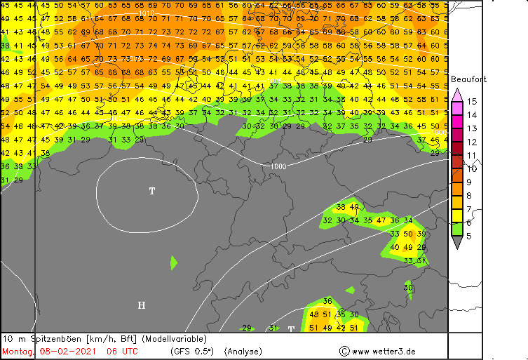
On Sunday morning, the air pressure gradient also increased so that in northern Germany, Denmark, and BeNeLux, gusts of around 80 km/h (Bft9) occured in
exposed location , gusts of around 40 km/h (Bft 6) in lower altitudes. Along the coasts, there was a risk of storm surge along the Bay of Kiel and Lübeck,
but also along the East English coast. Wave heights of up to 6 m occured along the East English coast.
|
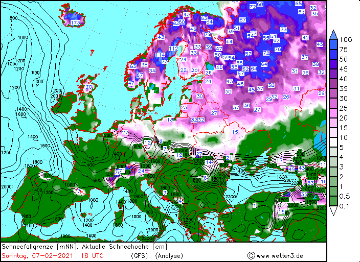
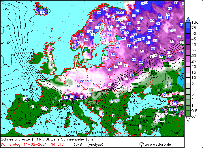
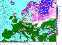
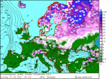
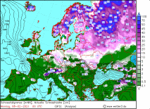
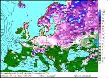
snow height in cm and snowfall line, February 06 and 07, 2021:
Wetter3
|
 |
 |
 |
 |
|
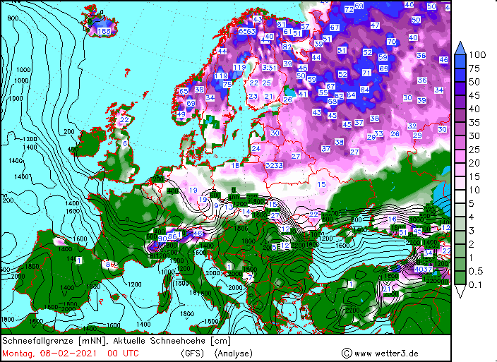
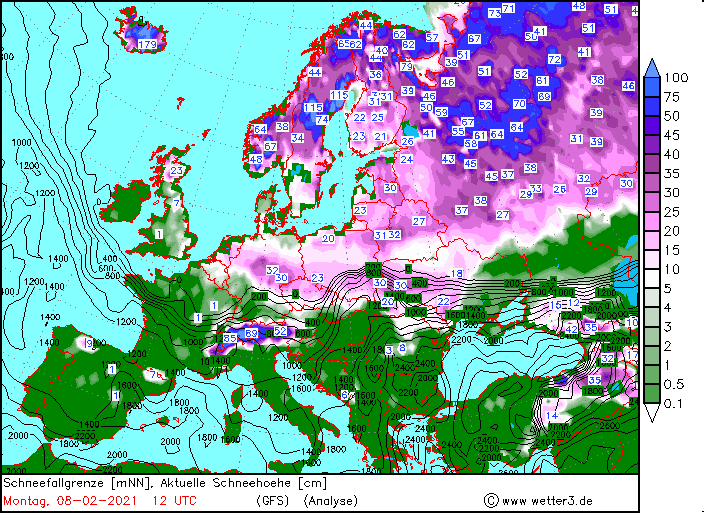
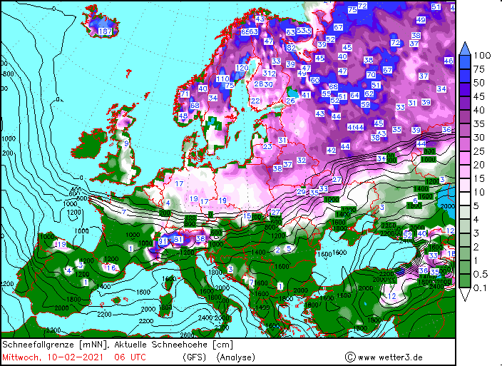
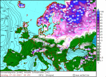
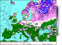
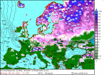
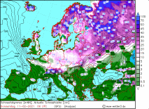
snow height in cm and snowfall line, February 08 and 11, 2021:
Wetter3
|
 |
 |
 |
 |
|
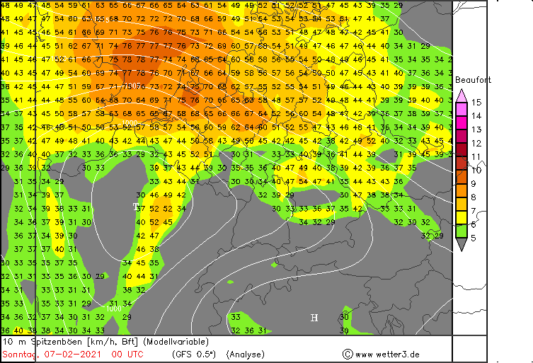
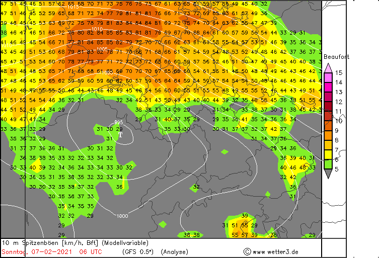
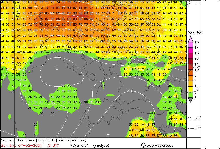
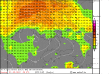
10m peak gusts, February 07 and 08, 2021:
Wetter3
|
 |
 |
 |
 |
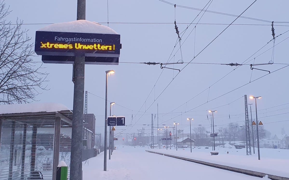
Because oft he black ice and also the high snow amount traffic disruptions occured in the affected areas. There were not only delays but also
cancellations in local and long-distance public transport, even a few das after the event. Due to the freezing rain, trees and branches broke and
overhead lines were also damaged. The combination of gale gusts and snowfall caused a significant visibility issues. Due to the low temperatures in the
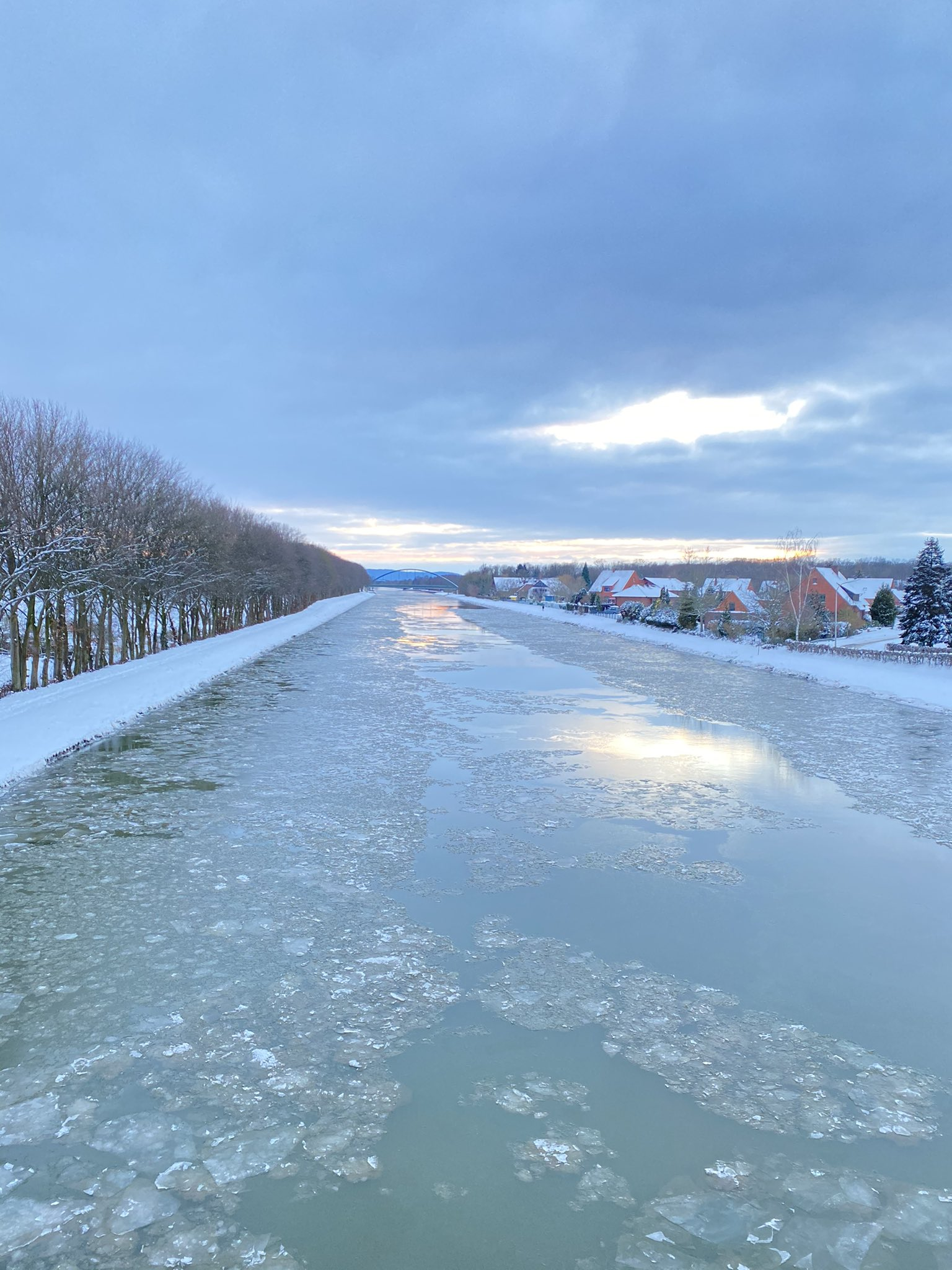
northeast, the Baltic Sea along the ports and also some rivers freezed, so that there may be disruptions in shipping traffic. From February 8th to 12th low
temperature below zero also occured in the southern parts of Germany.
|
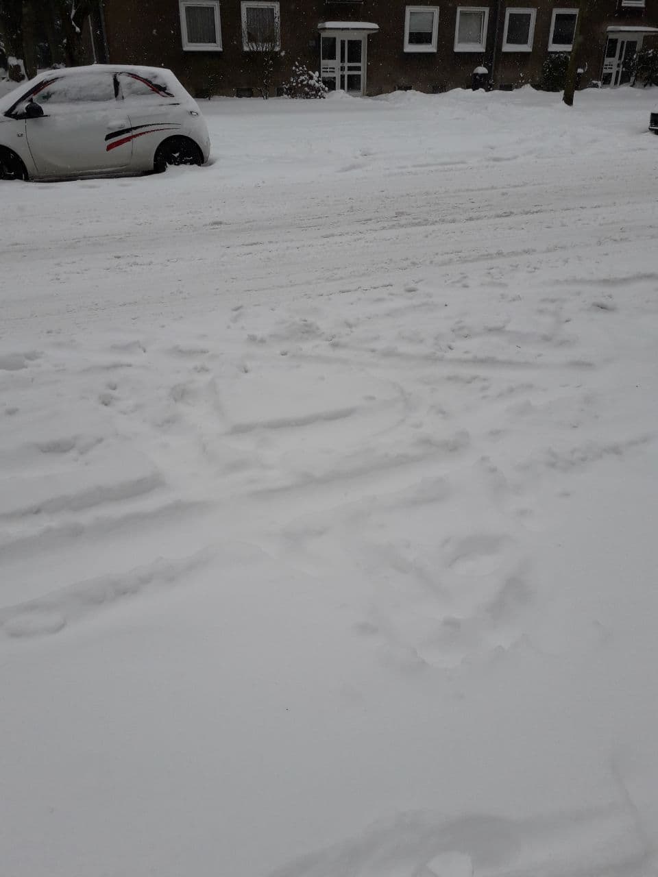
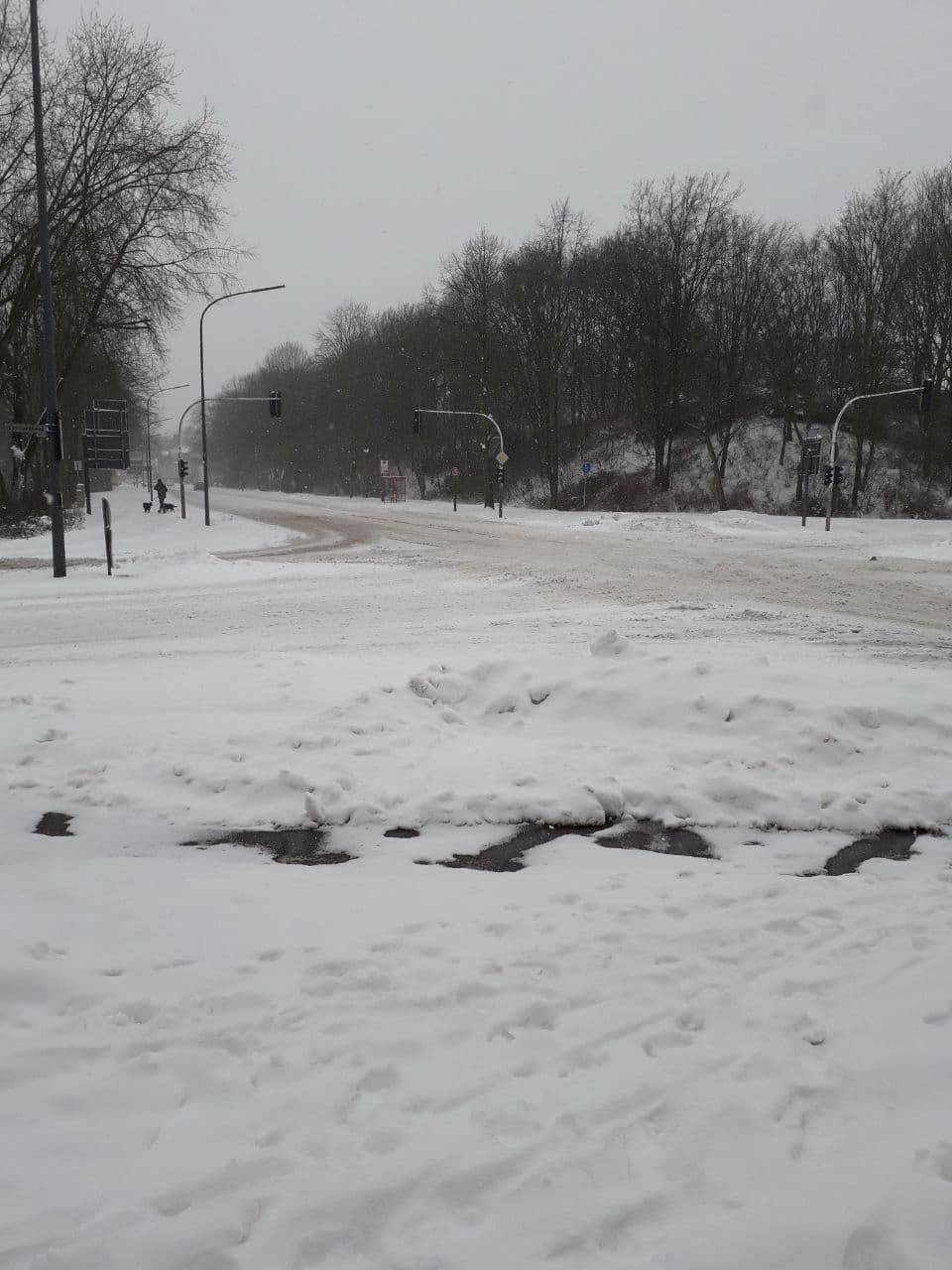
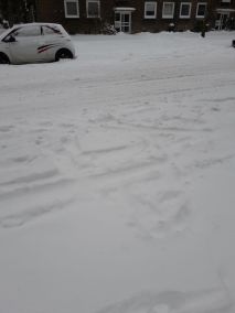
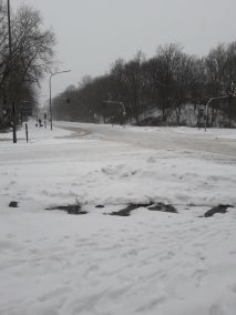
Images of several locations in Germany, February 27 2021, Source: Luisa Jebram,
feminine,
Laura Kranich
|
 |
 |
 |
 |
Text: MG
February 20, 2021
|