|
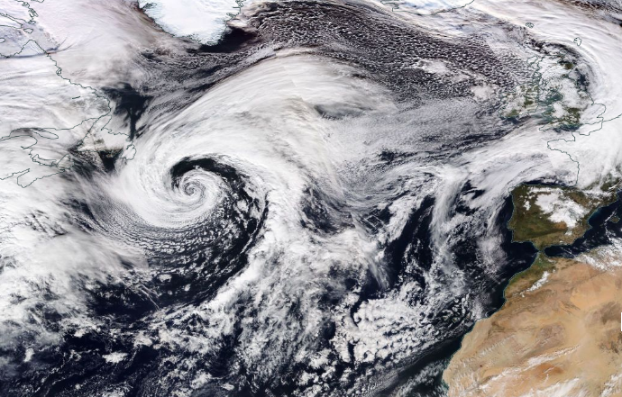
Winterstorm GORAN reached Europe on January 20th and caused windspeed of more than 150 km/h in several countries. In the low lands about 70 km/h were measured,
locally more than 70 km/ were registered. A marginal low forme das a VB cyclone on January 22nd and caused high windspeed as well es torrential precipitation in
alpine regions of more than 100mm in 24 hours.
Weather Situation
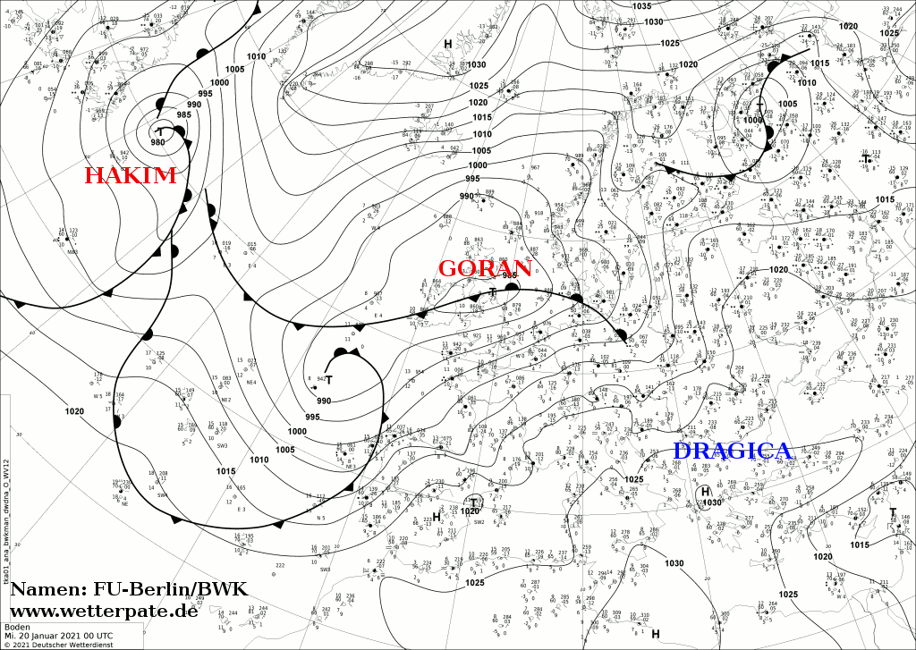
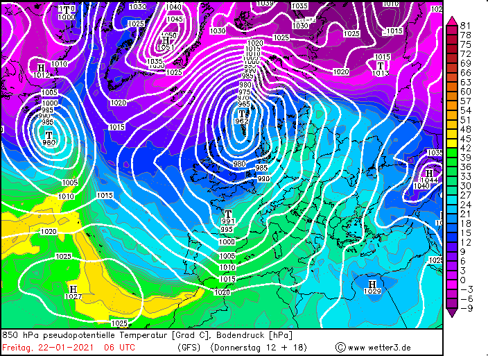
The weather over Europe in January 2021 continued to be unstable, with fairly cold and brief periods of milder weather. Low pressure areas frequently reached the
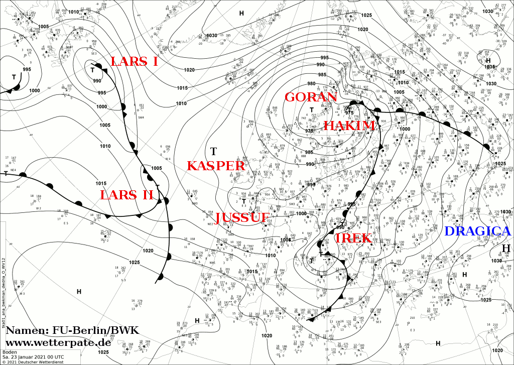
European continent, including low GORAN. GORAN was a Norwegian cyclone and developed into a storm low. Days earlier, it formed on a frontal zone as a quite large
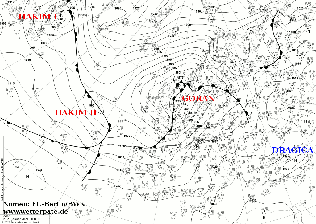
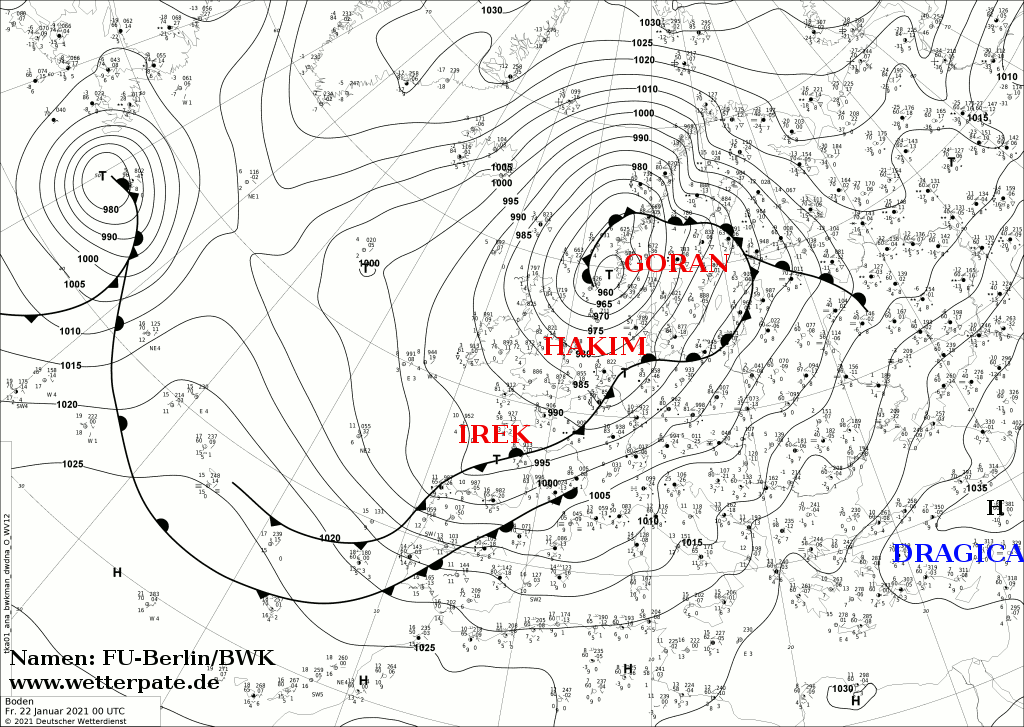
pressure system over the North Atlantic. It quickly moved eastward, reaching the British Isles and Europe on January 20. Two days later, low pressure IREK formed on
its well-developed frontal system. IREK was a VB low and followed the typical track of this type of low-pressure systems.
|
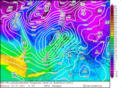
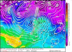
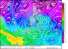
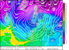
850 hPa equivalentpot. Temperature, January 20-22, 2020:
Wetter3
|
 |
 |
 |
 |
Development
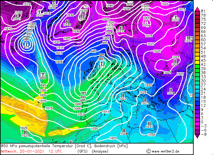
GORAN formed a few days before reaching Europe over the North Atlantic south of Newfoundland as a weak pressure disturbance in front of a trough. From 15 January,
the pressure in the core began to drop rapidly, favored by its location in front of the trough. In 24 hours, the pressure dropped from 1005 hPa to 985 hPa. Meanwhile,
a wave was now clearly visible in the temperature field, whose amplitude grew and GORAN developed a remarkable frontal system. Rather slowly, GORAN moved eastward
across the Atlantic. Its path to Europe was blocked by High DRAGICA, which also moved eastward only slowly. The pressure in the core of GORAN dropped to 975 hPa by
January 16. After that, GORAN lost its connection to the trough and the supply of warm air was interrupted, so that the pressure slowly began to rise. Not until
January 20 GORAN again entered favorable atmospheric conditions and found itself in front of a new pronounced trough. The pressure dropped to 980 hPa. High pressure
DRAGICIA moved off to southeastern Europe, clearing the way to Europe. With a core pressure of 975 hPa, GORAN reached the British Isles on January 20, with its core
over Scotland. Its frontal system spread as far as Spain and Portugal. The air pressure gradient was enormous and was highest on the southwestern and southern flanks.
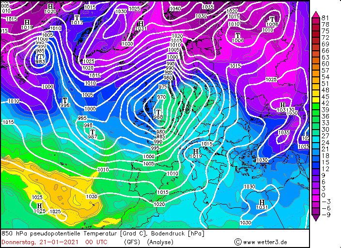
In Great Britain, wind speeds were still within limits. The highest wind speeds occurred in combination with the cold front. As the cold front moved across France and
the BeNeLux states on Wednesday evening and Thursday night, gusts above 140 km/h were recorded there. The pressure continued to fall and reached its minimum of
950 hPa over the North Sea on Thursday afternoon. Meanwhile, the frontal system spread to Germany and Denmark and gusts up to 160 km/h were measured at exposed
locations. At lower altitudes and in the lowlands, however, high wind speeds around 70 km/h were also recorded.
|
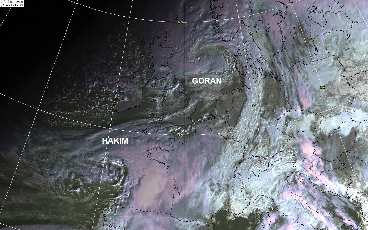
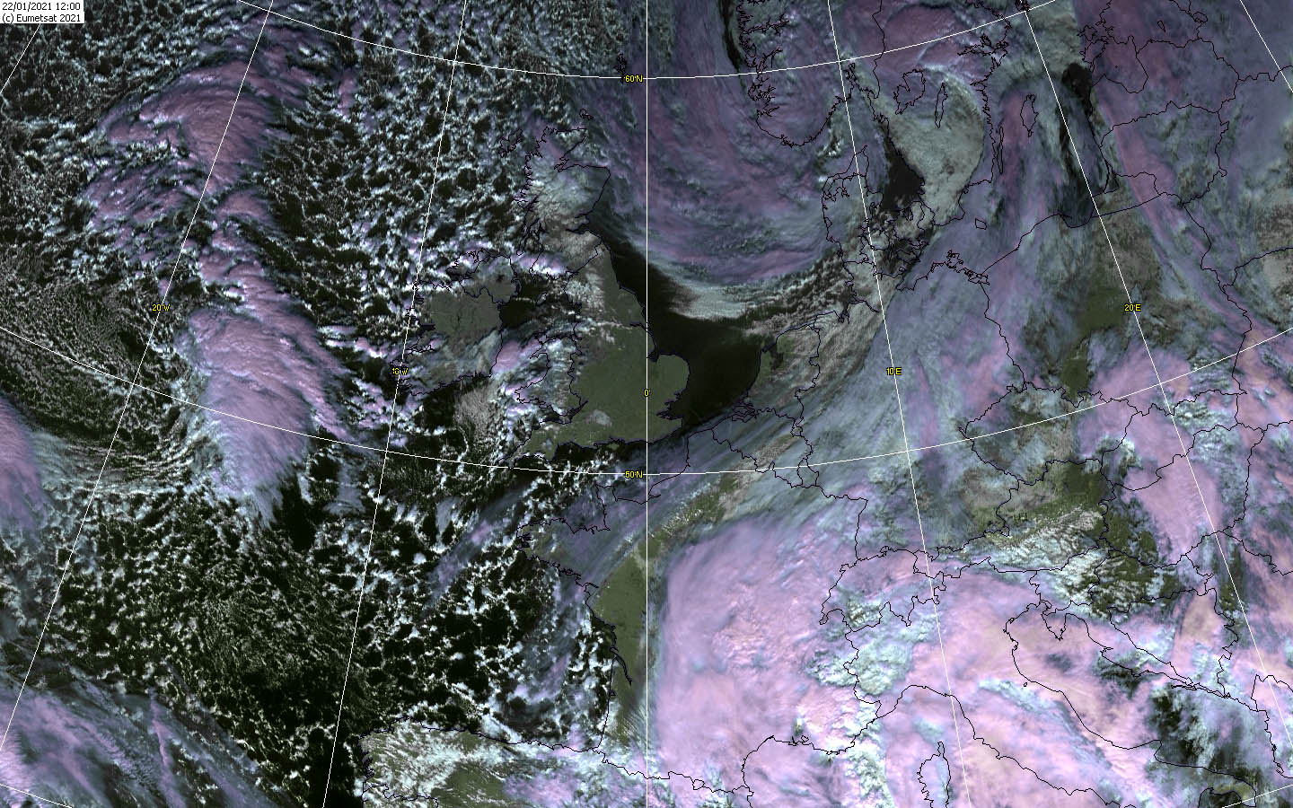
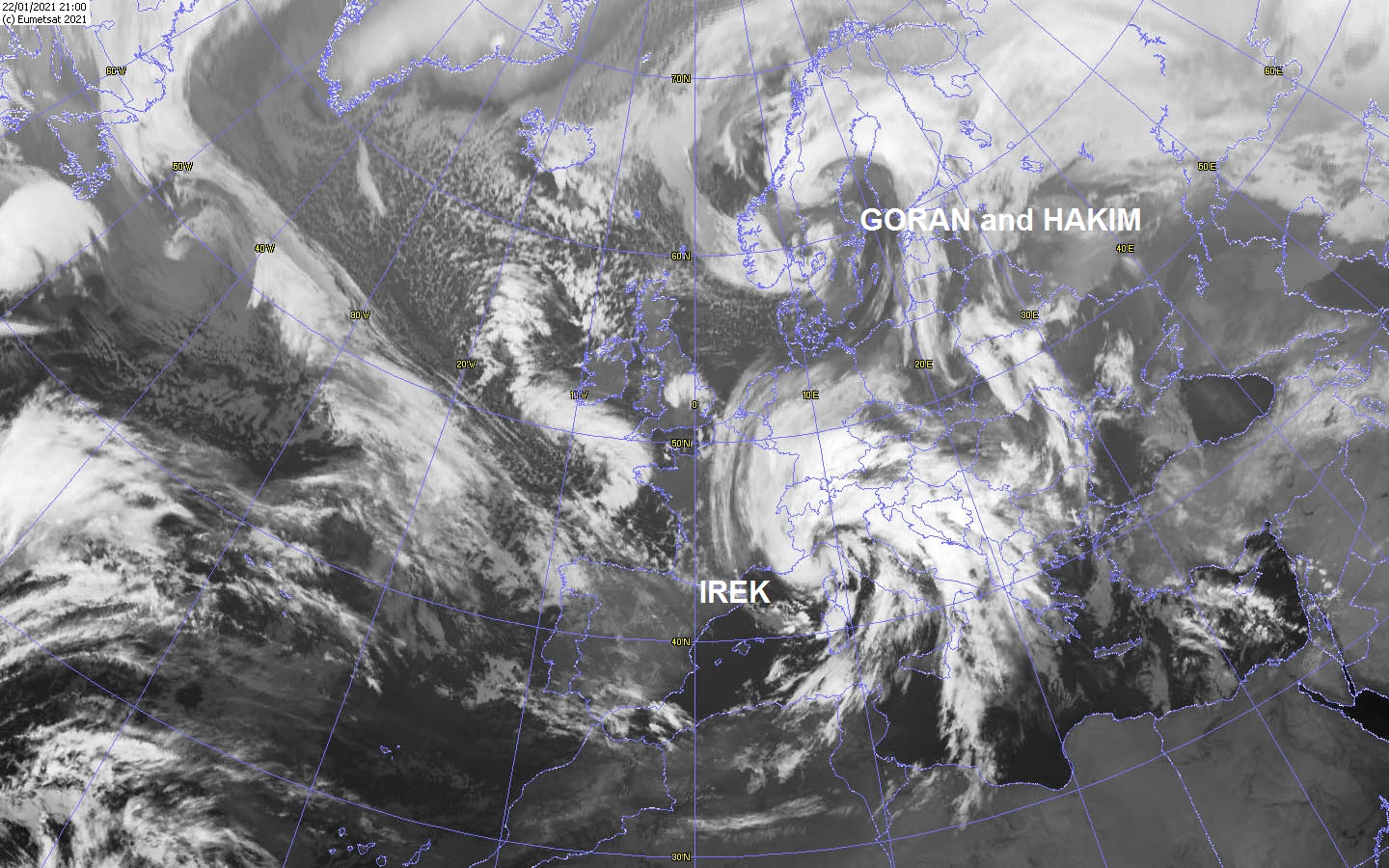
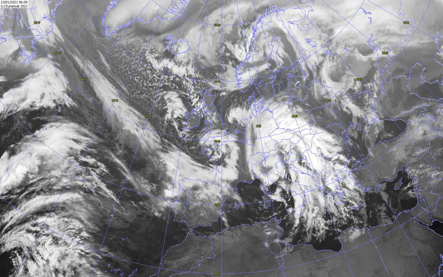
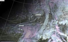
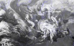
Satellite images (IR, VIS), December 20-23, Source:
Wokingham
|
 |
 |
 |
 |
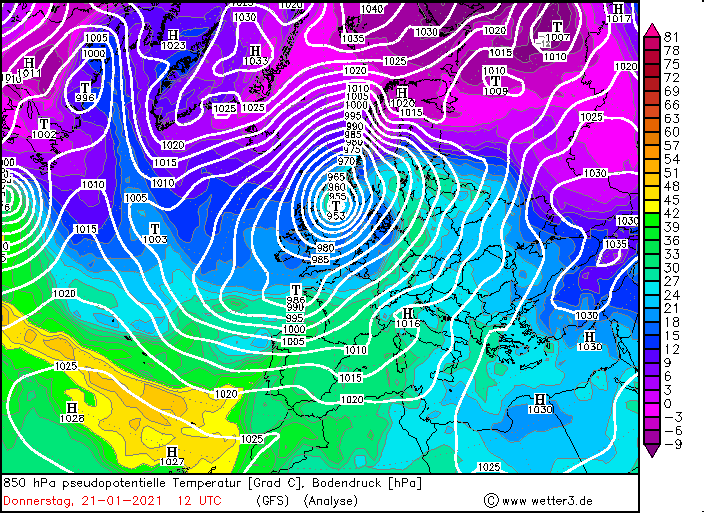
On Thursday evening, low pressure HAKIM developed on GORAN's frontal system, which again caused high wind speeds over France on Friday night. HAKIM's storm field
spread to Germany and BeNeLux on Friday, causing gusts of around 150 km/h in exposed areas and around 60 km/h in the lowlands. GORAN's storm field, on the other
hand, reached Scandinavia. The high wind speeds and the partly heavy snowfall led to blizzard-like conditions.
On Friday 22 January, GORAN's core pressure gradually increased, but the air pressure gradient remained high, so that wind speeds around
100 km/h continued to be reached over Scandinavia, resulting in blizzard-like conditions until Saturday morning. Low HAKIM also weakened, but wind
speeds over Germany remained high at 100 km/h, around 50 km/h in the lowlands. The wind weakened significantly not until the evening.
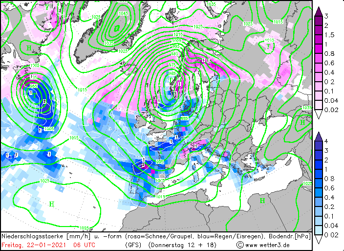
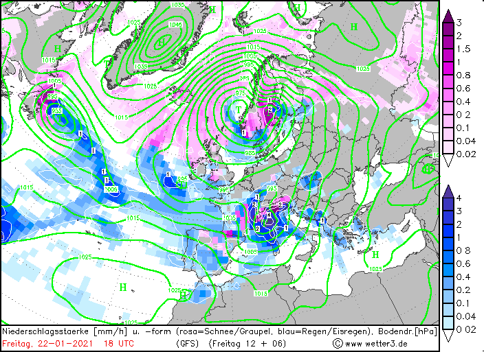
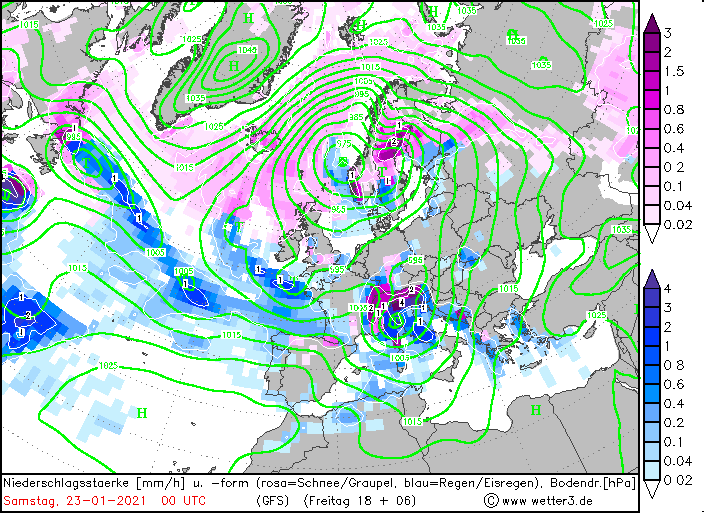
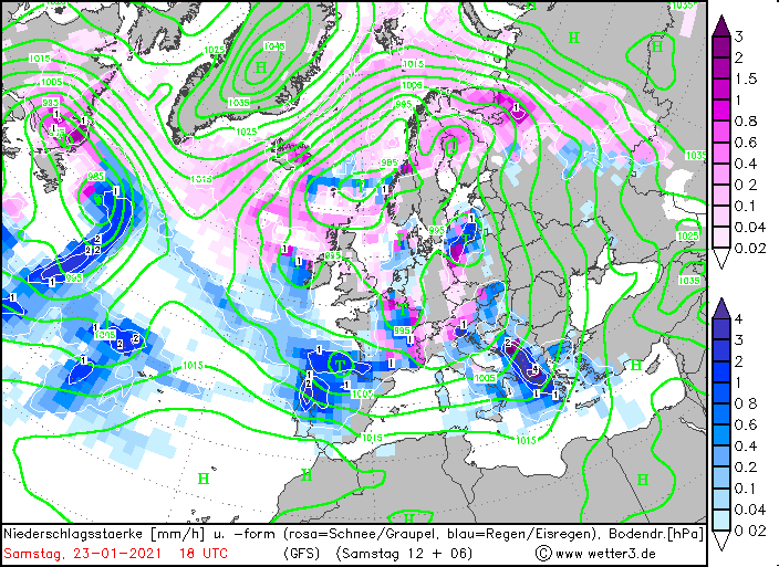
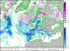
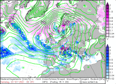
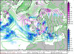
Meanwhile, a third low called IREK had formed over France. This VB low followed the typical track of this type of low pressure area and reached the Mediterranean
region on Friday evening. There, IREK caused high wind speeds and heavy precipitation, especially in the Alpine and Balkan regions. Within 24 hours, precipitation
amounts of over 200 mm were registered, locally even higher. Due tot he special formation oft he air pressure areas over Europe the Mistral formed Friday evening.
Windspeed over 200 km/h were measured this time.
|
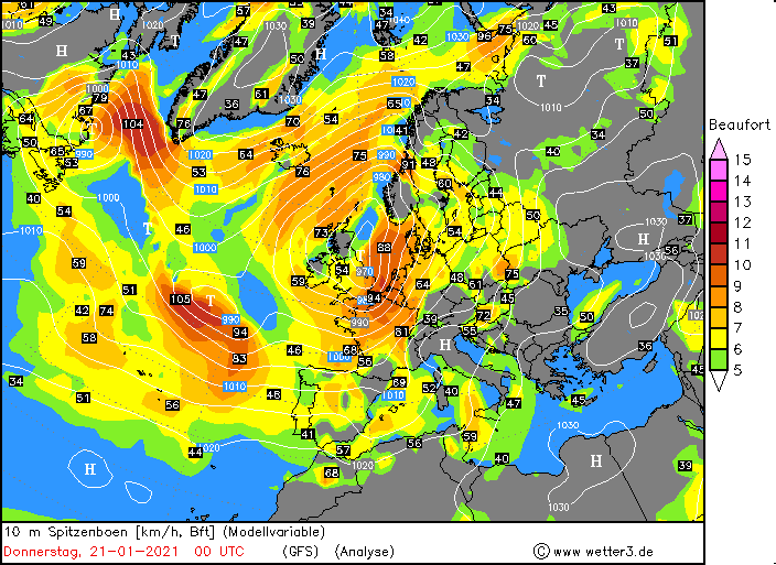
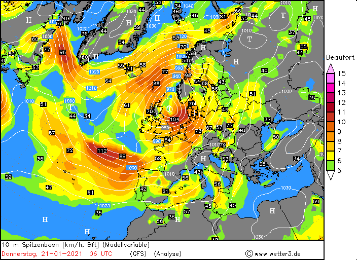
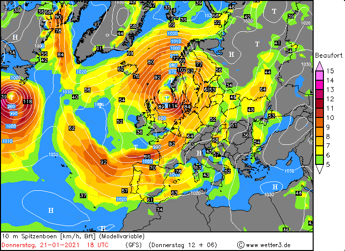
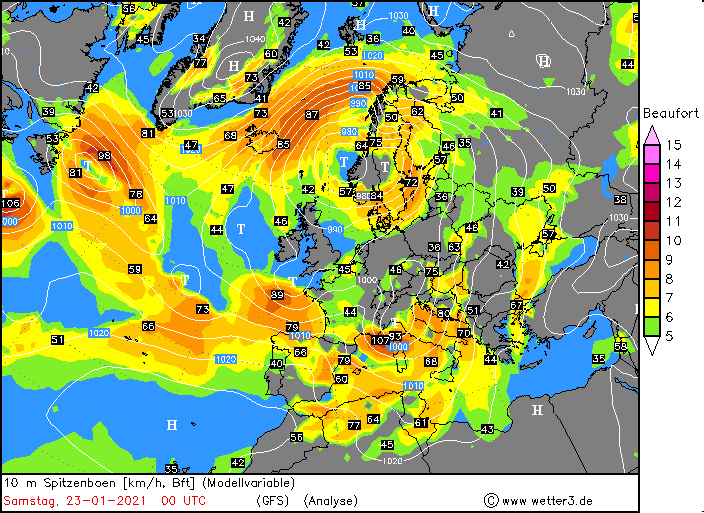
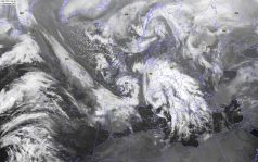
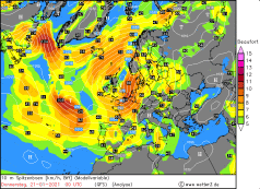
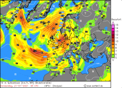
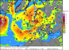
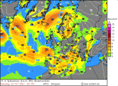
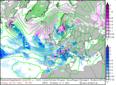
10m peak gusts Europe, January 21-23, 2021:
Wetter3
|
 |
 |
 |
 |
|
Precipitation amount and kind, January 22-23, 2021:
Wetter3
|
 |
 |
 |
 |
The highest wind speeds with more than 150 km/h were reached in Central Europe on January 21st till 23rd. But also in Scandinavia high wind speeds oer 130 km/h were
measured and with the intensive snowfall billzard like conditions occured.
However, wind speeds of between 60 and 70 km/h were also widespread at lower altitudes and in the lowlands. Occasionally, gusts of around 80 km/h occurred.
The most highest wind speed were measured in combinatin with the Mistral on the evening of January 22nd. Gusts over 200 km/h were measured.
The table below shows a selection of the strongest gust over Europe and the British Isles from Janaury 21 till January 23rd.
| Location |
Gusts in km/h |
Date |
Brocken (DE)
Cairnwell (GB)
Mount Aigoual (FR)
Hemavan Skorvfjallet (SE)
Kistefjell (NO)
Nord-Solvaer (NO)
Leuchtturm Alte Weser (DE)
Leuchttrum Kiel (DE)
Cagnano (FR)
Somosierra (ES)
Cap Sagro (FR)
Cap Corse (FR)
Mont Aigoual (FR)
Cap Corse (FR)
Torsvag Fyr (NO)
Brocken (DE)
Cap Bear (FR)
Ile Rousse (FR)
Sierra De Alfabia (ES)
Kistefjell (NO)
Cap Corse (FR)
Ile Rousse (FR)
|
162
150
148
133
133
130
129
126
214
212
208
189
184
166
151
151
151
148
144
144
191
162
|
21.01.2021
21.01.2021
21.01.2021
21.01.2021
21.01.2021
21.01.2021
21.01.2021
21.01.2021
22.01.2021
22.01.2021
22.01.2021
22.01.2021
22.01.2021
22.01.2021
22.01.2021
22.01.2021
22.01.2021
22.01.2021
22.01.2021
22.01.2021
23.01.2021
23.01.2021
|
|
Data source: Ogimet and Meteociel.
Text: MG
January 25, 2021
|