|
Southern Africa is suffering a destructive and dangerous heat wave / drought situation. From October 2019 to December 2019
there have been widely distributed rainfall deficits of more than 35%. This leads to substantial reduction of Lake Kariba's water level
and issues in food security.
The southern part of Africa has been experiencing a heat wave with pronounced drought for several months. Contrary to what is often
expected, southern Africa's climate is in general not characterised by enormous drought. The metropolis of Johannesburg records an
annual average rainfall of 790 mm and an annual average temperature of 16.0°C. Large parts of the total precipitation come together
in the local summer (Northern Hemisphere winter). East London, located on the south-east coast of the continent, also has a higher
annual precipitation of 822 mm than Karlsruhe, for example (728 mm). The popular tourist destination Capte Town in the southwest of
South Africa has an average annual precipitation of 853 mm and an average annual temperature of 16.9°C. Interestingly, dominant
amounts of the precipitation are falling in the local winter, i.e. in the Northern hemisphere summer. According to the Köppen climate
classification, the climate belongs to the same class as in the Mediterranean, called "Csb". The reason for this are frequent Atlantic
low pressure areas, which are more likely to hit Capetown in local winter due to the equatorwards shift of the
polar front. In the local summer, there is often a dry foehn wind from the inland Great Karoo, called Berg-Wind.
|
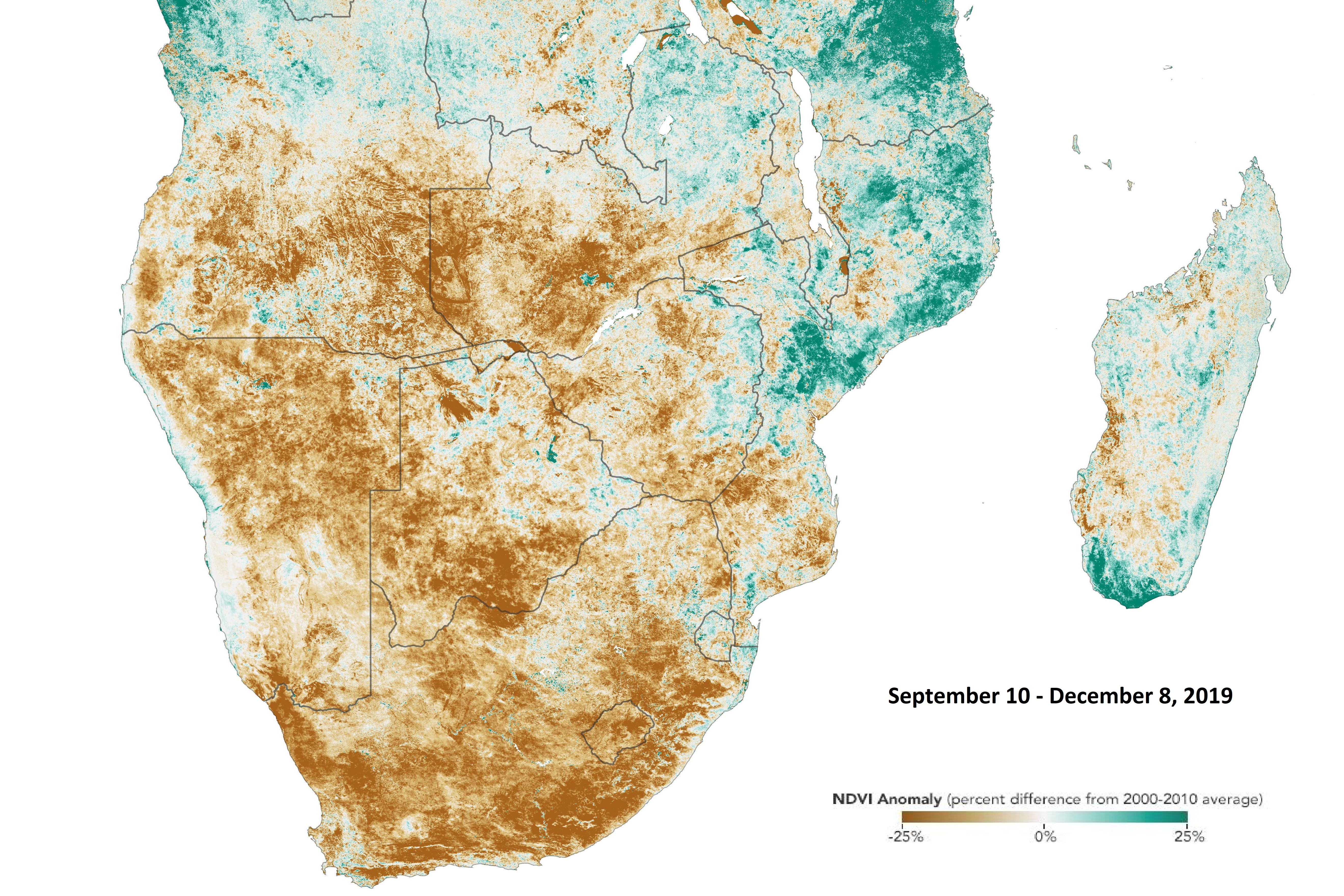
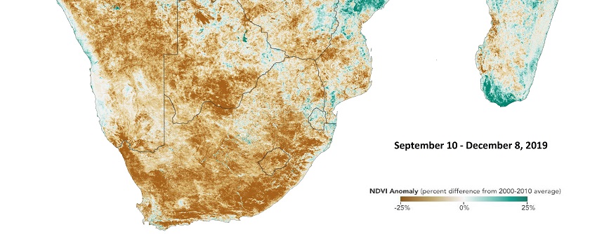
Precipitation anomaly (reference period 2000-2010) from September 10 until December 08,
Source: NASA
|
 |
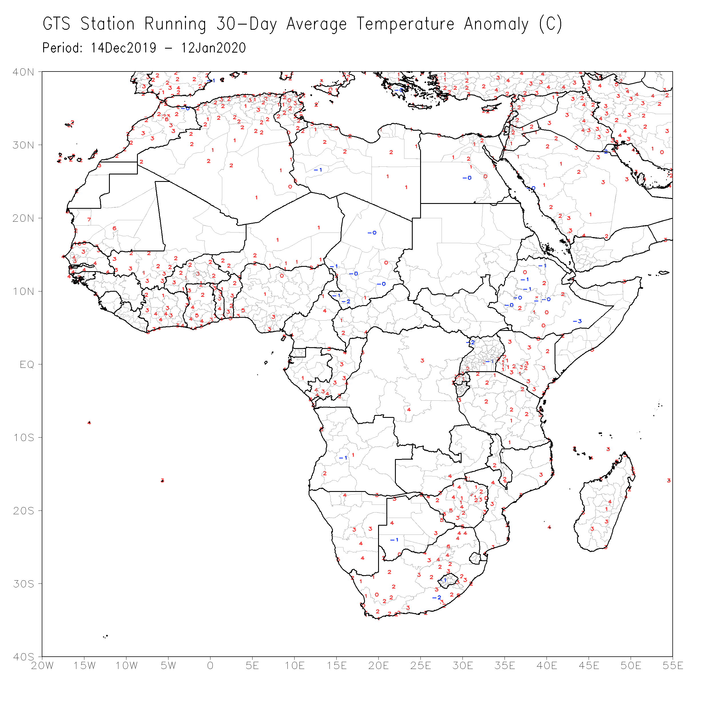
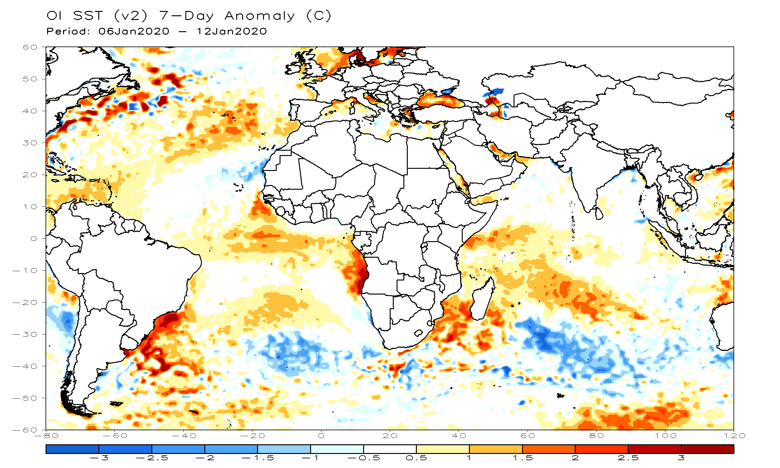
According tot he World Food Program, many parts of southern Africa have recieved average rainfall in just on of the past five
agricultural seasons. Nevertheless, the recent season is unusually dry and hot. Temperature-wise one can see large positive anomalies
in the whole southerly African continent. Looking at the recent 30 days, the temperature anomaly peaks in the area between the Kingdom
of Lesotho and northern Simbabwe. Around Lake Kariba the temperature anomaly is approximately +3 to +4°C.
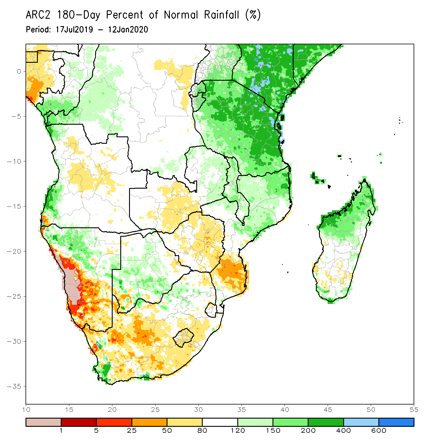
In a climatological averaged season in southern Africa rainfalls start to increase at the beginning of October. In 2019, rain saison
started late and also with very litte and unreliable precipitation. Looking at rainfall percentage referred to average values, the
drought is worst in western Namibia (in the Namib-Naukluft national park), where in some parts less than 1% of climatological average
rainfall has fallen (180-Day review from January 12). In fact, the total amount of precipitation was 0 mm, where the climatological
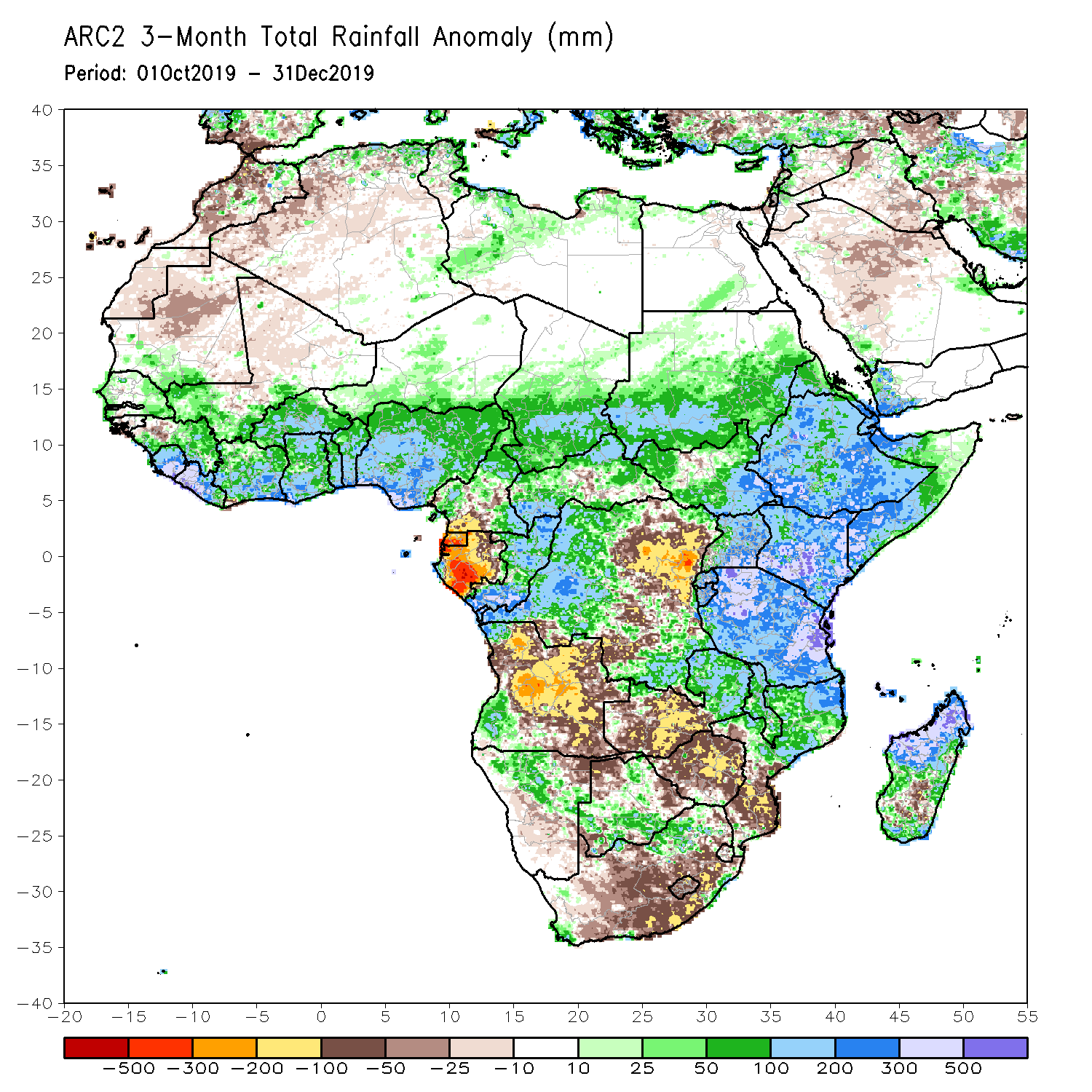
average in this reference period is 6 mm. Looking at absolute values of the past three months (October 2019 to December 2019), there
is a lack of precipitation in the order of 100 to 200 mm in large parts of South Africa, especially in the southeast. You can also
see huge precipitation deficits in central Angola with values around 200 mm below average. This corresponds to approximately 35% of
rainfall deficit.
In contrast to severe drought in the stated regions, large parts of eastern Africa and northern Madagascar have experienced
strongly above average precipitation amounts in the most recent three months. Above average sea surface temperatures led to
high amounts of available moisture and a powerful ending of the 2019 North Indian Ocean cyclone Season and an early start of
the 2019-20 South-West Indian Ocean cyclone season. For more details head over to:
Tropical Cyclone activity in the Indian Ocean in December 2019
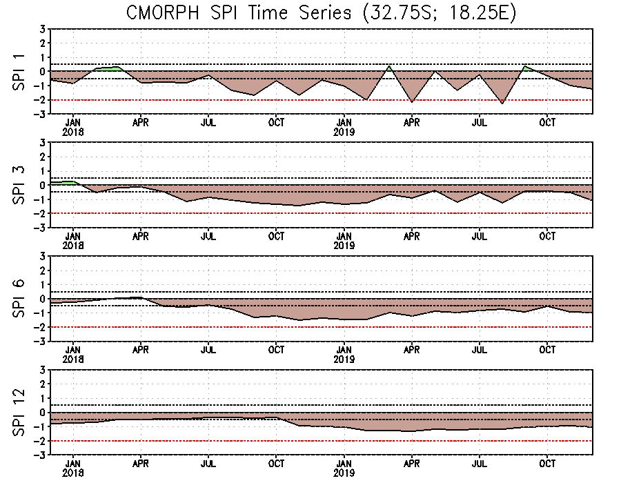
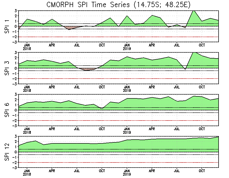
A good way to produce time series of precipitation anomalies is the Standardized Precipitation Index (SPI). It's
a commonly used index to characterize the meteorogical strength of drought or heavy rainfall events. With the help of
the SPI, precipitation perdiods can be compared on different time scales and from different climate zones. On short time
scales the SPI is closely related to soil moisture, while on longer time scales the SPI can be related to groundwater and
reservoir storage. SPI 1 refers to a one-month reference period, SPI 12 to a one-year period.
As mentioned in the beginning, in southern Africa (here as example Capetown) drought is not only a problem since 2019, but it's a
long term problem which became very pronounced in 2019. On the contrary, northern Madagascar seems to experience the opposite effects
with above average precipitation in almost every month in the past two years.
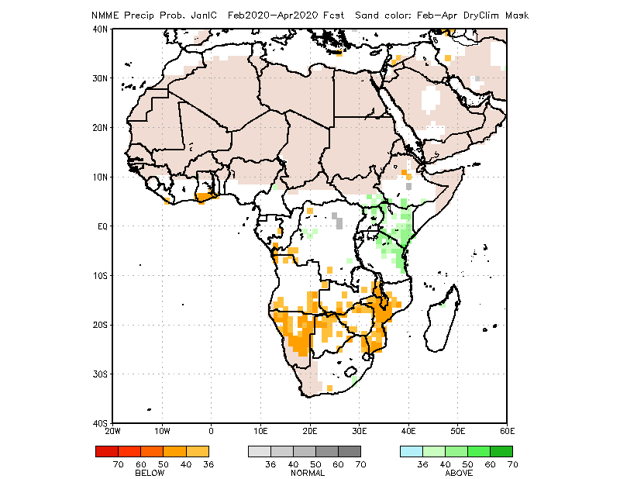
Accorrding to predictions from North American Multi-Model Ensemble (NMME) there is a slight to moderate tilt in the
odds to favor above-average rainfall over portions of East Africa through the northern hemisphere spring 2020. However,
below-average rainfall over portions of Southern Africa remain likely through the northern hemisphere spring 2020.
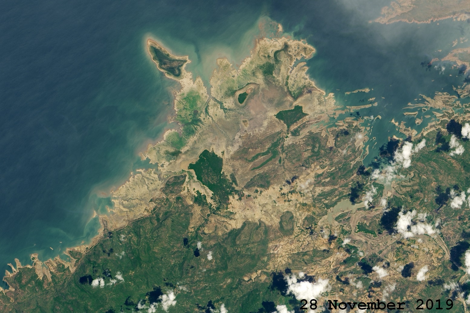
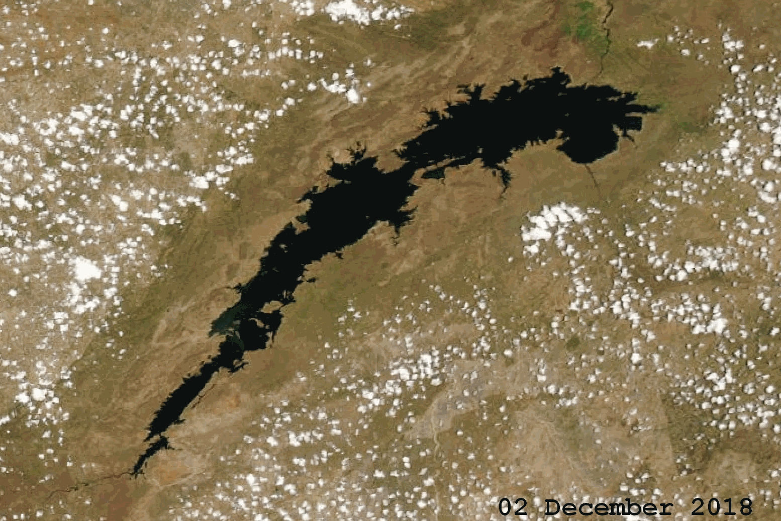
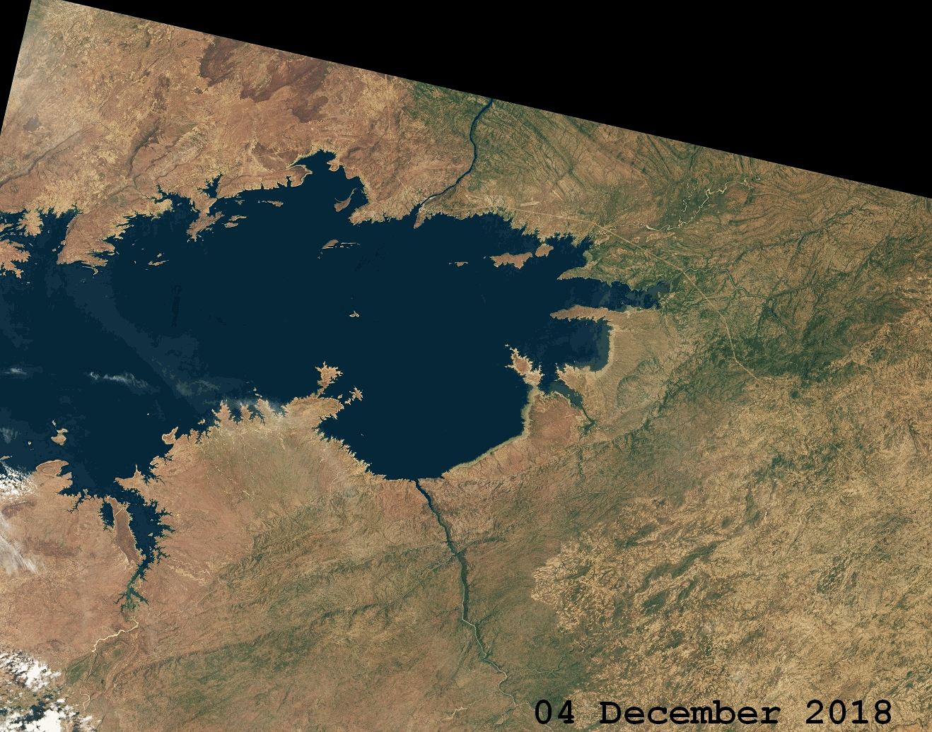
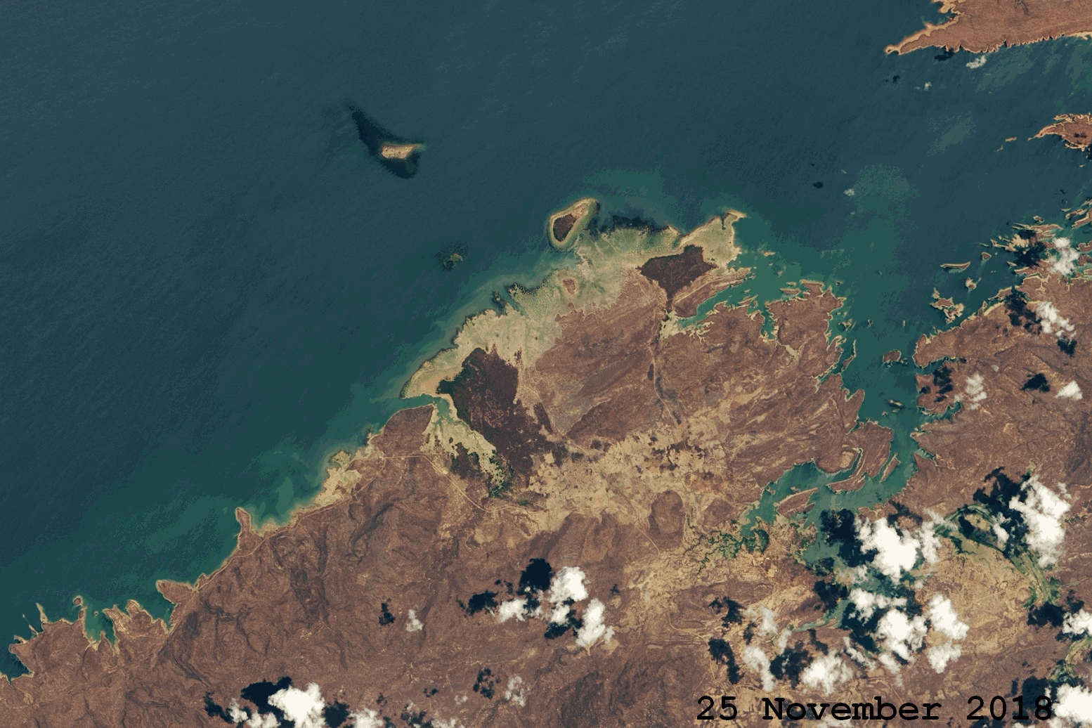
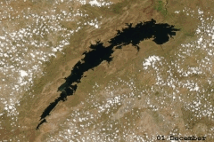
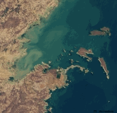
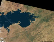
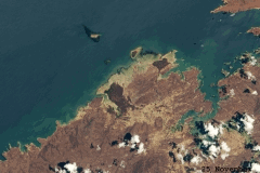
The pictures below show the reduction of Lake Kariba's water level between end of 2018 and end of 2019.
|
Satellite images from Lake Kariba (total see and its coastlines)
Source: NASA
|
 |
 |
 |
 |
Text: FS
January 14, 2019
|