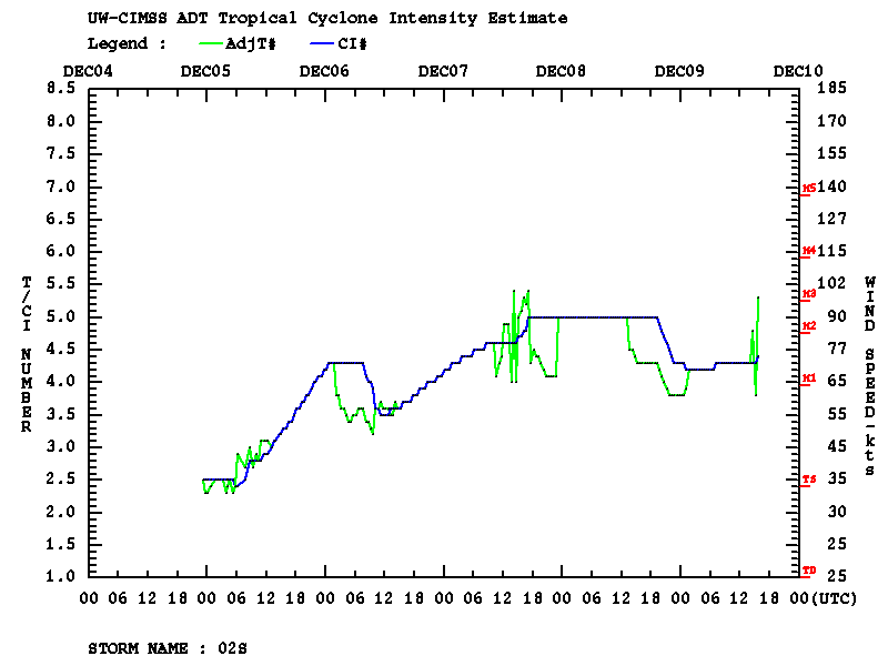
|
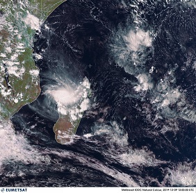
Tropical cyclones BELNA moved as category 2 cyclones over the Comoros and Mayotte and made landfall as category 1
cyclones on the northwest coast of Madagascar. Despite the few weather stations, wind speeds of 148 kph
and rainfall of 123 mm/24h were measured.
Tropical cyclones BELNA formed almost simultaneously with AMBALI in the Southern Indian Ocean. Due to the French
archipelago Mayotte in the northern part of the Strait of Mozambique, the system was also of interest for the French
weather service Meteo France. Already on 25 November, an area with increased shower activity west of the Seychelles
was noticed by Meteo France. A strong trough, reaching across the equator was formed, probably favoured by a Kelvin
wave, which led to a strongly positive anomaly in the sea surface temperature and a favourable phase of Madden Julian Oscillation.
|
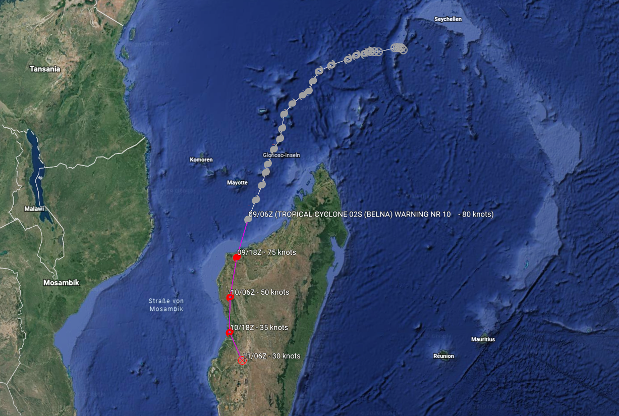
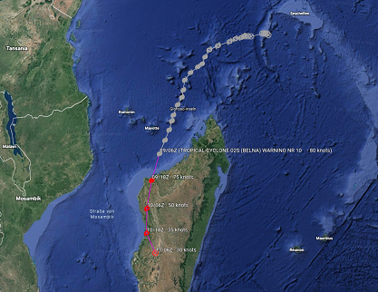
BELNAs trajectory and intensity (timeline),
Source: JWTC and
and CIMSS
|
 |
 |
The
prediction was initially difficult because a tropical disturbance formed in the same trough in the northern
hemisphere, which later formed the tropical cyclone PAWAN. On 04 December first signs of organized convection
were visible with strong convection in the center and rainbands around. On 05 December the system was upgraded
to a tropical storm and was named Belna.
|
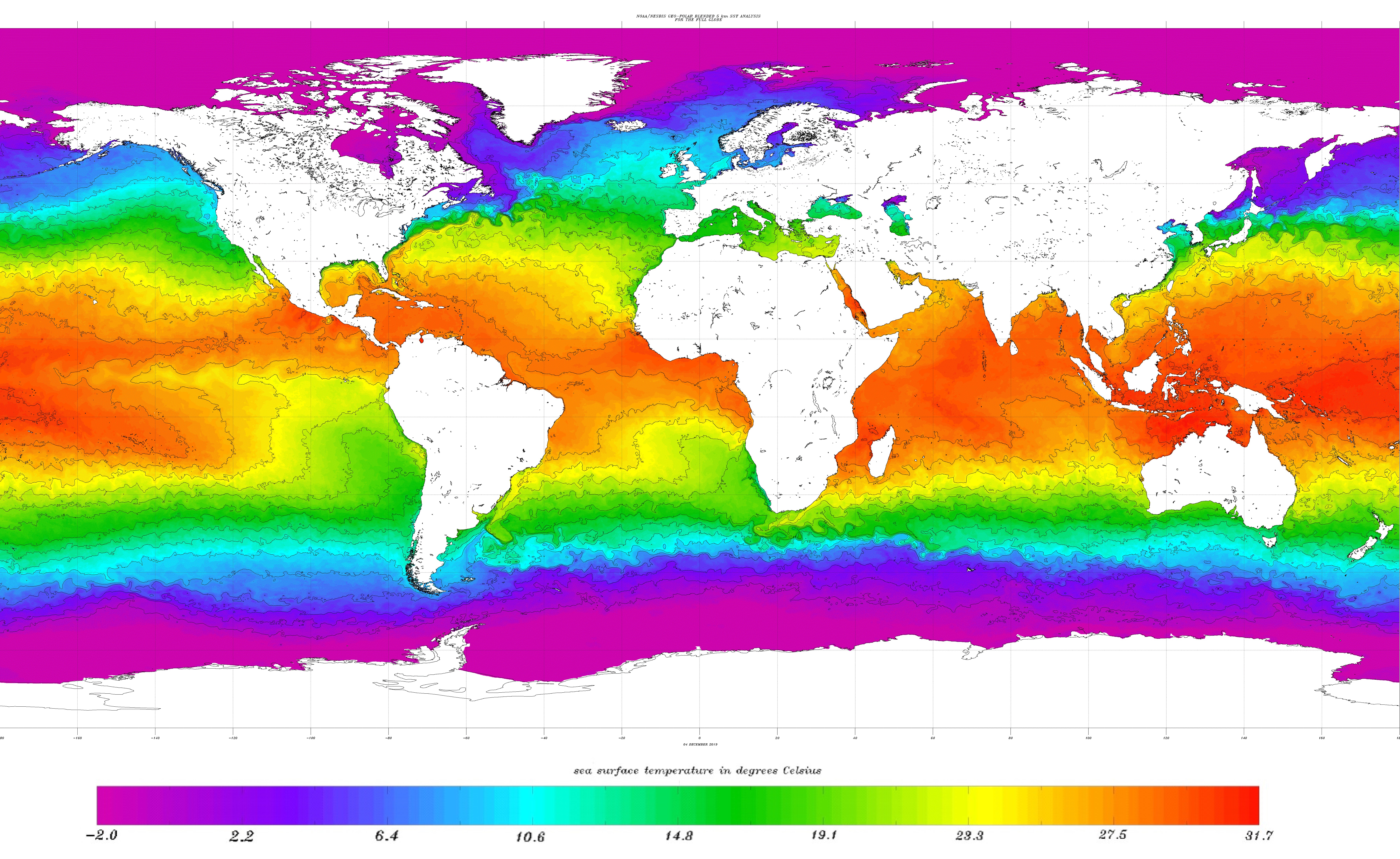
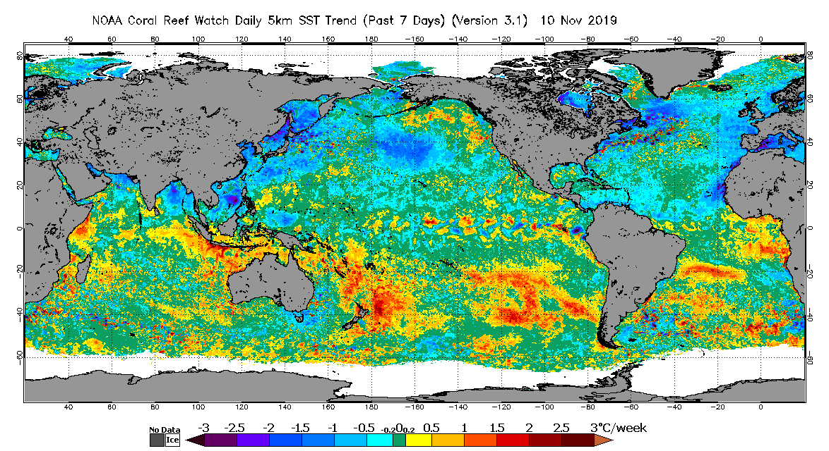
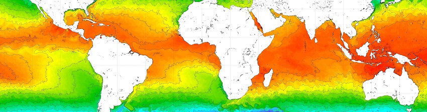
Global sea surface temperature, 04.12.
NOAA
|
 |
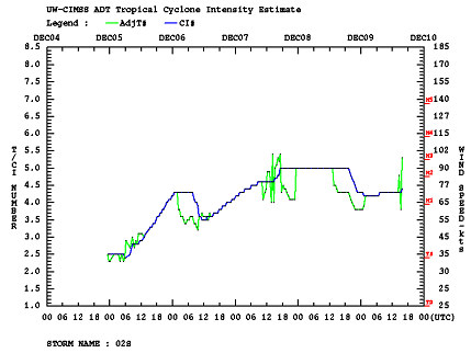
On 06 December BELNA formed a visible eye and reached the status of a category 1 cyclone. About 1500 km further east
tropical cyclone AMBALI set a new southern hemisphere record for most rapid intensification within 24 hours and even
reached the strength of a major hurricane for a short time. AMBALI's strong intensification was a product of almost
maximum solar radiation due to the proximity to the Southern Hemisphere summer solstice on 21 December, low vertical wind
shear and high sea surface temperature of up to 31°C.
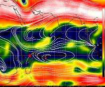
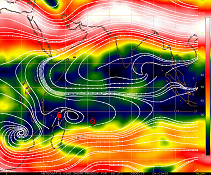
In the eastern part of the southern Indian Ocean a strong high pressure area developed. The anti-clockwise rotation
of the high pressure area in the southern hemisphere led to a change in the displacement directions of BELNA and AMBALI
from west to south-southwest (for BELNA) and even south (for AMBALI). AMBALI was thus directed to areas with decreasing
sea surface temperature. Geographical proximity to the adjacent high pressure area to the east led to the intrusion of
dry air into the system. Further northward deformation of the southern hemispheric subtropical jet also led to strong
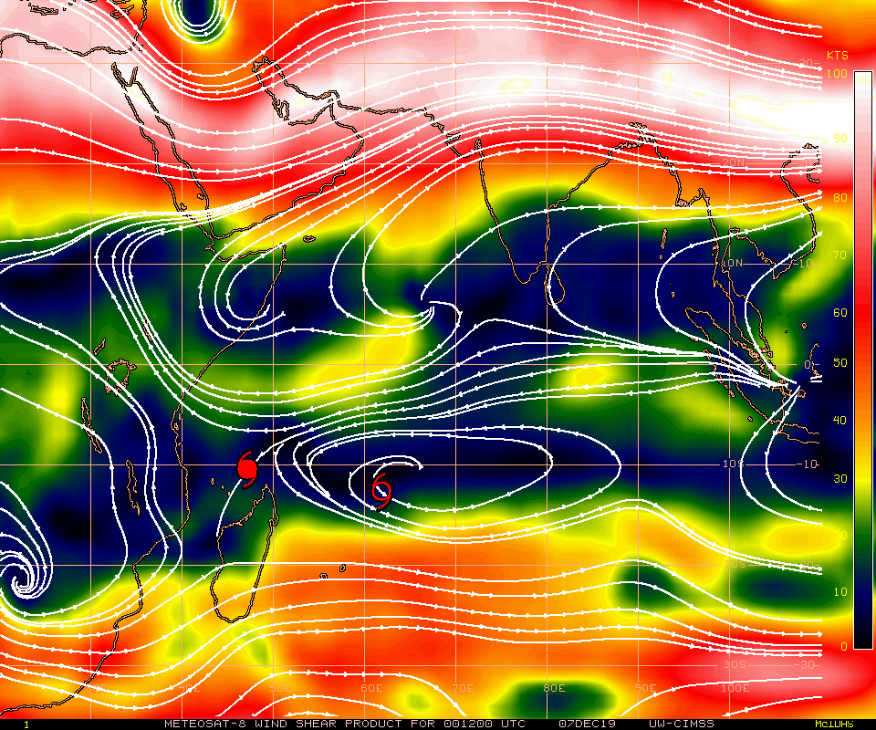
vertical wind shear (up to 70 kph difference between 150-300 hPa layer mean and 700-925 hPa layer mean).
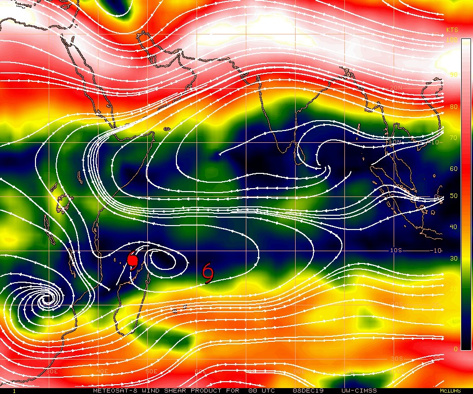
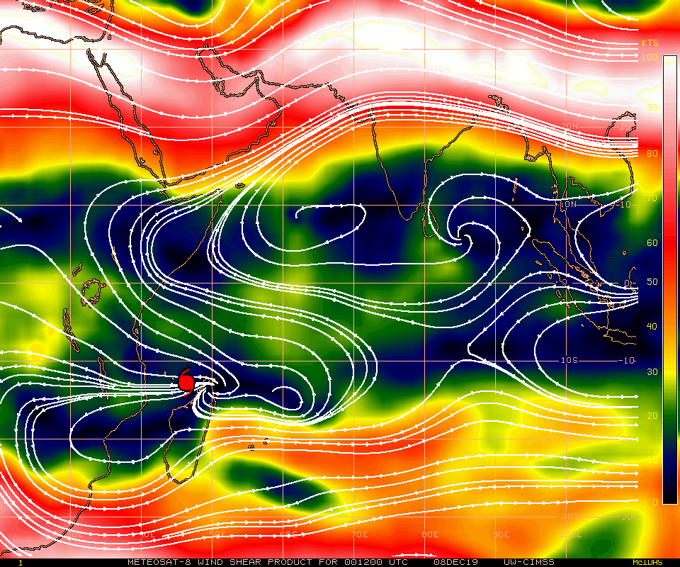
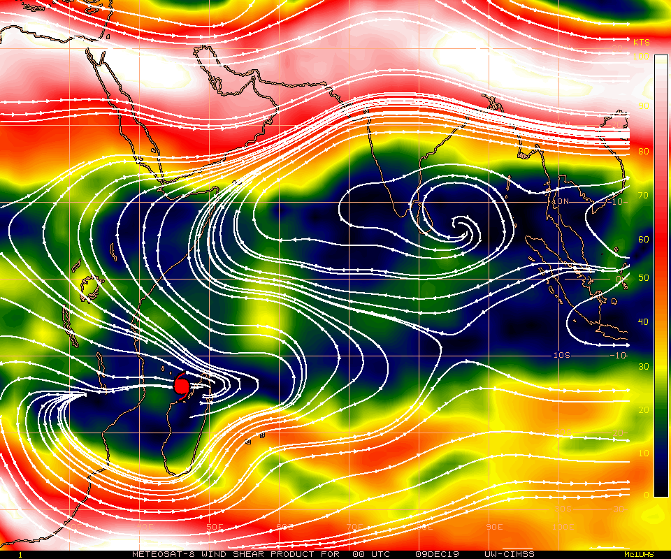
|
Vertical wind shear, 04.12., 12 UTC until 07.12. until 09.12.,
Source: EUMETSAT
|
 |
 |
 |
 |
 |
 |
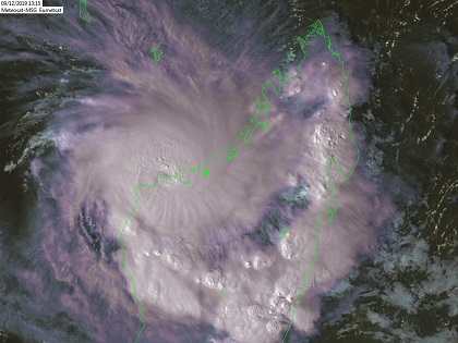
While AMBALI rapidly weakened again, BELNA continued to move in an almost perfect window of high sea surface temperatures
and low wind shear. The system reached its peak intensity in the late evening of 07 December with sustained mean winds of
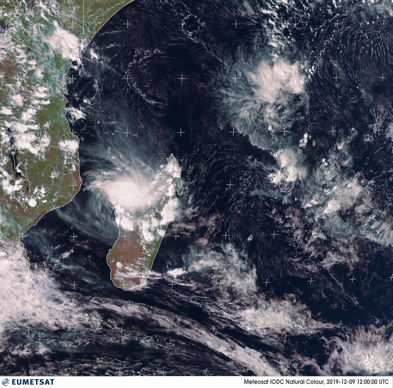
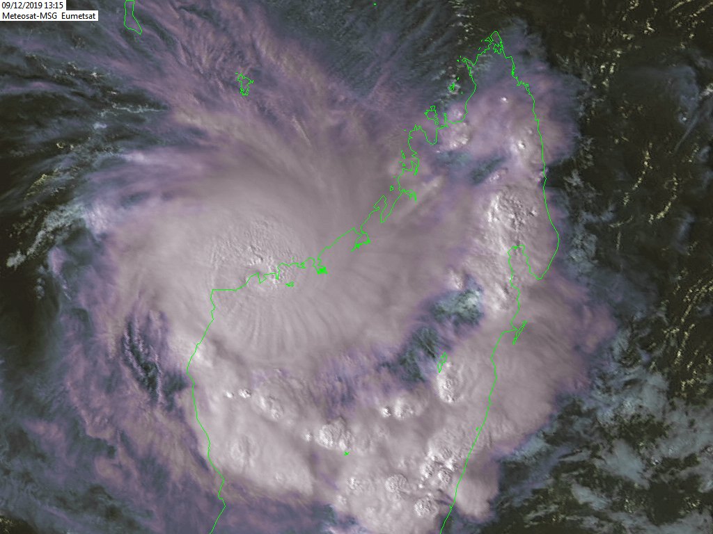
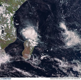
185 kph and a core pressure of approx. 975 hPa. As BELNA approached Madgaskar's northwest coast it weakened again to an upper
end Category 1 cyclone. The landfall occurred on 09 December at approx. 18 UTC. Satellite images show a repeated significant
intensification of the storm in the hours before landfall. High convection in the eye wall surrounding the storm eye as well
as multiple convective cells above the north of Madagskar indicate a short-term intensification.
|
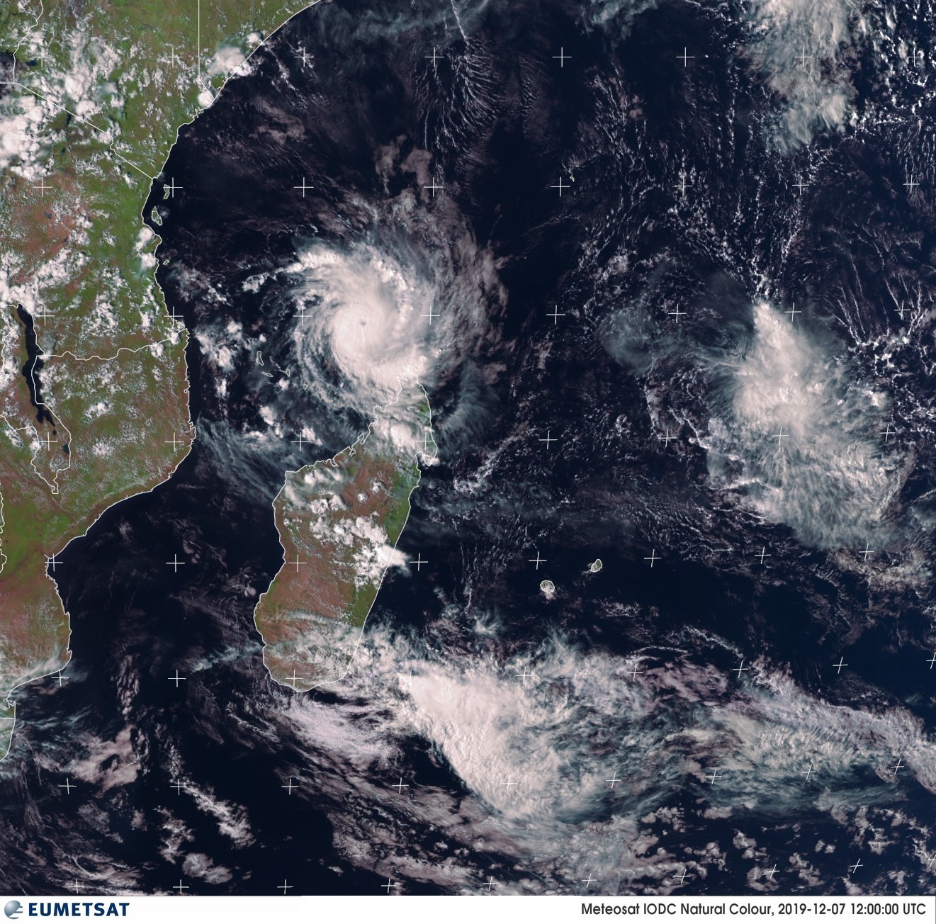
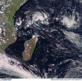
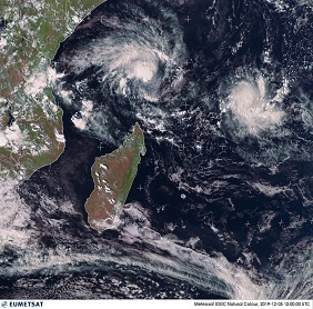
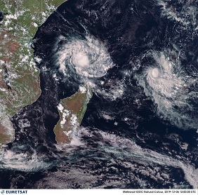
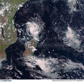
Satellite image, 04.12., 12 UTC until 09.12., 12 UTC,
Source: CIMSS
|
 |
 |
 |
 |
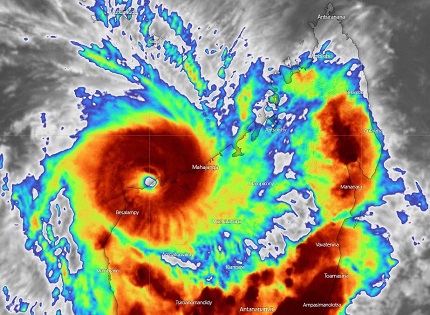
After landfall, the system slowly weakened due to increasing friction over land. While the rainfall in the northwest of
the island was well predicted by the weather models, there was unexpectedly strong convection and abundant precipitation
on the east coast. In the northernmost city of Madagascar, Antsiranana, there were large-scale floods. Large parts of Soalala
were also flooded. According to AP News, ten people were killed and 1400 people lost their homes. About 80% of the buildings
in Soalala were damaged or destroyed in the roof area.
|
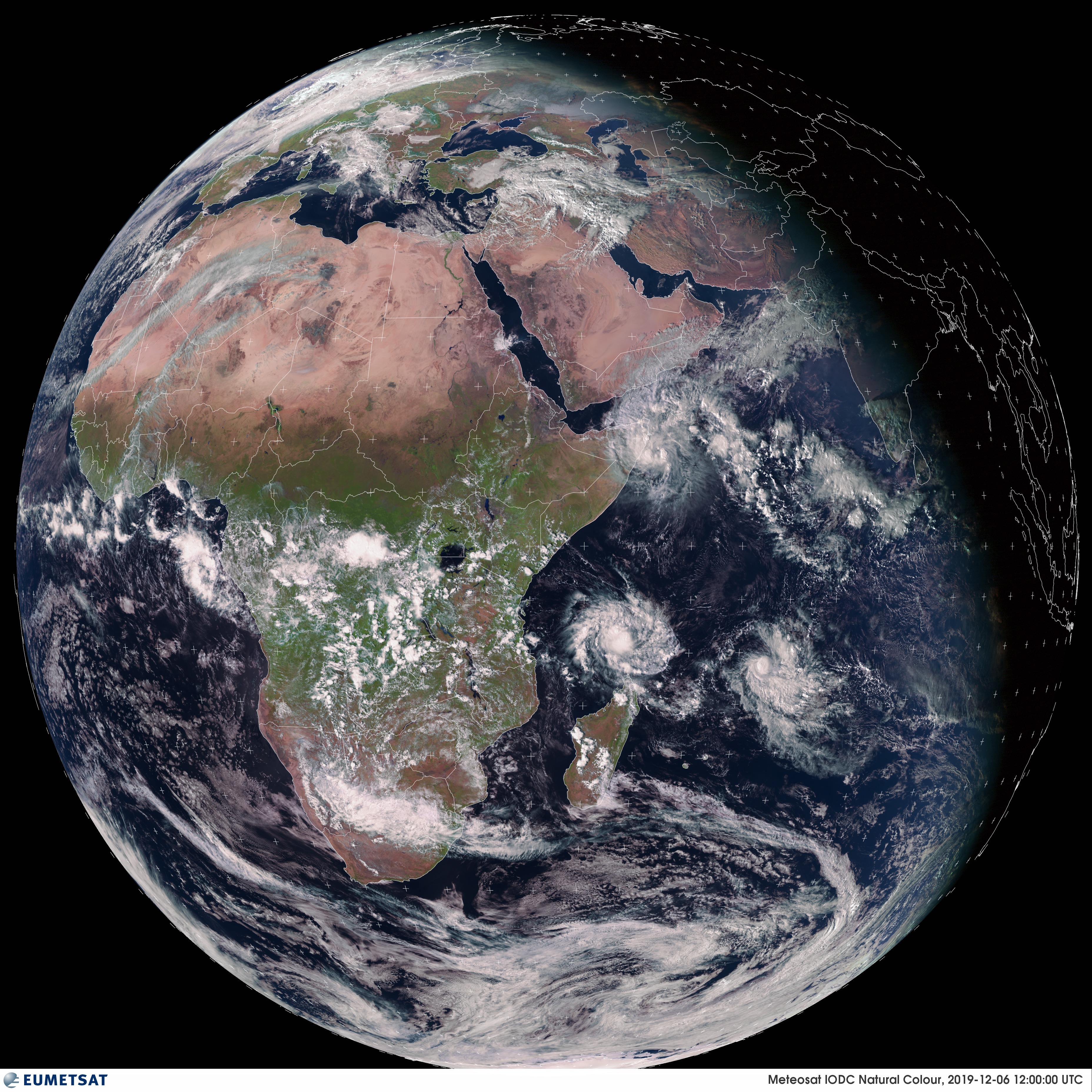
Satellite image, 09.12., 12 UTC,
Source: EUMETSAT
|
 |
 |
Unfortunately, due to the sparsely populated meteorological measuring network, there was no station in the direct impact
range of BELNA. Nevertheless, a precipitation of 57 mm/24h was measured in Bajunga on 10 December at 0 UTC. On Mayotte,
a French group of islands northwest of Madagascar, a precipitation of 123 mm was measured during the same period. Wind
speeds of 148 kph were measured in the Union of the Comoros, another archipelago in the northern Strait of Mozambique.
(source: Ogimet).
Text: FS
December 11, 2019
|