|
Sunday, 16 May 2021, 18:30 UTC
Issued: Sunday, 16 May 2021, 18:30 UTC
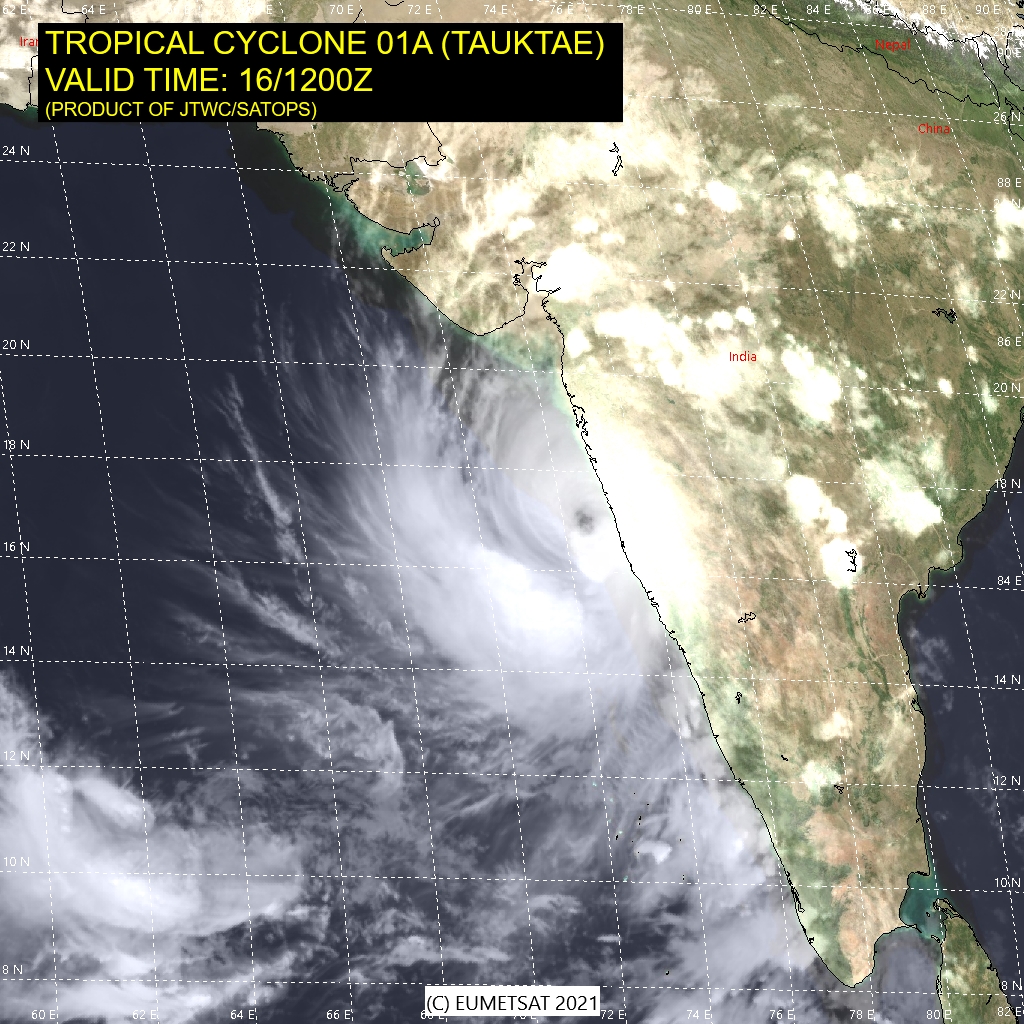
The strong tropical cyclone will affect the west coast of India with the city Mumbai with heavy rainfall and wind gusts over 200 km/h and make landfall
on early tuesday in southwest India near the island Diu with a high storm surge danger!
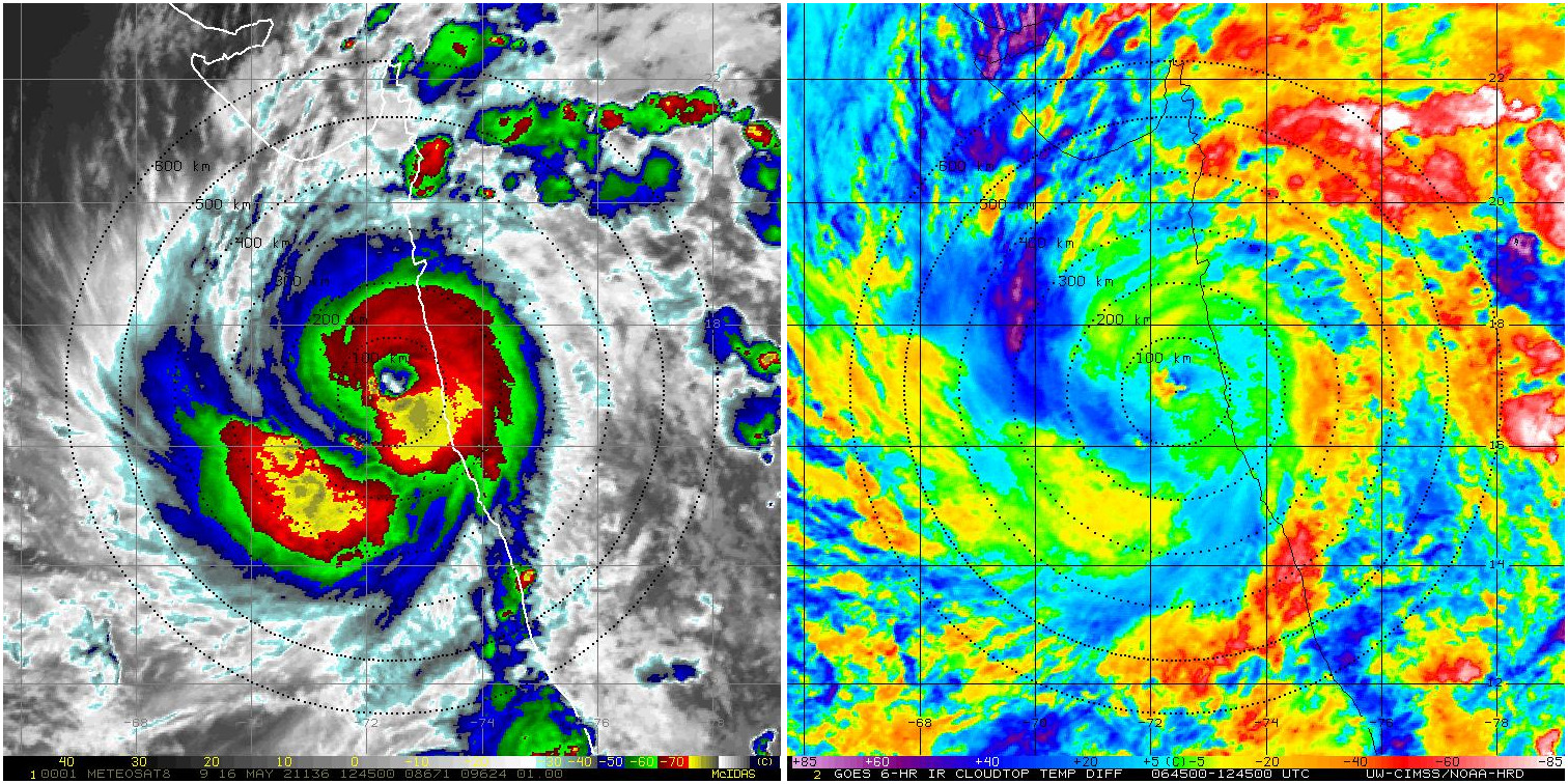
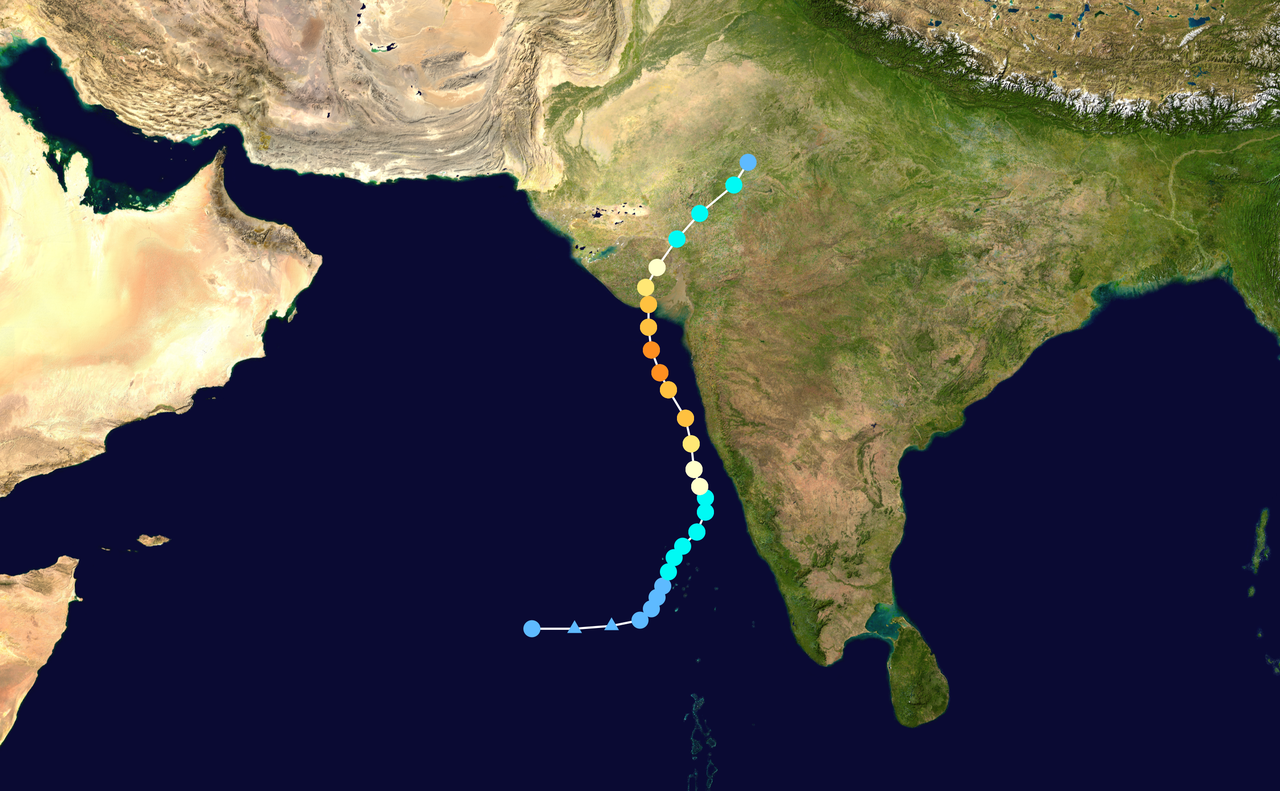
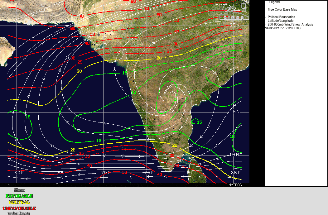
Tauktae evolved from a tropical depression to a tropical storm on May 14. Today, Sunday, the cyclone arrived in an area with low vertical wind shear below 10 m/s and at the same time very high sea surface temperatures.
In addition, moisture content in the mid-troposphere was very high, causing Taktoe to strengthen significantly and is currently classified as a Category 3 storm.
Heavy rainfall and wind gusts above 200 km/h will cause damage along the west coast of India in the coming days. Among others, the megacity Mumbai and over highly populated areas are also affected.
As the storm progressed, it moved further north and is expected to make landfall in the region around Diu in southwest India early on Tuesday. There, too, heavy rainfall, strong wind gusts of over 150 km/h and a strong storm surge must be expected.
As the region is only slightly above sea level, there will also be widespread flooding.
Issued: May 16, 2021, 18:00 UTC NB |