|
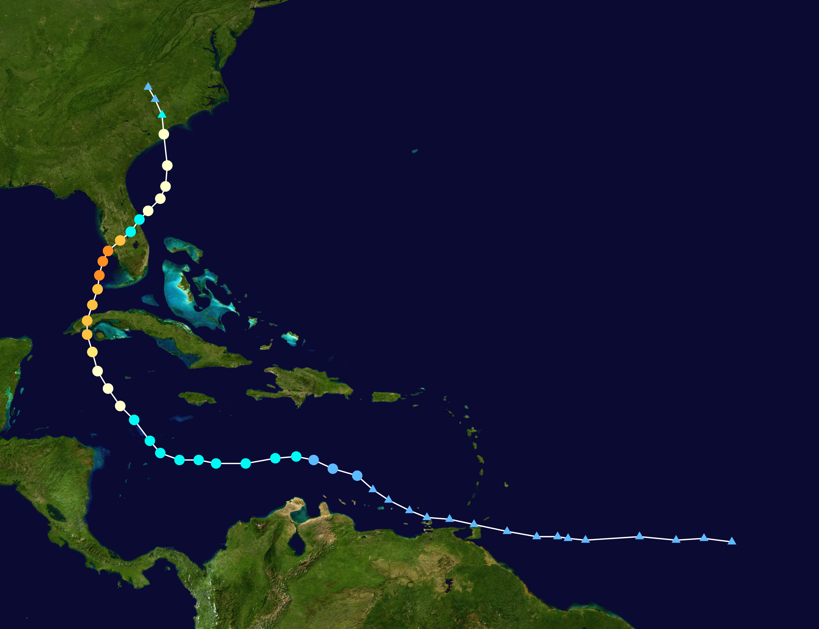
IAN was the first Major Hurricane in the 2022 Atlantic Hurricane Season to make landfall on US mainland. Its trajectory led over Cuba and Florida as a Major Hurricane.
After crossing Florida and re-entering the open Atlantic, IAN reached Hurricane strength again and made landfall in South Carolina as Cat. 1 Hurricane.
IAN is the fourth Hurricane of the 22 Atlantic Hurricane Season and the second Major Hurricane. It developed on September 22 showing signs of organized concection over the Atlantic Ocean.
On September 24 IAN reached Tropical Storm status and Hurricane status on September 26. Favourable atmospheric conditions with light vertical wind shear, high sea surface temperatures (30°C) and
high relative humidity in the mid troposphere led to continous intensification to a high-end category 3 Hurricane. IAN crossed Cuba on September 27 at 08:30 UTC with sustained winds of 205 kph.
|
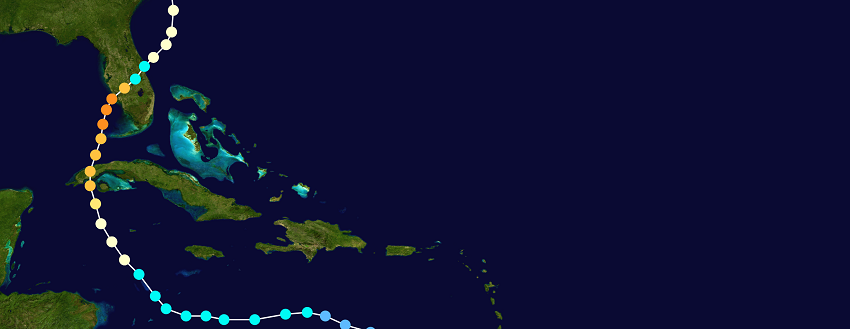
Trajecotory of Hurricane IAN, source:
NASA and NHC
|
 |
After crossing Cuba, IAN travelled northwards over the Gulf of Mexico and reached its peak intensity on 28 September at 10:35 UTC with sustained wind speed of 250 kph as a category 4 Hurricane.
At the same day, around 19:05 UTC, IAN made its second landfall as Major Hurricane at Cayo Costa Island and shortly thereafter at Punta Garda on the US mainland. IAN re-entered the open
Atlantic on September 29 at 15:30 UTC as a tropical storm. In the Atlantic, the system crossed the Gulf Stream and re-intensified into a hurricane again due to warm water temperatures.
On September 30 the system made its third and last landfall as a category 1 Hurricane in Georgetown, South Carolina.
|
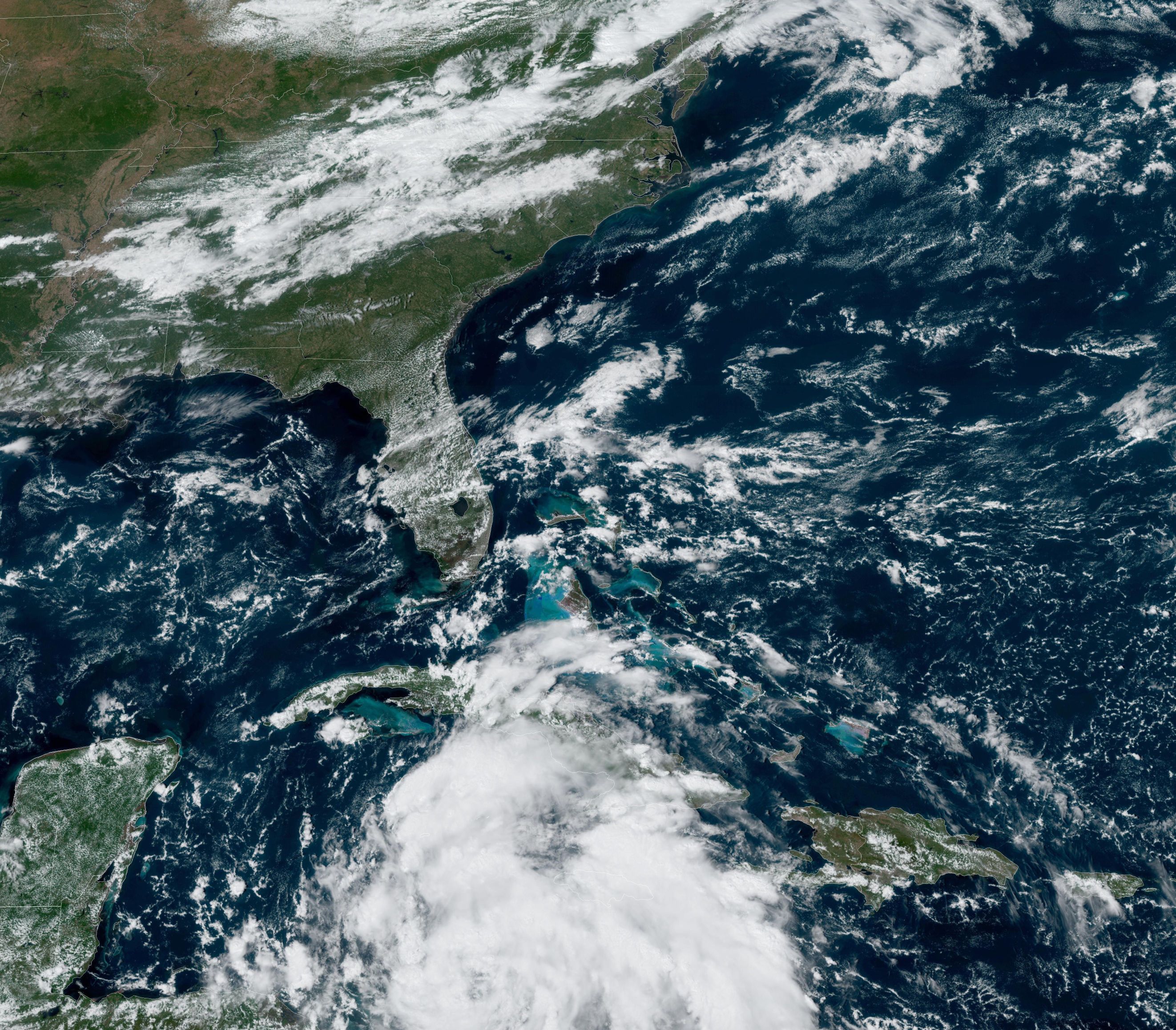
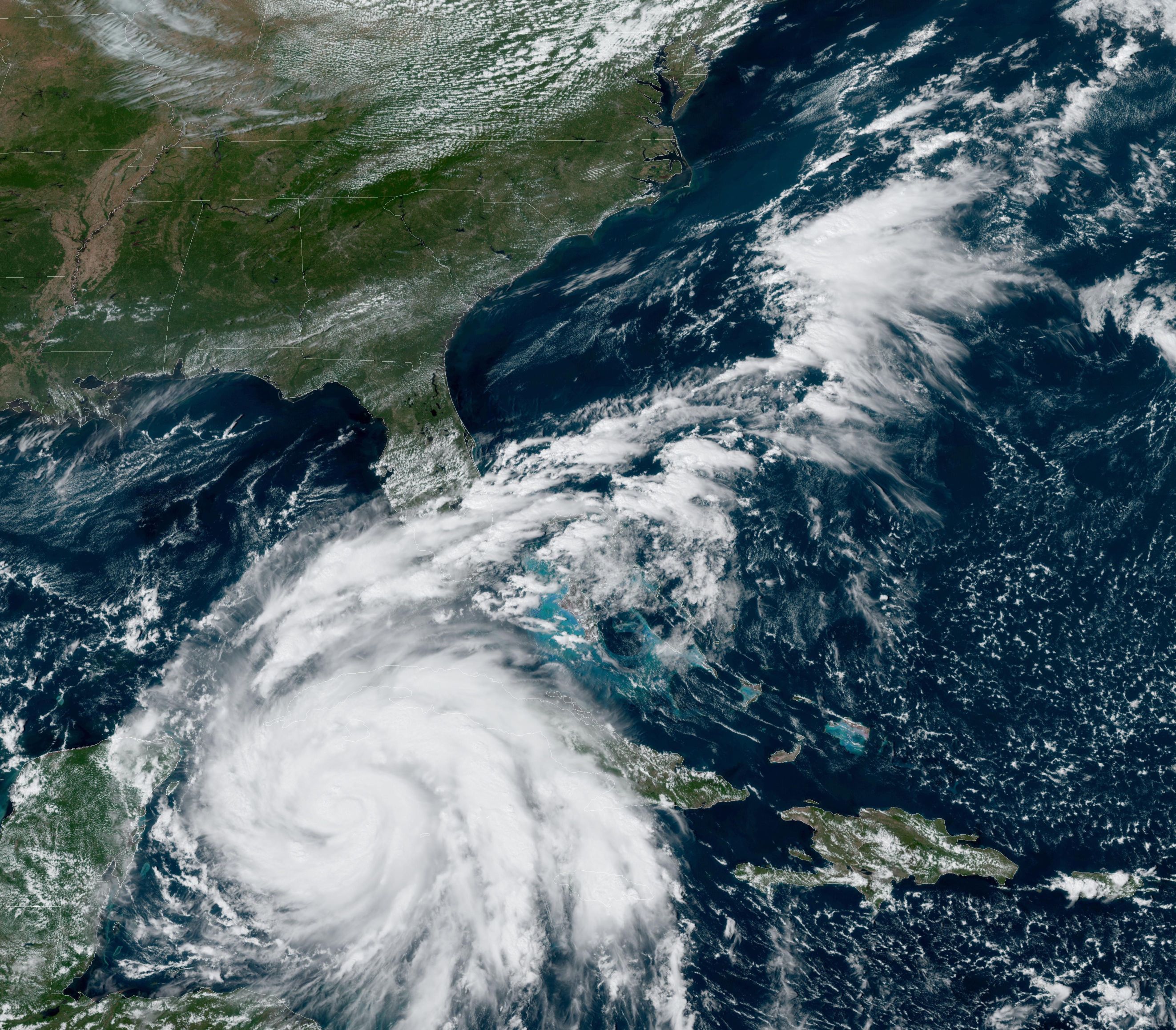
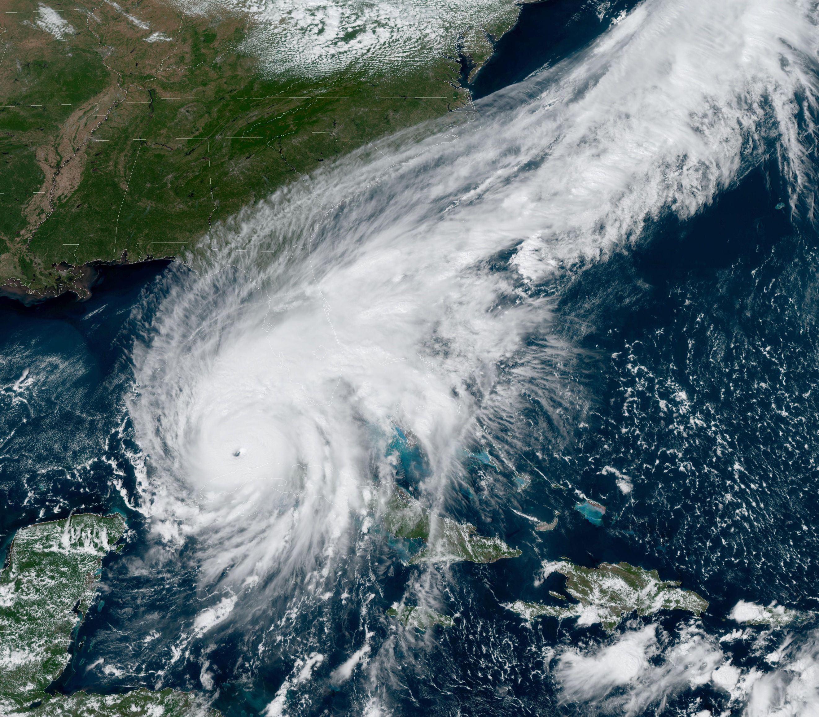
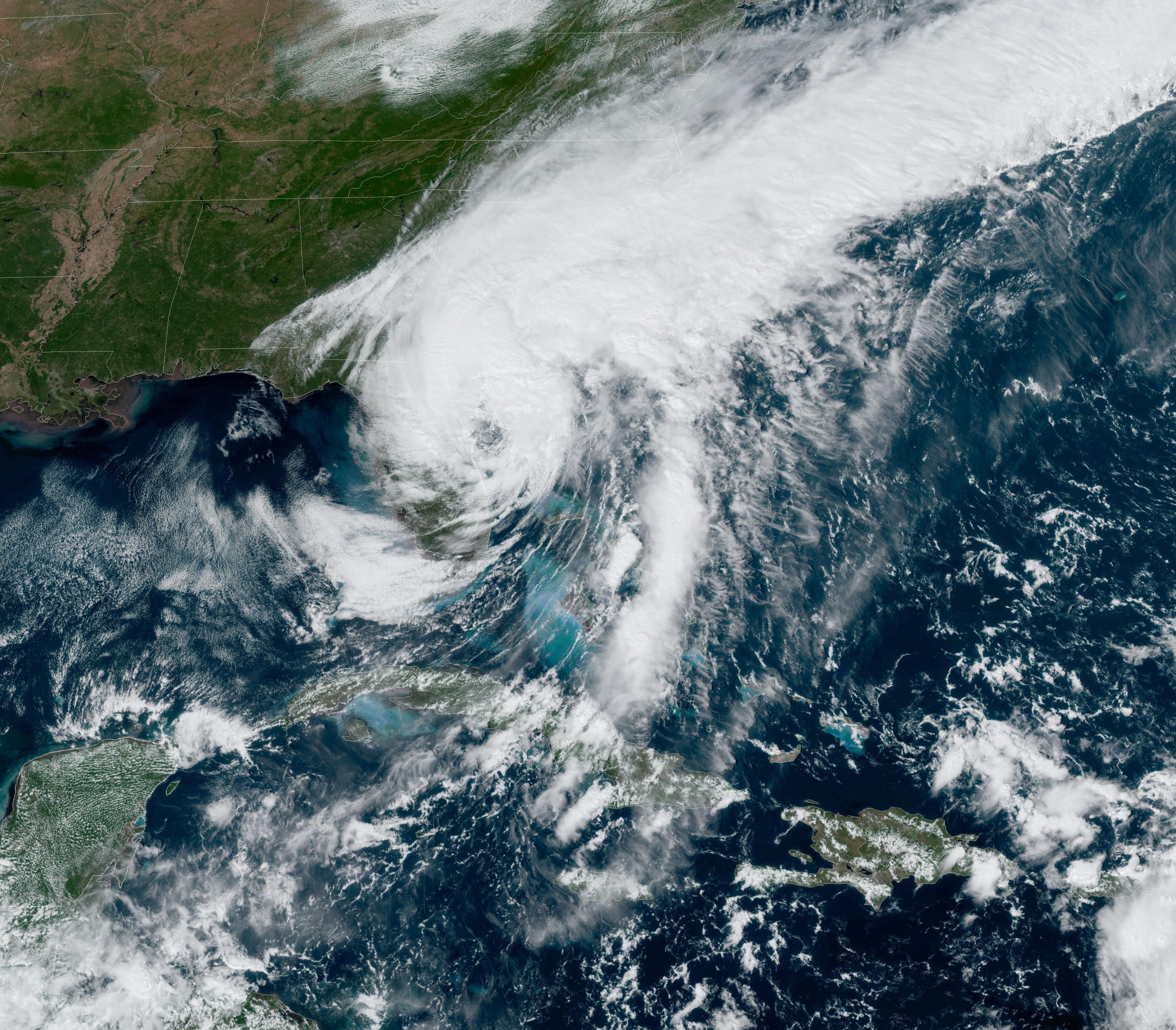
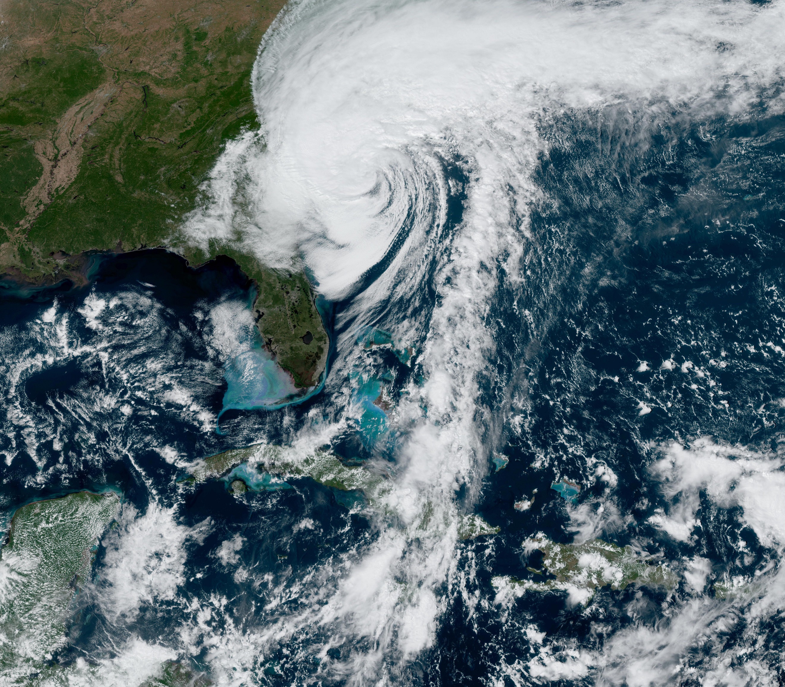
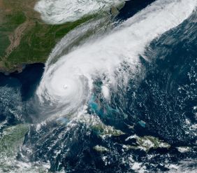
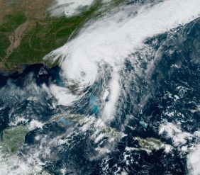
Satellite image Hurricane IAN, September 25 - 30, source:
NOAA
|
 |
 |
 |
 |
 |
 |
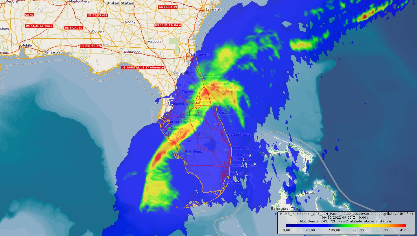
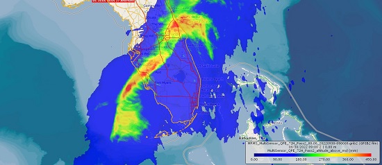
In addition to the significant damage caused by storms, IAN also caused flooding along its path due to heavy rainfall. Lee County (Sanibel Island) experienced flash flooding of 2.2 m, and several
stations in Florida reported daily precipitation values of more than 250 mm. Further, there were power outages and significant damage to infrastructure in Florida. Some villages are cut off and cannot be reached by emergency services.
More than 70 casualties were recorded in Florida, and at least 4 more in North and South Carolina.
|
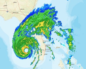
Precipitation related with IAN, September 28 - 30, source:
Rainviewer and NOAA
|
 |
 |
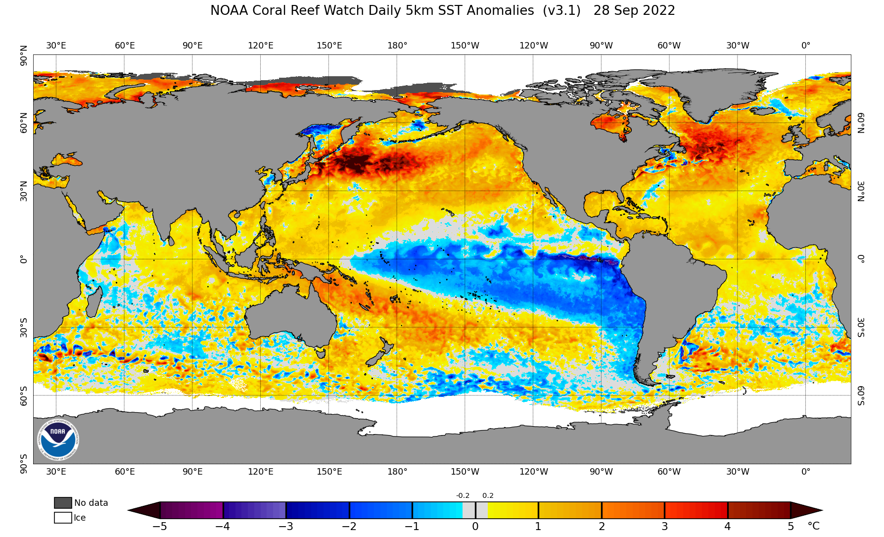
How will the Atlantic hurricane season continue after IAN? Although there is currently no other named system in the North Atlantic, current forecasts predict an above-average hurricane activity.
This is caused by a particularly pronounced Atlantic warm pool as well as a strong ENSO circulation (La Nina).
Text: FS
October 01, 2022
|