Severe Thunderstorms Central Europe
19 - 20 May 2022
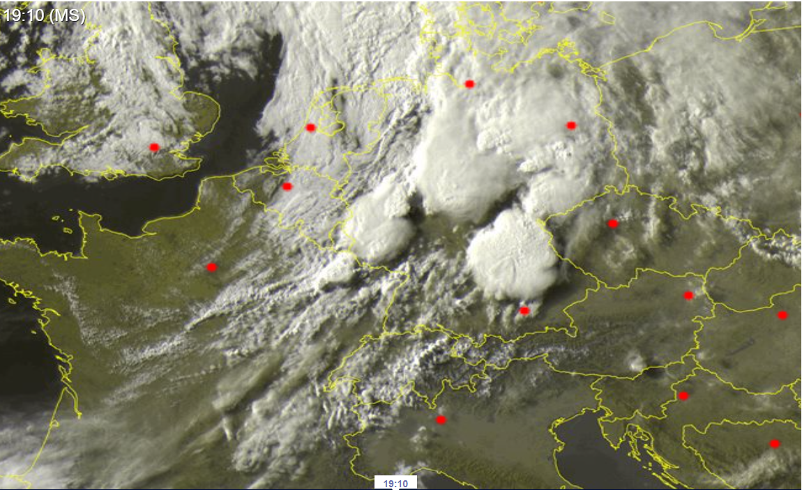
Satellite image of multiple MCS over Germany
Source: Sat24
On 19 May and 20 May two consecutive upper-level troughs caused severe thunderstorms in Germany and Central Europe. On both days the severest thunderstorm activity has been observed over the western part of Germany. The situation was preceded by the first heatwave of this year over Central Europe.
In the third week of May Central Europe has come under the influence of a ridge reaching northwards up to Central Scandinavia. In combination with a strong low south of Iceland Central Europe was under the influence of a southwesterly current, thus hot and moist air masses originating from the Mediterranean region were present over Central Europe. With 850 hPa temperatures reaching more than 15 °C over the southern part of Germany, the first days with more than 30 °C were recorded from 18 May onwards over the western part of Germany.
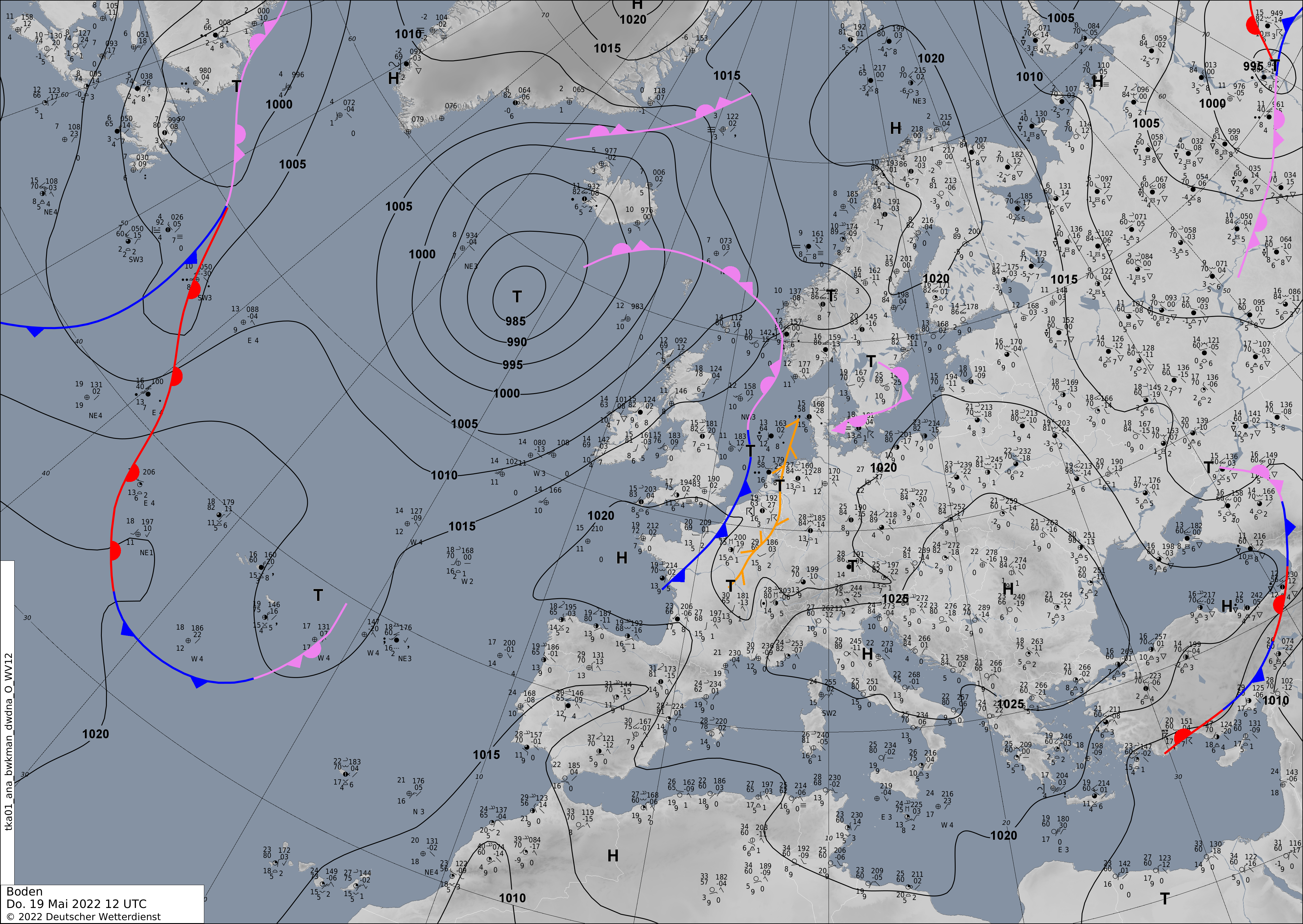
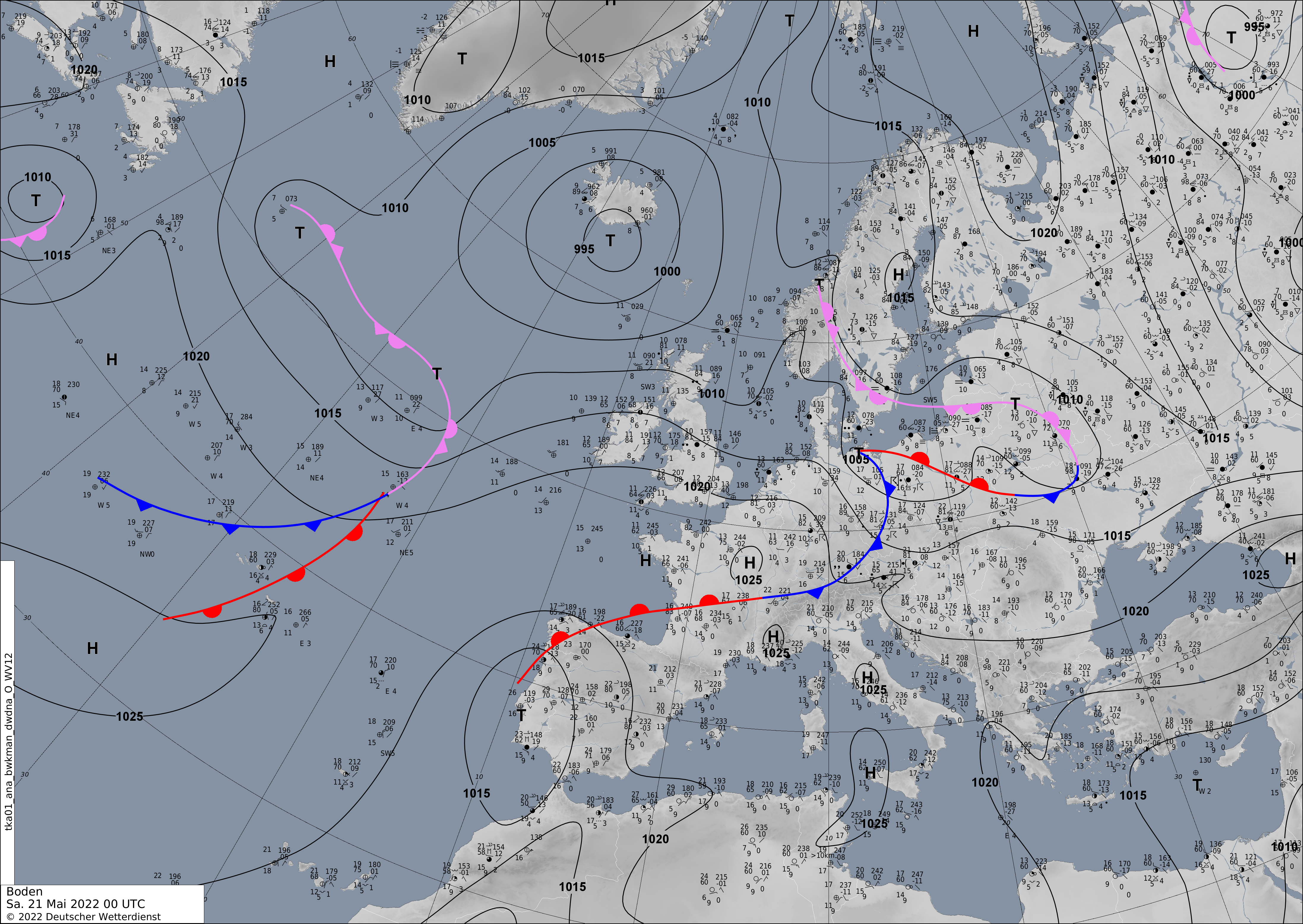
500hPa Geopotential and sea level pressure, 19.05.2022 12 UTC - 21.05.2022 00 UTC, source:
wetter3
Sea level pressure and fronts, 19.05.2022 12 UTC - 21.05.2022 00 UTC, source:
DWD
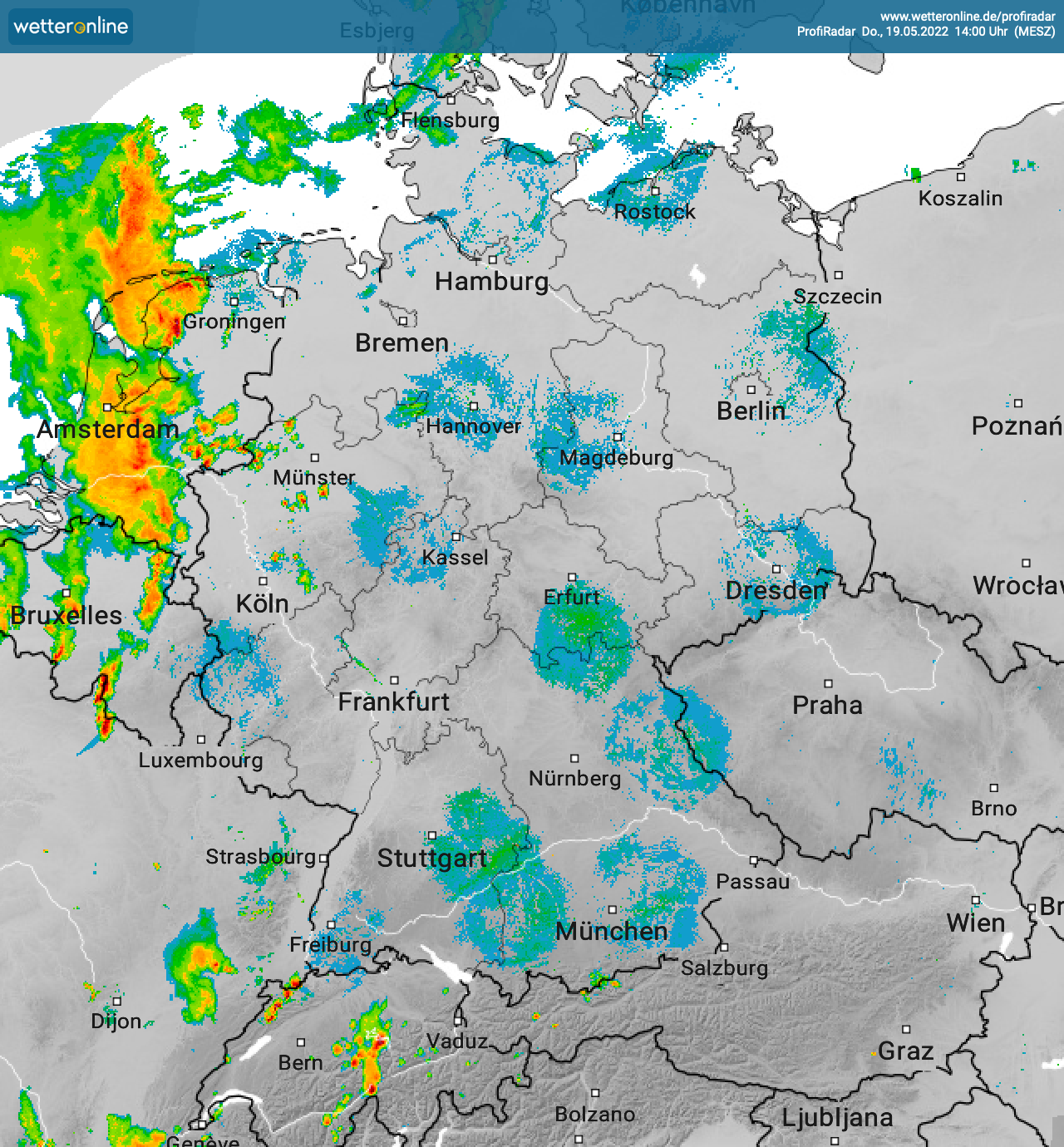
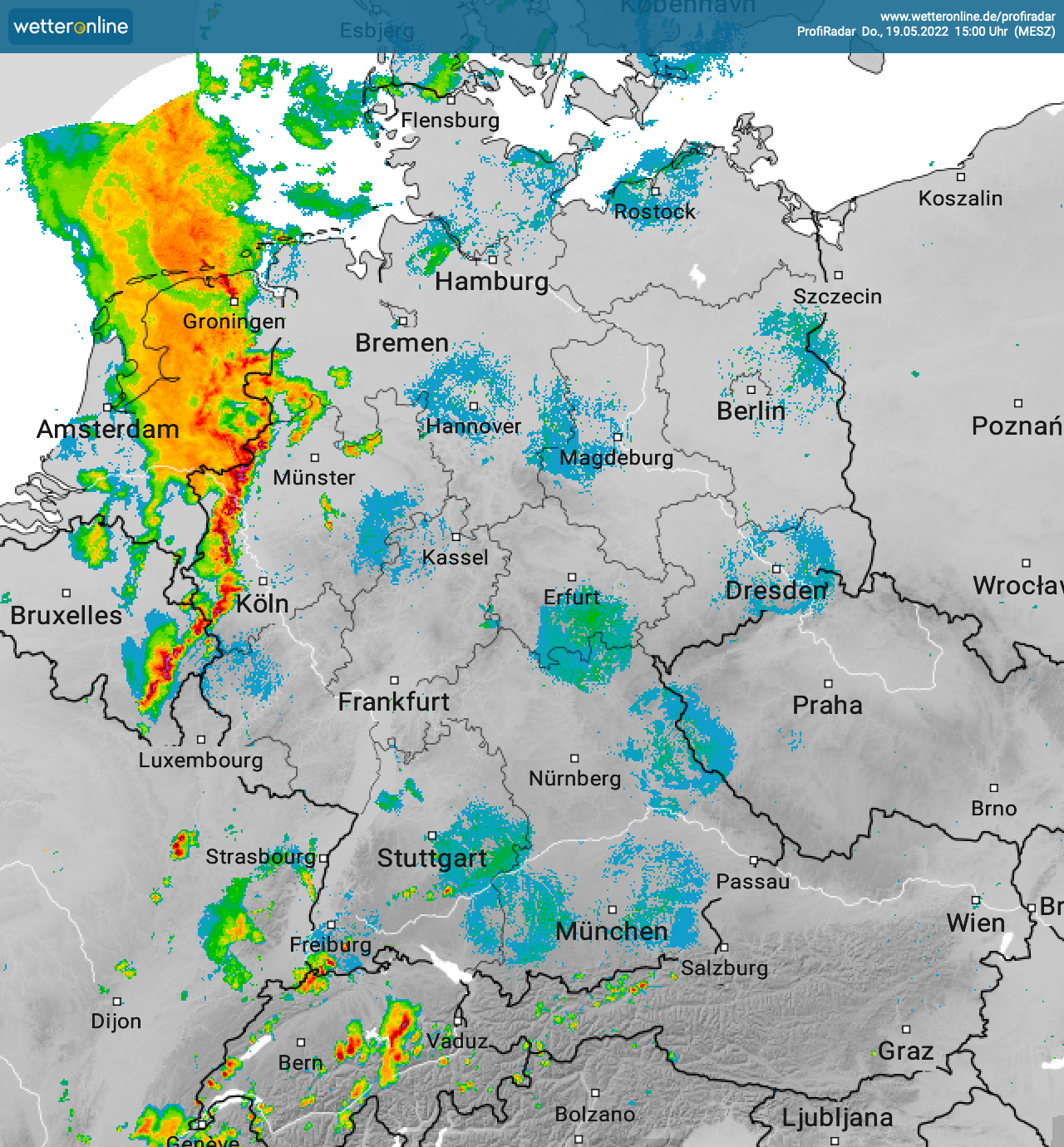
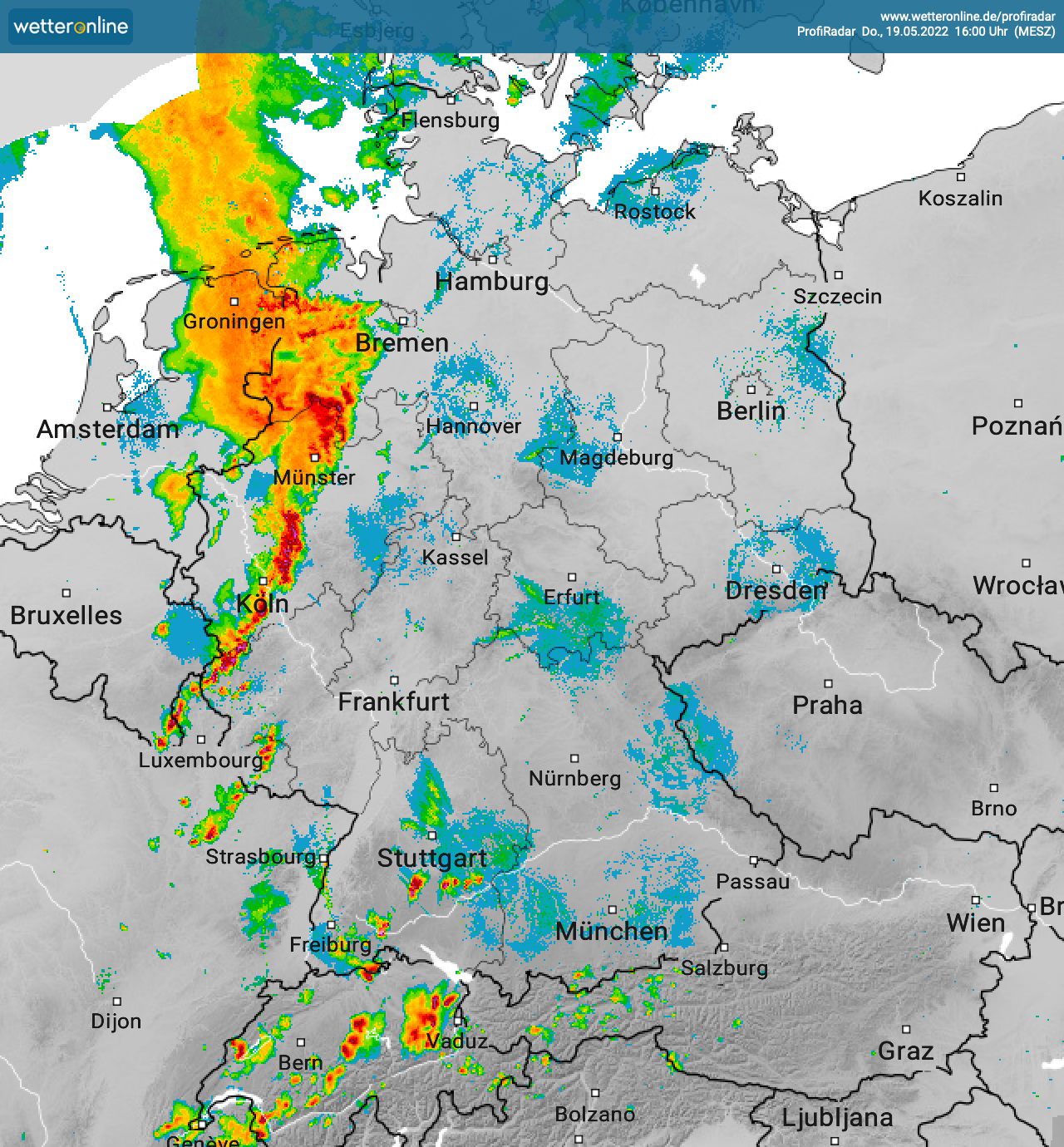
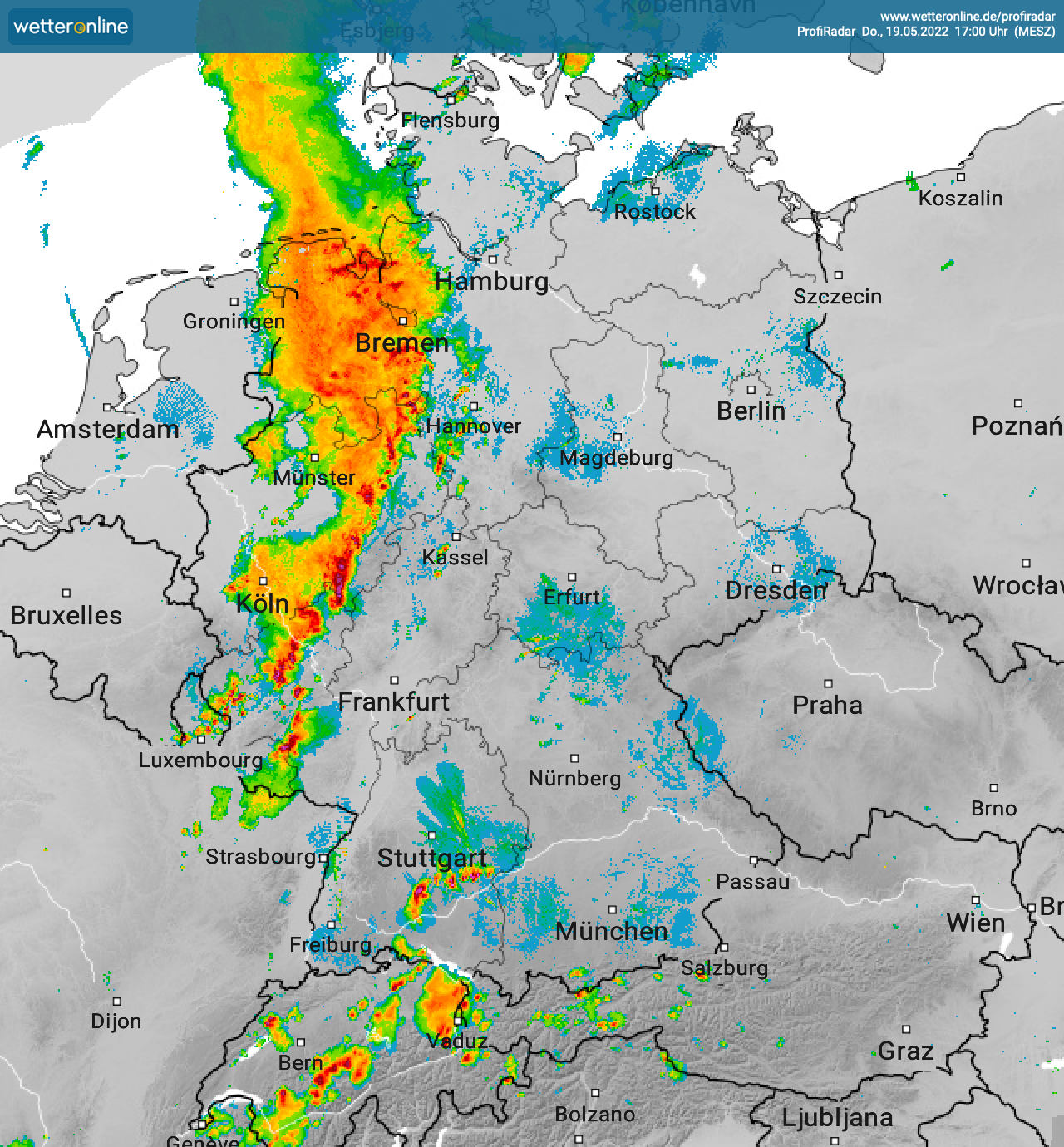
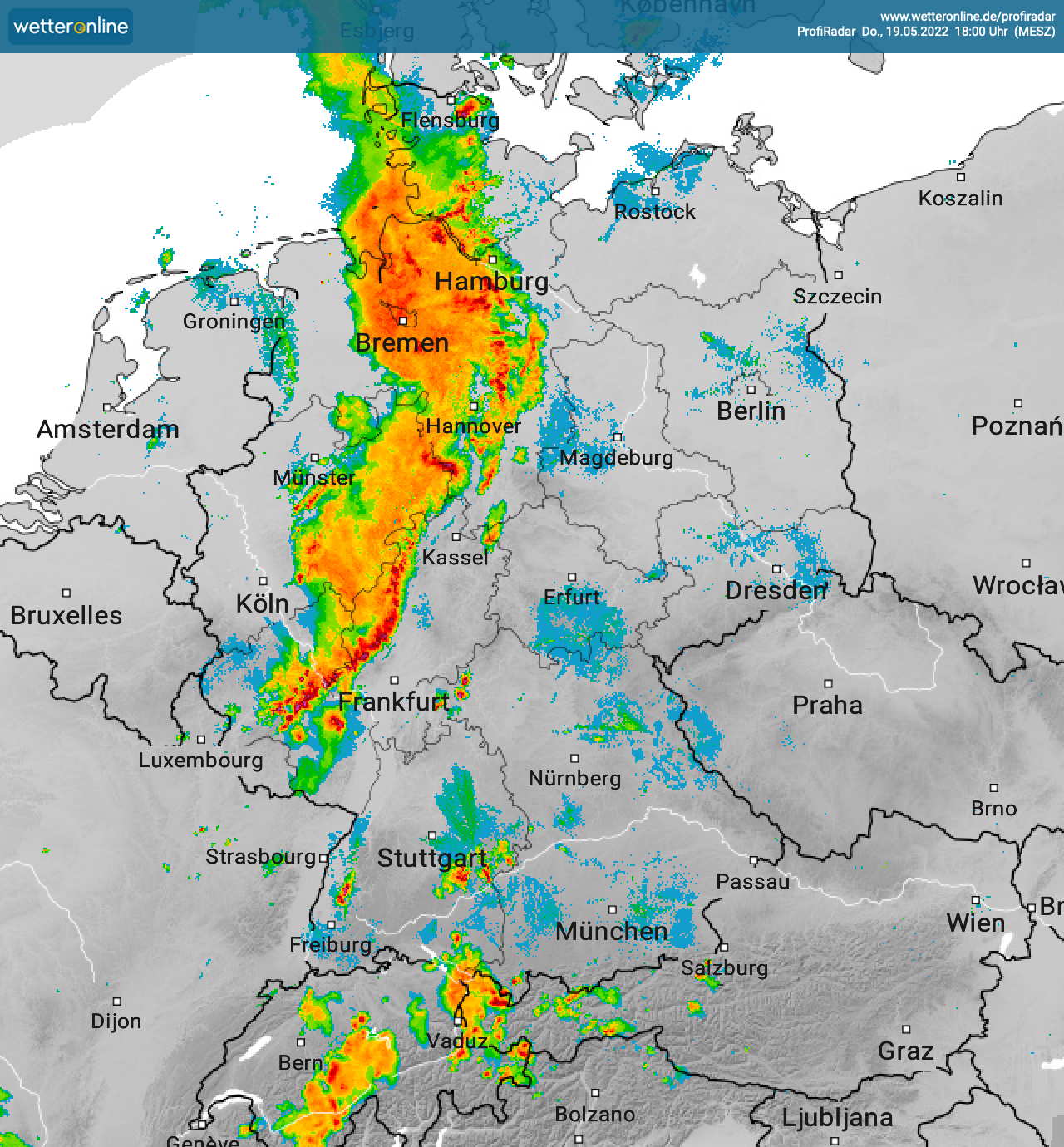
On 19 May the first upper-level trough moved northeastwards from the British Isles on the western flank of the ridge over the Netherlands and the northern part of Germany. The trough increased the southwesterly current, therefore the equivalent potential temperature reached more than 50 °C over the Benelux states and the western part of Germany. With precipitable Water reaching 30 mm to locally 35 mm in the same region, the lifting from the trough caused instabilities that lead to the development of the thunderstorms. In the afternoon hours a distinct squall line formed over the Netherlands moving into the western part of Germany. At 15 UTC the squall line spanned form Rhineland-Palatinate to the North Sea. Dissolving over the hilly regions of Rhineland-Palatinate it initialized secondary thunderstorms development over the Palatinate Forest in the evening hours.
Development of the squall line over Germany 19.05.2022 12 UTC - 16 UTC, source:
wetteronline
On 20 May the second upper-level trough accompanied by a surface low “Emmelinde” moved over northern Germany, with increased vertical shear. Atmospheric soundings of the station "Essen" in the western part of Germany already showed hook-like hodograph structure showing the potential for supercell development.
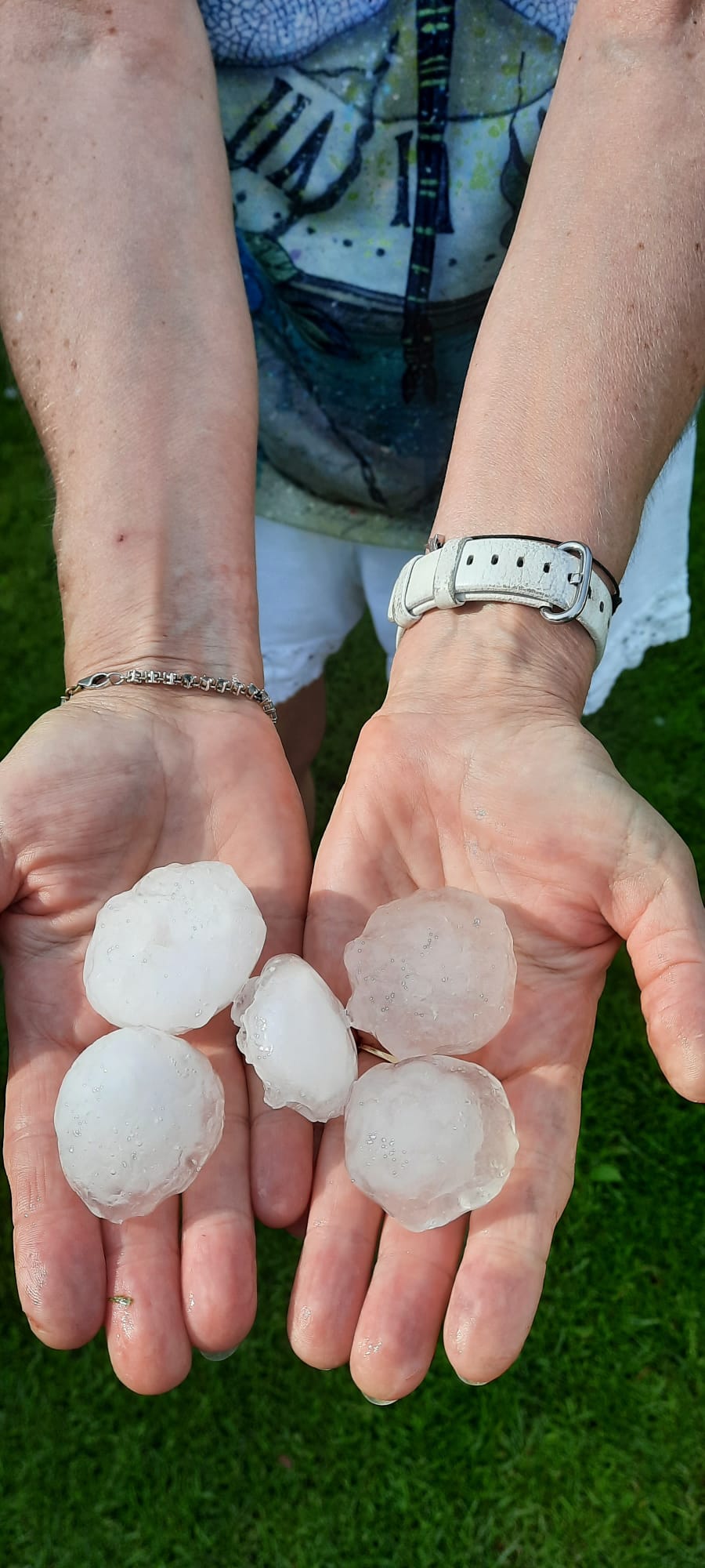
By 12 UTC radar images from the Benelux States showed strong cells moving eastwards into Rhineland-Palatinate and North Rhine-Westphalia. Over the Eifel Mountain range a particular strong cell developed, moving eastward into the so called “Neuwieder Becken” causing a hailstorm with hailstones reaching diameters of over 5 cm. High precipitation rates also caused localized flooding.
Impressions of Hailstones found in Kaltenengers (Rhineland-Palatinate), source: Jan Hillesheim
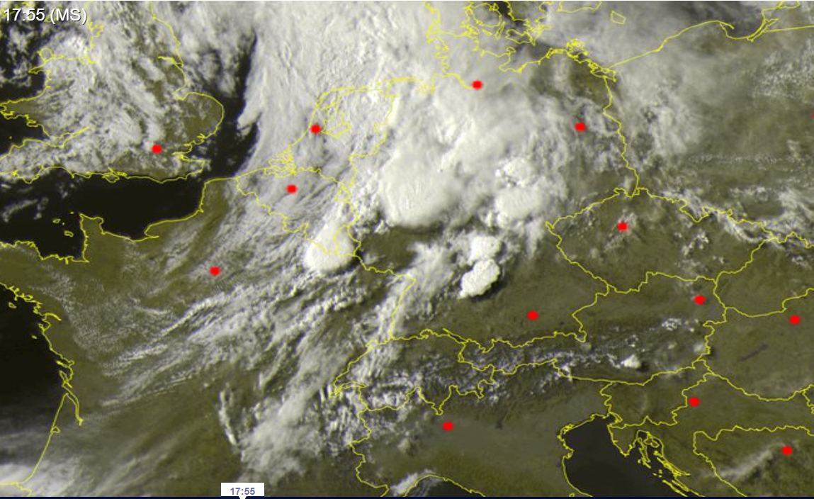
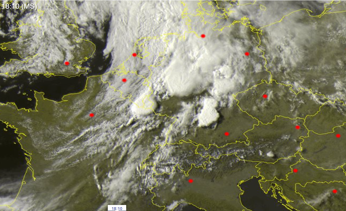
In North Rhine-Westphalia a supercell spawned multiple confirmed tornados. One tornado of this system hit the city of Paderborn causing widespread damage in the path of the tornado. Especially on the southern part of the region of convective activity consecutive convective development was observed. In the evening hours long tracked supercells moved eastwards over the central part of Germany, reaching the Czech Republic by 18 UTC.
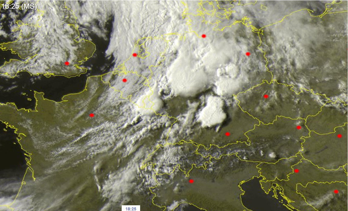
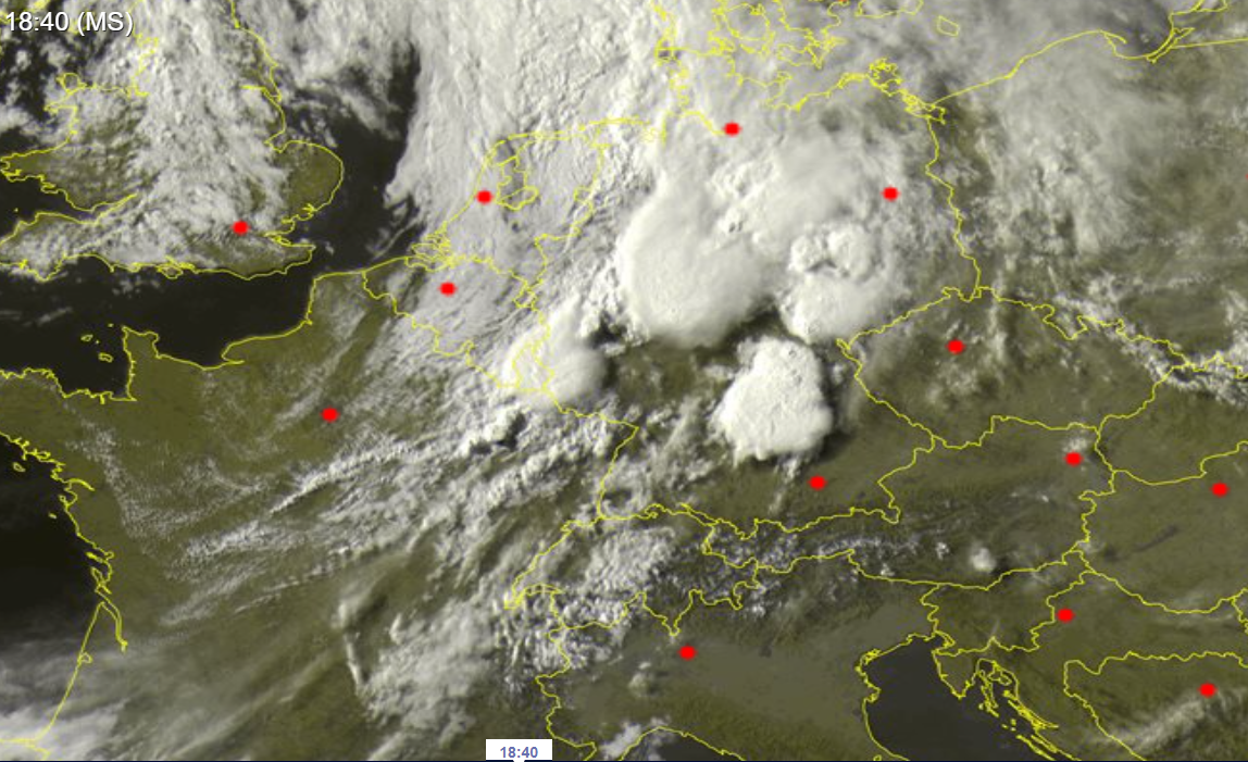
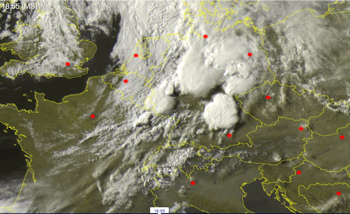
Satellite imagery (visible) of the convective development over Central Europe, 20 May 2022, 15:40 UTC - 17:10 UTC, source:
Sat24
In the first part of the night the convective activity over Central Europe died down, as the cold front moved south-eastwards over Germany, ending the first severe thunderstorm activity over Central Europe of this summer season.