|
Hurricane Henri was the eighth named storm, and the third hurricane of the 2021 Atlantic hurricane season. First tropical cyclone
to make landfall in the state of Rhode Island since Hurricane Bob in 1991. 19.4 mm/h in New York. 116 kph on Great Gull Island.
On 14 August, a minor depression formed about 320 km north-northeast of Bermuda with non-organised convection and thunderstorms.
On this day, the National Hurricane Center (NHC) designated the weather system as an area of potential tropical cyclogenesis
for the first time as the depression drifted south. Thunderstorms became more organised on 15 August. By early morning on
16 August, the NHC classified the system as Tropical Depression Eight, located about 230 km east-northeast of Bermuda.
Moderately warm (but not extraordinarily warm) water temperatures, provided basically good conditions for the formation of a
tropical system, but vertical wind shear initially inhibited rapid cyclogenesis. The developing depression moved slowly in a
southwesterly direction, circulating around a ridge of high ground off the coast of the eastern United States and, at the same time, the
Bermuda Islands. Later that day, the intensity of deep convection near the centre intensified and the system was declared Tropical Storm HENRI.
|
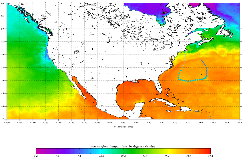
Sea surface temperature Northern America, 21 August, with overlayed trajectory of HENRI, source:
NOAA
|
 |
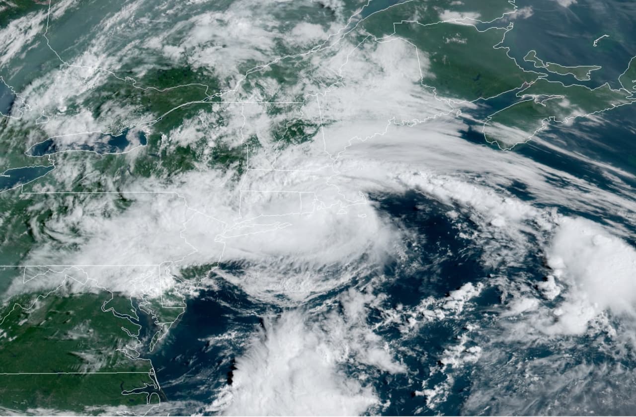
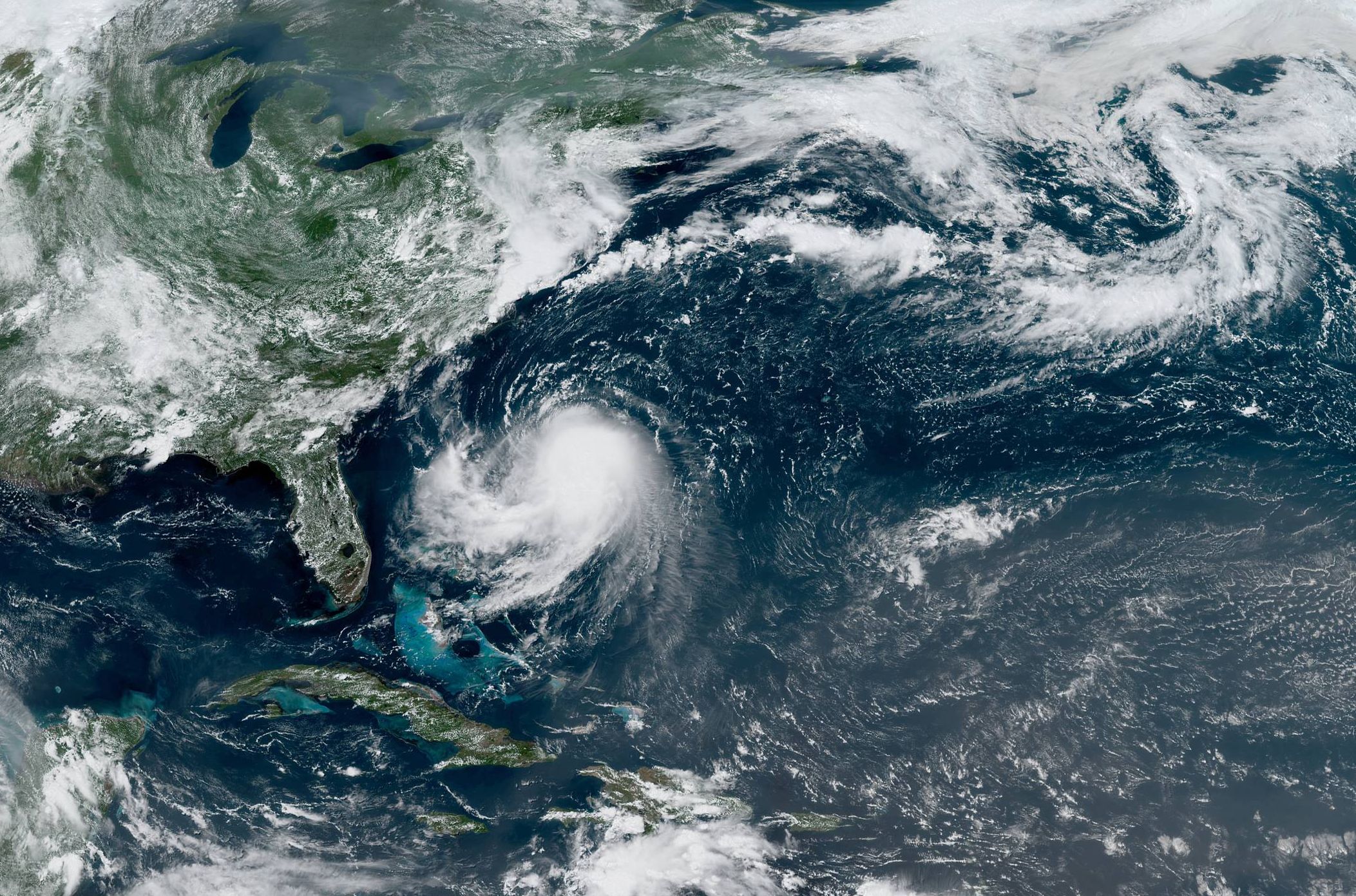
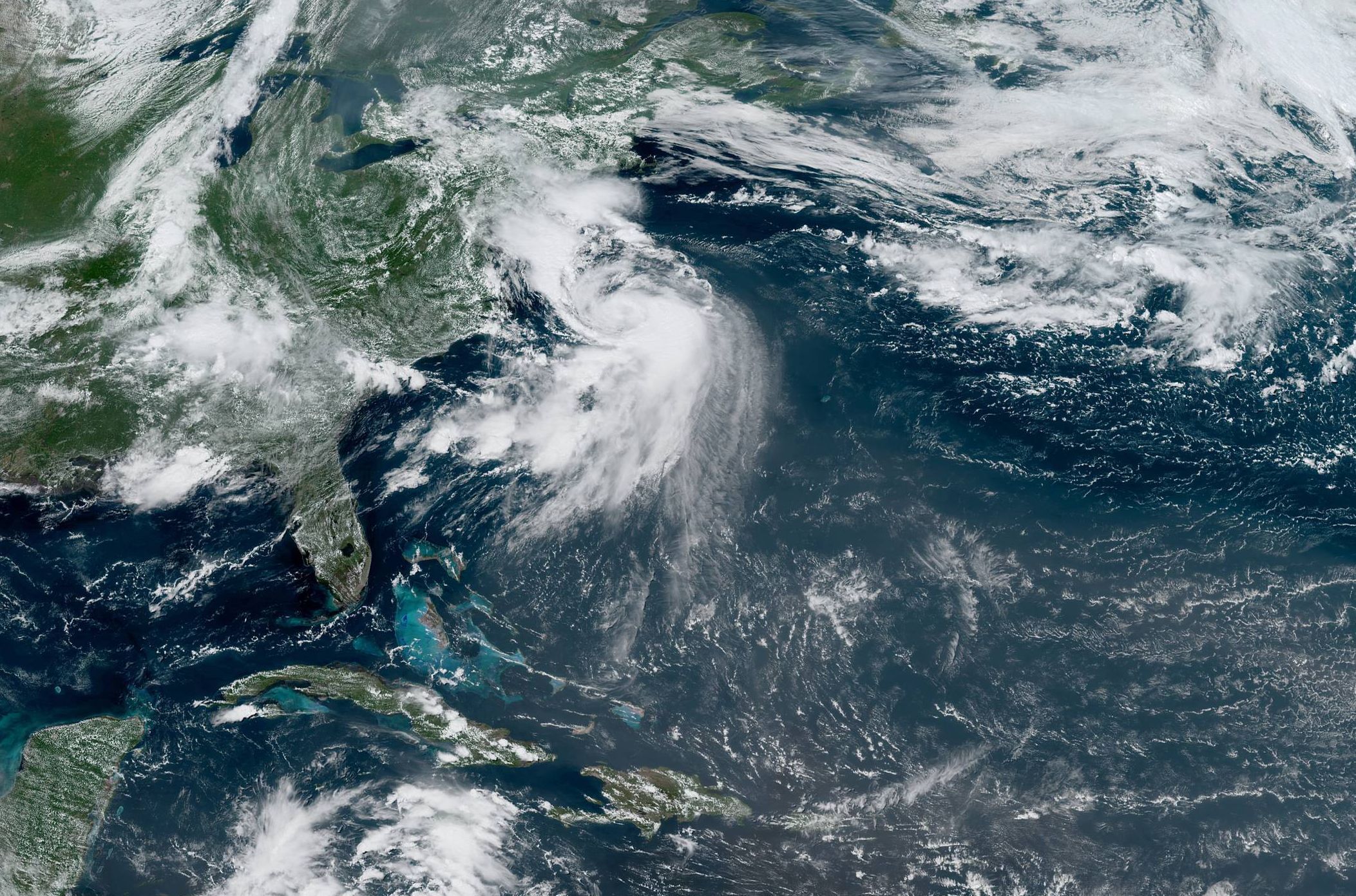
On 17 August, HENRI moved west along 30° northern latitude towards the eastern United States. Convection developed
into curved rainbands and an eye of the storm was visible on the rain radar from Bermuda, but still influenced by wind shear.
The shear and dry air caused the storm's structure to worsen on 19 August. On 20 August, HENRI turned north, steered
by an approaching trough over the Appalachians and a ridge forming to the northeast of the storm. The storm thus moved
back into more northerly waters and remained north of 29°N throughout its life cycle. Strictly speaking, therefore,
the tropical cyclone was never in the tropical region of the earth, which (depending on the definition) extends to a
maximum of 25°N. As can be seen impressively on the satellite images, the system was nevertheless partly fed with
tropical air, which was sucked into the centre of the storm on the southeastern flank.
|
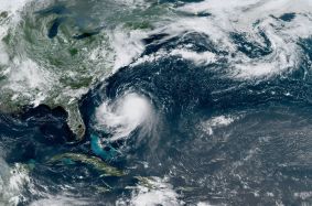
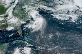
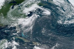
Satellite image (visible) from Hurricane HENRI on 20, 21 and 22 August, 18 UTC , source:
NOAA
| and
 |
 |
 |
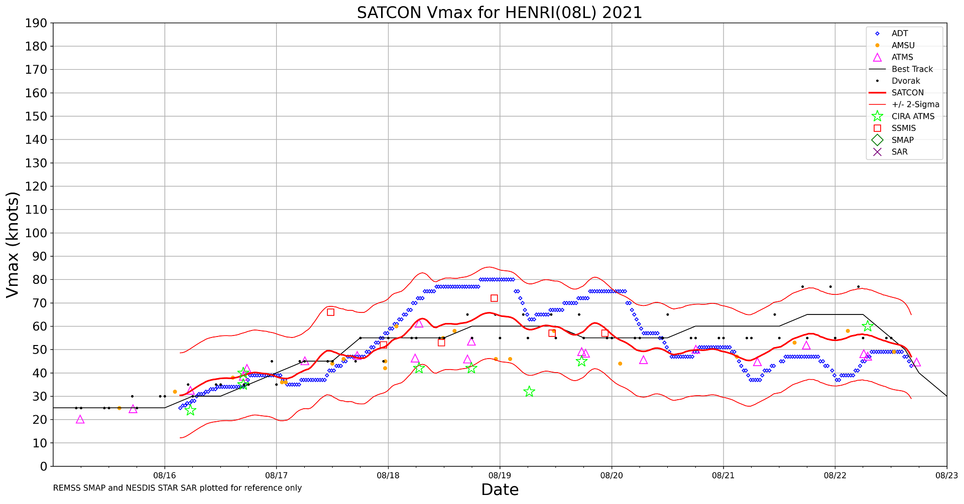
Although the external conditions were not optimal, the energy supply over the warming waters near the US coast was
sufficient for HENRI to be classified as a hurricane at 15:00 UTC on 21 August, after reconnaissance aircraft detected
hurricane-force winds. The persistent wind shear meant that HENRI never showed a clearly visible eye in the satellite
image despite its hurricane strength, and the system's storm structure was also under asymmetry throughout its life cycle.
Heading north, the system maintained its hurricane strength until 11:00 UTC on 22 August, when it approached southern New
England. The storm made landfall near Westerly, Rhode Island, at 16:15 UTC on 22 August with maximum sustained winds of
60 mph (95 km/h). Due to the much colder water temperatures off New England (less than 23°C near the coast), the hurricane
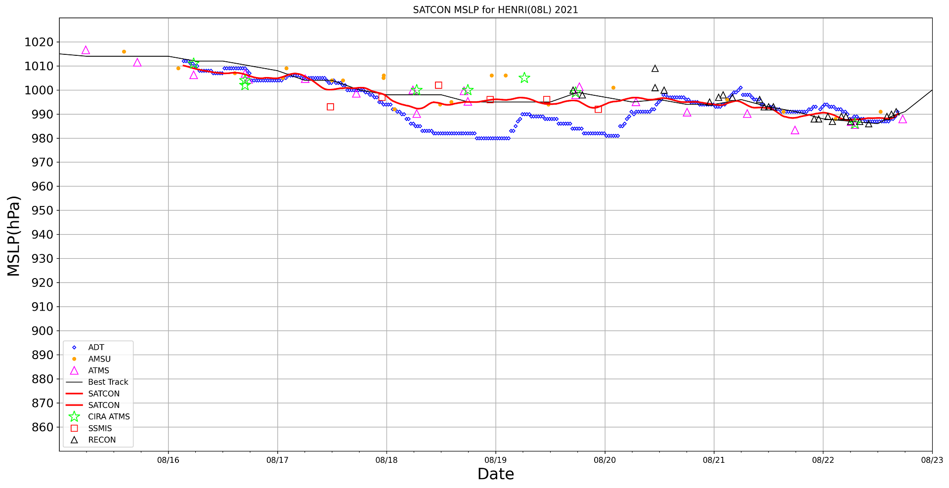
began weakening several hours before making landfall. As can be seen in the time series below, HENRI underwent an only very weak
intensification, but fluctuated at the lower edge of Category 1 Hurricane strength and the upper edge of a Tropical Storm status for multiple days.
The impact of Henri caused power outages in large parts of New England and at least 140,000 homes. In just one hour, a
record 19.4 mm of rain fell in Central Park, the highest precipiation in one hour ever recorded at a New York City station.
More than 50 mm fell in Brooklyn on the night of 21 August, and 40 to 50 mm fell in other parts of the city. A total of
113 mm fell on 21 August, the highest daily rainfall ever recorded in the city. In eastern Long Island, on Great Gull Island,
a wind gust of 116 kph was recorded. In the town of Cranbury, New Jersey, total rainfall exceeded 200 mm. Flooded streets
resulted from flash flooding. In the early afternoon of 22 August, over 4,500 people were without power in the state of New Jersey.
|
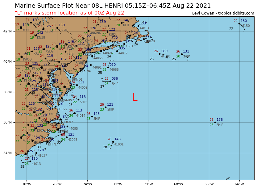
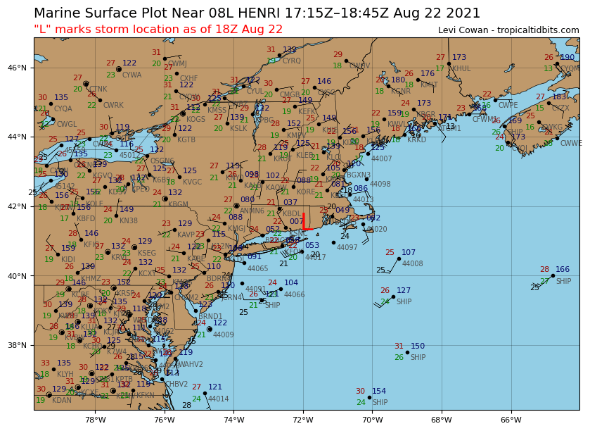
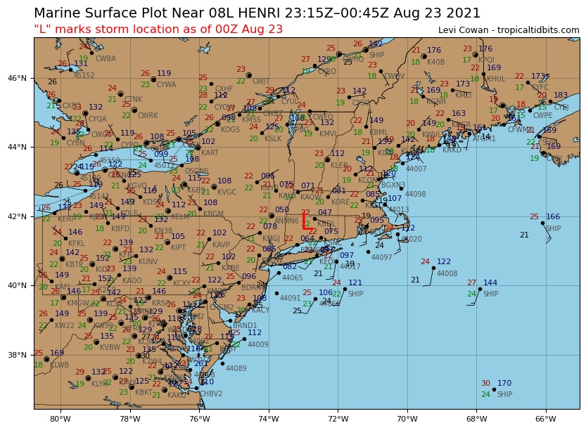
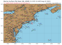
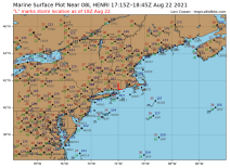
Surface observations near Hurricane HENRI from August 22 06 UTC to August 23 00 UTC, source:
Tropical Tidbits
|
 |
 |
 |
 |
|
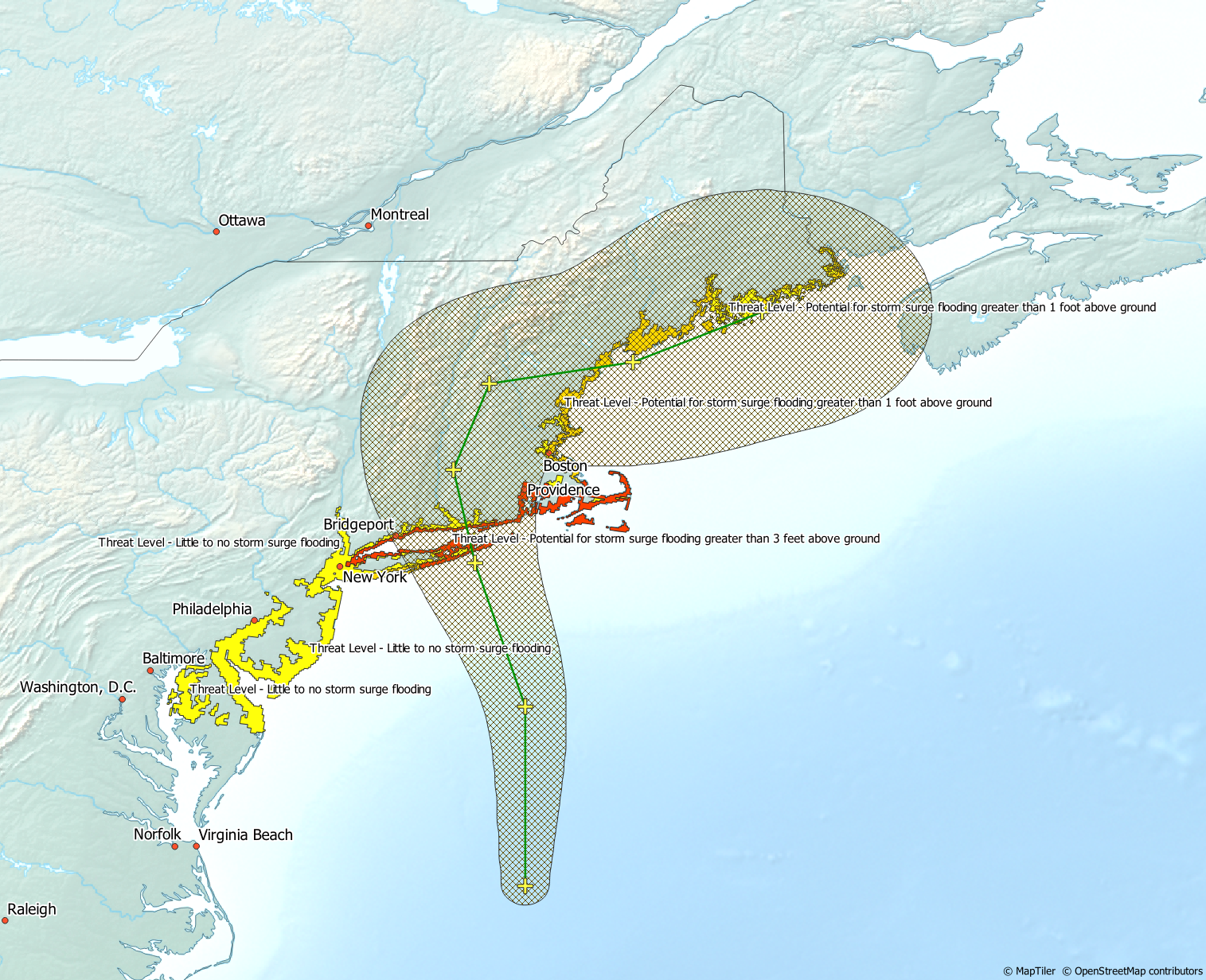
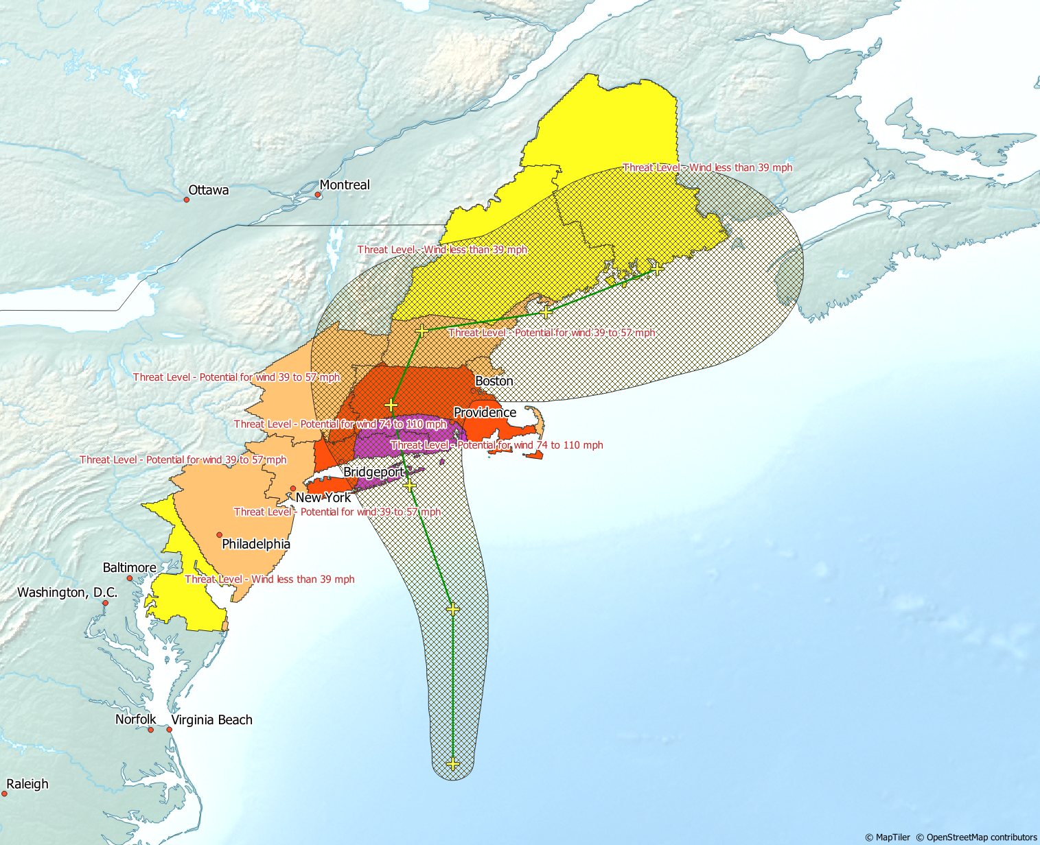
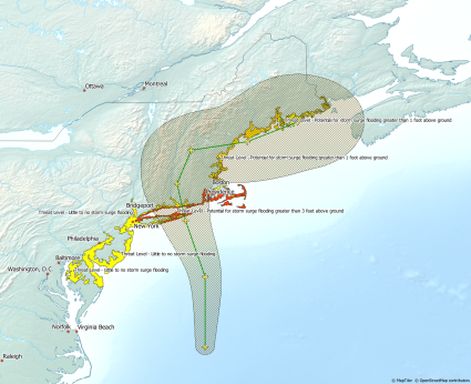
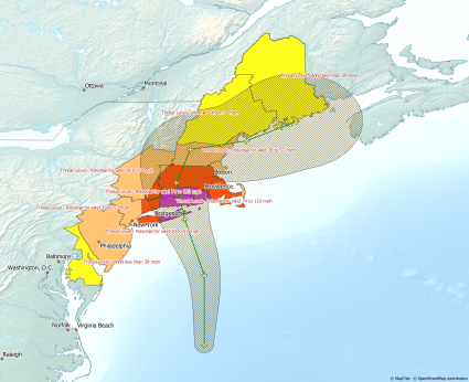
Storm surge height and wind field extension, Data source:
WeatherCAN, Visualisation: Bernhard Mühr,
|
 |
 |
Text: FS
August 23, 2021
|