|
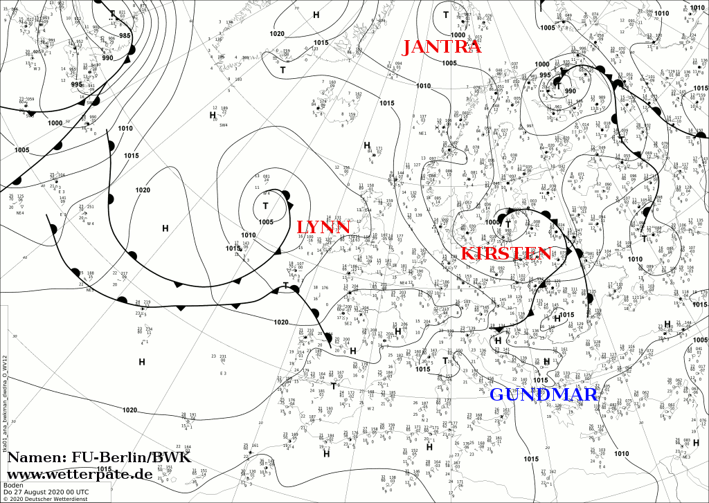
At the end of August Windstorm KIRSTEN caused gusts of up to 144 km/h (Brocken) in Germany and gusts of 120 km/h (Lake Vyrnwy) were registered in Great Britain.
KIRSTEN was a Shapiro-Keyser cyclone. For a storm low like KIRSTEN it is unusual that these occur during summertime.
Weather Situation
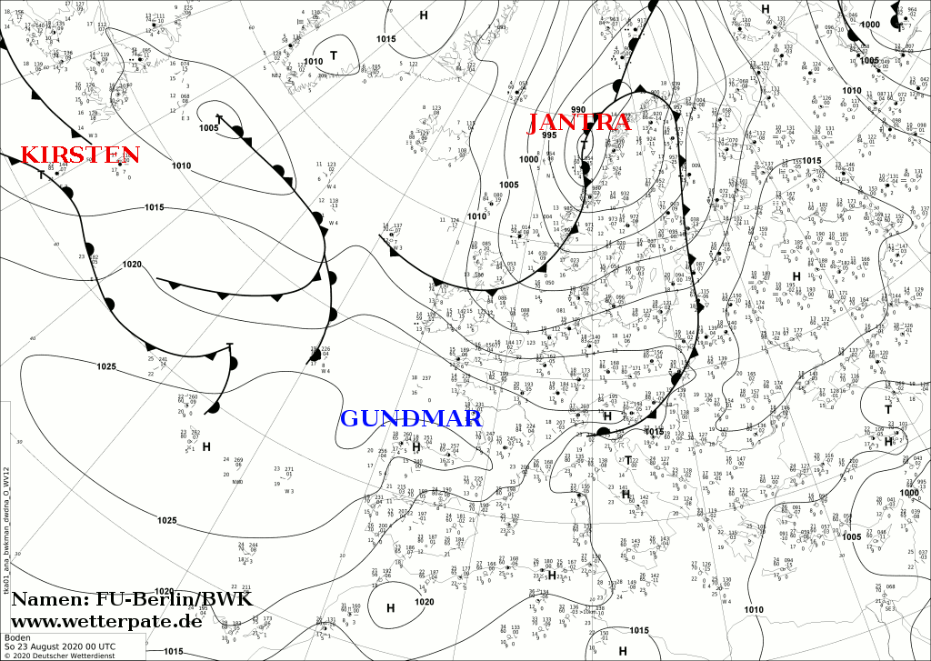
Storm low KIRSTEN developed from a wave disturbance in the front of a shallow long wave trough. While hot summerly high pressure weather had prevailed over
Europe the days before, KIRSTEN moved quickly eastwards and intensified into a storm low on the evening of August 24th. In the night of Tuesday it
reached Ireland and Great Britain, in the night of Wednesday it reached the BeNeLux States and Germany. In the further course storm KIRSTEN moved
to Eastern Europe.
|
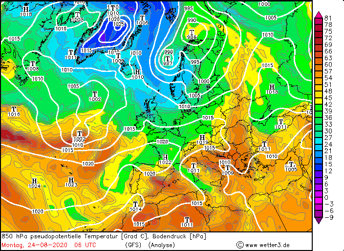
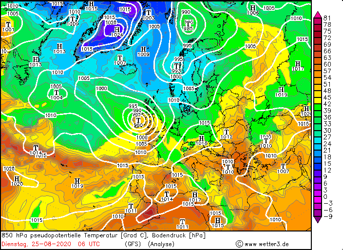
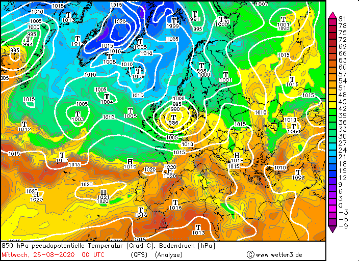
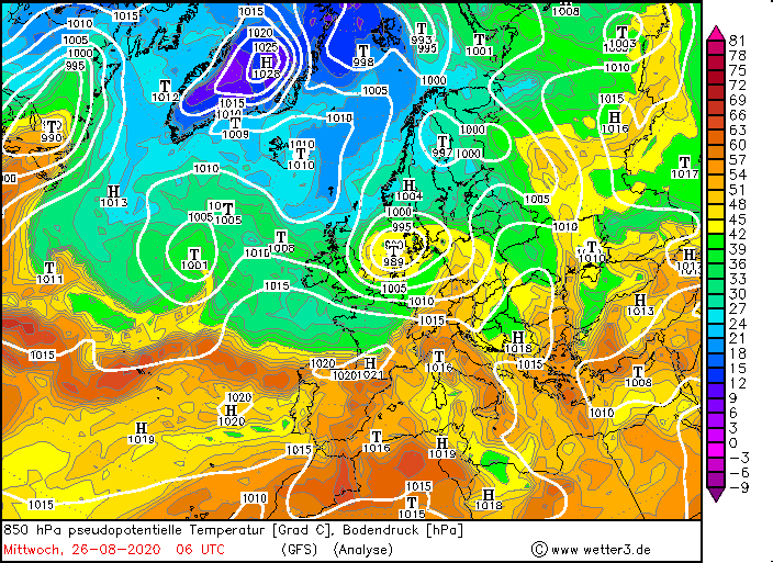
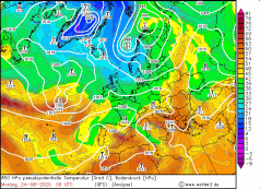
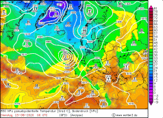
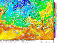
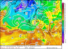
850 hPa equivalentpot. Temperature, October 24-26, 2020:
Wetter3
|
 |
 |
 |
 |
Development
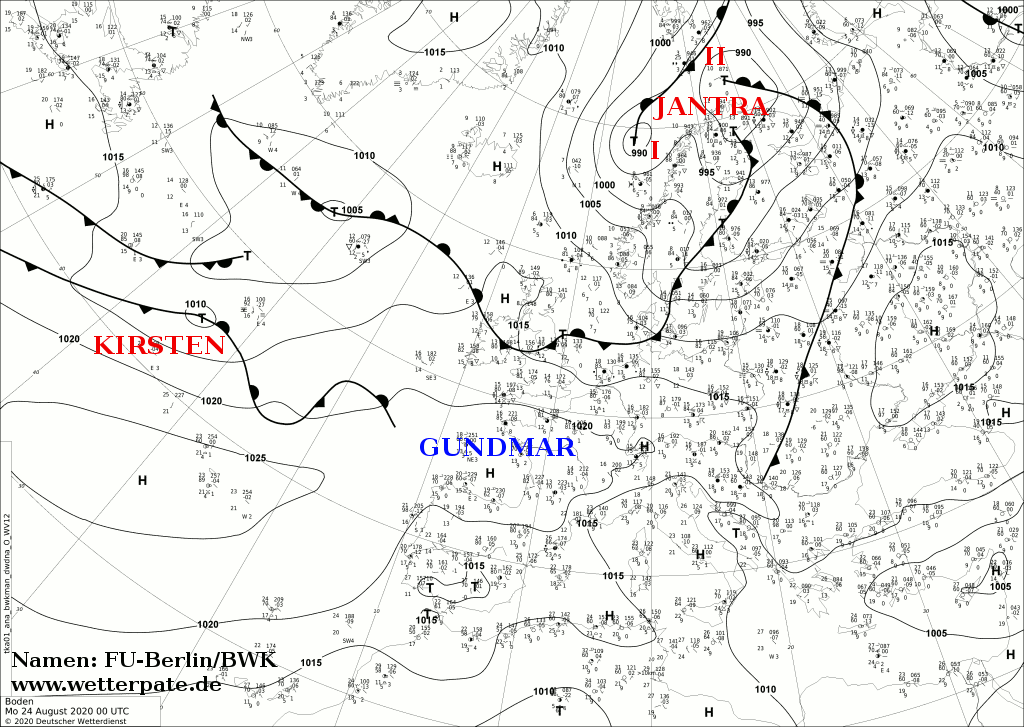
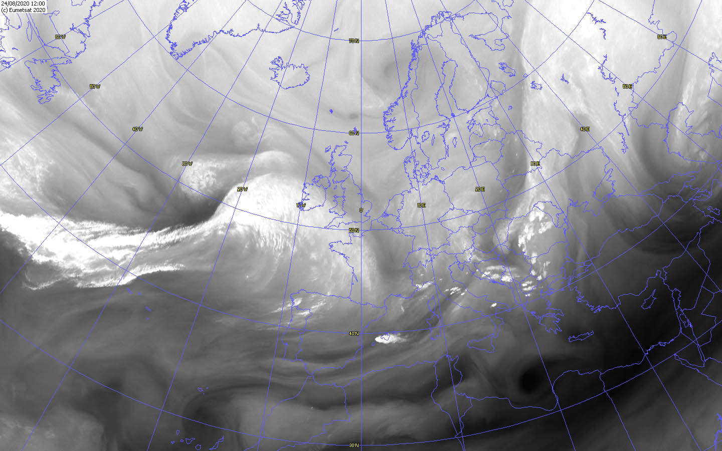
Storm low KIRSTEN was registered for the first time on August 23rd over the western Atlantic as a wave disturbance and lay in the middle of the frontal zone in
front of a shallow long wave trough. In addition, the wave disturbance was favorably located between two weak jet streams. As a result, KIRSTEN intensified
rapidly on 24 August and also shifted rapidly to the east, reaching the coast of Ireland in the evening of 24th August and the night of 25 August. Its core
pressure dropped from 1008 hPa to 985 hPa in just 24 hours. However, the fast intensification was not only due to the jet streams, but also to a dry intrusion.
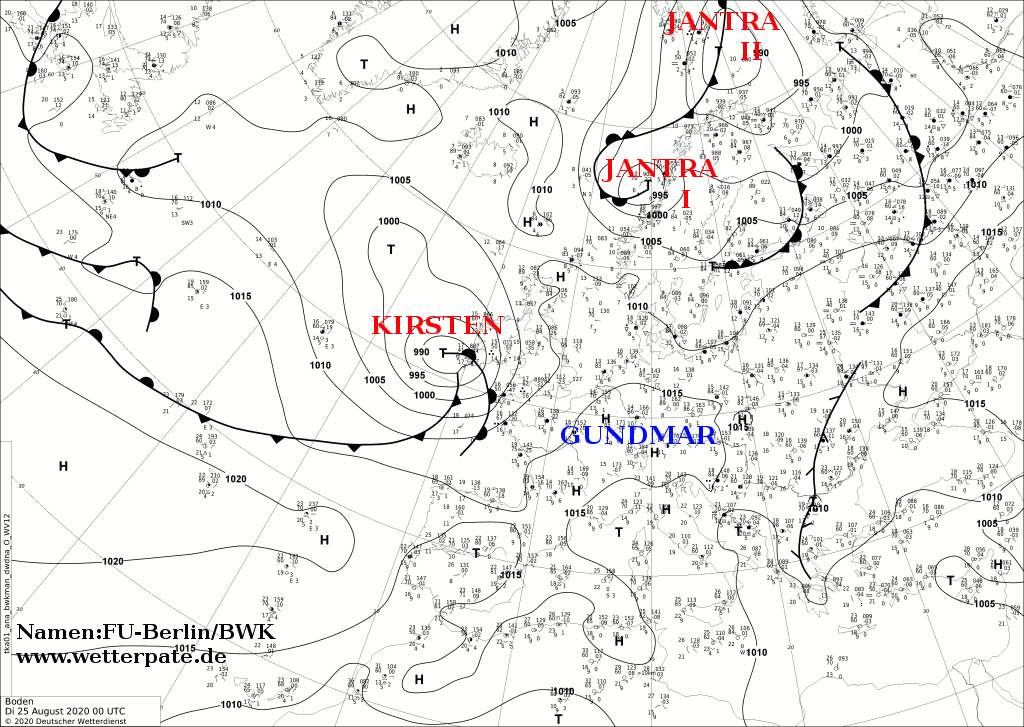
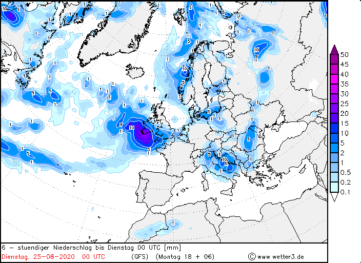
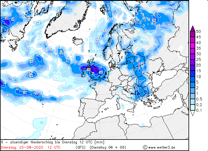
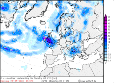
Its pressure continued to drop on August 25th, causing the air pressure gradient to intensify, making its storm field stronger as well. In Great Britain, gusts
of around 120 km/h were reached, and near the ground around 80 km/h. In addition, KIRSTEN caused heavy precipitation due to its pronounced warm front and its
warm front clouds. Locally, 40 to 60 mm fell in 24 hours. It is typical for a Shapiro-Keyser cyclone that the warm front is significantly prominent due to its
massive cloudiness and carries heavy to torrential precipitation. The cold front, on the other hand, is only weakly pronounced and only slightly weather-active.
|
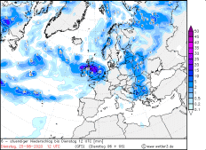
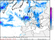
Precipitation amount, August 25, Source:
Wetter3
|
 |
 |
 |
 |
KIRSTEN's rate of displacement decreased from August 25th onwards, as the pronounced ridge with its ground high was still located above Southern and Central Europe.
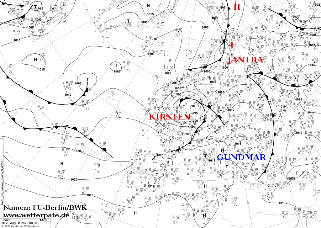
Nevertheless, KIRSTIN made it across the North Sea to Germany and the BeNeLux countries in the night of August 26. Although the core pressure began to rise, gusts
of 144 km/h were measured on the Brocken in Germany. Also the Feldberg, the Fichtelberg and the Weinbiet registered gusts above 100 km/h. Already the evening before,
the air pressure gradient increased and gusts of almost 100 km/h were measured in exposed areas. After that KIRSTEN shifted rapidly across the Baltic Sea to Eastern
Europe and gradually weakened.
|
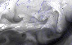
Satellite images, August 24-26, Source:
Wokingham
|
 |
 |
 |
 |
|
Satellite images (WV), August 24-26, Source:
Wokingham
|
 |
 |
 |
 |
Unusual was above all that KIRSTEN was a remarkable storm low, which is rather rare for this season, i.e. in summer. Even though the wind speeds were weaker compared
to storm lows in autumn and winter, the risk of damage was greater. The trees are all still fully leafy at this time of year and thus offer the wind a larger surface
to attack. In addition, most of the trees are extremely dry due to the dry summers of recent years, which further increases the risk of breaking branches and trunks.
Throughout Germany, damage and traffic obstructions were caused by fallen trees or broken branches. In addition, there were also local problems due to enormous
visual obstructions caused by sandstorms.
Text: MG
September 02, 2020
|