|
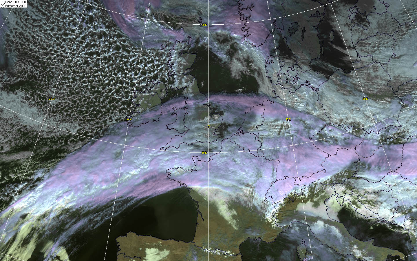
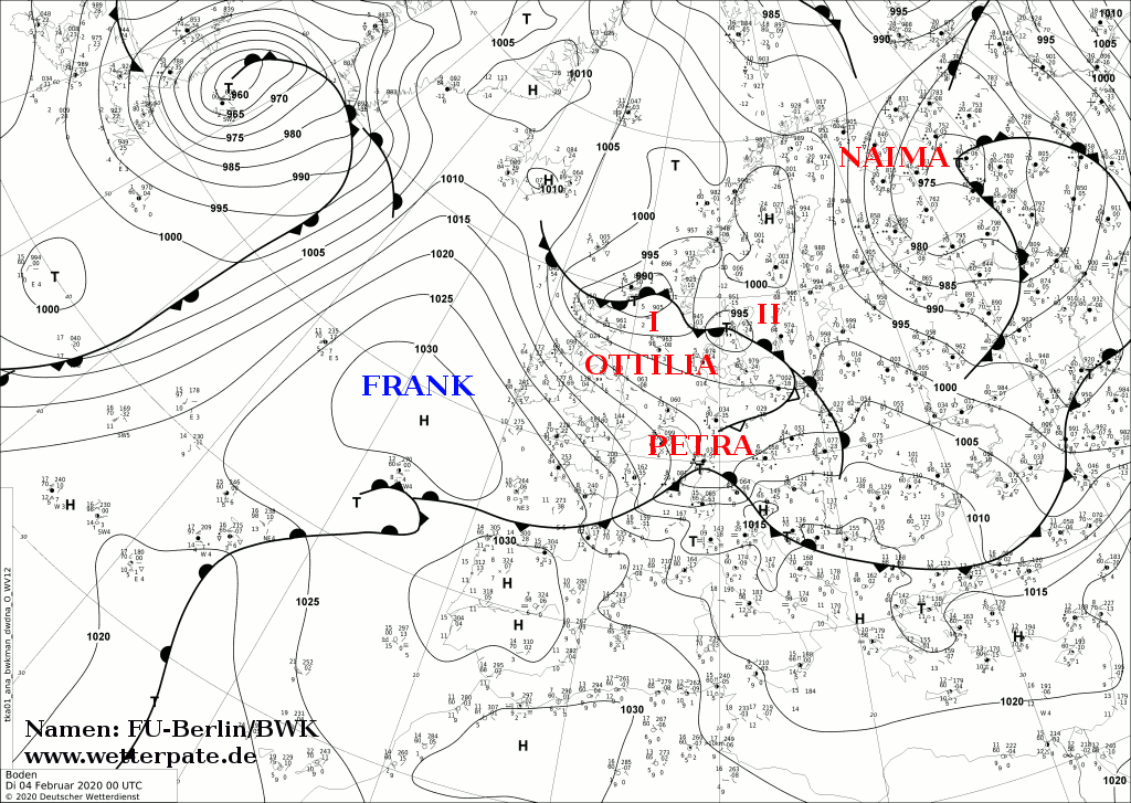
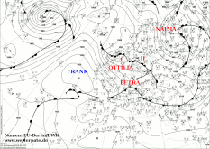
Storm OTTILIA reached Europe at the beginning of February and particularly Western and Central Europe were affected, as well as Ireland and
Great Britain. In Europe, the wind was negligible this time, but there was heavy rainfall. In the Black Forest more than 200 mm came together in 48 hours.
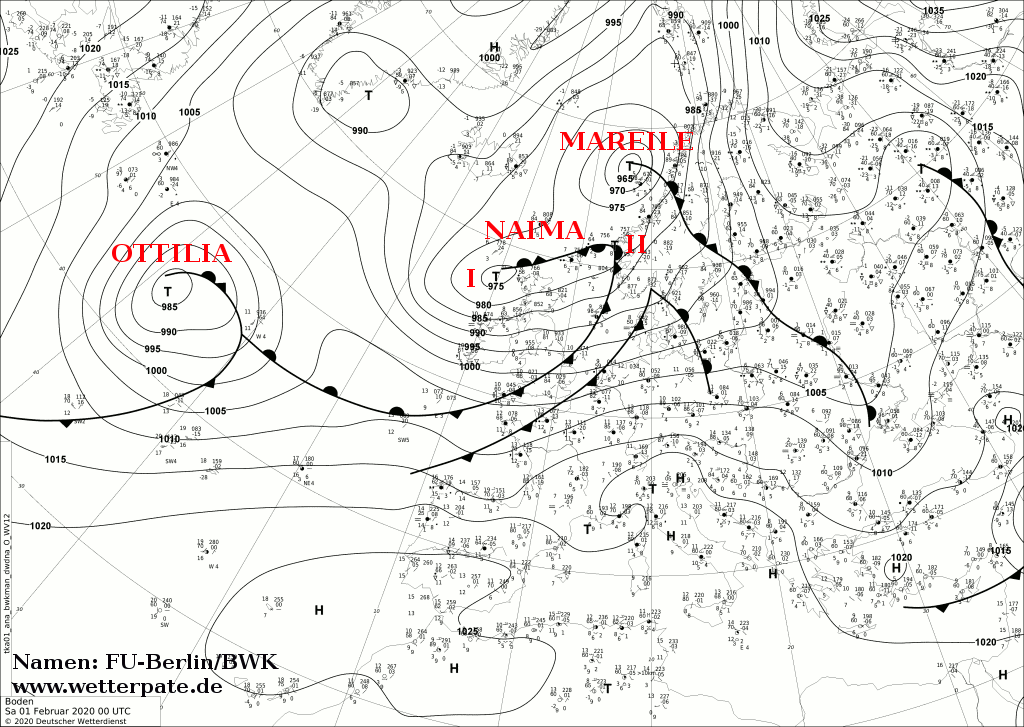
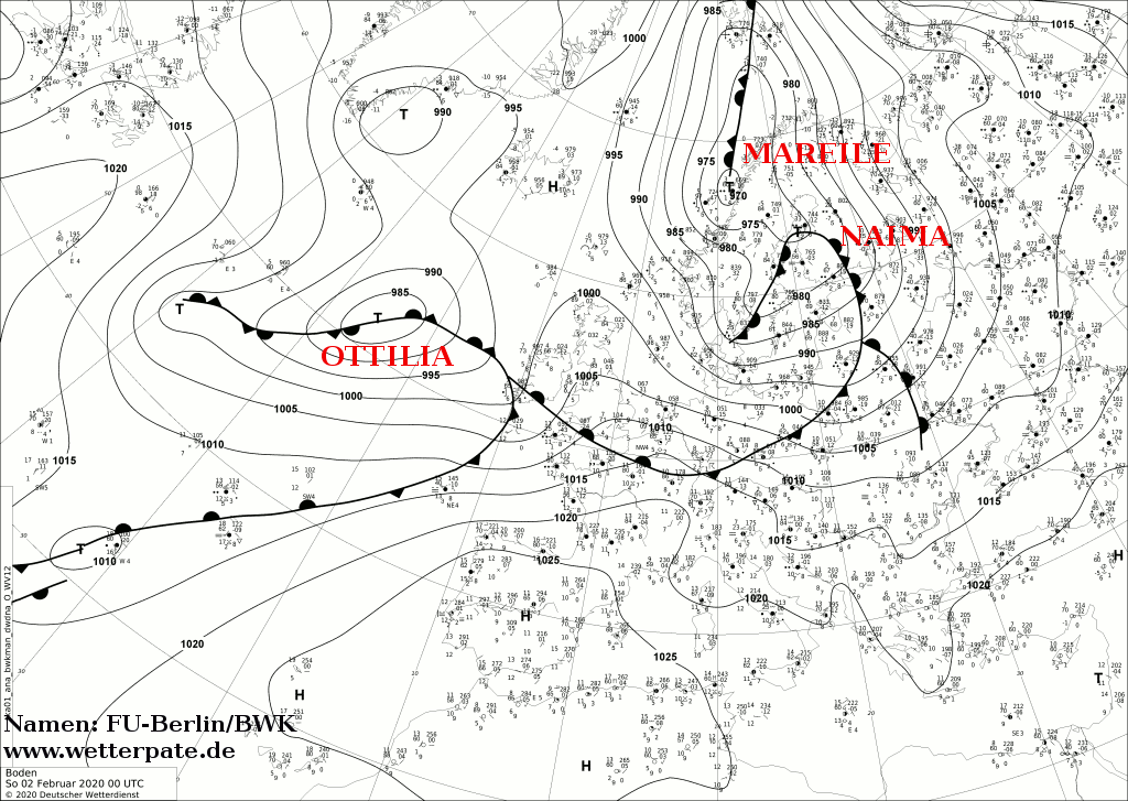
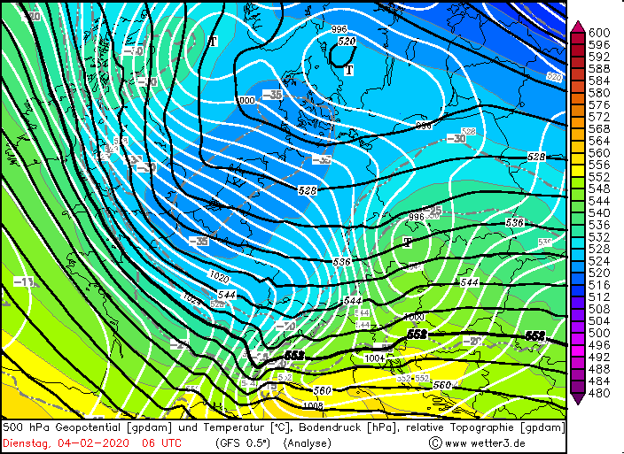
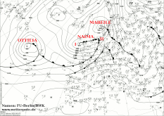
OTTILIA, like many low pressure systems, had its origin over the North Atlantic near Newfoundland. At the end of January, it originated there as a small
wave disturbance and shifted eastwards in the zonally moderately pronounced jet stream. On its way across the Atlantic it intensified and reached a
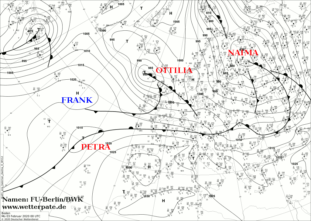
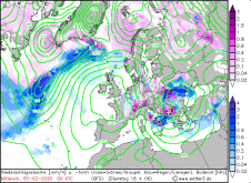
minimum core pressure of 980 hPa on 2 February. At this time, the core was located northwest of Great Britain. On 3 February, it moved across the European sea
to Scandinavia and its pressure began to rise.
|
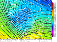
Sea level pressure and fronts, February 01-04, 2020:
FU-Berlin
|
 |
 |
 |
 |
|
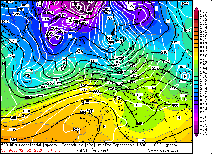
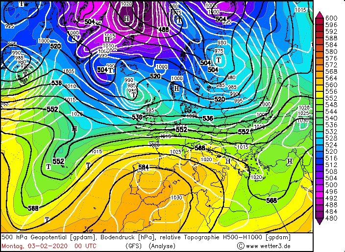
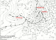
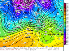
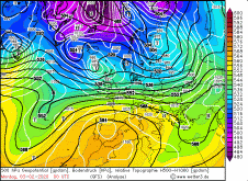
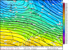
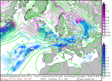
500 hPa Geopotential, February 02-04, 2020:
Wetter3
|
 |
 |
 |
 |
Its main storm field spread to Ireland and Scotland, reaching wind speeds of 213 km/h in Cairngorn on 3 February. In Germany, 140 km/h were reached on the Feldberg,
although it is not the wind but the precipitation that is of greater interest here.
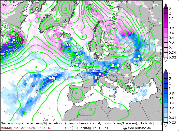
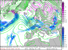
Already one day before, on February 2nd, the warm front of OTTILIA reached Germany. Beside high amounts of precipitation unusually mild temperatures were reached
by strong warm air advection. The snowfall line rose above 2500m and therefore the precipitation fell mostly as rain. At the low mountain ranges, especially in the
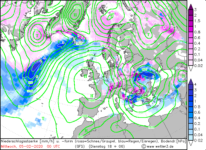
Black Forest, there were accumulations of precipitation. On February 2, 70 mm in 24 hours fell in Freudenstadt. In addition, OTTILIAS frontal system began to grind
at the Alps, where high precipitation of 50 mm was also recorded. Not infrequently, a so-called wave is formed, which can be recognized by the isobars on the
western edge of the Alps. These often result in long-lasting precipitation, which was also the case on 3 February. A first wave brought up to 119mm in 24 hours in
the Black Forest, and about 60mm in 24 hours at the edge of the Alps (see also table below).
|
Precipitation amount and kind, February 02-05, Source:
Wetter3
|
 |
 |
 |
 |
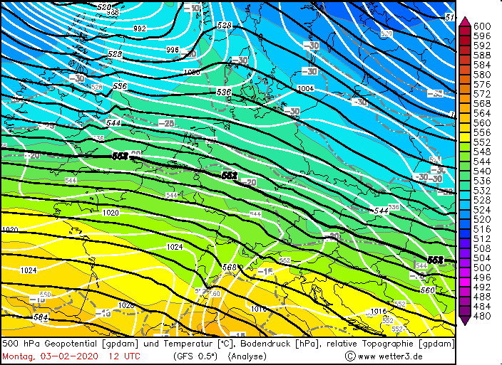
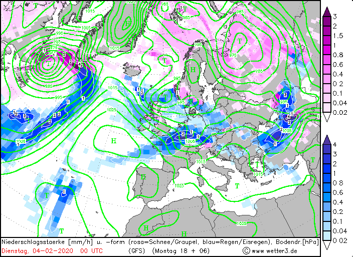
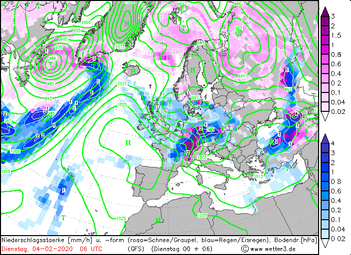
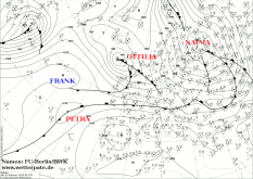
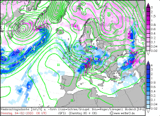
In the evening of February 3rd, another low called PETRA or often called the 2nd wave developed on the front of OTTILIA. This wave again brought gusts of wind
and torrential rain to southern Germany, especially the Black Forest and the edge of the Alps. Due to the cold air advection at the rear of the lows, the snowfall
line dropped to 600m, at certain times to below 200m, so that there was up to 30cm of fresh snow, especially in the Alps. The instability of the air masses also
caused showers and thunderstorms. In addition, the mistral set in in the south of France and caused gusts of 190 km/h the following days
| Location |
Precipitation amount in mm in 24h |
Date |
Feldberg (Schwarzwald)
Chieming
Hohenpeissenberg
Freudenstadt
München Stadt
Obersdorf
Kempten
Lechfeld
Altenstadt
Garmisch-Partenkirchen
|
119.0
70.0
66.0
61.0
59.0
56.0
55.3
55.0
53.0
49.2
|
03.02.2020
03.02.2020
03.02.2020
03.02.2020
03.02.2020
03.02.2020
03.02.2020
03.02.2020
03.02.2020
03.02.2020
|
|
| Location |
Gusts in km/h |
Date |
Cairngorn (GB)
Cairnwell (GB)
Aonach Mor (GB)
Great Dun Fell (GB)
Cap Corse (FR)
Cap Sagro (FR)
Alistro (FR)
Ile Rousse (FR)
Mont Aigoual (FR)
La Parata (FR)
Cap Bear (FR)
Cap Cepet (FR)
Solenzara (FR)
Bec De L'Aigle (FR)
|
213
141
131
131
194
176
162
162
158
152
140
140
140
139
|
03.02.2020
03.02.2020
03.02.2020
04.02.2020
04.02.2020
04.02.2020
04.02.2020
04.02.2020
04.02.2020
04.02.2020
04.02.2020
04.02.2020
04.02.2020
04.02.2020
|
|
Data source: Ogimet.
Text: MG
February 09, 2020
|