|
Great heat and severe thunderstorms initiated the meteorological summer in Germany. In addition to heavy rain, there were also downbursts and big hail.
The south and southwest were particularly affected, whereas the northeast, as so often, had only a few thunderstorms. The northeast was struggling with
forest fires and even the thunderstorms did little to remedy the situation.
Just in time for the meteorological start of summer on 1 June, temperatures in Germany rose to over 30░C.
May was much too cool and the first week of June brought heat and thunderstorms. On the 1st and 2nd of June high PIA allowed the temperatures to climb into
the midsummer during the day. From June 3 the wind turned a southwesterly an very hot and especially humid air were brought to Germany. Due to the interplay of
high PIA and shortwave low FRANK severe thunderstorms were generated by lift drivers such as positive vorticity advection and positive layer thickness advection.
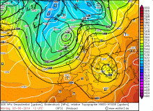
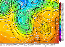
Also on the following days, Germany laid between the ridge above Eastern Europe and the trough over the Atlantic. In this zone, several shortwave / edge troughs
developed. The southwest wind remained and continued to bring hot and humid air, causing CAPE levels to rise sharply. Only on June 7 the weather calmed down until
storm low IVAN reached Germany and also produced severe thunderstorms
(see).
A few days later on June 10 an MSC hit Munich.
|
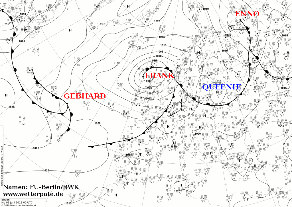
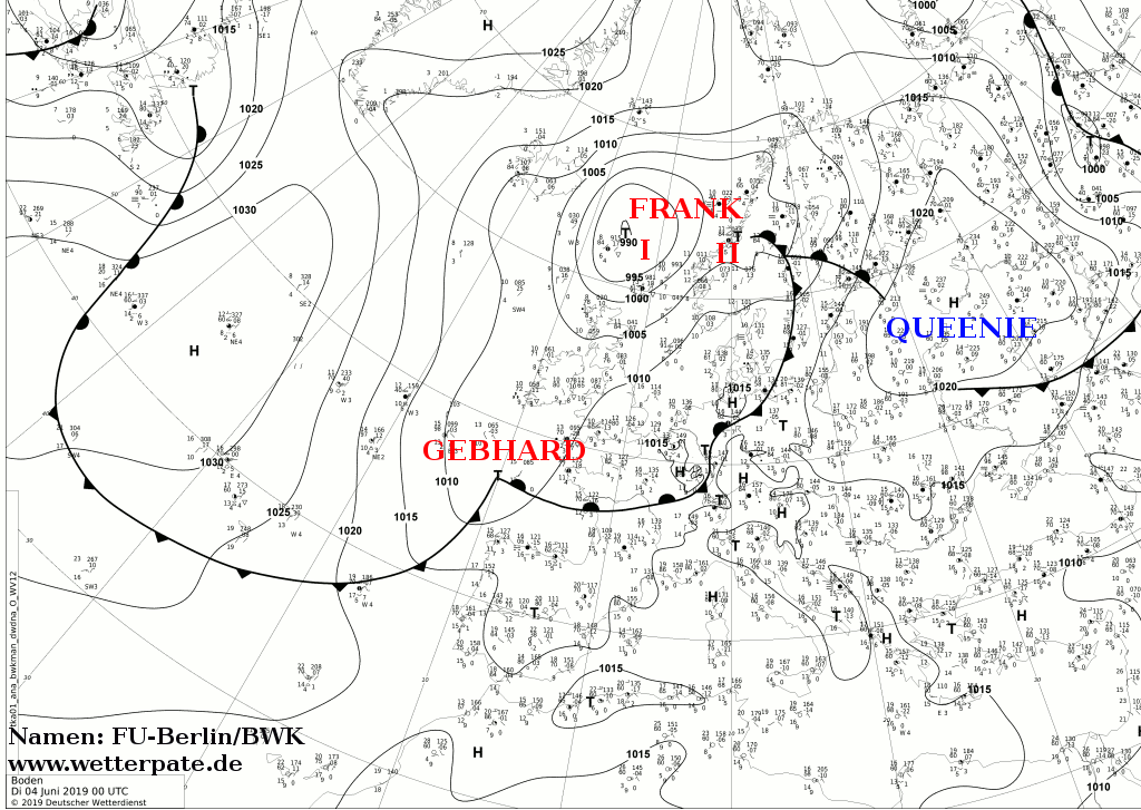
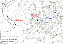
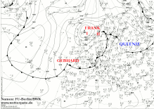
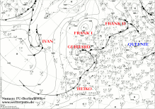
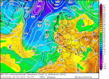
Surface pressure from 03 June, 00 UTC to 06 June, 00 UTC:
FU-Berlin
|
 |
 |
 |
 |
|
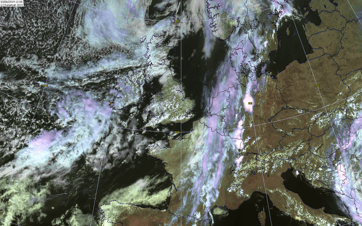
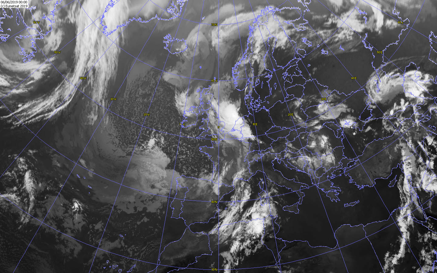
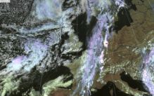
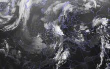
Satellite image (visible and IR) from 03 June, 15 UTC to 06 June, 00 UTC:
Wokingham Weather
|
 |
 |
 |
 |
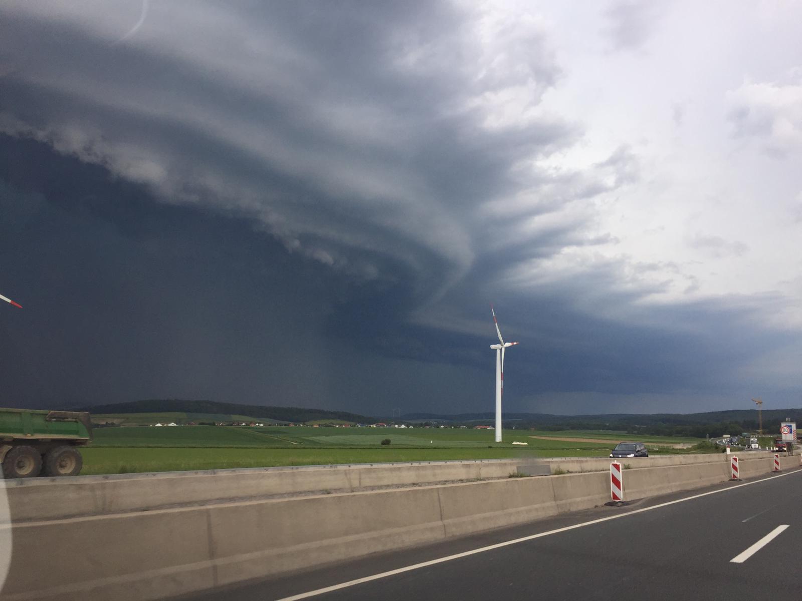
On June 3 in the early morning hours the first thunderstorms of which some were severe, became noticeable in northwestern Germany.
Some of these thunderstorms showed some rotation, which increases the danger of large hail and also tornadoes.
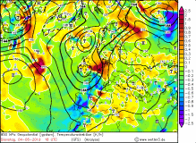
High PIA had moved further east / southeast, so that the northwest was already in the influence of the trough, and in the influence of a shortwave trough.
The storms developed early in the day on the cold front of low Frank, thanks to the upstream convergence zone. This extended across the Benelux to southern France.
Thunderstorms also developed during the day, such as in Alsace, while those on Germany initially weakened. Since the southwest wind, the temperatures rose to
around 30░C and the humidity was high, the CAPE values rose in the afternoon to 1500 J/Kg. However, the maximum CAPE region did not match with the leading
convergence zone of the cold front, so the thunderstorms were more muted. Individual heat storms formed on the German mountain ranges as in the Black Forest, as the
sun-facing slopes favor swells and thunderstorms. Due to the still very small wind shear, individual thunderstorm cells moved only slowly, which led to
flooding due to the heavy rainfall.
|
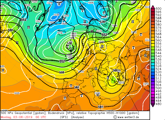
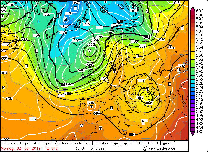
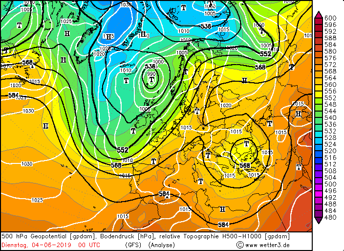
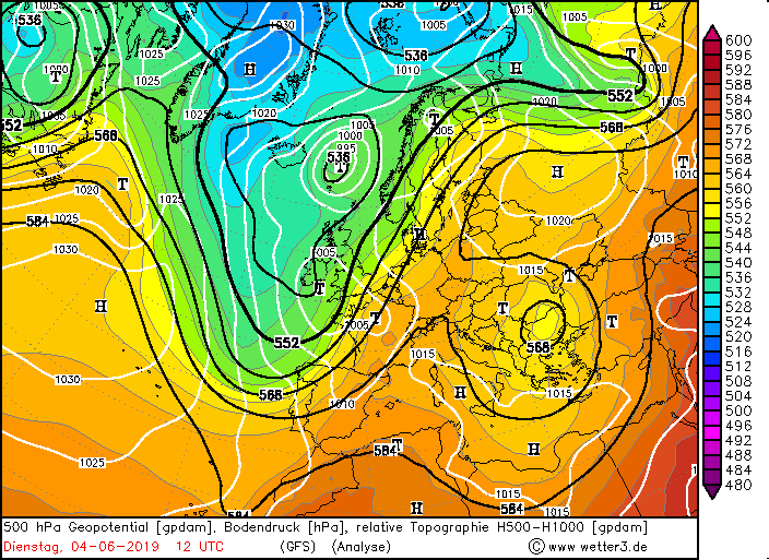
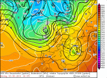
500 hPa Geopotential from 03 June, 00 UTC to 04 June 12 UTC:
Wetter3
|
 |
 |
 |
 |
|
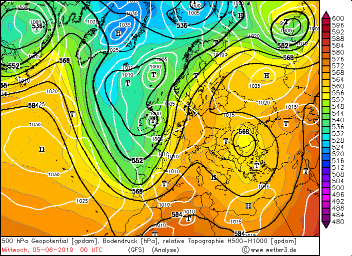
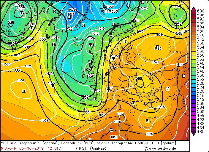
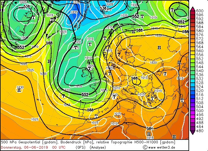
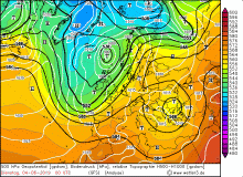
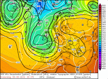
500 hPa Geopotential from 05 June, 00 UTC to 06 June 18 UTC:
Wetter3
|
 |
 |
 |
 |
The line of convergence shifted eastward during the day, reaching western Germany in the evening, eventually developing into a thunderstorm
line (squall line) that extended from the Baltic Sea all the way down to northern Switzerland. The thunderstorms were particularly severe in Hesse,
Lower Saxony and Baden-W³rttemberg and Rhineland-Palatinate. There were hail storms and gale winds as well.
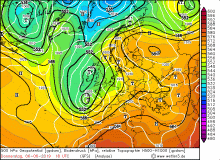
During the night the thunderstorms weakened. On June 4, the weather calmed slightly due to high-pressure influence. Only a few heat storms formed in the
afternoon, as the air mass remained wet and hot. In the evening, however, an MSC crossed the front of a shortwave over France and the Benelux. Already at
noontime first heat storms formed, which clustered into a mesoscale convective system.
|
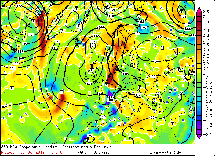
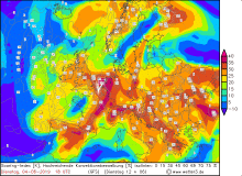
Temperature advection 04 June and 05 June, KO-Index 04 June, 18 UTC, pseudopot. temperature 06 June 00 UTC:
Wetter3
|
 |
 |
 |
 |
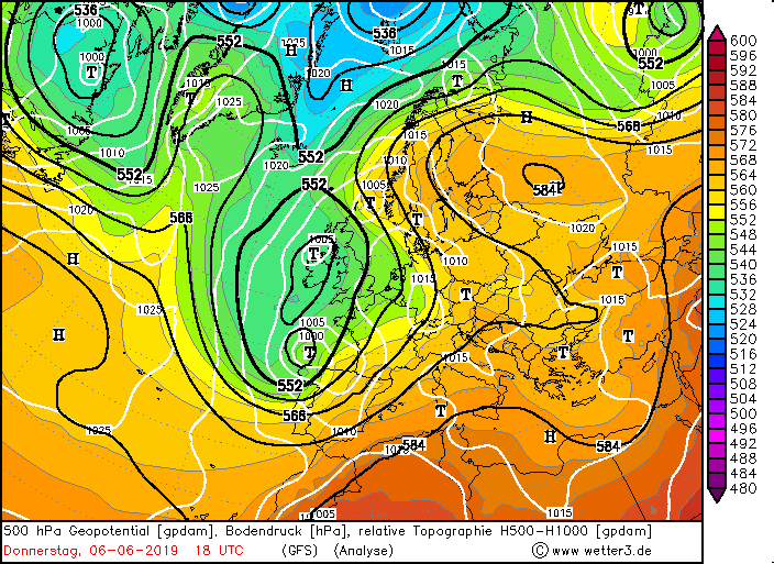
On evening of June 5, there was again a severe weather situation. Germany still was between the pronounced ridge, which extended over Central
Europe to Russia and a trough over the Atlantic, which extended over Great Britain down to the Bay of Biscay. In front of the trough a frontal zone had
formed again and a convergence line, but much more dynamic than on 3 June. The wind shear was higher and thus the degree of organization of the thunderstorms.
The frontal zone shifted only slowly and partly retrogradely, as in the east was still a strong high. At this frontal zone, small marginal troughs and short-wave
troughs formed again and again, which caused elevation and thus provided favorable conditions for severe thunderstorms. Furthermore, there was strong humidity and
warm air advection by the southwest wind. As a result, CAPE values rose to more than 2000 J / kg this evening. At the height directly in the area of the frontal
zone is a jet stream with 252 kph, which provided the wind shear (especially velocity shear) and thus provided another prerequisite for organized thunderstorms,
such as multi-cells or MCS.
Also on this day the temperatures rose again to 30░C, in the east even well over 30░C. The first thunderstorms formed orographically conditioned,
so predominantly in the low mountain ranges and the alps. These were initially single cells. In Germany, however, only a few single cells formed in the east,
in the south the inversion was too strong due to the high and also foehn effects played a role. With the approach of the shortwave trough from southwest, the
degree of organization increased as expected and the single cells developed into multi-cells and later to a squall line. This shifted from France and the Benelux
countries to the east and reached Germany in the late evening and in the night hours. It ranged from northern Baden-W³rttemberg to the North Sea. Most active were
the thunderstorms in Rhineland-Palatinate and North Rhine-Westphalia. This thunderstorm had an exceptionally high flash rate in addition to hurricane force
like downbursts and some heavy rainfall (sometimes hail). About 200,000 lightning strikes were recorded in Europe that night.
Also remarkable was the temperature gradient, which was caused by the strong warm air advection front of the frontside and the strong cold air advection
on the backside. If it was over 30░C hot on June 5, almost everywhere in the country, the thunderstorms came to a halt. Only the northeast remained largely dry,
except for occasional heat storms. There were again measured above 30░C. In Potsdam, the thermometer climbed to 34.7░C, so it was hotter than in Spain that
day with 32░C.
Text: MG
June 12th, 2019
|