|
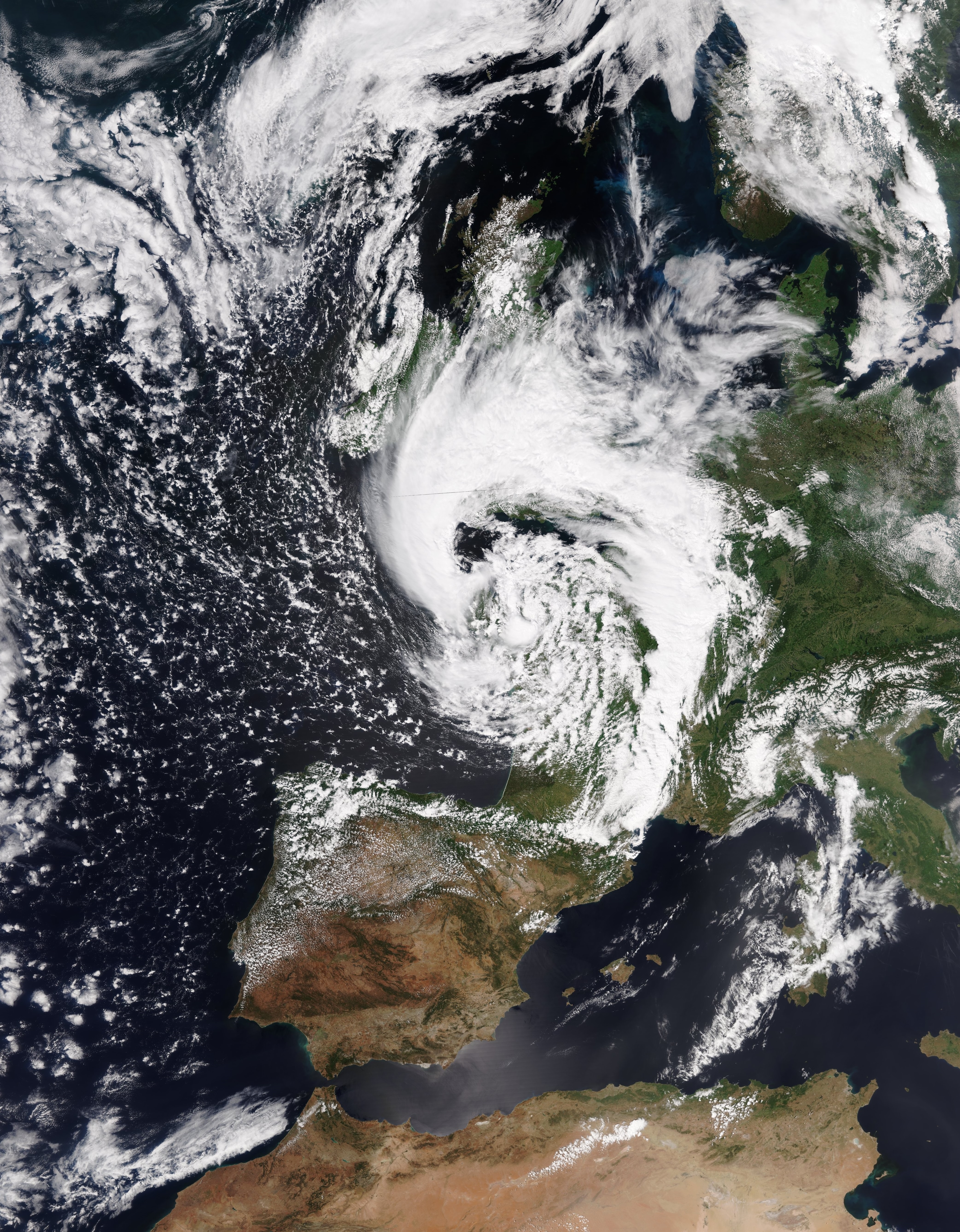
Low pressure area IVAN formed in the Atlantic Ocean off the coast of the Iberian Peninsula and caused severe
weather in Portugal, Spain, France, the Benelux countries and Germany. Rainfall amounts up to 58 mm/24h and
gusts up to 129 kph were registered.
Low pressure area IVAN formed out of a wave disturbance in the Atlantic Ocean already on June 04. At the back of a
trough reaching up to the Azores the low pressure area moved southeast towards the Iberian peninsula. On 06 June IVAN
moved the front of the trough. Due to strong uplift processes and a diffluent zone in the jet stream lying above,
the depression rapidly intensified to a core pressure of less than 1000 hPa.
|
|
|
|
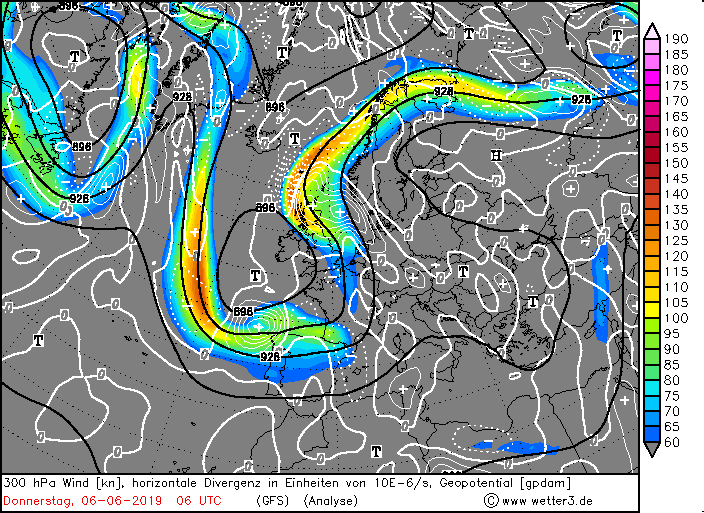
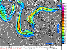
300 hPa wind and divergence, 06.06., 06 UTC
Image Credit: Wetter3
|
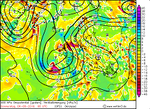
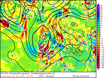
500 hPa geopotential and vertical movement
06.06., 06 UTC,
Image Credit: Wetter3
|
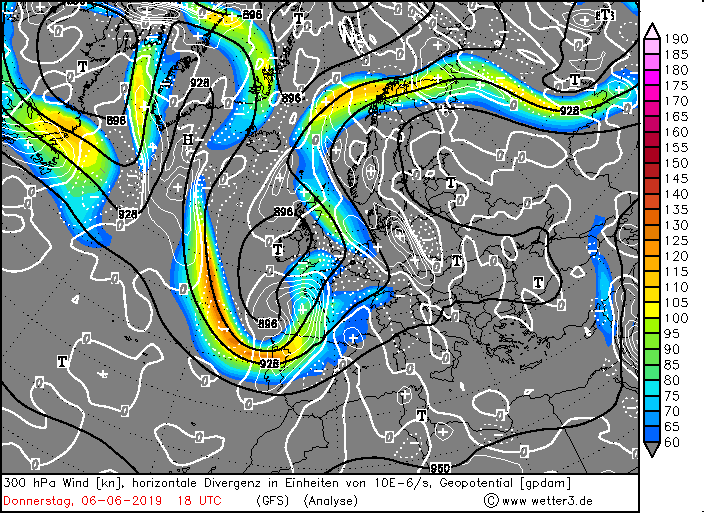
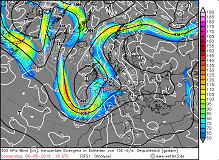
300 hPa wind and divergence, 06.06., 18 UTC
Image Credit: Wetter3
|
500 hPa geopotential and vertical movement
06.06., 18 UTC,
Image Credit: Wetter3
|
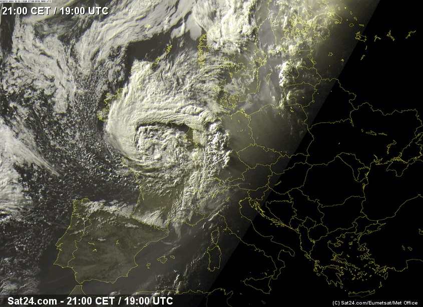
High atmospheric pressure over northern Africa resulted in a strong horizontal pressure gradient southwest of IVAN's
centre. On 06 June at 12 UTC, the depression moved past the northwest coast of the Iberian Peninsula, causing heavy
precipitation and storms. Rainfall of more than 40 mm/24h and storm gusts of more than 100 kph were widely measured.
Due to orographic precipitation, 58 mm fell in Noia (ES) within 24 hours. The strongest gust was determined at the
promontory Estaca de Bares with 129 kph.
|
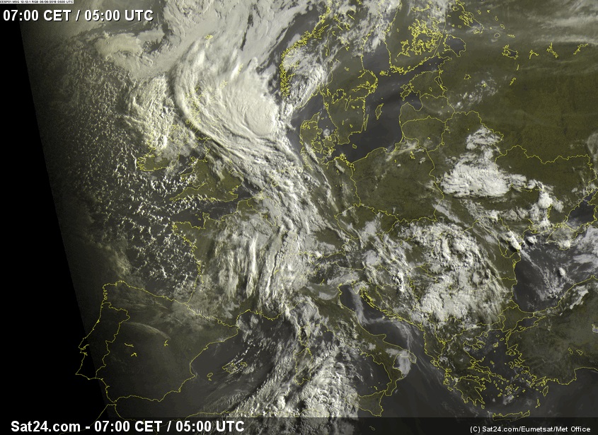
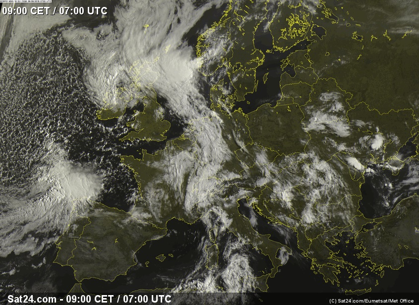
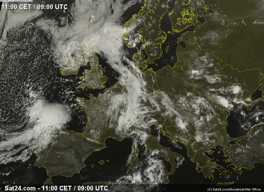
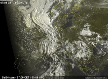
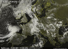
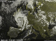
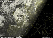
Satellite image (visible) from 06 June, 05 UTC to 06 June 11 UTC:
Sat24
|
 |
 |
 |
 |
|
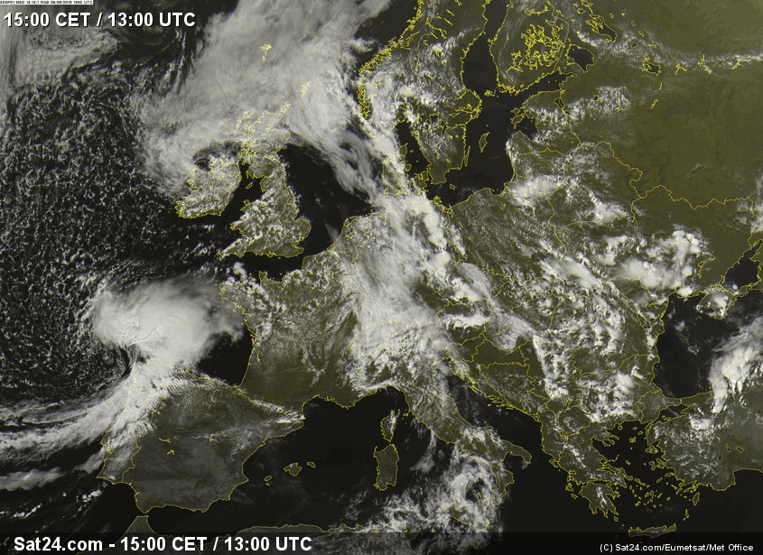
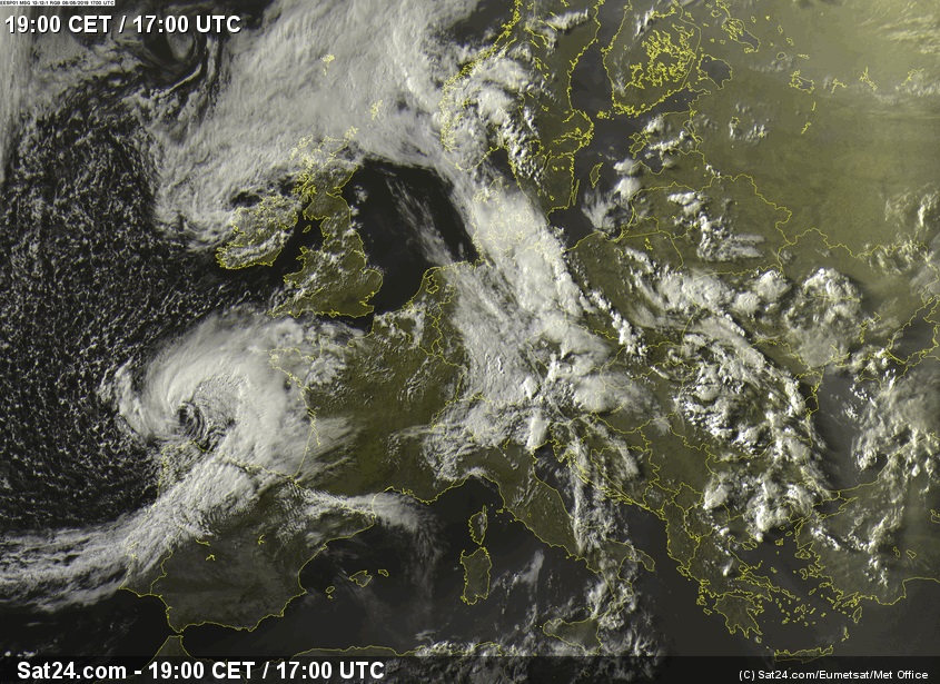
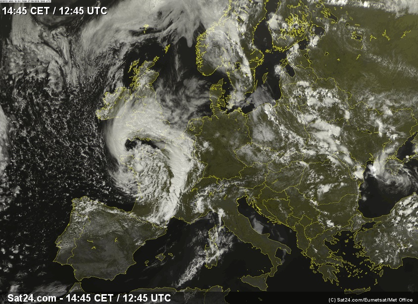
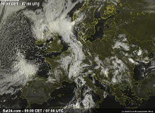
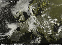
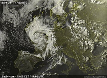
Satellite image (visible) from 06 June, 13 UTC to 06 June 19 UTC:
Sat24
|
 |
 |
 |
 |
The rotation of the low-pressure area weakened slightly due to increased friction over land, particularly in the mountains of northern Spain.
Due to the still very favourable cyclogenesis conditions, IVAN's core pressure decreased to about 992 hPa over the Bay of Biscay.
On 07 June at around 12 UTC, the centre of the depression made landfall on France in Brittany . Rainfall amounts of up to 45.2 mm/24h
and wind gusts of up to 128 kph were recorded on the French Atlantic coast.
IVAN has meanwhile developed a pronounced and weather-active occlusion front, which crossed Central Europe from the southwest on 07 June.
|
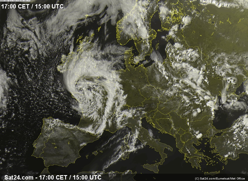
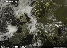
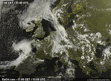
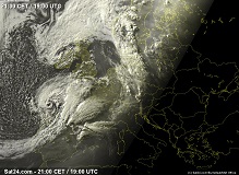
Satellite image (visible) from 07 June, 13 UTC to 06 June 19 UTC:
Sat24
|
 |
 |
 |
 |
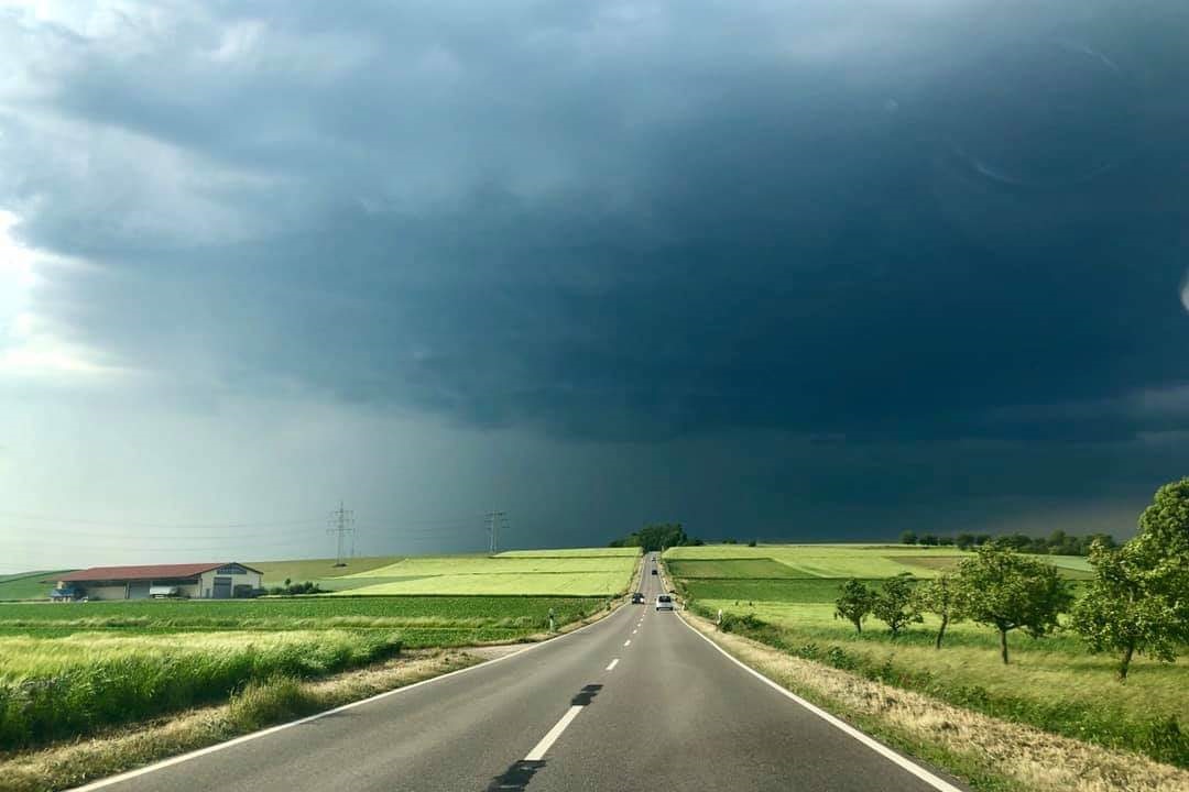
In the area of the cold front, heavy showers and thunderstorms formed over Germany. By clustering of the thunderstorm
cells, even supercells were formed. Due to the high translation speed of the thunderstorms, the total precipitation was
rather low. The peak was marked by the station Braunlage in Lower Saxony with 18 mm/24h. On mountaintops there were storm
gusts like on the Brocken with 116 kph and on the Feldberg with 93 kph. Near thunderstorm there were also gale-force gusts
in flat areas due to downbursts.
Measurements of 24h precipitation, 10 minutes mean winds and windgusts (selection):
| Location |
24 h precipitation in mm |
Date |
Noia (ES)
Mazaricos (ES)
Rois, Casas do Porte (ES)
Vimianzo (ES)
Landivisiau (FR)
Quesstant-Stiff (FR)
Ploudalmezeau (FR)
Lannion (FR)
Cherbourg / Maupertus (FR)
Braunlage (DE)
Kirchdorf / Poel (DE)
Herzberg (DE)
Hannover (DE)
|
58.0
56.0
54.0
49.0
45.2
41.8
38.2
35.8
35.0
18.0
17.0
17.0
14.0
|
06.06.2019
06.06.2019
06.06.2019
06.06.2019
07.06.2019
07.06.2019
07.06.2019
07.06.2019
07.06.2019
08.06.2019
08.06.2019
08.06.2019
08.06.2019
|
|
| Location |
Mean Wind (gusts) in kph |
Date |
Estaca de Bares (ES)
Fisterra (ES)
Cabo Vilan (ES)
Chandrexa de Queixa (ES)
Velilla del Rio Carrion (ES)
Estaca de Bares (ES)
Pointe du Raz (FR)
Beg Melen (FR)
Chassiron (FR)
Penmarch (FR)
St. Sauveur (FR)
Lannion / Servel (FR)
Ploumanach (FR)
Brocken (DE)
Feldberg (DE)
Weinbiet (DE)
Leuchtturm Alte Weser (DE)
Büsum (DE)
|
104 (129)
78 (116)
72 (107)
68 (102)
67 (100)
93 (120)
83 (107)
80 (119)
78 (111)
78 (100)
74 (111)
70 (119)
67 (128)
83 (116)
66 (93)
67 (100)
66 (90)
59 (85)
|
06.06.2019
06.06.2019
06.06.2019
06.06.2019
06.06.2019
07.06.2019
07.06.2019
07.06.2019
07.06.2019
07.06.2019
07.06.2019
07.06.2019
07.06.2019
08.06.2019
07.06.2019
07.06.2019
08.06.2019
08.06.2019
|
|
Data source (for Spain): Aemet.
Data source (for France): Ogimet.
Data source (for Germany): Deutscher Wetterdienst.
Text: FS
June 11th, 2019
|