Friday, 20 May 2022, 13:00 UTC
|
|

|
|
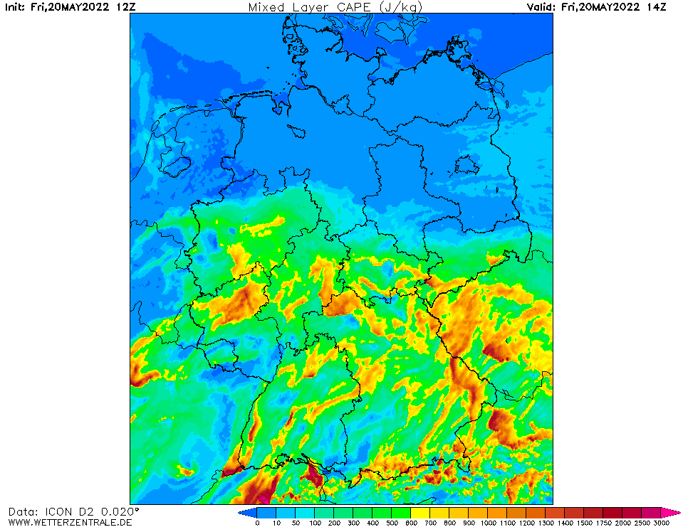
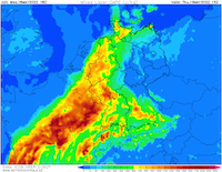
CAPE mixed layer Central Europe, 20.05., 14 UTC
Source: Wetterzentrale
|
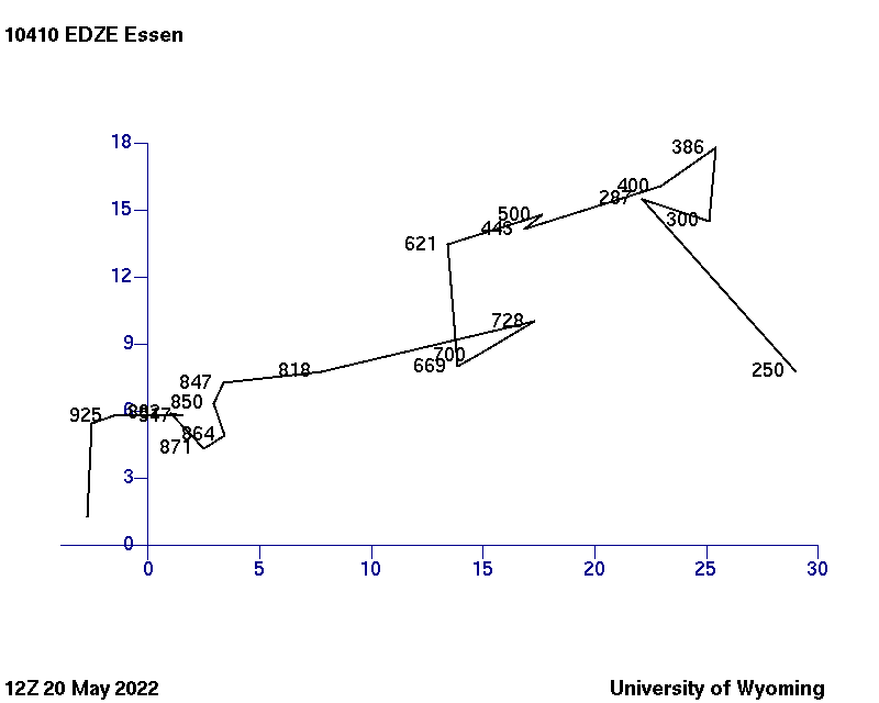
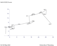
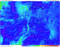
Hodograph Station Essen, 20.05., 12 UTC
Source: University of Wyoming
|
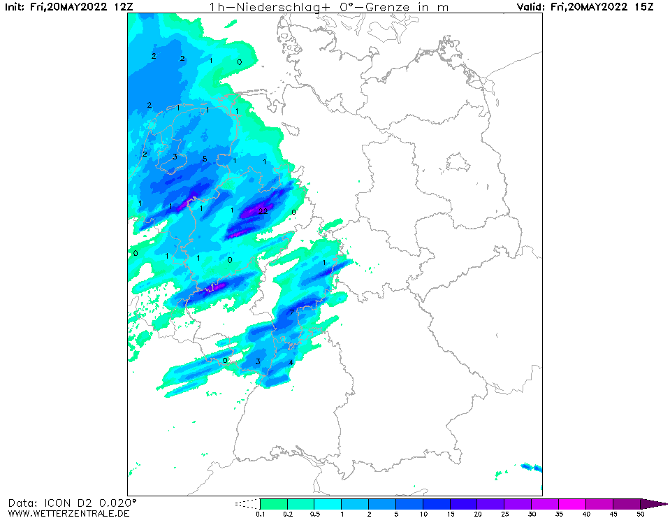
1 h precipitation Central Europe, 20.05., 15 UTC
Source: Wetterzentrale
|
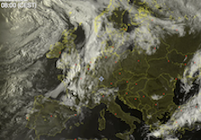
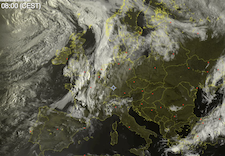
Satellite image (visible), 20.05., 13:00 UTC
Source: Sat24
|
Severe Thunderstorms
Central Europe
Issued: Friday, 20 May 2022, 13:00 UTC
A small upper atmosphere disturbance causes severe thunderstorms in the western part of Germany, potentially accompanied with damaging winds, large hail and heavy percipitation in a short period of time.
20.05.2022
On Friday during the day a small upper-level trough is moving westwards from the British Isles over the northern part of Germany, accompanied with a small surface low. This system causes lifting over the western part of Germany in the afternoon hours, enhancing the possibility for severe weather in this region.
With the surface low the southwesterly current is intensified, and hot and moist air is present over the western part of Germany and the Benelux states. The equivalent potential temperature reaches values of over 50 °C and the precipitable water reaches locally values of over 35 mm in the afternoon hours. Mixed-layer CAPE-levels over central Germany are in the range of 600 to 1500 J/kg giving the environment for potentially severe thunderstorms.
The 12 UTC temps from western Germany show a clear hook-like structure in the hodograph, giving the possibility for rotating updrafts and supercell development. Numerical weather model output suggests the possibility for long-lived supercells travelling eastwards over the central part of Germany during the evening hours.
With the possibility of organized storm structure, the potential is given for severe weather in the following hours over North Rhine-Westphalia and the northern part of Rhineland-Palatinate moving eastwards in the afternoon and early evening hours. Main threats are damaging winds with gust reaching more than 120 km/h and high hourly precipitation rates over 30 mm/h. Also larger hail is possible.
Thursday, 19 May 2022, 07:00 UTC
|
|
|
|
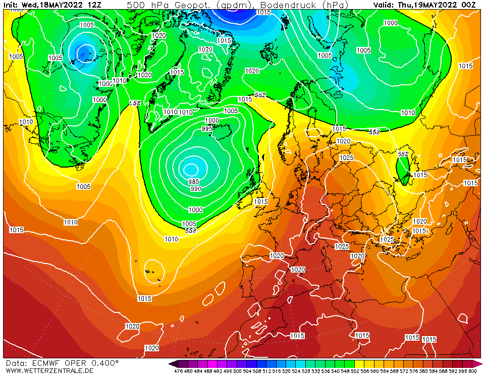
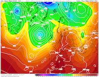
500 hPa Geopotential Europe, 19.05., 00 UTC
Source: Wetterzentrale
|
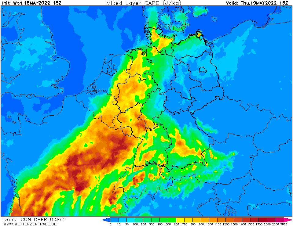
CAPE mixed layer, 19.05., 15 UTC
Source: Wetterzentrale
|
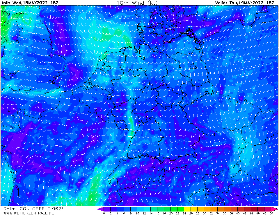
10 m Wind Central Europe, 19.05., 15 UTC
Source: Wetterzentrale
|
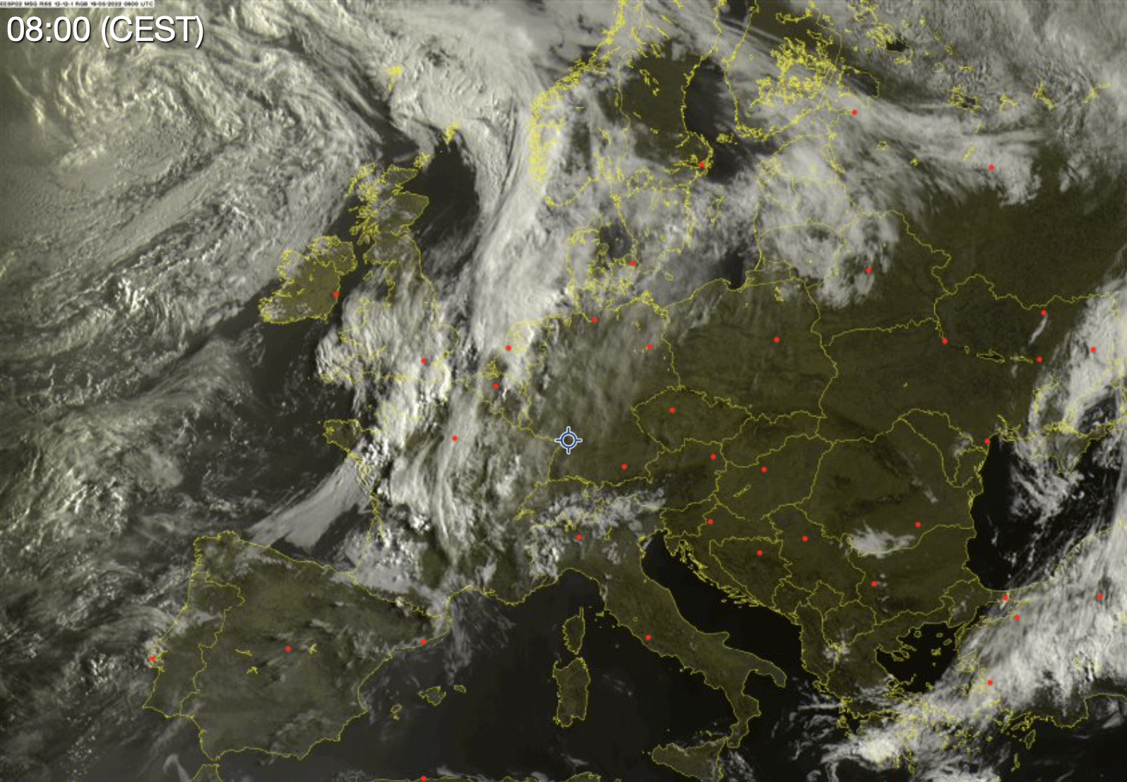
Satellite image (visible), 19.05., 06:00 UTC
Source: Sat24
|
Heatwave and Severe Thunderstorms
Central Europe
Issued: Thursday, 19 May 2022, 07:00 UTC
On the western edge of a high pressure ridge over Central Europe high temperatures are accompanied by potentially severe thunderstorms.
19.-20.05.2022
By a strongly amplified ridge over Central Europe extending northwards up to Central Scandinavia Central Europe is under the influence of a south-westerly current, causing the first heatwave of the this year on Thursday and Friday. Daytime highs in the Upper Rhine Plain are expected to reach over 30 °C (86 °F) over a widespread area for the first time this year. On Thursday a small low pressure system approaches Northern Germany and the hot temperatures are accompanied by thunderstroms which have the possibility for severe weather.
The low pressure system will cause instabilities over the Benelux and Northwestern Germany on Thursday around midday leading to the possibility for severe convective systems developing in the hot and moist atmosphere. Mixed layer CAPE-levels will be reaching 900 to 1400 J/kg over the western part of Germany in front the convective systems. With the precipitable water reaching 30 to 36 mm over the same region the possibility is giving for thunderstorms bringing heavy percipitation over a short period of time. Numerical weather models are suggesting the possibility for linear storm structures developing over Western Germany in the afternoon hours on Thursday leading to the risk of high wind gusts and larger hail. The convective systems are expected to move eastwards in the evening hours and dissolve in the first part of the night.
On Friday convective development is again expected over Western Germany and the Benelux throughout the day, mixed layer CAPE-levels are expected slightly lower than Thursday reaching 600 to 1200 J/kg. Ahead of the cold front of the lower pressure system the precipitable water will be reaching 35 mm over most of Western Germany leading to the possibility of high percipitation thunderstroms. The possibility of organized storm structure is giving, therefore severe weather such as high winds and larger hail are possible. In the evening hours the convective systems are expected to move over the southern part of Germany.
Issued: May 19, 2022, 07:00 UTC
KG
Issued: May 20, 2022, 13:00 UTC
KG
|