Thursday, 04 February 2021, 21:00 UTC
|
|

|

|
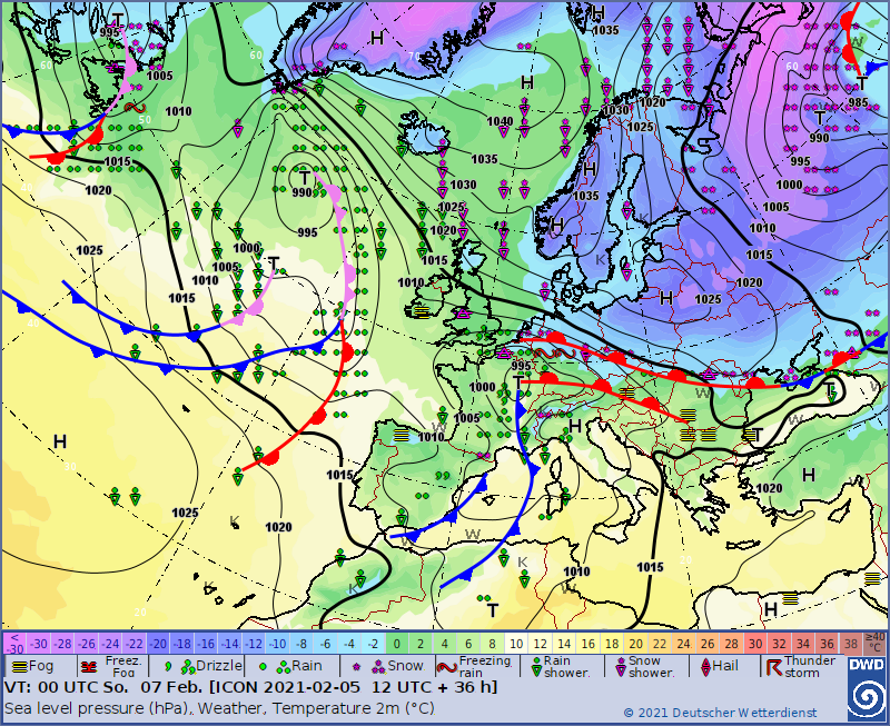
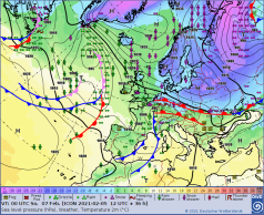
Sea level pressure and fronts, 07.02. 00 UTC
Data Source: DWD
|
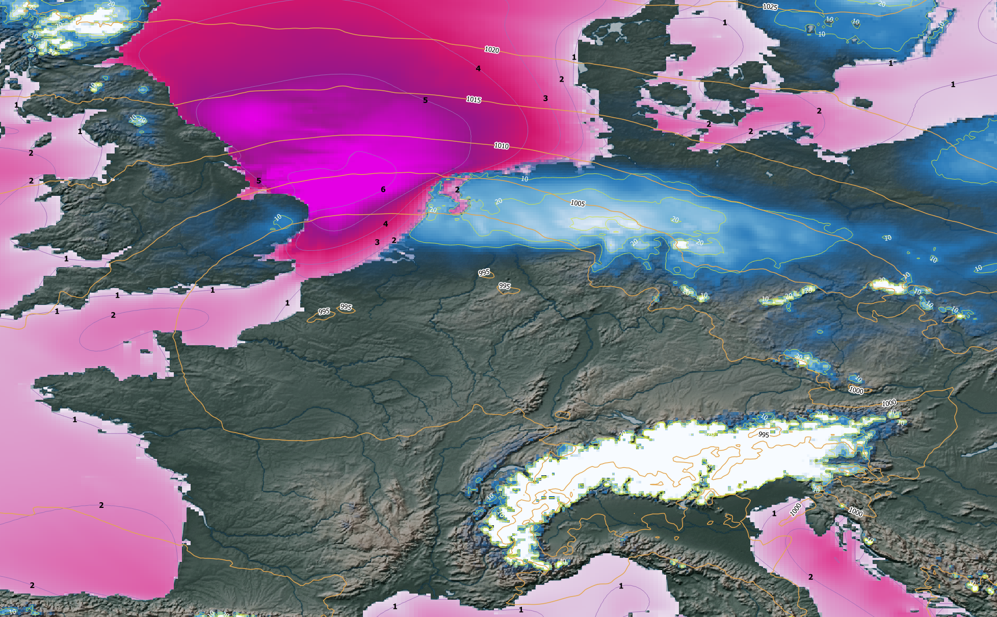
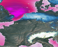
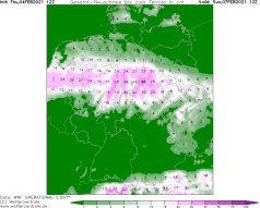
Snow height (blue) and wave height (pink)
Central Europe, 07.02. 12 UTC
|
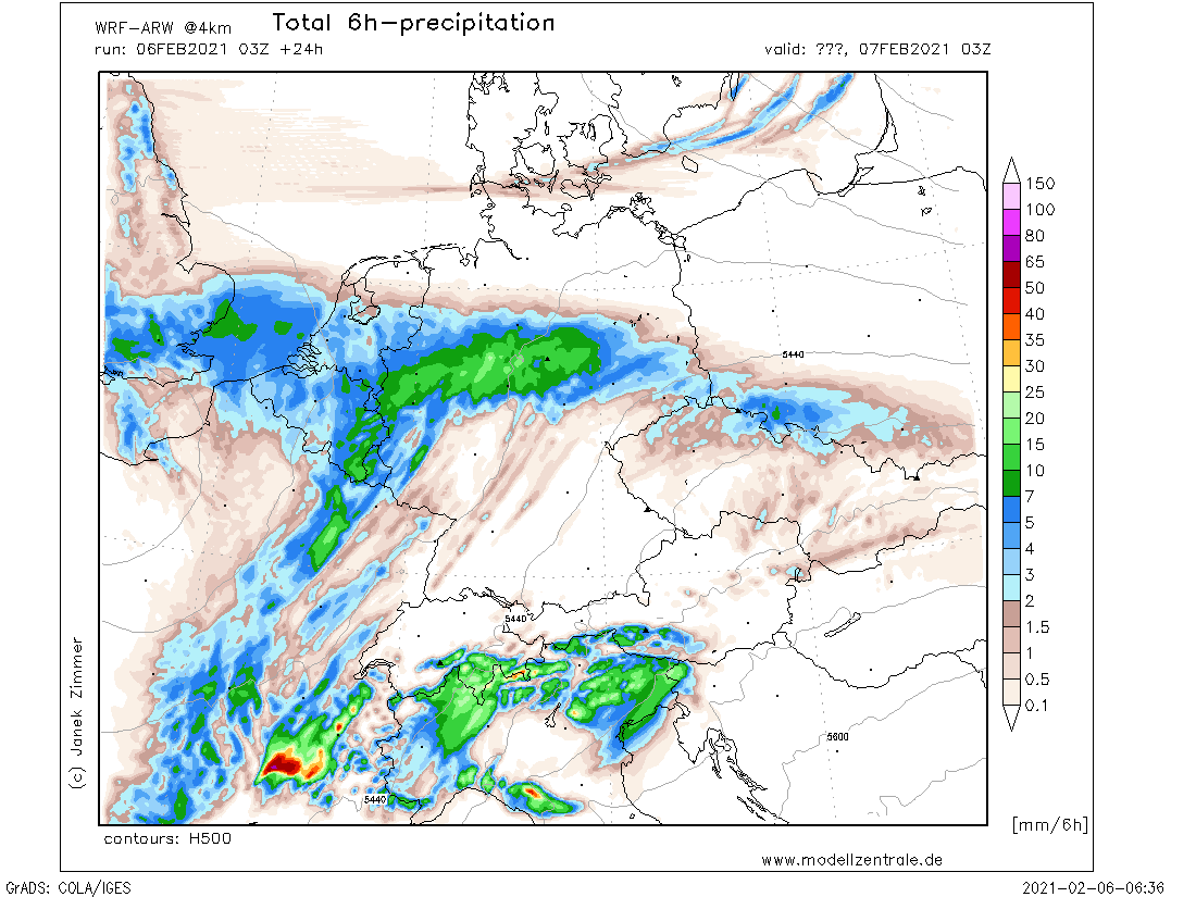
6h precipitation Central Europe, 07.02., 03 UTC
Data Source: Modellwetter
|
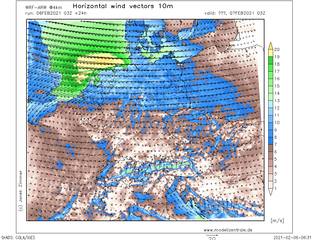
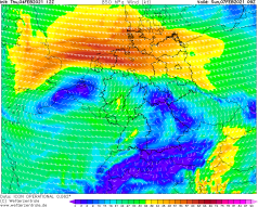
10m wind Central Europe, 07.02., 03 UTC
Data Source: Modellwetter
|
Black Ice, Snowstorm
Germany, Denmark
Issued: Saturday, 06 February 2021, 11:00 UTC
Due to a significant air mass boundary over Germany that seperats rather mild air in the south and cold air in the northeast moderate snowfall will occure in the
next few days. Especially from Saturday onwards strong snofall will occur in central and nothern Germany but also freezing rain and black ice, which can turn out to
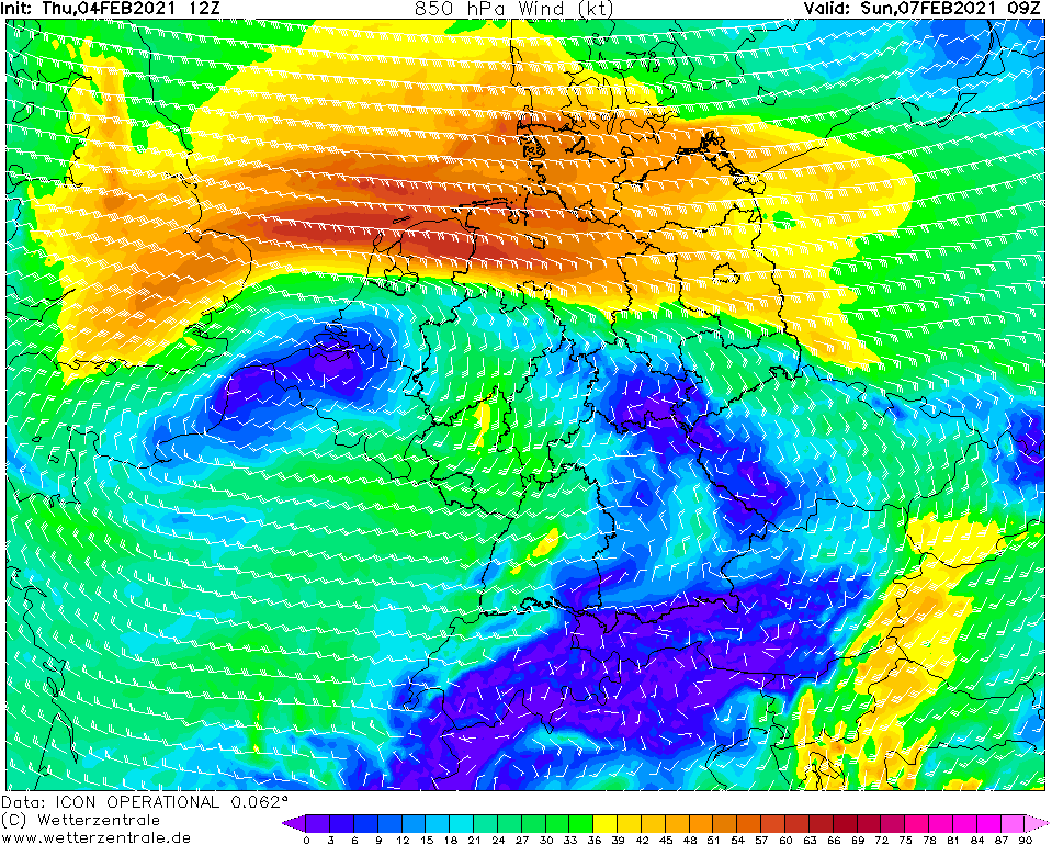
be severe. Additionally the air pressure gradient will strenghten on Sunday and will cause gale gusts over northern Germany, Denmark and also the BeNeLux states.
04.-08.02.2021
Central Europe remains between a low over Ireland and the high-pressure bridge, which extends from Greenland over Scandinavia to the Black Sea. As a result, a
significant air mass boundary has formed over Germany, with a temperature gradient that will intensify today (Saturday) and tomorrow (Sunday). Low pressure
TRISTAN with its core over Spain will shift to France during the day and during the night to Sunday TRISTAN will reach the BeNeLux States. In the southern
parts of Germany, rather mild air will continue to be advected by the south and southwest winds. However, especially in the northeast of Germany, rather cold
air will be advected by the easterly wind. The air mass boundary shows a temperature gradient of around 10K to 15K in a range of about 50 km. By the middle of
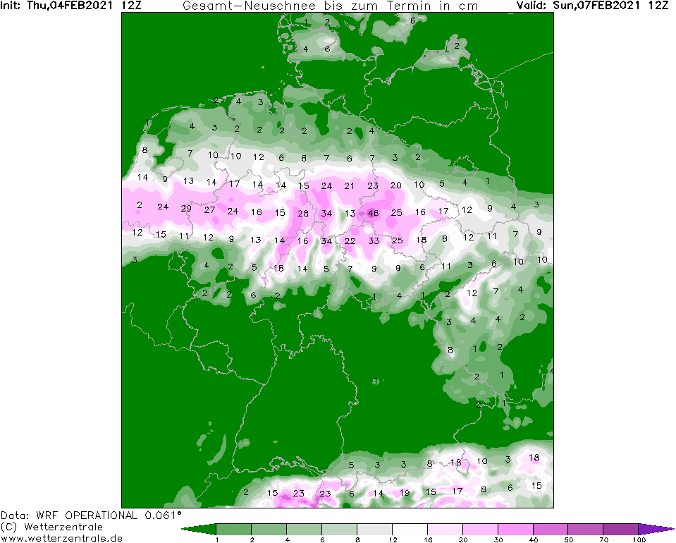
next week, the T gradient will increase to around 20K. TRISTAN's frontal system will overlap with the air mass boundary and moderate to heavy precipitation will
occur in this area in a strip over central Germany. On the northern side of the front, the precipitation will be in form of moderate to heavy snowfall, whereas
on the southern side, freezing rain may form. This may lead to a severe black ice situation. Affected by freezing rain are mainly the Ruhr area, northern Hesse
and Saxony. In the northern parts of Germany, especially in North Rhine-Westphalia, Lower Saxony and Schleswig-Holstein, but also Denmark and the BeNeLux states,
fresh snowfall amounts of 20-40 cm are expected. Locally, these may be higher.
On Sunday morning, the air pressure gradient will also increase, so that in northern Germany, Denmark, and BeNeLux, gusts of around 80 km/h (Bft9) must be expected
in exposed locations, and gusts of around 40 km/h (Bft 6) in lower altitudes. The heavy snowfall will cause snow drifts as well as poor visibility conditions. Along
the coasts, there is a risk of storm surge along the Bay of Kiel and Lübeck, but also along the East English coast. Wave heights of up to 6 m are expected along the
East English coast.
Traffic disruptions must be expected in the affected areas. There may be delays and cancellations in local and long-distance public transport.
Due to the freezing rain, trees and branches may bend and overhead lines may also be damaged. The combination of gale gusts and snowfall will cause
significant visibility issues. Due to the low temperatures in the northeast, the Baltic Sea along the ports and also some rivers could freeze,
so that there may be disruptions in shipping traffic.
Thursday, 04 February 2021, 21:00 UTC
|
|
|
|
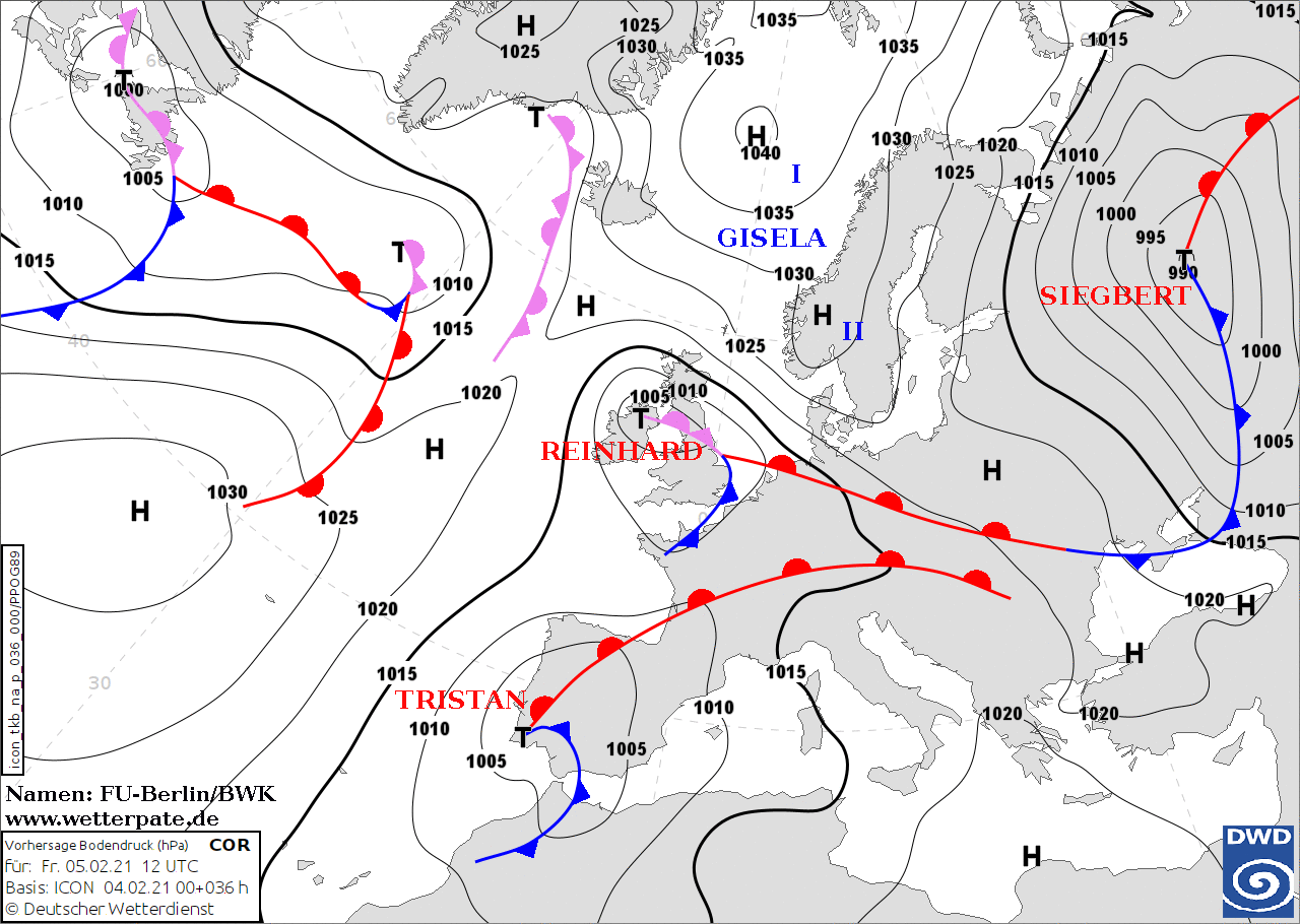
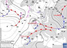
Sea level pressure and fronts, 05.02. 12 UTC
Data Source: FU-Berlin
|
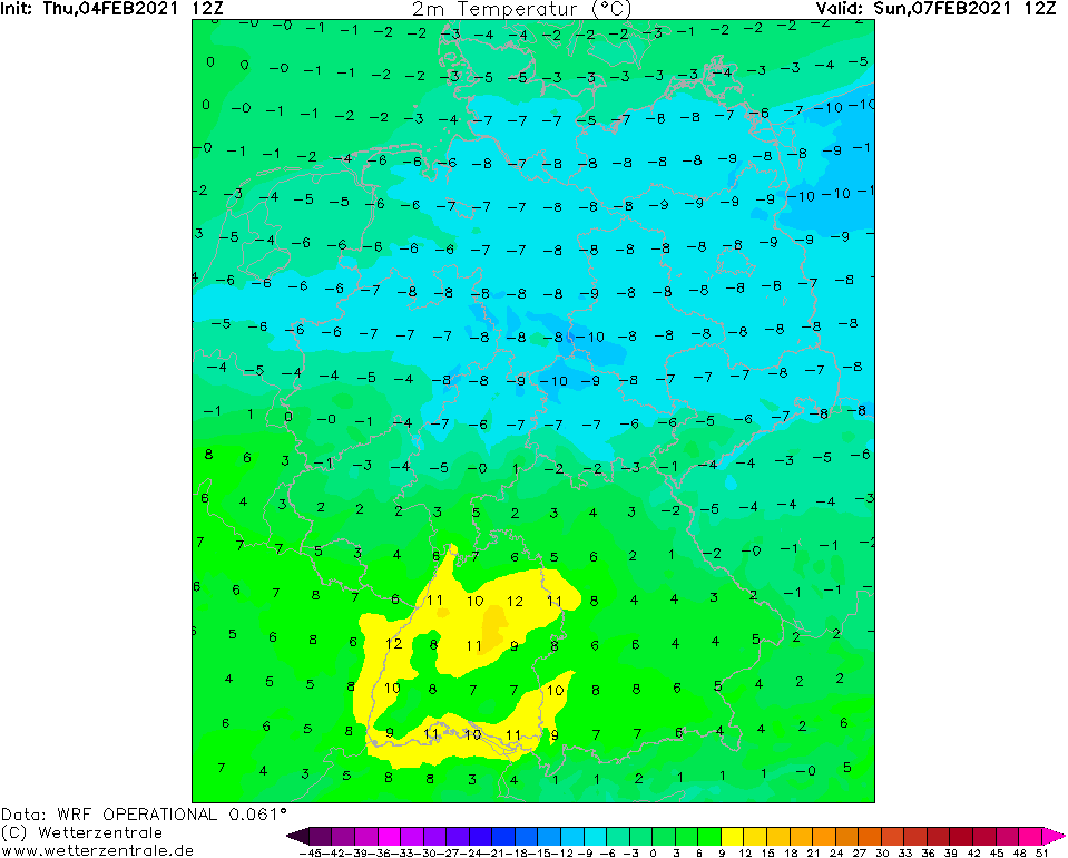
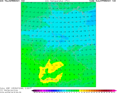
2m temperature Germany, 07.02. 12 UTC
Data Source: Wetterzentrale
|
Fresh snow amount Germany, 07.02., 12 UTC
Data Source: Wetterzentrale
|
10m Central Europe, 07.02., 09 UTC
Data Source: Wetterzentrale
|
Black Ice, Snowstorm
Germany, Denmark
Issued: Thursday, 04 February 2021, 21:00 UTC
Due to a significant air mass boundary over Germany moderate snowfall will occure in the next few days especially from Saturday onwards, but also freezing rain and
black ice, which can turn out to be severe. Additionally the air pressure gradient will strenghten and will cause gale gusts over northern Germany, Denmark and also
the BeNeLux states.
04.-08.02.2021
Central Europe currently lies between a low over Ireland and a high-pressure bridge over Scandinavia. As a result airmasses with a sharp temperature gradient in
a small corridor about 50 km km has formed over Germany. In the southern parts there are mild sea airmasses with temperatures in the double-digit range (Rhine plain).
In the northern and northeastern parts, however, there is moist and cold air around freezing point. From Friday on the warm front of low TRISTAN will reach southern
Germany from the southwest, which will again increase the temperature contrasts. Low TRISTAN will move over France towards Germany on Saturday. The wind in the south
of Germany will turn to the south, which is why it will remain mild there. In the northeast of Germany the wind will turn to the east, so that cold air masses below
freezing point ( about -10 degree celcius) will be advected there. At the air mass boundary/the frontal system of TRISTAN, heavy snowfall as well as freezing rain
will occur, which may result in severe icy conditions. Affected are mainly North Rhine-Westphalia, Lower Saxony and Schleswig-Holstein, but also Denmark and the
BeNeLux states.
On Sunday, in addition to snowfall, the air pressure gradient over northern Germany and BeNeLux intensifies. In addition to heavier snowfall, the wind
(around 50 km/h, exposed locations around 100 km/h) will cause snowdrifts and poor visibility conditions. On the coasts, there is a risk of storm surge.
The frontal system will also move very slowly to the north, so that local snowfall amounts of around 0.5m are possible. In the south of Germany, especially at
the edge of the Alps due to the Föhn, it will remain mild.
Issued: February 04, 2021, 21:00 UTC
MG
Issued: February 06, 2021, 11:00 UTC
MG
|