Friday, 22 January 2021, 09:00 UTC
|
|
|

|
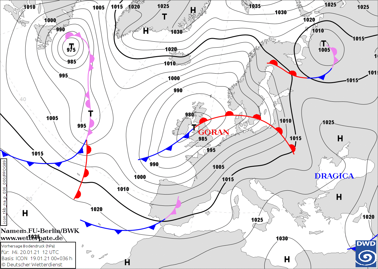
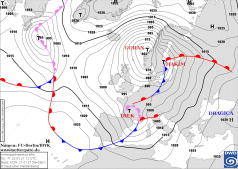
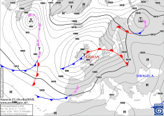
Sea level pressure and fronts, 22.01. 12 UTC
Data Source: FU-Berlin
|
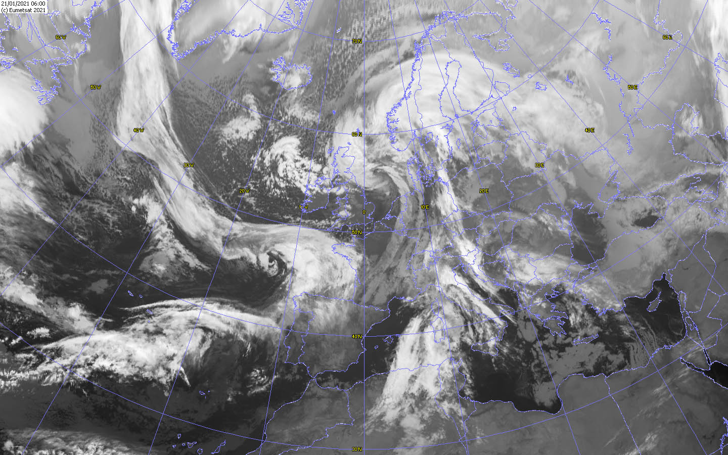
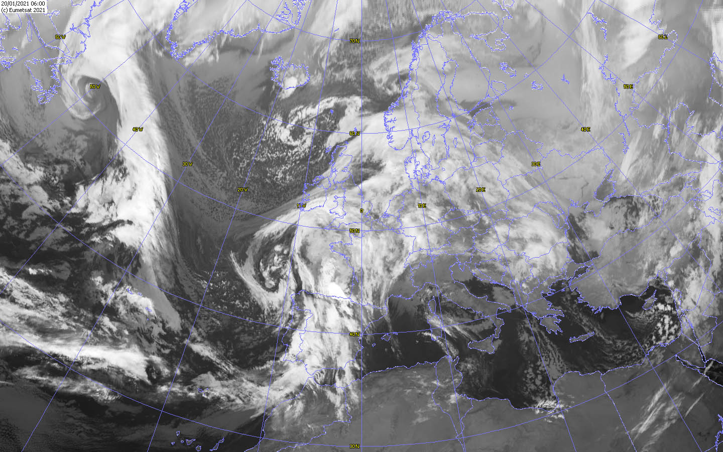
Satellite image (IR), 21.01. 06 UTC
Data Source: Wokingham
|
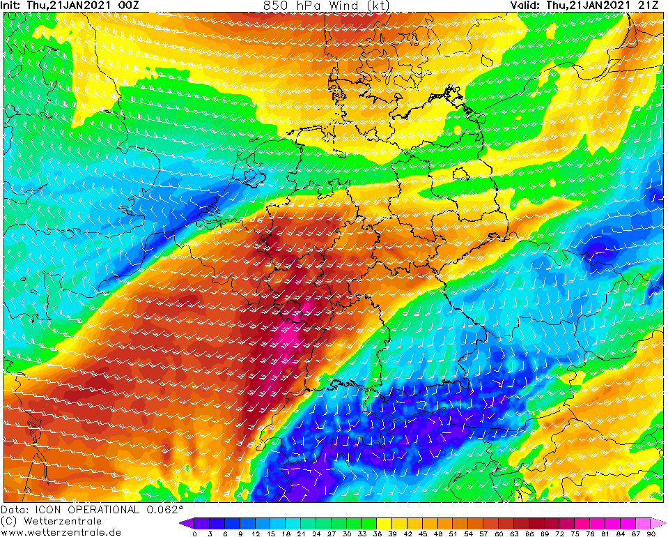
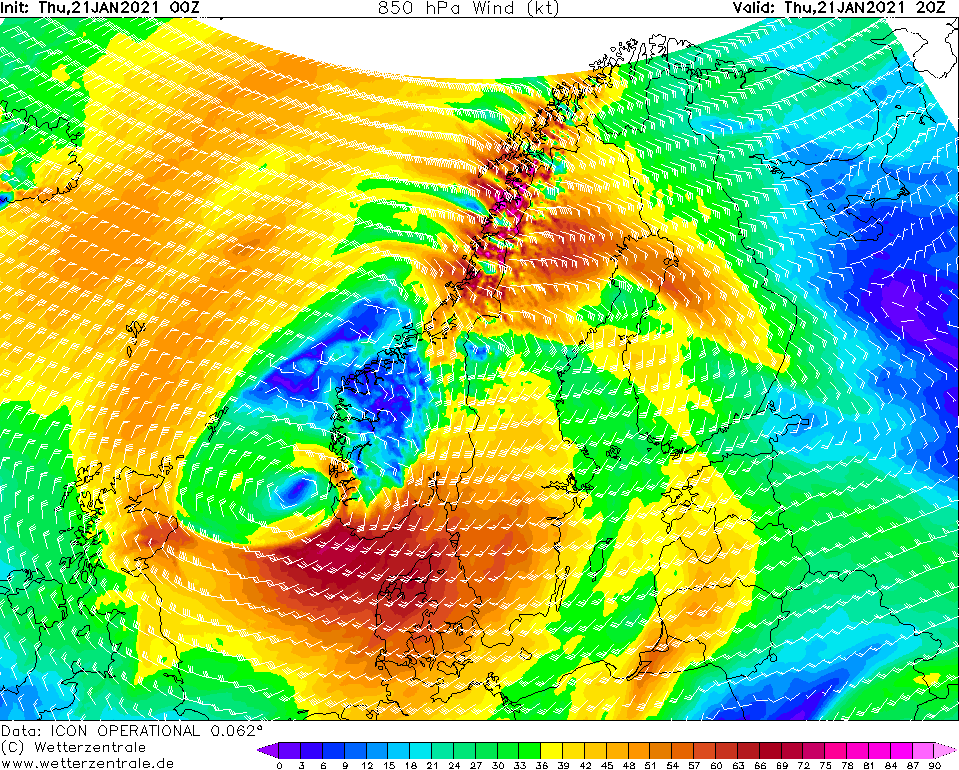
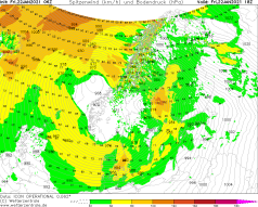
850 hPa Wind Central Europe, 21.01., 21 UTC
Data Source: Wetterzentrale
|
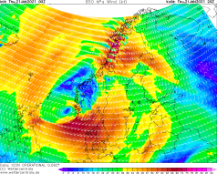
850 hPa Wind Scandinavia, 21.01., 20 UTC
Data Source: Wetterzentrale
|
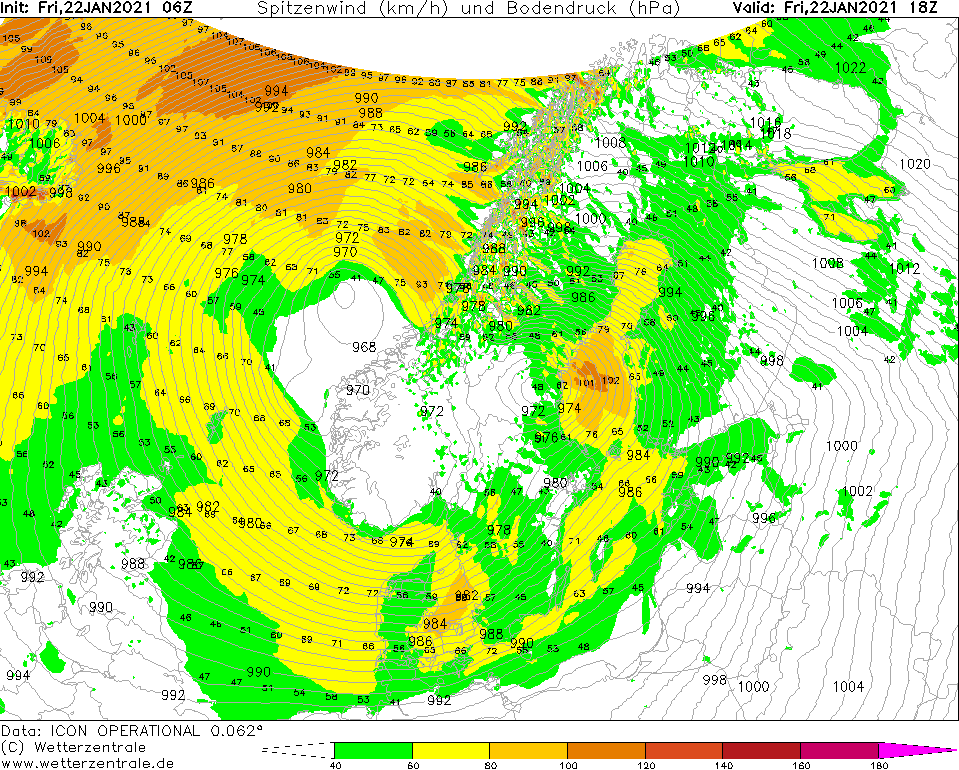
Winterstorm
Europe
Issued: Friday, 22 January 2021, 09:00 UTC
Winter storm GORAN is located over the southwest of Norway and ist core pressure started to rise. On Friday GORAN will cause wind speeds of up to 100 km/h (bft 10)
over Scandinavia and will also cause blizzard like condition due to moderate snowfall. Winter storm HAKIM is weakening as well but will cause wind speeds around
100 km/ (bft 10) in central Europe on Friday morning.
20.-23.01.2021
Winter storm GORAN reached Scandinavia last night. Its core is located over the southwest of Norway. Although its core pressure has risen to 965 hPa and will
continue to rise, the air pressure gradient remains high, so that wind speeds of around 100 km/h continue to occur, especially over northern Norway and southwestern
Sweden, as well as over Finland. In relation to the frontal system of GORAN, it will snow in the previously mentioned areas, resulting in blizzard like conditions.
Not until Saturday morning the wind will weaken.
The marginal low HAKIM which led to gusts up to 151 km/h (Brocken) during the night, especially in Germany, will also weaken during the next hours. Until the afternoon, however,
wind speeds around 100 km/ must still be expected and even in the lowlands isolated gusts around 50 to 60 km/h cannot be excluded.
Due to the special formation of the air pressure areas over Europe, the Mistral will form in the evening. Wind speeds around 120 km/h are expected. In addition, a
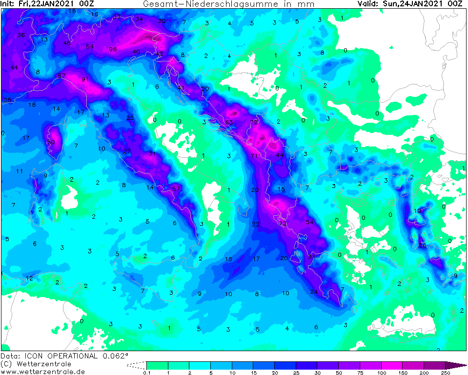
VB cyclone will develop over southern Europe. Low IREK will provide gusts around 120 km/h in the Mediterranean region from Friday evening and, above all, heavy
precipitation along the southern side of the Alps, which is typical for this type of low pressure area. Precipitation amounts around 250 mm are expected in Italy and
the Balkan states until Sunday.
Thursday, 21 January 2021, 08:30 UTC

|

|

|
|
Sea level pressure and fronts, 22.01. 12 UTC
Data Source: FU-Berlin
|
Peak gusts, Scandinavia, 22.01., 18 UTC
Data Source: Wetterzentrale
|
Peak gusts, France, 22.01., 18 UTC
Data Source: Wetterzentrale
|
Total precipitation amount,Italy and Balkan region, 24.01., 00 UTC
Data Source: Wetterzentrale
|
Winterstorm
Europe
Issued: Thursday, 21 January 2021, 08:30 UTC
Winter storm GORAN is located over the North sea and ist core pressure dropped to 955 hPa. Within the next few hours GORAN will cause wind speeds of up to
120 km/h (bft 12) in exposed locations over BeNeLux, Germany and Denmark. In lower altutudes and in low lands there will be gusts of up to 70 km/h (bft7-8).
A second low, a marginal low of GORAN, will reach central Europa on the night to Friday and will cause wind speeds up to 120 km/h.
20.-23.01.2021
Winter storm GORAN is currently located with its core over the North Sea with a core pressure of 955 hPa. GORAN will move rather slowly eastward towards
Scandinavia in the coming hours. Despite a slowly increasing core pressure, the air pressure gradient will remain high, especially on the southern flank, so
that wind speeds around 120 km/h will occur during the day, especially over BeNeLux, Germany and Denmark. Wind speeds around 60 km/h are also expected in the
lowlands. Last night, gusts around 148 km/h were already recorded in France (Mt. Aigoual), and 162 km/h were recorded on the Brocken mountain in Germany. The main storm field
will reach Scandinavia in the night to Friday, causing wind speeds around 120 km/h and partly heavy snowfall. Blizzard like conditions are expected. In northern
Norway, gusts above 130 km/h cannot be excluded.
In addition, another marginal low pressure system will reach Central Europe on Thursday evening. HAKIM II will again cause wind speeds around 120 km/h in France on
Friday night, in Germany gusts around 130 km/h are possible for a short time, especially over Saarland and Rhineland-Palatinate. Friday morning, the storm field will
spread over the rest of the country (except for the far south and southeast of Bavaria). The Föhn over the Alps will continue and will probably not break down until
the weekend.
Wednesday, 20 January 2021, 10:00 UTC
|

|
|
|
Sea level pressure and fronts, 20.01. 12 UTC
Data Source: FU-Berlin
|
Satellite image (IR), 20.01. 06 UTC
Data Source: Wokingham
|
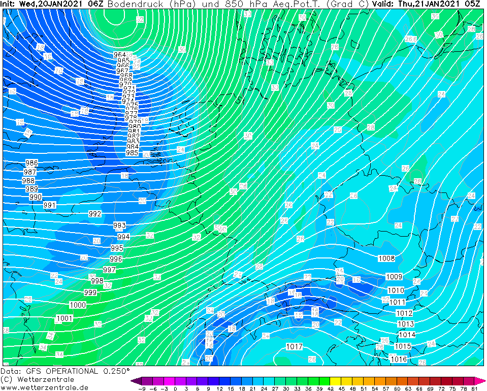
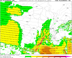
850 hPa Wind Central Europe, 21.01., 05 UTC
Data Source: Wetterzentrale
|
850 hPa pseudopot. temperature Central Europe,
21.01., 05 UTC
Data Source: Wetterzentrale
|
Winterstorm
Europe
Issued: Wednesday, 20 January 2021, 10:00 UTC
Winter storm GORAN will strenghen over the next few hours and will cause gusts of more than 130 km/h (bft 12) in exposed locations over France, Germany and BeNeLux.
In lower altutudes and in low lands there will be gusts of up to 70 km/h (bft7-8). A second low, a marginal low of GORAN, will reach central Europa on Friday and
will cause wind speeds up to 120 km/h.
20.-23.01.2021
Winter storm GORAN is currently located with its core over Scotland with a core pressure around 980 hPa. However, due to the interaction with a weak jet stream
approaching from the northwest, GORAN will intensify and the core pressure will drop to about 960 hPa by tomorrow morning. This will increase the air pressure
gradient, especially on the southwestern and southern flanks of the depression. However, with around 120 km/h, wind speeds in England will remain within limits.
The highest wind speeds will develop in combination with the cold front and a shortwave trough. There, wind speeds above 130 km/h are expected, especially in
exposed locations. The cold front and the shortwave trough will reach the Bay of Biscay today, Wednesday, at noon, and move across the English Channel in the evening
and Thursday night. On Thursday morning, they will reach the BeNeLux States and Germany. The highest wind speeds are expected in the north and northwest of France,
as well as over BeNeLux, all of western Germany (especially Rhineland-Palatinate, North Rhine-Westphalia, Saarland, northern Baden-Württemberg) northern
Germany (Lower Saxony, Schleswig-Holstein) and in central Germany (Hesse, Thuringia). In the lowlands, wind speeds between 50 and 70 km/h are expected, wit
gusts above 70 km/h are not excluded. On Thursday evening, the storm field will intensify over Denmark, where wind speeds around 120 km/h are expected.
GORAN as a controlling central low will move rather slowly over the North Sea towards Scandinavia with the core pressure dropping below 955 hPa.
A second marginal low will reach Central Europe on Thursday evening. The strongest gusts of around 120 km/h are again expected in northern France and later over
western and southwestern Germany. In addition, the Föhn will build up over the Alps from Wednesday evening and persist until Friday.
Issued: January 20, 2021, 10:00 UTC
MG
Issued: January 21, 2021, 08:30 UTC
MG
Issued: January 22, 2021, 09:00 UTC
MG
|