|
Low pressure area HENDRIK created wind gusts up to 166 kph in Germany. Significant restrictions in railway traffic, damages to traffic infrastructure and electricity network.
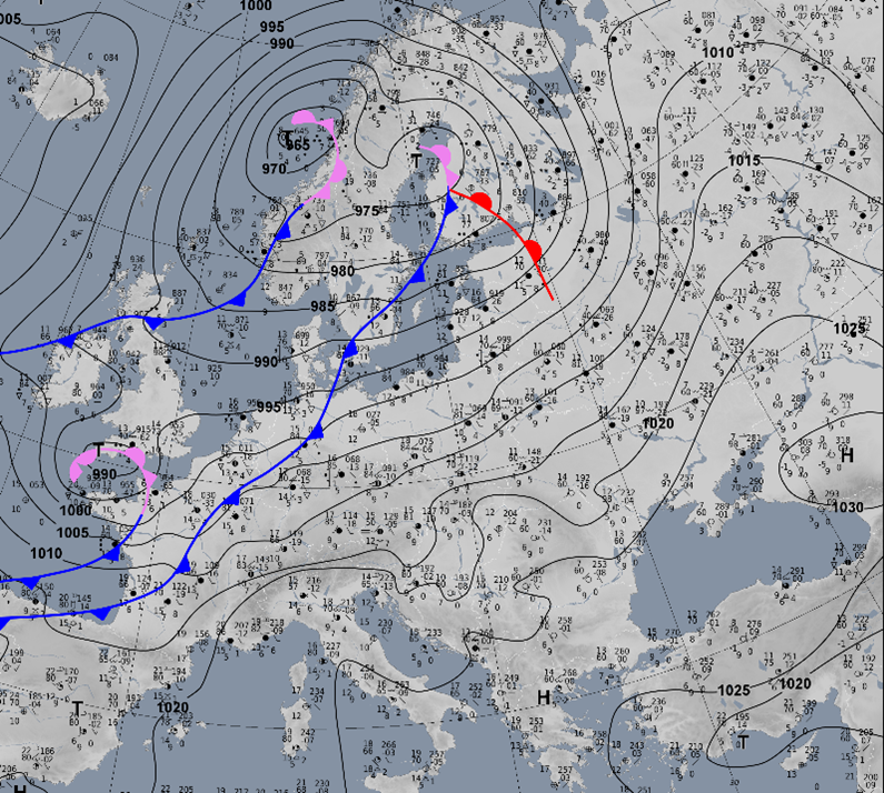
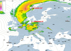
The fast-runner low HENDRIK II formed at the tip of a trough lying over the North Atlantic. The leading central low HENDRIK III directed HENDRIK II at high speed in a zonal
movement slightly north of the Bay of Biscay. On the evening of 20 October, HENDRIK II crossed the western exit of the English Channel, and by the next morning it was already
over the Bay of Kiel. The cold front of HENDRIK II crossed Germany on 21 October, during which the highest wind speeds were recorded. In western Germany this was already the
case in the early morning hours, in eastern Germany the wind velocitites peaked during afternoon/evening.
|
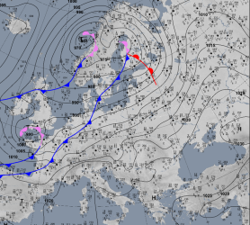
Sea level pressure, fronts and surface observations, 20.10. 18 UTC until 21.10. 18 UTC, source:
DWD
|
 |
 |
 |
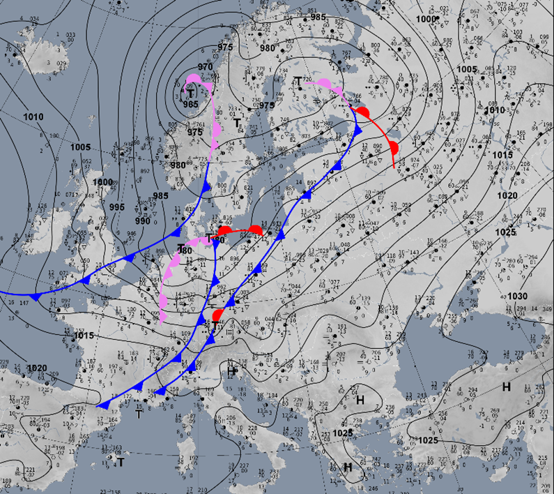
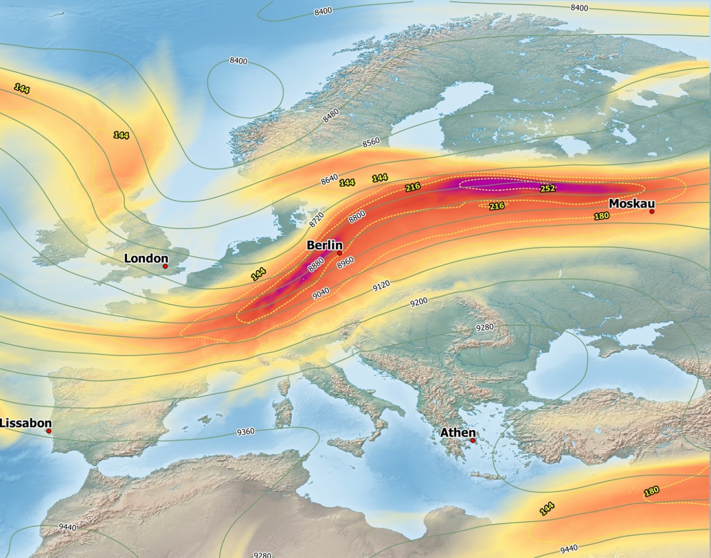
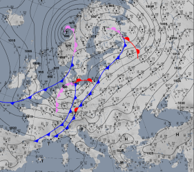
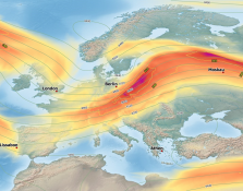
In general, the highest wind speeds occurred south of the centre of HENDRIK II because the horizontal pressure gradient reached its maximum there. The analysis of the 300 hPa
geopotential surface shows the jet streak with wind speeds of over 200 kph. The anticyclonic curvature over Eastern Europe indicates the warm air still resting there, which
caused warmer-than-average temperatures in Central Europe on 20 October. In the surface field, the wind speeds are less defined in a homogeneous way, but rather on a smaller
scale. Analysis charts of the Arpege model indicate wind gusts of up to 110 kph in the lowlands, and up to 155 kph in elevated areas, especially the Black Forest.
|
300hPa geopotential and wind, surface wind gusts, 21.10. 06 UTC and 21.10. 12 UTC, source:
Meteofrance, vizualisation: Bernhard Mühr
|
 |
 |
 |
 |
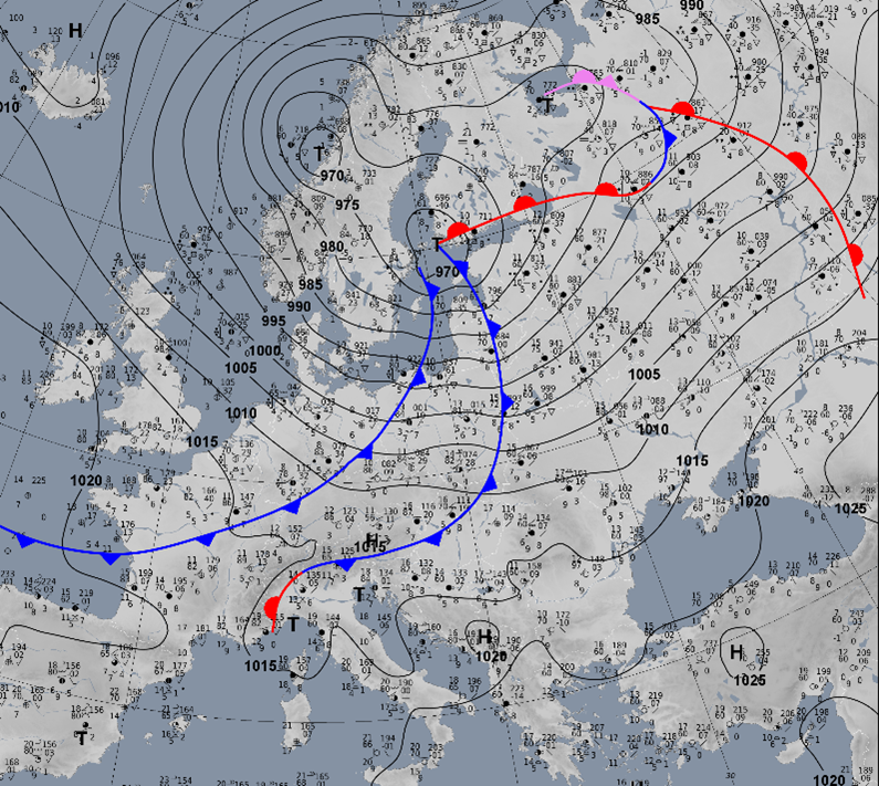
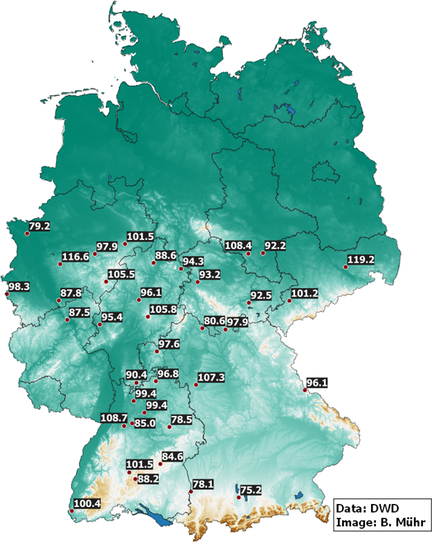
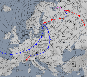
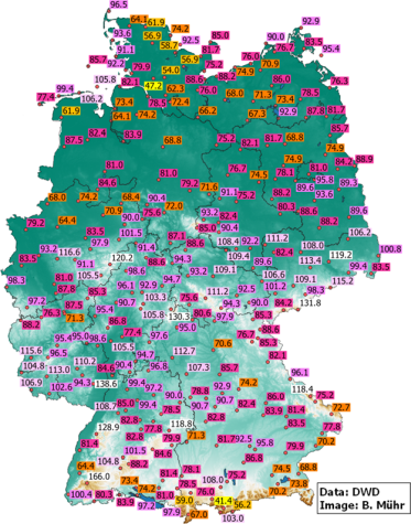
The observations from the DWD's national measurement network show the intensity and extent of HENDRIK II's wind field. While the Feldberg marked the peak with a gust of
166 kph, there were also wind gusts of more than 100 kph at the North Sea (Spiekeroog, Alte Weser lighthouse), in North Rhine-Westphalia, Saarland, Rhineland-Palatinate,
Baden-Wuerttemberg, Hesse, Thuringia, Bavaria, Saxony-Anhalt and Saxony. In Saxony in particular, there were also violent gusts in the lowlands causing numerous reports
of damage.
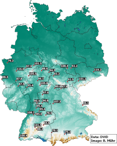
In the southern half of Germany, HENDRIK set numerous monthly records for maximum wind gusts. In Bavaria, the station Lautertal-Oberlauter recorded the strongest October
wind gust in the 50-year measurement history with 97.9 kph. The same applies to the measured value at the Dresden-Klotzsche station, which at 119.2 kph marked the peak value
in 46 years.
|
Observed gusts from 21.10.2021, new monthly wind gust records, source:
DWD, vizualisation: Bernhard Mühr
|
 |
 |
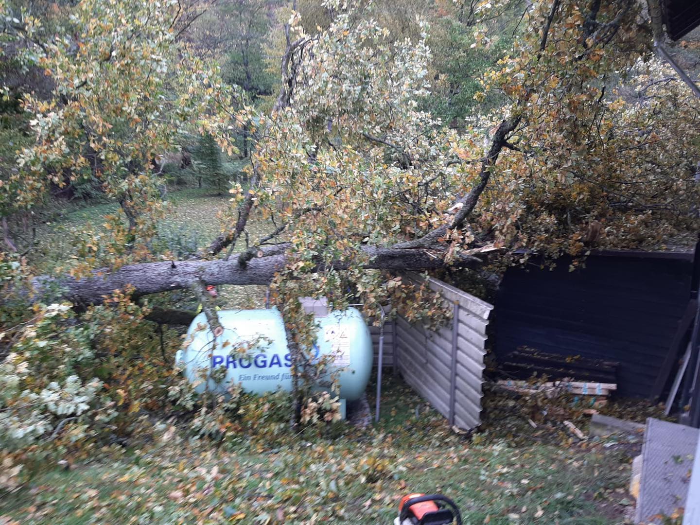
The storm caused a lot of damage. In Germany, 55,000 people were temporarily without electricity (France: 250,000). Rail traffic had to be suspended in Saxony, Saxony-Anhalt
and Thuringia, and there were significant restrictions in other federal states. Several fallen trees caused damage to buildings and cars, in Speyer the A61 motorway had to be
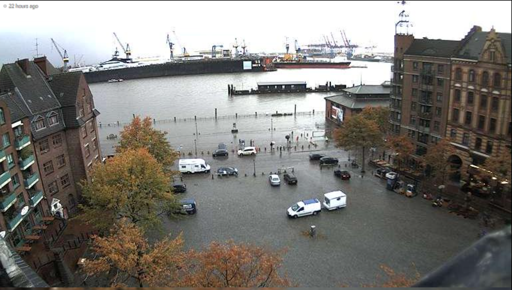
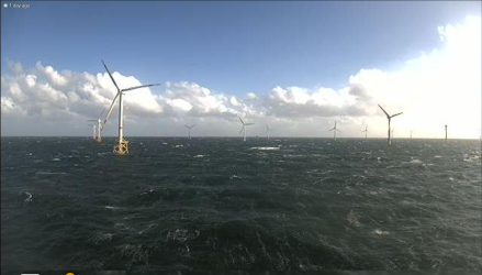
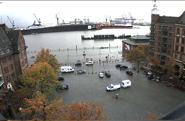
closed due to several tilted / sideways trucks. In Rhineland-Palatinate, damage was caused to a wind turbine near Kastellaun. At Hamburg's fish market, a storm surge of 171cm
above the threshold for mean high water occurred. In total, at least one fatality can be attributed to the storm, as well as several injuries.
|
Webcam images from Offshore Windpark Borkum and Hamburg Fischmarkt, 21.10. 15 UTC, source:
Windy
|
 |
 |
Text
Text: FS
October 25, 2021
|