|
Shortly after Winterstorm GRETA another winterstorm named HERMINE reached Europe and the British Isles. HERMINE caused windspeeds of 167 km/h in Caingron (GB) and
in the low lands 60-70 km/h over France, BeNeLux countries as well as Germany. HERMINEs fronts also caused torrential rain- and snowfall of 60mm/24h over the
alpine regions.
Weather Situation
After Winter Storm GRETA had caused stormy weather over the Christmas holidays, Winter Storm HERMINE reached Europe and the British Isles only a few days later.
HERMINE was an extensive low-pressure area over the North Atlantic and moved rather slowly over Scotland, England and Whales to France and later over the BeNeLux
States and Germany on December 27 to 29. Over Scandinavia, the winter storm weakened and dissipated. HERMINE was a Norwegian cyclone and had a significant frontal
system, which caused heavy precipitation in the form of snow and rain, especially over France and later the Alpine regions.
|
850 hPa equivalentpot. Temperature, December 26-29, 2020:
Wetter3
|
 |
 |
 |
 |
Development
HERMINE formed on December 23 over the North Atlantic near Newfoundland with a core pressure of about 970 hPa. In front of a jet stream, HERMINE moved eastward and
reached Iceland on 26 December. The Core pressure dropped below 960 hPa. HERMINE had a strong air pressure gradient on its southwestern and southern flanks, so its
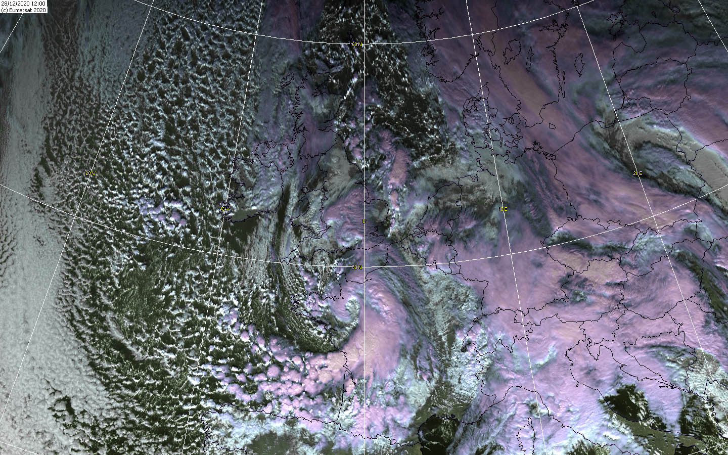
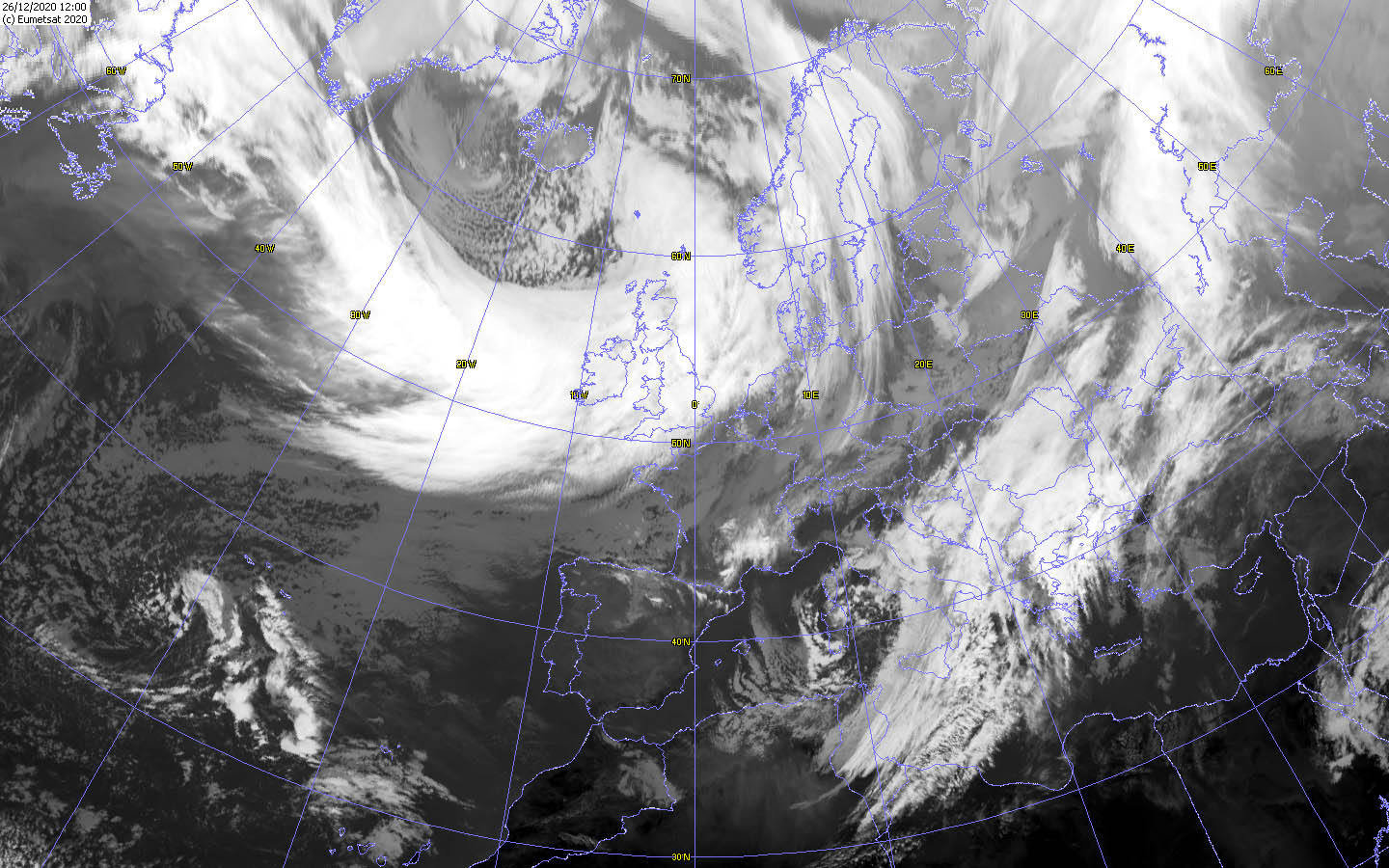
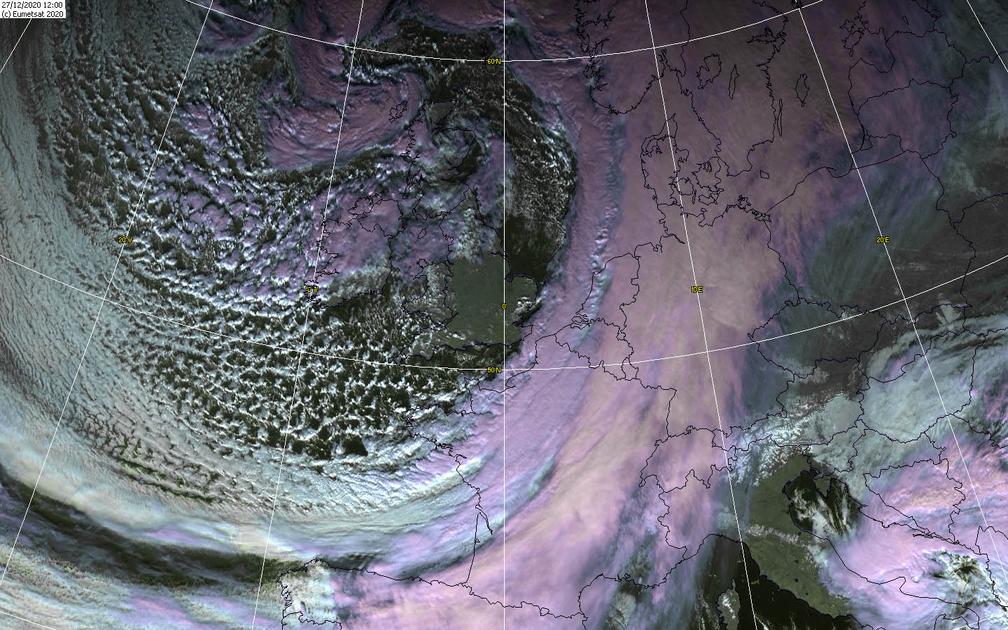
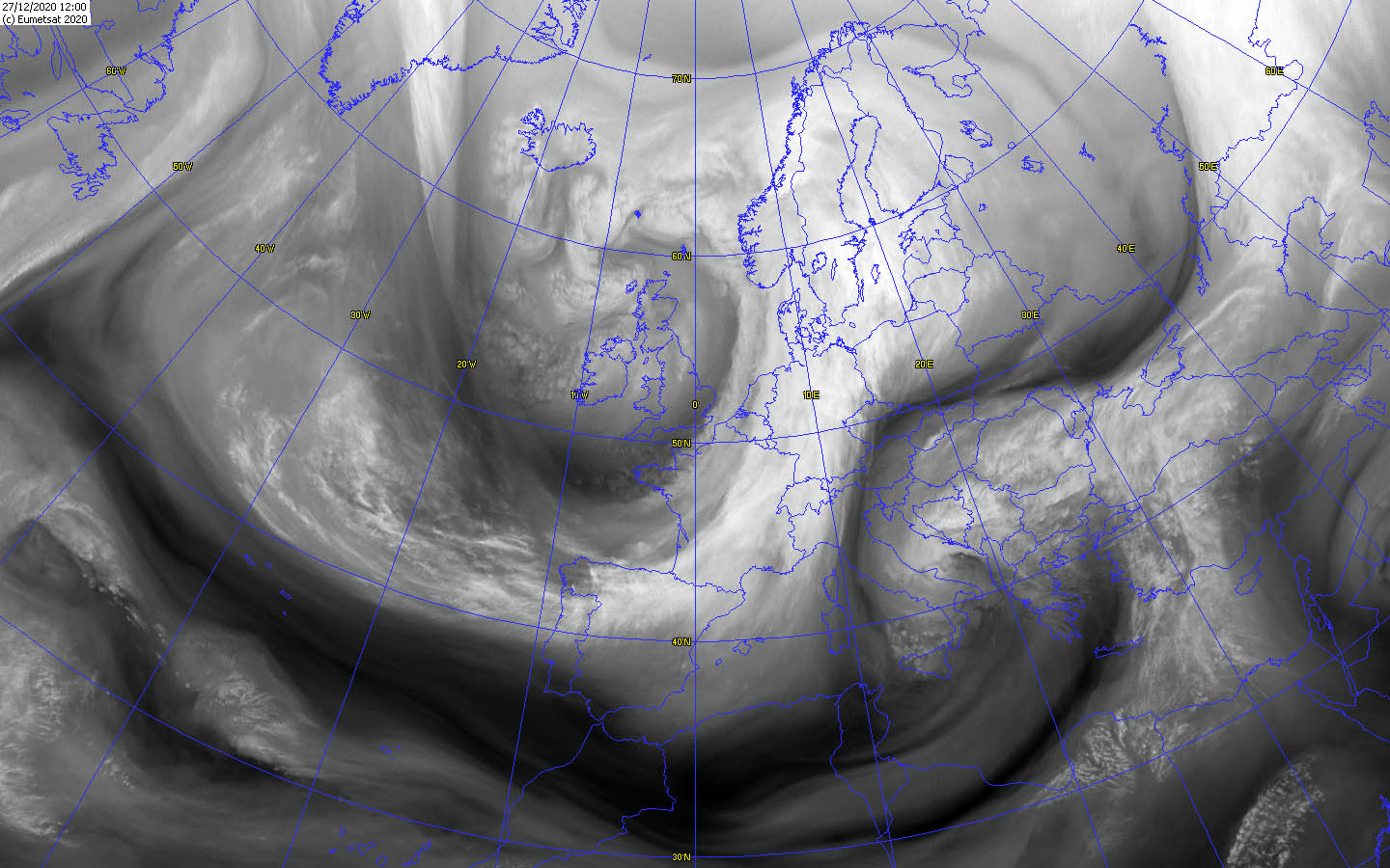
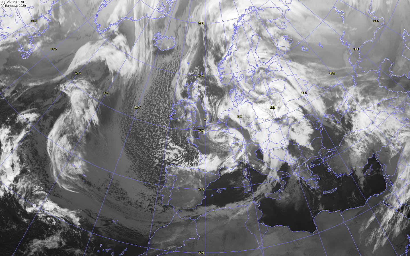
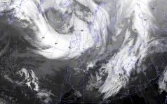
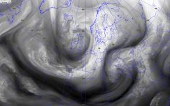
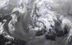
storm field was already evident over Ireland and Great Britain. Also, its significant and massive frontal system (see satellite images) had already reached the
British Isles. In front of the frontal system, some milder air was advected and precipitation fell in the form of rain. On the rear side of the cold front, however,
most of the precipitation fell as snow, again at cooler temperatures. The sharp edge of the cold front can be seen very well on the satellite images, but also on the
analysis images of the pseudopotential temperature at 850 hPa. On 27 December, HERMINE's core finally reached Scotland and had a core pressure of 955 hPa. The jet
stream had strengthened, favoring HERMINE's development. A weak dry intrusion probably also contributed to the pressure drop in the core. The still massive cold
front and its precipitation reached the (northern) coasts of Central and Southern Europe. In the night of 28 December, the pressure in the core started to increase
and HERMINE moved across the English Channel to France, reaching the BeNeLux States and Germany in the night of 29 December. In the process, the pressure rose
980 hPa and the air pressure gradient also decreased. Meanwhile, a small marginal low developed in the lee of the Alps, causing heavy snow and rainfall over the
Alpine regions. On December 29, HERMINE moved over the Baltic Sea towards Scandinavia and dissipated over the following days.
|
Satellite images (IR, VIS and WV), December 26-28, Source:
Wokingham
|
 |
 |
 |
 |
|
Precipitation amount and kind, December 26-29, 2020:
Wetter3
|
 |
 |
 |
 |
The highest wind speeds were reached over Scotland and France on December 26 and 29. However, wind speeds of between 60 and 70 km/h (France, Germany) were
also widespread at lower altitudes and in the lowlands. Occasionally, gusts of around 80 km/h occurred.
|
300 hPa wind speed and divergence, December 26-28, 2020:
Wetter3
|
 |
 |
 |
 |
|
300 hPa wind speed and divergence, December 27-29, 2020:
Wetter3
|
 |
 |
 |
 |
| Location |
Gusts in km/h |
Date |
Cairngorn (GB)
Estaca De Bares (ES)
Mont Aigoual (FR)
Ile Rousse (FR)
Cap Bear (FR)
Cap Corse (FR)
Schmücke (DE)
Ouessant-Stiff (FR)
Beg Melen (FR)
Great Dun Fell (GB)
Brignogan (FR)
Aberdaron (GB)
Brocken (DE)
Feldberg (DE)
|
167
151
151
151
148
148
144
144
140
139
137
133
130
122
|
26.12.2020
27.12.2020
26.12.2020
29.12.2020
26.12.2020
28.12.2020
27.12.2020
28.12.2020
27.12.2020
26.12.2020
28.12.2020
26.12.2020
27.12.2020
27.12.2020
|
|
Data source: Ogimet.
Text: MG
December 31, 2020
|