|
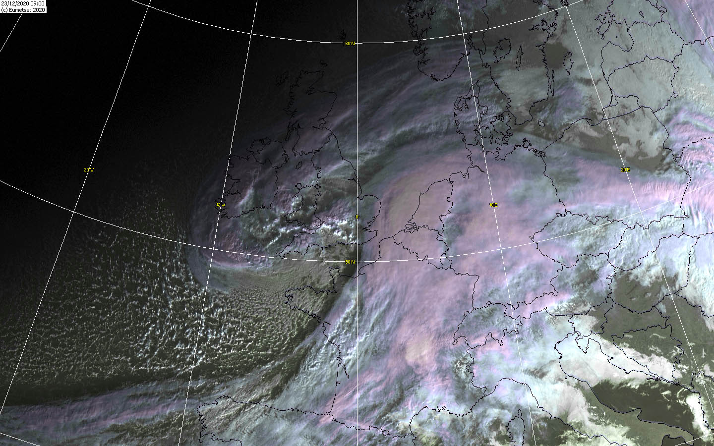
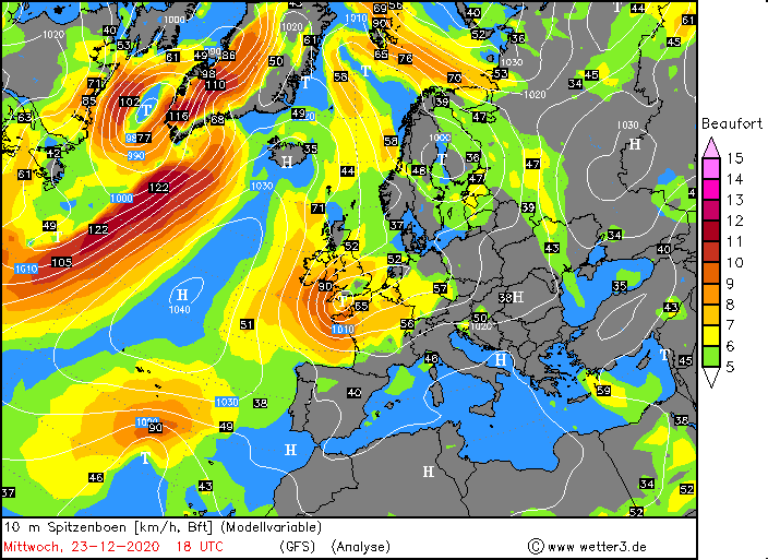
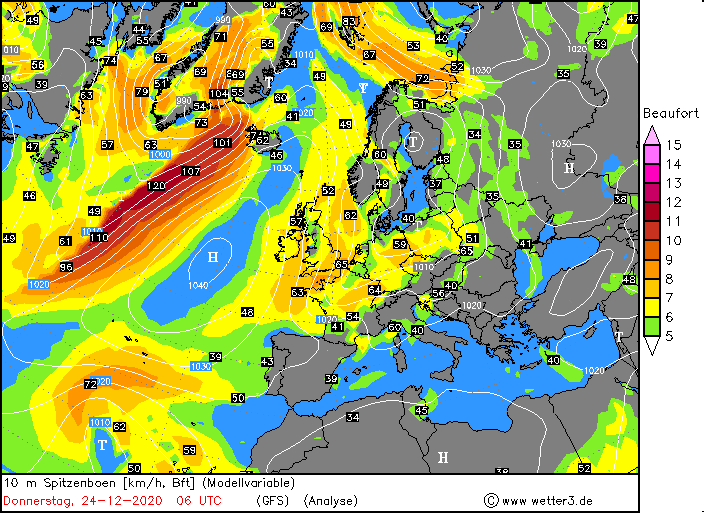
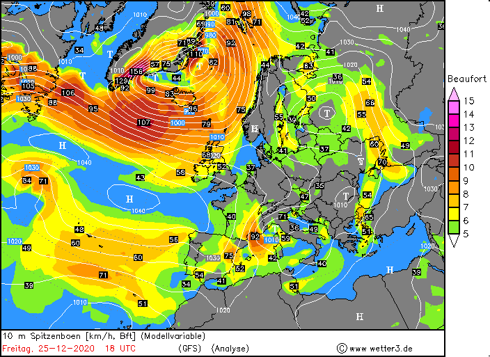
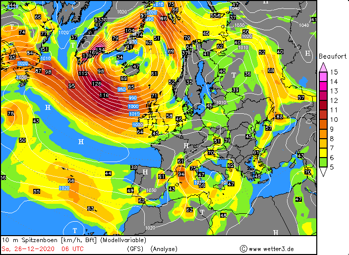
Winter storm GRETA caused stormy and rainy weather in Europe and the British Isles over the Christmas holidays. The highest wind speeds with 141 km/h were
recorded at Cairngorn (UK) and Cap Bear (FR) on December 25. The massive warm front clouds of the Shapiro-Keyser cyclones also resulted in striking precipitation
amounts, as also on December 25 on Mount Pilatus in Switzerland with 62.9 mm. In addition, a pronounced mistral with wind speeds up to 148 km/h developed on the
same day in France.
Weather Situation
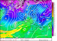
December was relatively mild in Europe due to a steady southwesterly wind. Low pressure systems repeatedly reached the mainland and brought mild
sea air inland. GRETA, on the other hand, developed into a windstorm and quickly moved across the British Isles and Central Europe to Eastern Europe.
In addition to heavy precipitation and gale gusts, it brought winter-like temperatures due to the pronounced new cold air on the back side of the frontal
system and high ZVEN.
|
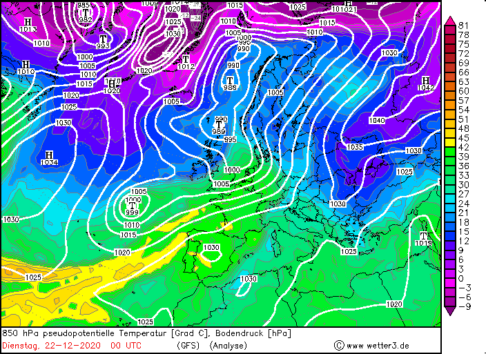
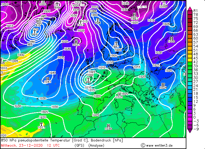
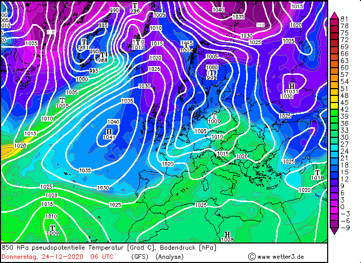
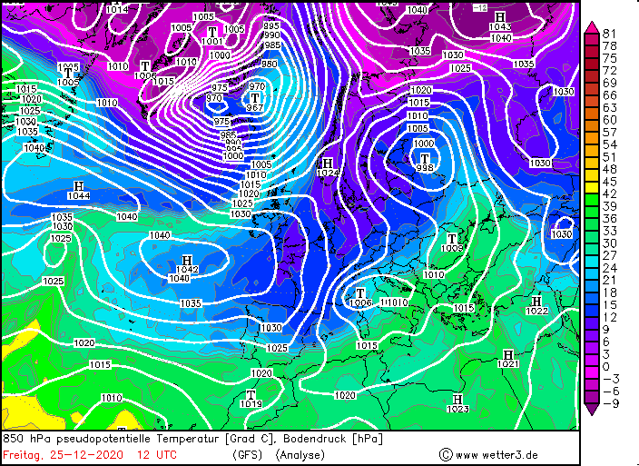
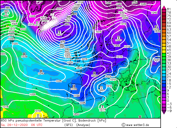
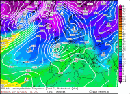
850 hPa equivalentpot. Temperature, December 22-26, 2020:
Wetter3
|
 |
 |
 |
 |
 |
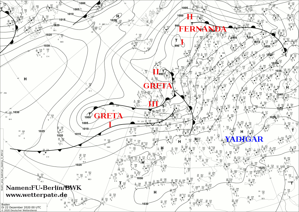
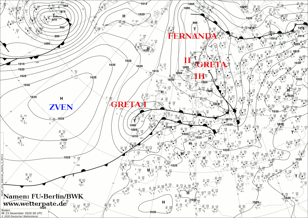
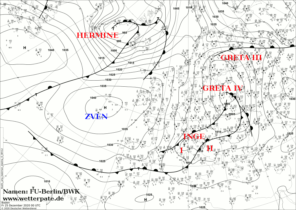
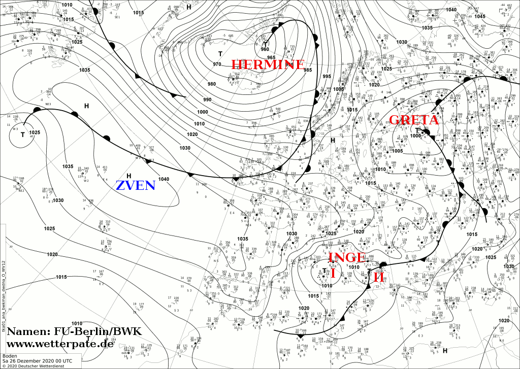
Development
After unusually mild temperatures in Central Europe and especially in Germany in mid-December, winter storm GRETA brought significantly colder and windier
weather to Europe. GRETA was a Shapiro-Keyser cyclone. GRETA moved across the Atlantic as a wave disturbance on December 19, initially moving very slowly eastward.
Core pressure was around 985 hPa and even increased to around 1000 hPa by 21 December. GRETA reached the Bay of Biscay as late as 22 December and continued to move
rather slowly across the English Channel and the BeNeLux countries. On December 24, the displacement speed increased significantly, so that GRETA quickly crossed
Germany and Denmark and reached Eastern Europe by December 25. Core pressure began to increase only slowly and GRETA dissipated a few days later. Wind speeds of
over 140 km/h were recorded at the summits. But wind speeds between 40 and 70 km/h were also reached in the lowlands and at lower altitudes.
|
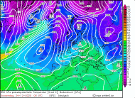
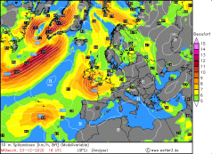
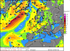
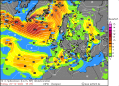
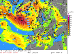
10m wind speed, December 23-26, 2020:
Wetter3
|
 |
 |
 |
 |
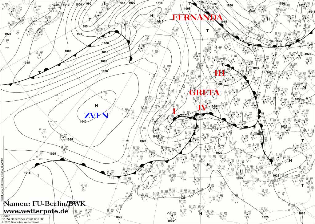
In addition, the frontal system south of the Alps developed another low, which resulted in heavy precipitation in the form of rain but
mainly snow. These heavy precipitations mainly affected the Alpine regions and northern Italy, but also the Adriatic coast and the Balkan states.
Due to the special constellation of the pronounced high-pressure area ZVEN over the Atlantic and Western Europe, the retreating low GRETA over Eastern Europe as well
as the Leeward low at the Alps, the mistral developed over France. High wind speeds of 148 km/h were also reached there. The mistral is a cold, dry northwesterly
wind that can be found in the south of France in the area of the Rhone Valley and, in contrast to the Föhn, is one of the katabatic winds. Through the valley,
the wind is accelerated by the jet effect and reaches remarkable wind speeds. It can persist for several days (in this case it was almost 3 days).
Text: MG
December 30, 2020
|