|
Major Hurricane IOTA was the strongest storm of the 2020 Atlantic Hurricane Season so far. It reached Category 5 with wind speeds of 260 kph
and central pressure of 917 hPa. Landfall in northern Nicaragua as high end Category 4 hurricane.
Major Hurricane IOTA was the 30th named storm of the very active Atlantic Hurricane Season 2020 and the strongest hurricane of the season
so far. A tropical wave, which was already monitored by the National Hurricane Center on November 08, turned into an area of organized
convection in the Central Caribbean Sea on November 11. On 13 November the system was classified as a tropical storm, extending the record
of most named storms per season from 29 to 30 (old record: 28 named storms in 2005). Late in the evening of November 14, convection began
to wrap around the center, making IOTA the 13th hurricane of the current season on November 15. Rapid intensification lead to IOTA reaching
Major Hurricane Status on early 16 November, making the 2020 season the first Atlantic Hurricane Season to create two Major Hurricanes in
November (the other one was ETA).
|
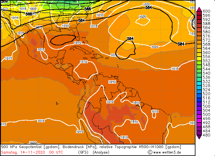
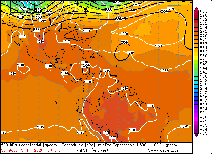
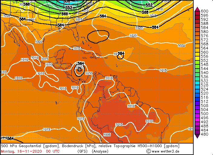
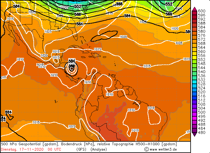
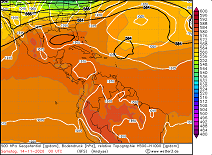
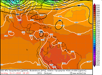
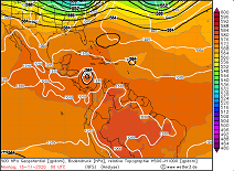
500 hPa Geopotential from 14 to 17 November, source:
wetter3
|
 |
 |
 |
 |
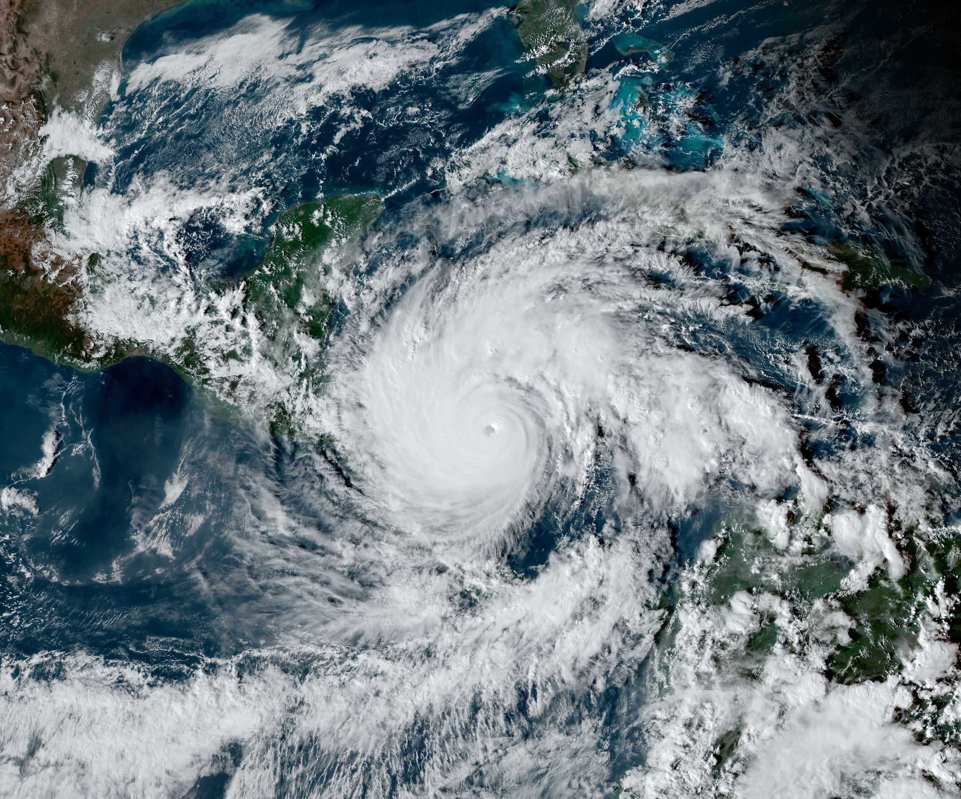
Already in the evening of the same day the system reached its peak intensity with a core pressure of 917 hPa and 260 kph and was classified
as a Category 5 hurricane. This makes IOTA the first tropical storm named after the Greek alphabet to reach Category 5 and also the latest
Category 5 hurricane in the calendar year (old record: Cuba Hurricane in 1932). From the time of its formation until it went ashore, IOTA was
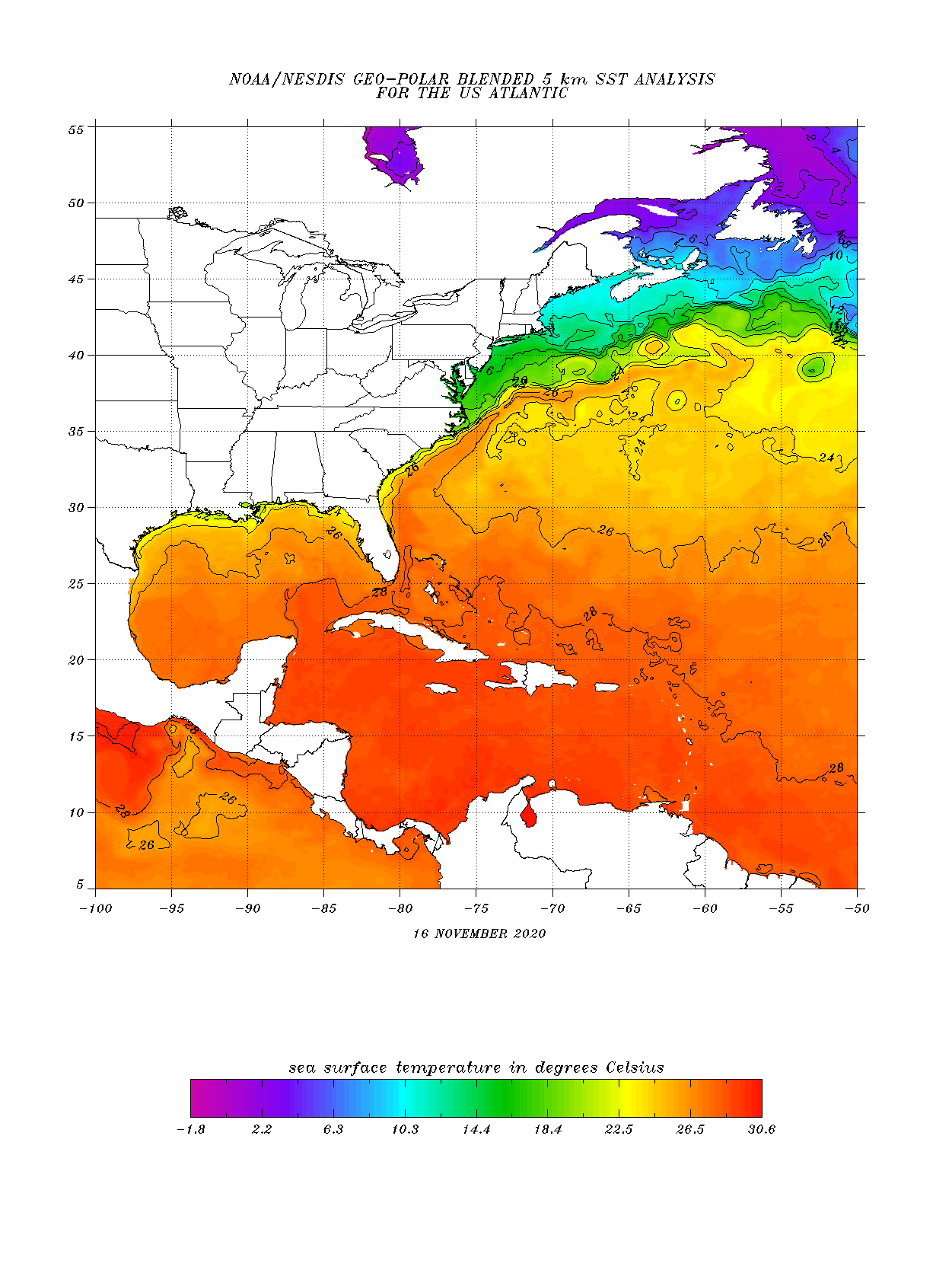
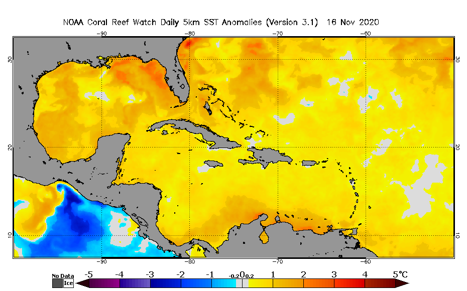
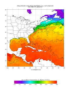
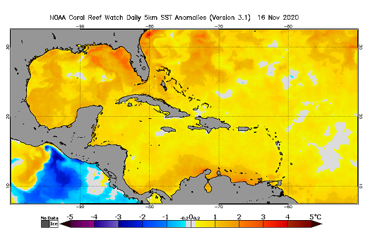
always in the area around the 13th latitude and showed little movement in north-south direction. The high water temperatures of up to 29°C
in the Caribbean Sea, hardly any vertical wind shear, but still enough distance to the equator (which is necessary for the Coriolis force to
have sufficient effect) made the explosive intensification of the storm possible.
Sea surface temperature and anomaly in the Carribean Sea, source:
NOAA
 |
 |
|
On November 17, IOTA approached the east coast of Nicaragua and showed first signs of weakening due to the interaction with the mainland at
about 03:00 UTC. The eye of the storm crossed the coast only 40 minutes later and made landfall on Nicaragua as a high-end Category 4 hurricane.
Wind speeds at that time were approximately 250 kph and core pressure was 920 hPa. The landfall occurred in the area of the port city of Puerto
Cabezas about 25 km south compared to hurricane ETA two weeks earlier. Since recording began, only four category 4+ hurricanes have made
landfall in Nicaragua before November 2020, with ETA and IOTA adding two more within 14 days.
|
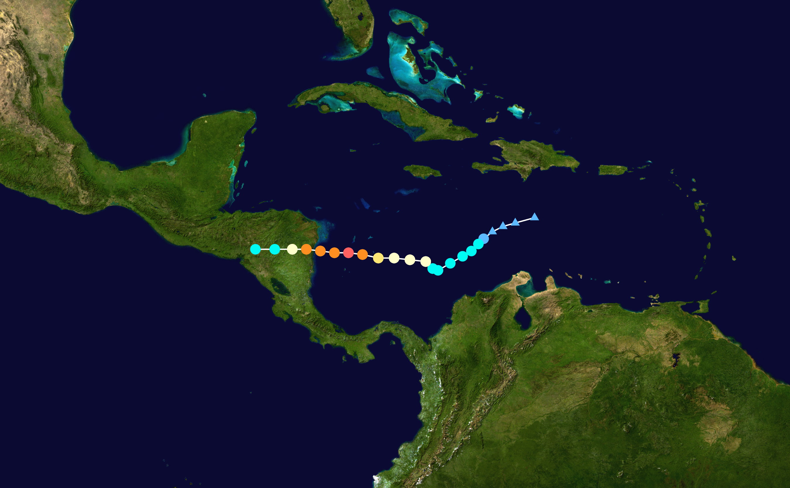
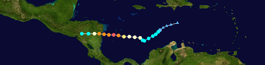
IOTA's trajectory, background image:
NASA , tracking by
NHC
|
 |
Due to the already heavily damaged infrastructure caused by Hurricane ETA, there is little communication to the outside world. Reports indicate
continuous flooding since ETA's passage and massive destruction by storm and flood damage. On November 17, La Ceiba Airport (Honduras) reported
257.2 mm of daily precipitation, while Trujillo and Tela reported 140.6 and 133.0 mm. There are no precipitation reports from Nicaragua - but it
can be assumed that the local values are much higher.
It is also interesting to note that the 2020 Atlantic hurricane season shows a tendency to produce particularly strong storms towards the end of
the season. While the first 24 named systems produced only two major hurricanes, the last six named systems produced four.
Sources: GOES Image Viewer
Text: FS
November 18, 2020
|