|
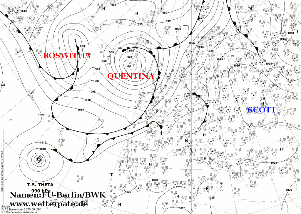
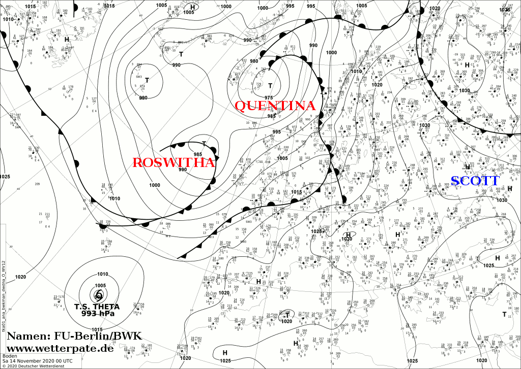
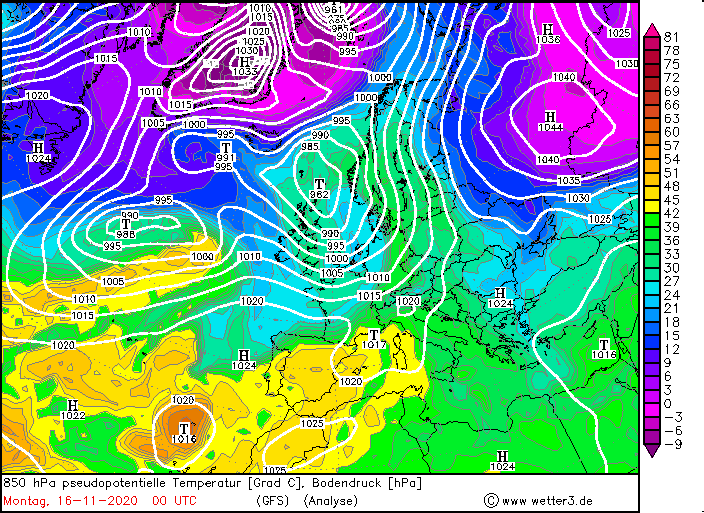
Storm low ROSWITHA was a Norwegian cyclone which brought gusts of up to 130 km/h in Great Britain and France.
The high wind speeds were caused by the air pressure gradient and the fast moving cold front. The warm air advection at the front of its frontal system was
also striking.
Weather Situation
Before ROSWITHA reached Great Britain and Europe, the high SCOTT provided mild and calm autumn weather. In Great Britain and Ireland,
on the other hand, the occlusal front of Low QUENTINA was still in place. ROSWITHA was a fast-moving low-pressure system and its core moved directly over Ireland
and Great Britain. The cold front moved quickly over France and Central Europe after SCOTT had moved further to the southeast, clearing the way for the new front.
|
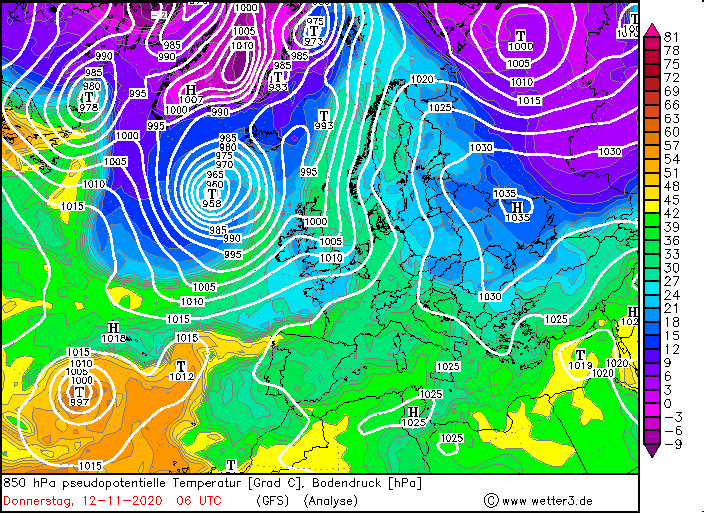
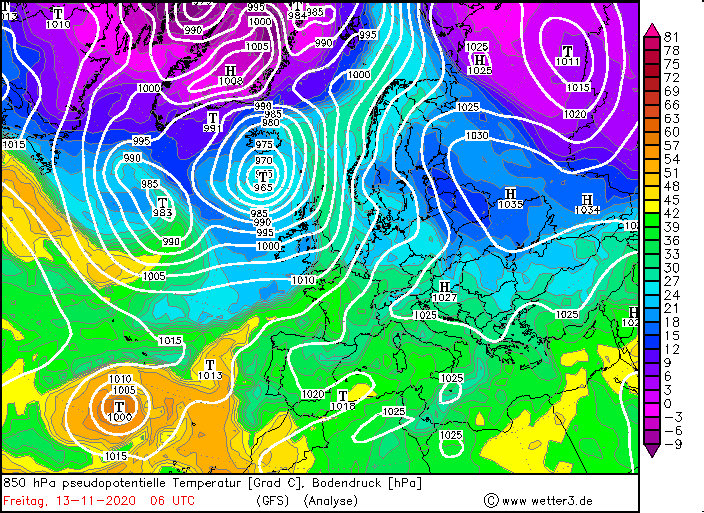
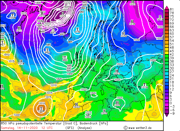
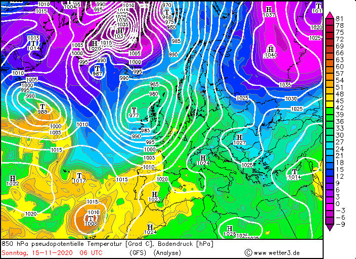
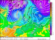
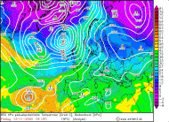
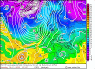
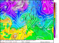
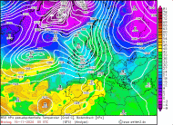
850 hPa equivalentpot. Temperature, November 11-15, 2020:
Wetter3
|
 |
 |
 |
 |
 |
Development
ROSWITHA originated as a small wave disturbance in front of a trough over Canada on November 11. The amplitude of the wave disturbance was already clearly visible in
the temperature field and on the weather maps of the pseudopotential temperature. The pressure already began to fall slightly over Canada. ROSWITHA was at the front
side of a jet stream in the area of positive divergence. ROSWITHA moved over Newfoundland to the North Atlantic within 24 hours and its core pressure dropped from
about 1000 hPa to 978 hPa. In addition, the amplitude in the temperature field increased. While ROSWITHA moved east across the Atlantic, its core pressure increased
slightly as she was no longer in the region of positive divergence. On November 14th ROSWITHA get back again into the range of positive divergence and into the
range of a dry intrusion, whereupon its core pressure again fell rapidly. By this time it had reached Ireland and Great Britain. Due to the pressure gradient,
gusts of around 130 km/h were registered.
.
|
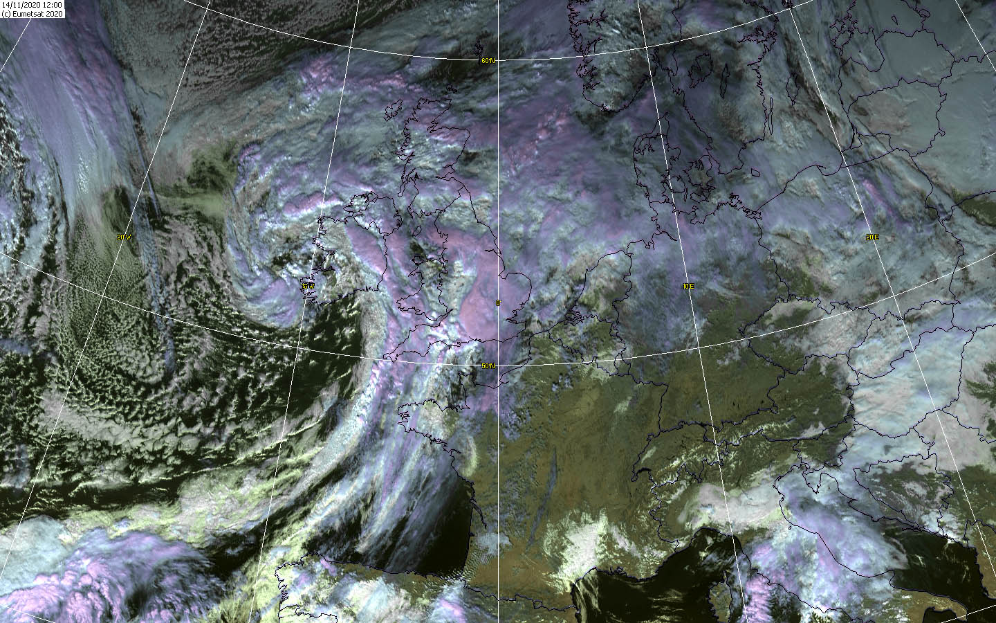
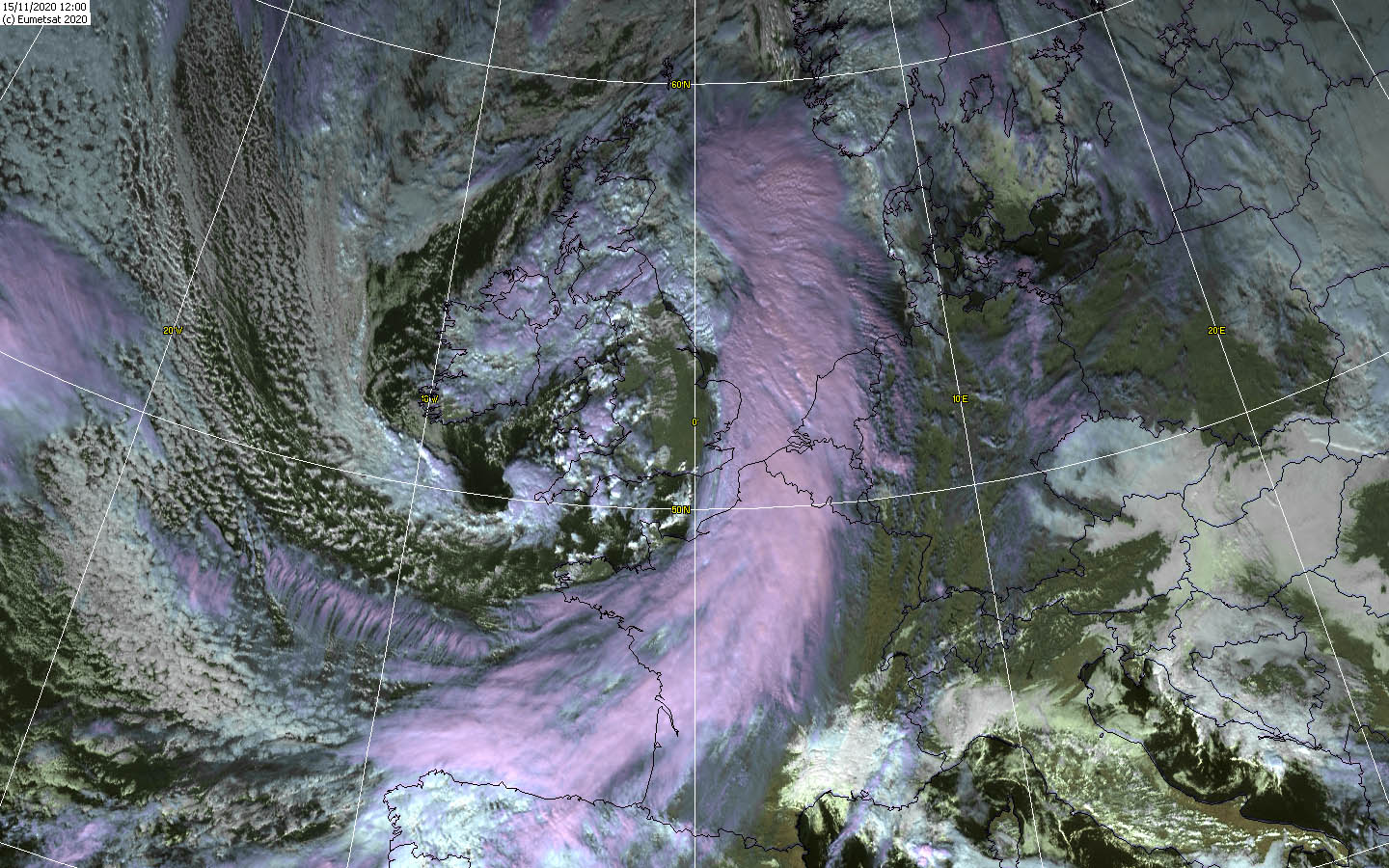
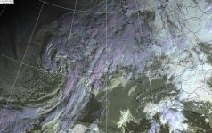
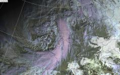
Satellite images (VIS), November 14-15, Source:
Wokingham
|
 |
 |
 |
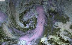 |
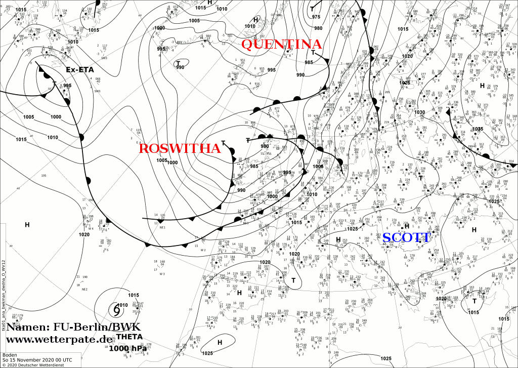
ROSWITHA also formed a remarkable cold front, which reached the coasts of France in the night of November 15th, where on Sunday morning it caused gusts of up to
130 km/h. In the afternoon, the cold front reached the BeNeLux states and northwest Germany. In the night to Monday the storm field or cold front then spread to the
entire western part of Germany and caused stormy gusts also during the day, in the lowlands strong to stiff gusts around 60 km/h. Not relevant for warning but
interesting was ROSWITHA's striking warm air advection at the front of the front system. In France and Germany, temperatures around 19 degrees were measured on
November 14 and 15, which is unusually warm for November.
Text: MG
November 17, 2020
|