|
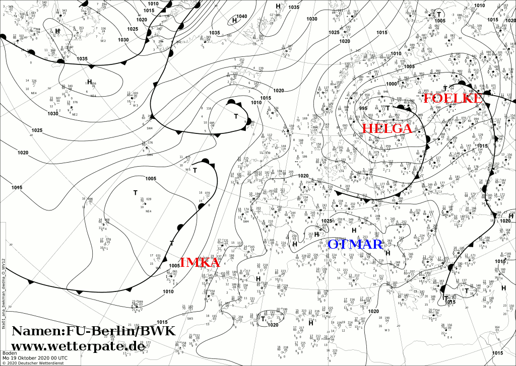
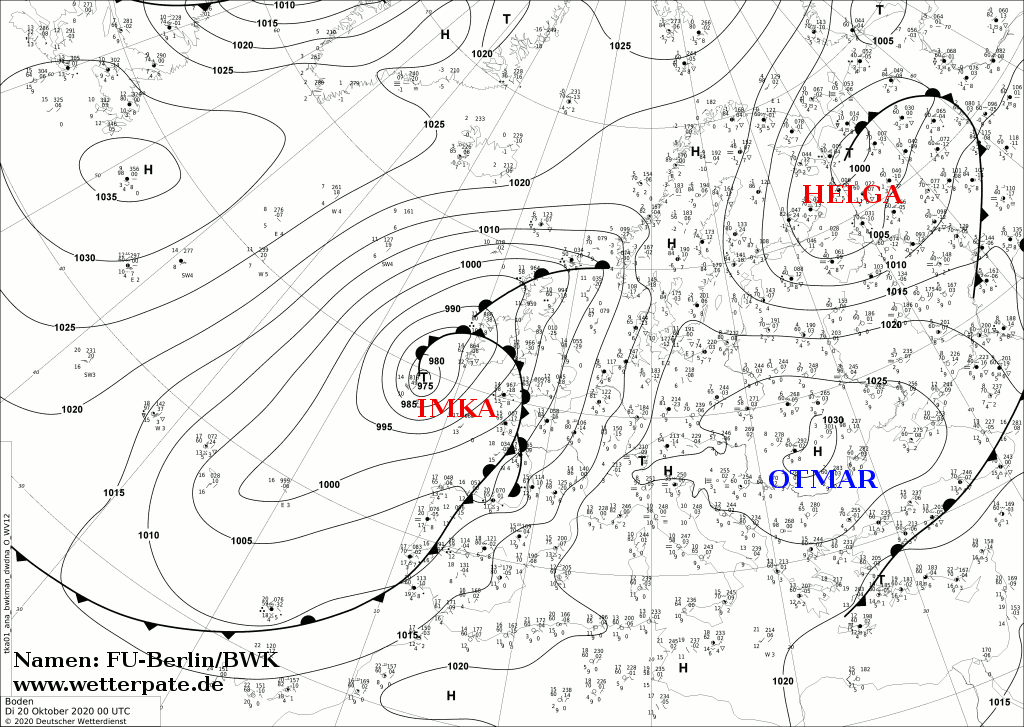
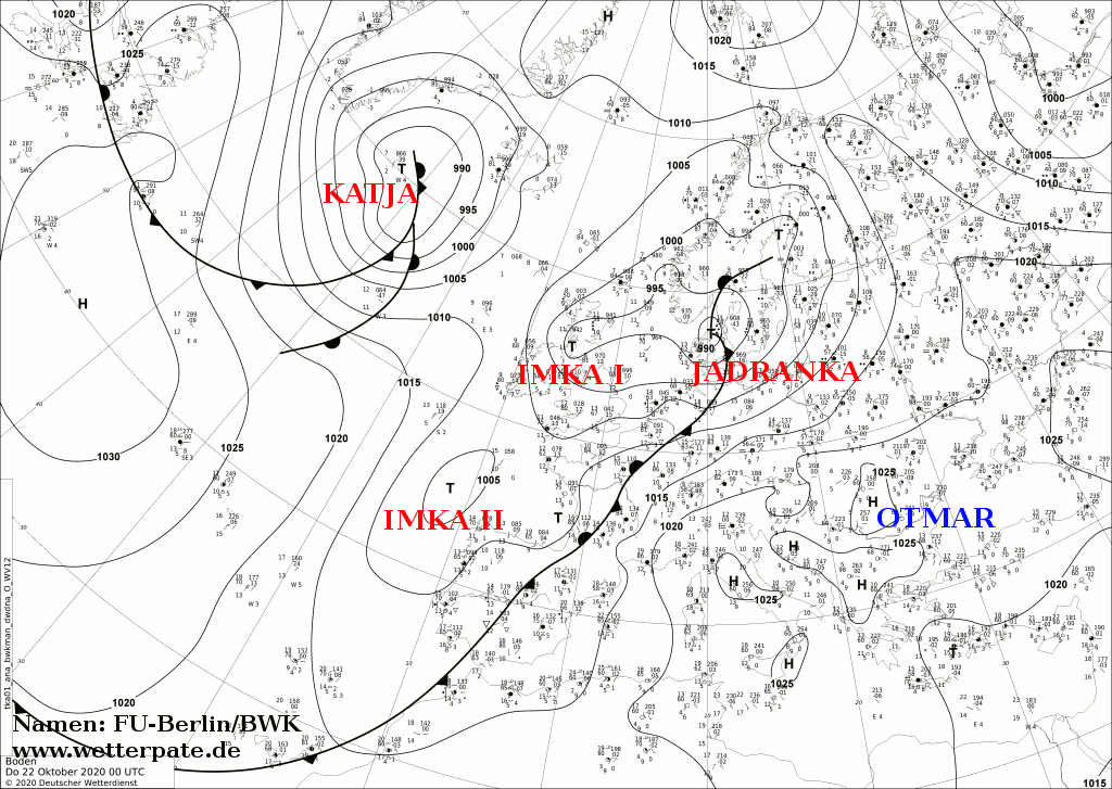
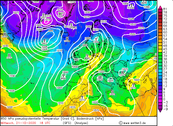
Two storm lows reached Europe and Great Britain in mid-October. First, IMKA moved directly over Ireland on Tuesday, October 20, causing gusts of 110 km/h.
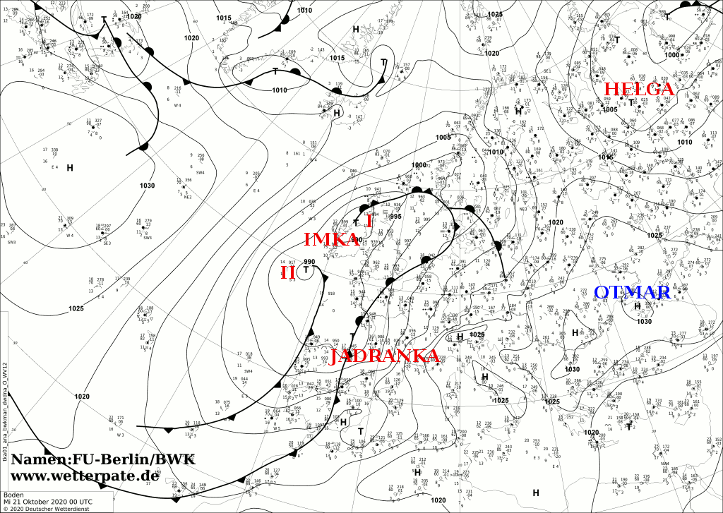
Still in the night to Wednesday its marginal low JADRANKA reached Spain and France. There, wind speeds of around 140 km/h were measured.
JADRANKA also caused temperatures just below 25 degrees in some parts of France and Germany.
Weather Situation
After the high pressure system OTMAR had provided calm weather, two storm lows set course for Europe in mid-October. A trough extending far to the south shifted
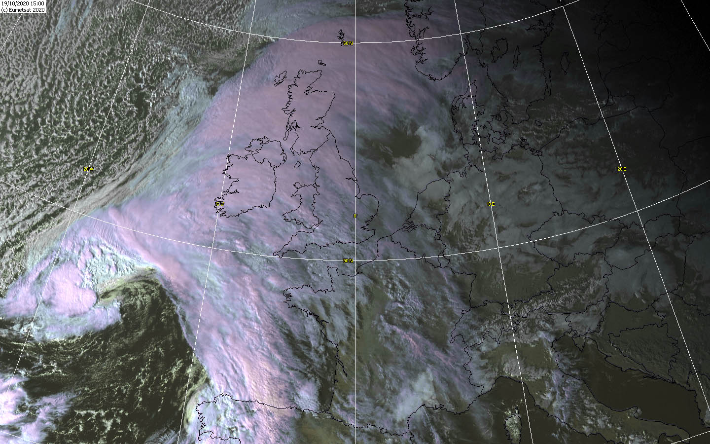
to the east, with low IMKA at its front. A short time later low JADRANKA formed on the frontal system of IMKA. IMKA moved with its core directly over Ireland and
Scotland where it stayed longer and a little later took the role of the controlling central low. JADRANKA, on the other hand, moved across the Bay of Biscay and the
English Channel later on across the North Sea to Scandinavia where it finally disintegrated.
|
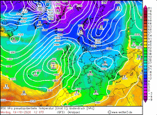
850 hPa equivalentpot. Temperature, October 19-21, 2020:
Wetter3
|
 |
 |
 |
 |
Development
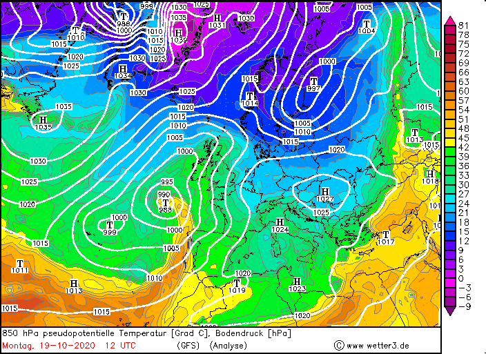
Already a few days before, IMKA developed over the Atlantic Ocean southwest of Iceland. It intensified only slightly in the first few days because the environmental
conditions were initially unfavorable for intensification. However, from Sunday 18 October IMKA entered the influence of a jet stream and its positive divergence
areas and IMKA slowly began to intensify. Most striking was the wave interference in the temperature field and thus the distinct warm air sector and warm air
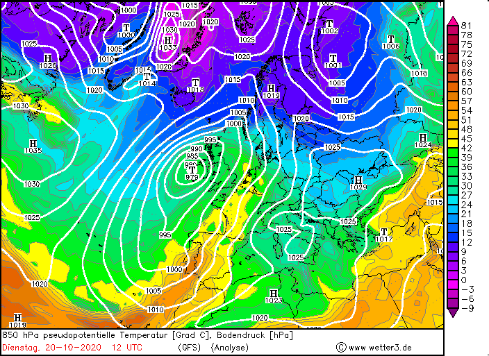
advection in front of the warm front. From Sunday evening on, the core pressure began to fall and IMKA shifted to the northeast. At noon on October 20,
IMKA reached Ireland with a core pressure of 975 hPa. Along its cold front a wave disturbance was already visible, which later developed into
storm depression JADRANKA. IMKA itself hardly shifted at all from this point on and moved only very slowly towards Scotland. Its pressure began to rise and it took
the role of the controlling central low.It stayed longer over Northern Ireland and the North of Scotland. IMKA caused wind speeds around 110 km/h and her wind field
weakened rapidly. IMKA had little or no significant impact on the European mainland.
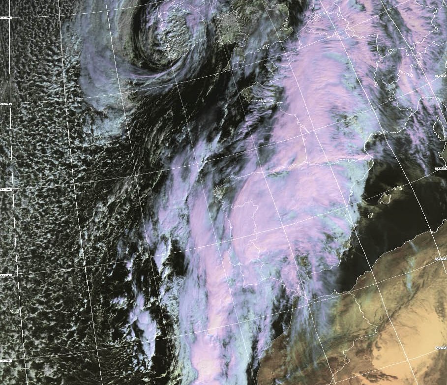
JADRANKA formed as already mentioned as a marginal low of IMKA. Already on Tuesday 20 October JADRANKA was perceived as wave interference on the cold front of IMKA.
At this time the wave disturbance was off the coast of Portugal and shifted quickly to the northeast over the Bay of Biscay. The wave interference intensified
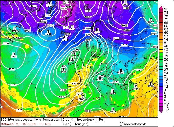
rapidly because it was in the area of a right jet entrance, thus in the area of positive divergence. In the night of Wednesday, October 21, the storm field of
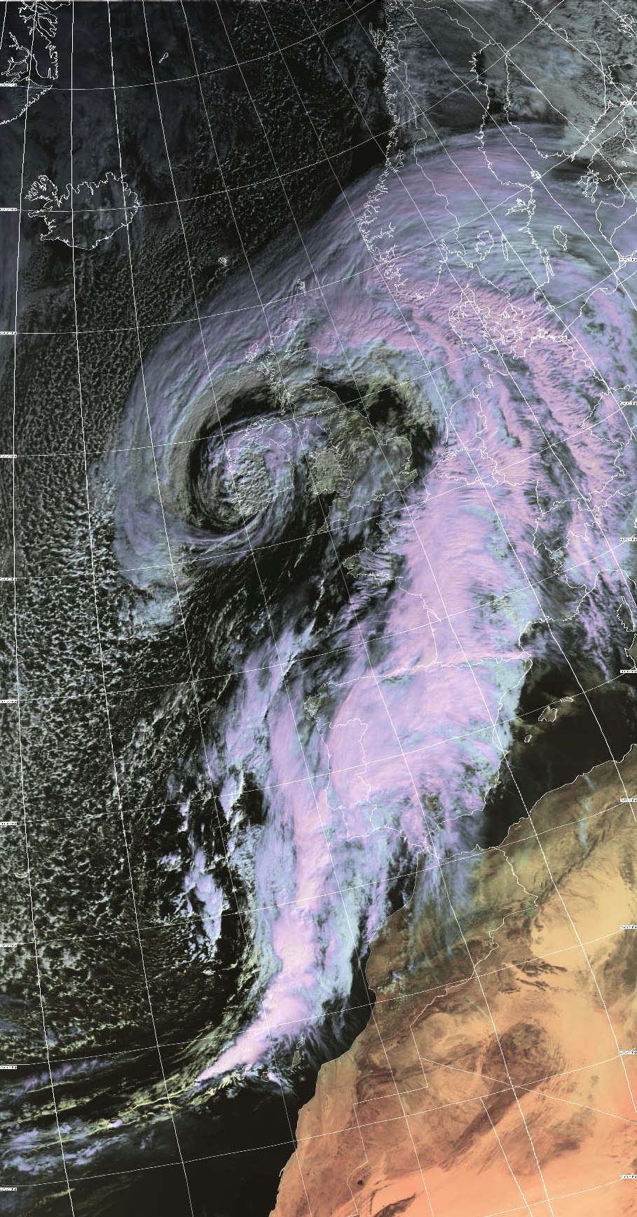
JADRANKA first reached the eastern part of Spain and the western part of France. Stations on the Pyrenees registered gusts around 135 km/h and foehn effects are
visible on the satellite images (cloudless zone on the eastern edge of the Pyrenees). Temperatures rose to 26 degrees Celsius already at night due to the
warmdowndraft winds. On the western edge, however, it rained siginificantly due to the stagnant precipitation. In France, however, JADRANKA caused gusts of
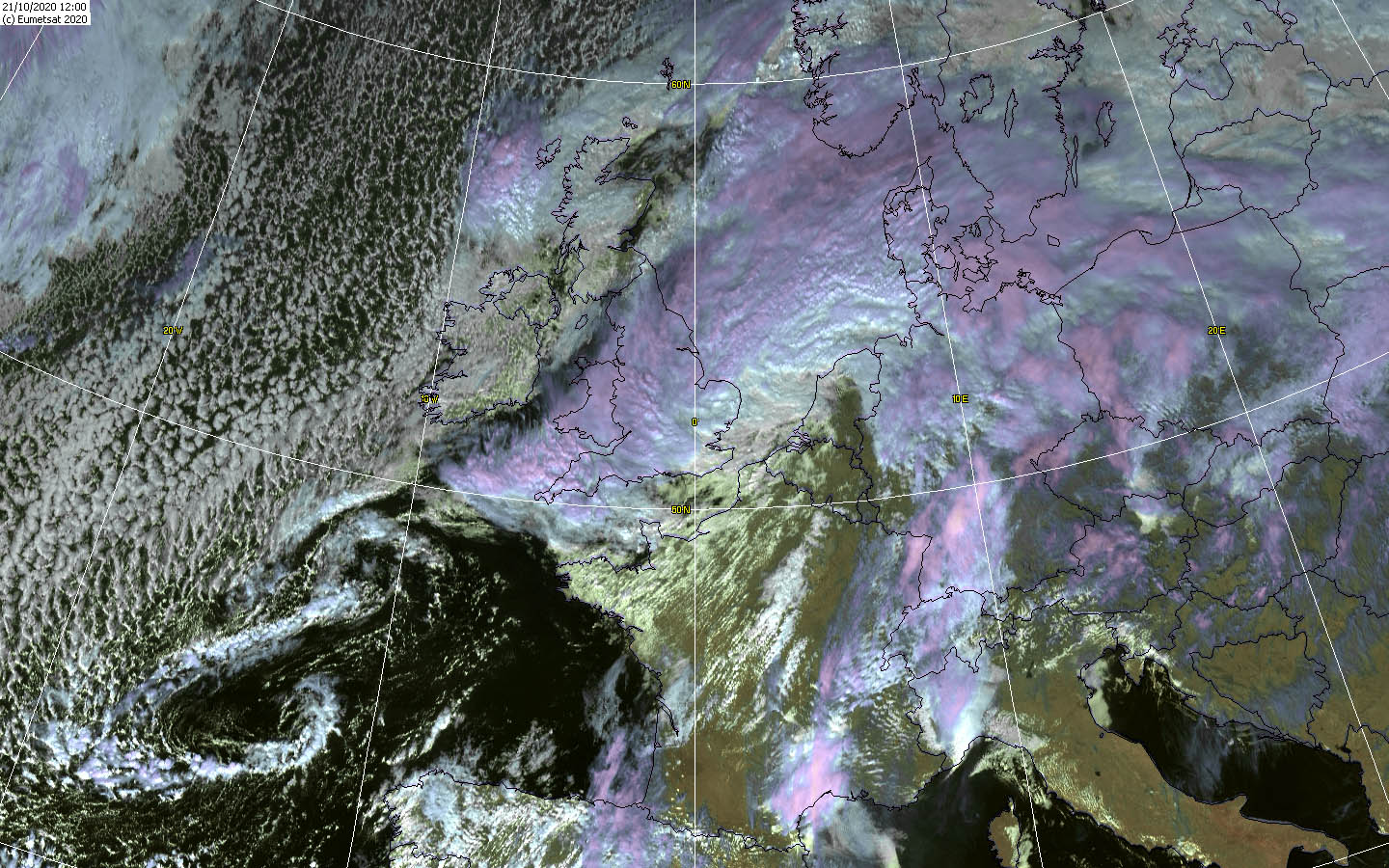
151 km/h (Mont Aigoual). Later in the day, JADRANKA and its storm field reached the BeNeLux States and the west and northwest of Germany with gusts up to 120 km/h.
The storm field weakened as the core pressure of JADRANKA increased and the pressure gradient decreased.
|
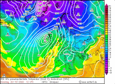
Satellite images (VIS), October 19-21, Source:
Wokingham
|
 |
 |
 |
 |
Remarkable at JADRANKA was not only the wind speeds but also the enormous warm air advection. In Germany as well as in France warm air masses from the southwest
were advected, so that the temperatures partly rose to almost 25 degrees. At some stations it was enough as almost for a summer day in mid-October.
Not by warm air advection but by a foehn storm on the Alps, temperatures around 20 degrees were also registered in the south of Bavaria and Baden-Württemberg.
The foehn storm reached wind speeds of 140 km/h in the Alps at a height of about 1800 meters.
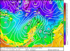
EDIT November 3, 2020: At the end of October and beginning of November, temperatures again rose to over 20 degrees Celsius in some places, especially on
the Upper Rhine. This meant that at this time, too, almost a summer day was reached in some places and even almost a tropical night.
The reason here was also a strong warm air advection in front of a low pressure system.
Text: MG
October 31, 2020
|