|
Major hurricane Laura reached 1-minute sustained winds of up to 250 kph and became the 5th strongest tropical cyclone which made landfall
in the USA. The storm reached the coast of Louisiana at 27th August as a Cat 4 hurricane, with damaging winds, heavy precipitation and a
strong sturm surge.
The development of major hurricane Laura started on 24 August when an area of low pressure developed in the southeast of the
Caribean. An almost ideal distance to the equator, sea surface temperatures up to 30°C and low vertical wind shear
provided a favourable environment. The tropical storm formed a wide eye due to the strongest intensification stage over the Gulf of mexico.
In the further course, bands of deep convection formed near the circulation centre. The system was then upgraded to a major hurricane of the categorie 4.
|
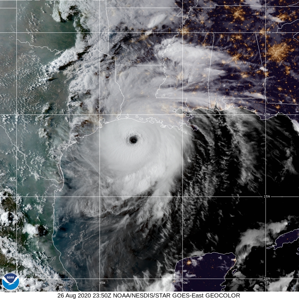
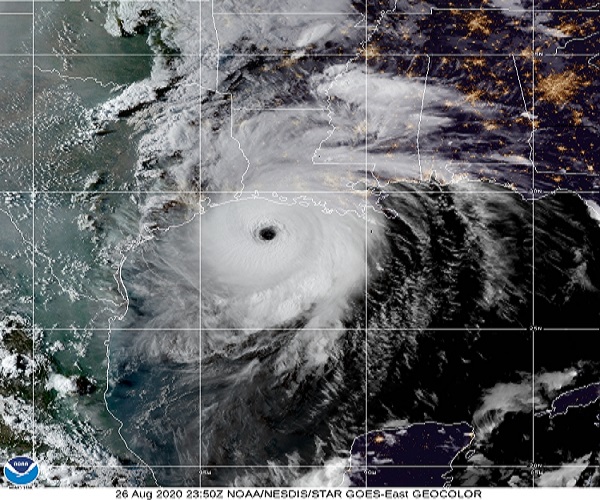
Satellite image Hurricane Laura, source:
NOAA and
NASA
|
 |
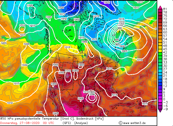
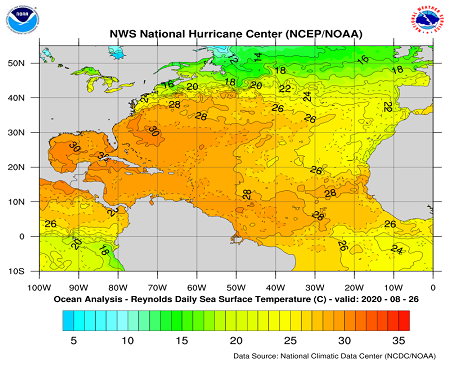
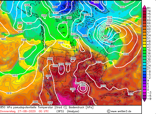
On 26 August the tropical storm run through a strong intensification. The main reasons was the high sea surface temperature up to
30°C and the low vertical wind shear. The GFS analyse indicate very high pseudopotential temperature over 75 K around the eye of
the storm. This shows the extremly high energy amount in the lower troposphere in this area. On 23:50 Z the hurricane had a strong eye with
descending air in the core of the system. This lead due to a inflow of dry air in the storm to enhanced latent heat fluxes from the ocean
to the troposphere, which can reinforce the hurricane.
|
Sea surface temperature and pseudopotentiel temperature while the intensification stage, source:
NASA
GFS
|
 |
 |
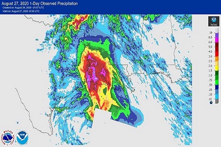
At the 27 August Laura reached as a hurricane Cat 4 the coast of Louisiana. The storm surge between 5 and 6 meters caused severe floodings
inlands as far as 60 kilometers. These surge is caused by strong cyclonic winds, which push a wall of water onto the shore. The strenght is
dependend on the wind speed and also on the velocity and on the angle of the system relativ to the coast. Another important factor for
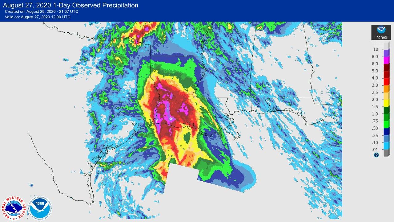
the severe floodings was the heavy precipitation. In parts of Louisiana and Texas the weather stations shows total precipitation amounts
over 200 mm and in 24 h over 150 mm (see also table at bottom). The highest storm surge was observed in Louisiana to the east of the strom because
of the cyclonic rotation.
|
Satellite image and precipitation amount after landfall, source:
NASA
|
 |
 |
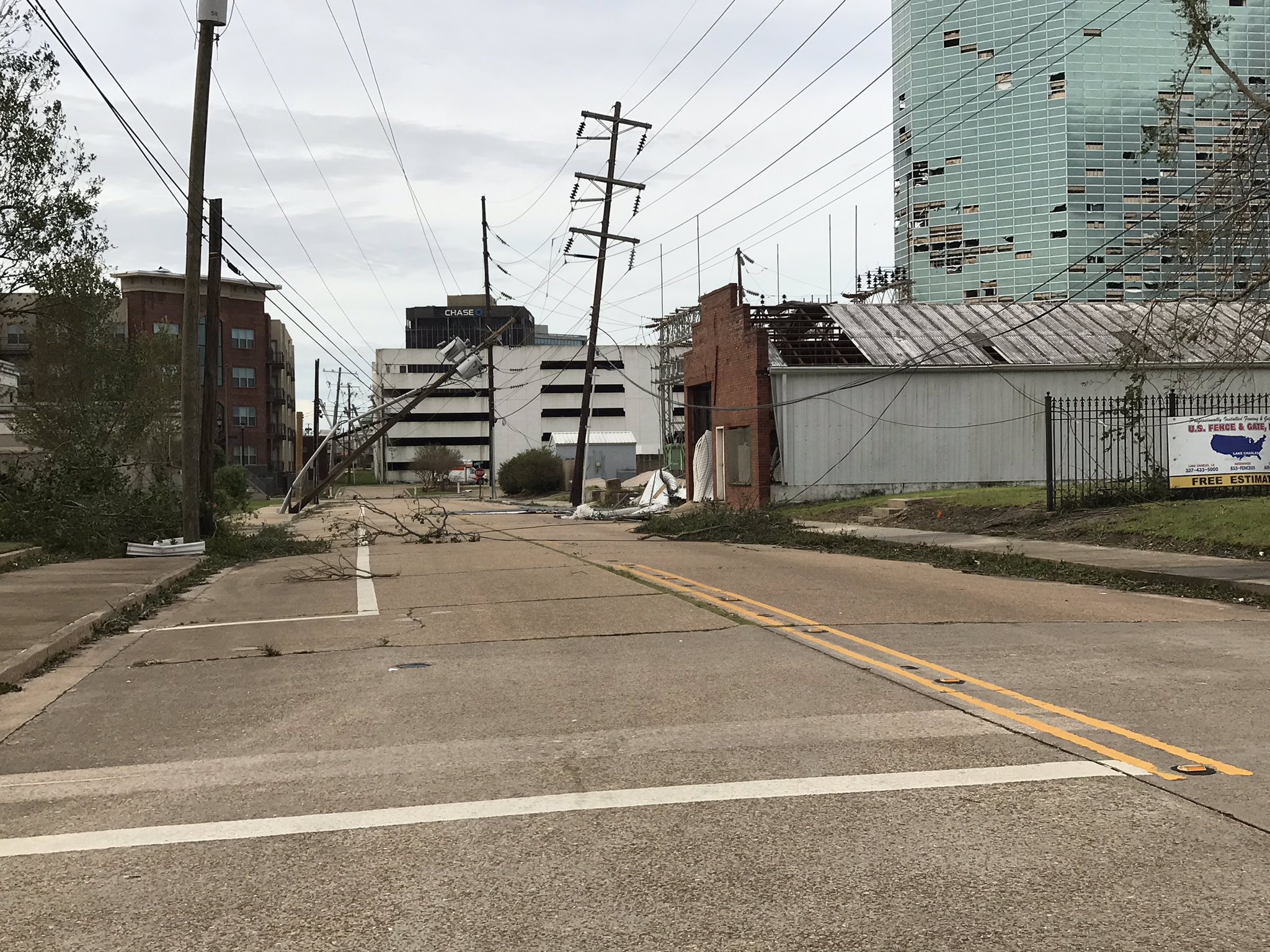
The eye move directly over Cameron in Louisiana and show afterwards a strong persistence. Only several hundreds kilometers inland the
storm loose his structure due to the capping energy source and move as a extrotropical cyclone northeastwards. The maximum wind velocity
on a weather station was recorded in Lake Charles with 174.1 kph (see table at bottom). After that wind gust the anemometer was damaged. The estimated wind
gusts in this area were much higher. Speeds up to 250 kph were observed by Dopller lidars and aircraft measurements.
|
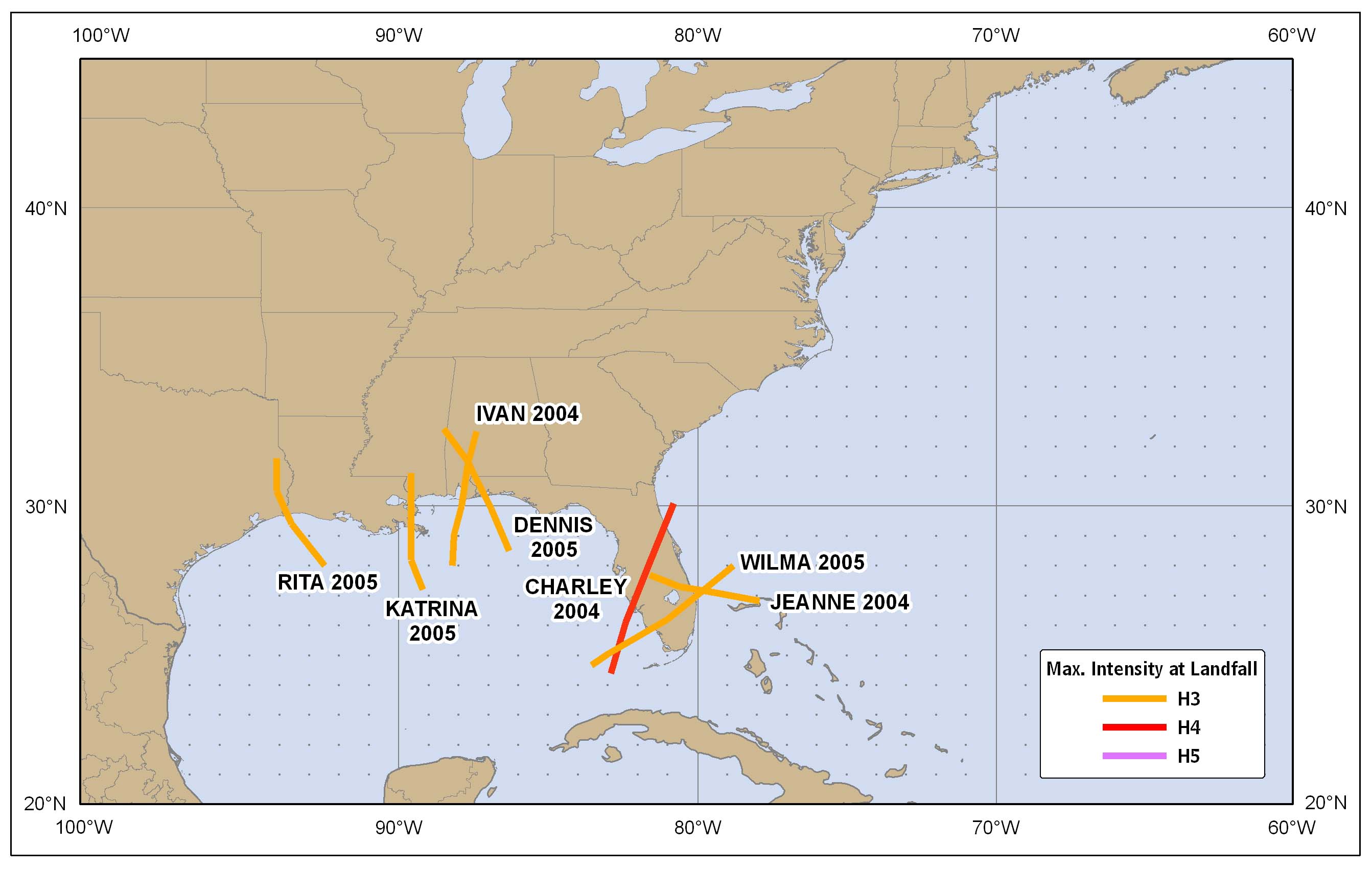
Stormt tracks from 2001 to 2010 and climatological occurence of hurricanes, source:
NOAA
|
 |
 |
Laura was the 5 th strongest hurricane which reach the coast of the USA. In a 10 year time period from 2001 up to 2010 only one
storm of the same categorie in 2004 made landfall in the USA. In Louisiana was it the strongest hurricane since 1856. The hurricane season
in the atlantic start at the beginn of August and ends at the end of October. In September occur the most major hurricanes. The main reason
for that is the diurnal cycle of the sea surface temperatures in the northern atlantic, which have the highest values in the first week of
september.
| Location |
24h Precipitation in mm |
Date |
Lafayette-Regio. Airport (LA)
Opelousas (LA)
Fort Polk (LA)
New Iberia LA-Acadiana (LA)
|
174.0
143.3
143.3
111.5
|
27.08.2020
27.08.2020
27.08.2020
27.08.2020
|
|
| Location |
Maxium wind speed in km/h |
Date |
Lake Charles (LA)
Port Arthur TX-Jefferson (LA)
New Iberia LA-Acadiana (LA)
|
174.1
117.0
115.0
|
27.08.2020
27.08.2020
27.08.2020
|
|
Text: NB
August 29, 2020
|