|
A strong meridional gradient of sea surface temperature and a cold air trough over East Asia caused a distinct
Japanese monsoon season. Daily precipitation of more than 140 mm was common. The station with the heaviest
precipitation was in Ushibuka with a maximum daily precipitation of 429 mm and a 10-day precipitation of 800.5 mm.
Besides the well-known Indian and African monsoons, this phenomenon also exists on the southern coast of Japan.
The Japanese monsoon season, called Tsuyu, prevails in June and July depending on the region and usually lasts
four to six weeks. In Japanese spelling, the name has the same meaning as the Japanese word for "mould", because
during this time the high humidity near the ground often caused mould formation and problems with drying the laundry.
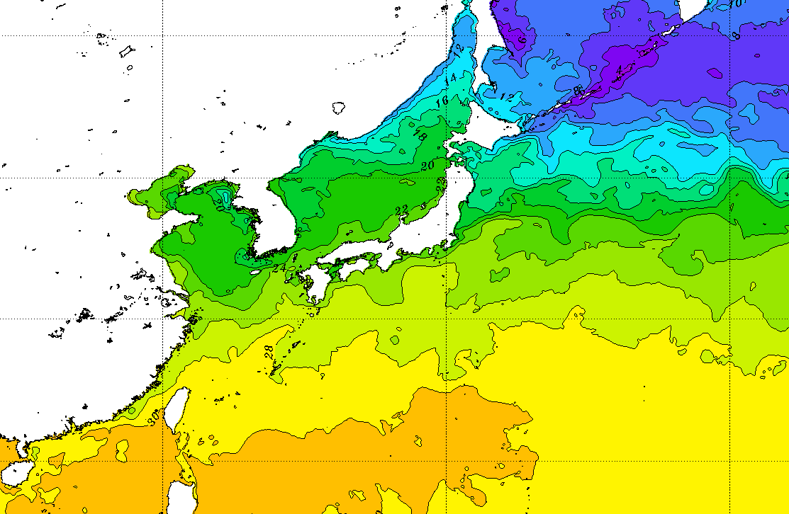
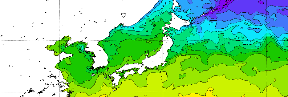
As can be seen in the graphic below, in the summer months warm water masses push their way up to the south coast of
Japan. North of the group of islands, however, there are still cold water masses. A strong meridional gradient of
the sea surface temperature is crucial for the Japanese monsoon season.
|
Sea surface temperature, source:
NOAA
|
 |
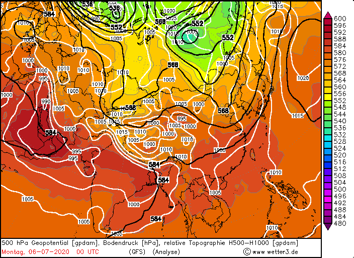
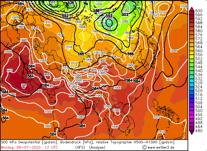
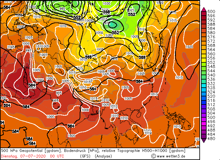
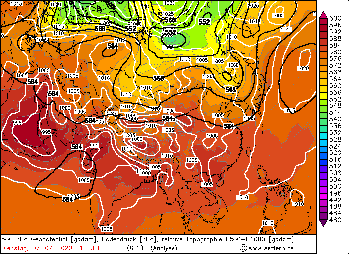
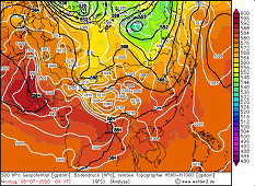
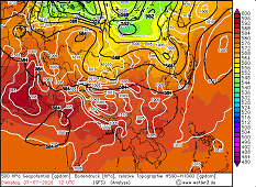
Due to the contrast between the cold northern winds from the polar region and the subtropical, humid and very warm
winds of the equatorial Pacific, Japan is in the middle of an air mass boundary where precipitation is favoured. In
the northern branch of the Pacific subtropical anticyclone, strong precipitation can also be transported from the
Asian mainland to Japan. At the beginning of July, an additional cold air trough over eastern Russia and China
provided synoptic uplift drives over Japan.
|
500 hPa Geopotential 06 and 07 July, source:
wetter3
|
 |
 |
 |
 |
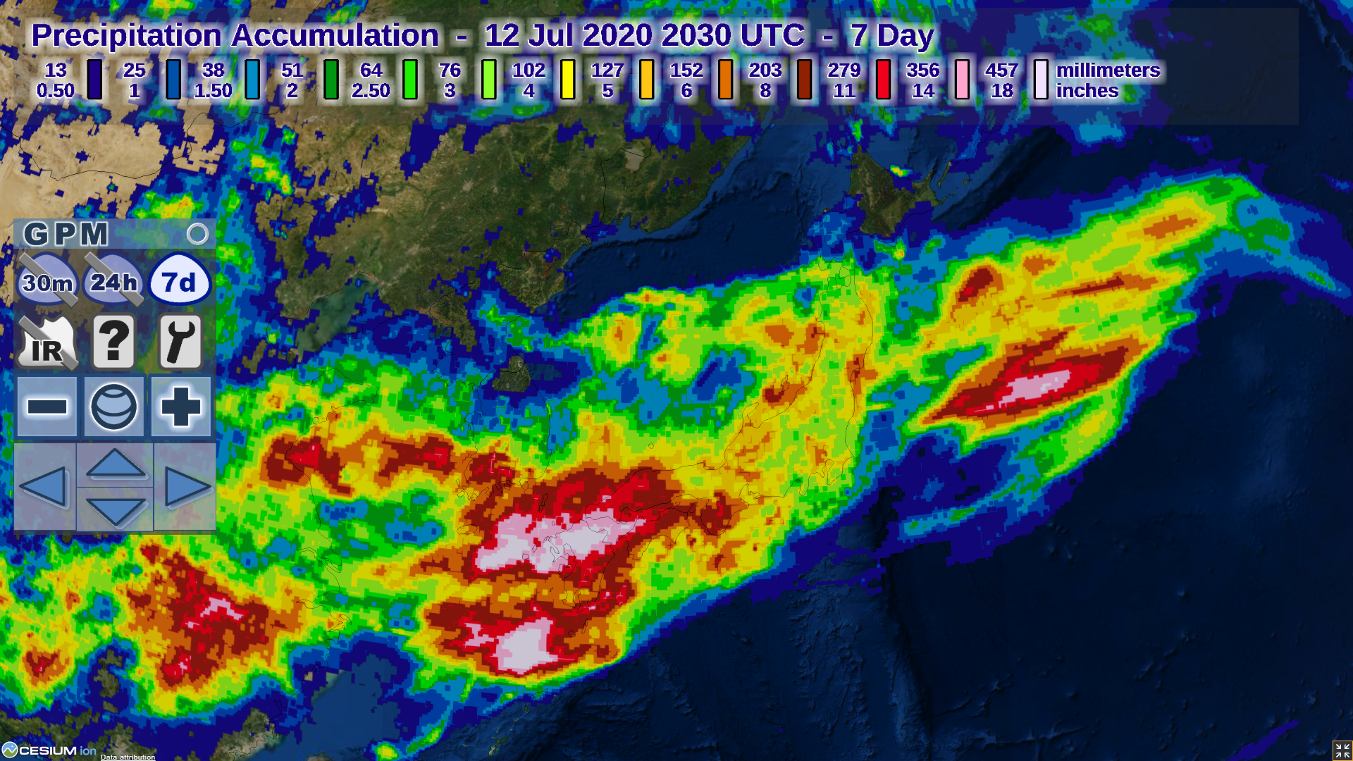
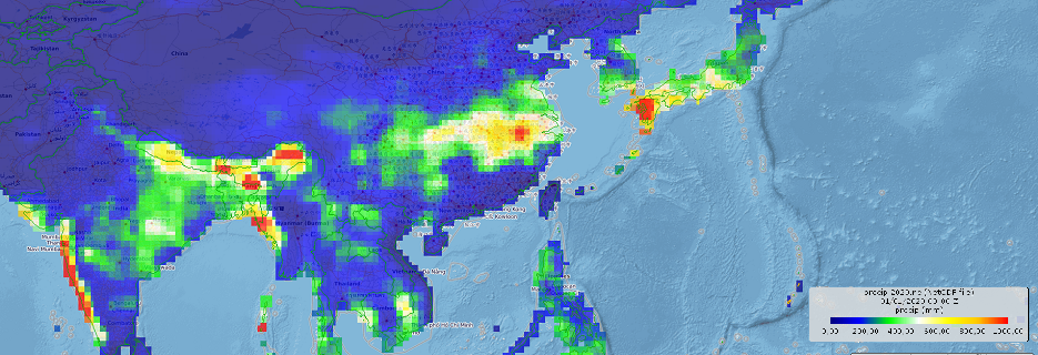
Due to the individual orography of Japan, the precipitation quantities are very variable. It is not uncommon for
one place to have more than 100 mm of daily precipitation followed by several days with only little precipitation.
Nevertheless, in the orographically favoured areas there is often more than 1000 mm total precipitation within one
monsoon season. In the extreme southwest of the prefecture Kumamoto, at the Ushibuka station, more than 800 mm
precipitation was recorded within 10 days. This precipitation is mainly composed of three rainy days on 28.06.,
04.07. and 06.07. (112 mm, 429 mm and 134 mm).
With 429 mm, Ushibuka also recorded the heaviest precipitation day of this year's Japanese monsoon season on 04.07.
Further stations, mainly in the southwest of Japan, also achieved daily rainfall of more than 140 mm and 10-day
precipitation of more than 500 mm.
|
30-day accumulated precipitation from 15 June to 15 July, source:
NOAA
|
 |
| Location |
24h Precipitation in mm |
Date |
Ushibuka
Sasebo
Makurazaki
Hirado
Tanegashima
Aburatsu
Nagasaki
Shimizu
Sasebo
Yakushima
Ushibuka
Makurazaki
Yakushima
Nagasaki
Yakushima
|
429.0
298.0
202.0
197.0
165.0
148.0
145.0
145.0
145.0
142.0
134.0
129.0
125.0
122.0
121.0
|
04.07.2020
07.07.2020
06.07.2020
07.07.2020
10.07.2020
06.07.2020
07.07.2020
04.07.2020
27.06.2020
30.06.2020
06.07.2020
28.06.2020
01.07.2020
08.07.2020
28.06.2020
|
|
| Location |
10 day Precipitation in mm |
Date |
Ushibuka
Yakushima
Makurazaki
Aburatsu
Nagasaki
Hirado
Shionomisaki
|
800.5
576.0
568.0
564.0
495.0
412.0
379.0
|
06.07.2020
07.07.2020
06.07.2020
07.07.2020
10.07.2020
10.07.2020
10.07.2020
|
|
Text: FS
July 19, 2020
|