|
Several phases of long lasting mild weather caused by low pressure areas made the recent winter season in Central Europe to one of the warmest ever recorded.
Strong moisture transport from Atlantic also led to above-average precipitation amounts, especially in February.
The passage of several low pressure areas in the 2019/2020 winter season caused unusual high temperatures and a distinct lack of frost. The first low-pressure
systems of the season (Toni, Veiko, Wilfried, Xander) caused strong gusts in German mountain tops, but the most extensive precipitation fell on the Iberian
Peninsula and in the Mediterranean area (115.8 mm/24h in Sarges, PT). The effects of Yadid, Zelio and Ailton were also concentrated in southern Europe with
gusts of more than 150 kph on four consecutive days at the Iberian Peninsula. Low pressure system Fenja mainly affected the United Kingdom with peak gusts
of up to 195 kph, but hurricane gusts and heavy precipitation also occurred in northern Germany.
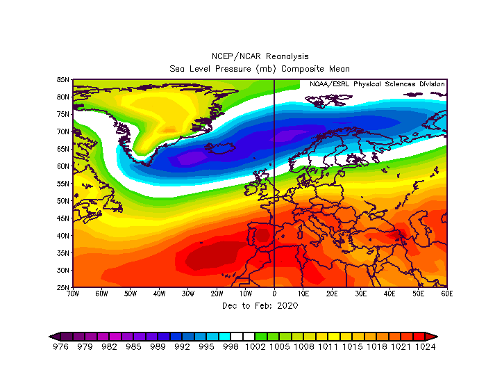
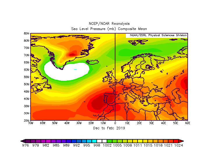
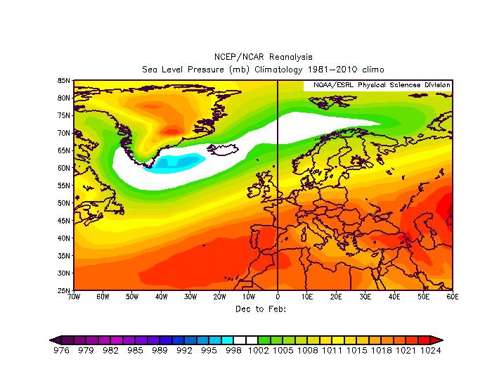
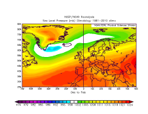
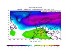
Mean sea level pressure (01 Dec 2019 - 29 Feb 2020) from recent and last winter season.
Also average winter conditions (1981-2010) and deviation of recent winter season to average:
NOAA ESRL
|
 |
 |
 |
 |
At the end of January, Lolita brought heavy precipitation in the north, and led to the first significant snowfall in the southern midlands. Within
24 hours, up to 25 cm of fresh snow fell. The low-pressure systems Ottilia, Sabine and Bianca provided a stormy and rainy February to Europe. Ottilia
showed off with daily precipitation of more than 100 mm and peak gusts of up to 213 kph (in Cairngorn, GB), while Sabine caused hurricane gusts throughout
Germany a few days later. At the end of February, Bianca led to snowfall at mid-height and high altitudes such as intensive rainfall underneath. Daily precipitation amounts of
more than 50 mm were achieved. The unusual high frequency of low pressure areas can be seen in the mean surface pressure of the winter season (meteorological
definition of winter season: December to February). Values around -10 hPa in northern Europe show the strength of the Northern Atlantic storm track in the recent season.
|
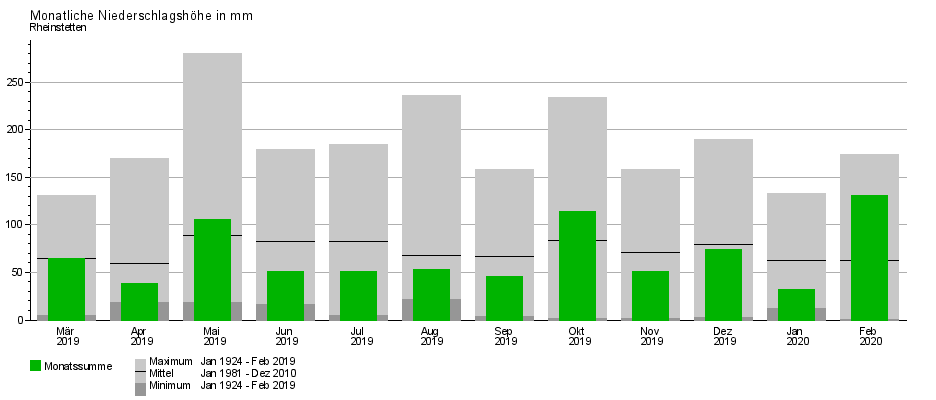
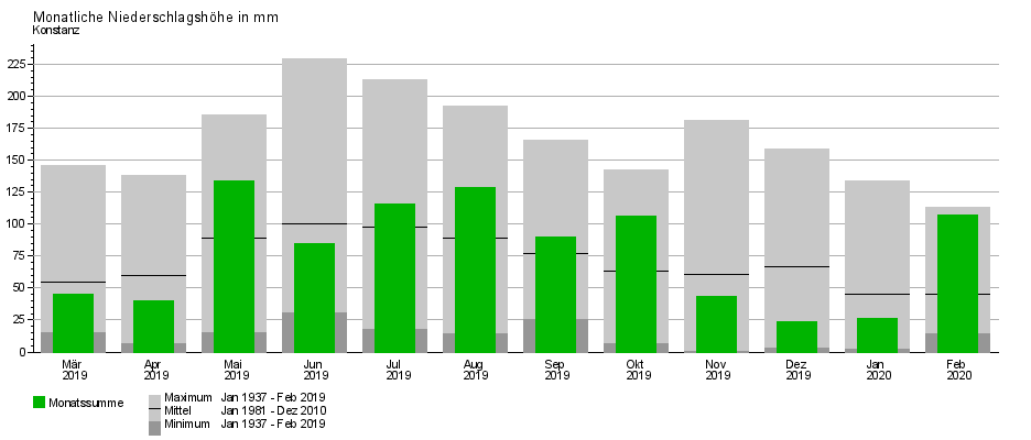
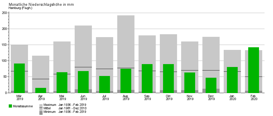
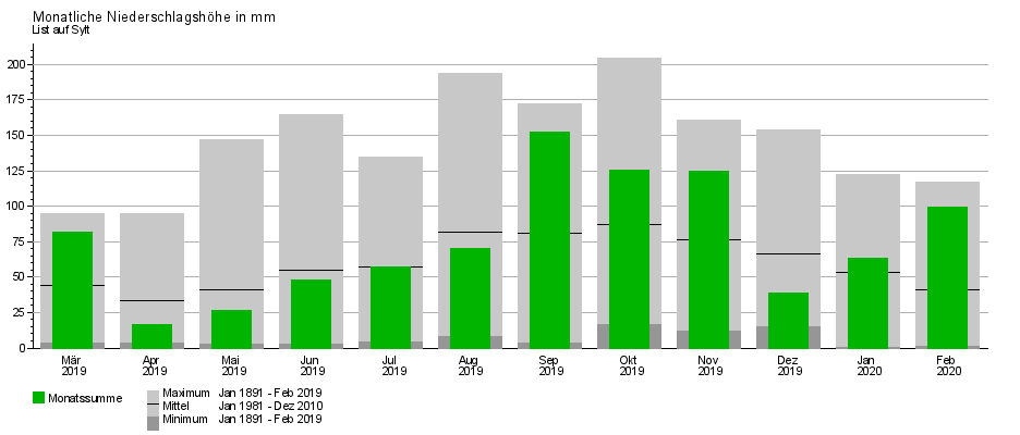
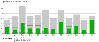
Accumulated precipitation of of past 12 months for Rheinstetten and Constance (southern Germany) such as for Hamburg and Sylt (northern Germany). Source:
DWD
|
 |
 |
 |
 |
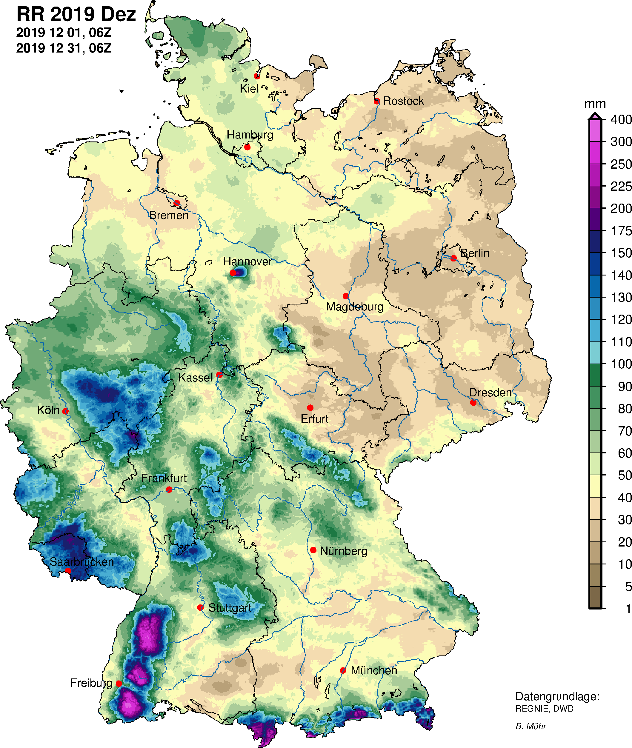
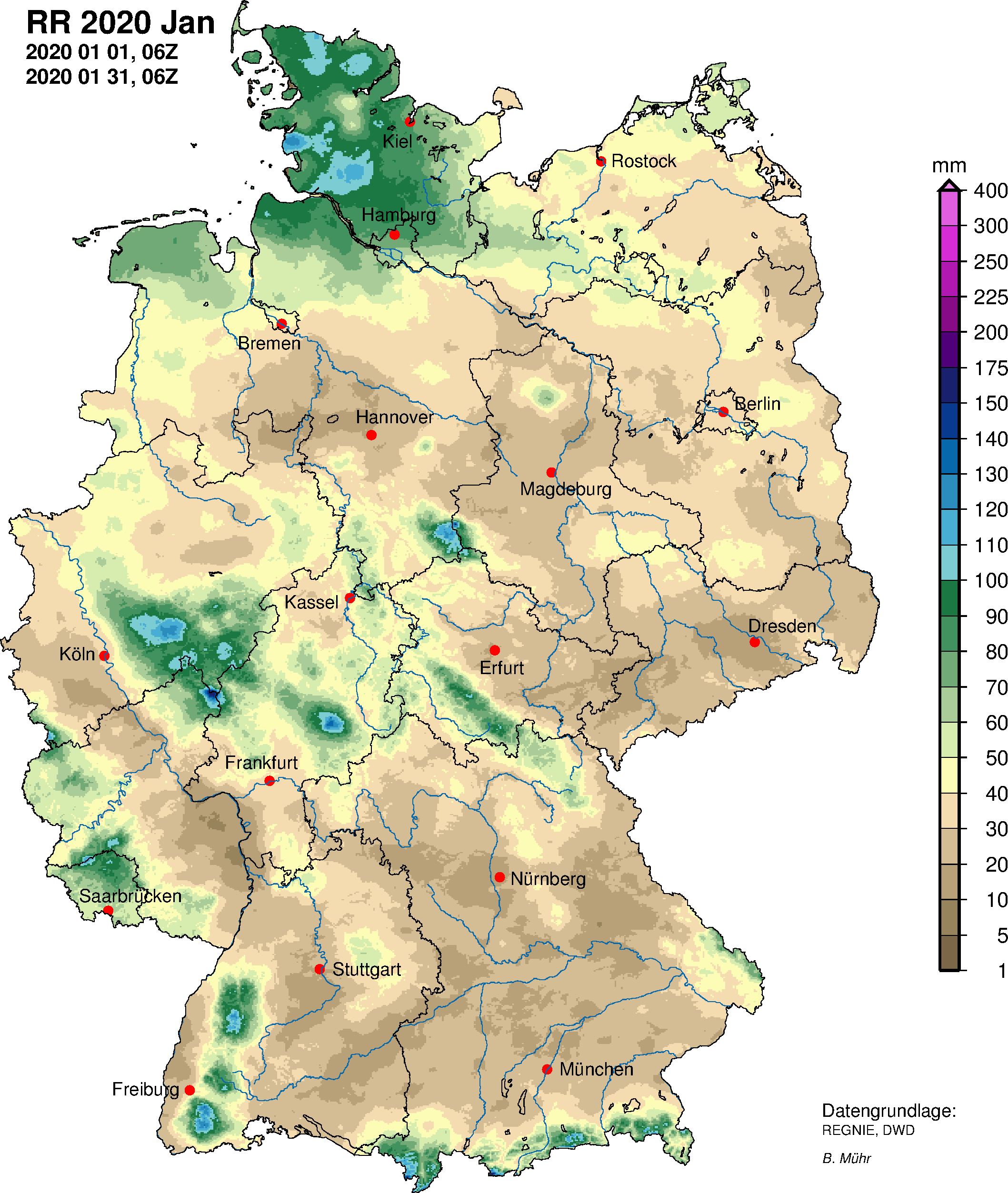
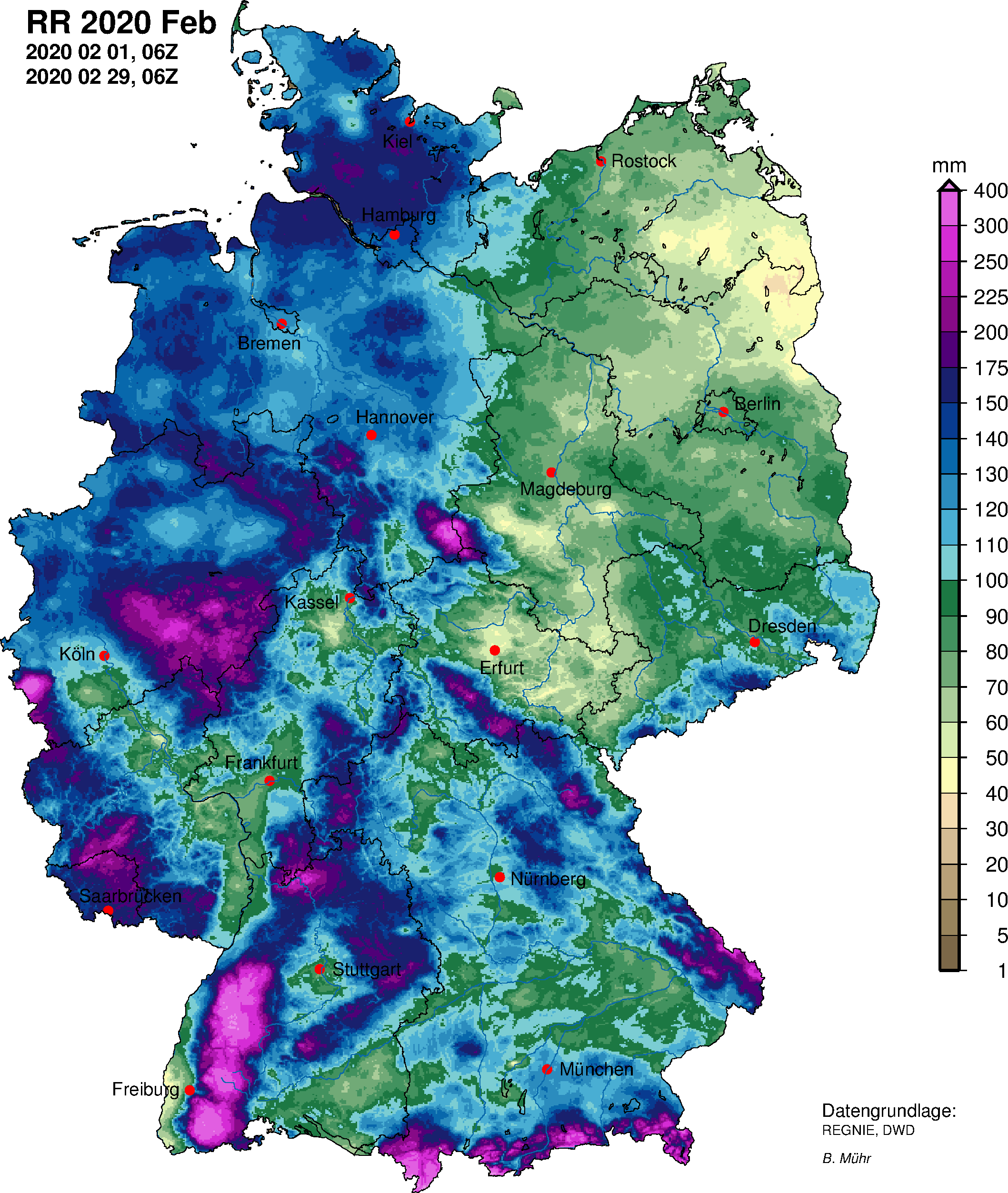
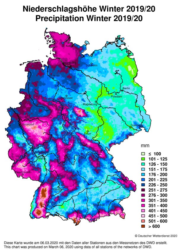
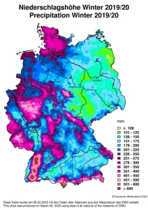
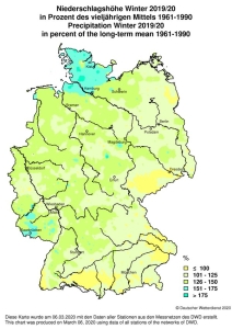
The precipitation surplus in the south is mainly due to the high precipitation in February. Here, the precipitation quantities in
December were below, in January even clearly below the multi-year average values. In the north of the country, December was also
low in precipitation, but January already had above-average precipitation. At some stations, the recent season set a new accumulated
precipitation record for the month February. At Hamburg (airport) February 2020 was even the wettest month of the past 12 months, clearly
exceeding the summer months which usually bring the most rainfall in Central Europe. December and January recorded an above-average number
of hours of sunshine. Despite the somewhat bleaker February, the average value was also exceeded in many places in Germany.
With very mild temperatures, there was no sustained onset of winter with snowfall and frost in the lowlands. Days of frost (daily
maximum temperature below 0 °C) were also a very rare event. Due to a partly very changeful weather situation with short cold and
longer lasting very mild phases, the snow depths were mostly low even at higher altitudes. In the German low mountain ranges, there
was even regular rainfall instead of snowfall, which repeatedly brought the winter sports season to a complete stop or hindered even
a start of the season.
|
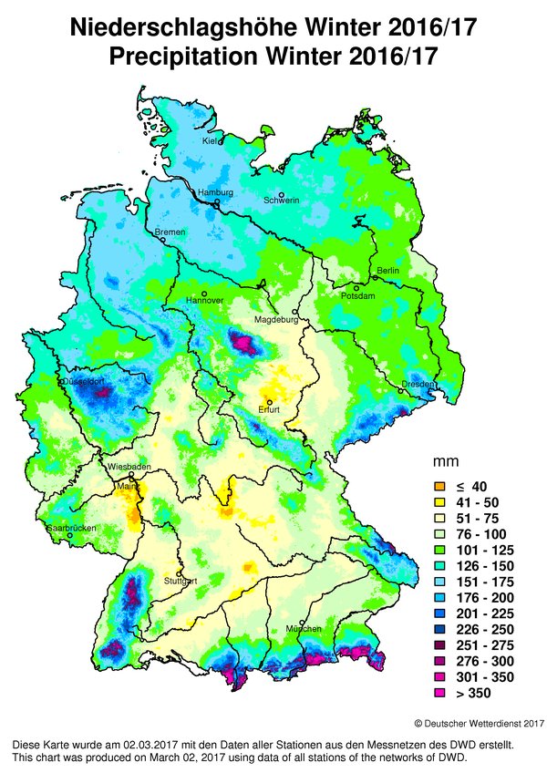
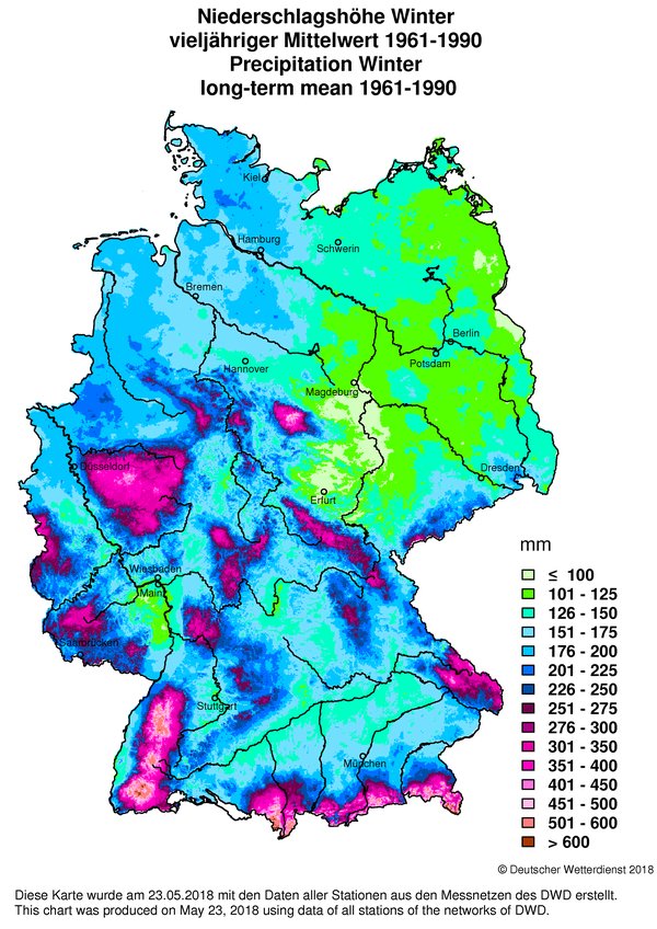
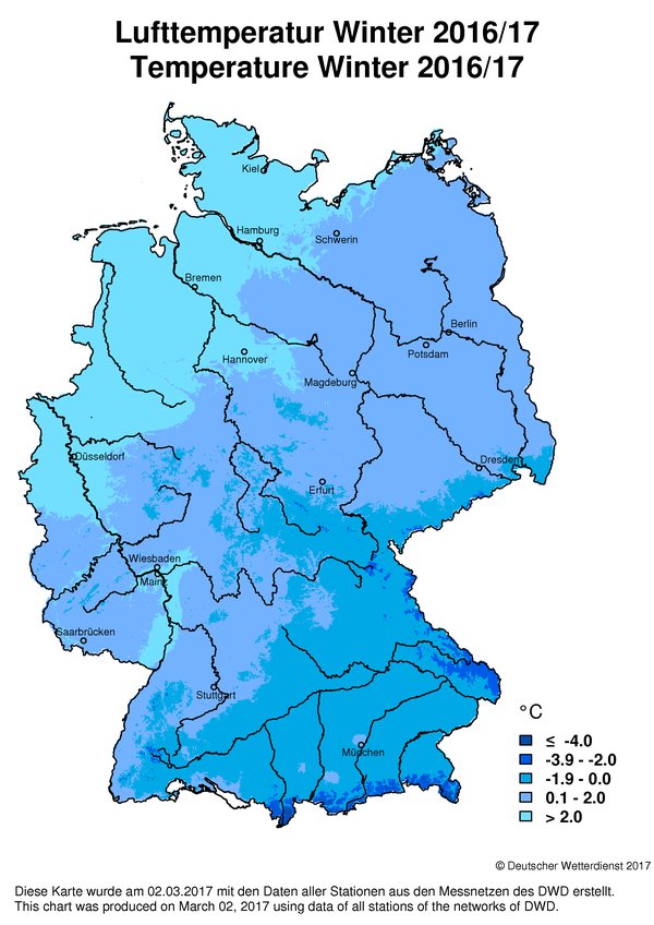
Accumulated precipitation of recent and 2016/2017 winter season. Also climatological average (1961-1990) and deviation of recent season to average. Source:
DWD
|
 |
 |
 |
 |
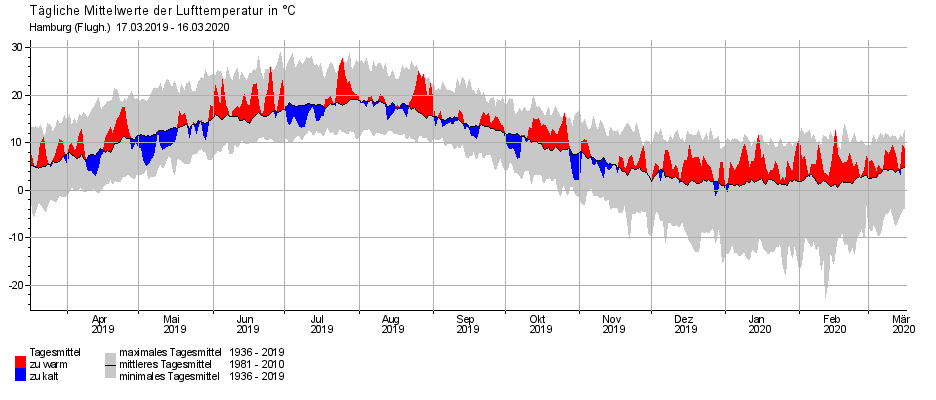
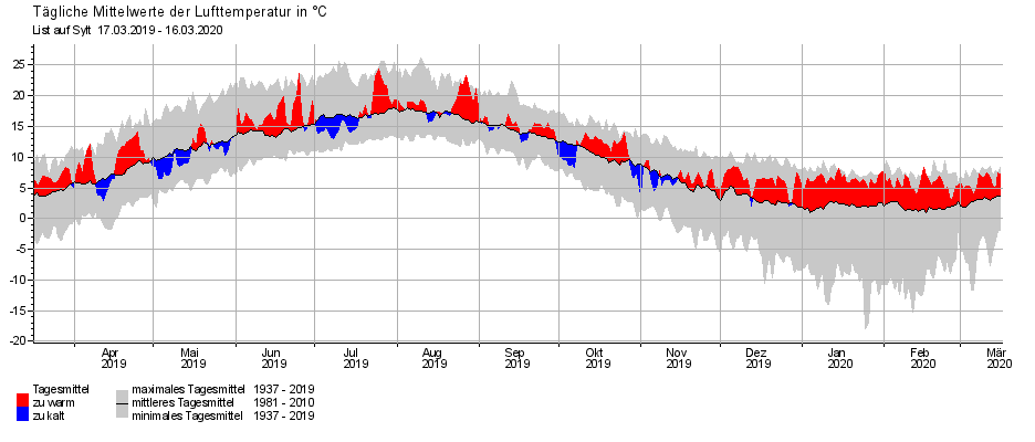
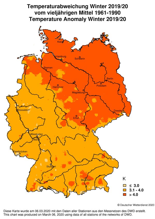
The winter 2019/20 was extremely mild, excessively humid and also relatively sunny in Germany. Each of the three winter
months was warmer than the multi-year monthly mean. The months of December and January were clearly over-warm. However,
the highest positive anomaly was reached in February. Only the winter 2006/07 showed even higher temperatures. The
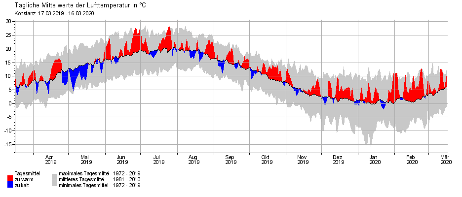
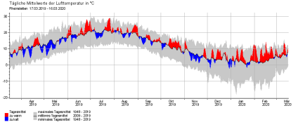
temperature surplus is particularly visible in the north of Germany. The time series of the daily mean temperature
on Sylt (shown below) demonstrates that in 2020 not a single day was below its average temperature. Due to the
geographical location of Sylt, this is not only the result of the concrete weather situation, but also of above-average
water temperatures.
|
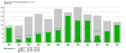
Daily mean temperature of of past 12 months for Rheinstetten and Constance (southern Germany) such as for Hamburg and Sylt (northern Germany). Source:
DWD
|
 |
 |
 |
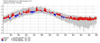 |
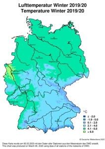
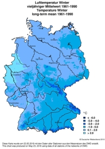
In the winter of 2019/2020, the Germany-wide average temperature was 4.2 °C. Thus, the deviation from the new reference
period 1981-2010 is +3.3 K, while the multi-year average value of the international climatological reference period
1961-1990 was exceeded by 3.9 K. The winter of 2019/2020 was the second warmest winter since 1901 and 1881.
|
Mean temperature of recent and 2016/2017 winter season. Also climatological average (1961-1990) and deviation of recent season to average. Source:
DWD
|
 |
 |
 |
 |
Especially in February the winter season was also characterized by the frequent occurunce of high wind speeds, which
found their peak with low pressure area Sabine on 10 February. The trajectory of the storm leading through the centre
of Germany brought hurricane-like gusts especially to the southern part of the country, where these wind speeds are not
common. With early warnings and appropriate safety precautions many damages could be avoided. Nevertheless, the exceptional
wind speeds caused trees to collapse and damage to buildings and infrastructure.
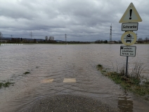
Effects by heavy precipitation or storm. Flooding in Hirschhorn and Karlsruhe. Storm damages in Karlsruhe and Güntersdorf/Schweitenkirchen.
Source: Nicole Egner, Bernhard Mühr, Einsatz-Report24, Marius Block
|
 |
 |
 |
 |
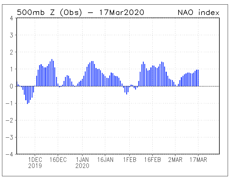
Even though there are still many unanswered questions in this area of research, there are still good reasons to believe in a
connection between the NAO index and seasonal weather conditions in Europe. The NAO index is based on the difference of the
standardized air pressure anomalies between Lisbon, Gibraltar or Ponta Delgada (one of these three stations) and Reykjavic.
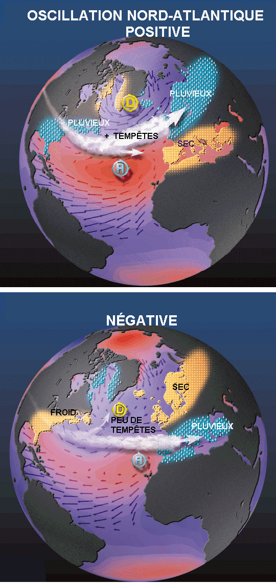
A strongly positive NAO index, as it was the case in the recent winter, leads to an increased polar vortex, stronger westerly
wind drift in the mid-latitudes and a change in the typical storm track, which means that the effects of winter storms are
more frequently felt in Central Europe. In December 1999 (winter storm Lothar), the NAO index was also strongly positive with +1.61.
Text: FS
March 17, 2020
|