|
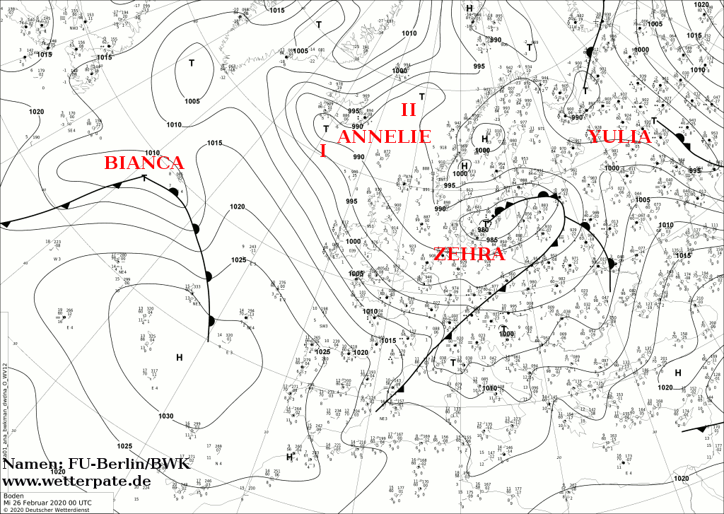
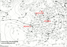
At the end of February, storm low BIANCA reached Central Europe and caused besides gale gusts, the first snowfall of the winter, especially in Germany
(even in low altitudes). Gusts of up to 166 km/h were measured on the Feldberg in the Black Forest.
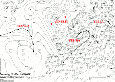
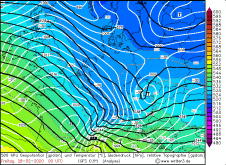
Like most storm lows BIANCA developed over the Atlantic and was initially a wave disturbance. On 26 February, it was within a
weak jet stream over the Atlantic and quickly shifted eastward. In the night of 27 February, BIANCA reached France, where it initially caused
gusts of 156 km/h. Most impressive was the massive warm front cloudiness, which BIANCA pushed ahead. Therefore it brought not only severe gusts
but also remarkable amounts of precipitation. The cold front initially remained rather poorly developed and inactive.
|
Sea level pressure and fronts, February 26-28, 2020:
FU-Berlin
|
 |
 |
 |
|
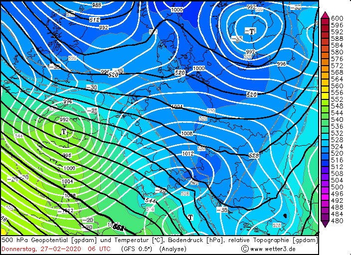
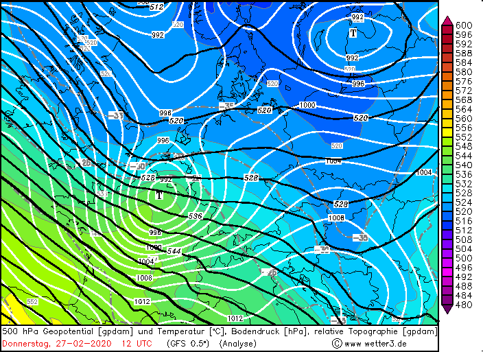
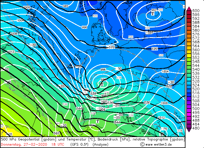
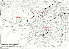
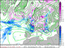
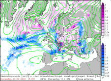
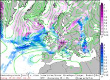
500 hPa Geopotential, February 27-28, 2020:
Wetter3
|
 |
 |
 |
 |
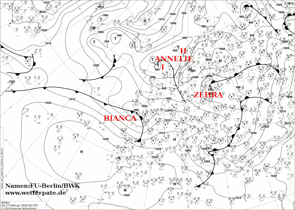
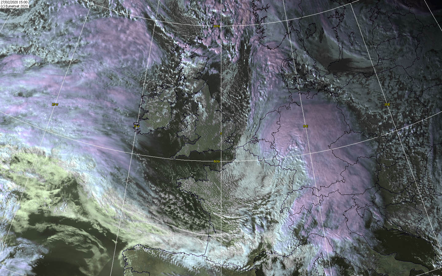
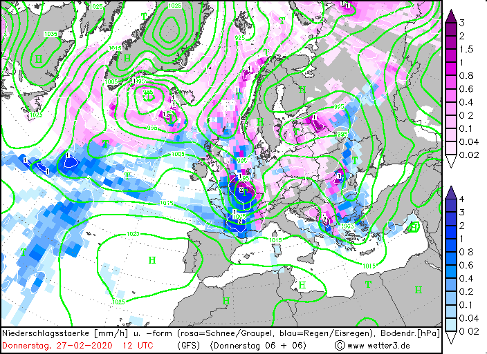
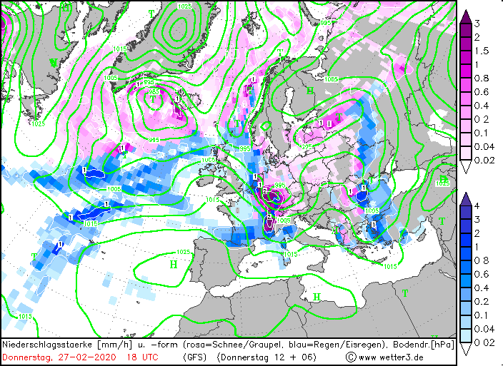
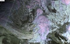
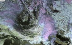
Later in the day BIANCA reached Germany. Its core moved directly across the middle of Germany. Its warm front cloudiness increased further, which is clearly
visible on the satellite images. The massive cloudiness directly at the northern tip, also called cloud head, wrapped around the low centre and brought an extensive
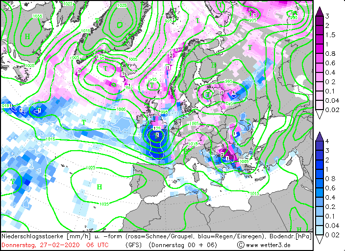
precipitation area with it. From the north-west, cold air was advected at the back of the low, so that the precipitation in Germany actually fell predominantly as
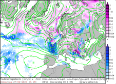
snow. Already from noon on, the precipitation became noticeable from the west. At first it still fell as rain, but changed into sleet and finally into snow, at
least in the west and south of Germany. It also snowed in lower altitudes, but there the snow remained there, if at all, only as slush, because the ground
temperatures were clearly above 0 degrees and thus too mild. From about 400m on the snow remained, so that in many places more than 10cm came together, locally
even 20cm. The advected cold air even caused snow thunderstorms locally (Thundersnow). Besides snowfall, gale gusts occurred in the south. Some of them caused
blizzard-like conditions and snowdrifts.
|
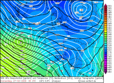
Satellite images (VIS), February 27, Source:
Wokingham
|
 |
 |
 |
|
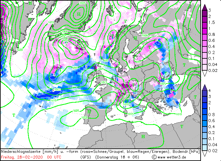
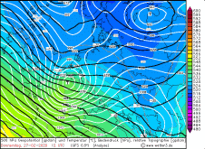
Precipitation amount and kind, February 27, Source:
Wetter3
|
 |
 |
 |
 |
The severe gales gusts, especially in exposed locations, caused trees to uproot and topple over. This blocked roads. However, some trucks were also caught by such
gusts and knocked over. In addition, the snow caused numerous accidents and the snowdrifts also caused traffic obstructions and accidents.
In our southern neighboring countries Switzerland and Austria, snowfall and heavy gale gusts also occurred (see table below).
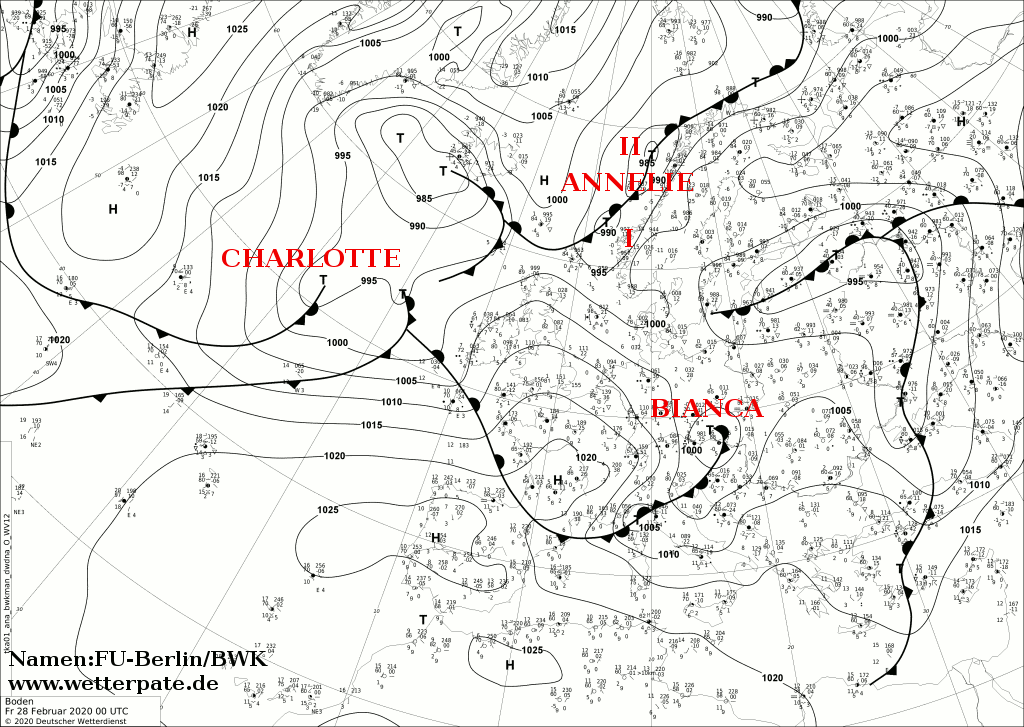
In the night of 28 February, BIANCA moved off to Eastern Europe and weakened, which calmed things down again.
Below is a selection of peak gusts and fallen snow quantities.
| Location |
Gusts in km/h |
Date |
Feldberg (Schwarzwald)
Hornisgrinde (Schwarzwald)
Zugspitze
Altenstadt
Feuerkogel (AU)
Patscherkofel (AU)
Galzig (AU)
Schmittenhöhe (AU)
Chasseral (SW)
Saentis (SW)
Crap Masegn (SW)
Titlis (SW)
Gütsch (SW)
Cap Sagro (FR)
Ile Rousse (FR)
Mont Aigoual (FR)
|
166
153
148
126
162
148
140
130
172
169
156
150
143
156
148
133
|
27.02.2020
27.02.2020
27.02.2020
27.02.2020
27.02.2020
27.02.2020
27.02.2020
27.02.2020
27.02.2020
27.02.2020
27.02.2020
27.02.2020
27.02.2020
27.02.2020
27.02.2020
27.02.2020
|
|
| Location |
Fresh Snow in cm |
Date |
Schollbrunn (DE)
Monschau (DE)
Ruppertschütten (DE)
Bruchweiler (DE)
Plech (DE)
Beerfelden (DE)
Hahn (DE)
Weiden (DE)
Dahlem-Schmidtheim (DE)
Wattendorf (DE)
|
23
22
22
21
19
17
17
17
16
12
|
27.02.2020
27.02.2020
27.02.2020
27.02.2020
27.02.2020
27.02.2020
27.02.2020
27.02.2020
27.02.2020
27.02.2020
|
|
Data source: Ogimet and DWD
Text: MG
February 09, 2020
|