|
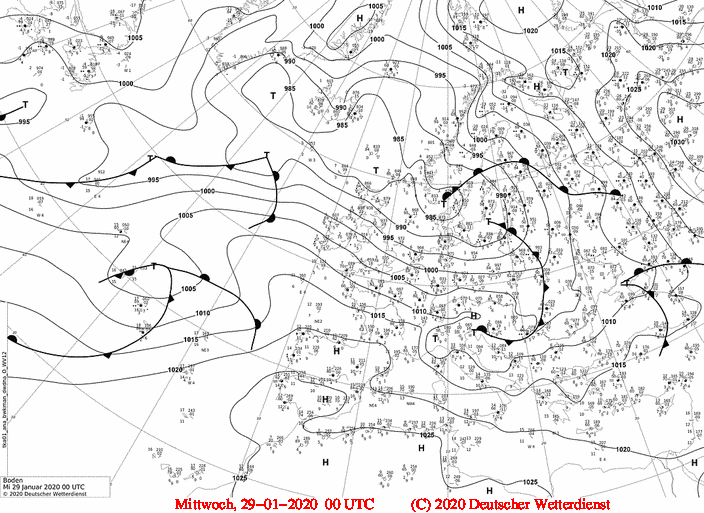
Low pressure area LOLITA caused stormy winds at the French Atlantic coast and on several mountain tops around Central Europe.
No severe, but still unusual high precipitation amounts in southern Germany for winter season. Up to 30 cm fresh snow in the northern Alps.
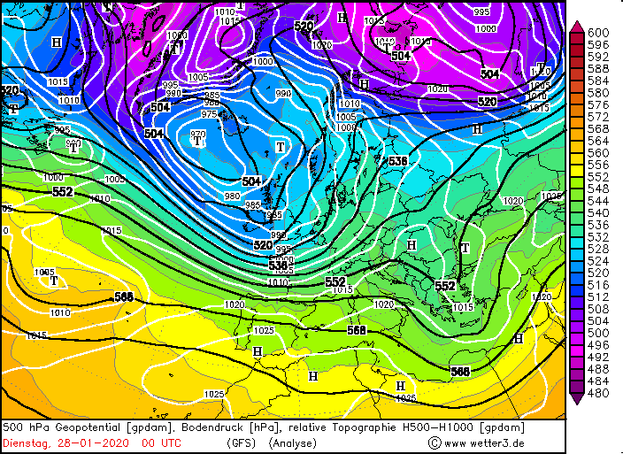
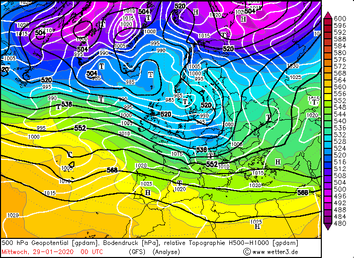
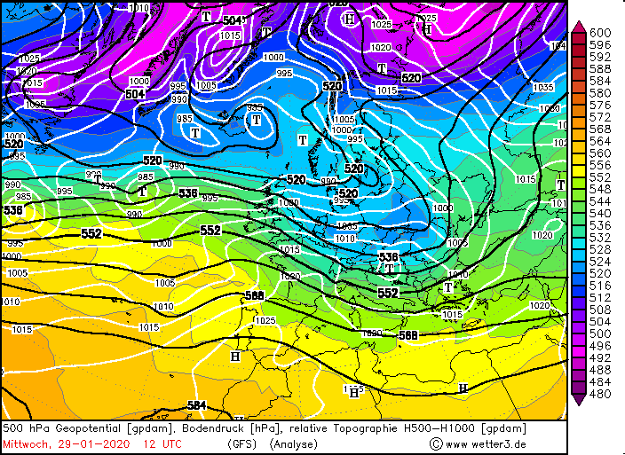
A pronounced low-pressure system over Iceland directed several high-speed low-pressure systems towards Central Europe at the
end of January. While low LOLITA crossed the German-Danish border and thus also affected the southern part of Central Europe,
MAREILE moved further north and mainly affected the northern part of the British Isles.
|
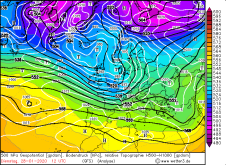
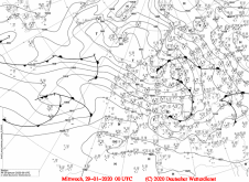
500 hPa Geopotential and Temperature, Sea level pressure, January 27-29, 2020:
Wetter3
|
 |
 |
 |
 |
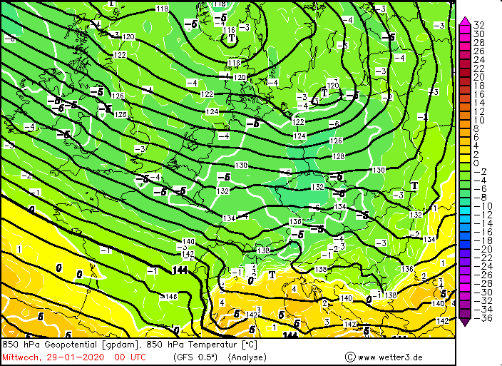
LOLITA formed in a trough over the North Atlantic Ocean west off the British Isles. Due to the southwesterly current at the
front of the trough, temperatures in Germany were still very mild on 27 and 28 January, with double-digit maximum temperatures
in the south of the country. As the jetstreak was located behind (west of) the trough axis, the trough increased its amplitude
as it continued to propagate eastwards. This allowed humid, but also cold polar air to flow into Central Europe. With maximum
temperatures of 8°C in the Rhine valley and 2 to 5°C in large parts of Bavaria, 29 January would not be classified as particularly
cold climatologically, but in the current winter this was already a somewhat colder day.
|
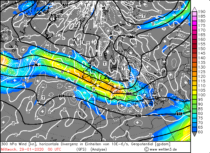
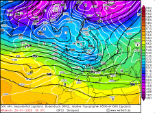
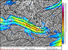
Sea level pressure and fronts, 300 hPa wind and divergence, 850 hPa Temp, 6h precipitation, January 29, Source:
Wetter3
|
 |
 |
 |
 |
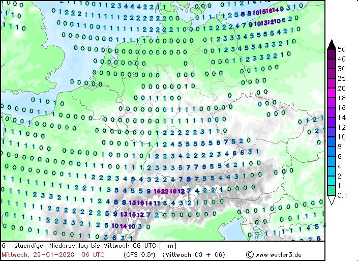
As the intensity of the precipitation on 28 January peaked (more than 25 mm/24h at severeal stations in southern Germany
and at the North Sea), the aggregate state of the precipitation became of interest on 29 January due to the influence of the
cold polar air. In the north of Germany the snow line dropped to 500 m, in the south only to about 750 m. With 20 to 25 cm of
fresh snow within 24 hours, the most significant amounts of snow fell on the north side of the Alps, which, when exposed to
northwesterly air flow, provide a good pattern for orographic rain. Snowfall also occurred in the Black Forest, the station
on Feldberg reported 12 cm of new snow, in the northern Black Forest up to 10 cm (Freudenstadt).
|
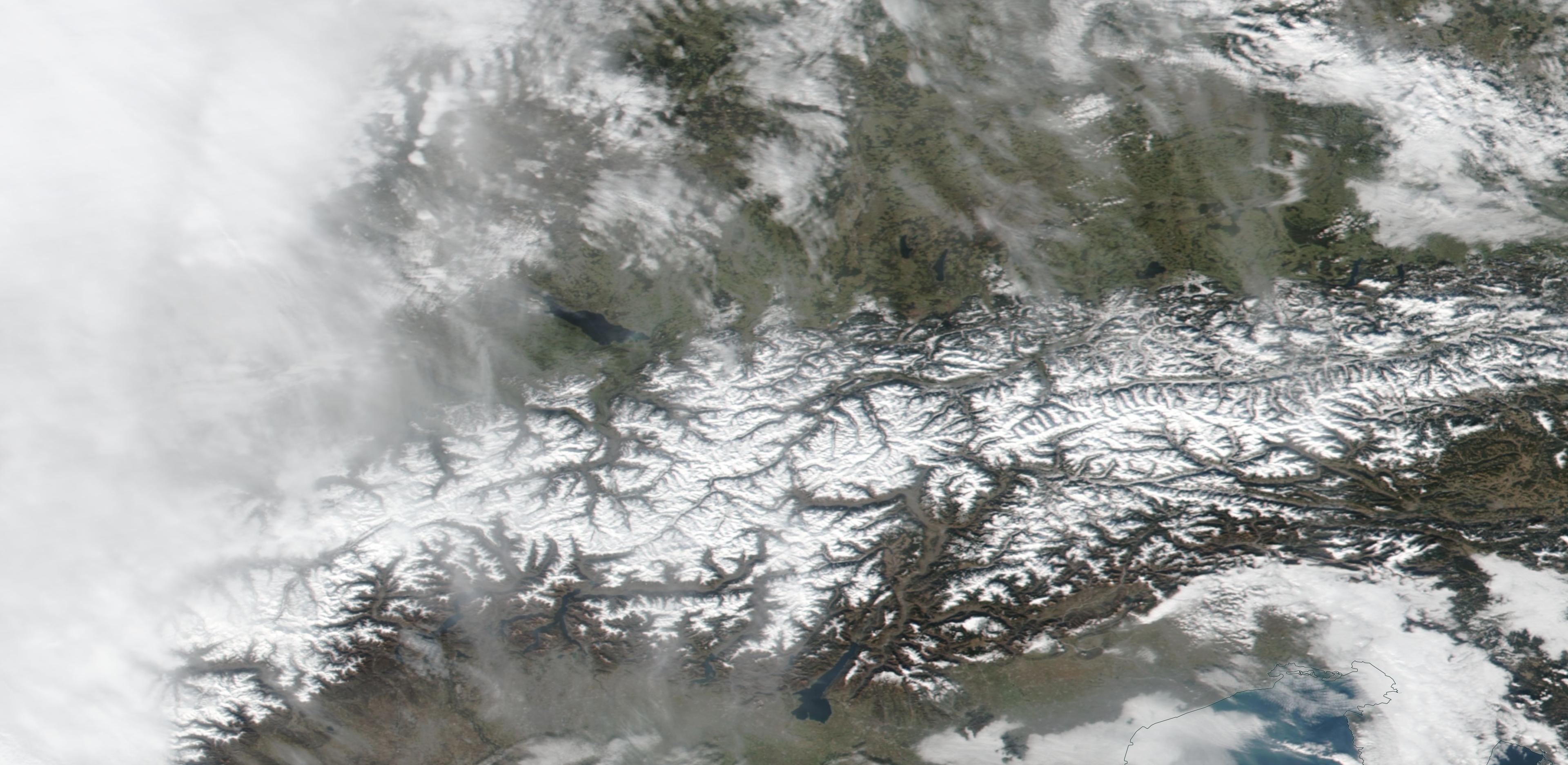
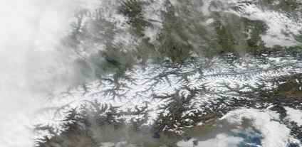
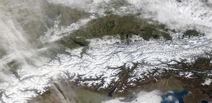
Satellite image Alps, January 27 and January 30, Source:
NASA Worlview
|
 |
 |
While skiing activities in the Alps are to some extent ensured by the intensive use of snow cannons and the existence of high
altitudes, the current winter season caused major problems especially for smaller skiing areas below 1000 m altitude. The short-lived
snowfalls on 29 January raised hopes among many operators that they could (re)start their business. However, the slight rise of a
high-pressure ridge over the Mediterranean Sea caused a zonal, partly even south-westerly flow towards Germany in the following days.
Several strong low-pressure systems advected warm and humid air from the Atlantic, which resulted in temperatures around 15°C and
rain reaching up to high altitudes.
Text: FS
February 04, 2020
|