|
In early and mid-January, several winter storms reached Europe, causing wind speeds of up to 195 kph in Cairngron (GB). Spain and France were mainly affected,
as well as the UK and the Benelux countries.
Weather situation
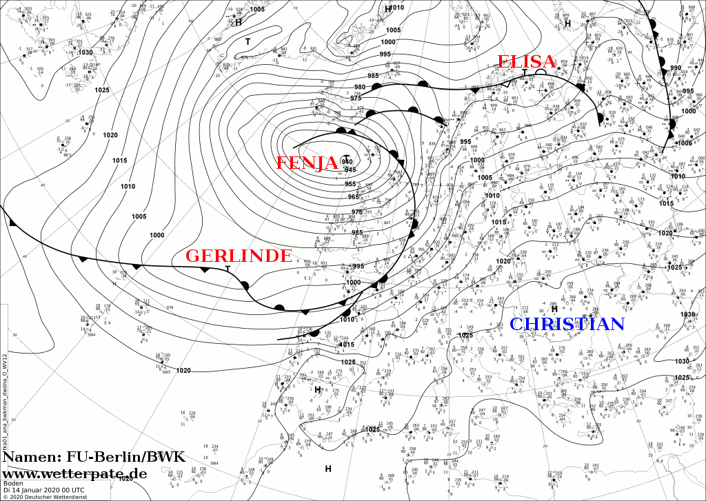
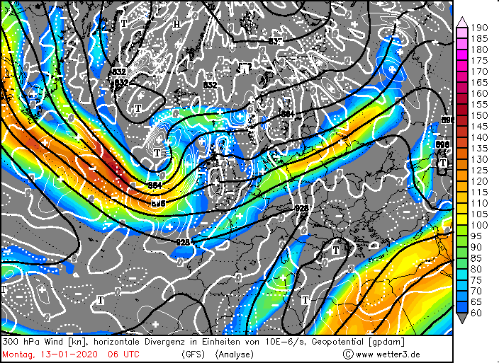
The first storm low was FENJA and developed on the Labrador Sea near Newfoundland on January 12, when the core pressure was 1005 hPa. 24 hours later the core
pressure was only 960 hPa. FENJA thus underwent an explosive cyclogenesis, as its core pressure fell by more than 24 hPa. In 24 hours the pressure fell by 45 hPa,
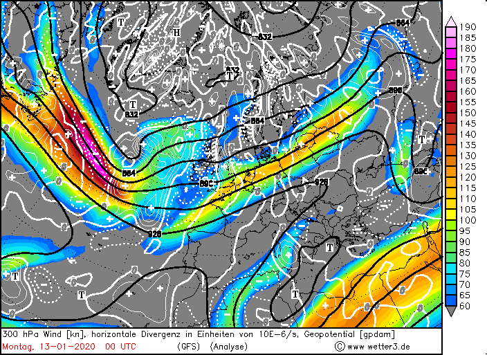
which is an enormous intensification. The reason for this was the favourable position in front of a powerful jet stream. By January 12, FENJA was already in
positive divergence and positive vorticity advance, which accelerated the pressure drop. An additional intensification was caused by a dry intrusion.
Even one day later it was still in this range. On January 14, FENJA reached the European North Sea and the Faroe Islands with a core pressure of 940 hPa.
Although the jetsream weakened, it supported the pressure drop over this period. FENJA took on the role of the controlling central low and on January 15 that the
core pressure began to rise again. FENJA was accompanied by a strong warm air advection (see also layer thickness advection) for Germany. Record temperatures up
to 17 degrees were registered on January 13 and 14. Also in Sweden and Norway it became unusually mild for this time of year.
|
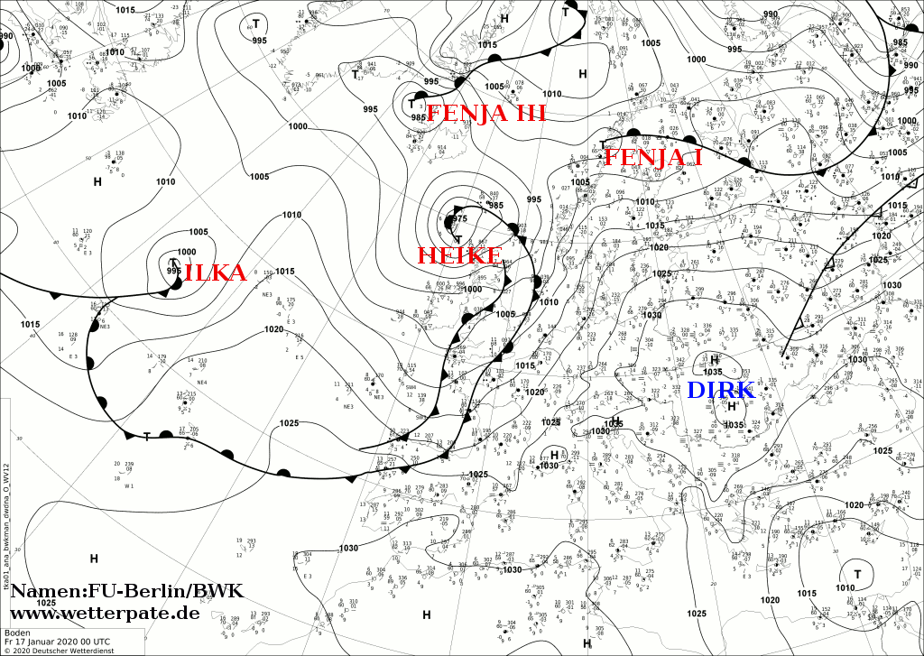
Sea level pressure and fronts, January 14-17, 2020:
FU-Berlin
|
 |
 |
 |
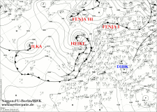 |
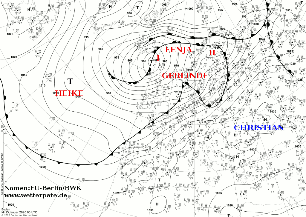
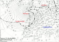
The next winter storm GERLINDE was not long in coming. It developed on the long cold front of FENJA with a core pressure of 1005 hPa and also on the Labrador Sea.
It did not undergo explosive cyclogenesis. It was in the positive divergence area of a jet stream, but at 243 kph it was much weaker than that of FENJA (400 kph).
GERLINDE reached its pressure minimum of 980 hPa on 15 January.
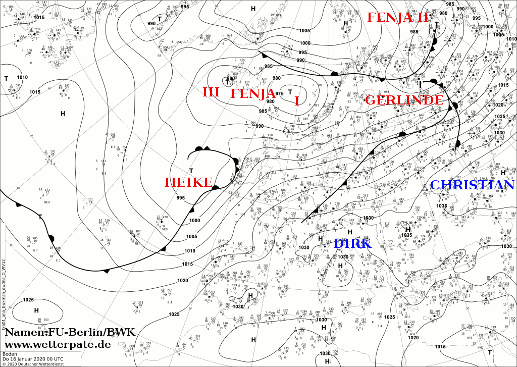
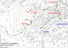
The next storm low on the Atlantic Ocean occurred on 15 January. HEIKE had a core pressure of 1000 hPa. It shifted relatively slowly, as the way to the southeast and
east was partly blocked by the pronounced high-pressure areas CHRISTIAN and DIRK. HEIKE reached a pressure minimum of 975 hPa and became the controlling central
low on 17 January.
|
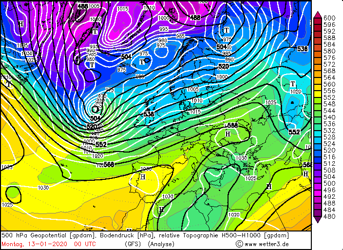
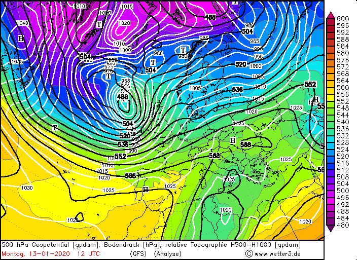
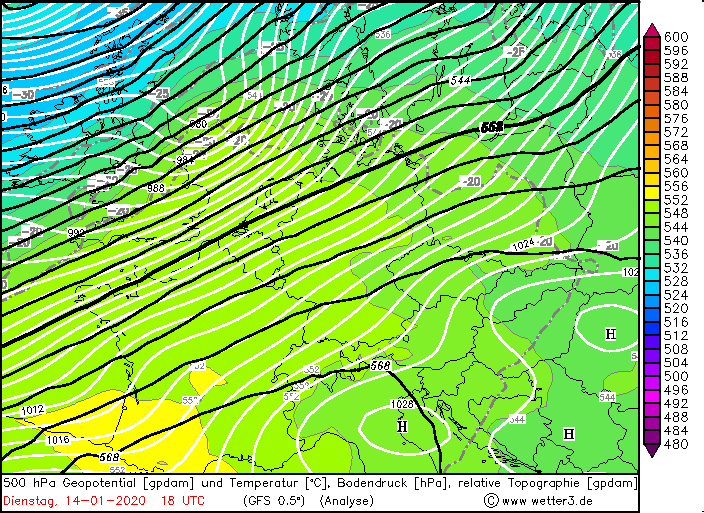
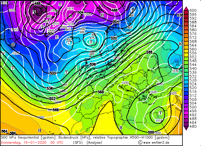
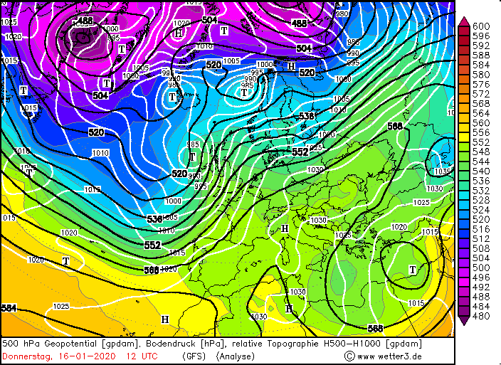
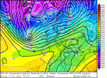
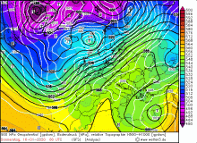
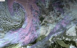
500 hPa Geopotential, January 13-17, Source:
Wetter3
|
 |
 |
 |
 |
|
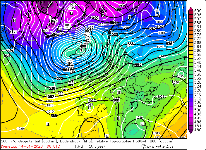
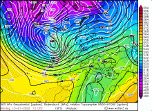
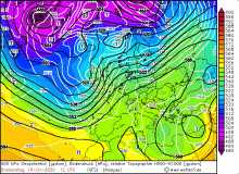
500 hPa Geopotential, January 13-17, Source:
Wetter3
|
 |
 |
Storm tracks and Damages
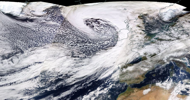
FENJA's centre did not reach the European mainland. However, its fronts and the storm field influenced Europe. The strongest winds were registered on exposed
locations and on the coastal areas of the affected regions. Especially in Scotland high wind speeds of over 140 kph were reached. The pressure in Stornoway
(northern Scotland) was 963 hPa, while at the same time 998 hPa prevailed at Shoreham Airport (southern England). This corresponds to a pressure gradient of 35 hPa
per 870 km (average 4.5 hPa per 100 km). The storm field first reached Ireland on 13 January and shortly afterwards Great Britain, and in the evening the coasts of
Spain and France. In the night of 14 January, a second wind maximum developed on the southeast flank, which hit Ireland and northern Scotland. FENJA developed two
daughter cyclones.
|
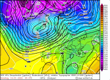
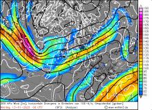
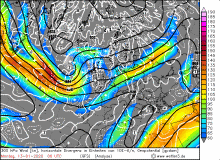
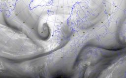
300 hPa wind and divergence and Satellite Images (water vapour and visible), January 13, Source:
Wetter3 and
Wokingham
|
 |
 |
 |
 |
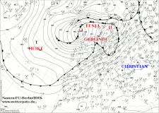
GERLINDE reached the Bay of Biscay on 14 January. Its core travelled over England and Wales and the North Sea. Its main storm field reached France and
England on 14 January and the Benelux countries, Denmark and Sweden in the evening and at night. On 15 January it also reached the European North Sea and its
pressure began to rise.
HEIKE moved across the Atlantic north of Ireland and northwest of Scotland. Her storm field was limited to the north of France, Ireland and Great Britain. On 17
January she reached the European North Sea like FENJA and GERLINDE before.
The high wind speeds damaged buildings, uprooted and overturned trees, broke off branches and also damaged buildings and vehicles. The wind also caused high waves
and thus storm surges. In combination with the high tides, flooding occurred. In France, torrential rainfall occurred in the Massif Central due to frontal
precipitation. This also led to flooding. In some regions air traffic was interrupted. Delays and cancellations also occurred in local and long-distance traffic.
| Location |
Gusts in kph |
Date |
Cairngorn (GB)
Aonach Mor (GB
Bealach Na Ba No2 (BG)
Cairnwell (GB)
Great DUn Fell (GB)
South Uist Range (GB)
Roches Point (IR)
Capel Curig (GB)
Glen Ogle (GB)
Aonach Mor (GB)
Brignogan (FR)
Pointe Du Raz (FR)
Barfleur Point (FR)
Ouessant-Stiff (FR)
Cairngorn (GB)
Aonach Mor (GB)
Bealach Na Ba No2 (GB)
Cairnwell (GB)
Mont Aigoual (FR)
|
195
181
181
156
152
141
133
128
128
150
130
128
126
122
165
156
148
144
133
|
13.01.2020
13.01.2020
13.01.2020
13.01.2020
13.01.2020
13.01.2020
13.01.2020
13.01.2020
13.01.2020
14.01.2020
14.01.2020
14.01.2020
14.01.2020
14.01.2020
15.01.2020
15.01.2020
15.01.2020
15.01.2020
15.01.2020
|
|
Data source: Ogimet.
Text: MG
January 21, 2020
|