|
KAMMURI reached wind speeds of up to 215 kph and made landfall as Category 2 Typhoon.
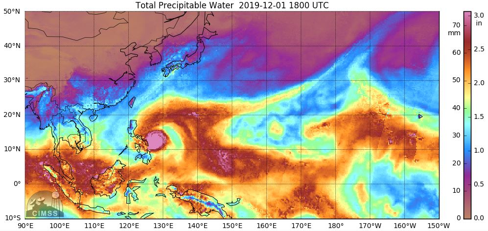
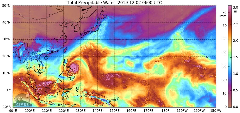
Precipitation of more than 300 mm/48h ocurred in the Philippine Islands.
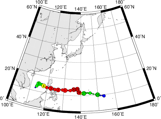
KAMMURI was the 28th named storm and the 16th typhoon of the 2019 Pacific typhoon season. The storm developed on 25 November
from a wave disturbance near the Mariana Islands. After a few days of strong but disorganized convection, the system was
upgraded to a Typhoon on 28 November. The initially slow displacement speed of the storm prevented further intensification
because the ocean water below KAMMURI cooled down due to upwelling caused by the storm itself. Moderate wind shear inhibited
further intensification, too.
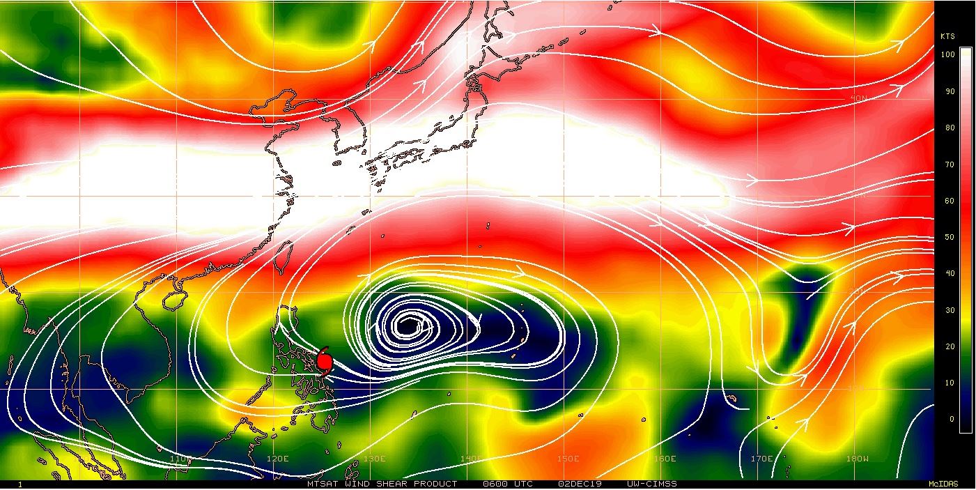
On 01 December, the storm accelerated to a westward-facing displacement velocity of 20 kph. This caused KAMMURI to move in
a small area with hardly any wind shear. In addition, the system entered the Pacific Warm Pool, an area with a high sea surface
temperatures of 29-30°C. The favourable atmospheric conditions led to a rapid intensification of the typhoon. Shortly thereafter,
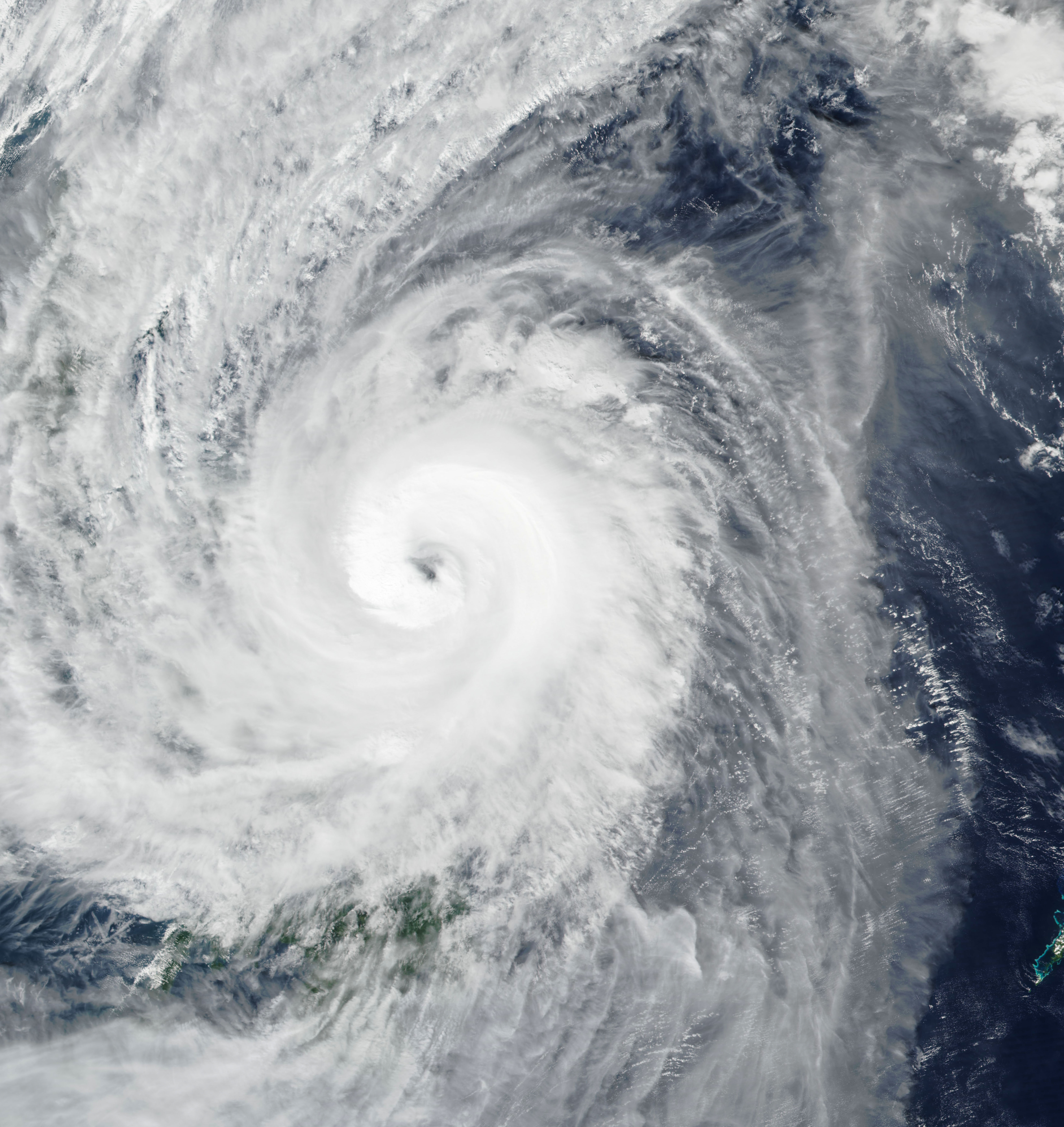
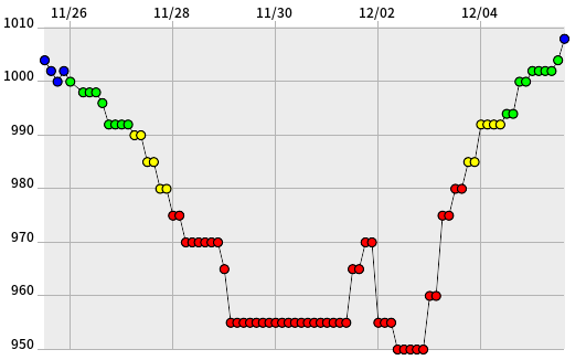
on 02 December at 07 UTC, KAMMURI reached its peak intensity with 1-minute sustained winds of 215 kph. The core pressure decreased
from 970 to 950 hPa within 12 hours. The satellite images showed the system with a well visible eye and well organized deep convection.
Source: NICT
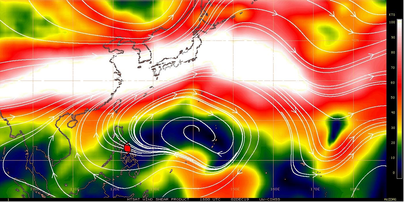
A few hours later the storm made landfall over Gubat, Sorgoson, a municipality with about 60,000 inhabitants. KAMMURI moved
further westnorthwest over the Bicol region. As can be seen in the satellite film in form of multiple stationary cloud structures,
the storm weakened due to friction on the mountainous island state. On 03 December KAMMURI moved on over Buris Island, Bondoc
Peninsula and the Mindoro Strait. In the evening of the same day, the storm was downgraded to Category 1 Typhoon and a few hours
later to a tropical storm.
|
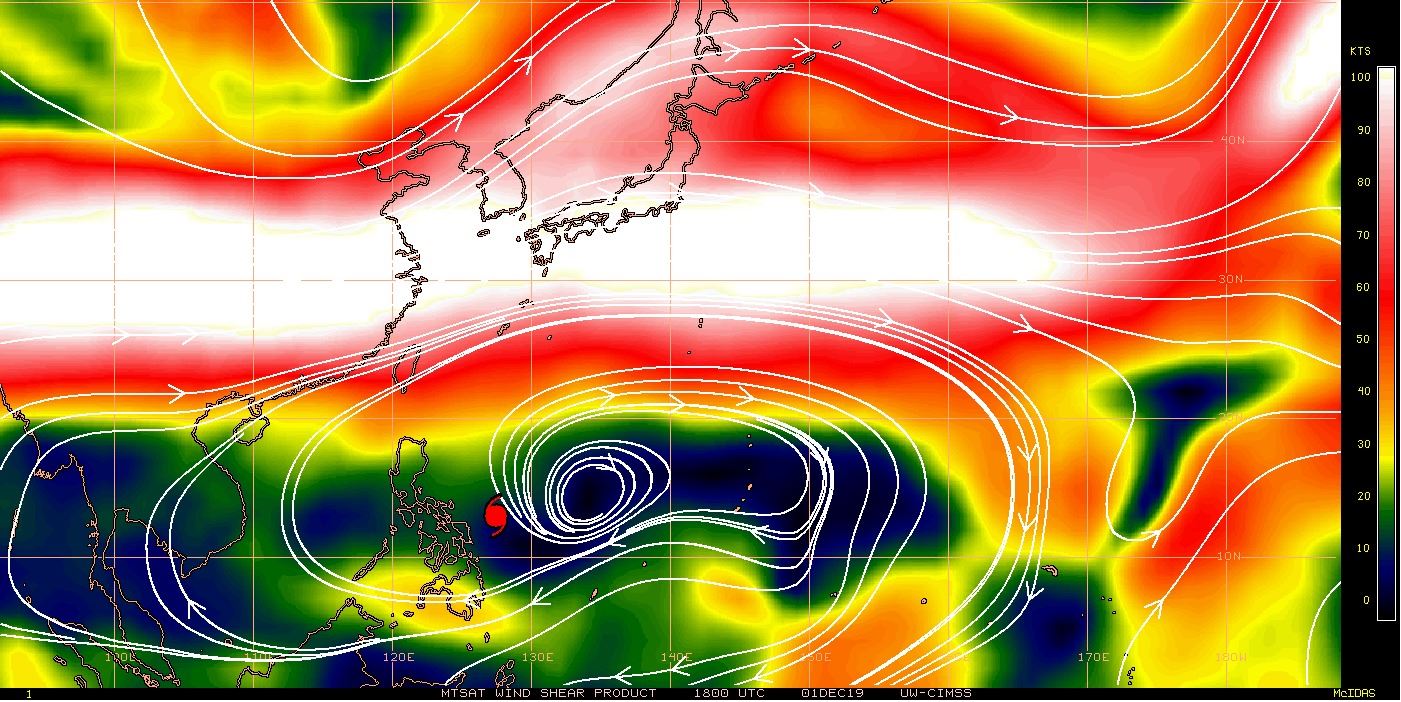
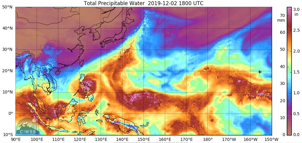
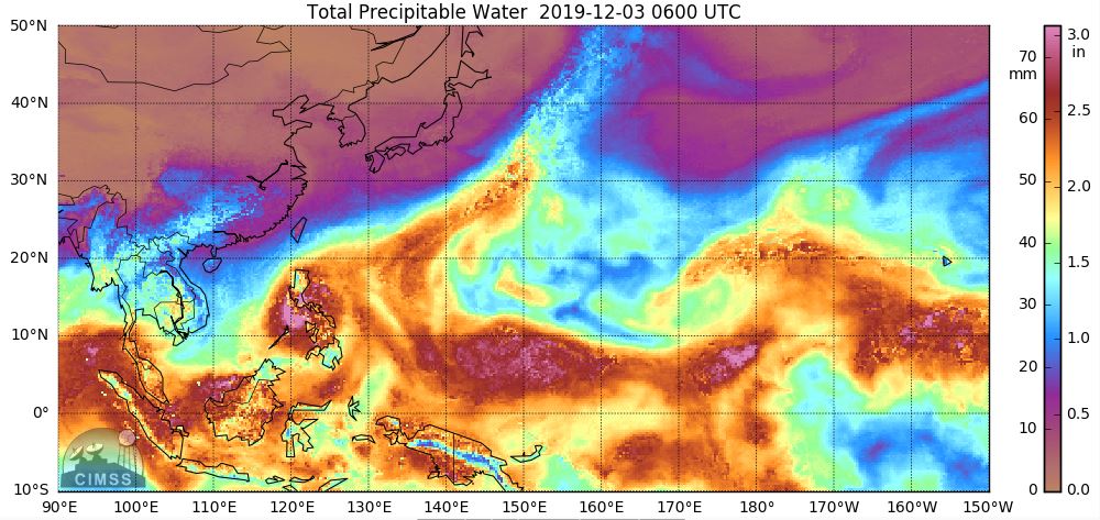
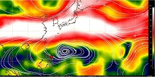
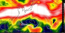
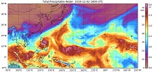
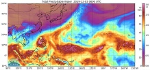
Wind shear and total precipitable water, 01.12. until 03.11.,
Source: CIMSS
|
 |
 |
 |
 |
 |
 |
 |
 |
Since typhoons are not unusual in the Philippines, extensive preparations were made. 113,300 people were evacuated, another
500,000 remained under mandatory evacuation. Many flights were cancelled. In the regions of Bicol, Eastern Visayas, Calabarzon,
Mimaropa and the National Capital Region around Manila school was suspended. Despite the preparations, there were at least 13
deaths. More than 100,000 houses were damaged, at least 30,000 were completely destroyed. There was also damage to roads, bridges
and the electricity network (source: DG ECHO Daily Flash,
NDRRMC).
|
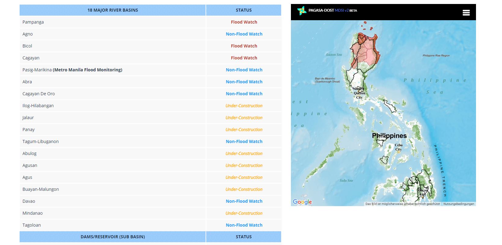
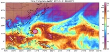
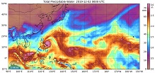
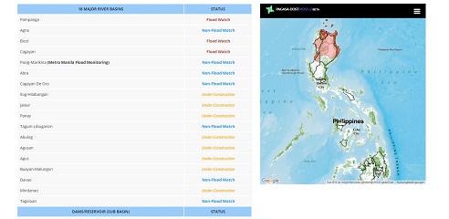
Flood watches and KAMMURIS cloud top temperature,
Source: PAGASA and
CIMSS
|
 |
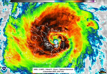 |
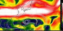
As seen on the infrared image, a large area of deep convection (cloud top temperature below -75°C) extended northwest of the storm
center over the largest island in the Philippines, Luzon. In this area the wind direction was also ideal for orographic rain at the
northern mountains Sierra Madre and Cordillera Central (mountain tops up to 3000 m height). The weather station in Infanta recorded
a 24-hour precipitation of 218 mm. Casiguran and Aparri recorded total precipitation of 341 and 317 mm/48h, respectively.
| Location |
24 h precipitation amount in mm |
Date |
Infanta
Casiguran
Baler Radar Site
Tayabas
Casiguran
Tuguegarao
Aparri
Aparri
|
218
114
103
101
227
168
121
196
|
04.12., 00 UTC
04.12., 00 UTC
04.12., 00 UTC
04.12., 00 UTC
05.12., 00 UTC
05.12., 00 UTC
05.12., 00 UTC
06.12., 00 UTC
|
|
Data source:
Source: Ogimet.
Text: FS
December 06, 2019
|