|
Super typhoon HAGIBIS was the 4th typhoon of category 5 this year and reached wind speeds of 260 kph. The strongest precipitation
was registered with 942.5 mm in 24 hours. On October 11th it hit Japan as category 2 storm.
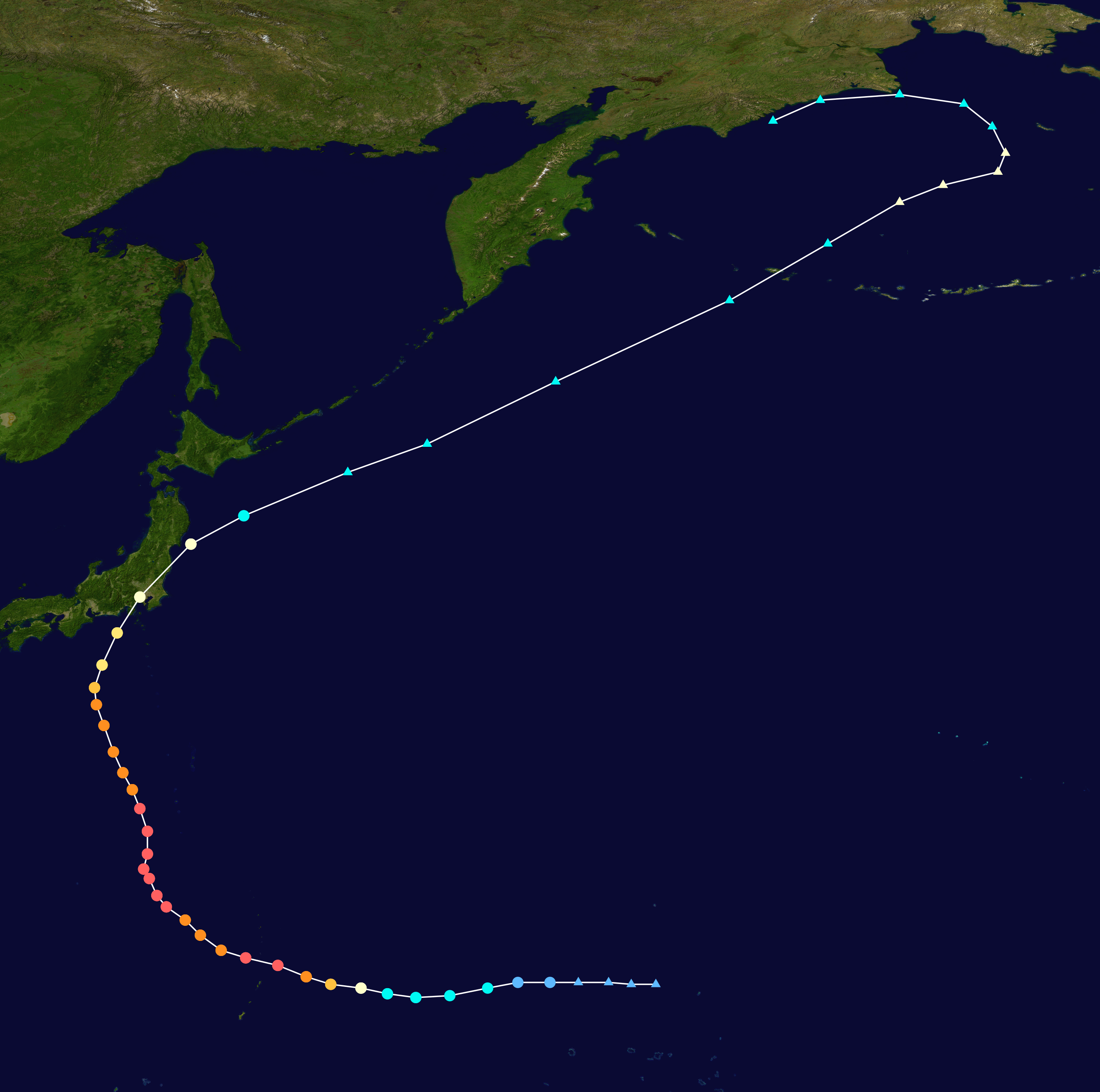
Development and trajectory
On October 02, a thunderstorm cluster a couple of hundred miles north of the Marshall Islands was registered in the southern part of the North Pacific.
On October 5, rotation began and on October 6, the tropical storm developed into a Category 1 typhoon with wind speeds of 97 kph. From this point on,
HAGIBIS experienced an extremely rapid intensification. Already on the next day it had reached category 3 and in the evening category 5 so within 24 hours
it changed from a category 1 storm to a super typhoon. Wind speeds of 257.5 kph were reached, the core pressure was only 915 hPa.
This rapid development can only be observed very rarely. NOAA's Hurricane Research Department only lists one Northwest Pacific typhoon
(Super Typhoon FORREST in 1983) that developed so rapidly. The number one in the western hemisphere is Hurricane PATRICIA in 2015
(193 kph intensification within 24 hours) and Hurricane WILMA in 2005 (177 kph intensification within 24 hours).
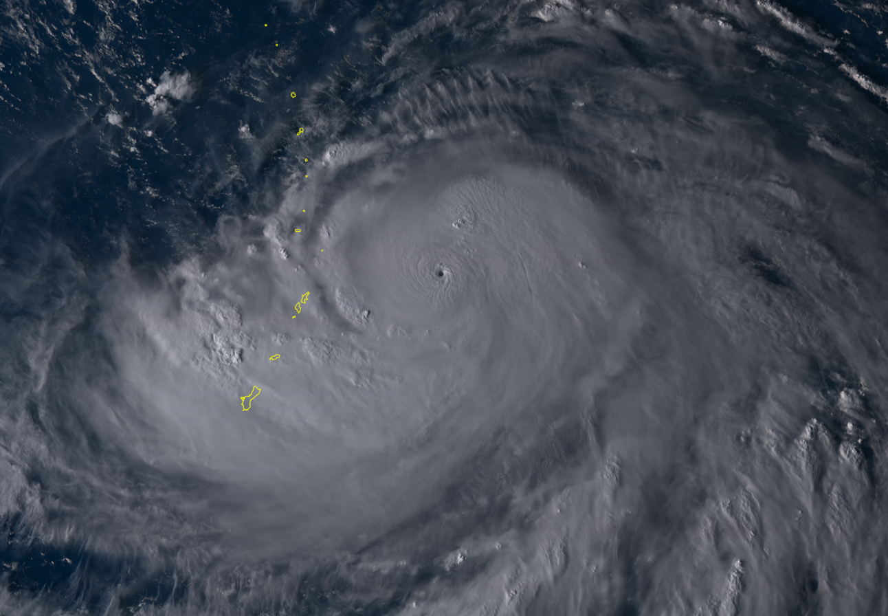
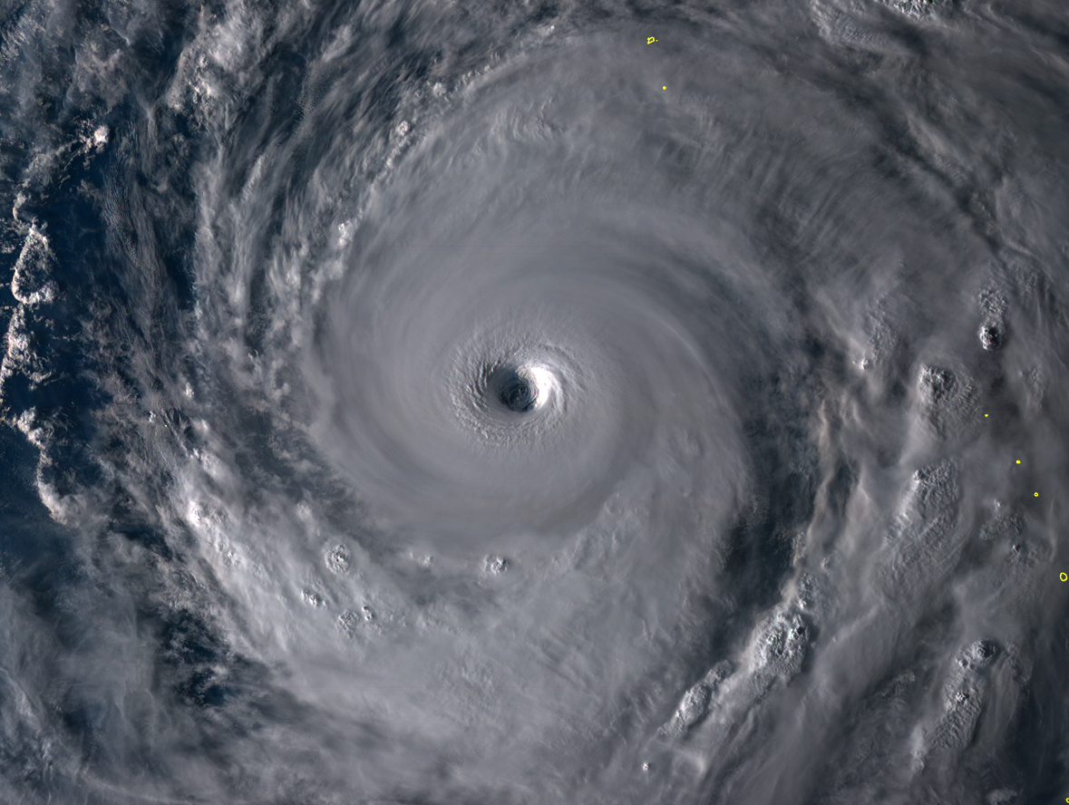
His eye remained unusually small (pinhole). However, he went through an eyewall replacement cycle on October 8th, which gave him a larger and almost
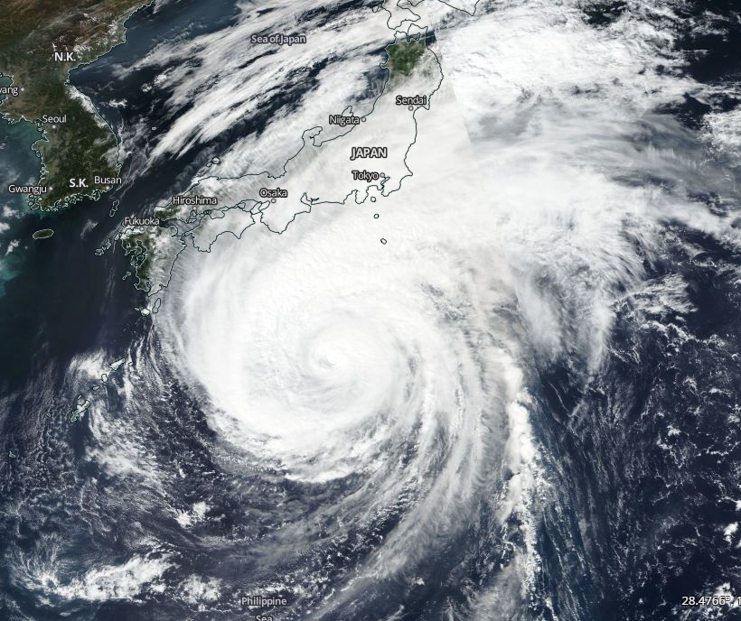
perfectly round eye. On October 11th the cloud bands reached the east coast of Japan. HAGIBIS had wind speeds of 225.3 kph.
Already on the following day HAGIBIS weakened to a category 2 storm and in the evening to category 1.
|
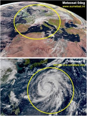
Satellite image, size comparision of HAGIBIS and Europe: source
Sever Weather
|
 |
Observations and damages
The rapid instensification was triggered by the favourable environmental conditions, above all by the still high water temperatures and the low wind shear.
The extremely fast intensification was terminated by the eyewall replacement cycle. .
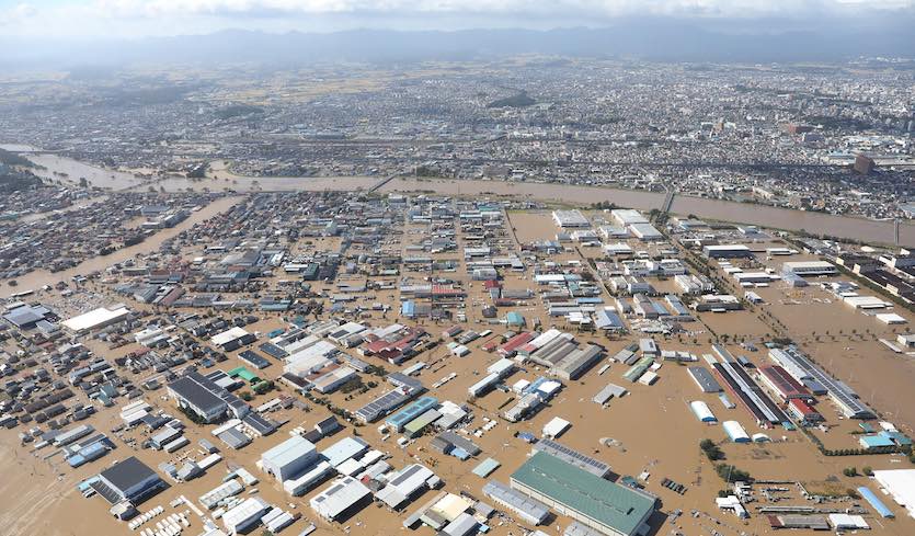
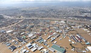
On 11 October, HAGBIS landed in Japan as Category 2 Storm. The Kanto region was particularly affected. Intense winds and precipitation caused
storm surges and floods as well as landslides. In some parts, electricity was lost. Local and long-distance transport were affected by the damage.
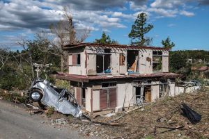
On the morning of 12 October, thunderstorms in the cloud bands triggered a tornado in Ichihara. With 942.5 mm in 24 hours HAGIBIS was Japan's second-heaviest
24-hour rainfall on record, according to the UK Met Office.
So far it is known that at least 77 people have died as a result of HAGIBIS, more than 220 have been injured and 10 are missing.
|
Aftermath of HAGIBIS (left) and tornado damage (right): source
Wunderground
|
 |
 |
Text: MG
October 16, 2019
|