|
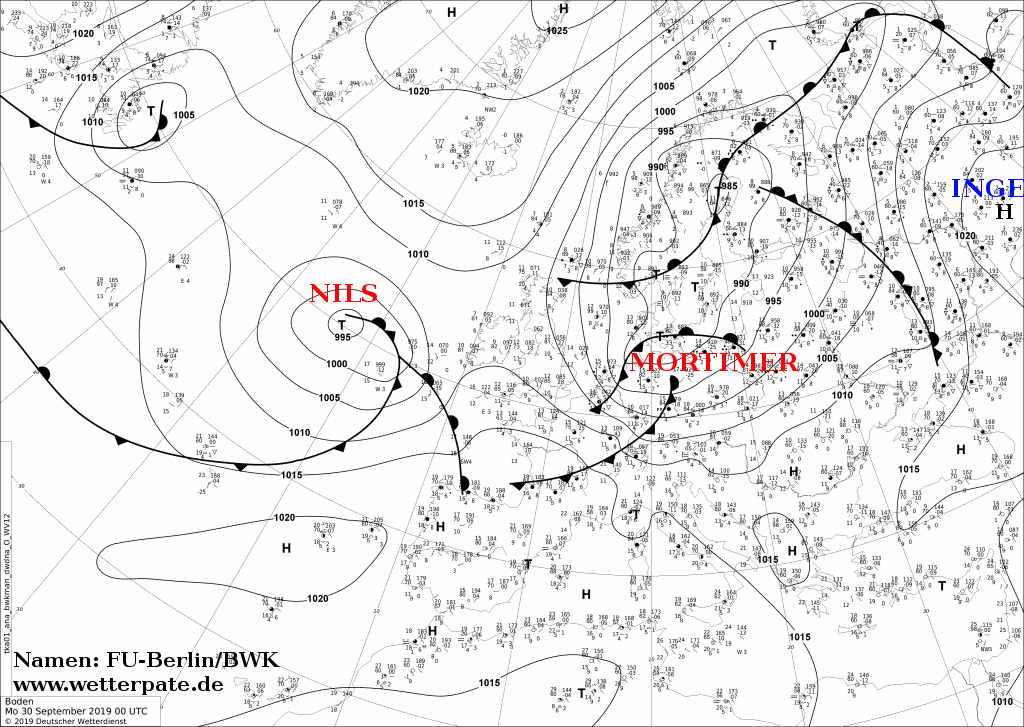
The windstorm MORTIMER is the first autumn storm of 2019 and reached Germany at the end of September. The south and southeast of Germany were particularly affected.
The strongest gust of 148 kph was registered on the Feldberg in the Black Forest, Baden-Württemberg.
Weather situation
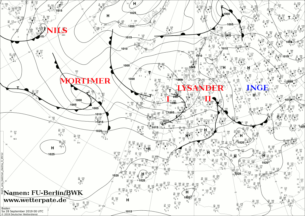
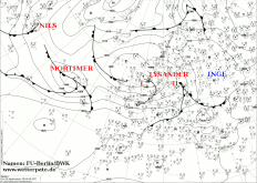
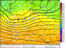
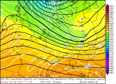
MORTIMER formed in front of a flat trough, which tip swung over Denmark and northern Germany. MORTIMER stayed on the front of the trough for several days and
benefited from the favourable position at the left jet exit. The centre moved across the North Sea, the Baltic Sea and Denmark. It did not reach Germany.
The frontal cloudbands of the cold front and post frontal weather by the inflowing polar air were remarkable. The strongest gusts were registered in western and
central Germany (selected gusts in table below).
|
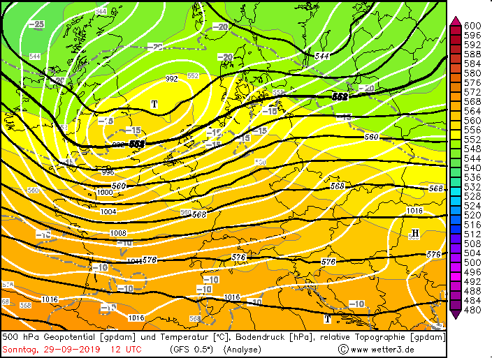
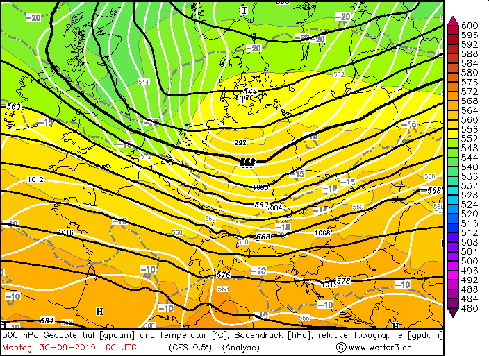
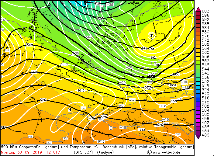
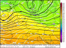
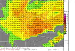
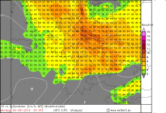
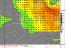
Sea level pressure and 500 hPa Geopotential from Sep 28-30, Source:
Wetter3
|
 |
 |
 |
 |
 |
 |
 |
 |
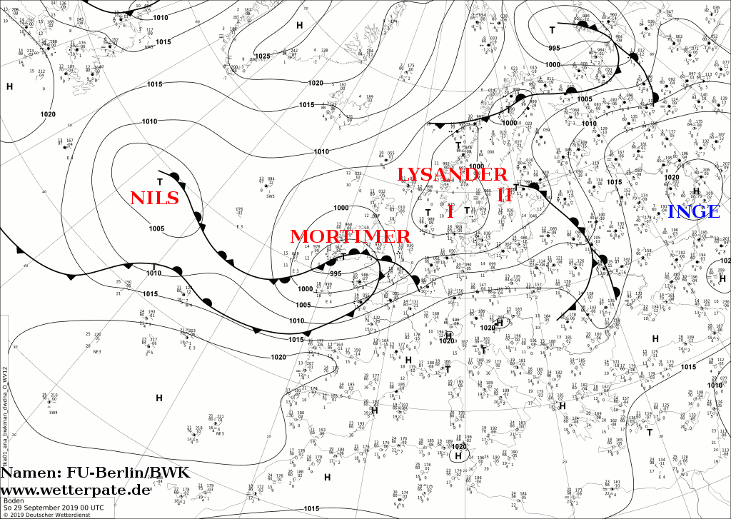
Development
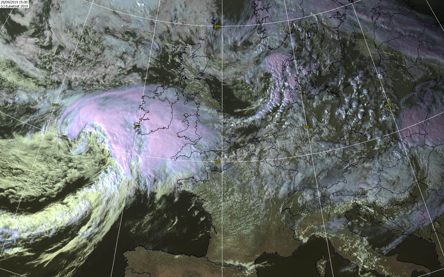
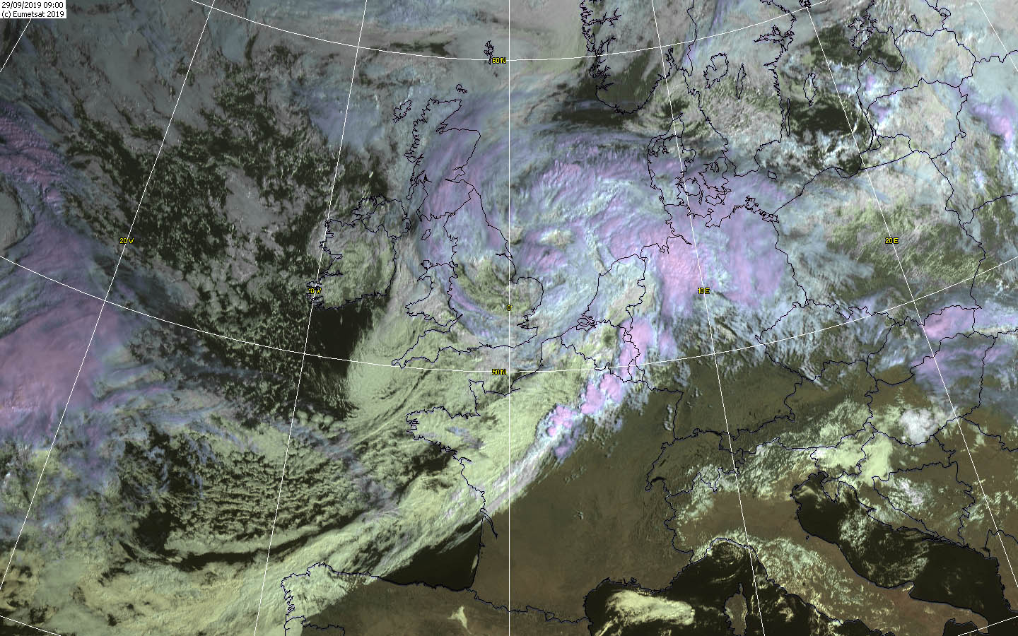
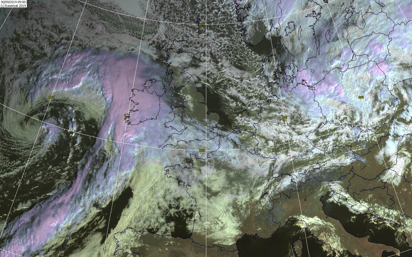
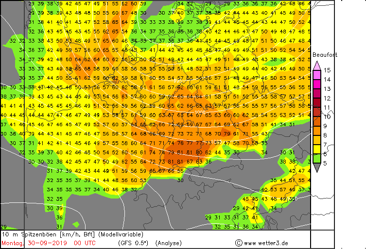
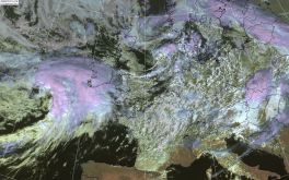
On Sunday, September 29, the first stormy gusts reached Western Germany in the morning. Already one day before MORTIMER announced itself impressively on
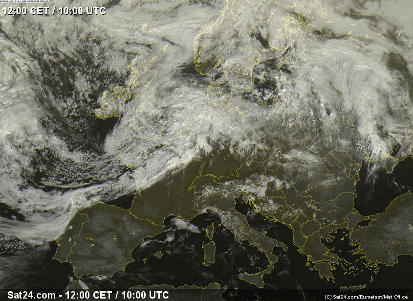
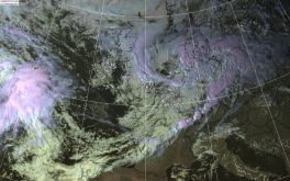
the satellite images. The south and southeast initially benefited from a high pressure area and the wind remained weak for the time being. This can also be seen
on the satellite images. In the south of Germany it is almost cloudless and the front cloudiness of the low visibly delimits its influence. Thunderstorms developed
along the cold front and behind it, producing gusts of storm strength mainly in the north.
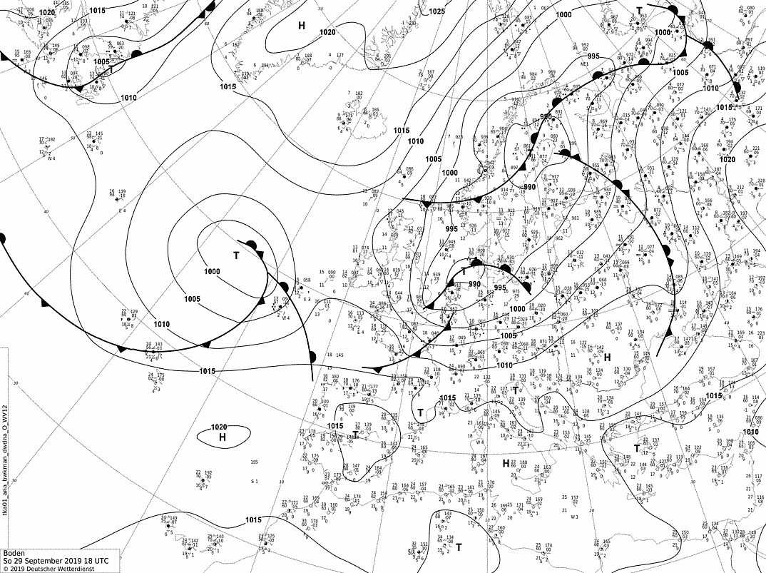
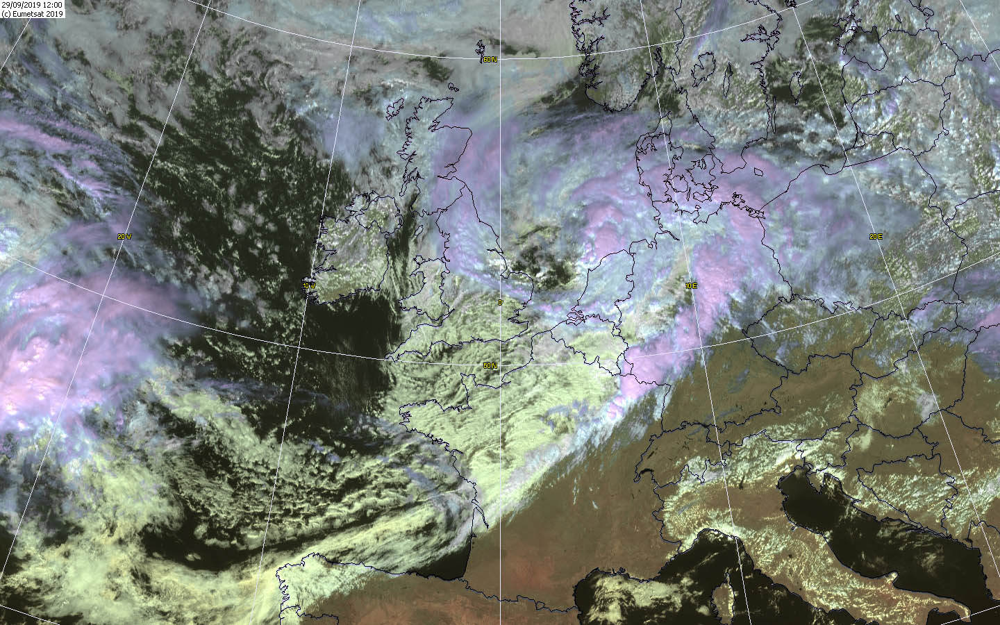
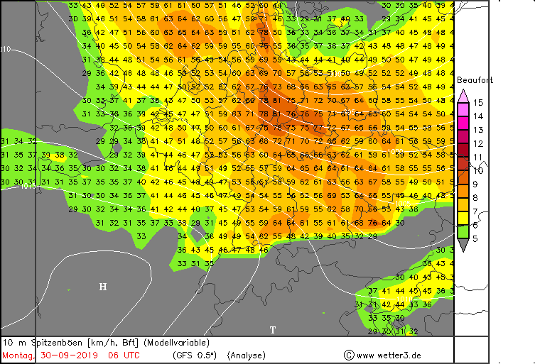
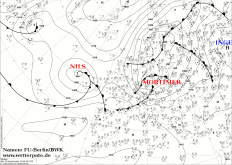
MORTIMER developed two wind maxima. The first one reached on the evening of October 29th and brought hurricane-like gusts mainly to the south and the middle of
Germany. In the night to Monday a second narrow wind maximum formed over Bavaria and also brought hurricane-like gusts there. After the thunderstorms had left the
north of Germany, the wind remained very weak there.
|
Satellite images (visible) from Sep 28-30, Source:
Wokingham and
Sat24
|
 |
 |
 |
 |
|
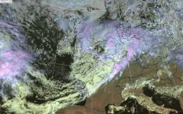
Satellite images, Source:
Sat24
|
 |
 |
 |
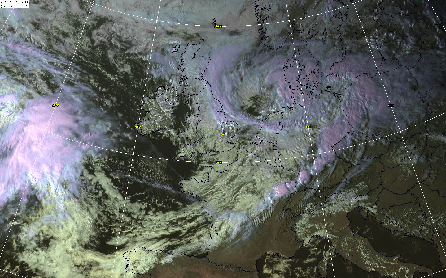
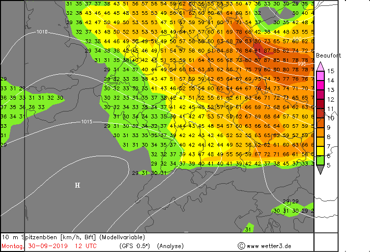
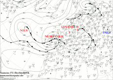
On Monday, MORTIMER quickly shifted to the East. On its southwest flank, another narrow wind maximum with hurricane-like gusts formed in the
morning, triggered by the strong air pressure gradients. This extended first over Lower Saxony and Saxony-Anhalt and shifted then over Mecklenburg-Western
Pomerania and Brandenburg, and until noon to Berlin and Saxony. In the rest of the country a stiff wind continued to blow and showers and thunderstorms had to be
expected again in the north. The typical back side weather.
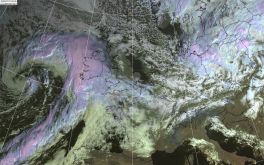
On the satellite pictures you can notice lee waves caused by the strong wind along the mountains. The wind/air hits a mountain range and
is forced to ascend on the luv side. On the lee side it falls off again and starts to oscillate due to its inertia. These leewave ridges are characterized
by long clouds parallel to the mountains.
Damages and windmaxima
Since the trees were still full of leaves at this time of year, there was a particular risk of falling trees, even in gusts that were well below storm strength.
The danger of branches or trees breaking off was also very great, as the wood from the branches and trees had dried out as a result of the drought years 2018 and 2019.
There were delays and cancellations in local and long-distance traffic.
|
Peak wind gusts, Sep 29-30,
Source: Wetter3
|
 |
 |
 |
 |
| Location |
Wind gusts in kph |
Feldberg, Schwarzwald
Brocken
Fichtelberg
Grosser Arber
Weinbiet
Zugspitze
Kahler Asten
Leuchtturm Alte Weser
|
148
144
119
119
119
104
101
101
101
|
|
Data source:
Source: Ogimet,
Text: MG
October 05, 2019
|