|
Tropical cyclone BARRY was the first tropical storm of the 2019 Atlantic hurricane season to reach hurricane
force and affect the mainland. It made landfall as a Category 1 hurricane in Louisiana, USA, on July 13.
As the name suggests, BARRY was not the first tropical system in the Atlantic in the 2019 season. A tropical system was already registered east
of the Bahamas on 20 May. It was called ANDREA, but due to dry air advection and strong vertical wind shear, it weakened again on 21 May and
never reached mainland.
BARRYs development
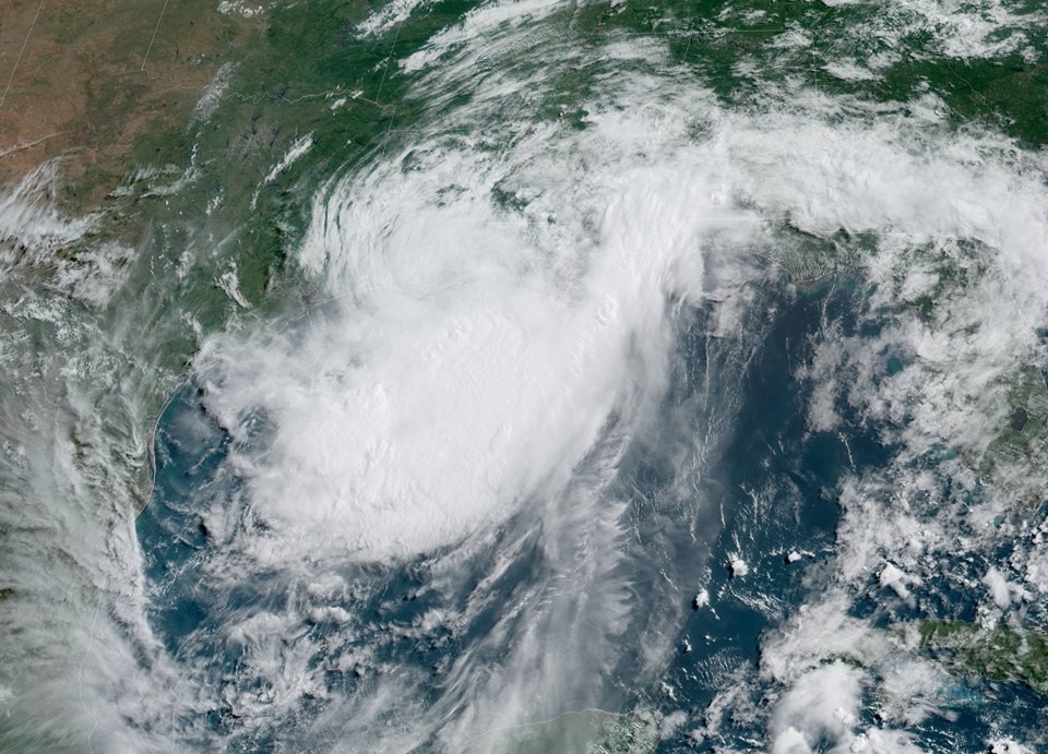
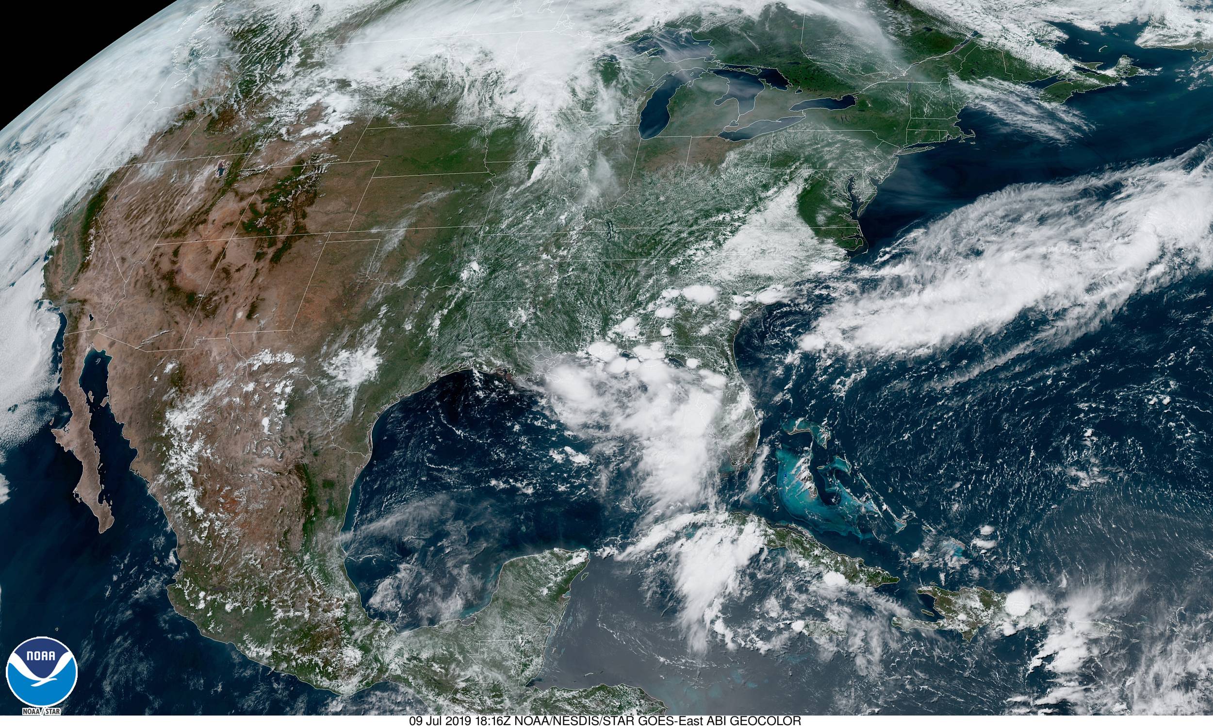
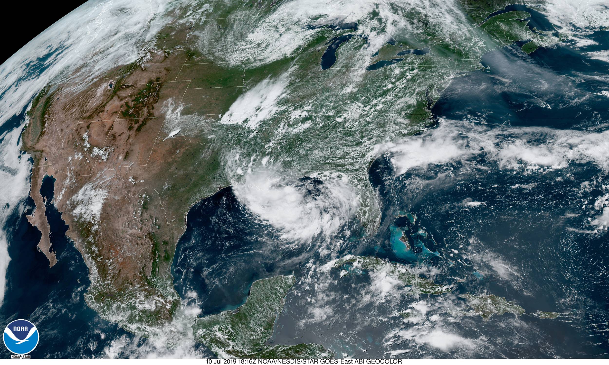
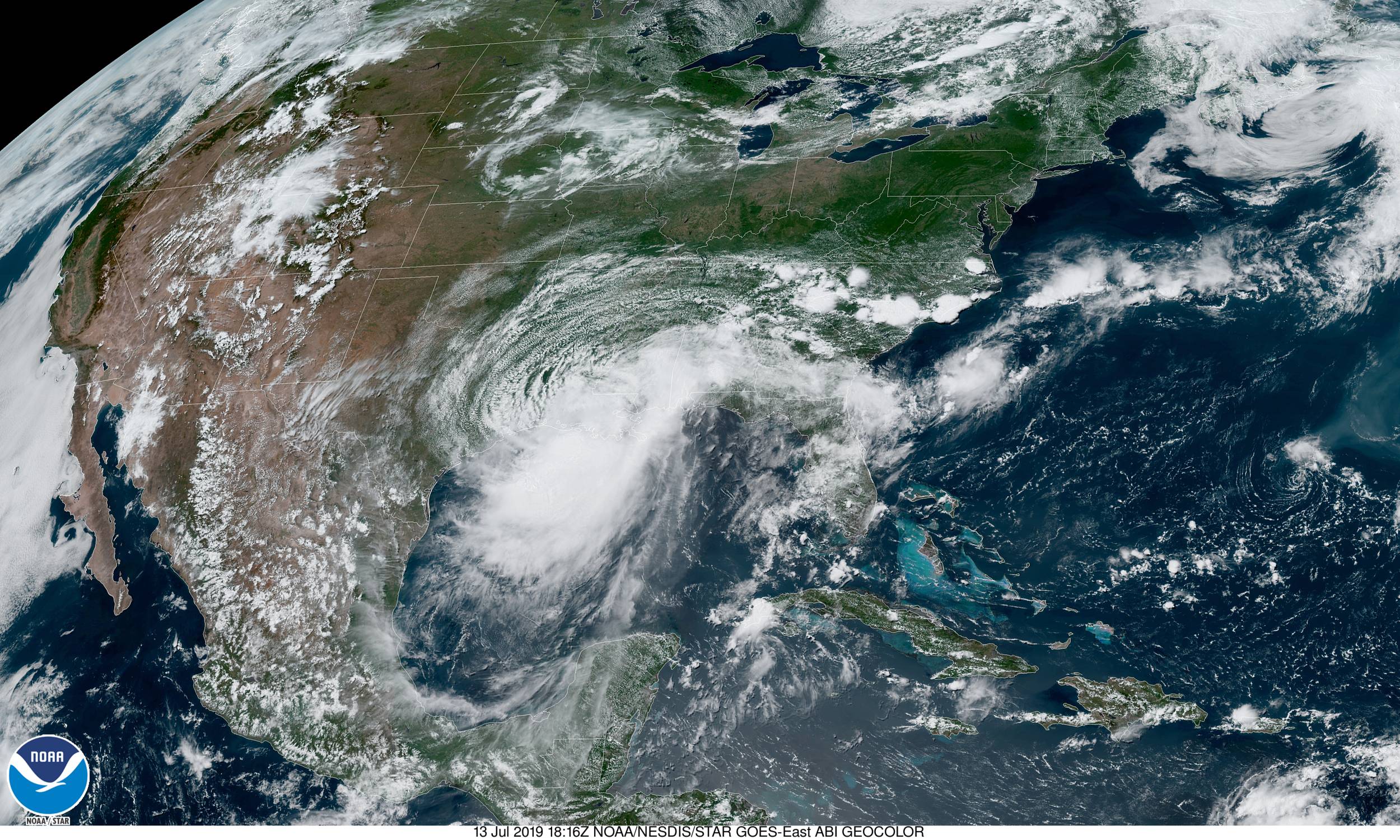
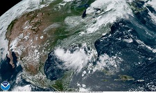
Hurricane BARRY emerged from an area of strong convection over the US federal state of Tennessee. A trough over southeastern parts of the USA
directed the system to the south, triggering the formation of a low pressure area extending across the Florida peninsula. On 10 July, the system
shifted over Apalachee Bay in the northeastern Gulf of Mexico. Due to high water temperatures of more than 30°C, low wind shear and the supply
of humid air, the system strengthened to a tropical storm named BARRY on 11 July.
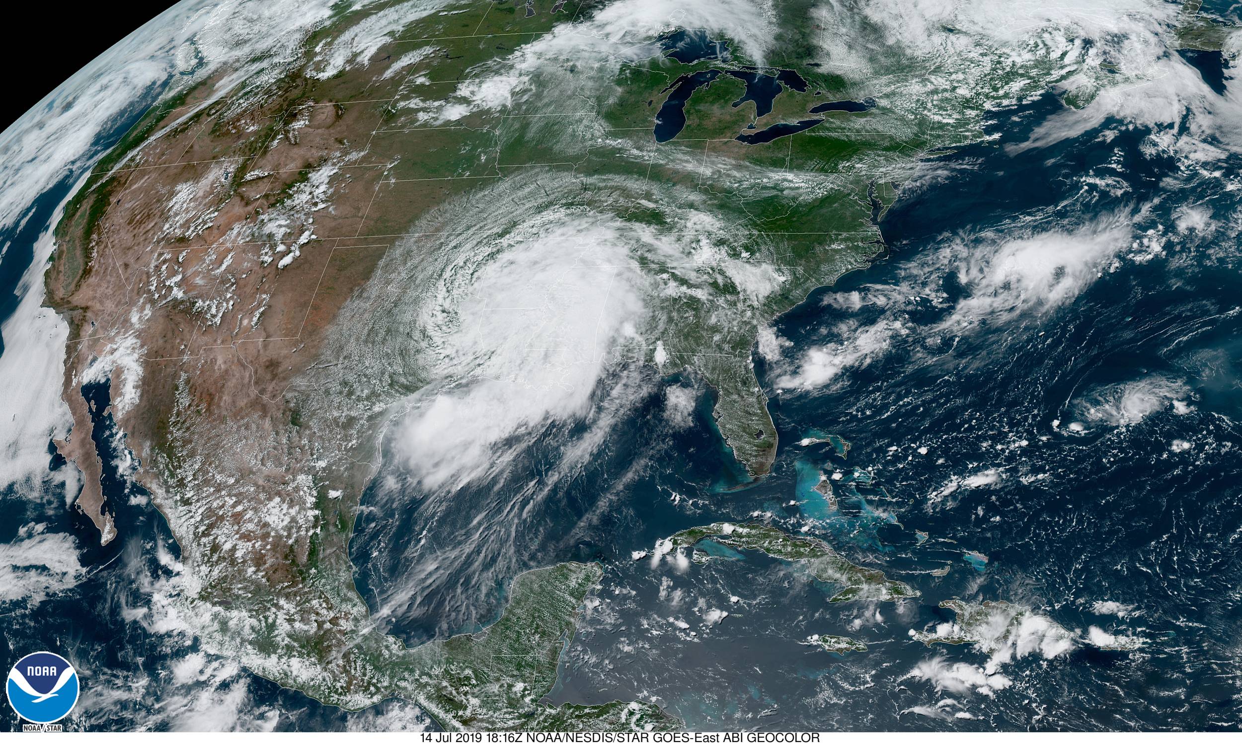
Despite the initially asymmetric structure, convection organized to a large rainband on the southern area and Barry intensified further until
he reached Hurricane Category 1 at about 12 UTC on 13 July.
|
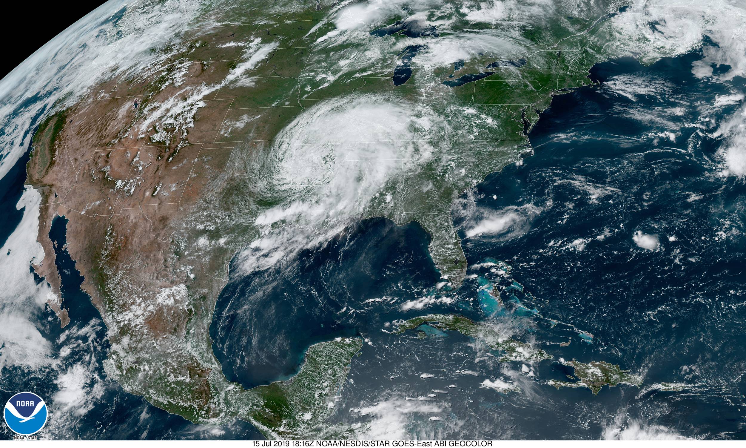
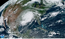
Satellite image (visible) of BARRYs development, 09-16 July, 2019:
NOAA STAR
|
 |
 |
 |
 |
 |
 |
 |
 |
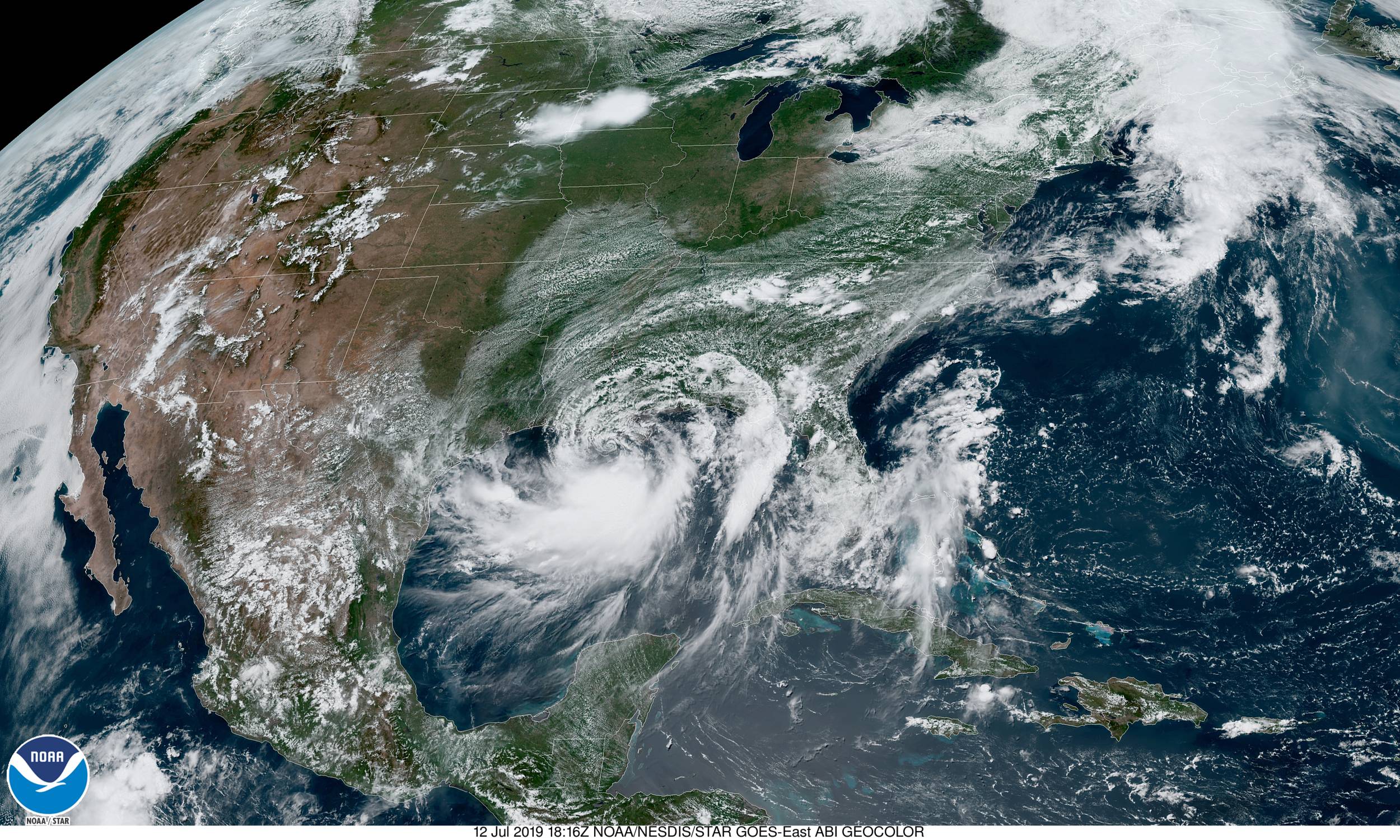
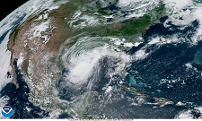
By this time it had already shifted further west and was located immediately off the coast of Louisiana. At its maximum intensity, its core pressure
was 991 hPa and its maximum wind speeds 125 kph, however hurricane-like wind speeds were limited to a small area east of the center.
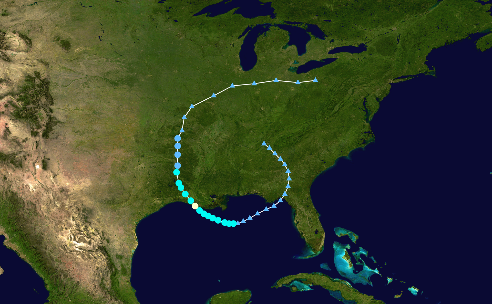
On July 13 at about 18 UTC, BARRY made landfall as Category 1 hurricane at Intracoastal Citiy, Louisiana, and quickly weakened to a tropical storm.
Further shifting first northwest and then north, BARRY descended to a tropical depression at 21 UTC on 14 July.
|
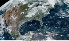
BARRYs trajectory from 07-17 July. Background image from
NASA, tracking data from
NOAA
|
 |
Wind and Rainfall
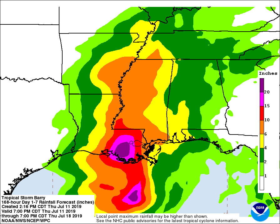
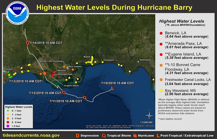
The greatest danger of the hurricane did not come from its winds, but from the enormous amount of precipitation and the storm surge. The largest
total precipitation of 595 mm was registered at Ragley Station, Louisiana. In and around New Orleans, more than 150 mm of precipitation was widespread,
leading to large-scale flooding. The Mississippi River also crossed the flood line and flooded nearby settlements.
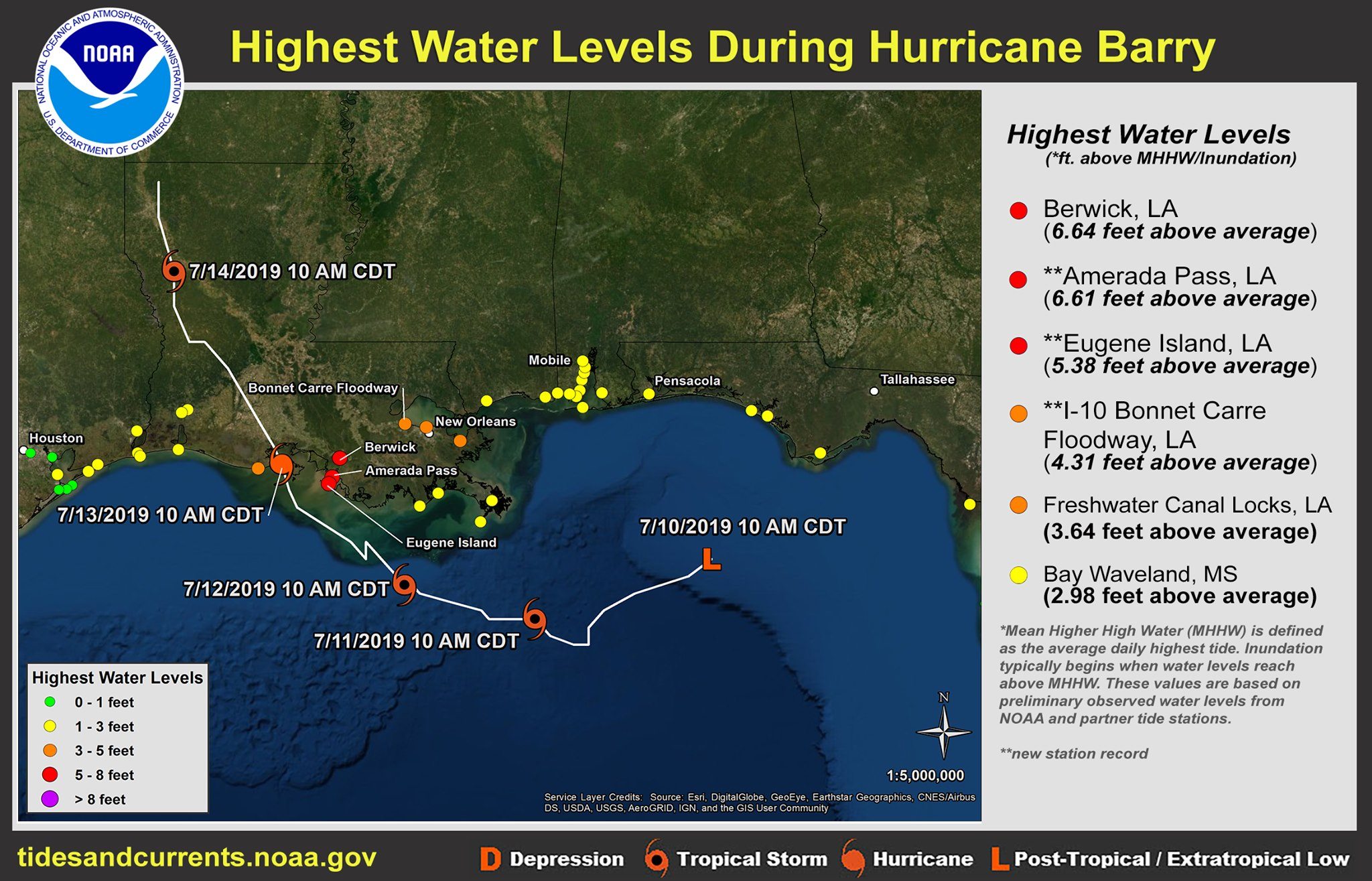
A measuring station at Amerada Pass recorded a storm surge of 2.1 m, just like in Berwick, Lousiana. On the south shore of Lake Ponchartrain
the flood mark was exceeded by 0.9 m, on the north shore by up to 1.5 m. The Atchafalaya River in Morgan City, Louisiana, also exceeded flood limit and led to inundation.
|
Highest water levels during hurricane BARRY
NOAA and
|
 |
Stormy winds unrooted trees and tore down power lines. Over 100 000 households were left without electricity. The greatest effects were felt in
Lefourche Parish and Baton Rouge, Louisiana, who were hit by the east side of the cyclone.
Historical classification
After hurricanes BOB (1979), DANNY (1997) and CINDY (2005), BARRY was the fourth hurricane since the beginning of weather recording to make landfall in the
state of Lousiana. With similar indicators (core pressure, maximum wind speeds) as BOB and CINDY, BARRY could become the second strongest hurricane in the region.
Hurricane DANNY was even stronger with wind speeds of 130 kph, a core pressure of 984 hPa and extremely severe precipitation amounts such as 932 mm (Alabama).
Text: FS
July 18th, 2019
|