|
In the time period from 07 to 10 July, the Mediterranean region, especially Italy and the Balkans, experienced severe storms with heavy rain and hail.
Almost 90 mm fell in Portugal in only a few hours and the largest hailstone known to date has a diameter of 14.5 cm and a weight of almost 30 kg (Italy).
Heavy hurricane force downbursts and tornadoes have been registered in Italy and the Balkans.
In mid-July there were severe storms in the Mediterranean region. The first ones occurred on 08 July in Spain and Portugal.
The extreme precipitation of the thunderstorm cells, which then additionally dammed up at the mountains, was particularly stormlike here.
They continued with Italy on 09 July. Also on 10 July thunderstorms raged, which spread to the east towards the Balkans. There were supercells and
multi-cell thunderstorms.
Weather Situation
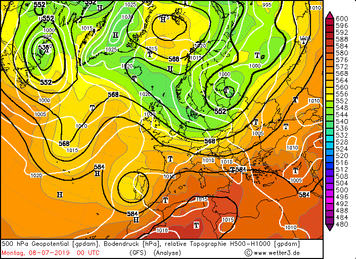
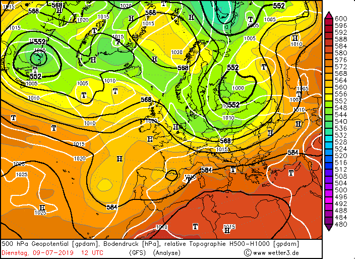
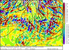
At the beginning of July, the weather in the Mediterranean region was initially calm and dry. However, the ridge with its corresponding high pressure area slowly
shifted eastwards and cleared the way for a trough or an already cut off low, which also shifted eastwards from the Atlantic. At the beginning of the 08th July there
is still high air pressure on the ground in the whole Mediterranean area. Only Portugal and the west of Spain were already in the influence of the low altitude,
which began to labilise the air. At the altitude (500 hPa) Spain was already completely under the influence of the cut off low. Between the tip of the trough over
northern Europe and the tip of the ridge over Africa and the Mediterranean the weather inactive cold front of a low was located. (very nice to see on the 700 hPa
pressure maps and the 850 hPa pseudopotential temperature maps). This extended almost zonally over Central and Eastern Europe and stagnated and later became a wavy
front with a convergence line in front, which will later play a role in the thunderstorms in Italy.
|
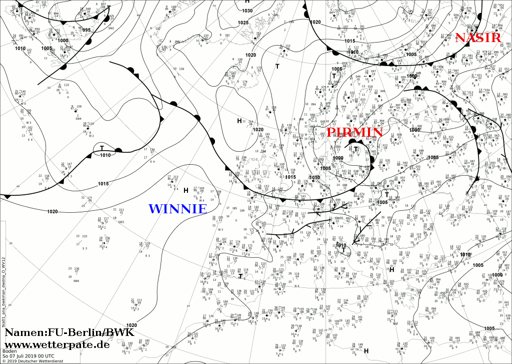
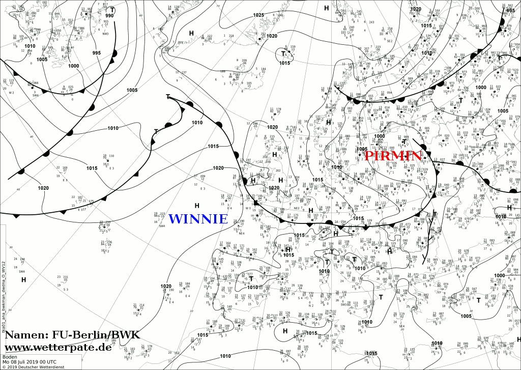
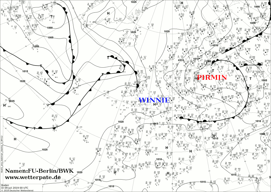
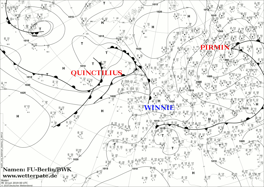
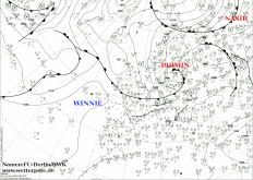
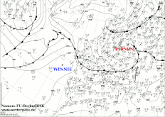
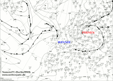
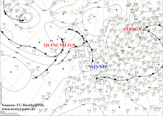
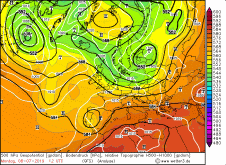
Sea level pressure and fronts, July 07-10, 2019:
FU Berlin
|
 |
 |
 |
 |
The unstable air mass of the cut off low already generated heavy thunderstorms with heavy rain and hail in the morning of 08 July in the east of Spain.
In the late afternoon also the thunderstorms over Portugal became active. Over Italy a MCS was generated around 3:00 UTC. In the late evening around 18:00 UTC
the thunderstorm activity increased strongly over the Balkan region.
In the night from 08 to 09 July, the thunderstorms remained active and shifted eastwards, but lost energy and weakened initially.
It was not until midday that energy was supplied again due to radiation and the thunderstorms regained strength. The back and thus the influence
of high pressure had shifted further to the east and thus enabled the air mass to become unstable. The cut off low also shifted to the east and was located
with the core above the south of France. In addition, it merged with the trough over Russia and northern Europe.
|
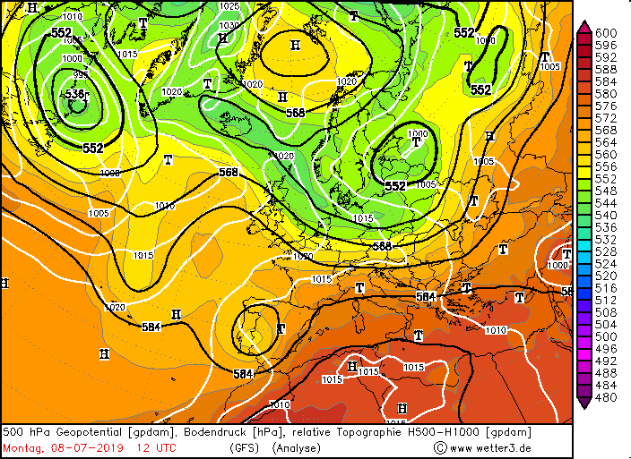
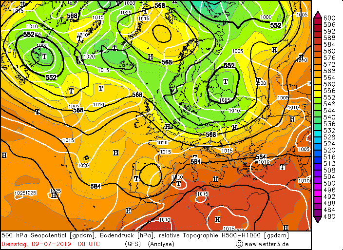
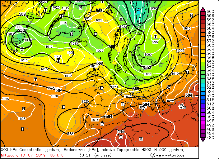
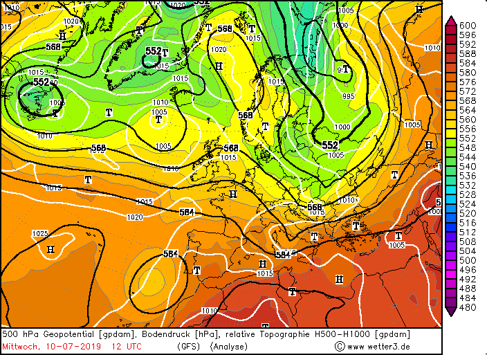
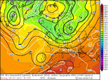
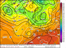
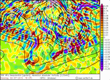
500 hPa geopotential, July 07-10, 2019
Wetter3
|
 |
 |
 |
 |
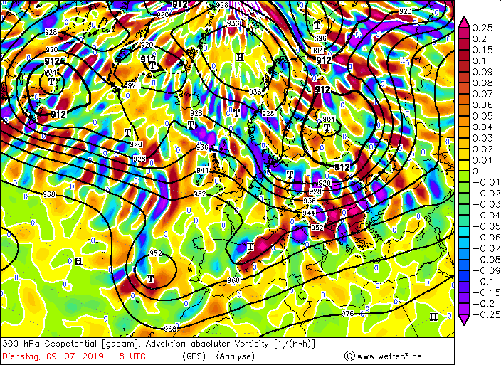
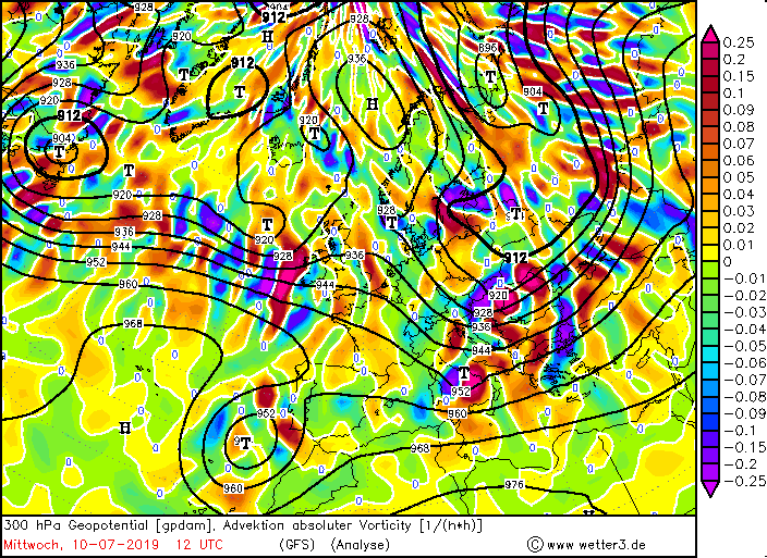
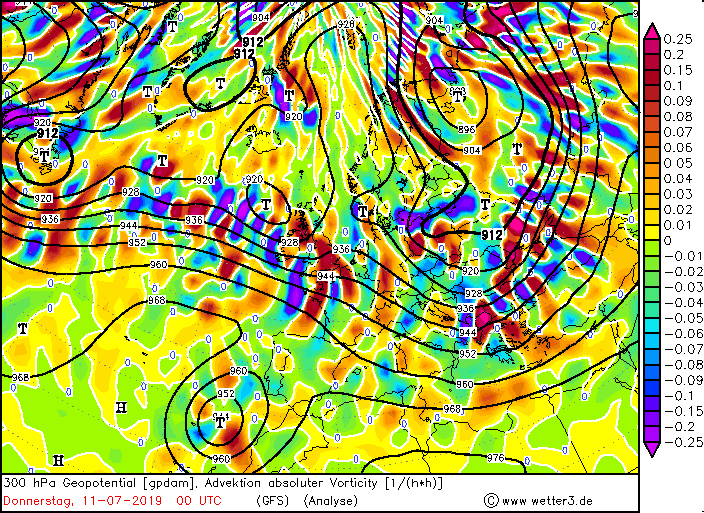
On 10 July, the ridge had retreated into the southern Mediterranean, so that severe storms could again form on this day, especially over the Balkan region.
The trough and the wavy cold front, which stretched over the Alps to Eastern Europe and even further east, were still almost zonal.
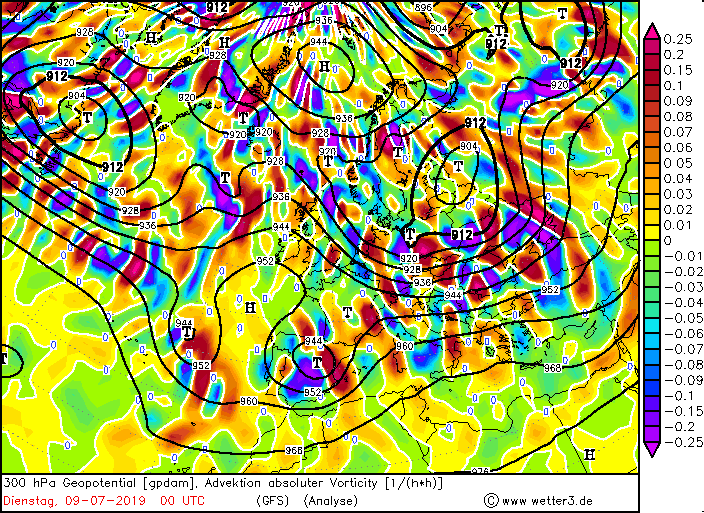
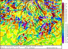
In addition to the unstable air of the low altitude, the thunderstorm formation and the degree of organization were supported by a weak jet stream as
well as strong humidity and warm air advection on the southeast side of the low altitude. Also the advection of positive vorticity is not negligible
(especially on July 10th). In the following days the high air pressure increased and the weather calmed down again.
|
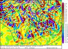
300 hPa vorticity advection, July 07-10, 2019
Wetter3
|
 |
 |
 |
 |
Severe weather Portugal and Spain, July 08-09
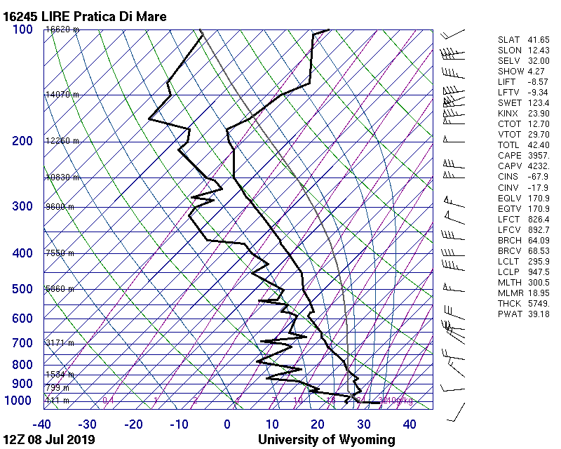
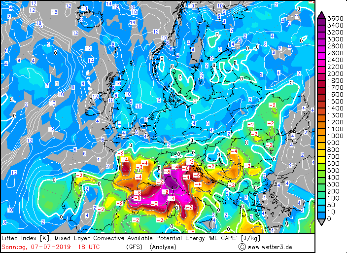
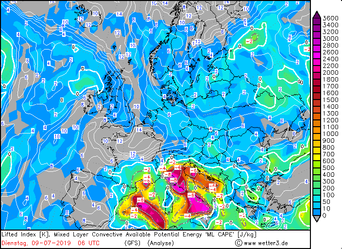
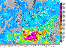
Due to the already mentioned cut off low humid and hot air masses were advected to the north to Spain. As a result CAPE values in Spain and Portugal increased
to 700 to 2600 J/Kg. Also in the northwest of Italy CAPE values rose, partly to almost 4000 J/Kg! Soundings from 08 July at 12:00 UTC shows values of 3957 J/Kg
and PPW of 39.18 mm. The first thunderstorm of the day developed during night at 02:00 UTC on the west coast of Italy between Genoa and Florence.
The single cell developed into a super cell, which remained active for about 5 hours and then rapidly weakened. The remedy for the development of the supercell was
the cut off low (large-scale uplift) near Spain and the still high CAPE values (over 3000 J/Kg), which were adversely affected by this, as well as a weak jetstream
(instability), wind shear (speed shear) not to forget. Around 02:30 UTC the first thunderstorms were also detected in Spain, which initially weakened and even
became completely inactive in the north.
From noon at about 12:00 UTC, the thunderstorms intensified due to radiation in the southeast of Spain and began to cluster linearly. Towards the north along
the Pyrenees new cells formed, along the line of highest CAPE values (up to 2000 J/Kg), very probably additionally favoured by the mountain range and the
elevation of the cut off low. Towards afternoon / evening a thunderstorm line had formed with relatively strong cells, which now also reached the north of
Portugal. By the southwest wind also Sahara dust was transported to Spain, which favoured the precipitation development. Within the dust advection also powerful
single cells (even a supercell) formed over the Mediterranean Sea. In the north of Spain around 18:00 UTC a particularly powerful complex had formed, which was
either a supercell or a MCS, thus a mesoscale convective system (clustered single cells, giant lenticular cloud shield). A typical feature of this type of
multicell is that they peak in the evening or at night.
The heavy rainfall in Spain was of course favoured by the thunderstorms themselves, but also by the congestion at the Pyrenees. For more details,
see the tables below. In Italy it remained calm throughout the day, apart from a few short-lived single cells which formed in the northeast.
The thunderstorms in northeastern Spain and Italy remained active into the night. In the Balkan region, the first thunderstorms also occurred near the coast.
A supercell developed over the Adriatic Sea around 21:00 UTC, which covered the entire Adriatic coast and parts of the sea with its cirrus shield.
It slowly shifted to the northeast and remained active until the early hours of July 9th.
Severe weather Italy and Balkan, Juli 09-10
On the 9th and 10th of July there were again severe thunderstorms in Italy, but also in the Balkan region thunderstorms developed.
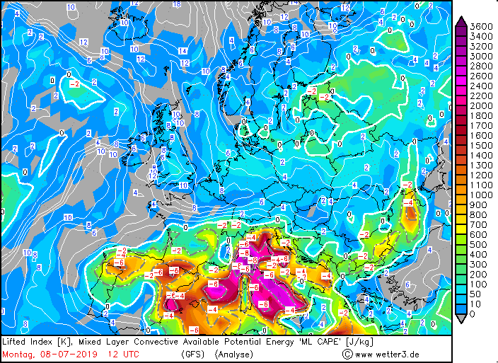
The drop of cold air still brought a large amount of humidity and warm temperatures to Italy and the Balkan region, so that CAPE values around
2600 J/Kg were again reached. At night, CAPE values were even higher (soundingst up to 2800 J/Kg) and wind shear (speed shear) was noticeable,
which explains why the thunderstorms remained active until about 5:00 UTC. Also the PPW values were very high with 35.23 to 40.01 mm on both days.
In the morning the weather calmed down for a short time (except on the Thyrrenian Sea, where thunderstorms remained active). Around 11:00 UTC the first
thunderstorms in the northwest of Italy came to life again. At first locally limited single cells were formed, which quickly became more powerful.
By the thunderstorms over the thyrrenic sea, which had shifted southeast, a powerful single cell was triggered in the middle of Italy. This cell and one from
the northwest each grew into a supercell, which shifted to the southwest. Around 14:00 UTC individual thunderstorms were triggered in the Balkan region.
This thunderstorm line extended from the supercell in the north of Italy to Macedonia.
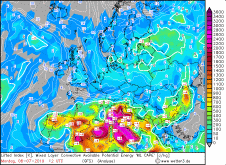
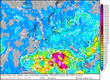
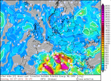
|
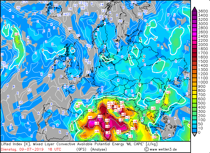
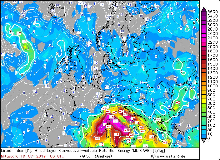
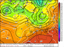
Mixed Layler CAPE, July 07-10, 2019
Wetter3
|
 |
 |
 |
 |
The southern supercell weakened around 17:00 UTC, while the northern one remained active. It survived about 14 hours and covered a distance of about km.
It shifted to Macedonia/Greece and weakened from 1:00 UTC. At this time the next strong thunderstorm or 3 cells at once arose over the Adriatic Sea.
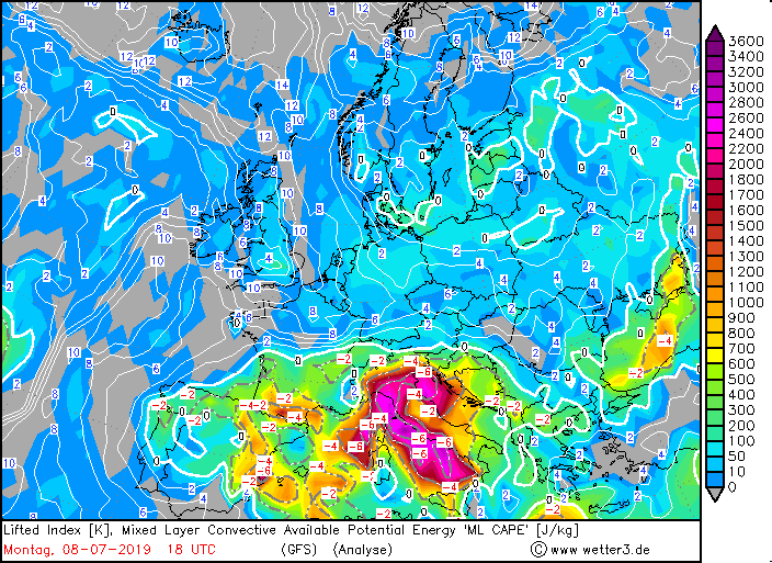
Also on 10 July the CAPE values reached values around 2800 J/Kg, but decreased in the course of the day and reached in the evening only 2000-2400 J/Kg.
Only sporadically values above 3000 J/Kg were reached again. However, the Lifted Index remained very low with -6°C to -8°C. The three named cells remained
active until 7:00 UTC. Around 11:00 UTC it began to thunder again more strongly at the east coast and the center of Italy and strong single cells formed first.
These cells clustered more and more around noon and made their way towards the Balkan coasts. The CAPE values there were higher than in Italy, which gave the cells
renewed strength. Thunderstorms also formed in southeastern Greece. Two particularly strong cells developed in the night to 11 July over Albania and the southwest of
Bulgaria. From 2:00 a calming of the weather situation then returned in completely Eastern Europe and like still active thunderstorms weakened gradually.
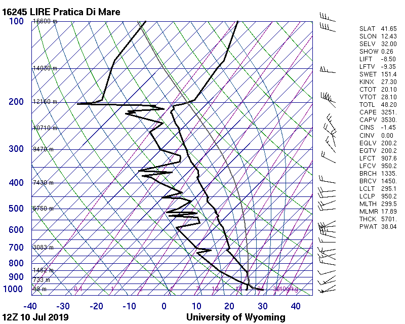
Again briefly back to the soundings of the two days. There the extremely humid air mass, especially in the first 100 m, can be seen very well.
The dew point is high and the dew point and temperature lines are very close. The dew point is also reached at low altitudes. In addition, both
days show high speed shear and from 10 July directional shear. High CAPE values, a low Lifted Index and wind shear promote the development of violent
thunderstorms such as super cells and/or multi cells. However, thunderstorm indices should be treated with caution. If, for example, there is no uplift,
thunderstorms may not develop at high CAPE values.
|
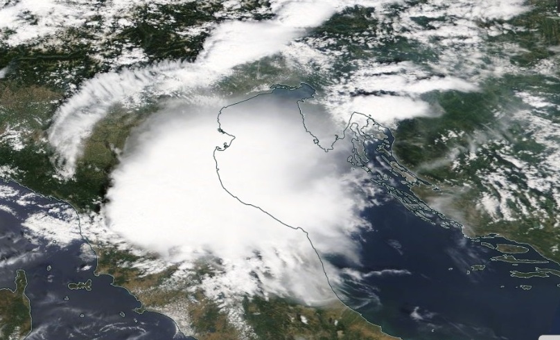
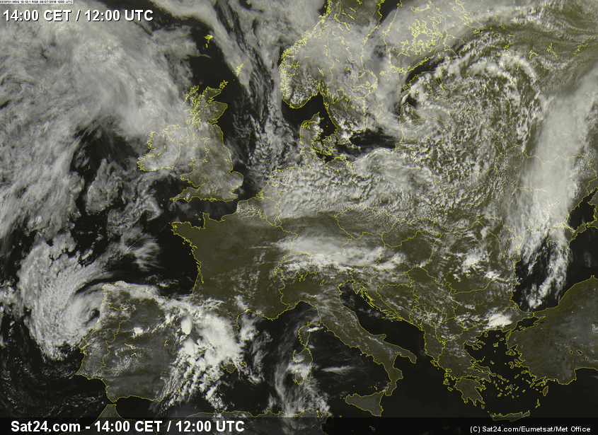
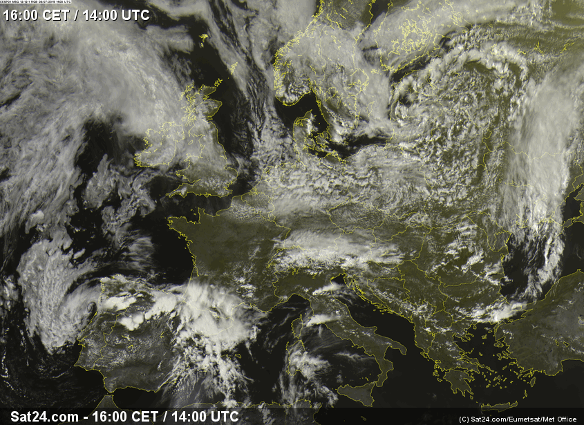
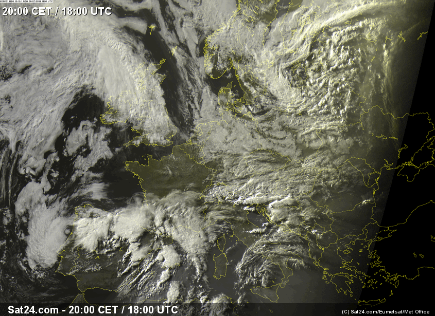
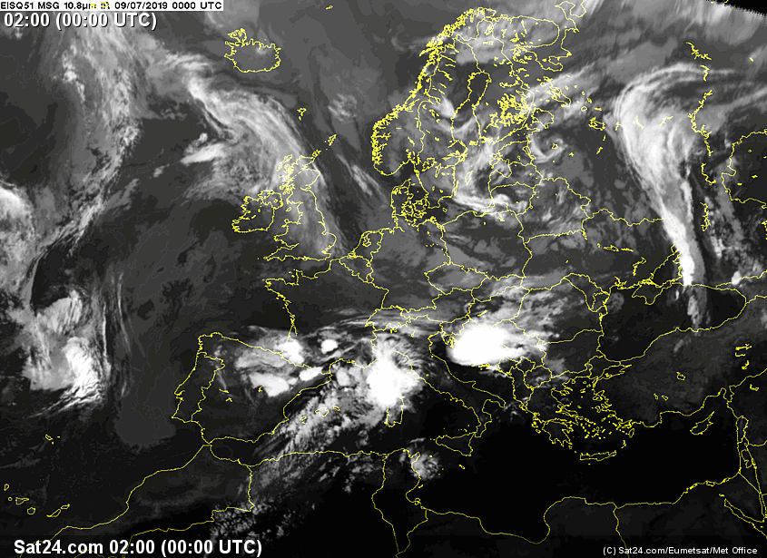
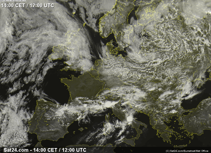
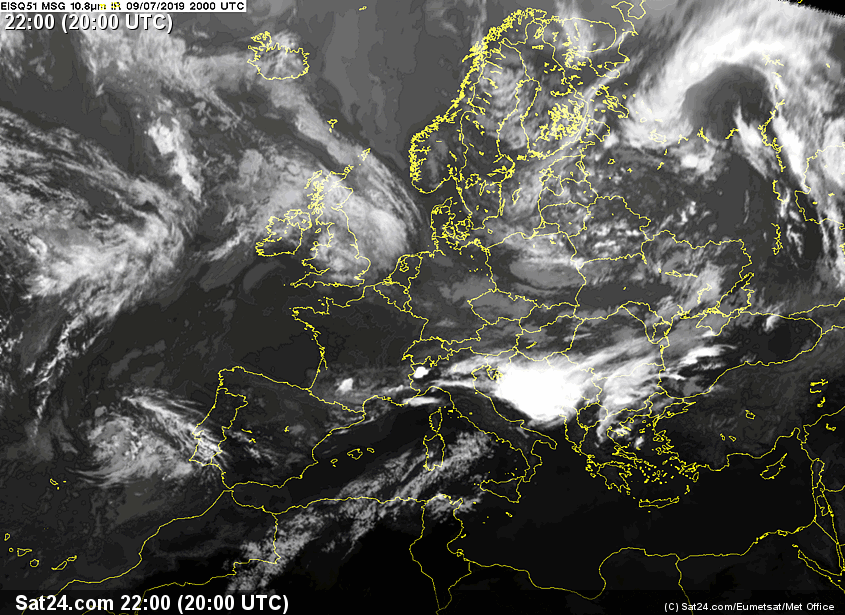
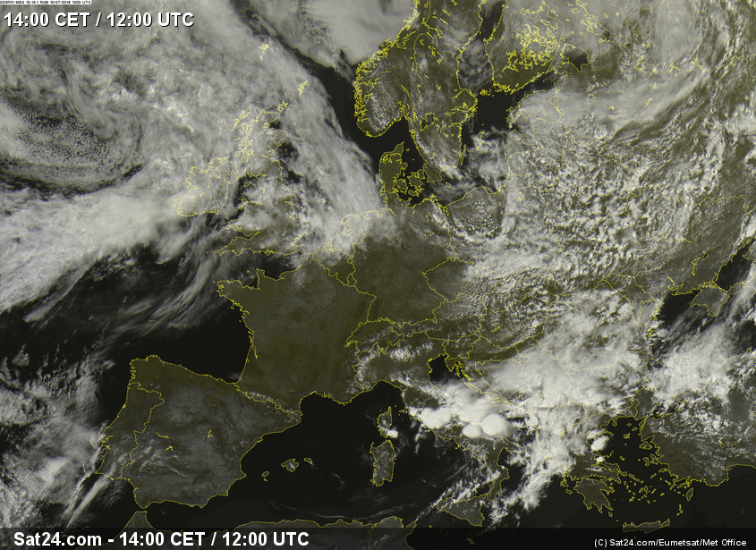
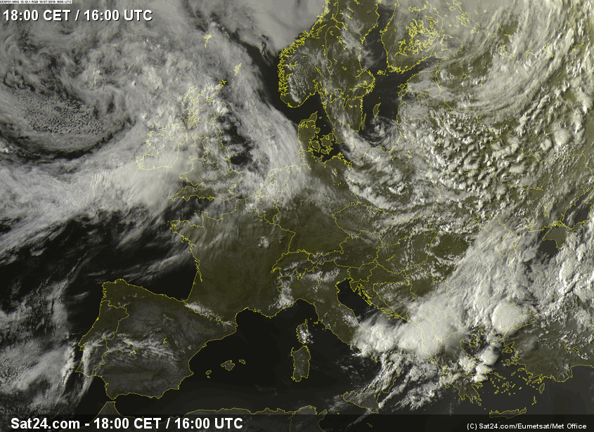
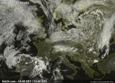
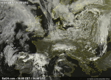
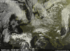
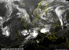
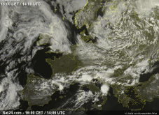
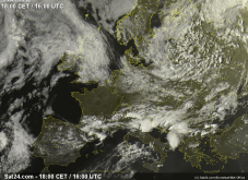
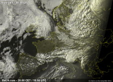
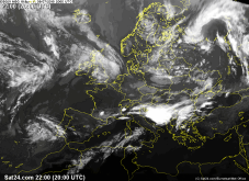
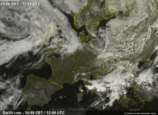
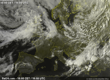
Satellite images (visible), several dates:
Sat24
|
 |
 |
 |
 |
 |
 |
 |
 |
 |
 |
 |
 |
Damages
The damage in Spain and Portugal was mainly caused by flooding. The floods swept away vehicles and damaged houses and roads.
In Italy, too, the high rainfall caused damages. However, another side effect of the thunderstorms attracted the most attention, namely hail.
In some parts of Italy, hail bombs the size of an orange arrived on the ground. The largest of these had a diameter of 14.5 cm and weighed almost 30 kg.
It does not have to be explained that thereby enormous damage, also in the agriculture was caused. Not quite so big, but at least baseball big hail bombs
also came down in the Balkan regions. Here, too, there was great damage, especially in agriculture. Due to the sevre thunderstorms and the strong up winds and
the longevity of the cells, the hailstones could become so large. The high wind speeds at medium and high altitudes caused hurricane like downbursts, which also
caused great damage.
In the table below you can see 24 hours precipitation in Italy, Spain and Portugal (left) and the Balkan region (right):
| Location |
Precipitation amount in mm |
Date |
Angra D. Heroismo Acores (PT)
Remini (IT)
Irurita (ES)
S. Giovanni (IT)
Horta Acores (PT)
Soria (ES)
Roncesvalles (ES)
Treviso/istrana (IT)
La Molina (ES)
Ripoll (ES)
Aragues del Puerto
Saelices El Chico (ES)
Pico Aerodrome (PT)
Marina Di Ginosa (IT)
Frontone (IT)
Termoli (IT)
|
86.8
80.2
73.1
72.0
67.6
67.0
57.8
49.1
44.0
43.8
41.6
41.4
41.0
40.0
38.0
37,3
|
08.07.2019
10.07.2019
08.07.2019
10.07.2019
08.07.2019
08.07.2019
08.07.2019
09.07.2019
09.07.2019
09.07.2019
08.07.2019
08.07.2019
08.07.2019
10.07.2019
09.07.2019
10.07.2019
|
|
| Location |
Precipitation amount in mm |
Date |
Knin (HR)
Korca (AL)
Vranje (RS)
Kriva Palanka (MKD)
Vlre (AL)
Dubrovnik/ Cilipi (HR)
Mostar (BA)
Tuzla (BA)
Berovo (MKD)
Lazaropole (MKD)
Kopaonik (RS)
Komiza (HR)
Makarska (HR)
|
45.0
44.0
34.1
33.0
31.0
30.0
30.0
28.0
23.0
22.0
22.0
22.0
22.0
|
10.07.2019
11.07.2019
10.07.2019
10.07.2019
11.07.2019
10.07.2019
10.07.2019
10.07.2019
10.07.2019
10.07.2019
10.07.2019
10.07.2019
10.07.2019
|
|
Data source: Ogimet.
Text: MG
July 16th, 2019
|