|
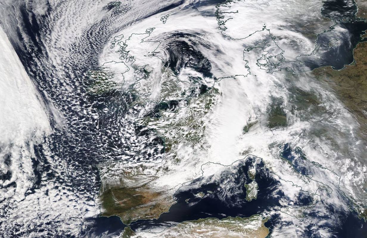
Low pressure area PHILIPP provided abundant precipitation in the Southern Alps and unusual amounts
of fresh snow for this time of year. Locally, up to 138 mm of precipitation fell within 24 hours.
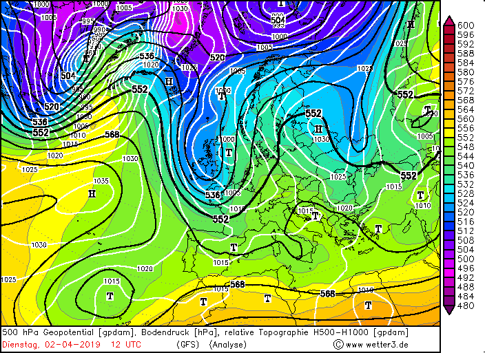
At the beginning of April, a trough formed in a bulge of the polar front. Because the jetstreak was located
west of the trough axis, its could be increased in a short time. The trough quickly reached Great Britain,
France, the Iberian Peninsula and even the northern border of Africa.
|
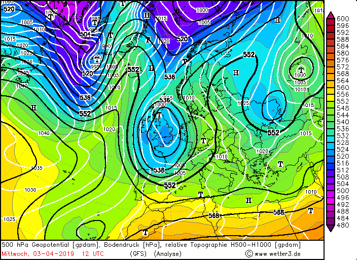
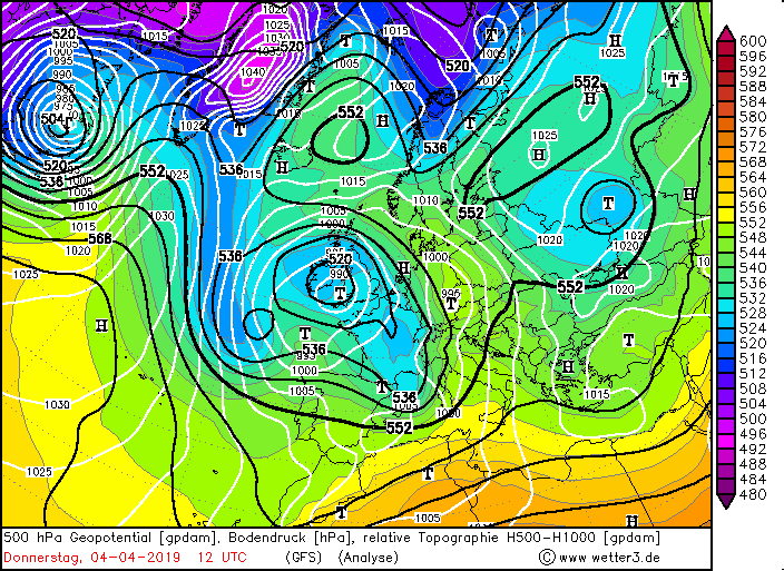
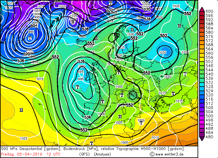
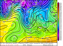
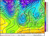
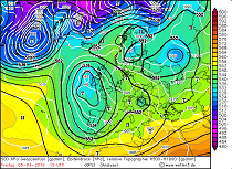
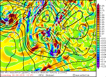
500 hPa Geopotential, soil pressure and 500-1000 hPa ReTop from 02 April to 05 April:
wetter3
|
 |
 |
 |
 |
|
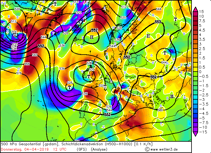
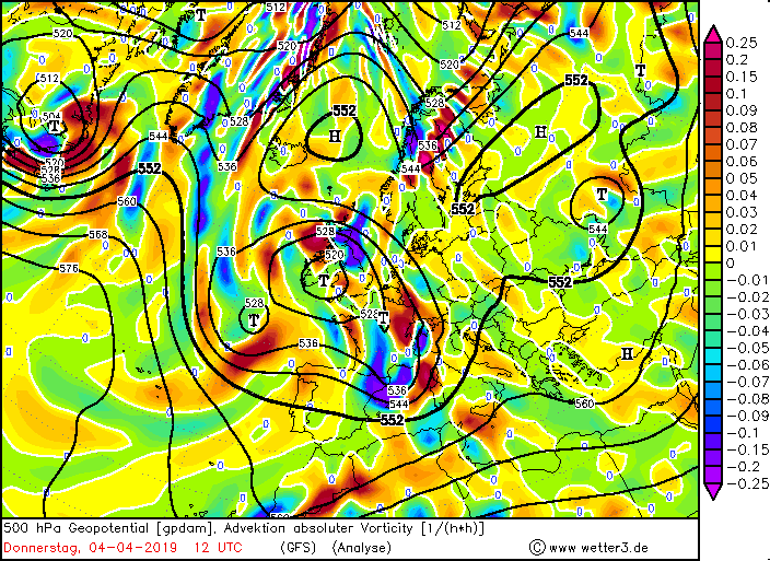
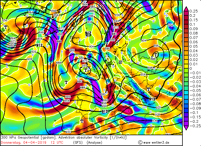
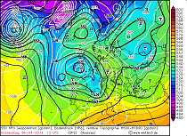
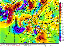
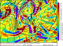
Thickness advection (500-1000 hPa), 500 hPa vorticty advection, 300 hPa vorticity advection, 700 hPa verticle movement:
wetter3
|
 |
 |
 |
 |
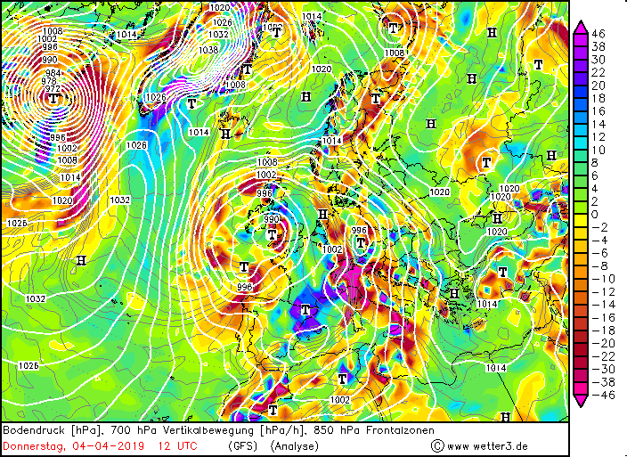
On 02 and 03 April, the low-pressure area PHILIPP formed in front of the trough over Great Britain. A short time
later a cut-off process took place and low PHILIPP became a cold depression with a large vertical extension.
The cyclonic rotation transported humid air from southern regions, especially the Mediterranean, to Central Europe.
Due to PHILIPPs low relocation speed, Central Europe was influenced by southwestern air masses over a period of several days.
|
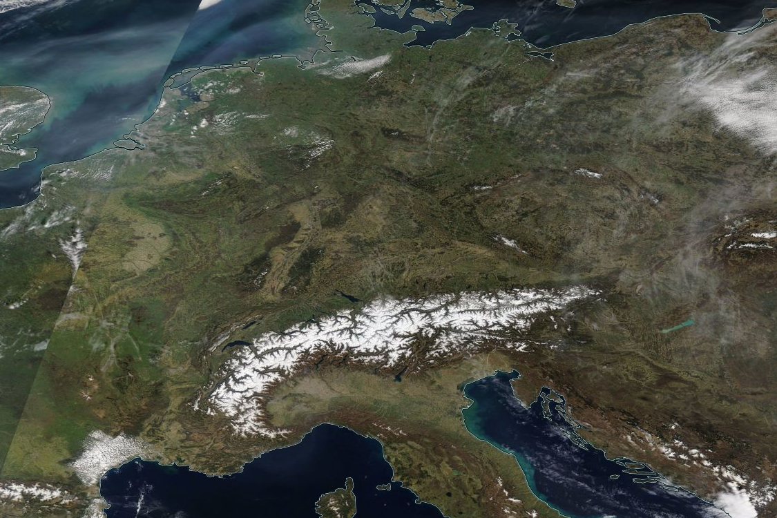
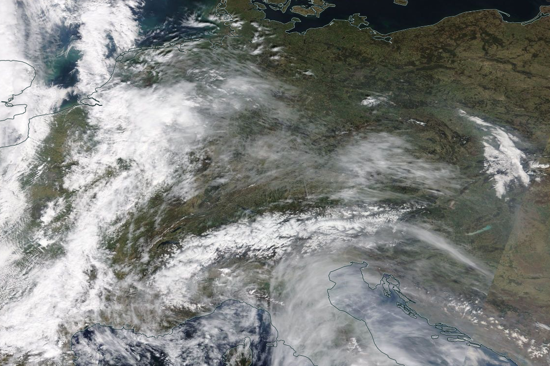
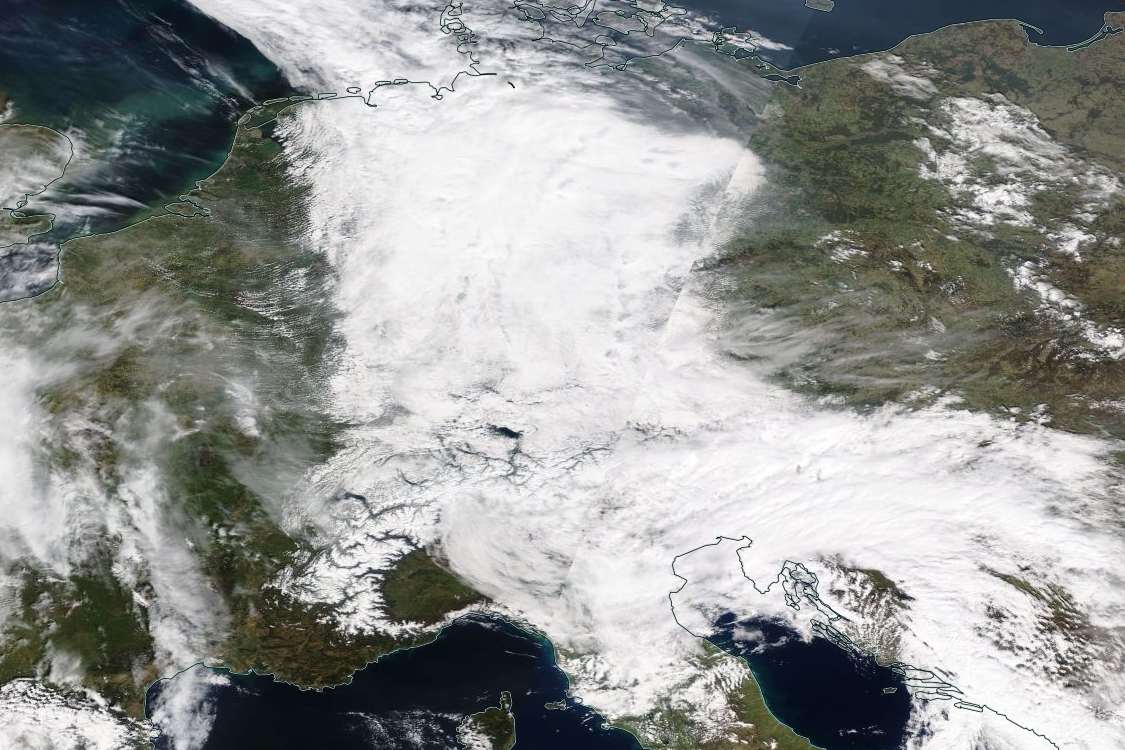
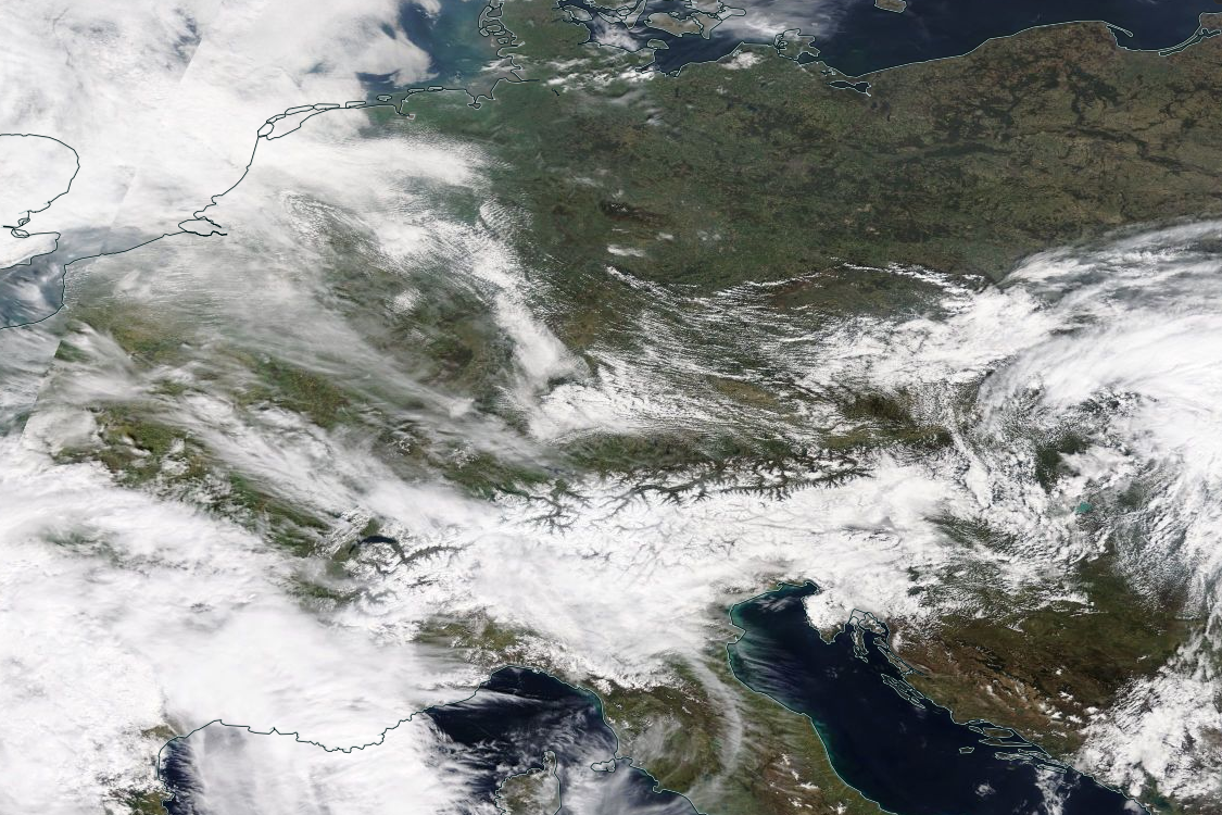
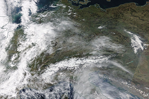
Satellite image of the Alps from 30 March to 06 April:
NASA Worlview
|
 |
 |
 |
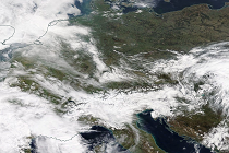 |
The mild air masses from the southwest provided warm air advection (positive thickness advection) in Central Europe.
The cold air mass above surface low PHILIPP caused the low pressure area to intensify with increasing altitude. This
led to positive Vorticity advection, incresing with height, at the front of the depression.
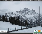
These two processes resulted in strong vertical movement over Italy, Switzerland and Austria. The orographic conditions
on the southern side of the Alps further intensified this vertical movement, generating abundant precipitation amounts,
especially from 03 April to 05 April as can be seen in the webcam time series below.
|
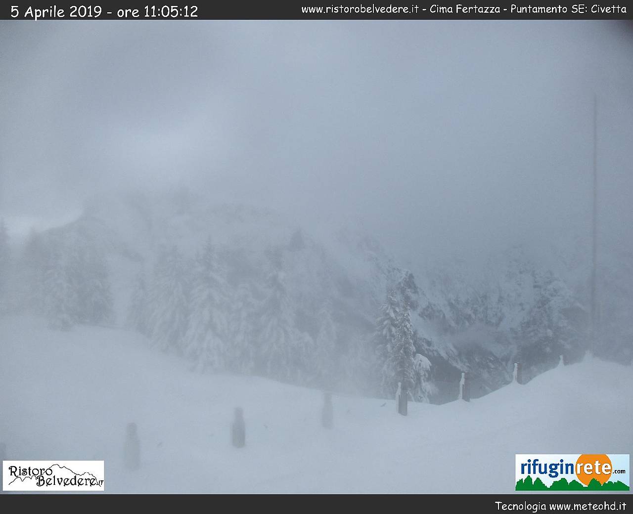
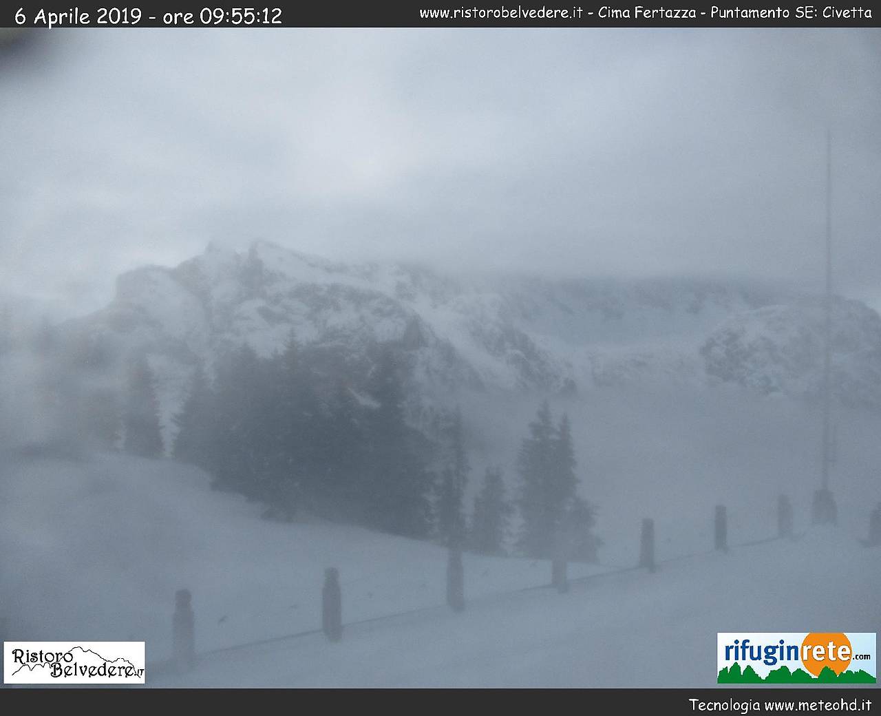
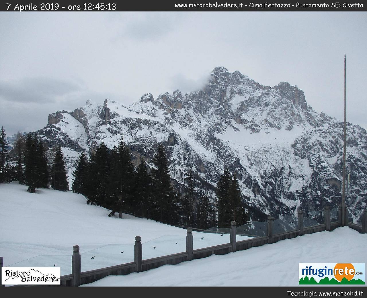
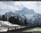
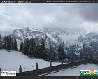
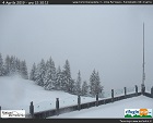
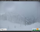
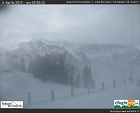
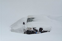
Webcam images from station Alleghe - Cima Fertazza (IT):
Bergfex
|
 |
 |
 |
 |
 |
 |
|
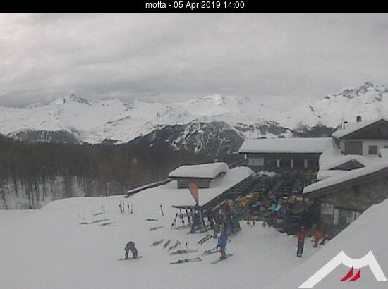
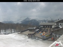
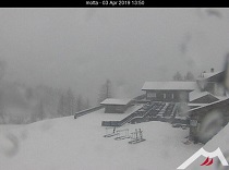
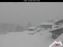
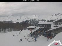
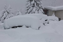
Webcam images from station Motta IT):
Bergfex
|
 |
 |
 |
 |
Although the air masses were transported from much warmer areas, they were still cold enough to provide large amounts of
fresh snow above 1000 m in the Southern Alps and above 500 m in the Black Forest and the Vosges. The reason for this is, on the one hand,
the still low water temperature of the Mediterranean of about 13°C at this time of year and, on the other hand, the pronounced
cold air mass that was mixed into the air from the cut-off low (down to -40°C in 500 hPa).
As the cold air inside the upper low pressure zone warmed up gradually and the formation of precipitation itself contributed to the
warming of the air mass by diabatic effects, the snow line rose in the course of the event. On 05 April the snow line was already over 2000 m.
|
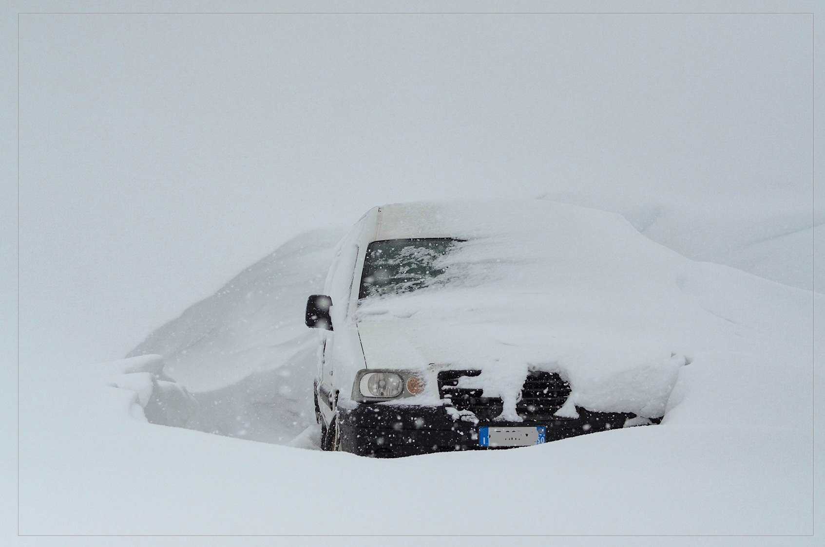
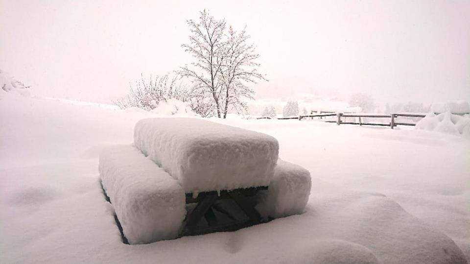
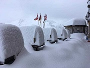
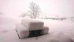
Snow pictures from Passo Rolle (IT, 1989 m), Livigno (IT, 1800 m), Göschenen (CH, 1111 m), Chablais à Bellevaux (FR, 1100 m):
Severe Weather Europe
|
 |
 |
 |
 |
The table below shows some selected daily precipitation values in Italy and Switzerland.
Data source: Meteonetwork
and Meteoschweiz
| Location |
24 h prec. in mm |
Date |
Mosogno (CH)
Bosco-Gurin (CH)
Robiei (CH)
Garessio Borgo (IT)
Pila (IT)
Ulten Eissbrunn (IT)
Melag Pratznerberg (IT)
Tremalzo (IT)
Niardo (IT)
Sacca di Esine (IT)
Ponte Arno' (IT)
Busteggia (IT)
Tremalzo (IT)
Via della Campagna (IT)
|
138,2
104,8
95,3
57,8
49,0
102,1
101,1
96,8
96,0
96,0
94,2
82,4
33,6
30,5
|
03 April
03 April
03 April
03 April
03 April
04 April
04 April
04 April
04 April
04 April
04 April
04 April
05 April
05 April
|
|
Text: CL
Apr 10th, 2019
|